occupation mounds (lomas) in the llanos de...
TRANSCRIPT

1
OCCUPATION MOUNDS (LOMAS) IN THE LLANOS DE MOXOS
Dr. Clark L. Erickson
Department of Anthropology University of Pennsylvania
University of Pennsylvania Museum of Archaeology and Anthropology
33rd and Spruce Streets Philadelphia, PA 19104-6398
tel. 215-898-2282 fax 215-898-7462
Email [email protected]
Originally published in Spanish in 2000
Lomas de ocupación en los Llanos de Moxos. IN Arqueología de las Tierras Bajas.
Edited by Alicia Durán Coirolo and Roberto Bracco Boksar, Comision Nacional de Arqueologia, Ministerio de Educacion y Cultura,
Montevideo, Uruguay, pp. 207-226 (2000). Please cite the published Spanish version
ABSTRACT Prehispanic earthen mounds (lomas) are ubiquitous to the Llanos de Moxos region of the Bolivian Amazon. Because archaeological research has been limited, little is known about these impressive earthworks. Various distinct types of mounds are defined by their size, form, and complexity. Radiocarbon dating of mounds demonstrates that they were constructed and used over considerable periods of time. The characteristics of form and design of certain mounds (mounds on mounds and dual mounds) in the region indicate intentional planning and construction. Other mounds show growth through accretion. This paper summarizes presents preliminary interpretations regarding the age, function, and formation processes of these earthworks, in addition to reconstruction of demography, settlement patterns, and social organization of the mound cultures.

2
INTRODUCTION Artificial earthen mounds are ubiquitous in many areas of the tropical lowlands of South America. They appear to have been constructed and utilized for various purposes (for example, occupation, human burial, ceremonial activities, and agriculture). One of the most impressive expressions of prehispanic mound construction was at the mouth of the Amazon River on Isla Marajo where several hundred of large mounds have been reported, most believed to be associated with the Marajoara Culture (Nordenskiöld 1916; Meggers and Evans 1957; Roosevelt 1991). The recently discovered Faldas de Sangay Site in the Ecuadorian Amazon is a complex of hundreds of mounds spread over an area of 12 km2, the spatial design of which appears to have been formally planned (Porras 1987). In Venezuela, the mounds and other earthworks of the Llanos de Orinoco have been associated with chiefdom societies (Spencer and Redmond 1992; Zucchi and Denevan 1979). Other prehispanic mounds may have been constructed by less complex societies such as the archaeological cultures found in the Pantanal of Brazil and Paraguay on the Upper Rio Paraguay (Schmidt 1917, 1974; Rogge this volume; Schmitz this volume), in the coastal bañados of Laguna Merím in Uruguay (various authors in this volume), and in delta of the Rio Parana (Torres cited in Nordenskiöld 1916). The impressive prehispanic mound-building cultures of the savannas of the Rio San Jorge and Rio Zenu in Colombia (Plazas et al. 1993; Falchetti this volume), the coastal plain of Surinam and the Guiana (Boomert 1976), the Guayas Basin of Ecuador (Stemper 1994), and the Llanos de Moxos of Bolivia (Nordenskiöld 1910, 1913; Denevan 1980; Erickson 1995) are also associated with extensive raised field agricultural systems. Mounds in tropical South America and the rest of the world served many different functions. The majority of very small mounds were probably agricultural or individual house mounds and are not included in this discussion. Of the larger mounds, occupation mounds appear to be the most common. These sites were formed through intentional elevation of platforms (e.g. the cerritos mounds of Uruguay), and through the gradual accumulation of midden materials associated with occupation (e.g. the sambaquí mounds of coastal Brazil) and the collapse of wattle and daub structures (ed. the mounds of Moxos). Mounds also served ceremonial functions, contained burials, and provided elevated platforms for elite households. Many are associated with additional earthwork features such as defensive moats and embankments, causeways, and canals. Mounds may have also held gardens and orchards for household production. A mound could be spatially isolated or part of a large complex such as the ones of Isla Marajo or Sangay. In some cases, mounds appear to have been associated with relatively complex societies, possibly chiefdoms, in the lower Amazon, Bolivia, and Ecuador; in other cases, they were associated with hunting-gathering-fishing societies such as in coastal Brazil, Uruguay and Argentina.
3
MOUNDS OF THE LLANOS DE MOXOS, BOLIVIA Numerous large mound (loma) complexes are found in the Llanos de Moxos (or Mojos) of the Department of the Beni in the Bolivian Amazon (Figure 1). Here, earthen mound structures were created for a variety of functions, many associated with vast complexes of other forms of earthworks such as raised fields, causeways and canals (Denevan 1980; Erickson 1995). Estimates of 20,000 pre-Columbian mounds have been proposed for the Moxos region (Lee 1979). Although this estimate has not been confirmed, most scholars agree that the number of actual mounds is quite high (Bustos 1976b, 1978b, 1978d; Denevan 1980; Dougherty and Calandra 1981-2, 1984; Erickson 1980, 1995; Erickson et al. 1991; Faldín 1984; Pinto Parada 1987; Vejarano 1991). . Although the overwhelming majority of the mounds of the Bolivian Amazon are prehispanic, there are ethnohistorical accounts of mounds being constructed by the the Baure, indigenous group of northeastern Moxos (summarized in Denevan 1980:117). Prehispanic mounds are still important for the contemporary inhabitants of the region of Moxos. Because their height provides adequate drainage, mounds are regularly utilized as settlements for ranchers and small communities of farmers. When located near settlements, mounds are often used for garden and field sites. The Sirionó use mounds as major reference points on their treks between settlements and important hunting, fishing, gathering, orchard, and agricultural fields (Figure 2). Isolated forest "island" mounds (islas) within the savanna are often important sites for collecting of economic plant products (especially wild and domesticated tree fruits) and hunting game. Mounds are also frequently mentioned as central features in local mythology and folklore. One common theme in native stories is the "Loma Santa,” a mythical large earthen mound with utopian qualities, where oppressed indigenous peoples can escape poverty and exploitation by whites. In the recent history of the Moxos region, there are numerous millenarian movements in search of the Loma Santa (Reister 1976). Local pilots claim to have seen Loma El Retiro, a huge mound that rises far above the surrounding forest canopy but no one agrees on its physical location. Archaeological Investigations of Mounds in the Moxos Region: The archaeological investigation of mounds in the Llanos de Moxos began with the study of mounds near Trinidad and Loreto by Erland Nordenskiöld in 1908-9 (Nordenskiöld 1910, 1913, 1923). His stratigraphic excavations of the mounds of Hernmarck, Velarde, and Masicito produced incised and polychrome pottery that demonstrated stylistic similarities with other Amazonian Complexes (Lathrap 1970, Howard 1947). Stig Rydén (1941) reported on the large mound Cañada de la Loma Vieja at Casarabe. Wanda Hanke (1957) excavated the mound of Eviato. These excavations, while not extensive, provided important information on the types of artifacts
4
associated with mound constructions. In 1979, Faldín (1984) and Erickson (1980) surveyed and recorded mounds between Trinidad and San Borja which documented with dense distribution of these settlement types and their association with other forms of earthworks. The team of Bernardo Dougherty, Horacio Calandra, Victor Bustos and Juan Faldín recorded, mapped, and excavated many mounds near Trinidad during the 1970s and early 1980s (Bustos 1976a, 1976b, 1976c, 1978a, 1978b, 1978d; Dougherty and Calandra 1981, 1981-2, 1984, 1985; Faldín 1984; Pinto Parada 1987). These excavations were important for establishing an initial pottery chronology for mounds, providing information on the internal structure of these features, and documenting mound form. Denevan (1980:108-121; Table 2) listed 55 mounds and summarized the various types of mounds and their distribution within Moxos. Despite all of these efforts, we still have limited information on the mounds in the Llanos de Moxos. Mounds are difficult to excavate because of their scale and internal complexity. The sheer number of artifacts recovered from limited excavations in these structures is impressive. Small "telephone booth" style excavations in large mounds do little to address issues beyond dating and chronology. Horizontal excavations, useful for determining function of mounds, internal settlement plans, activity areas are prohibitively expensive. To properly undertake a large scale excavation of a mound would require huge sums of funding, large research teams of specialists, and long periods of field and laboratory time. Types of Mounds in Moxos and Their Distribution: Artificial mounds are common landscape features throughout the Llanos de Moxos region. Large and medium mounds are prominent in their contrast with the flat terrain of the rest of the Moxos (Figures 2-4). Mound boundaries are easily determined. Even the smallest mounds are relatively easy to identify in this flat landscape. Small mounds or islas are often defined by the sharp boundary between savanna and forest (forests can become established on the higher, better drained mound surface). Mounds are often distributed in a linear fashion along the major river courses such as the Rio Matos and the Rio Apere and abandoned river channels (Figure 5). In some areas, mounds appear to occur at regularly spaced intervals. Mounds occur in clusters, often around water bodies or "plaza"-like open spaces. There is considerable variation in mound morphology and size. The lack of regularities in form indicates that the mound builders were not using a formal design (but some important exceptions are discussed below). There is no clear relationship between the size at the base and the height of a mound. Overall, mounds tend to be round or oval, although some arc around natural water bodies such as old river meander channels. Mounds are often irregular in base outline, have uneven surfaces, and are commonly irregularly stepped. Most are associated with water-filled ponds or
5
irregular "moat-like" features, often formed as old meander channels from natural geomorphological processes or created as intentional barrow pits during mound construction. Some mounds are related to other earthwork features such as canals, causeways, ramps, and raised fields. The following discussion is based on reports from Denevan (1980), Dougherty and Calandra (1981-3, 1984), Nordenskiöld (1916), Kenneth Lee (1976), personal communication and from Mario Vilca, Kenneth Lee, Ricardo Botega, and Rodolfo Pinto Parada, and fieldwork undertaken by the Proyecto Agro-Arqueológica del Beni between 1990 and 1995. Mounds of any size can be placed into two major groupings, simple mounds and complex mounds. Simple mounds are single discrete mounds with little irregularity. Complex mounds are those with two or more high points, irregular surface topography, mounds on top of mounds, dual mounds (sometimes connected by causeways) and/or multiple mounds. In some cases the irregularity of mounds may have been an attempt to construct an effigy figure, although most irregularity is probably due to long occupation and the continual addition of fill and midden in a random manner. Complex mound forms are most often associated with the large and medium mounds. A classification based on size is suggested in the following discussion: Large Mounds: A large mound covers at least several hectares at its base and has a height of 3-18 meters (Figures 2, 5, 7-9). These mounds are most common near Trinidad, Casarabe, Loreto, and the Bosque San Pedro. They tend to be located on the forested high ground either along the edges of floodplains or on levees of the major river, the Rio Mamoré, or important tributaries. Many of these mounds are located on the edges of abandoned river channel meanders, locations prized for their fishing and hunting potential. I would estimate that there are between 200 - 300 large mounds in the Moxos region. Medium Mounds: A medium mound covers 1-2 hectares at its base and has a height of 1-3 meters (Figure 4). These mounds have been reported throughout the forested zones and gallery forests of the Moxos region from Casarabe and Trinidad to the east and San Borja on the Rio Maniqui to the west; from the Rio Isiboro-Secure to the south and Exaltación to the north. Most of them appear to be associated with active or abandoned river channels. Many also form forest islands in the savannas. I estimate that there are several thousand in the Moxos region. Small Mounds: (or "islas") Small mounds, which cover less than 1 hectare and are usually less than one meter tall, are the most common form of mound. They probably served as house or house cluster platforms and are found in the same zones as the medium sized mounds. They are often located in the open savannas or on old abandoned river channel levees as "forest islands" (islas) and are often associated with
6
raised field agriculture. There are many thousands of these mounds in the region, but it has not been adequately demonstrated that all are anthropogenic features (see below). The medium and small mounds are often associated with conditions of seasonal or permanent inundation. Special Purpose Mounds: During our fieldwork of 1992 and 1994, two sites were located with a mound morphology distinct from the more common forms. These were long rectangular or "loaf" shaped parallel mounds defining a flat rectangular plaza-like area. At the Cayalo Site on the Rio Apere two such complexes were found. One was built on a platform 70cm tall which covers at least a hectare. This form similar in shape and size to ball game courts found elsewhere in the Americas; thus, we are tentatively referring to them as "ball courts." The formal design of these features and their spatial separation from the occupation zone of the site suggests a ritual function. In both cases, these special-purpose mound complexes are associated with separate occupation mounds. Mound Functions: Few mounds in the Llanos de Moxos have been scientifically excavated by archaeologists and many of these excavations have not been analyzed or published. The stratigraphy of mounds is extremely complex and their artifact "richness" makes excavation slow and difficult. Many mounds have been disturbed through agriculture, erosion, looting, digging of house foundations, and road construction. These disturbed areas which provide a means of studying a mound without major excavation. Common artifacts recovered from the disturbed surfaces of mounds, river cuts, and archaeological excavation include the following: • pottery from domestic cooking, serving, and storage vessels; decorated wares
(polychromes and incised types) possibly used for special purposes (Figure 11) • large ceramic urns possibly used for storage, brewing of manioc beer, and burial
of human remains (Figure 12) • burned clay daub from house walls, hearths, and ovens; burned clay and
ceramics with basketry impressions • ground stone axes, usually in the form of a "T" • animal and human bone; bones of fish and aquatic mammals are quite common • clay floors and platforms • human and animal figurines of fired clay • small freshwater mollusks ("turos"), sometimes in dense concentrations. • large grooved and incised "grater" bowls or platters ("ralladores") (Figure 10) and
oblong incised ceramic "manos" for grinding. • organic-rich earth mixed with ash, shell, bone, burned clay, and pottery. These remains are evidence that prehispanic mounds served the following functions:

7
Occupation: The most common use of mounds appears to have been for human settlement. The classes of artifacts and feature types found in mounds (low house platforms and discrete occupation floors; post holes, organic-rich garbage middens and pits, and fill material) support this interpretation. Many pre-Columbian mounds are still used by ranchers and small farmers as residential sites. The mound of Loma Suarez near Trinidad supports a town and military base. A community of Sirionó lives on the Loma Eviato near Casarabe. Burial: A common feature within larger mounds is burials. Nordenskiöld (1916:149) believed that this might been done so that the dead would not have to be buried in water during the rainy season. The most common form appears to be urn burial, where human remains are placed in large ceramic vessels in a seated position with a smaller inverted vessel capping the opening (Nordenskiöld 1910, 1913, 1916, Dougherty and Calandra 1981). Many urn burials are visible in mounds sectioned by river erosion. In 1994, we excavated an urn burial which was eroding out of the banks of the Rio Apere at Loma Esperanza. The individual was seated within a large urn with several smaller vessels. Some of the mound interments may represent secondary burials and bundles of burials. A non-urn, extended burial with several grave offerings was excavated at Loma Alta de Casarabe (Pinto Parada 1987:286-287) and other mounds (Dougherty and Calandra 1981:99-100). Mounds with burials do not appear to have been dedicated to a single use as cemetery because they also have evidence of domestic occupation. Because large mounds have long histories and the domestic and burial activities may not have been contemporaneous, there may have been phases when the mound was dedicated to domestic activities interspersed with periods of specific use as formal cemeteries. Fortifications: Many settlements, especially those in the Baures region, were fortified with wooden palisades and deep moat-like ditches during the early period of Spanish contact and missionization in Moxos. The enhanced visibility over the flat landscape provided by mounds would have made them excellent defensive locations. The water-filled ponds, ditches, and barrow pits commonly around the large mounds could have served as a deterrent for intruders. Thus far, no evidence of palisade walls has been found to be associated with mounds. Ritual: Mounds may have had special ceremonial functions but this has not been conclusively demonstrated. The presence of small mounds on top of large mound platforms may have had ritual functions (discussed below). Mounds often have large straight ramps, causeways, and canals which may have had alignments that were important in ceremonial events. The "ball court" features discussed above may have had a ritual function. Gardens, Fields, and Orchards: The use of mounds for gardens, fields, and orchards is
8
probably a post-settlement function. Because of the presence of rich organic, well-drained soils, mounds are considered by contemporary farmers to be ideal locations for agriculture. Balée (1996) has documented that the species composition on the mound of Loma Ibibate reflects long-term human activities such as burning, selective cutting of species, gathering, and gardening at the location. Gardens may have been located between residential structures on prehispanic occupation mounds, although residence appears to have been very dense on most mounds. Hunting Locations: Mounds are considered by the Sirionó, Moxos, and other inhabitants of the Moxos region to be ideal sites for hunting. Large mounds are honeycombed with hundreds of burrows dug by animals. The mounds provide dry habitats for animals to escape the seasonal inundation (lasting up to 6 months). During the wet season, animal populations can be quite dense on the larger mounds (Denevan 1980:102-3). During the dry season, animals are attracted to the water reserves near mounds. Prized game species such as peccaries, deer, agouti, and tapir are also attracted to mounds by the crops in gardens and fields. Political Boundary and Territorial Markers: Mounds are highly visible features on the landscape, especially in an extremely flat one such as the Llanos de Moxos. The combination of monumentality in construction, use as burial sites (possibly tombs for ancestral figures), association with other "overengineered" features (discussed below), and the presence of possible ball courts and other public ritual space on some sites suggest the mound structures themselves may have carried powerful symbolic meaning for the prehispanic peoples of Moxos. Ethnographic and archaeological cases of the use of burial mounds in the Americas are rich with descriptions of how mounds are part of the cultural landscape (Dillehay 1995, this volume, Yerkes this volume, Brown this volume). Mounds are multifunctional and probably rarely were used for single specific functions. It is also evident that mound functions may have changed over time after cycles of residential settlement, construction, maintenance, and abandonment. Features Associated with Mounds: Mounds are rarely isolated. They often occur in clusters or complexes. Many are associated natural water bodies (occasionally active river channels, but more frequently abandoned river channels, swamps and marshes) and artificial water bodies such as ponds, reservoirs, ditches, and moat-like features. The human-constructed water features are normally the result of barrow pits for mound fill (Figure 9). These features often hold water year round. They would have been important sources of household water during the dry season, when water can become scarce. Mounds are often associated with wide raised causeway segments that form

9
regional networks. Causeways which radiate from mounds are found at Loma Eviato, Loma Ibibate, Loma Velarde, Loma Providencia, Loma Esperanza, Isla Rodeo, Loma Chuchini, and Loma Cayalo. Most of these causeways are accompanied by canals. Several ramp-like features are associated with Loma Eviato. Large blocks of raised fields are commonly associated with the smaller forest island mounds and the medium mounds, often completely surrounding them such as at Isla Rodeo. None of the larger mounds appear to have been directly associated with raised fields, with the exception of a mound near Trinidad, which has a series of radial causeways demarcating blocks of small raised fields. Many of the larger mounds have a distinct smaller mound or "peak" on top, usually on or near the center (Figure 2, 9). This mound-on-mound feature is found at Loma Suarez, Eviato, Cayalo, and Ibibate. The specific function of this feature has not been determined but may have been the platforms for the house of a "chief" or a ritual building. At Loma Ibibate, this feature was associated with more highly decorated pottery and evidence of burials. Archaeological Investigations of Loma Ibibate: We made a brief investigation of the large mound of Loma Ibibate located on the Sirionó Indigenous Territory in 1991. Loma Ibibate is a major topographic feature in the Sirionó territory and community members say that it has been used for swidden gardens, temporary hunting camps and semi-permanent farmsteads. The name Ibibate means "big mound" in Sirionó. Our research team mapped the mound while ethnobotanist William Balée conducted a study of its anthropogenic vegetation. The mound is located at the boundary of savanna and forest near an old abandoned river channel. Loma Ibibate is actually two large mounds (Loma I and Loma II) connected by a short (10m) earthen causeway (Figure 8). Loma I measures 150 x 200 x 18m and Loma II measures 200 x 300 x 5m. This complex is the largest and tallest that has been accurately mapped in the Moxos region, covering 9 hectares at its base and towering 18 m above the ground surface. The mound is surrounded on most sides by artificial water bodies or abandoned river channels that appear to have been enlarged by the ancient inhabitants (Figure 9). According to informants, these feature hold water year round. Loma Ibibate and a neighboring mound, Loma Eviato (5 m tall), are visible to each other across 3 km of savanna, each providing high vantage points. The topographic map of Loma I and reconnaissance of Loma II shows that the mound surface is very irregular, although parts of the structure may have been specially prepared as a platform. Ridges or "arms" of the two mounds extend from the center to the edges. This does not appear to be due to erosion. The highest points of Loma I and
10
Loma II are not in the center of the mounds. The few exposed surfaces of the mound are covered with the artifact classes discussed above (pottery, bone, shell, ash, and burned clay). Fine decorated pottery was concentrated near the summit of the mound but this was also the area of most disturbances. Evidence of domestic occupation was also found in posthole sampling outside the boundaries of the mound in non-artificially elevated areas. Sirionó informants identified more than 30 large mounds in the immediate area of Loma Ibibate and report many more within the nearby Bosque San Pablo to the east. The mounds of the Sirionó Territory are related in size, shape, and general artifact types to the numerous large mounds of the Casarabe and Loreto regions. This zone has the highest concentration of large and medium mounds in the Beni region. The second largest recorded mound, Loma Alta de Casarabe (600 x 450 x 16 m) is located less than 20 km from Ibibate. Mound Formation Processes: Bernardo Dougherty and Horacio Calandra (1981:92, 1981-3, 1984:182, 187) have questioned the artificial nature of mounds in the Beni region. These scholars argue that human occupation of mounds was sporadic and ephemeral, and that mounds are primarily formed by natural processes. They encountered "sterile" layers between cultural deposits in the mounds that they excavated, and argue they are sediments deposited by natural flooding. This explanation for mound formation is geomorphologically impossible, because rivers in flat landscapes do not deposit sediments in a way that produces spatially discrete mounds of 10 meters or more. Other scholars argue for the artificial nature of the mounds (Lee 1979; Pinto Parada 1987; Nordenskiöld 1910, 1913; Erickson et al. 1991, 1993, 1994; Erickson 1995, Denevan 1980). Artifacts indicating human presence and agency are found to the bases of these mounds, sometime even at levels below the present surrounding land surface. The issue of continuous vs. sporadic usage by human groups has not been resolved, but as these locations are prime settlement sites located near waterways and important resources, they would probably not have been neglected for year-round and continuous settlement. Were individual mounds formed all at once in a single stage of construction? The large and medium mounds certainly were not, although some of the smaller islas may represent single construction phases and occupations. The larger mounds have multicomponent occupations, and some have yielded radiocarbon dates. These dates cover thousands of years (Dougherty and Calandra 1981-3; Pinto 1987), indicating long-term use of the mounds. Mounds were probably formed through long, slow accretion, a combination of processes involving intentional addition of fill and the
11
unintentional byproduct of human activities (refuse buildup, house collapse). Some mounds may have been constructed through the intentional addition of fill removed from barrow pits near the mounds. Inhabitants of the Moxos region today often bring in fill to raise house platforms 10-20 cm to keep moisture out of the house, even in well drained locations. Traditional houses in the Moxos region are constructed with wattle-and-daub walls ("tapera"). These walls can contain several tons of earth, and when buildings erode and collapse, this soil is added to the platform (Figure 13). Midden materials are often found within mound excavations and were apparently regularly incorporated into the mound to increase its size. Considering the area covered by some of the larger settlement mounds, populations would have been numerous and dense on these better drained formations; and large mounds probably grew more rapidly than the smaller mounds. The long sequences of radiocarbon dates from artificial stratigraphic levels within mounds excavated by the Argentinean team (see below) supports the gradual accretion model of mound formation processes. Mound construction and accumulation was most likely the result of relatively continuous domestic occupation and other uses of the mounds over a considerable amount of time. Many of the mounds containing burial urns may have been constructed rapidly, using fill to cover the urns. When Loma Mary, located near Trinidad, was being eroded by the Rio Mamoré, Kenneth Lee (personal communication) noted in the mound profile that burial urns were placed on distinct floors and artificial fill placed around and over them to bury them (as opposed to digging pits within an already established mound for burial of the urns) (Figure 14). Many mounds of all sizes are associated with active or abandoned river channels and levees. It is likely that early dwellers first sought naturally higher ground such as levee formations for habitation and burial sites. These locations are rarely elevated more than a meter, and most are much lower in height. Since these locations are flooded less frequently or only seasonally, they are located near abundant natural resources or fishing, hunting, collecting and farming, and the river facilitates communication, they would have been ideal locations for settlement. Over time, human occupation would have added soil and midden to the sites, and the same places would have been reused to take advantage of now artificially raised higher ground. This greatly enhanced the formation process of the mound and the desirability of the location as a living site. The formation processes of the smaller isla mound sites are more problematic. Our project has examined a number of these features in the central Llanos de Moxos and found that nearly all yield pottery when tested with soil augers. An excavation in Isla Rodeo produced quantities of pottery and domestic debris. Most island formations bisected by construction in 1976 of the Trinidad-San Borja highway have pottery in their

12
profiles. However, Robert Langstroth (1996) has studied several isla formations in the savannas west of Trinidad and found that they do not show evidence of artificial construction or use by humans. In summary, most prehispanic mounds developed through complex site formation processes. Many mounds appear to have been created through accretion--the gradual accumulation of mass over time through artificial fill additions, wattle and daub collapse of house walls, house platform construction, and midden buildup. Planned construction in shorter periods of time through the intentional addition of construction fill, the burial of funerary urns, and the terracing of mound platforms may have also played a role, especially in the formation of “monumental mounds" discussed below. The Dating of Mounds in Moxos: Few of the pre-Columbian mounds have been adequately dated. The chronology of pottery for the Moxos region has not been firmly established, and as a result, relative dating using pottery is not reliable. The Argentinean research project in the early 1980s recovered radiocarbon samples from various mound locations and published 38 radiocarbon dates for the sites of Loma Palmasola, Loma Mary, Isla de los Aceites, Loma Kiusiu, Loma Salvatierra, and Loma Alta de Casarabe (Dougherty and Calandra 1984; Pinto Parada 1987:310-311). Dates of 810 BC + 160 years for Loma Mary, 825 BC + 80 years for Isla de los Aceites, and 735 BC + 145 years for Loma Alta de Casarabe indicate that the mounds have a considerable time depth [although it must be noted that some of these early dates are out of stratigraphic order when compared to other dates from the same mound]. Our research team recovered two charcoal sample associated with an urn burial from excavations in Loma Esperanza II that dated to AD 920 + 45 years and AD 1350 + 25 years. Samples from the small mound of Isla Rodeo place the midpoint of occupation at AD 1035 + 25 years. We have dated non-mound occupations below raised field constructions as early as 800 BC at the El Villar Site (Erickson et al. 1991). It is obvious that the mound cultures of the Llanos de Moxos have a long history, possibly beginning more than 2700 years ago. This provides plenty of time for the formation of even the largest mounds through the accretionary process of human occupation, construction, and maintenance. The Cultural Affiliation of Moundbuilders: At the time of Spanish and Portuguese contact, there were many ethnic groups speaking diverse languages lived in the Bolivian Amazon (Métraux 1947; Denevan

13
1980). The maps of ethnic groups and boundaries within the Moxos region show a mosaic type of distribution, much of which may have been the result of colonial and post-colonial historical processes (introduction of Old World diseases, missionization, warfare, rubber boom, and new political, social, technological, and economic systems). Early scholars noted the overlap of the archaeological mound cultures with the historical distribution of Arawak speakers (Baure and Moxo) (Nordenskiöld 1910, 1916; Métraux 1947). More recent studies demonstrate that the distribution of prehispanic mounds and raised fields overlaps with the distribution of non-Arawak groups (Panoan, Tupi-Guarani and unclassified groups) as well, although the majority of the larger mounds are indeed located in historically Arawak locations (Denevan 1980, Erickson 1995). The pottery from early mound excavations by Nordenskiöld, Rydén, Hanke, and others has been compared to pottery styles in other regions of Amazonia and the Andean highlands (Lathrap 1970, Howard 1957, and others). The strongest stylistic, and presumably linguistic and chronological, ties are with the Central and Lower Amazon of Brazil. Lathrap (1970) has proposed a series of outward migrations from the Central and Lower Amazon over the past 4-5,000 years. The cultural affiliations are clearly with the rest of the Amazonian lowlands, not with the nearby Andean Highlands. Implications of Mound Settlement Patterns: The density of mounds and their apparent regular distribution in certain areas of Moxos is impressive. The larger mounds cluster in the zone between Trinidad, Casarabe, Bosque San Pablo, and Loreto. Many of these mounds are separated by less than two kilometers. Many of the medium mounds along the Rio Apere are also found approximately every two kilometers along the river course (Figure 5). Thousands of smaller mounds or islas are found in the vast savannas of the central and northern Moxos region. Many of these mounds are in clusters or are found within one km of another. The mounds found along active and abandoned rivers appear to be regularly spaced, but the meandering patterns of the fluvial systems tend to create the impression of a more random distribution. No intensive survey correlating mounds and other sites has been made, so it is difficult to interpret the data on mound distribution. Settlements on mounds appear to have ranged from isolated households and clusters of houses to towns and villages. Several mounds and mound cluster communities appear to have reached what would be considered "urban" proportions in other parts of the world. We are not yet able to accurately convert mound surface space to population figures, but some of the larger mounds may have provided living space for thousands of inhabitants. In general, the data indicates that the general settlement pattern was dense and populations were high throughout Moxos prehistory, but individual settlements were

14
dispersed over the landscape. This may have been due to the nature of resources (fishing, hunting, collecting, and agricultural soils), the agricultural system of intensive raised fields, and/or socio-political institutions that resisted centralization, urbanism, and vertical hierarchies. The indigenous polities described by the early chroniclers and later classified by scholars as "Tropical Forest Chiefdoms" (Steward and Faron 1959) were socially and politically complex in many ways, and "chiefs" held considerable political power over the population, but at the same time, there were many groups that were not organized hierarchically as "chiefdoms" (Métraux 1947, Denevan 1940). Despite the dispersed nature of the populations in Moxos, mechanisms such as the vast intra- and inter-regional networks of causeways, canals, and natural waterways would have organized local and regional interaction. This "horizontal" organizational strategy is similar to that described by Carole Crumley as "heterarchy" (as opposed to "hierarchy"), or, "complex systems in which elements have the potential of being unranked (relative to other elements) or ranked in a number of ways, depending on systemic requirements" (1994:12). The diverse mosaic of languages and ethnic groups found in the Llanos de Moxos region at contact tend to support this hypothesis. Nordenskiöld (1916) noted that mounds are often much larger and taller than would be necessary to simply prevent the flooding of settlements. Many of these mound constructions could be considered truly monumental. The "over-constructed" main mound of Loma Ibibate rises 18 meters above the forest floor. Most of the mound is a large platform which appears to have been designed and leveled. Many large low earthen platforms covering many hectares at their base have been reported east of Trinidad (Langstroth 1996). Many of the larger Moxos mounds were probably served specific religious and political purposes, in addition to providing settlement sites. Some of the larger mounds are connected with "visual sight lines," in that they are visible to each other across sections of savanna (Loma Ibibate and Loma Eviato) and site intervisibility may have helped determine the distance between individual mounds. There are a number of cases of pairing of mounds forming "dual mound complexes" (Loma Ibibate, Loma Chuchini, Loma Dos Islas, Loma Cayalo, and Loma Esperanza) (Figure 6, 8). This patterning may represent ancient systems of social organization relating to dual organization or moiety systems that are common among many ethnographic peoples of the Amazonian region (e.g. Gê, Bororo, Kraho, Kayapó) (Levi-Strauss 1965). The moiety divisions of historical and contemporary communities tend to be divided across the plaza and ring of houses. In the archaeological mound cases, it appears to have been a division into separate mounds. The dual mounds of Loma Ibibate and Loma Chuchini have short, large causeways connecting the mounds (Figure 8). It is surprising that the larger mounds do not appear to be directly associated with raised fields. A number of the medium-sized mounds have blocks of raised fields adjacent to them (Loma San Carlos, Loma Providencia, Loma Cayalo, Loma

15
Esperanza, and Loma Desengaño) that are possibly contemporaneous with the occupation and use of the mounds. Several mounds have radial causeway systems that divide up the raised fields around them into distinct units, possibly the remains of an ancient land tenure system or means of organizing labor. Mound Destruction Mounds within the Moxos region are in danger of being destroyed. Because of high rainfall in the region, mounds have suffered erosion for hundreds of years. Many of the mounds located near the major meandering rivers have been partially or completely erased by river channel changes in recent years. Animals burrow deeply into the mounds disturbing archaeological context and increasing the erosion. Human destruction of mounds has also increased in recent years. Mounds near modern settlements are regularly looted for pottery and other archaeological objects. Many larger mounds are covered with looters' pits. Cattle use the mounds to escape inundation during the rainy season, destroying the vegetation cover, digging for salt, and churning the surfaces with their hooves. Many mounds are still being used for settlement, and modern disturbance has disrupted the archaeological context of these sites (Figure 3). Although massive, many mounds are being dismantled by heavy machinery for construction fill to raise road beds. Mound soil has a texture which is ideal for road and other construction. Some mounds have been partially leveled for modern constructions. CONCLUSIONS Mound formation was probably the result of a combination of accretionary process and intentional construction by the populations that used them. Original locations for settlement included the micro-relief created by natural levee formations, which were modified over time to result in the formation of large occupation mounds. Mounds are a significant part of the ancient cultural landscape of the Llanos de Moxos. Mound formation transformed the natural landscape at a massive scale and they still have a major impact on contemporary settlement and landuse. Mounds also play an important role in the local belief systems such as the search for the Loma Santa. The distribution patterns of mounds provide archaeological evidence of large regional populations living in numerous settlements spread over the landscape with regular spacing. Mounds have been used for settlement in the Llanos de Moxos for at least 2700 years and many mounds apparently were either occupied continuously or reoccupied periodically, in some cases until the present. Many of the individual mounds are quite large and smaller mounds often form multi-mound clusters which reach urban-like proportions. In a few cases, mounds approach monumental scale.

16
The number of mounds and their impressive patterning cannot be directly used to reconstruct the socio-political organization of the region (Erickson 1993, 1996). Mound construction is not necessarily labor intensive, especially if done gradually over the long periods of time documented in the archaeological record. As Nordenskiöld noted, "It doesn't take a great inventive mind to arrive at the idea of building an earth mound when one lives in flooded plains" (1916:152). The dispersed nature of settlement and the diversity of archaeological pottery styles during the pre-Columbian period supports the idea of numerous ethnic polities living in hamlets, villages and towns spread over the agricultural landscape. These communities were often joined by a network of canals and causeways for communication and transportation, in addition to natural waterways. Certain larger mounds may have served as more central places, possibly as residences of politically important families or for public ritual. Mounds were certainly more than just living sites.

17
REFERENCES CITED Balée, William, 1996 Indigenous Agroforestry and Tropical Diversity: Reconsiderations of the Refuge
Theory. unpublished manuscript. Boomert, A. 1976 Precolumbian raised fields in Coastal Surinam. Proceedings of the Sixth
International Congress for the Study of the Pre-Columbian Cultures of the Lesser Antilles, Guadeloupe, 1975: pp. 134-144.
Bustos, Victor 1976a Investigaciones arqueológicas en el Departamento del Beni. Proyecto:
Excavación de Loma Cachipere en Puerto Almacén. Documentos Internos del INAR, La Paz.
1976b Proyecto de reconocimiento arqueológica en Trinidad. Documentos Internos
del INAR, no. 23/76, La Paz. 1976c Investigaciones arqueológicas en las tierras bajas de Bolivia. Documentos
Internos del INAR 1978a La arqueología en los llanos del Beni, Bolivia. Documentos Internos del INAR,
no. 32/78, La Paz. 1978b Proyecto de excavaciones arqueológicas en el departamento del Beni, en
lomas de la región de Cocharcas y Villa Banzar. Documentos Internos del INAR, no. 10/78, La Paz.
1978c Una hipotesis de relaciones culturales entre el altiplano y la vertiente Oriental
de los Andes. Pumapunku, 12:115-126, La Paz. 1978d Investigaciones arqueológicas en Trinidad, Departamento del Beni Instituto
Nacional de Arqueología, Publicación no. 22, La Paz. Crumley, Carole L. 1994 Historical Ecology: A Multidimentional Ecological Orientation. In Historical
Ecology: Cultural Knowledge and Changing Landscapes. edited by Carole Crumley, School of American Research, Santa Fe, pp. 1-16.
Denevan, William 1980 La geografia cultural aborigen de los llanos de Mojos. Juventud, La Paz.
18
Dillehay, Tom D. 1995 Mounds of Social Death: Araucanian Funerary Rites and Political Succession.
In Tombs for the Living: Andean Mortuary Practices. edited by Tom Dillehay, Dumbarton Oaks Research Library and Collection, Washington DC, pp. 281-313.
Dougherty, Bernardo and Horacio Calandra 1981 Nota preliminar sobre investigaciones arqueológicas en los Llanos de Moxos,
Departamento del Beni, Republica de Bolivia. Revista del Museo de la Plata 8(Sección Antropologica no. 53):87-106, La Plata.
1981-2 Excavaciones arqueológicas en la Loma Alta de Casarabe, Llanos de Moxos,
Departamento del Beni, Bolivia. Relaciones de la Sociedad Argentina de Antropología, 14(2):9-48, Buenos Aires.
1984 Prehispanic Human Settlement in the Llanos de Mojos, Bolivia. In Quaternary
of South America and Antarctic Peninsula volume 2, edited by Jorge Rabassa, pp. 163-199, A. D. Balkema, Rotterdam.
1985 Ambiente y arqueología en el oriente Boliviano. La Provincia Itenez del
departamento del Beni. Relaciones de la Sociedad Argentina de Antropología, Buenos Aires.
Erickson, Clark L. 1980 Sistemas agrícolas prehispánicos en los Llanos de Mojos. América Indígena
40(4):731-755. 1993 The Social Organization of Prehispanic Raised Field Agriculture in the Lake
Titicaca Basin. In Economic Aspects of Water Management in the Prehispanic New World, Research in Economic Anthropology, Supplement No. 7, edited by Vernon Scarborough and Barry Isaac, JAI Press, pp. 369-426.
1995 Archaeological Perspectives on Ancient Landscapes of the Llanos de Mojos in
the Bolivian Amazon. In Archaeology in the American Tropics: Current Analytical Methods and Applications. edited by Peter Stahl, Cambridge University Press, Cambridge, pp. 66-95.
1996 Una investigacion de camellones de cultivo en la cuenca del lago Titicaca del
Peru..Proyecto Interinstitucional de Waru Waru, Puno, Peru. Erickson, Clark L., José Esteves, Wilma Winkler, and Marcos Michel 1991 Estudio preliminar de los sistemas agrícolas precolombinos en el departamento

19
del Beni, Bolivia. unpublished manuscript, University of Pennsylvania and the Instituto Nacional de Arqueología.
Erickson, Clark L, W. Winkler, J. Walker, K. Candler, D. Angelo, M. Michel 1993 Informe preliminar sobre las investigaciones del Proyecto Agro-Arqueológico
del Beni en 1992. unpublished manuscript, University of Pennsylvania and the Instituto Nacional de Arqueología.
1994 La arqueologia de la agricultura de camellones y la infraestructura hidráulica en
el departamento del Beni en 1993: Informe preliminar de las investigaciones arqueológicas del Proyecto Agro-Arqueológico del Beni en 1993 unpublished manuscript, University of Pennsylvania and the Instituto Nacional de Arqueología.
Faldín, Juan 1984 La arqueología beniana y su panorama interpretivo. Arqueología Boliviana
1:83-90. Hanke, Wanda 1957 Einige funde im Beni-Gebiet, Ostbolivien. Archive fur Volkerkunde (Wien)
12:136-143. Howard, George D. 1947 Prehistoric Ceramic Styles of Lowland South America, Their Distribution and
History. Yale University Publications in Anthropology, no. 37, New Haven. Langstroth, Robert 1996 Forest Islands in an Amazonian savanna of Northeastern-Bolivia. Ph. D.
Dissertation, Department of Geography, University of Wisconsin, Madison. Lathrap, Donald W. 1970 The Upper Amazon. Praeger, London. Lee, Kenneth 1979 7.000 años de historia del hombre de Mojos: agricultura en pampas esteriles:
informe preliminar. Universidad Beni, Universidad Técnica del Beni, Trinidad, pp. 23-26.
Levi-Strauss, Claude 1944 On Dual Organization in South America. America Indígena 4:37-47. Meggers, Betty and Clifford Evans 1957 Archaeological Investigations at the Mouth of the Amazon. Bulletin of the
20
Bureau of American Ethnology 167, Washington DC. Métraux, Alfred 1942 The Native Tribes of Eastern Bolivia and Western Matto Grosso Bulletin of the
Bureau of American Ethnology, no. 134, Washington D.C. Nordenskiöld, Erland 1910 Archaologische Forschungen im Bolivianischen Flachland. Zeitschrift fur
Ethnologie 42:806-822, Berlin. 1913 Urnengraber und Mounds im Bolivianischen Flachlande. Baessler Archiv
3:205-255, Berlin y Leipzig. 1916 Die Anpassung der Indianer an die Verhältnisse in den
Uberschwemmungsgebieten in Südamerika. Ymer 36:138-155 (Stockholm). 1924a The Ethnography of South America as seen from Mojos in Bolivia Comparative
Ethnological Studies, no. 3, Goteborg. 1924b Finds of Graves and Old Dwelling-Places on the Río Beni, Bolivia Ymer 44:229-
237 (Stockholm). Porras. P. 1987 Investigaciones arqueológicas a las faldas de Sangay, Provincia Morona
Santiago. Artes Gráficas Senal, Quito. Pinto Parada, Rodolfo 1987 Pueblo de Leyenda. Tiempo del Bolivia, Trinidad. Plazas, Clemencia, Ana Maria Falchetti, Juanita Saenz Samper, and Sonia Archila 1993 La sociedad hidraulica Zenu: Estudio arqueológico de 2.000 años de historia
en las llanuras del Caribe Colombiano. Museo del Oro, Banco de la Reupública, Bogotá.
Riester, Jurgen 1976 En busca de la Loma Santa. Amigos del Libro, La Paz. Roosevelt, Anna C. 1990 Moundbuilders of the Amazon. Academic Press, San Diego. Ryden, Stig 1941 A Study of the Sirionó Indians. Elanders Boktryckeri Aktiebolag, Goteborg.
21
Stemper, David 1993 La Persistencia de los Cacicazgos Prehispánicos en el Río Daule, Costa del
Ecuador. University of Pittsburgh Memoirs in Latin American Archaeology No. 7, Pittsburgh.
Steward, J. H. and L. C. Faron 1959 Native Peoples of South America. McGraw-Hill, New York. Schmidt, Max 1914 Die Guato und Ihr Bebiet. Baessler-Archive Band IV:251-283, Leipzig. 1974 Comments on Cultivated Plants and Agricultural Methods of South American
Indians. In Native South Americans: Ethnology of the Least Known Continent edited by Patricia J. Lyon, Little Brown and Co, Boston, pp. 60-68.
Spencer, Charles and Elsa Redmond 1992 Prehispanic Chiefdoms of the western Venezuelan Llanos. World Archaeology
24:134-157. Vejarano Carranza, Carmelo 1991 Informe viajes de campo con personas Proyecto Moxos. manuscrito sin
publicar, Instituto de Investigaciones Sociales y Económicas de la Universidad Técnica del Beni, Trinidad.
Zucchi, Alberta and William Denevan 1979 Campos elevados e historia cultural prehispánica en los llanos occidentales de
Venezuela. Universidad Católica Andrés Bello, Caracas.
22
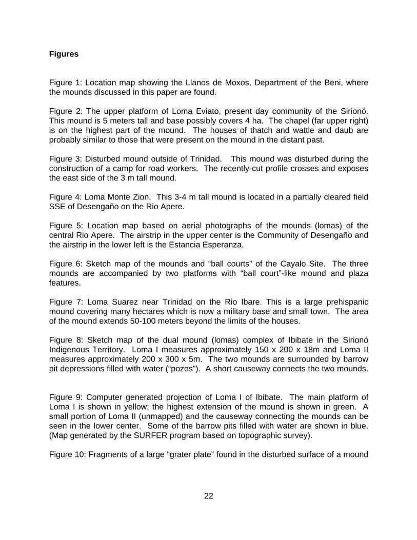
Figures Figure 1: Location map showing the Llanos de Moxos, Department of the Beni, where the mounds discussed in this paper are found. Figure 2: The upper platform of Loma Eviato, present day community of the Sirionó. This mound is 5 meters tall and base possibly covers 4 ha. The chapel (far upper right) is on the highest part of the mound. The houses of thatch and wattle and daub are probably similar to those that were present on the mound in the distant past. Figure 3: Disturbed mound outside of Trinidad. This mound was disturbed during the construction of a camp for road workers. The recently-cut profile crosses and exposes the east side of the 3 m tall mound. Figure 4: Loma Monte Zion. This 3-4 m tall mound is located in a partially cleared field SSE of Desengaño on the Rio Apere. Figure 5: Location map based on aerial photographs of the mounds (lomas) of the central Rio Apere. The airstrip in the upper center is the Community of Desengaño and the airstrip in the lower left is the Estancia Esperanza. Figure 6: Sketch map of the mounds and “ball courts” of the Cayalo Site. The three mounds are accompanied by two platforms with “ball court”-like mound and plaza features. Figure 7: Loma Suarez near Trinidad on the Rio Ibare. This is a large prehispanic mound covering many hectares which is now a military base and small town. The area of the mound extends 50-100 meters beyond the limits of the houses. Figure 8: Sketch map of the dual mound (lomas) complex of Ibibate in the Sirionó Indigenous Territory. Loma I measures approximately 150 x 200 x 18m and Loma II measures approximately 200 x 300 x 5m. The two mounds are surrounded by barrow pit depressions filled with water (“pozos”). A short causeway connects the two mounds. Figure 9: Computer generated projection of Loma I of Ibibate. The main platform of Loma I is shown in yellow; the highest extension of the mound is shown in green. A small portion of Loma II (unmapped) and the causeway connecting the mounds can be seen in the lower center. Some of the barrow pits filled with water are shown in blue. (Map generated by the SURFER program based on topographic survey). Figure 10: Fragments of a large “grater plate” found in the disturbed surface of a mound
23
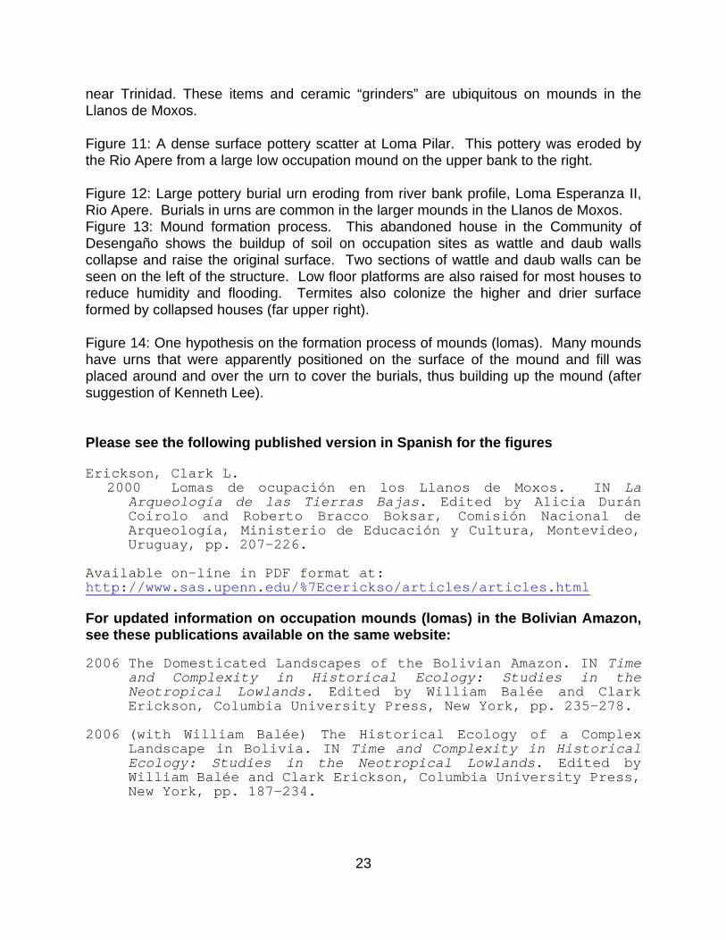
near Trinidad. These items and ceramic “grinders” are ubiquitous on mounds in the Llanos de Moxos. Figure 11: A dense surface pottery scatter at Loma Pilar. This pottery was eroded by the Rio Apere from a large low occupation mound on the upper bank to the right. Figure 12: Large pottery burial urn eroding from river bank profile, Loma Esperanza II, Rio Apere. Burials in urns are common in the larger mounds in the Llanos de Moxos. Figure 13: Mound formation process. This abandoned house in the Community of Desengaño shows the buildup of soil on occupation sites as wattle and daub walls collapse and raise the original surface. Two sections of wattle and daub walls can be seen on the left of the structure. Low floor platforms are also raised for most houses to reduce humidity and flooding. Termites also colonize the higher and drier surface formed by collapsed houses (far upper right). Figure 14: One hypothesis on the formation process of mounds (lomas). Many mounds have urns that were apparently positioned on the surface of the mound and fill was placed around and over the urn to cover the burials, thus building up the mound (after suggestion of Kenneth Lee). Please see the following published version in Spanish for the figures Erickson, Clark L.
2000 Lomas de ocupación en los Llanos de Moxos. IN La Arqueología de las Tierras Bajas. Edited by Alicia Durán Coirolo and Roberto Bracco Boksar, Comisión Nacional de Arqueología, Ministerio de Educación y Cultura, Montevideo, Uruguay, pp. 207-226.
Available on-line in PDF format at: http://www.sas.upenn.edu/%7Ecerickso/articles/articles.html For updated information on occupation mounds (lomas) in the Bolivian Amazon, see these publications available on the same website: 2006 The Domesticated Landscapes of the Bolivian Amazon. IN Time
and Complexity in Historical Ecology: Studies in the Neotropical Lowlands. Edited by William Balée and Clark Erickson, Columbia University Press, New York, pp. 235-278.
2006 (with William Balée) The Historical Ecology of a Complex
Landscape in Bolivia. IN Time and Complexity in Historical Ecology: Studies in the Neotropical Lowlands. Edited by William Balée and Clark Erickson, Columbia University Press, New York, pp. 187-234.