new photogrammetric tools for highway mapping - … · new photogrammetric tools for highway...
TRANSCRIPT

Presenter
George Southard 27 July 2015
Trimble Navigation Limited Colorado, USA
New Photogrammetric Tools for Highway Mapping
Photogrammetric Mapping
First - a Little History
Photogrammetric Mapping
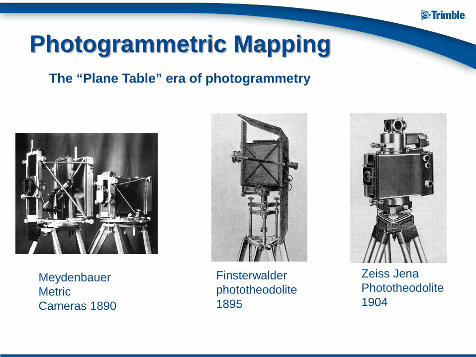
Finsterwalder phototheodolite 1895
Zeiss Jena Phototheodolite 1904
Meydenbauer Metric Cameras 1890
The “Plane Table” era of photogrammetry
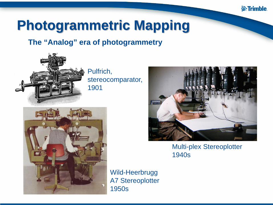
Multi-plex Stereoplotter 1940s
Pulfrich, stereocomparator, 1901
Photogrammetric Mapping The “Analog” era of photogrammetry
Wild-Heerbrugg A7 Stereoplotter 1950s
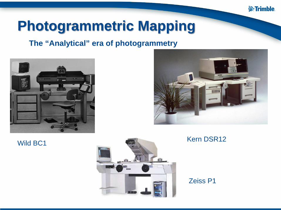
Photogrammetric Mapping The “Analytical” era of photogrammetry
Wild BC1 Kern DSR12
Zeiss P1

Photogrammetric Mapping The “Airborne” era of photogrammetry
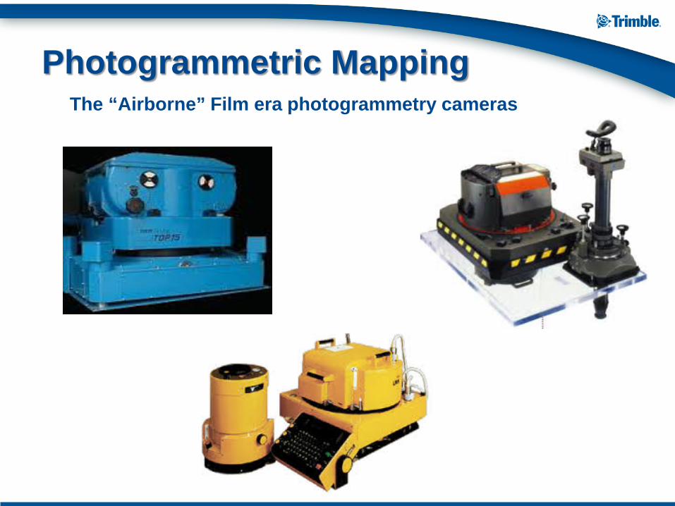
Photogrammetric Mapping The “Airborne” Film era photogrammetry cameras
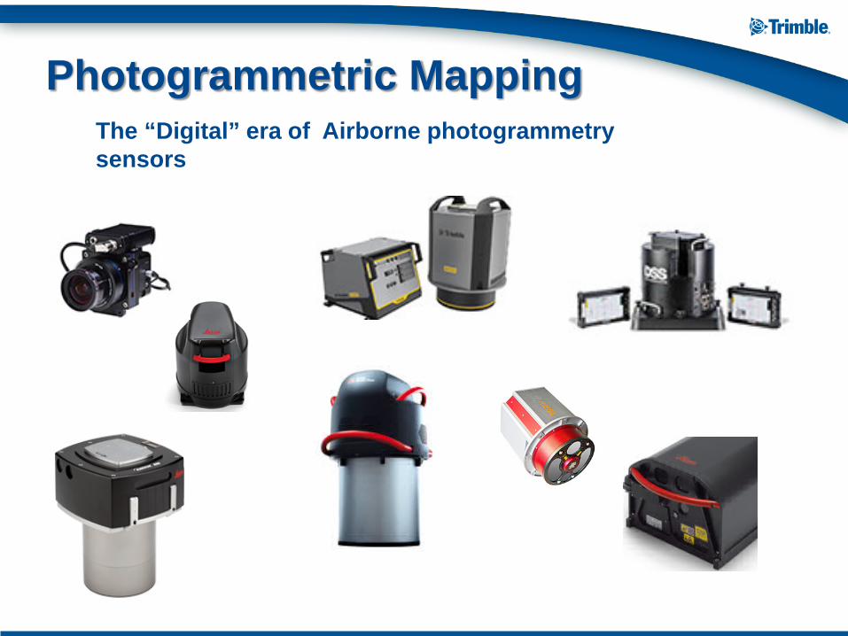
Photogrammetric Mapping The “Digital” era of Airborne photogrammetry sensors
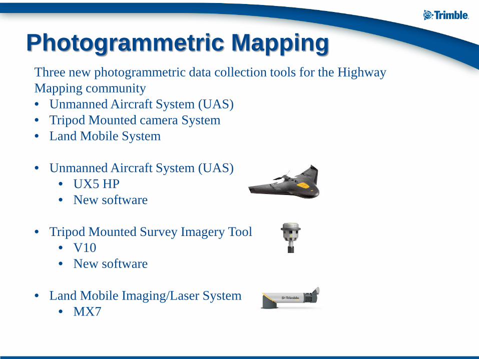
Photogrammetric Mapping Three new photogrammetric data collection tools for the Highway Mapping community • Unmanned Aircraft System (UAS) • Tripod Mounted camera System • Land Mobile System
• Unmanned Aircraft System (UAS)
• UX5 HP • New software
• Tripod Mounted Survey Imagery Tool
• V10 • New software
• Land Mobile Imaging/Laser System
• MX7
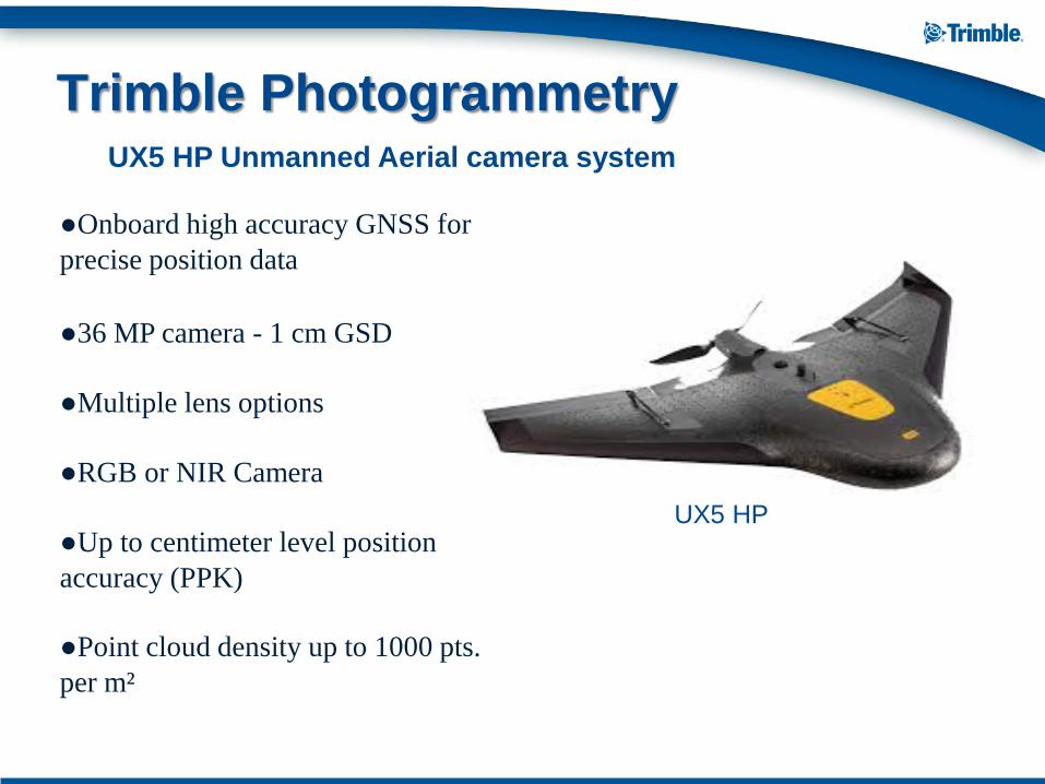
Trimble Photogrammetry UX5 HP Unmanned Aerial camera system
●Onboard high accuracy GNSS for precise position data ●36 MP camera - 1 cm GSD ●Multiple lens options ●RGB or NIR Camera ●Up to centimeter level position accuracy (PPK) ●Point cloud density up to 1000 pts. per m²
UX5 HP
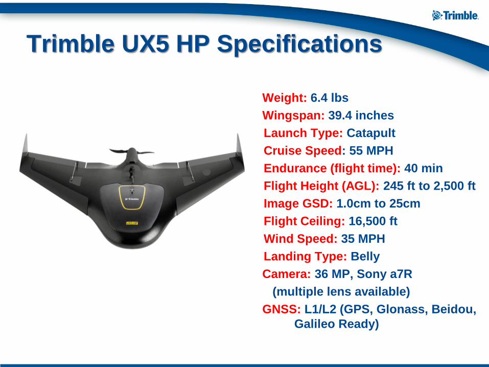
Trimble UX5 HP Specifications
Weight: 6.4 lbs Wingspan: 39.4 inches Launch Type: Catapult Cruise Speed: 55 MPH Endurance (flight time): 40 min Flight Height (AGL): 245 ft to 2,500 ft Image GSD: 1.0cm to 25cm Flight Ceiling: 16,500 ft Wind Speed: 35 MPH Landing Type: Belly Camera: 36 MP, Sony a7R (multiple lens available) GNSS: L1/L2 (GPS, Glonass, Beidou, Galileo Ready)
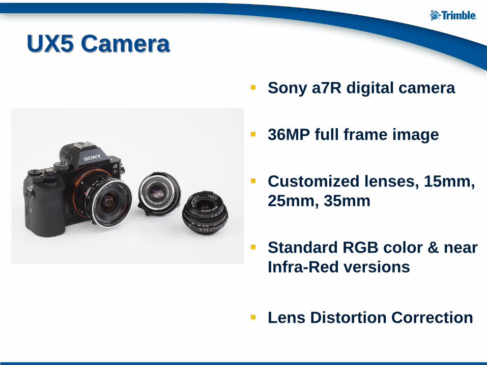
UX5 Camera Sony a7R digital camera 36MP full frame image Customized lenses, 15mm,
25mm, 35mm Standard RGB color & near
Infra-Red versions
Lens Distortion Correction
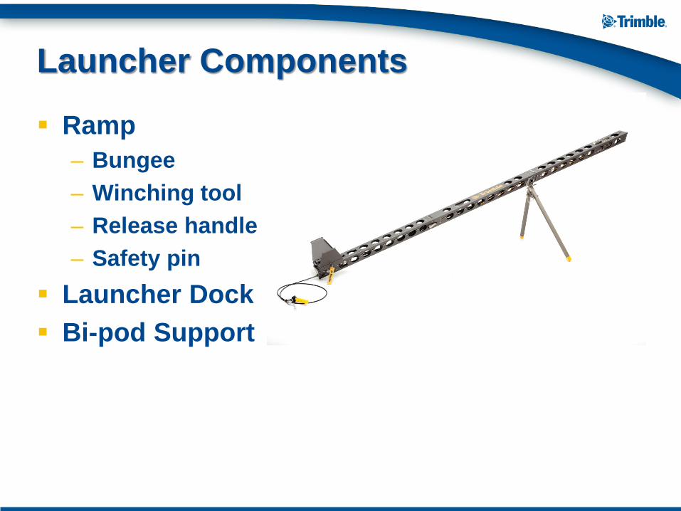
Launcher Components
Ramp – Bungee – Winching tool – Release handle – Safety pin
Launcher Dock Bi-pod Support
Launcher
Consistent launch – Speed – Launch angle – No risk of stall – Short learning curve for operator – Less stressful (user has to control speed & angle
with a hand launch) Safety
– Consistent & controlled launch sequence – User not exposed to running motor – Complies with Machinery Directive 2006/42/EC
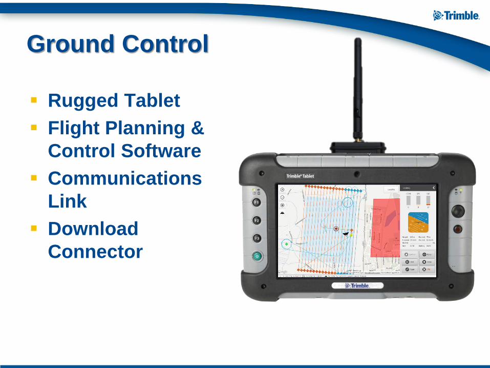
Ground Control
Rugged Tablet Flight Planning &
Control Software Communications
Link Download
Connector
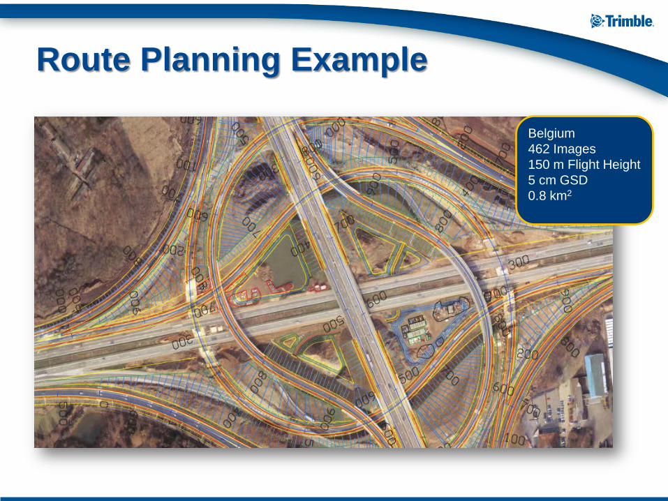
Route Planning Example
Belgium 462 Images 150 m Flight Height 5 cm GSD 0.8 km2
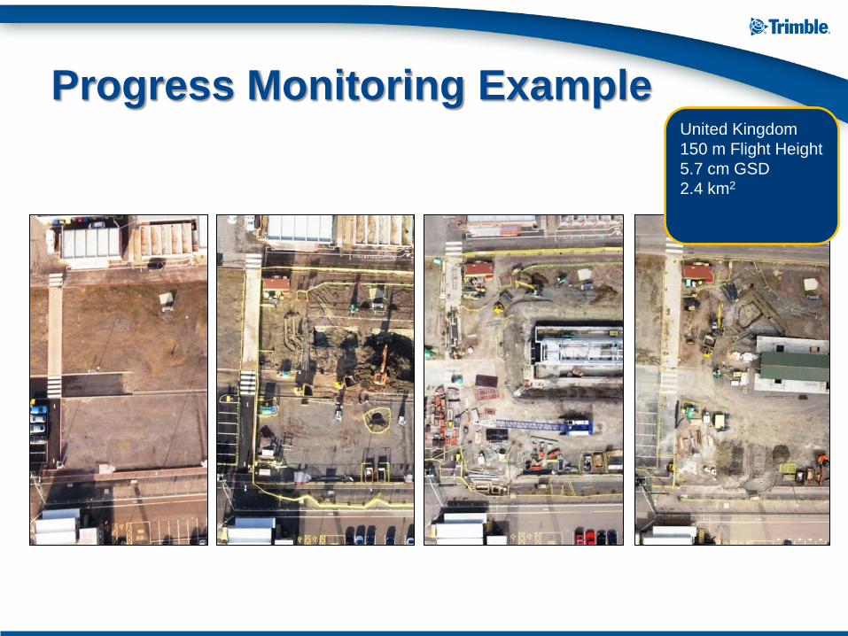
Progress Monitoring Example United Kingdom 150 m Flight Height 5.7 cm GSD 2.4 km2
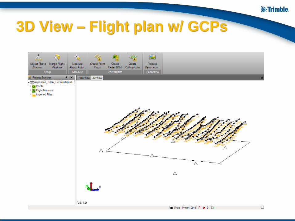
3D View – Flight plan w/ GCPs
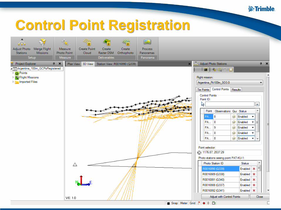
Control Point Registration
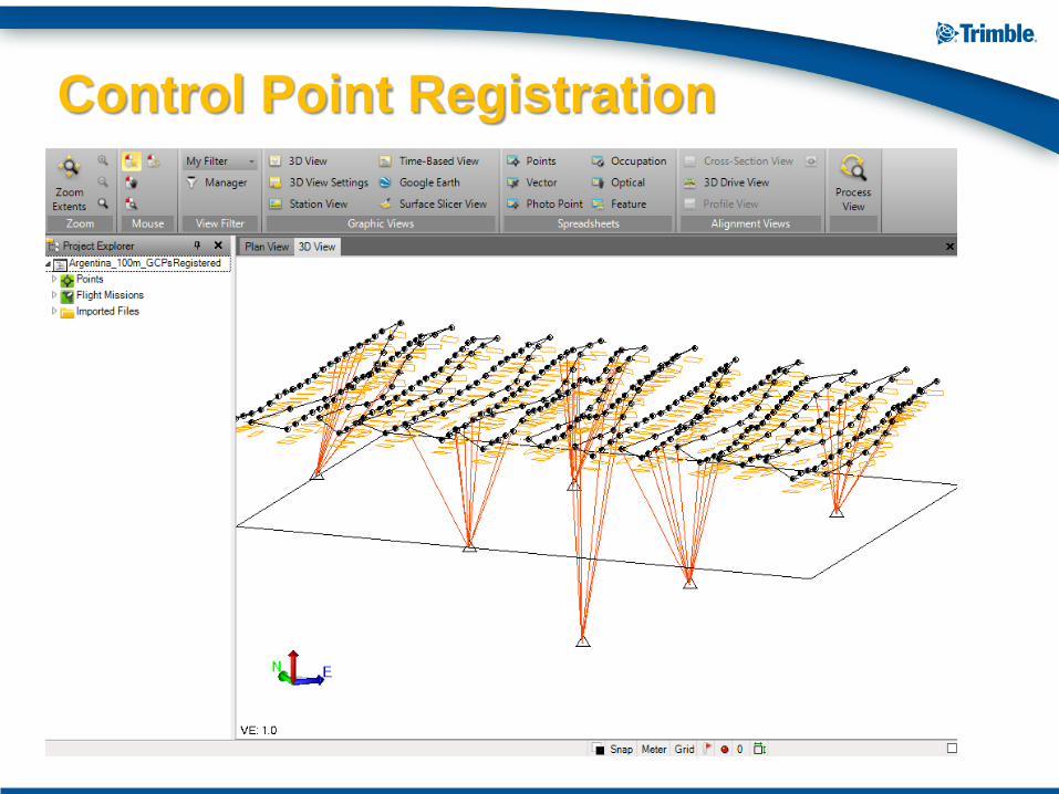
Control Point Registration
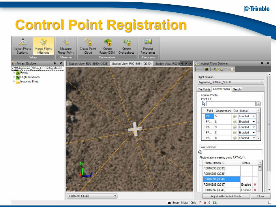
Control Point Registration
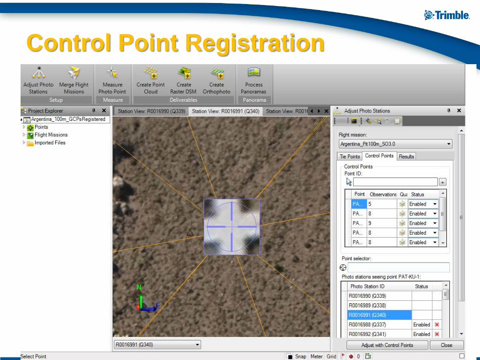
Control Point Registration
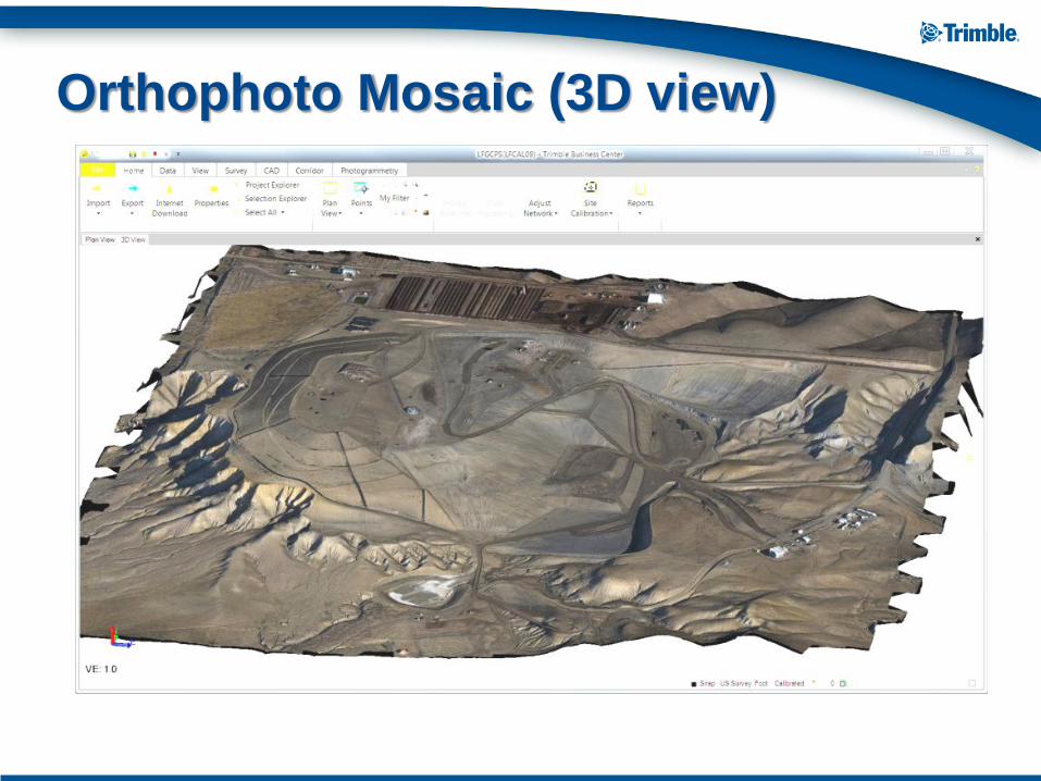
Orthophoto Mosaic (3D view)
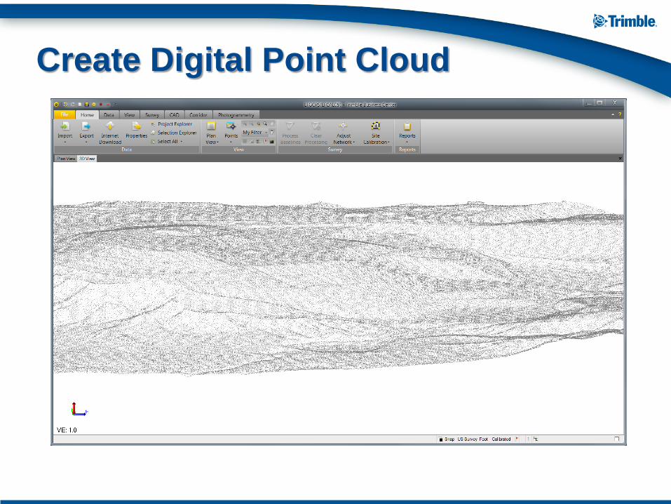
Create Digital Point Cloud
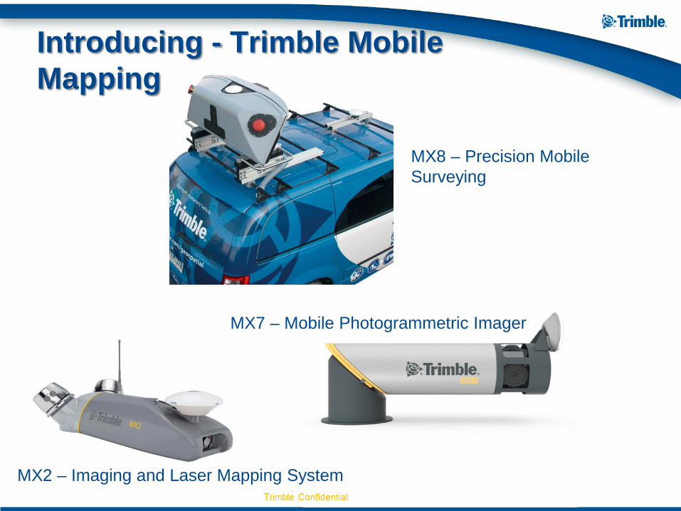
Introducing - Trimble Mobile Mapping
MX2 – Imaging and Laser Mapping System
MX8 – Precision Mobile Surveying
MX7 – Mobile Photogrammetric Imager
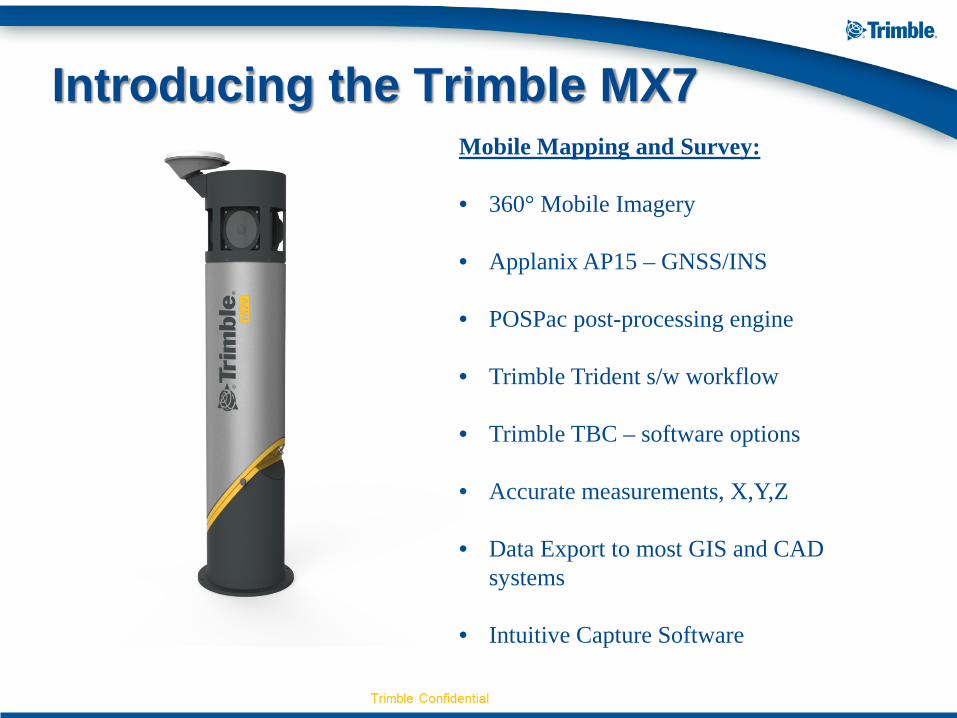
Introducing the Trimble MX7 Mobile Mapping and Survey:
• 360° Mobile Imagery
• Applanix AP15 – GNSS/INS
• POSPac post-processing engine
• Trimble Trident s/w workflow
• Trimble TBC – software options
• Accurate measurements, X,Y,Z
• Data Export to most GIS and CAD
systems
• Intuitive Capture Software
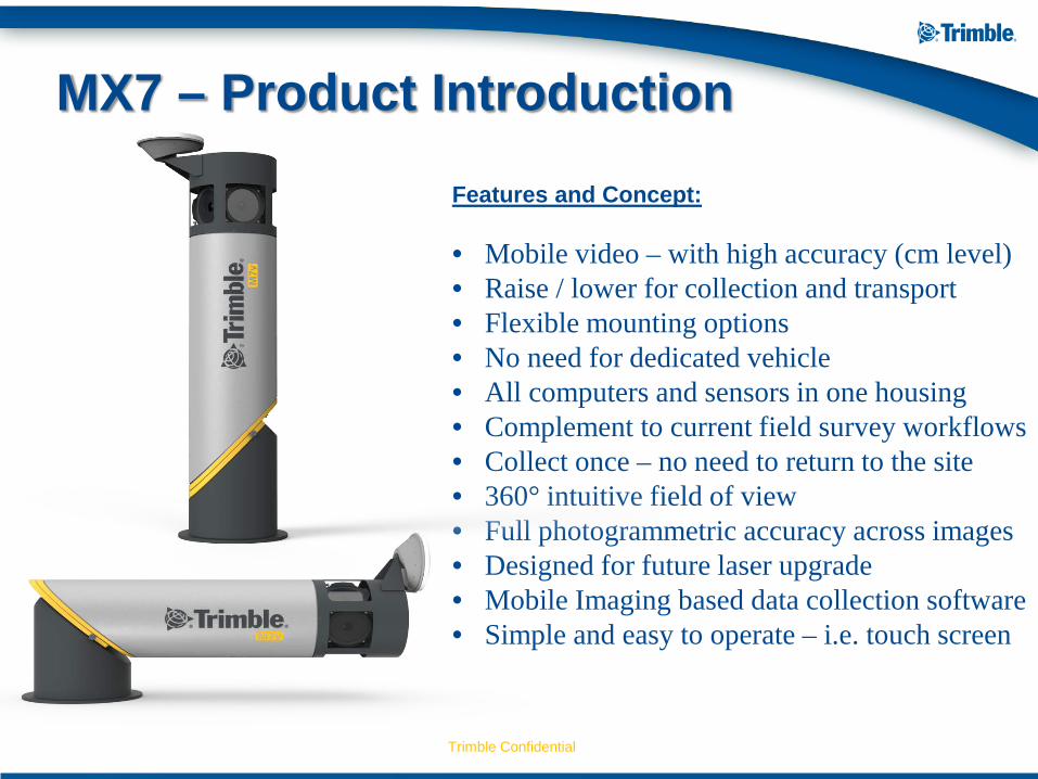
MX7 – Product Introduction
Features and Concept: • Mobile video – with high accuracy (cm level) • Raise / lower for collection and transport • Flexible mounting options • No need for dedicated vehicle • All computers and sensors in one housing • Complement to current field survey workflows • Collect once – no need to return to the site • 360° intuitive field of view • Full photogrammetric accuracy across images • Designed for future laser upgrade • Mobile Imaging based data collection software • Simple and easy to operate – i.e. touch screen
Trimble Confidential
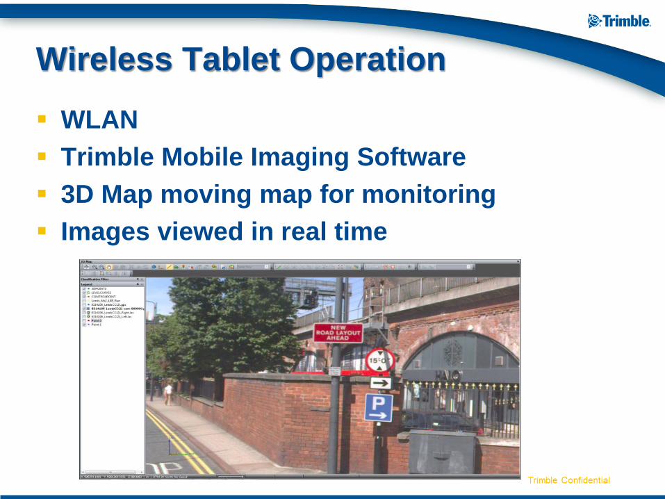
WLAN Trimble Mobile Imaging Software 3D Map moving map for monitoring Images viewed in real time
Wireless Tablet Operation
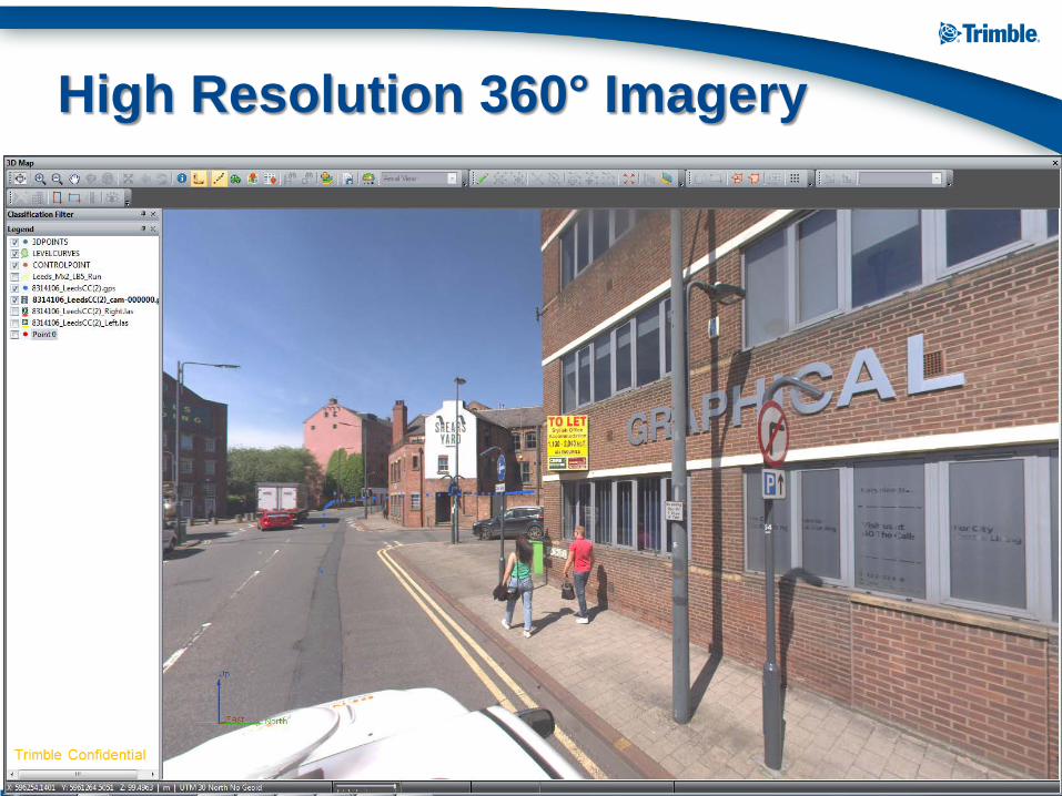
High Resolution 360° Imagery
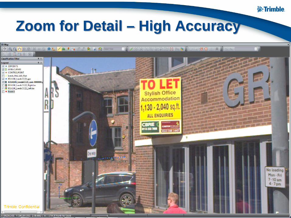
Zoom for Detail – High Accuracy
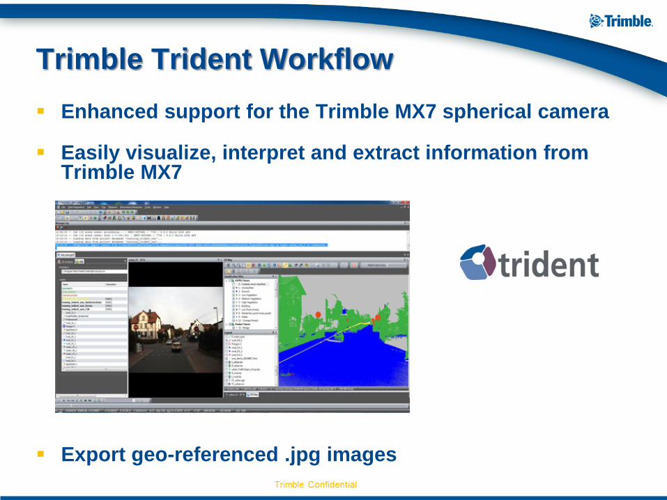
Enhanced support for the Trimble MX7 spherical camera Easily visualize, interpret and extract information from
Trimble MX7
Export geo-referenced .jpg images
Trimble Trident Workflow
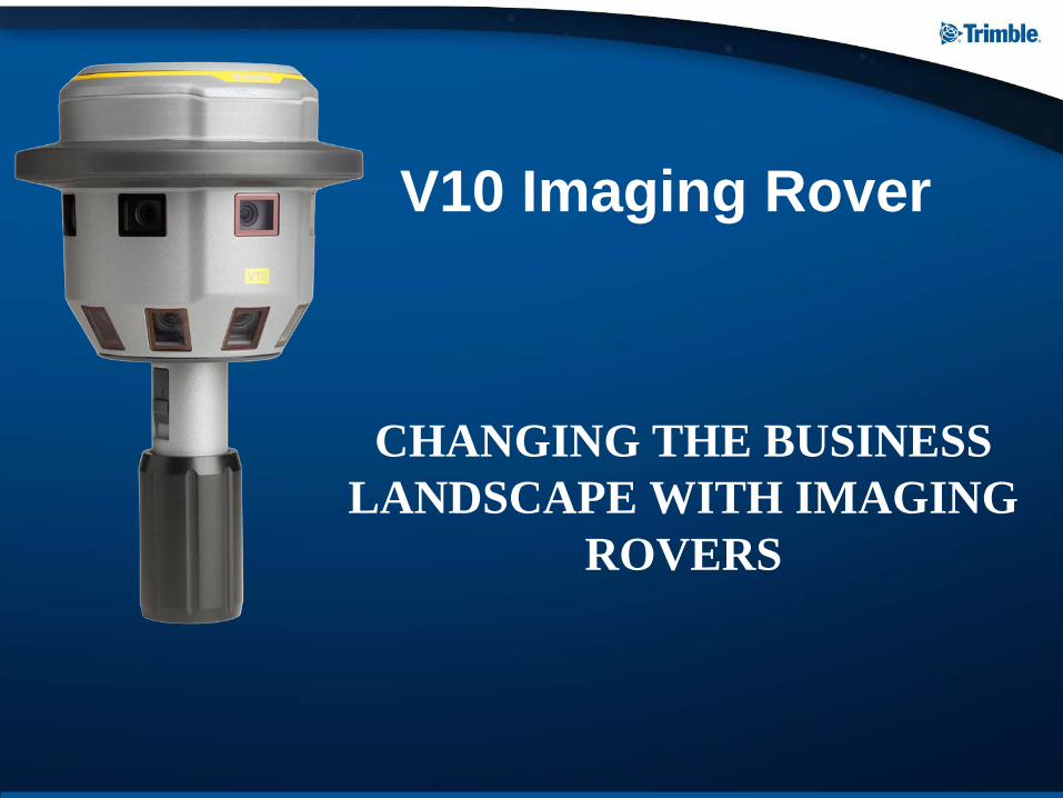
CHANGING THE BUSINESS LANDSCAPE WITH IMAGING
ROVERS
V10 Imaging Rover
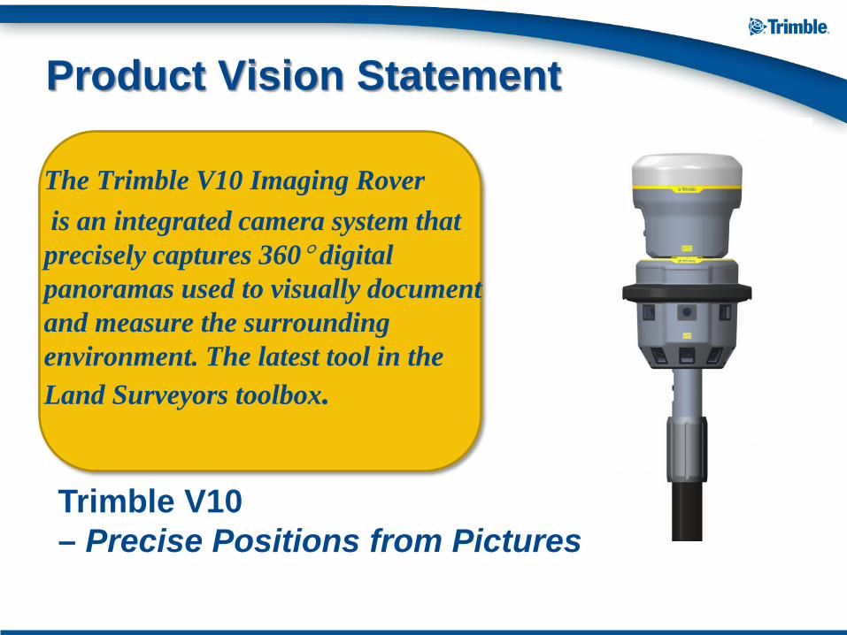
Product Vision Statement
The Trimble V10 Imaging Rover is an integrated camera system that precisely captures 360° digital panoramas used to visually document and measure the surrounding environment. The latest tool in the Land Surveyors toolbox.
Trimble V10 – Precise Positions from Pictures
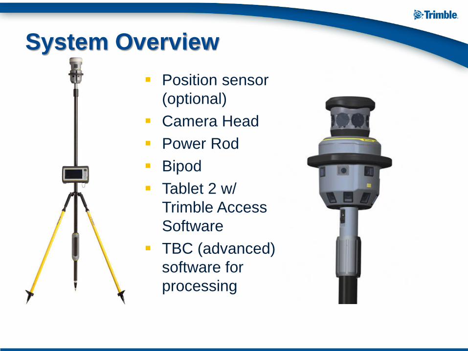
System Overview Position sensor
(optional) Camera Head Power Rod Bipod Tablet 2 w/
Trimble Access Software
TBC (advanced) software for processing
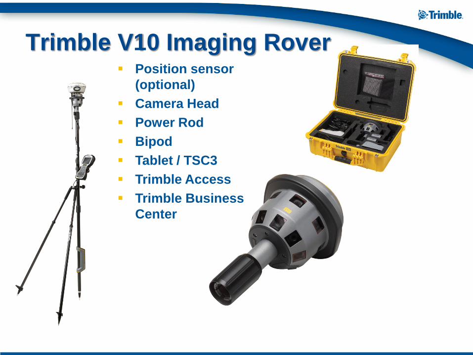
Trimble V10 Imaging Rover Position sensor
(optional) Camera Head Power Rod Bipod Tablet / TSC3 Trimble Access Trimble Business
Center
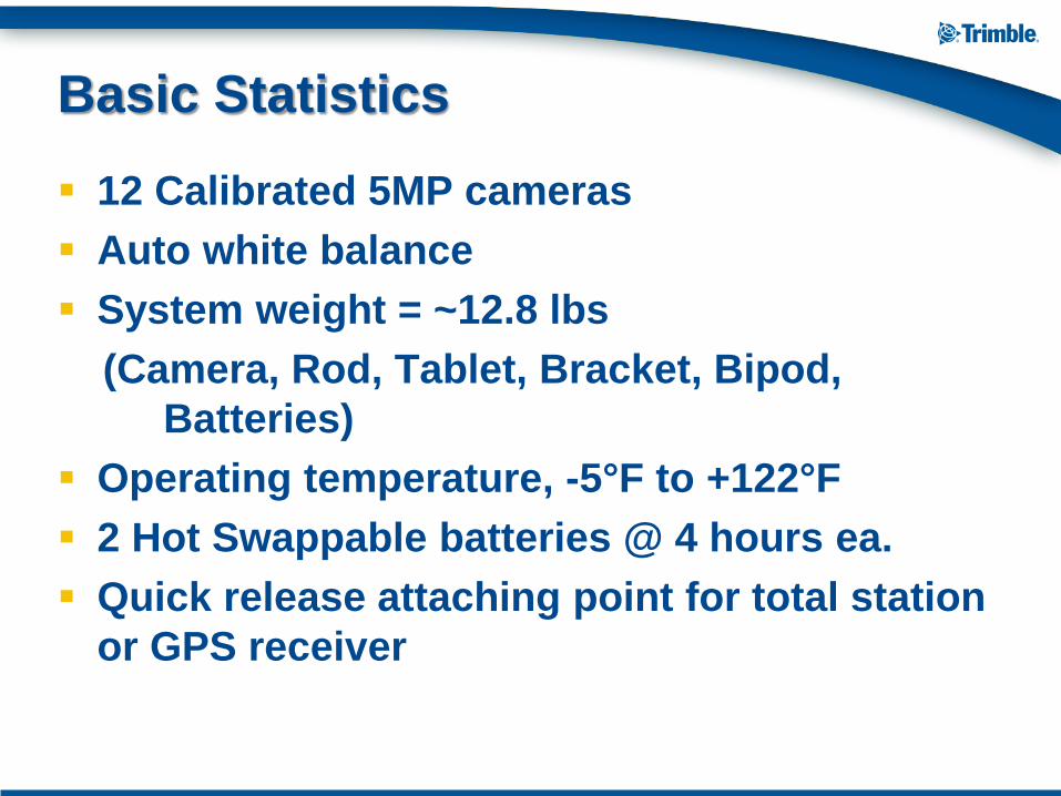
12 Calibrated 5MP cameras Auto white balance System weight = ~12.8 lbs (Camera, Rod, Tablet, Bracket, Bipod, Batteries) Operating temperature, -5°F to +122°F 2 Hot Swappable batteries @ 4 hours ea. Quick release attaching point for total station
or GPS receiver
Basic Statistics
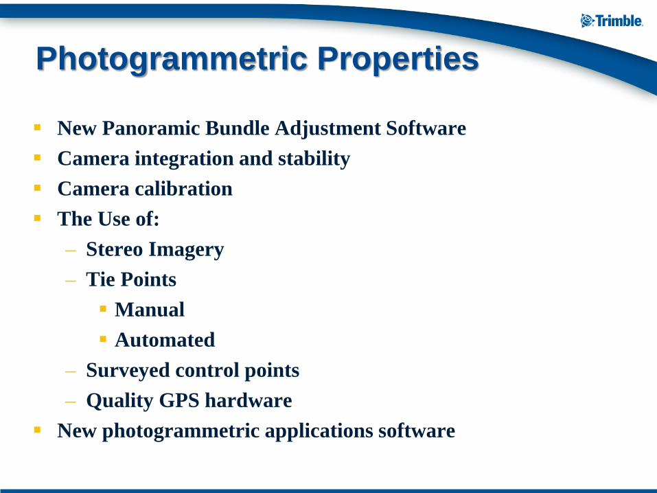
New Panoramic Bundle Adjustment Software Camera integration and stability Camera calibration The Use of:
– Stereo Imagery – Tie Points Manual Automated
– Surveyed control points – Quality GPS hardware
New photogrammetric applications software
Photogrammetric Properties
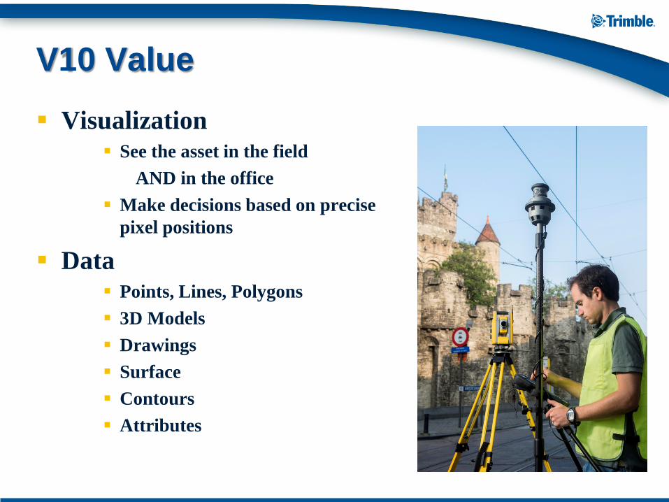
Visualization See the asset in the field AND in the office Make decisions based on precise
pixel positions
Data Points, Lines, Polygons 3D Models Drawings Surface Contours Attributes
V10 Value
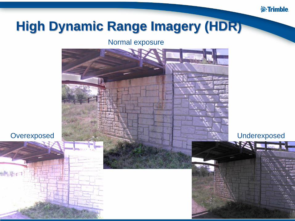
High Dynamic Range Imagery (HDR)
Underexposed
Normal exposure
Overexposed
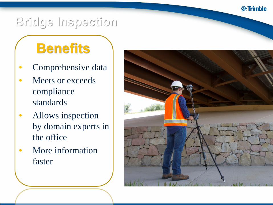
Benefits • Comprehensive data • Meets or exceeds
compliance standards
• Allows inspection by domain experts in the office
• More information faster
Bridge Inspection
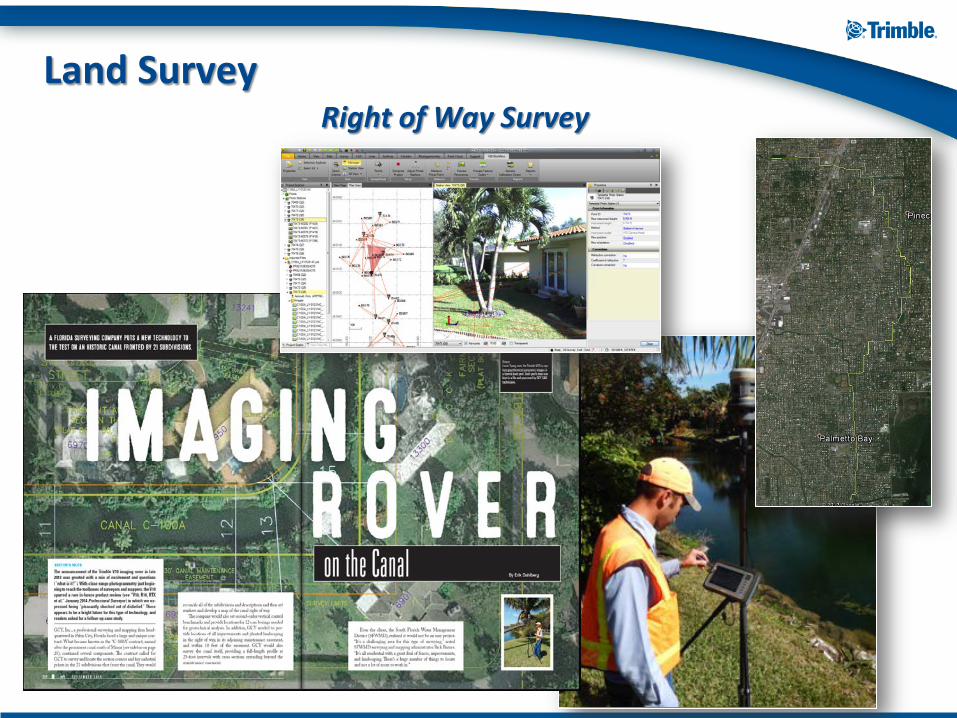
Right of Way Survey Land Survey
THANK YOU