mysore transportation
TRANSCRIPT

TRANSPORTATION ASSIGNMENT
MYSORE CITY
Submitted to:
Mr. Gaurav Vaidya sir
Submitted by:Sachin Rathod
(2013BPLN016)

CONTENT
CITY PROFILE
ROAD CONNECTIVITY
- ROAD NETWORKS
- TRANSPORT MEANS
RAIL CONNECTIVITY
AIR CONNECTIVITY
Source images: Mysore city images from Google

MYSORE CITY PROFILE Mysore, one of the largest districts
in Karnataka, is an important tourist and heritage centre.
Mysore city is the second biggest city of the State, which lies 135 Kms from the State Headquarters, Bangalore.
It is now the headquarters of Mysore District covering an area of more than 40 sq. km.
The city is well connected to the neighboring States of Kerala and Tamil Nadu through road and rail
network.

CONNECTIVITY TROUGH MYSORE CITY

ROAD CONNECTIVITY
State highways 17, 33, 88 pass through Mysore connecting it to nearby cities.
Mysore is connected by National Highway NH-212 to the state border town of Gundlupet, where the road forks into the states of Kerala and Tamil Nadu.
State Highway 17, which connects Mysore to Bangalore, was upgraded to a four-lane highway in 2006, reducing travel time between the two cities.
State Highways 33 and 88 connects Mysore city to H D Kote and Madikeri respectively.
The existing four-lane road linking Mysore to Bangalore is being upgraded to a six-lane highway, thus significantly reducing the commute time. `

ROAD NETWORK MAP


Mysore city has radial and gridiron pattern road network with arterial roads originating from the city centre. Palace is the focal point of origin of all arterial roads running radially to outer areas of the city. The city has 5 main arterial roads, which are also the State Highways connecting
Bangalore and Ooty
Bannur and Kanakapura
Hunsur and Mangalore
H.D. Kote and Manantvady
The total road network in the city was 335 kilometers in 1971. It increased to 432 kilometers in 1981, which accounts for 29% of increase over a decade. There are 48 main roads in the city covering a total length of around 58 km. As on 2011, the total length of all types of roads was about 1773 km.
ROAD CONNECTIVITY

TRANSPORT MEANS
The Karnataka State Road Transport corporation (KSRTC) and other private agencies operate buses both within the city and between cities.
Within the city, buses are cheap and popular means of transport, auto-rickshaws are available, and tongas (horse-drawn carriages) are popular.
Mysore also has a 42.5-kilometre (26.4 mi) long ring
road that is being upgraded to six lanes by the MUDA.
Source: Outer Ring Road Mysore Project
S no. Types of vehicles Total No. of vehicles
1. 2 – wheelers 286079
2. Cars 324313. Auto rickshaws 14677
4. Motor cab 16155. Omni Buses 27576. KSRTC & Pvt. Buses 2693
7. Trucks 59378. Others 8825
TOTAL 355014
Vehicles registered in Mysore as on year 2011
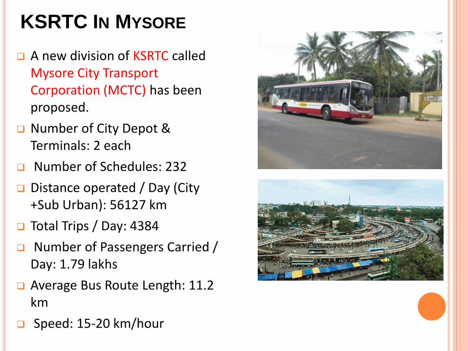
KSRTC IN MYSORE
A new division of KSRTC called Mysore City Transport Corporation (MCTC) has been proposed.
Number of City Depot & Terminals: 2 each
Number of Schedules: 232
Distance operated / Day (City +Sub Urban): 56127 km
Total Trips / Day: 4384
Number of Passengers Carried / Day: 1.79 lakhs
Average Bus Route Length: 11.2 km
Speed: 15-20 km/hour

OUTER RING ROAD (ORR)
Outer Ring Road (ORR) around Mysore City was conceived to
divert the traffic from the city area, which are crossing through the
city and minimize the congestion within the city.
The entire length of ORR takes off from Bangalore – Mysore
Road (SH-17) and circumferences Mysore City on the western
side crossing KRS Road, Hunsur Road, Bogadi Road, HD Kote
Road and joins the Ooty Road near the Regulated Market; and in
the eastern side crossing Bannur Road and joins Mahadevpura
Road near Star Poultry Farm.
Along the western side of the city, the ORR of 25 km stretch is
mainly 2 lane which is proposed to be widened to 4 lane divided
carriageway. Towards the eastern side, 7.2 Km stretch ORR is 4
lane divided carriageway of 20m wide and 9.5 Km stretch between
Bannur and Nanjangud is yet to be tackled.

RAIL CONNECTIVITY
The first railway line established in the city was the Bangalore–Mysore Junction metre gauge line, which was commissioned in 1882.
Mysore railway station has three lines, connecting it to Bangalore, Hassan and Chamarajanagar.
Mysore is the railway junction for the district, and rail lines connect Mysore city to Bangaloreto the northeast via Mandya, the rail junction at Hassan to the northwest, and Chamarajanagar via Nanjangud to the south east.

AIRWAYS
Mysore Airport also known as Mandakalli Airport is an airport serving the city of Mysore.
Distance from the City:10 Kms .
After the airport was commissioned for operation in 2010, Kingfisher Airlines operated daily flights, connecting Mysore with Chennai, Delhi, Mumbai via Bangalore.
The flights operated with nearly 75% occupancy inbound to Mysore, while the occupancy was said to be low in the outbound from Mysore.
Chartered flights have been operating since the airport was recommissioned, with 150 flights operating in 2010 and 155 in 2011.

REFERENCE
www.mysore.nic.in
www.mapsofindia.com
Mysore City Corporation
CDP Mysore

THANK
YOU