muddy waters and the wadden sea harbours
TRANSCRIPT
WODCON XXI PROCEEDINGS
MUDDY WATERS AND THE WADDEN SEA HARBOURS E. van Eekelen1, M.J. Baptist2, P.J.T. Dankers3, B. Grasmeijer 4, T. van Kessel 5 and D.S. van Maren6
ABSTRACT
Several harbours along the Dutch Wadden Sea deal with large siltation rates and limited possibilities for developments. However, development of new harbour activities is needed for these harbours to be able to survive in the long run. As these harbours lie in or close to areas with a protected status, expansion is not straightforward. In this paper we illustrate that harbour development is possible when a Building with Nature approach is used. This approach facilitates a design in which the proactive utilization and/or provision of ecosystem services serves as part of the engineering solution. We introduce four Building with Nature concepts that can be used in harbour designs, i.e. 1) optimising dredging strategies, 2) enhancing saltmarsh development, 3) creating estuarine gradients, and 4) optimising flow patterns. Based on these concepts, three case studies have been identified and pilot projects initiated. In the Port of Harlingen a pilot has started in which an optimized dredging strategy is combined with saltmarsh development. Around the Port of Delfzijl an estuarine gradient is combined with a salt marsh. For the Port of Den Helder a new design was proposed in which the concepts of enhancing salt marsh development, creating estuarine gradients and optimizing flow patterns are combined. Our conclusion is that even in a UNESCO listed site such as the Wadden Sea, harbour development is possible when ecosystem services are used and provided for, and when a Building with Nature concept is put at the heart of an engineering design. Keywords: Ecosystem services, Building with Nature, cohesive sediment, harbour development, wetland restoration
INTRODUCTION
The Wadden Sea, the largest coherent system in the world of intertidal sand flats and mud flats, is listed as UNESCO World Heritage since 2009 because of its Outstanding Universal Value on geological and ecological processes and biodiversity (Reise et al. 2010, Schuerch et al. 2014). Yet, the coastal morphology and thereby hydrodynamic conditions and suspended sediment concentrations have been highly affected by human interventions such as the construction of dikes, dams, harbours and polders and dredging works for navigation (Allen 2000, Reise 2005, Lotze et al. 2006, Elias et al. 2012). As a result, the ecological value of the system, especially in and around the economically active regions, such as harbours, has decreased. At the same time, harbour development, an important economical factor in these areas, is hampered due to the protected status of nature in this UNESCO and Natura2000 site. A headlock that can only be solved when harbour development is combined with nature development.
1 Environmental Engineer, Van Oord Dredging and Marine Contractors, Schaardijk 211, 3063 NH Rotterdam, The
Netherlands, T: +31 88 8268571, [email protected] 2 Ecologist, IMARES Wageningen UR, Ankerpark 27, 1781 AG Den Helder, The Netherlands, T: +31-317-487068,
[email protected]. 3 Morphologist, Royal HaskoningDHV, Jonkerbosplein 52, 6534 AB Nijmegen, The Netherlands, T: +31-88-
3486869, [email protected] 4 Coastal Morphologist, Arcadis, Hanzelaan 286, 8017 JJ Zwolle, The Netherlands, T: +31 646 129 960, Email:
[email protected] 5 Morphologist, Deltares, Postbus 177, 2600 MH Delft, the Netherlands, +31 615306670,
[email protected]. 6 Morphologist, Deltares, Postbus 177, 2600 MH Delft, the Netherlands, +31 615306670,
WODCON XXI PROCEEDINGS
The Dutch Wadden Sea has four medium sized harbours. All harbours have to deal with large siltation rates and limited expansion space. Within the EcoShape Building with Nature research program (BwN), special attention is given to these Wadden Sea harbours. In order to continue economic development and growth, to safeguard the protected status of the Wadden Sea and to unbundle the headlock, a new design and development method is needed. The BwN Wadden Sea Harbours program started in 2013. Its focus is on decreasing siltation rates and increasing the potential for harbour development whilst at the same time enhancing the ecological state of the harbour and its direct surroundings. A ‘learning by doing’ approach is followed in which a variety of BwN-concepts is tested and studied in the most promising locations within the Wadden Sea area. In this paper we firstly introduce the general concept of Building with Nature designs. Thereafter we elaborate on the specific concepts that will be implemented in pilot studies in the Wadden Sea area. The focus lies on the Wadden Sea harbours, their problems and limitations and mostly their opportunities.
BUILDING WITH NATURE CONCEPTS
General A key characteristic that distinguishes a BwN design from other integral approaches is the proactive utilization and/or provision of ecosystem services as part of the engineering solution (De Vriend and Van Koningsveld 2012; De Vriend et al. 2014b). Although situations differ, some basic steps appear to be part of every BwN design. The following design steps were developed, tested and supported by scientific knowledge in the first BwN programme (De Vriend and Van Koningsveld 2012; De Vriend et al. 2014b; De Vries et al. 2014):
• Step 1: Understand the system (including ecosystem services, values and stakeholder interests) • Step 2: Identify realistic alternatives that use and/or provide ecosystem services • Step 3: Evaluate the qualities of each alternative and preselect an integral solution • Step 4: Fine-tune the selected solution (practical restrictions, governance context) • Step 5: Prepare the solution for implementation in the next project phase (ToR)
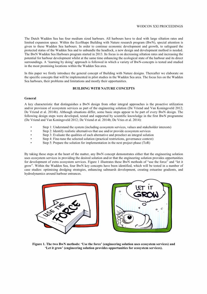
By taking these steps at the heart of the matter, any BwN concept demonstrates either that the engineering solution uses ecosystem services in providing the desired solution and/or that the engineering solution provides opportunities for development of extra ecosystem services. Figure 1 illustrates these BwN methods of “use the force” and “let it grow”. Within the Wadden Sea, four BwN key concepts have been identified, which will be tested in a number of case studies: optimising dredging strategies, enhancing saltmarsh development, creating estuarine gradients, and hydrodynamics around harbour entrances.
Figure 1. The two BwN methods: ‘Use the force’ (engineering solution uses ecosystem services) and
‘Let it grow’ (engineering solution provides opportunities for ecosystem services).
WODCON XXI PROCEEDINGS
Optimizing Dredging Strategies Dredging of sediments from ports and access channels provides an economic loss to port authorities, while disposal of sediments is often considered to have negative environmental consequences through high turbidities resulting in loss of visibility and burial of benthic organisms. At the same time, sediment is becoming an increasingly valuable resource (especially in view of accelerating sea level rise). One of the BwN concepts that will be tested in a pilot study is using fine-grained sediments dredged from a Wadden Sea harbour as a resource. Mud dredged from the port of Harlingen will be disposed close to the shore, at a location where tidal flows will transport the material to nearby intertidal and salt marsh zones: a Mud Motor. The sediment will be dredged and transported in a small trailing hopper suction dredger (approximate capacity of 600 m3). Dredging and dumping will take place in the storm season over an 8 month period from September to March in two or three consecutive years. Differing from the Sand Motor or Sand Engine, in which a large volume of sand was deposited once (Aarninkhof et al. 2012; Stive et al. 2013), the Mud Motor will serve as a semi-continuous source of sediment. The aim of the pilot project is to realize and monitor this mud motor. At the same time the project is coupled to a fundamental research program aiming at understanding in detail the underlying physical and ecological processes. Such in-depth knowledge is essential for upscaling the concept to different and / or larger environments. If the pilot is successful, this technique can be applied elsewhere to increase coastal protection or prevent drowning of salt marshes under relative sea level rise (Schuerch et al. 2013). This concept uses both BwN methods “use the force” and “let it grow”. Enhancing Salt Marsh Development Coastal habitats such as tidal areas and salt marshes are ranked among the most important habitats in the Netherlands regarding ecosystem services (Temmerman et al. 2013). One of these services, next to water infiltration and regulation, nurturing fisheries and providing livelihoods to communities, from shellfisheries to tourist industries, is coastal protection through wave attenuation (Möller 2006, Temmerman et al. 2013, Bouma et al. 2014). Therefore, tidal flat and salt marshes form a very important part of coastal safety worldwide. The development of new salt marshes in areas where they do not yet exist is one of the concepts being used in the BwN Wadden Sea Harbour program. The concept can be executed differently at different locations. At some locations a sufficiently solid foundation is firstly needed before development can start. At other locations this foundation may be present and other boundary conditions, such as a more sheltered area, the availability of suspended sediment or pioneering species, must be provided for. A pilot study executed near the harbour of Delfzijl will provide valuable new information concerning these issues. This concept uses both BwN methods “use the force” and “let it grow”. Creating Estuarine Gradients In most of the Wadden Sea harbours, the release of freshwater runoff from the hinterland is contributing significantly to the maintenance dredging requirements. The estuarine gradients concept was developed to resolve this issue. The concept consists of creating bypasses around a harbour, creating more gradual salinity transitions and accompanying natural variations, whilst at the same time improving fish passage possibilities. These solutions form a win-win situation reducing maintenance dredging and improving the natural quality. This concept uses both BwN methods “use the force” and “let it grow”. Optimizing Flow Patterns The configuration of harbour breakwaters strongly influences the hydrodynamics, and therefore morphologic changes in the area around a harbour. Traditionally, the design of breakwaters primarily aims at optimizing the hydrodynamic conditions for ship traffic (safety) and minimizing harbour siltation. However, breakwater design may be additionally optimized to improve the hydromorphological conditions of the surrounding coastal area, thus improving local habitats. Typical effects of different layouts are a change in flow and sediment flow patterns and as a result the development of salt marshes, tidal flats or brackish environments. This concept may be used at locations where the possibilities for harbour expansion are limited due to regulation on nature protection. In general an extensive hydromorphological study is necessary to determine which harbour layout will serve the ecological quality of a surrounding area best. This concept uses one or two BwN methods, depending on the design specifics.
WODCON XXI PROCEEDINGS
OVERVIEW OF PILOT PROJECTS
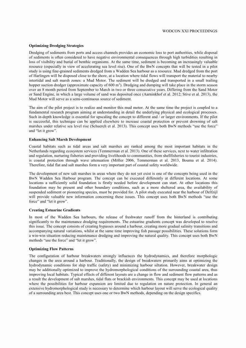
Based on the concepts illustrated above, a number of case studies have been identified. Three of these will be elaborated below in more detail. Salt Marsh Development By a Mud Motor To safeguard navigation, about 1.3 million m3 of mainly fine sediments are dredged in the harbour basins of the Port of Harlingen. The dredged sediment is disposed in the Wadden Sea, in the vicinity of the harbour. It is expected that a considerable amount of sediment shows a return flow towards the harbour, leading to a cyclic series of dredging and disposal. This is not only economically inefficient, it may also lead to increased local turbidity, negatively impacting primary production and the ecological food chain (Allen 2000, Reise 2005, Lotze et al. 2006, Eriksson et al. 2010, Elias et al. 2012). Beneficial use of these dredged sediments by disposing the sediment at a new location (see Figure 2), closer to a salt marsh system, is expected to:
1. Reduce recirculation towards the harbour, hence less maintenance dredging; 2. Promote the growth and stability of salt marshes, improving the Wadden Sea ecosystem; 3. Stabilize the foreshore of the dykes, and therefore less maintenance of the dyke.
Figure 2. Overview of dredge site (Port of Harlingen), (1) Mud Motor location and
(2) saltmarsh development location. Within the Building with Nature program a pilot was set up in order to determine the effectiveness of using offshore deposited excess dredge material from the harbour for salt marsh development (Figure 2). The new disposal location was determined based on numerical model predictions. The effectiveness of the mud motor in accreting the foreshore will be monitored through detailed bed level monitoring, but especially through the use of tracers. Tracers will be released at the existing disposal location, and at the new disposal location, to determine the effectiveness in dredged sediments reaching the salt marsh area. Combined with detailed measurements of suspended sediment transport processes, numerical hindcasts of the tracer experiments will improve prediction of dredge spoil release in very muddy, shallow environments, including the transport from the subtidal zone, through the intertidal area, towards the salt marshes. Salt marsh accretion is the result of the balance between mud sediment deposition, sediment erosion and soil compaction. It is hypothesized that by the sediment load of tidal flows over the salt marshes will increase due to the
Transport from Port of Harlingen to Mud Motor by dredging vessel Transport from Mud Motor to saltmarsh development location by natural forcing
WODCON XXI PROCEEDINGS
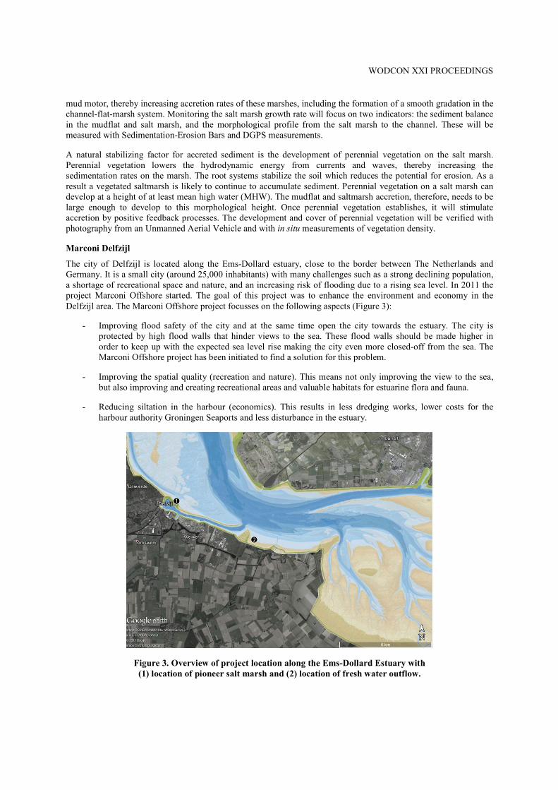
mud motor, thereby increasing accretion rates of these marshes, including the formation of a smooth gradation in the channel-flat-marsh system. Monitoring the salt marsh growth rate will focus on two indicators: the sediment balance in the mudflat and salt marsh, and the morphological profile from the salt marsh to the channel. These will be measured with Sedimentation-Erosion Bars and DGPS measurements. A natural stabilizing factor for accreted sediment is the development of perennial vegetation on the salt marsh. Perennial vegetation lowers the hydrodynamic energy from currents and waves, thereby increasing the sedimentation rates on the marsh. The root systems stabilize the soil which reduces the potential for erosion. As a result a vegetated saltmarsh is likely to continue to accumulate sediment. Perennial vegetation on a salt marsh can develop at a height of at least mean high water (MHW). The mudflat and saltmarsh accretion, therefore, needs to be large enough to develop to this morphological height. Once perennial vegetation establishes, it will stimulate accretion by positive feedback processes. The development and cover of perennial vegetation will be verified with photography from an Unmanned Aerial Vehicle and with in situ measurements of vegetation density. Marconi Delfzijl The city of Delfzijl is located along the Ems-Dollard estuary, close to the border between The Netherlands and Germany. It is a small city (around 25,000 inhabitants) with many challenges such as a strong declining population, a shortage of recreational space and nature, and an increasing risk of flooding due to a rising sea level. In 2011 the project Marconi Offshore started. The goal of this project was to enhance the environment and economy in the Delfzijl area. The Marconi Offshore project focusses on the following aspects (Figure 3):
- Improving flood safety of the city and at the same time open the city towards the estuary. The city is protected by high flood walls that hinder views to the sea. These flood walls should be made higher in order to keep up with the expected sea level rise making the city even more closed-off from the sea. The Marconi Offshore project has been initiated to find a solution for this problem.
- Improving the spatial quality (recreation and nature). This means not only improving the view to the sea, but also improving and creating recreational areas and valuable habitats for estuarine flora and fauna.
- Reducing siltation in the harbour (economics). This results in less dredging works, lower costs for the harbour authority Groningen Seaports and less disturbance in the estuary.
Figure 3. Overview of project location along the Ems-Dollard Estuary with
(1) location of pioneer salt marsh and (2) location of fresh water outflow.
WODCON XXI PROCEEDINGS
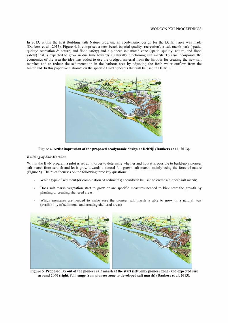
In 2013, within the first Building with Nature program, an ecodynamic design for the Delfzijl area was made (Dankers et al., 2013), Figure 4. It comprises a new beach (spatial quality: recreation), a salt marsh park (spatial quality: recreation & nature, and flood safety) and a pioneer salt marsh zone (spatial quality: nature, and flood safety) that is expected to grow in due time towards a naturally functioning salt marsh. To also incorporate the economics of the area the idea was added to use the dredged material from the harbour for creating the new salt marshes and to reduce the sedimentation in the harbour area by adjusting the fresh water outflow from the hinterland. In this paper we elaborate on the specific BwN concepts that will be used in Delfzijl.
Figure 4. Artist impression of the proposed ecodynamic design at Delfzijl (Dankers et al., 2013).
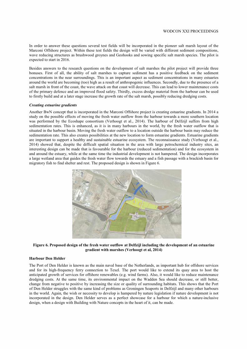
Building of Salt Marshes Within the BwN program a pilot is set up in order to determine whether and how it is possible to build-up a pioneer salt marsh from scratch and let it grow towards a natural full grown salt marsh, mainly using the force of nature (Figure 5). The pilot focusses on the following three key questions:
- Which type of sediment (or combination of sediments) should/can be used to create a pioneer salt marsh; - Does salt marsh vegetation start to grow or are specific measures needed to kick start the growth by
planting or creating sheltered areas; - Which measures are needed to make sure the pioneer salt marsh is able to grow in a natural way
(availability of sediments and creating sheltered areas)
Figure 5. Proposed lay out of the pioneer salt marsh at the start (left, only pioneer zone) and expected size around 2060 (right, full range from pioneer zone to developed salt marsh) (Dankers et al, 2013).
WODCON XXI PROCEEDINGS
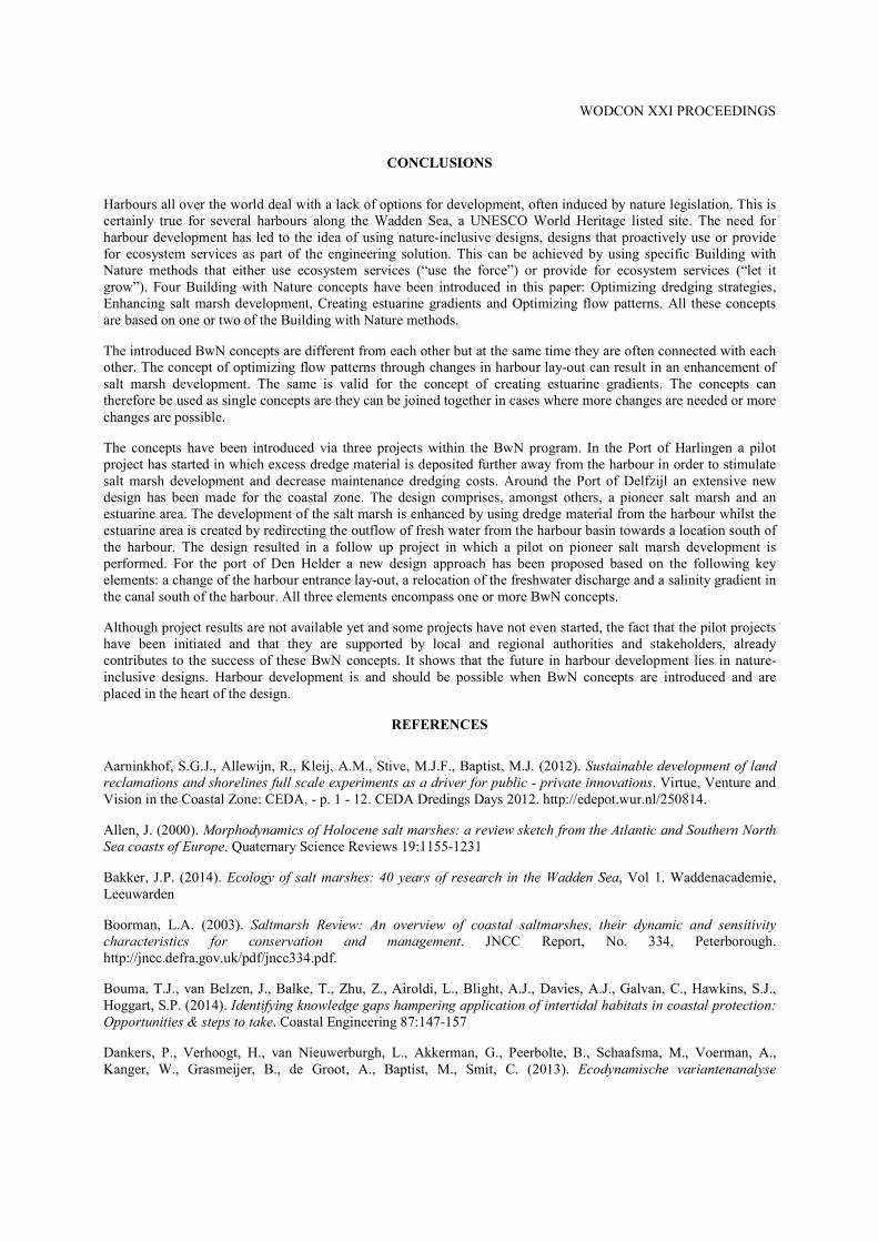
In order to answer these questions several test fields will be incorporated in the pioneer salt marsh layout of the Marconi Offshore project. Within these test fields the design will be varied with different sediment compositions, wave reducing structures as brushwood groynes and Geohooks and sowing specific salt marsh species. The pilot is expected to start in 2016. Besides answers to the research questions on the development of salt marshes the pilot project will provide three bonuses. First of all, the ability of salt marshes to capture sediment has a positive feedback on the sediment concentrations in the near surroundings. This is an important aspect as sediment concentrations in many estuaries around the world are becoming (too) high as a result of anthropogenic influences. Secondly, due to the presence of a salt marsh in front of the coast, the wave attack on that coast will decrease. This can lead to lower maintenance costs of the primary defence and an improved flood safety. Thirdly, excess dredge material from the harbour can be used to firstly build and at a later stage increase the growth rate of the salt marsh, possibly reducing dredging costs. Creating estuarine gradients Another BwN concept that is incorporated in the Marconi Offshore project is creating estuarine gradients. In 2014 a study on the possible effects of moving the fresh water outflow from the harbour towards a more southern location was performed by the Ecoshape consortium (Verhoogt et al., 2014). The harbour of Delfzijl suffers from high sedimentation rates. This is enhanced, as it is in many harbours in the world, by the fresh water outflow that is situated in the harbour basin. Moving the fresh water outflow to a location outside the harbour basin may reduce the sedimentation rate. This also creates possibilities at the new location to form estuarine gradients. Estuarine gradients are important to support a healthy and sustainable estuarine ecosystem. The reconnaissance study (Verhoogt et al., 2014) showed that, despite the difficult spatial situation in the area with large petrochemical industry sites, an interesting design can be made that is favourable for the harbour (reduced sedimentation) and for the ecosystem in and around the estuary, while at the same time the industrial development is not hampered. The design incorporates a large wetland area that guides the fresh water flow towards the estuary and a fish passage with a brackish basin for migratory fish to find shelter and rest. The proposed design is shown in Figure 6.
Figure 6. Proposed design of the fresh water outflow at Delfzijl including the development of an estuarine
gradient with marshes (Verhoogt et al, 2014) Harbour Den Helder The Port of Den Helder is known as the main naval base of the Netherlands, as important hub for offshore services and for its high-frequency ferry connection to Texel. The port would like to extend its quay area to host the anticipated growth of services for offshore renewables (e.g. wind farms). Also, it would like to reduce maintenance dredging costs. At the same time, its environmental impact on the Wadden Sea should decrease, or still better, change from negative to positive by increasing the size or quality of surrounding habitats. This shows that the Port of Den Helder struggles with the same kind of problems as Groningen Seaports in Delfzijl and many other harbours in the world. Again, the wish or necessity to develop is hampered by nature legislation if nature development is not incorporated in the design. Den Helder serves as a perfect showcase for a harbour for which a nature-inclusive design, when a design with Building with Nature concepts in the heart of it, can be made.

WODCON XXI PROCEEDINGS
To achieve a nature-inclusive design, it is aimed to investigate three BwN concepts through three design parts (see Figure 7):
1. Optimising flow patterns: a change of the lay-out of the harbour entrance; 2. Creating estuarine gradients and enhancing salt marsh development: a relocation of the freshwater
discharge from the harbour towards Balgzand; 3. Creating estuarine gradients: a smooth salinity gradient in the Balgzand canal.
A new design of the harbour entrance would make it possible to strengthen classical harbour functions by creating more space. At the same time, a new design can result in a reduced trapping efficiency of sediments, with favourable consequences for maintenance dredging. One of the options to reduce trapping efficiency is to create a double-entry harbour. Moreover, by careful selection of the hard substrate of the modified harbour jetties, this special local habitat could be strengthened. A relocation of the freshwater discharge will also reduce maintenance dredging, as density-driven exchange between the Marsdiep and the harbour will be reduced. At the new freshwater discharge location a brackish habitat can be developed offering optimal habitat suitability for target species such as Seagrass in the Wadden Sea. The positive effect on habitat suitability could be extended landwards by introducing a gradual transition between freshwater and seawater in the Balgzand canal. Fish migration would be strongly enhanced if salt water is allowed to flow landwards. As a first step, a pilot including monitoring would be required to determine whether fish migration does increase to the anticipated level and whether upwelling of brackish water in the vicinity of the Balgzand canal does not become problematic for farming.
Figure 7. Project locations around the Port of Den Helder with (1) modification of entrance lay-out, (2)
relocation of freshwater discharge towards Balgzand and (3) smooth fresh-saline gradient in Balgzand canal. As both a modification of the harbour entrance and a relocation of the freshwater discharge are too costly for a field pilot, these aspects could be studied with 3D numerical models for hydrodynamics and sediment transport. The results from these models should then be analysed in multiple iterative design workshop, resulting in optimised designs. To make the final design viable, criteria on costs, (traditional) harbour functions and ecosystem services should be well balanced. Both harbour functionality and ecosystem services should be enhanced requiring acceptable financial investments. Last but not least, creating local support by the public, governmental and non-governmental organisations is essential for a successful project.
Exchange of water
WODCON XXI PROCEEDINGS
CONCLUSIONS
Harbours all over the world deal with a lack of options for development, often induced by nature legislation. This is certainly true for several harbours along the Wadden Sea, a UNESCO World Heritage listed site. The need for harbour development has led to the idea of using nature-inclusive designs, designs that proactively use or provide for ecosystem services as part of the engineering solution. This can be achieved by using specific Building with Nature methods that either use ecosystem services (“use the force”) or provide for ecosystem services (“let it grow”). Four Building with Nature concepts have been introduced in this paper: Optimizing dredging strategies, Enhancing salt marsh development, Creating estuarine gradients and Optimizing flow patterns. All these concepts are based on one or two of the Building with Nature methods. The introduced BwN concepts are different from each other but at the same time they are often connected with each other. The concept of optimizing flow patterns through changes in harbour lay-out can result in an enhancement of salt marsh development. The same is valid for the concept of creating estuarine gradients. The concepts can therefore be used as single concepts are they can be joined together in cases where more changes are needed or more changes are possible. The concepts have been introduced via three projects within the BwN program. In the Port of Harlingen a pilot project has started in which excess dredge material is deposited further away from the harbour in order to stimulate salt marsh development and decrease maintenance dredging costs. Around the Port of Delfzijl an extensive new design has been made for the coastal zone. The design comprises, amongst others, a pioneer salt marsh and an estuarine area. The development of the salt marsh is enhanced by using dredge material from the harbour whilst the estuarine area is created by redirecting the outflow of fresh water from the harbour basin towards a location south of the harbour. The design resulted in a follow up project in which a pilot on pioneer salt marsh development is performed. For the port of Den Helder a new design approach has been proposed based on the following key elements: a change of the harbour entrance lay-out, a relocation of the freshwater discharge and a salinity gradient in the canal south of the harbour. All three elements encompass one or more BwN concepts. Although project results are not available yet and some projects have not even started, the fact that the pilot projects have been initiated and that they are supported by local and regional authorities and stakeholders, already contributes to the success of these BwN concepts. It shows that the future in harbour development lies in nature-inclusive designs. Harbour development is and should be possible when BwN concepts are introduced and are placed in the heart of the design.
REFERENCES
Aarninkhof, S.G.J., Allewijn, R., Kleij, A.M., Stive, M.J.F., Baptist, M.J. (2012). Sustainable development of land reclamations and shorelines full scale experiments as a driver for public - private innovations. Virtue, Venture and Vision in the Coastal Zone: CEDA, - p. 1 - 12. CEDA Dredings Days 2012. http://edepot.wur.nl/250814. Allen, J. (2000). Morphodynamics of Holocene salt marshes: a review sketch from the Atlantic and Southern North Sea coasts of Europe. Quaternary Science Reviews 19:1155-1231 Bakker, J.P. (2014). Ecology of salt marshes: 40 years of research in the Wadden Sea, Vol 1. Waddenacademie, Leeuwarden Boorman, L.A. (2003). Saltmarsh Review: An overview of coastal saltmarshes, their dynamic and sensitivity characteristics for conservation and management. JNCC Report, No. 334, Peterborough. http://jncc.defra.gov.uk/pdf/jncc334.pdf. Bouma, T.J., van Belzen, J., Balke, T., Zhu, Z., Airoldi, L., Blight, A.J., Davies, A.J., Galvan, C., Hawkins, S.J., Hoggart, S.P. (2014). Identifying knowledge gaps hampering application of intertidal habitats in coastal protection: Opportunities & steps to take. Coastal Engineering 87:147-157 Dankers, P., Verhoogt, H., van Nieuwerburgh, L., Akkerman, G., Peerbolte, B., Schaafsma, M., Voerman, A., Kanger, W., Grasmeijer, B., de Groot, A., Baptist, M., Smit, C. (2013). Ecodynamische variantenanalyse
WODCON XXI PROCEEDINGS
Kustontwikkeling Delfzijl. Onderzoek naar mogelijkheden van strand en kwelder aanleg en dijkversterking. Ecoshape, 9T3470.J0/R0003. De Vriend, H. J. & Van Koningsveld, M., 2012. “Building with Nature: Thinking, acting and interacting differently.” EcoShape, Building with Nature, Dordrecht, the Netherlands. De Vriend, H. J.; Van Koningsveld, M. & Aarninkhof, S. G. J., 2014a. “`Building with Nature': the new Dutch approach to coastal and river works” Proceedings of the ICE - Civil Engineering, 167(1), pp. 18-24 De Vriend, H. J.; Van Koningsveld, M.; Aarninkhof, S. G. J.; De Vries, M. B. & Baptist, M. J., 2014b. “Sustainable hydraulic engineering through Building with Nature” Journal of Hydro-environment Research, Elias, E., Van der Spek, A., Wang, Z., De Ronde, J. (2012) Morphodynamic development and sediment budget of the Dutch Wadden Sea over the last century. Netherlands Journal of Geosciences 91:293-310 Eriksson, B.K., van der Heide, T., van de Koppel, J., Piersma, T., van der Veer, H.W., Olff, H. (2010). Major changes in the ecology of the Wadden Sea: human impacts, ecosystem engineering and sediment dynamics. Ecosystems 13:752-764 Lotze, H.K., Lenihan, H.S., Bourque, B.J., Bradbury, R.H., Cooke, R.G., Kay, M.C., Kidwel, S.M., Kirby, M.X., Peterson, C.H., Jackson, J.B. (2006) .Depletion, degradation, and recovery potential of estuaries and coastal seas. Science 312:1806-1809 Möller, I. (2006). Quantifying saltmarsh vegetation and its effect on wave height dissipation: Results from a UK East coast saltmarsh. Estuarine, Coastal and Shelf Science 69:337-351 Reise, K .(2005). Coast of change: habitat loss and transformations in the Wadden Sea. Helgoland Marine Research 59:9-21 Reise, K., Baptist, M., Burbridge, P., Dankers, N., Fischer, L., Flemming, B., Oost, A., Smit, C. (2010). The Wadden Sea-a universally outstanding tidal wetland. The Wadden Sea 2010 Common Wadden Sea Secretariat (CWSS); Trilateral Monitoring and Assessment Group: Wilhelmshaven(Wadden Sea Ecosystem; 29/editors, Harald Marencic and Jaap de Vlas) 7 Schuerch, M., Dolch, T., Reise, K., Vafeidis, A.T. (2014). Unravelling interactions between salt marsh evolution and sedimentary processes in the Wadden Sea (southeastern North Sea). Progress in Physical Geography 38:691-715 Stive, M.J., De Schipper, M.A., Luijendijk, A.P., Aarninkhof, S.G., Van Gelder-Maas, C., Van Thiel de Vries, J.S., De Vries, S., Henriquez, M., Marx, S. & Ranasinghe, R. (2013). A new alternative to saving our beaches from sea-level rise: The sand engine. Journal of Coastal Research, 29(5), 1001-1008. Temmerman, S., Meire, P., Bouma, T.J., Herman, P.M., Ysebaert, T., De Vriend, H.J. (2013). Ecosystem-based coastal defence in the face of global change. Nature 504:79-83 Verhoogt, H., Schaafsma, M., van der Ziel, F., van Mastrigt, A., Baptist, M., Rippen, A., Griffioen, B., Grasmeijer, B. (2014). Verkenning zoet-zout natuur en spuilocatie nabij Pier van Oterdum. Planstudie nieuwe spuilocatie en zoet-zout natuur. Ecoshape BC8760-102-100. Vroom, J. (2015). Modelresultaten slibverspreiding t.b.v. slibmotor Koehol. Delft, Deltares memo 1209751-000-ZKS-0001. Van Koningsveld, M.; De Vries, M. B. & De Vriend, H. J., 2014c. “Building with Nature - A Systematic Approach to Benefit Oriented Design” Journal of Environmental Management
WODCON XXI PROCEEDINGS
CITATION
Eekelen, E. van, Baptist, M.J, Dankers, P.J.T., Grasmeijer, B., Van Kessel, T. and Van Maren, D.S.. (2016) “Muddy waters and the Wadden Sea Harbours”. Proceedings of the Twenty-First World Dredging Congress, WODCON XXI, Miami, Florida, USA, June 13-17, 2016.
ACKNOWLEDGEMENTS
The authors would like to acknowledge the EcoShape foundation as well as the Waddenfonds for their financial contributions to the projects ‘Salt marsh development by a Mud Motor’ and ‘Building of Salt Marshes’ mentioned above. Furthermore the authors would like to acknowledge other partners within these projects, including but not limited to the municipality of Harlingen, the municipality of Delfzijl, the program ‘Waddenzeehavens’ and It Fryske Gea. Finally, acknowledgements are made to all other persons, organisations and public bodies that are or have been supportive to all developments, projects and project proposals discussed within this paper.