missouri minimum standards - missouri department of...
TRANSCRIPT

Missouri Minimum Standards
Missouri Society of Professional Surveyors “Minimum Standards Workshop” Lake Ozark , Missouri July 15, 2006 J. Michael Flowers PLS State Land Surveyor
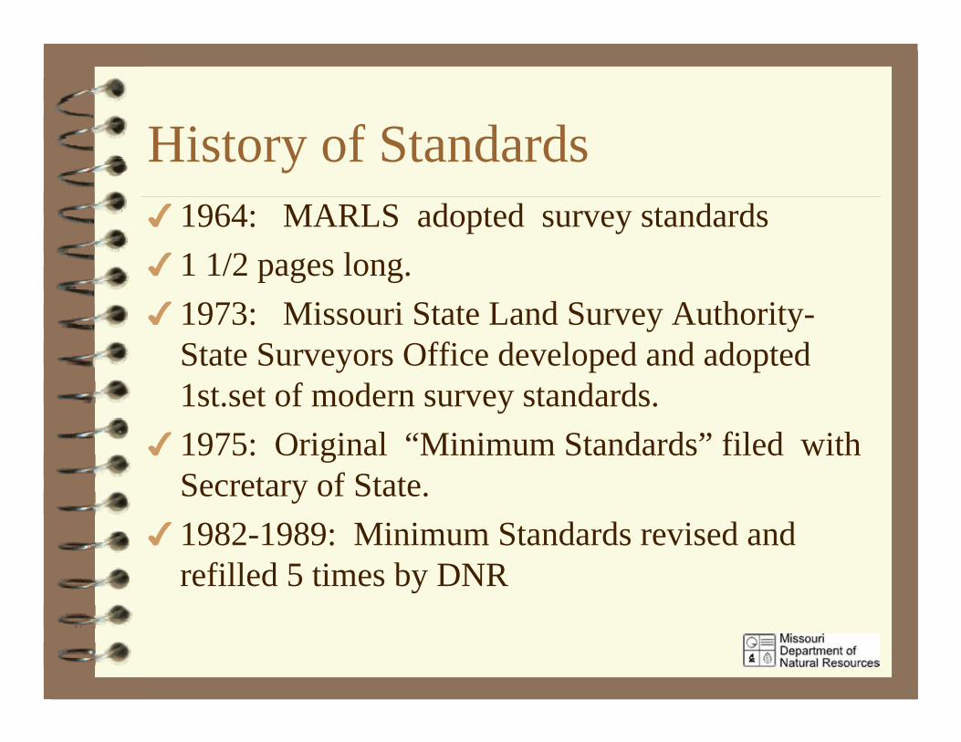
History of Standards1964: MARLS adopted survey standards1 1/2 pages long.1973: Missouri State Land Survey Authority-State Surveyors Office developed and adopted1st.set of modern survey standards.1975: Original “Minimum Standards” filed withSecretary of State.1982-1989: Minimum Standards revised andrefilled 5 times by DNR
History continued
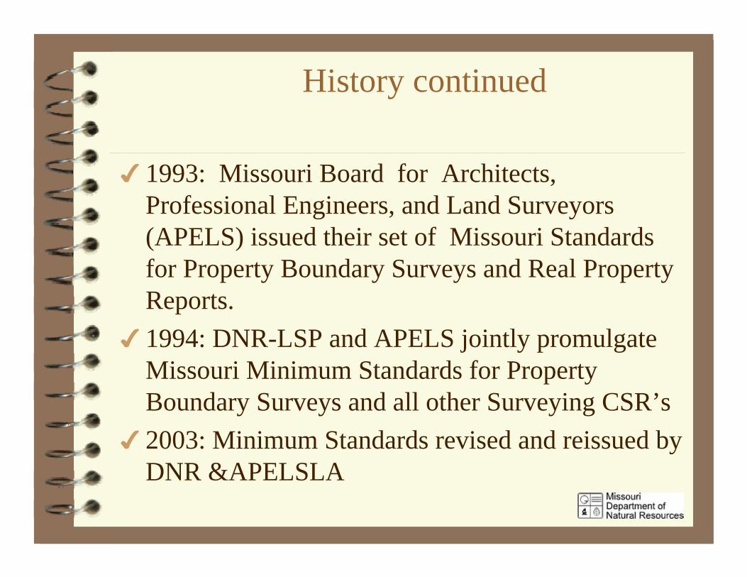
1993: Missouri Board for Architects,Professional Engineers, and Land Surveyors(APELS) issued their set of Missouri Standardsfor Property Boundary Surveys and Real PropertyReports.1994: DNR-LSP and APELS jointly promulgateMissouri Minimum Standards for PropertyBoundary Surveys and all other Surveying CSR’s2003: Minimum Standards revised and reissued byDNR &APELSLA
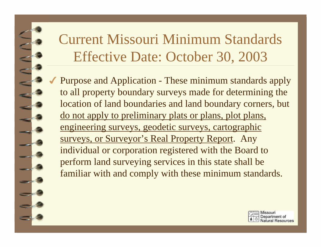
Current Missouri Minimum StandardsEffective Date: October 30, 2003
Purpose and Application - These minimum standards applyto all property boundary surveys made for determining thelocation of land boundaries and land boundary corners, butdo not apply to preliminary plats or plans, plot plans,engineering surveys, geodetic surveys, cartographicsurveys, or Surveyor’s Real Property Report. Anyindividual or corporation registered with the Board toperform land surveying services in this state shall befamiliar with and comply with these minimum standards.

Current Missouri Minimum Standards
Purpose - The Missouri Minimum Standards forProperty Boundary Surveys are not intended to beused in place of professional land surveying judgment.There may be special circumstances and conditions thatmake it impractical to comply with some provisions of theminimum standards. If the survey deviates from these“Minimum Standards”, this deviation shall be noted,described, and justified on the plat of survey by theprofessional land surveyor. This provision cannot be usedto intentionally circumvent the basic tenets of theseminimum standards.
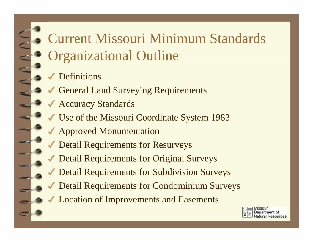
Current Missouri Minimum StandardsOrganizational Outline
DefinitionsGeneral Land Surveying RequirementsAccuracy StandardsUse of the Missouri Coordinate System 1983Approved MonumentationDetail Requirements for ResurveysDetail Requirements for Original SurveysDetail Requirements for Subdivision SurveysDetail Requirements for Condominium SurveysLocation of Improvements and Easements
Minimum Standards DefinitionsBlock - A group of lots existing within well-defined and fixedboundaries, usually being surrounded by streets or physicalbarriers and usually having an assigned number, name, letter, orother identifier through which it may be identified.Controlling Corners - The corners that determine the location ofthe record title boundaryExterior Corners - The corners that define the shape and size ofthe parcel.Property Description - A description of real property bygovernment survey, metes and bounds, or lot numbers of record.The description must be complete enough so a particular parcel ofland can be located and identified.Linear Error of Closure - The square root of the sum of thesquares of the error in north coordinates (y) and in eastcoordinates (x).
Definitions
Material Variations - Material variations are those differencesbetween surveyed lines and lines of possession or measurementscalled for in the record source of the property being surveyed thatare in the professional judgement of the surveyor , substantial andimportant to the location of the subject survey.Physical Monument - Refers to both natural and artificial physicalobjects which are accepted and used to mark boundaries andcorners.
DefinitionsProperty Boundary Surveys– Original Survey - A survey which creates a new parcel out of a
larger parent tract for the purpose of conveying the newparcel. Boundary adjustment plats, consolidation plats,riparian plats, lot splits, and minor subdivisions are examplesof original surveys.
– Resurvey - A survey executed to remark, reestablish, restore,or delineate the boundary line or corners of a parcel previouslycreated by a deed, survey, or subdivision.
– Condominium Survey - A survey executed to create and definecondominium property in accordance with Chapter 448RSMo.
– Subdivision Survey - A subdivision survey is the partition ofland into two or more parcels by platting the divisions of landin accordance with RsMo, 445 and per any appropriateplatting procedures and from which parcels are then sold byreference to a plat of record.
DefinitionsRadial Survey Measurement Tolerance - The computed expectedrelative accuracy of any distance determined by radial surveyingmethods. It is computed using an analysis of component distance anddirection errors.Radial Survey Method - The determination of the coordinate values ofpoints by measuring directions and distances from a central point asopposed to determination of the coordinates of points by traverse.The determination of coordinates by “side shots” from a closedtraverse is not considered a radial surveying method.Record Title Boundaries - The boundaries of the real estate describedin the title of record.Relative Position Tolerance - The relative accuracy between all pairsof points in a survey. In practice, it is computed for sampling of pairsof points using either an analysis of component distance and directionerrors or from a minimally constrained, correctly weighted leastsquares adjustment.
Definitions
Title of Record - A title to real estate, evidenced and provable by oneor more conveyances or other instruments all of which are dulyentered on the public records.Traverse Closure - The linear error of closure of the traversecomputed either from analysis of the component distance anddirection errors or from the actual traverse measurements.Unites States Public Land Survey Corners - Corners of the U.S.Public Land Survey are those points that determine the boundaries ofthe various subdivisions represented on the official government platsuch as the township corner, section corner, quarter-section corner,blank quarter section corners, center of section, fractional sectioncorners, grant corners, and meander corners.
General Requirements for Original,Resurveys, and Subdivisions
Research– 1) Based on legal/property description of parent tract taken
from title of record.– 2) Insofar as necessary, surveyor shall research and obtain
other data, such as adjoining deeds, maps, subdivision plats,GLO plats and field notes.
– 3) Analyze data and determine record title boundaries ofparent tract or of parcel to be surveyed.
General Requirements for Original,Resurveys, and Subdivisions
Field Work– 1) Search and locate controlling corners and other monuments that are
required to define the location of the exterior corners of the parcel to besurveyed.
– 2) Search and locate other real evidence that may affect the parcelincluding streets, right-of-ways, road, occupation lines, and possiblyresident witness information.
– 3) Evaluate reliability of evidence.– 4) Make measurements to correlate all found evidence. Measurements
should be made to the necessary level of precision compatible with the sizeand geometric shape of the parcel to obtain the desired accuracy neededfor the class of property of the surveyed parcel.
– 5) Correlate the facts obtained by the field survey with the record titleboundaries of the parcel or parent tract.
– 6) Determine location for Record Title Boundaries and MonumentCorners as required.
General Requirements for Original,Resurveys, and Subdivisions
Survey Plat Requirements– 1) Plats shall be made and provided indicating the results of the
survey with seal and signature of surveyor in responsible charge.– 2) Plat shall be drawn to a convenient scale on the type of material
consistent with the purpose and permanency required. AutoCAD orDigital format plats required by client are allowed; however, a hardcopy plat will be the official plat and take precedence over the digitaldata.
– 3) Name of person for whom the survey was made and date shall benoted on plat.
– 4) Multiple plats shall bear the seal and signature on each sheetprovided to the client.
– 5) Lettering on plat shall be no smaller than 0.08 in height.– 6) Boundary lines on plat shall be shown by direct angles, azimuths,
or bearings. They shall be based on a bearing system that isretraceable and described on the plat.
General Requirements for Original,Resurveys, and Subdivisions
Survey Plat Requirements (continued)– 7) Distances, directions, and curves shall be shown for all parcels
surveyed or created.– 8) A prominent north arrow shall be drawn on each sheet of the
plat containing graphics.– 8) Linear dimensions shall be horizontal in feet or meters at the
ground’s surface.– 9) A written scale shall be noted on plat. Any plat 8 1/2” x 14” or
larger shall also show a graphic scale.– 10) Vertical dimensions shall be shown by elevations above an
established or assumed datum.– 11) Distances, angles, bearings, azimuths, and calculated areas
will be shown on the plat to a number of significant figuresrepresentative of the actual precision of the measurements.
General Requirements for Original,Resurveys, and Subdivisions
Survey Plat Requirements (continued)– 12) Curved lines shall show two elements of the curve; however,
three is suggested including Radius, Central Angle and length ofarc. When curves are not tangent to the preceding or succeedingboundary line the bearing, angle, and direction of the initialtangent, radial line, or long chord shall be shown.
– 13) The survey shall show sufficient data (distances anddirections) to positively locate the parcel within the U.S.P.L.S.S orrecorded subdivision. If the survey can not be located by either ofthese provisions, it must be referred to other lines and pointsestablished by record.
General Requirements for Original,Resurveys, and Subdivisions
Survey Plat Requirements (continued)– 14) All controlling corner monuments, either found or set, shall
be shown and described on the plat by symbol or note.– 15) All controlling corners accepted or restored shall be shown or
noted on the plat– 16) Accuracy class or property being surveyed shall be noted or
shown on plat.– 17) Any material variation between measured and record
dimensions shall be noted on plat.– 18) Plat shall identify title documents for ajoiners. Preference for
source shall be by recording book-page.
Approved Monumentation
Permanent Monuments– 1) Concrete Monuments 4 in.x 24 in. with brass or
aluminum cap– 2) Post monument with 1 1/2 in. cap– 3) Steel, coated steel, or aluminum rods 5/8 in. x 24 in.
with aluminum cap– 4) Iron Pipes 3/4 in. x 24 in. with aluminum cap– 5) Brass or Aluminum Disks not less than 2 inches in
diameter and grouted or cemented into rock or concretewith magnet
Approved Monumentation
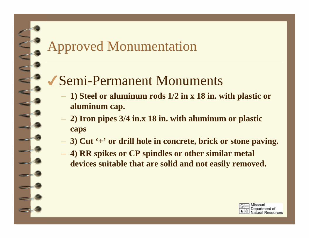
Semi-Permanent Monuments– 1) Steel or aluminum rods 1/2 in x 18 in. with plastic or
aluminum cap.– 2) Iron pipes 3/4 in.x 18 in. with aluminum or plastic
caps– 3) Cut ‘+’ or drill hole in concrete, brick or stone paving.– 4) RR spikes or CP spindles or other similar metal
devices suitable that are solid and not easily removed.
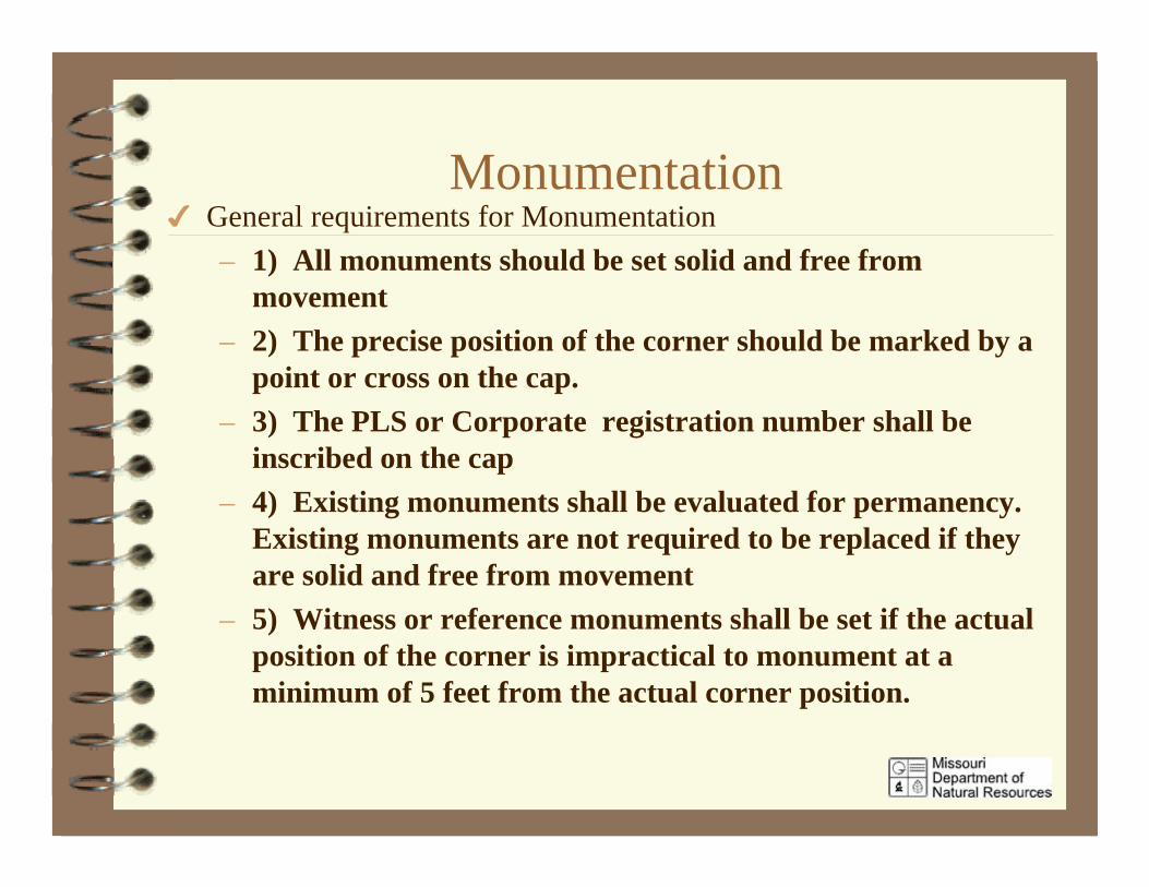
MonumentationGeneral requirements for Monumentation– 1) All monuments should be set solid and free from
movement– 2) The precise position of the corner should be marked by a
point or cross on the cap.– 3) The PLS or Corporate registration number shall be
inscribed on the cap– 4) Existing monuments shall be evaluated for permanency.
Existing monuments are not required to be replaced if theyare solid and free from movement
– 5) Witness or reference monuments shall be set if the actualposition of the corner is impractical to monument at aminimum of 5 feet from the actual corner position.
Accuracy Standards for PropertyBoundary Surveys
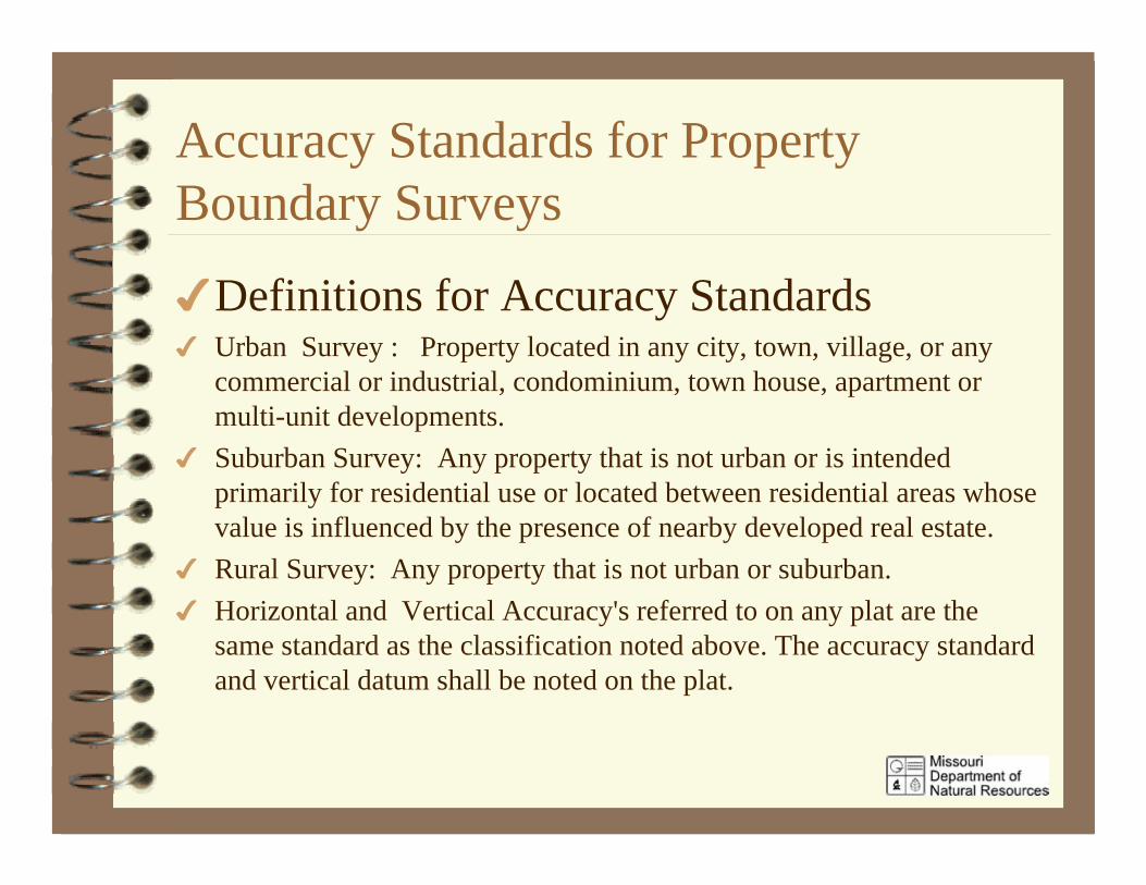
Definitions for Accuracy StandardsUrban Survey : Property located in any city, town, village, or anycommercial or industrial, condominium, town house, apartment ormulti-unit developments.Suburban Survey: Any property that is not urban or is intendedprimarily for residential use or located between residential areas whosevalue is influenced by the presence of nearby developed real estate.Rural Survey: Any property that is not urban or suburban.Horizontal and Vertical Accuracy's referred to on any plat are thesame standard as the classification noted above. The accuracy standardand vertical datum shall be noted on the plat.
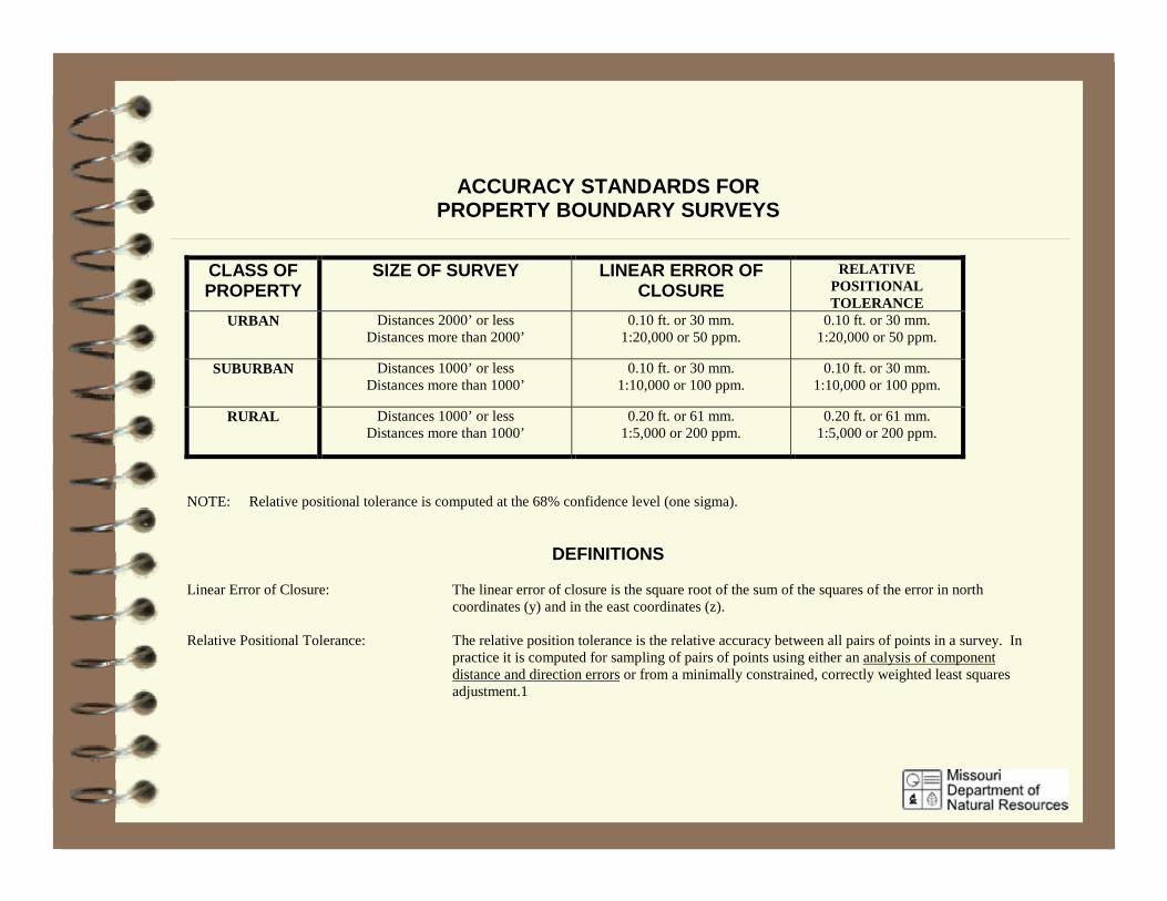
ACCURACY STANDARDS FORPROPERTY BOUNDARY SURVEYS
CLASS OFPROPERTY
SIZE OF SURVEY LINEAR ERROR OFCLOSURE
RELATIVEPOSITIONALTOLERANCE
URBAN Distances 2000’ or lessDistances more than 2000’
0.10 ft. or 30 mm.1:20,000 or 50 ppm.
0.10 ft. or 30 mm.1:20,000 or 50 ppm.
SUBURBAN Distances 1000’ or lessDistances more than 1000’
0.10 ft. or 30 mm.1:10,000 or 100 ppm.
0.10 ft. or 30 mm.1:10,000 or 100 ppm.
RURAL Distances 1000’ or lessDistances more than 1000’
0.20 ft. or 61 mm.1:5,000 or 200 ppm.
0.20 ft. or 61 mm.1:5,000 or 200 ppm.
NOTE: Relative positional tolerance is computed at the 68% confidence level (one sigma).
DEFINITIONS
Linear Error of Closure: The linear error of closure is the square root of the sum of the squares of the error in northcoordinates (y) and in the east coordinates (z).
Relative Positional Tolerance: The relative position tolerance is the relative accuracy between all pairs of points in a survey. Inpractice it is computed for sampling of pairs of points using either an analysis of componentdistance and direction errors or from a minimally constrained, correctly weighted least squaresadjustment.1
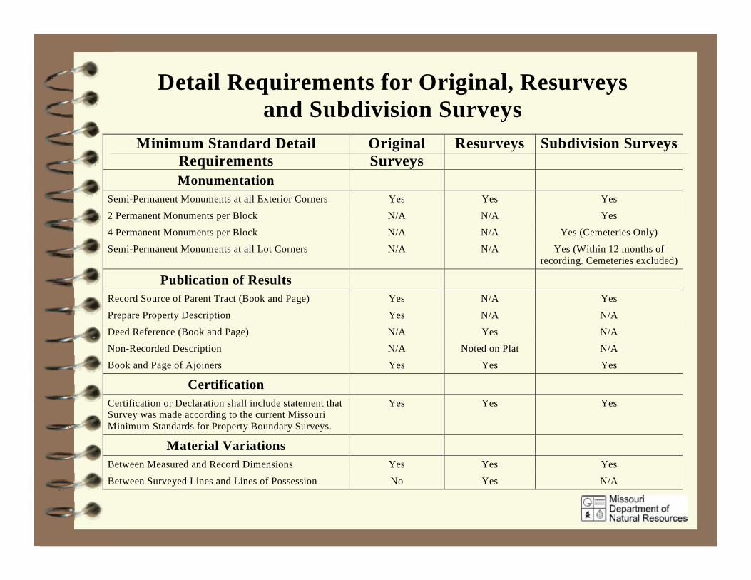
Detail Requirements for Original, Resurveysand Subdivision Surveys
Minimum Standard DetailRequirements
OriginalSurveys
Resurveys Subdivision Surveys
MonumentationSemi-Permanent Monuments at all Exterior Corners Yes Yes Yes
2 Permanent Monuments per Block N/A N/A Yes
4 Permanent Monuments per Block N/A N/A Yes (Cemeteries Only)
Semi-Permanent Monuments at all Lot Corners N/A N/A Yes (Within 12 months ofrecording. Cemeteries excluded)
Publication of ResultsRecord Source of Parent Tract (Book and Page) Yes N/A Yes
Prepare Property Description Yes N/A N/A
Deed Reference (Book and Page) N/A Yes N/A
Non-Recorded Description N/A Noted on Plat N/A
Book and Page of Ajoiners Yes Yes Yes
CertificationCertification or Declaration shall include statement thatSurvey was made according to the current MissouriMinimum Standards for Property Boundary Surveys.
Yes Yes Yes
Material VariationsBetween Measured and Record Dimensions Yes Yes Yes
Between Surveyed Lines and Lines of Possession No Yes N/A
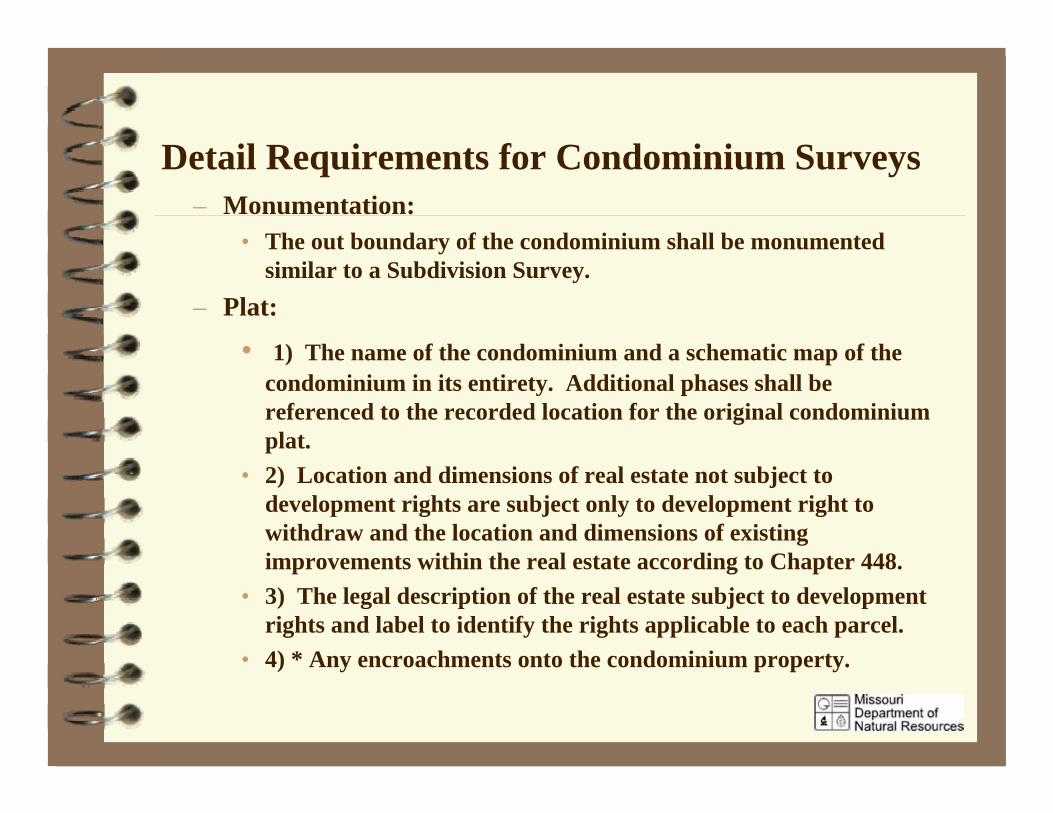
Detail Requirements for Condominium Surveys– Monumentation:
• The out boundary of the condominium shall be monumentedsimilar to a Subdivision Survey.
– Plat:
• 1) The name of the condominium and a schematic map of thecondominium in its entirety. Additional phases shall bereferenced to the recorded location for the original condominiumplat.
• 2) Location and dimensions of real estate not subject todevelopment rights are subject only to development right towithdraw and the location and dimensions of existingimprovements within the real estate according to Chapter 448.
• 3) The legal description of the real estate subject to developmentrights and label to identify the rights applicable to each parcel.
• 4) * Any encroachments onto the condominium property.
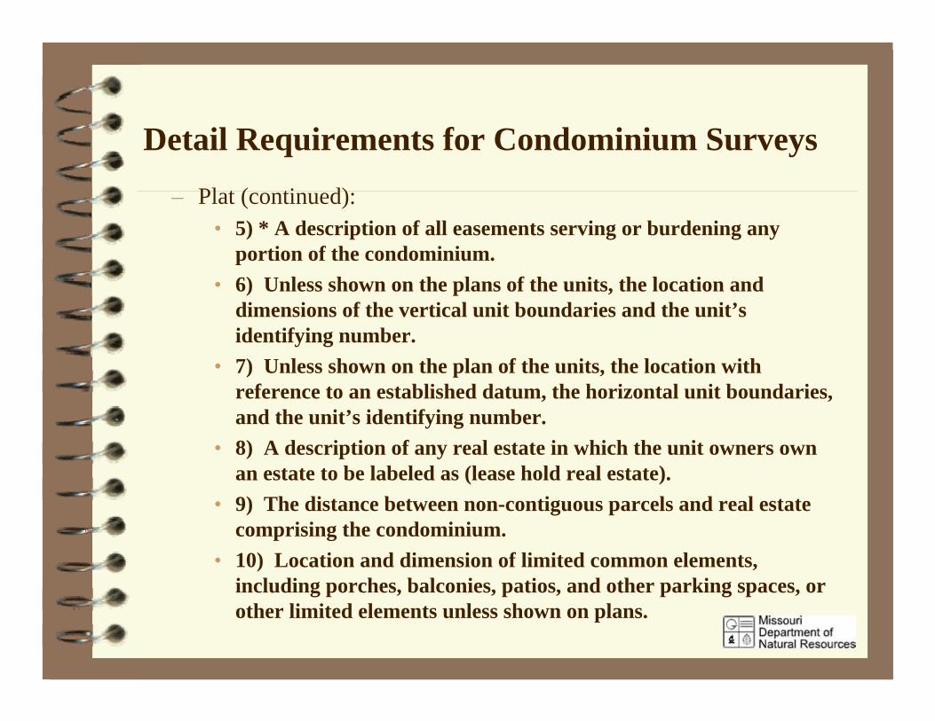
Detail Requirements for Condominium Surveys– Plat (continued):
• 5) * A description of all easements serving or burdening anyportion of the condominium.
• 6) Unless shown on the plans of the units, the location anddimensions of the vertical unit boundaries and the unit’sidentifying number.
• 7) Unless shown on the plan of the units, the location withreference to an established datum, the horizontal unit boundaries,and the unit’s identifying number.
• 8) A description of any real estate in which the unit owners ownan estate to be labeled as (lease hold real estate).
• 9) The distance between non-contiguous parcels and real estatecomprising the condominium.
• 10) Location and dimension of limited common elements,including porches, balconies, patios, and other parking spaces, orother limited elements unless shown on plans.
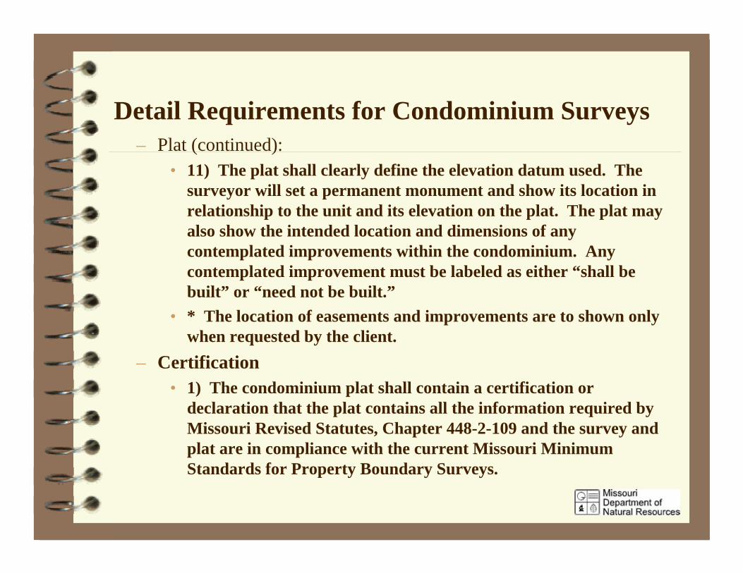
Detail Requirements for Condominium Surveys– Plat (continued):
• 11) The plat shall clearly define the elevation datum used. Thesurveyor will set a permanent monument and show its location inrelationship to the unit and its elevation on the plat. The plat mayalso show the intended location and dimensions of anycontemplated improvements within the condominium. Anycontemplated improvement must be labeled as either “shall bebuilt” or “need not be built.”
• * The location of easements and improvements are to shown onlywhen requested by the client.
– Certification• 1) The condominium plat shall contain a certification or
declaration that the plat contains all the information required byMissouri Revised Statutes, Chapter 448-2-109 and the survey andplat are in compliance with the current Missouri MinimumStandards for Property Boundary Surveys.
Location of Improvements and EasementsImprovements and Easements are to shown on theSurvey when specifically requested by the clientor required by ordinance.Improvements: Locate by a minimum of threedimensions all permanent structures having fixedfoundations, concrete slabs,footings, in groundswimming pools, concrete or permanent walls andbuildings. Dimensions are to be madeperpendicular to straight property lines and radialto curved property lines.
Location of Improvements and Easements
Easements: Easements shown on propertyboundary surveys shall be those shown onsubdivision plats and any evidenced byrecord documents which have beendelivered to the surveyor by the client.
Use of the Missouri Coordinate System 1983– When required by law, ordinance or contractual
agreement the surveyor shall utilize and showState Plane coordinates as follows:
• All coordinates shall be based on the “MissouriCoordinate System of 1983”
• The coordinates determined by the survey shallbe based on a first or second order controlstation as defined in 10 CSR 30-4 or 4 CSR 30-18.
• The one kilometer distance limitation in section60.461 RSMo. is waived.
Use of the Missouri Coordinate System 1983 NAD 83
• The plat or corner document shall show a tableor tie with grid bearings and distances or therelative positional tolerance of the coordinates inrelationship to the control station.
• The plat or corner document shall show whatcontrol stations, the coordinates of the station,and the grid factor used.
• Only “Missouri Coordinate System of 1983”coordinates can be recorded on any public landrecord or deed.
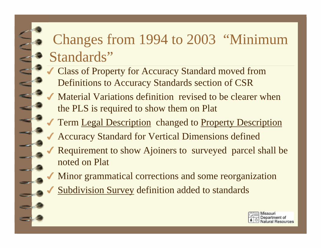
Changes from 1994 to 2003 “MinimumStandards”
Class of Property for Accuracy Standard moved fromDefinitions to Accuracy Standards section of CSRMaterial Variations definition revised to be clearer whenthe PLS is required to show them on PlatTerm Legal Description changed to Property DescriptionAccuracy Standard for Vertical Dimensions definedRequirement to show Ajoiners to surveyed parcel shall benoted on PlatMinor grammatical corrections and some reorganizationSubdivision Survey definition added to standards
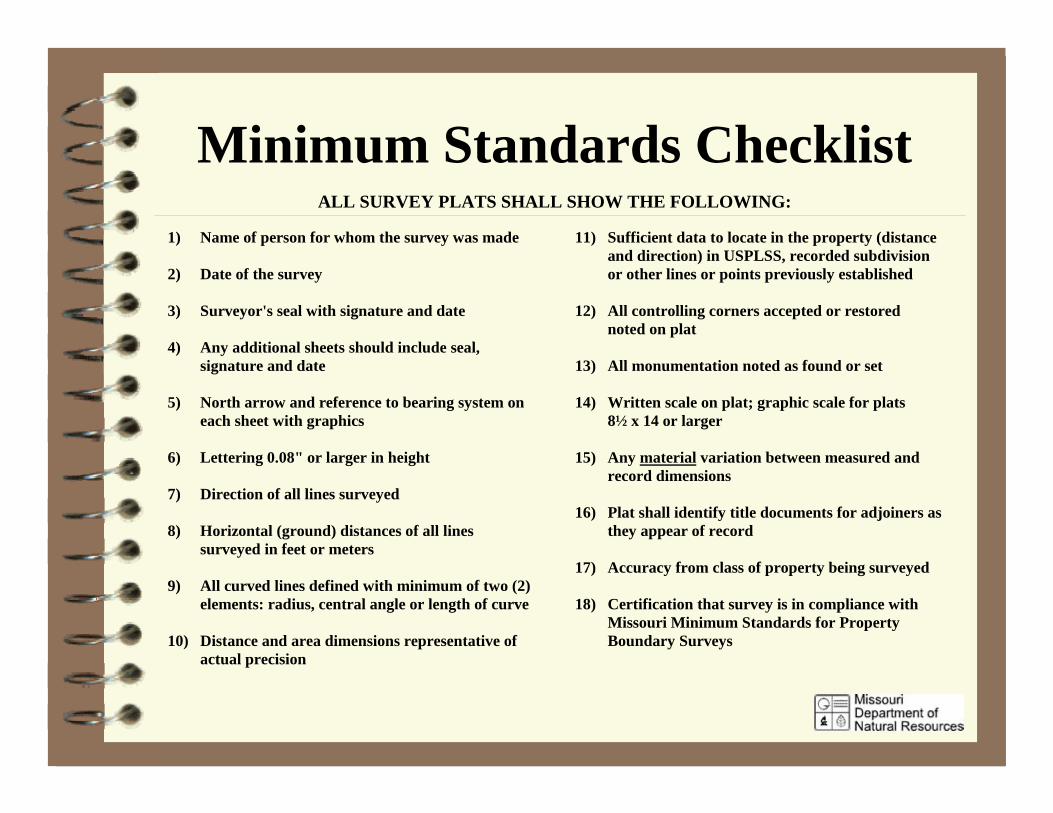
Minimum Standards ChecklistALL SURVEY PLATS SHALL SHOW THE FOLLOWING:
1) Name of person for whom the survey was made
2) Date of the survey
3) Surveyor's seal with signature and date
4) Any additional sheets should include seal,signature and date
5) North arrow and reference to bearing system oneach sheet with graphics
6) Lettering 0.08" or larger in height
7) Direction of all lines surveyed
8) Horizontal (ground) distances of all linessurveyed in feet or meters
9) All curved lines defined with minimum of two (2)elements: radius, central angle or length of curve
10) Distance and area dimensions representative ofactual precision
11) Sufficient data to locate in the property (distanceand direction) in USPLSS, recorded subdivisionor other lines or points previously established
12) All controlling corners accepted or restorednoted on plat
13) All monumentation noted as found or set
14) Written scale on plat; graphic scale for plats8½ x 14 or larger
15) Any material variation between measured andrecord dimensions
16) Plat shall identify title documents for adjoiners asthey appear of record
17) Accuracy from class of property being surveyed
18) Certification that survey is in compliance withMissouri Minimum Standards for PropertyBoundary Surveys
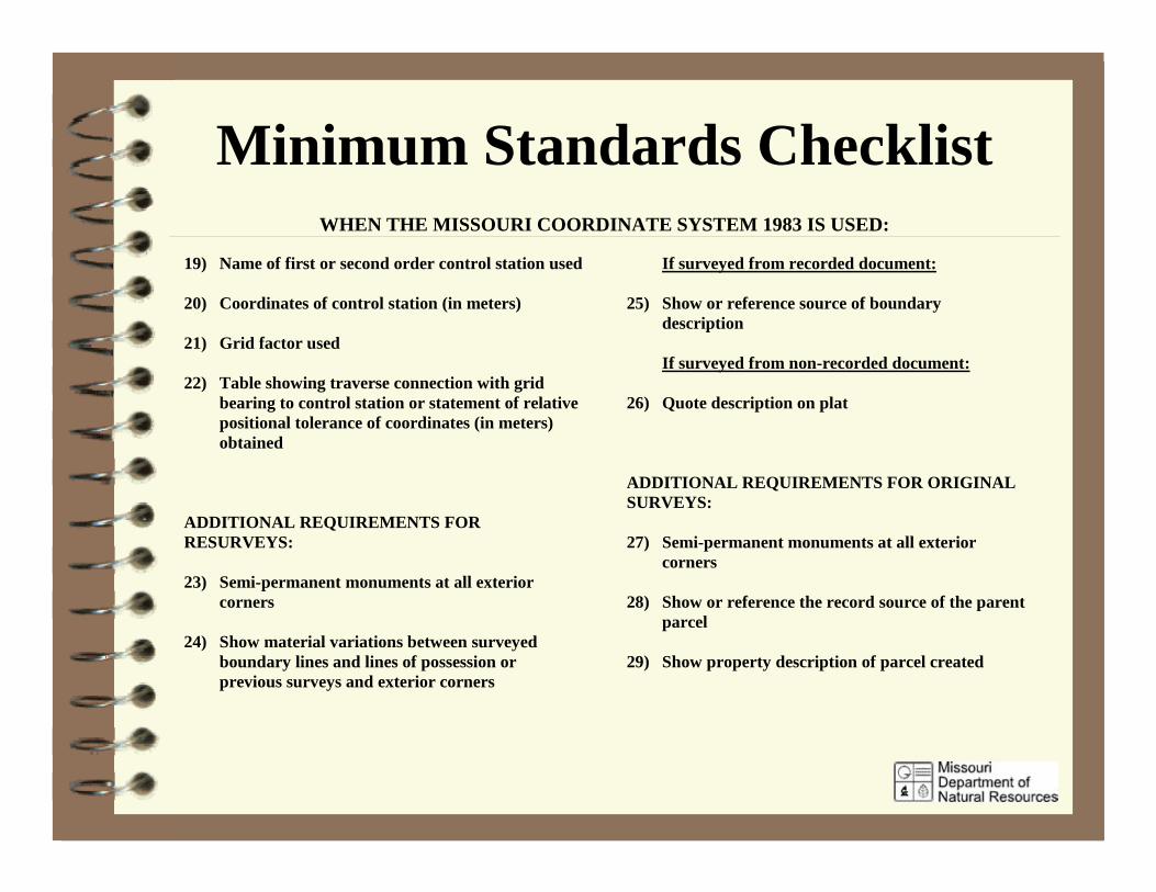
Minimum Standards ChecklistWHEN THE MISSOURI COORDINATE SYSTEM 1983 IS USED:
19) Name of first or second order control station used
20) Coordinates of control station (in meters)
21) Grid factor used
22) Table showing traverse connection with gridbearing to control station or statement of relativepositional tolerance of coordinates (in meters)obtained
ADDITIONAL REQUIREMENTS FORRESURVEYS:
23) Semi-permanent monuments at all exteriorcorners
24) Show material variations between surveyedboundary lines and lines of possession orprevious surveys and exterior corners
If surveyed from recorded document:
25) Show or reference source of boundarydescription
If surveyed from non-recorded document:
26) Quote description on plat
ADDITIONAL REQUIREMENTS FOR ORIGINALSURVEYS:
27) Semi-permanent monuments at all exteriorcorners
28) Show or reference the record source of the parentparcel
29) Show property description of parcel created
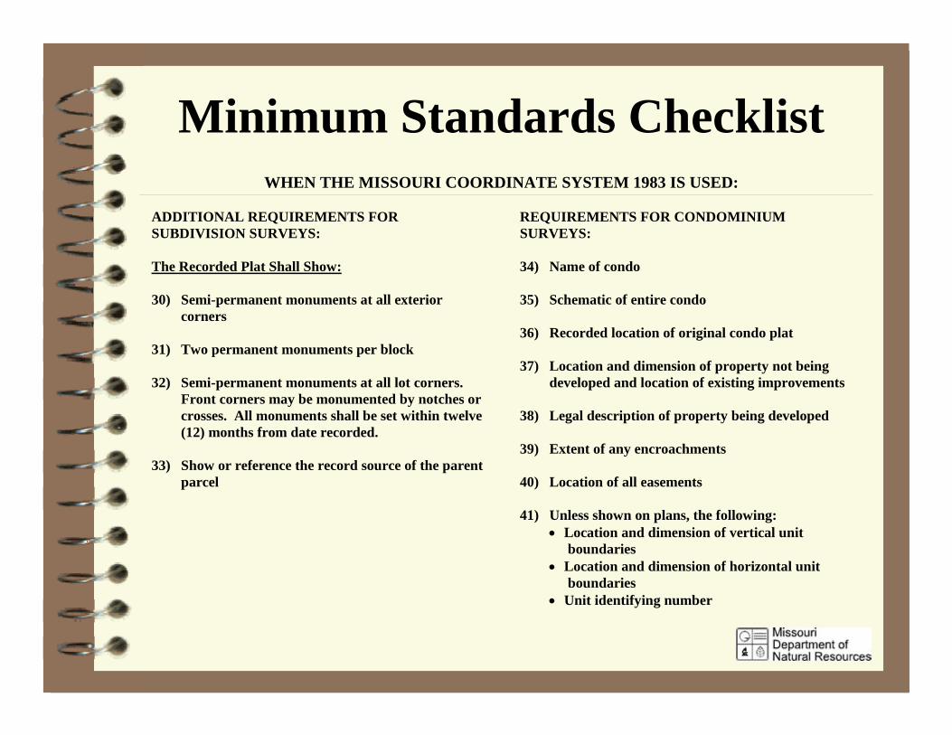
Minimum Standards ChecklistWHEN THE MISSOURI COORDINATE SYSTEM 1983 IS USED:
ADDITIONAL REQUIREMENTS FORSUBDIVISION SURVEYS:
The Recorded Plat Shall Show:
30) Semi-permanent monuments at all exteriorcorners
31) Two permanent monuments per block
32) Semi-permanent monuments at all lot corners. Front corners may be monumented by notches orcrosses. All monuments shall be set within twelve(12) months from date recorded.
33) Show or reference the record source of the parentparcel
REQUIREMENTS FOR CONDOMINIUMSURVEYS:
34) Name of condo
35) Schematic of entire condo
36) Recorded location of original condo plat
37) Location and dimension of property not beingdeveloped and location of existing improvements
38) Legal description of property being developed
39) Extent of any encroachments
40) Location of all easements
41) Unless shown on plans, the following:• Location and dimension of vertical unit
boundaries• Location and dimension of horizontal unit
boundaries• Unit identifying number
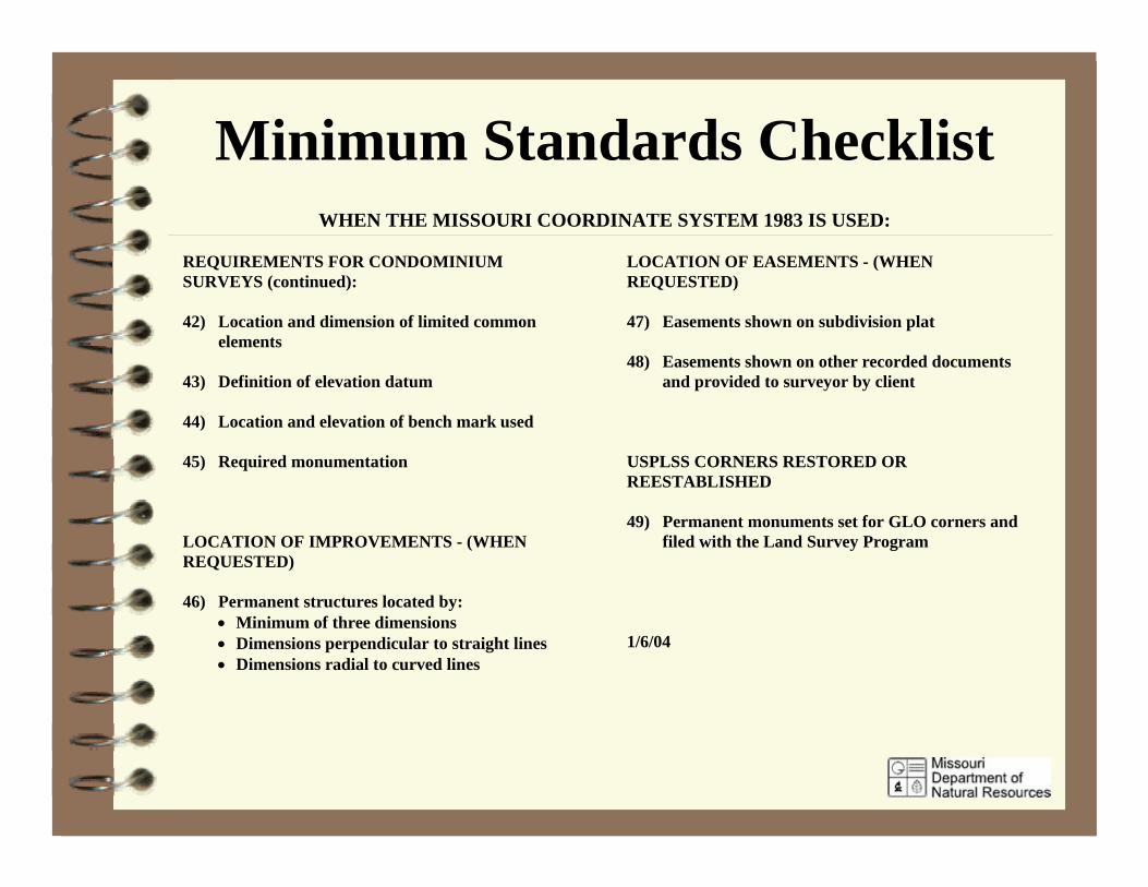
Minimum Standards ChecklistWHEN THE MISSOURI COORDINATE SYSTEM 1983 IS USED:
REQUIREMENTS FOR CONDOMINIUMSURVEYS (continued):
42) Location and dimension of limited commonelements
43) Definition of elevation datum
44) Location and elevation of bench mark used
45) Required monumentation
LOCATION OF IMPROVEMENTS - (WHENREQUESTED)
46) Permanent structures located by:• Minimum of three dimensions• Dimensions perpendicular to straight lines• Dimensions radial to curved lines
LOCATION OF EASEMENTS - (WHENREQUESTED)
47) Easements shown on subdivision plat
48) Easements shown on other recorded documentsand provided to surveyor by client
USPLSS CORNERS RESTORED ORREESTABLISHED
49) Permanent monuments set for GLO corners andfiled with the Land Survey Program
1/6/04

Test on Minimum Standards
Five Minutes

Minimum Standards Test1. The PLS is only requiredto sign, seal and date the 1stthe sheet of a multi pagesurvey document.2. Minimum Standardsrequire the PLS to produce aplat only for original surveys.3. If special circumstancesmake it impractical to complywith all the requirements ofthe Minimum Standards thePLS shall not include anycertification on his plat.
False
False
False

Minimum Standards Test4. The PLS is required toindicate material variationsbetween deed and surveydimensions on the plat of asurveyed parcel.5. The PLS is not required toshow controlling corners eitherset or found on the final plat.6. Semi permanent monumentsare required for the exteriorcorners of a subdivision.7. A 5/8” x 24” iron bar with aplastic cap is considered apermanent monument.
True
False
True
False
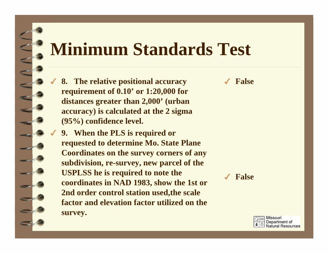
Minimum Standards Test8. The relative positional accuracyrequirement of 0.10’ or 1:20,000 fordistances greater than 2,000’ (urbanaccuracy) is calculated at the 2 sigma(95%) confidence level.9. When the PLS is required orrequested to determine Mo. State PlaneCoordinates on the survey corners of anysubdivision, re-survey, new parcel of theUSPLSS he is required to note thecoordinates in NAD 1983, show the 1st or2nd order control station used,the scalefactor and elevation factor utilized on thesurvey.
False
False
Minimum Standards TestFalse
False
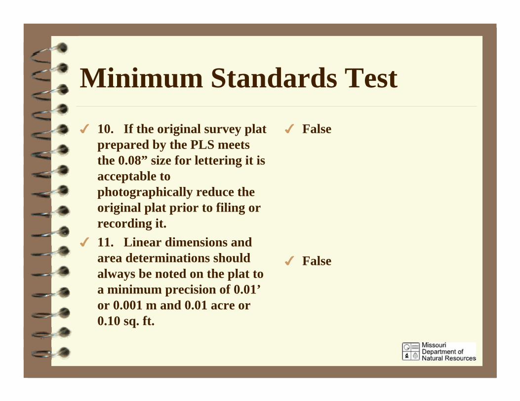
10. If the original survey platprepared by the PLS meetsthe 0.08” size for lettering it isacceptable tophotographically reduce theoriginal plat prior to filing orrecording it.11. Linear dimensions andarea determinations shouldalways be noted on the plat toa minimum precision of 0.01’or 0.001 m and 0.01 acre or0.10 sq. ft.
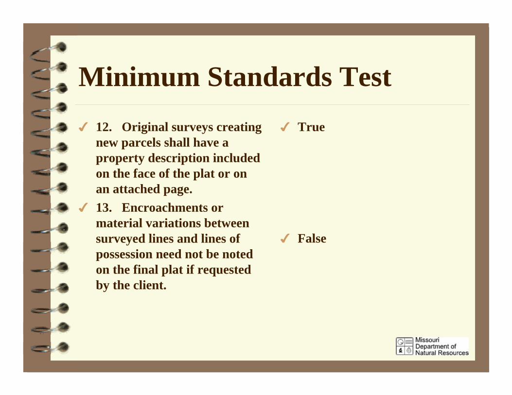
Minimum Standards Test12. Original surveys creatingnew parcels shall have aproperty description includedon the face of the plat or onan attached page.13. Encroachments ormaterial variations betweensurveyed lines and lines ofpossession need not be notedon the final plat if requestedby the client.
True
False
Minimum Standards Test14. All permanent and semi-permanent monumentationfor lot and block corners neednot be set when the final platis recorded, but must be setwithin 18 months of therecording date of the plat.
15. Record documents forparcels adjoining thesurveyed property shall beresearched and noted on theplat of survey.
False
True

End of ProgramQuestionsDiscussionPower Point Presentation available atwww.dnr.mo.gov/geology/lndsrv/
2006 Missouri Minimum Standards