michigan dot connected · pdf filemichigan dot connected vehicles michigan traffic safety...
TRANSCRIPT
Michigan DOT Connected Vehicles Michigan Traffic Safety Summit 2015
March 24th, 2015
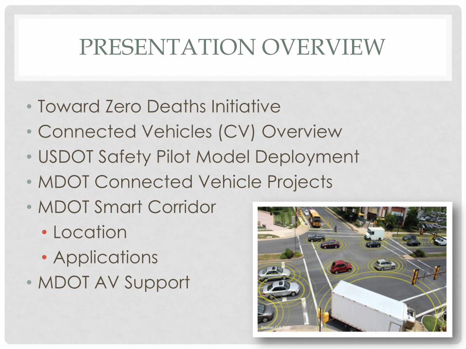
PRESENTATION OVERVIEW
• Toward Zero Deaths Initiative
• Connected Vehicles (CV) Overview
• USDOT Safety Pilot Model Deployment
• MDOT Connected Vehicle Projects
• MDOT Smart Corridor
• Location
• Applications
• MDOT AV Support

700
750
800
850
900
950
1000
1050
1100
1150
1200
2005 2006 2007 2008 2009 2010 2011 2012
Michigan Traffic Fatality Trends

CONNECTED VEHICLES V
eh
icle
s a
nd
Fle
ets
Wireless Devices
Infra
stru
ctu
re
Drivers/Operators
Connectivity

USDOT SAFETY PILOT MODEL DEPLOYMENT
• Determine effectiveness of
safety technology and
applications
• Support NHTSA decision-making
• $18 Million, 2.5 year program
• > 2,800 cars, trucks & buses
• 73 lane-miles
• 29 roadside equipment
installations
• “Road Test” from 8/21/12 to
8/30/13
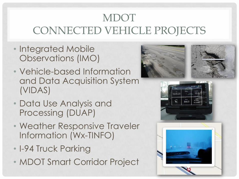
MDOT CONNECTED VEHICLE PROJECTS
• Integrated Mobile Observations (IMO)
• Vehicle-based Information and Data Acquisition System (VIDAS)
• Data Use Analysis and Processing (DUAP)
• Weather Responsive Traveler Information (Wx-TINFO)
• I-94 Truck Parking
• MDOT Smart Corridor Project
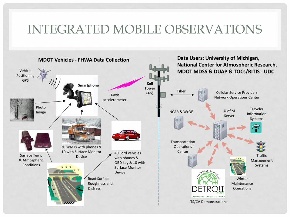
Vehicle Positioning
GPS
Surface Temp & Atmospheric
Conditions
Smartphone Cell Tower (4G)
Traffic Management
Systems
Transportation Operations
Center
Traveler Information
Systems
Cellular Service Providers Network Operations Center
NCAR & WxDE
Winter Maintenance Operations
MDOT Vehicles - FHWA Data Collection Data Users: University of Michigan, National Center for Atmospheric Research, MDOT MDSS & DUAP & TOCs/RITIS - UDC
U of M Server
20 WMTs with phones & 10 with Surface Monitor
Device 40 Ford vehicles with phones & OBD key & 10 with Surface Monitor Device
Fiber
Road Surface Roughness and Distress
3-axis accelerometer
Photo Image
ITS/CV Demonstrations
INTEGRATED MOBILE OBSERVATIONS
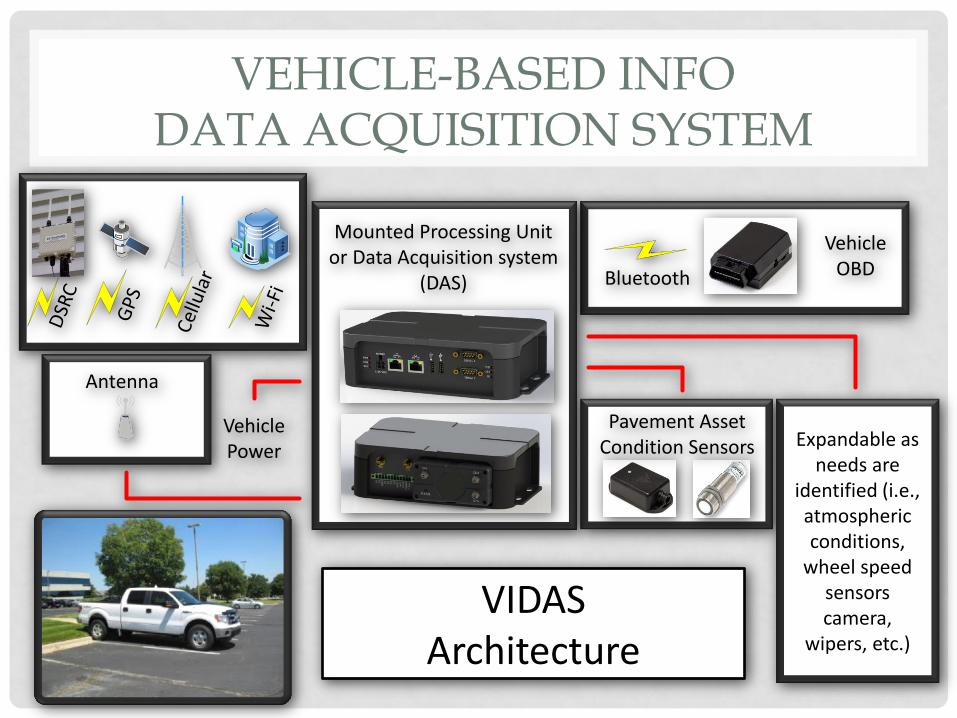
VEHICLE-BASED INFO DATA ACQUISITION SYSTEM
Bluetooth
Vehicle Power
Antenna
Mounted Processing Unit or Data Acquisition system
(DAS)
Vehicle OBD
Pavement Asset Condition Sensors Expandable as
needs are identified (i.e., atmospheric conditions,
wheel speed sensors camera,
wipers, etc.)
VIDAS Architecture
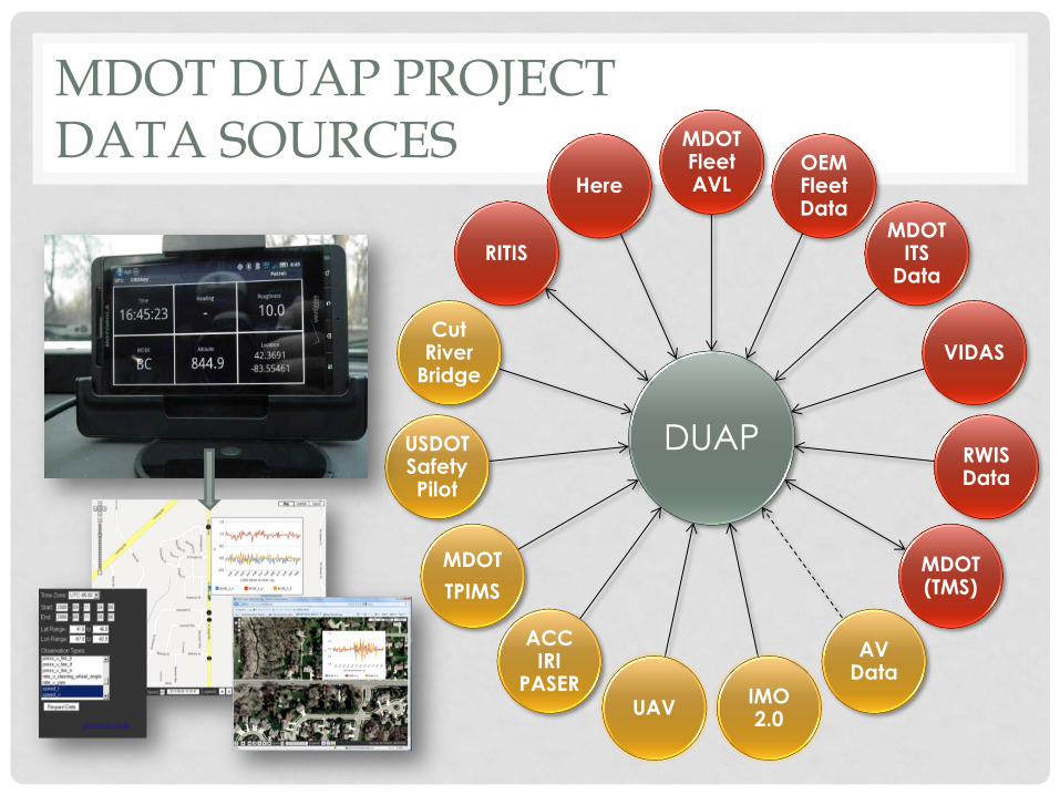
MDOT DUAP PROJECT DATA SOURCES
DUAP
MDOT Fleet AVL
OEM Fleet Data
MDOT ITS
Data
VIDAS
RWIS Data
MDOT (TMS)
AV Data
IMO 2.0
UAV
ACC IRI
PASER
MDOT
TPIMS
USDOT Safety Pilot
Cut River
Bridge
RITIS
Here


DUAP APPLICATIONS
• Initial Applications:
• Pavement:
• Condition – Ride Quality, Surface Smoothness
• Event – Pavement Defects & Severity – Potholes, Cracking
• Weather:
• Condition – Pavement Surface, Weather
• Event – Pavement Advisory – Slippery, Icy, Snow Covered
• Traffic:
• Condition – Average Speed, SPaT
• Event – Queues, Congestion, Incidents
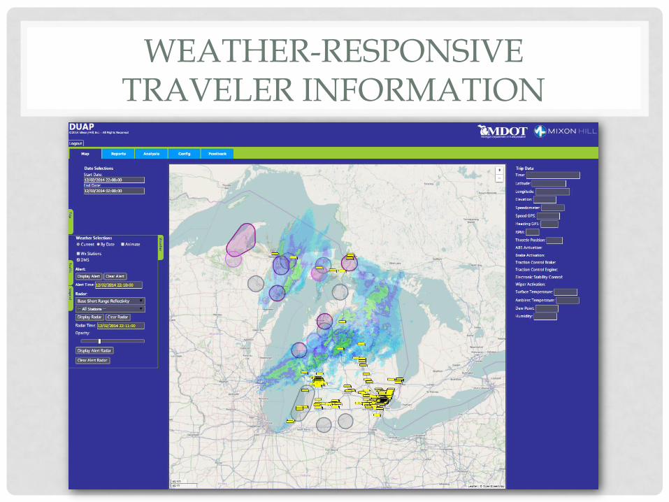
WEATHER-RESPONSIVE TRAVELER INFORMATION
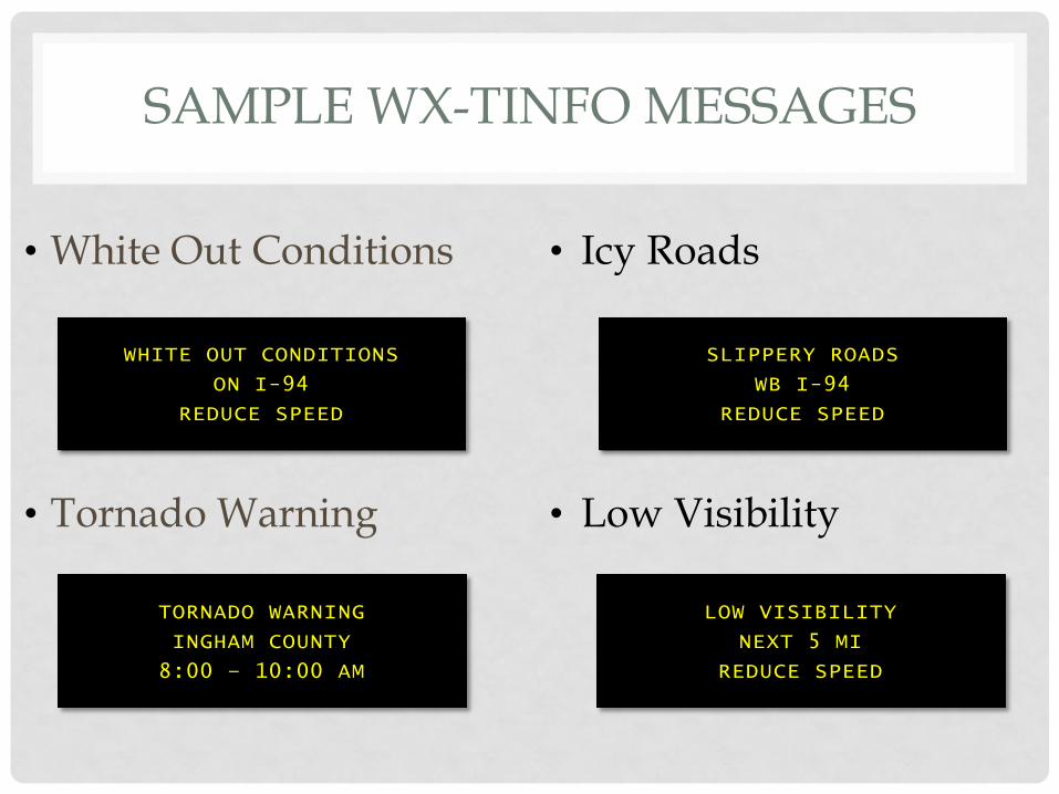
SAMPLE WX-TINFO MESSAGES
• White Out Conditions
• Tornado Warning
• Icy Roads
• Low Visibility
WHITE OUT CONDITIONS
ON I-94
REDUCE SPEED
TORNADO WARNING
INGHAM COUNTY
8:00 – 10:00 AM
SLIPPERY ROADS
WB I-94
REDUCE SPEED
LOW VISIBILITY
NEXT 5 MI
REDUCE SPEED

TRUCK PARKING INFO & MANAGEMENT SYSTEM
• Provide Real Time Availability
• Improve Safety
• 5 Public Rest Areas
• 10 Private Truck Stops
• Counting ins/outs
• Dynamic Truck Parking Signs
• Mi Drive
• Truck Smart Parking Services
• Smartphone Application
• On-Board DSRC Equipment
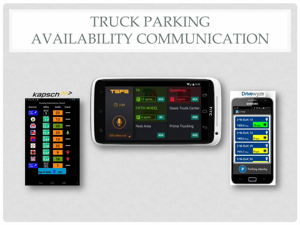
TRUCK PARKING AVAILABILITY COMMUNICATION
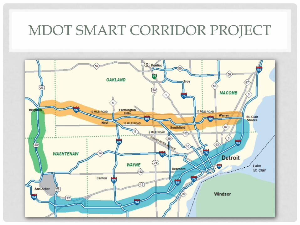
MDOT SMART CORRIDOR PROJECT

• Vehicle-to-Vehicle (V2V) • Emergency Electronic Brake Lights
• Do Not Pass Warning
• Forward Collision Warning
• Intersection Movement Assist
• Blind Spot/Lane Change Warning
• Left Turn Assist
• Vehicle-to-Infrastructure (V2I) • Curve Speed Warning
• Work Zone Speed Advisory
• Spot Weather Impact
• Road Hazard / Lane Closure Warning
• Traffic Light Phase Information
MDOT SMART CORRIDOR POTENTIAL CV APPLICATIONS
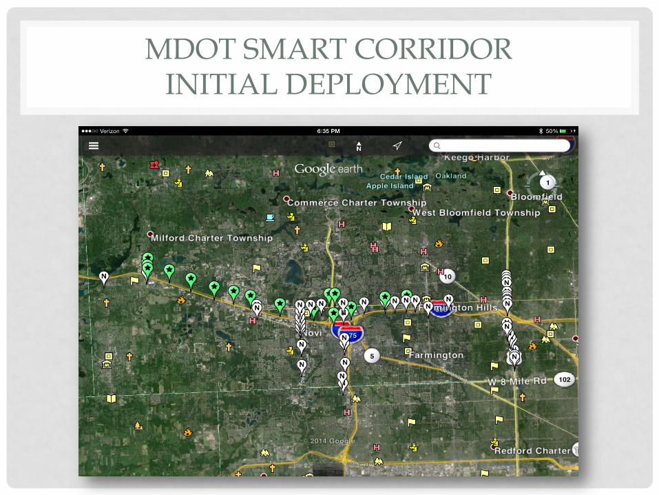
MDOT SMART CORRIDOR INITIAL DEPLOYMENT
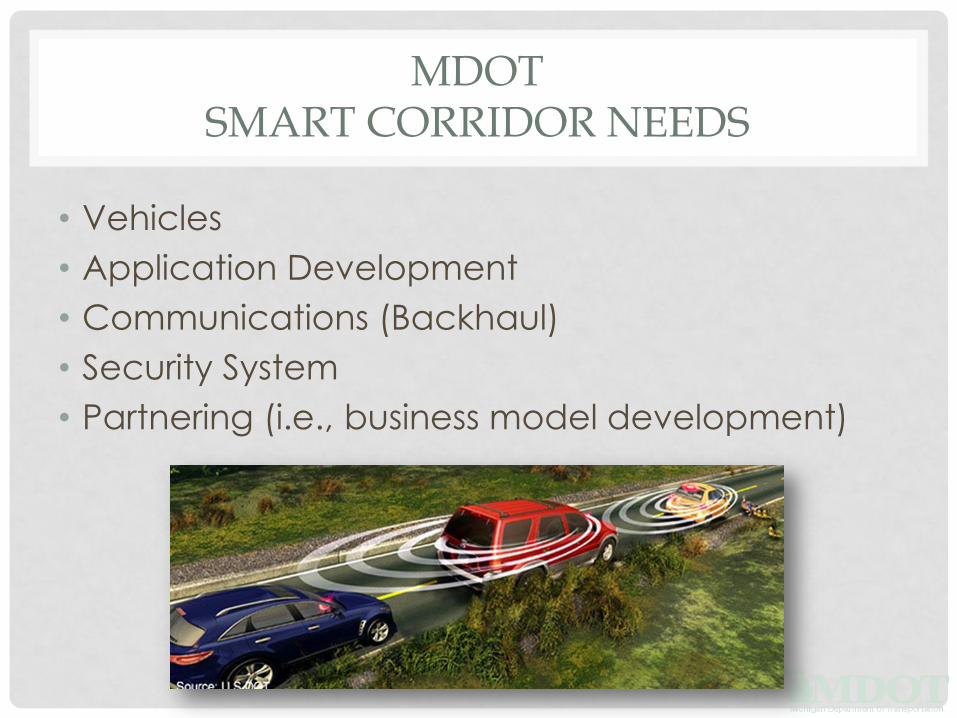
MDOT SMART CORRIDOR NEEDS
• Vehicles
• Application Development
• Communications (Backhaul)
• Security System
• Partnering (i.e., business model development)
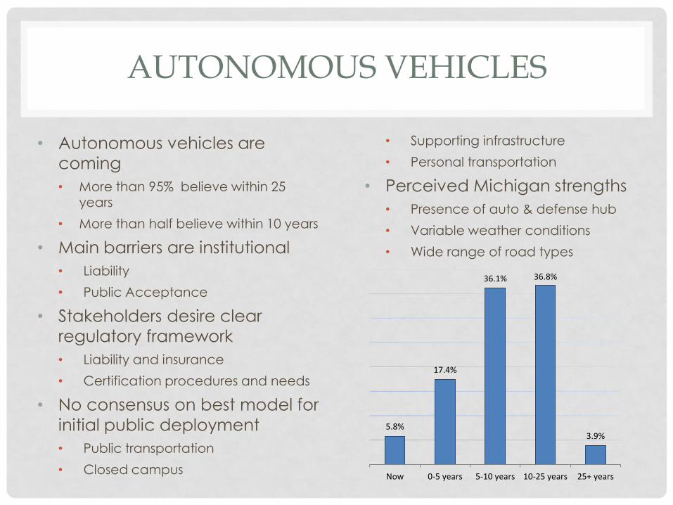
• Autonomous vehicles are
coming
• More than 95% believe within 25 years
• More than half believe within 10 years
• Main barriers are institutional
• Liability
• Public Acceptance
• Stakeholders desire clear
regulatory framework
• Liability and insurance
• Certification procedures and needs
• No consensus on best model for
initial public deployment
• Public transportation
• Closed campus
• Supporting infrastructure
• Personal transportation
• Perceived Michigan strengths
• Presence of auto & defense hub
• Variable weather conditions
• Wide range of road types
AUTONOMOUS VEHICLES
5.8%
17.4%
36.1% 36.8%
3.9%
Now 0-5 years 5-10 years 10-25 years 25+ years
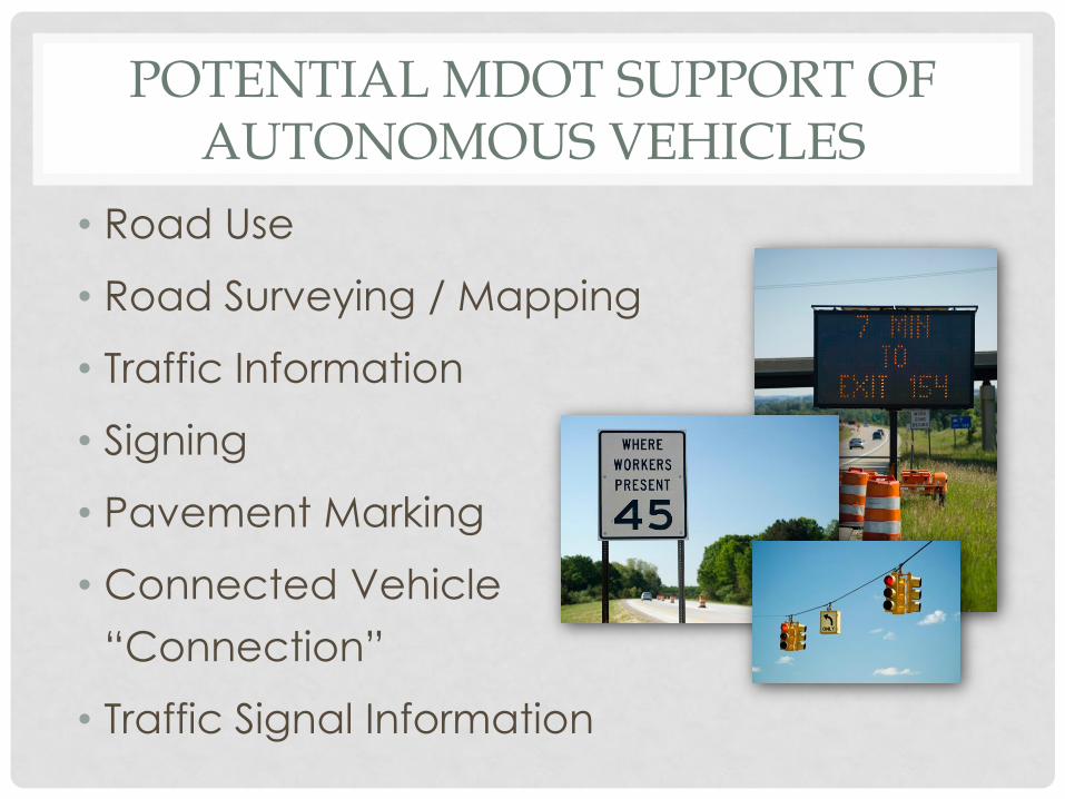
• Road Use
• Road Surveying / Mapping
• Traffic Information
• Signing
• Pavement Marking
• Connected Vehicle
“Connection”
• Traffic Signal Information
POTENTIAL MDOT SUPPORT OF AUTONOMOUS VEHICLES
QUESTIONS
Collin Castle, P.E. Connected Vehicle Technical Manager
MDOT ITS Program Office
(517) 636-0715