martholme viaduct : facilitating public access · martholme viaduct : facilitating public access...
TRANSCRIPT

Martholme Viaduct : Facilitating Public
Access
Design & Access Statement incorporating Heritage Statement
May 2017

Martholme Viaduct : Facilitating Public Access Design & Access Statement incorporating Heritage Statement May 2017
About Sustrans
Sustrans is the charity making it easier for people to walk and cycle. We connect people and places,
create liveable neighbourhoods, transform the school run and deliver a happier, healthier commute.
Join us on our journey. www.sustrans.org.uk
Head Office
Sustrans
2 Cathedral Square
College Green
Bristol
BS1 5DD
© Sustrans May 2017
Registered Charity No. 326550 (England and Wales) SC039263 (Scotland)
VAT Registration No. 416740656
Report number: NW20-B30-RE-01
Revision number: -
Purpose of issue Planning & Listed Building Consent
Date issued: 30 May 2017
Author: Jenny MacDonald
Checked: Will Haynes

Martholme Viaduct : Facilitating Public Access Design & Access Statement incorporating Heritage Statement May 2017
Table of contents
1 Introduction .................................................................................................................................. 1
2 Rationale ...................................................................................................................................... 1
3 Description of development ......................................................................................................... 3
4 Heritage Statement ...................................................................................................................... 4
5 Ecology ........................................................................................................................................ 7
6 Policy Context .............................................................................................................................. 7
7 Access ......................................................................................................................................... 8
8 Further information ....................................................................................................................... 8
Appendix A – Schedule of Planning Application Documents
Appendix B – Martholme Viaduct Listing Entry
1 Martholme Viaduct : Facilitating Public Access Design & Access Statement incorporating Heritage Statement May 2017
1 Introduction
1.1 This Design and Access Statement incorporating Heritage Statement has been produced in
support of a Planning submission and Listed Building Consent application for the removal
and re-erection of fencing on Martholme Viaduct in order to facilitate public access to the
deck of this Grade 2 listed structure to enjoy the commanding views of the local area
available from this high vantage point.
1.2 This development includes works to remove existing 2.0 metre high palisade fencing from
the southern end of the viaduct, currently preventing public access to the structure from the
Mill Lane Greenway on adjoining land. It is proposed to re-erect the same fence at the
northern end of the structure in order to prevent access being taken to or from adjoining
land but to enable open access to the deck of the viaduct by the public.
1.3 The principle of this development has been discussed with Ribble Valley Borough Council
and Hyndburn Borough Council with a pre-application site meeting on 30 June 2016. The
boundary between the boroughs follows the course of the River Calder that flows beneath
the viaduct. Ribble Valley Borough Council have confirmed they are the planning authority
for this application.
1.4 This Planning Application is for engineering works comprising the re-erection of fencing as
described.
1.5 The application fee associated would be £195.00, being calculated based on the
engineering works comprising an area less than 0.1 ha (32 m²) and being in one local
planning authority area (Ribble Valley Borough Council).
1.6 A Listed Building Consent application is being submitted to Ribble Valley Borough Council
1.7 This Planning and Listed Building Consent application is being submitted by Sustrans, a
leading UK charity making it easier for people to walk and cycle.
1.8 Martholme Viaduct is owned by Railway Paths Limited (RPL) a sister charity to Sustrans.
2 Rationale
2.1 Lancashire County Council has previously developed a permissive bridleway for horses,
cycles and pedestrians on a part of the former Great Harwood Loop Line railway formation
between Mill Lane and Martholme Lane. At present there is no access to Martholme
Viaduct and access from the level of the former railway formation to Martholme Lane is
achieved through the use of a lengthy flight of steps. Views across the Calder valley are
available from the existing path, but are restricted by the woodland that has developed on
the former railway formation around the existing path.
2.2 At present a palisade fence is erected across the southern end of the viaduct. It is not
known exactly when the fence was erected though it has been suggested it was erected to
prevent access at the time of the outbreak of Foot and Mouth disease in 2001.
2.3 At present there is no boundary fencing at the northern end of the viaduct. Although the
adjoining landowner has excavated a part of the depth of the former railway embankment
making access difficult we are concerned that having no boundary structure on the viaduct
itself would potentially lead to access being taken to or from the adjoining land which the
landowner does not currently wish to permit.

2 Martholme Viaduct : Facilitating Public Access Design & Access Statement incorporating Heritage Statement May 2017
2.4 In order to enable public access to the Viaduct and thus enjoy the wide and varied views
available from this high and clear vantage point we propose to remove entirely the current
south end fence and to re-erect it at the northern end of the viaduct structure to provide a
secure boundary to the adjoining property. Typical views from the viaduct are shown in
figures 2.1 and 2.2 below.
Figure 2.1 – view to the west from viaduct Figure 2.2 – view to the east from viaduct
2.5 Figure 2.1 below show the existing permissive bridleway from Mill Lane to Martholme Lane.
The Viaduct is shown in red. Currently there is no public access onto the viaduct.
Figure 2.3 – Location of Martholme Viaduct and existing permissive bridleway between
Mill Lane and Martholme Lane, Great Harwood (inset shows sign board for the path)
Mill Lane
Martholme
Lane
Great Harwood
Martholme
Viaduct
Existing permissive
bridleway
Contains OS data © Crown copyright and database right 2017

3 Martholme Viaduct : Facilitating Public Access Design & Access Statement incorporating Heritage Statement May 2017
2.6 Informal consultation has been undertaken with the owner of the property adjacent to the
northern end of the viaduct. This has highlighted concerns about their properties being
accessed by people traversing the viaduct confirming the need for security style fencing in
order to give adequate comfort to the landowner that access will not be available to or from
the viaduct off his land.
3 Description of development
3.1 Sustrans is seeking Planning Permission for the following works:
Re-erection of the existing 2.0m high steel palisade fence from the southern end of the
viaduct (OS Grid Reference SD 75109 33788) to the northern end of the viaduct (OS Grid
Reference SD 75206 33951). The fence will be located 2.0m from the northern end of the
viaduct deck. The fence will be supported on posts set in concrete foundations within the
grassed surface of the viaduct deck. The fence will not be affixed to the parapet walls. The
fence will be finished with a brush applied gloss black paint.
3.2 Figures 3.1 to 3.3 show details of the existing fence. It will be re-erected in a like-for-like
manner with the pedestrian gate located centrally within the fence. The pedestrian gate will
be locked. The gate is being retained in order to provide a safe means of access to the
remaining section of viaduct north of the fence for maintenance purposes.
Figure 3.1 – View of existing 2.0 metre high steel palisade fence at southern end of viaduct.
4 Martholme Viaduct : Facilitating Public Access Design & Access Statement incorporating Heritage Statement May 2017
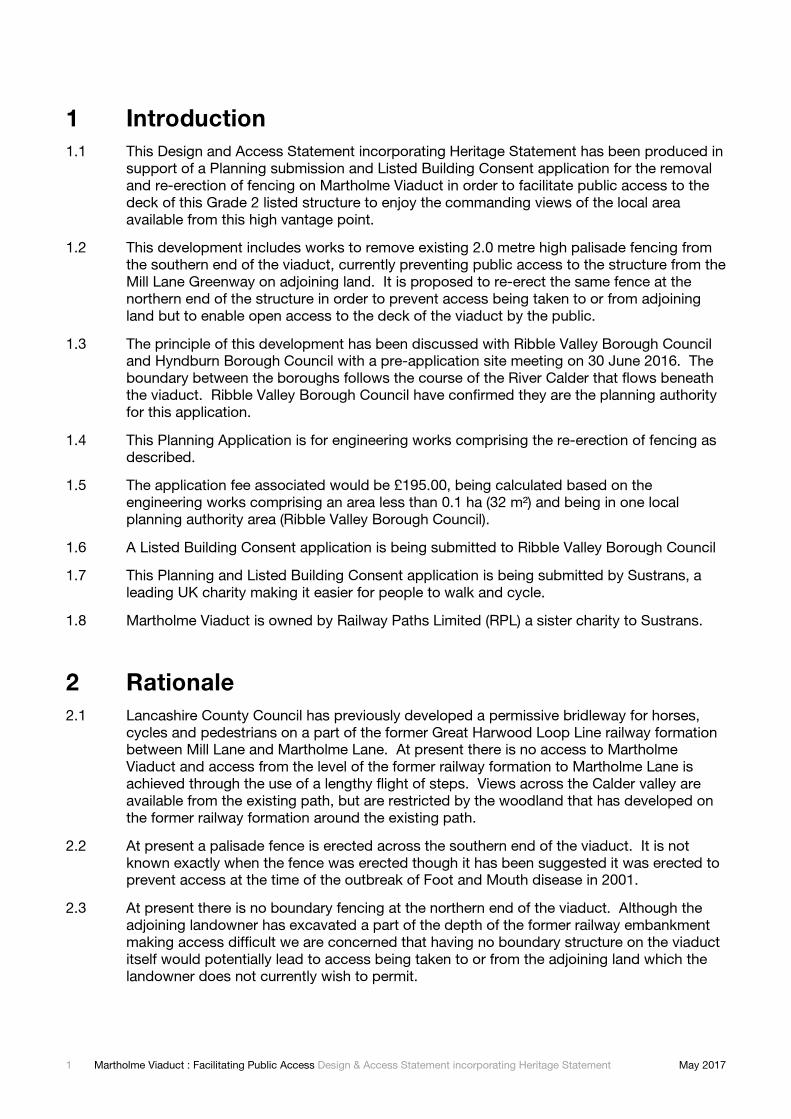
Figure 3.2 – Detail of end of fence extending over the parapet wall and closed pedestrian access
gate.
Figure 3.3 – View showing setting of existing fence looking south from centre of viaduct deck.
Relocated fence would be painted gloss black.
4 Heritage Statement
The Site and Brief History
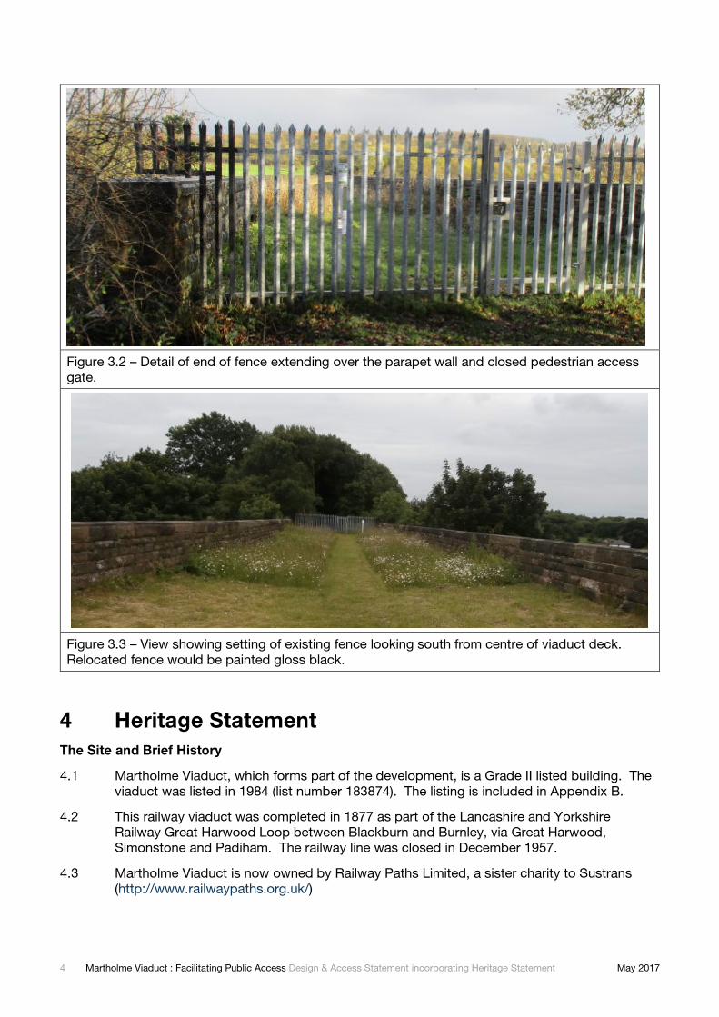
4.1 Martholme Viaduct, which forms part of the development, is a Grade II listed building. The
viaduct was listed in 1984 (list number 183874). The listing is included in Appendix B.
4.2 This railway viaduct was completed in 1877 as part of the Lancashire and Yorkshire
Railway Great Harwood Loop between Blackburn and Burnley, via Great Harwood,
Simonstone and Padiham. The railway line was closed in December 1957.
4.3 Martholme Viaduct is now owned by Railway Paths Limited, a sister charity to Sustrans
(http://www.railwaypaths.org.uk/)

5 Martholme Viaduct : Facilitating Public Access Design & Access Statement incorporating Heritage Statement May 2017
4.4 Public access has previously been permitted but the viaduct was fenced off at the southern
end in 2001 with a steel palisade fence. Since then no public access has been allowed.
Proposed Works to the Viaduct
4.5 As described in paragraph 3.1 it is proposed to take down the existing palisade fence at the
southern end of the viaduct and re-erect it at the northern end of the viaduct.
4.6 After consultation with the local planning authority it is understood that small scale repair
and maintenance of the structure of the viaduct are not regarded as requiring planning or
listed building consent subject to the repairs being carried out on a like-for-like basis.
4.7 The following proposed works are therefore only described here for information and the
presentation of the complete package of works to the viaduct. Masonry repairs will be
carried out In addition to the fence works proposed it is intended to carryout repairs to the
parapet wall on the north eastern side of the structure and to north western pilaster as
shown in figures 4.1 and 4.2 below. Other repointing to the internal faces of the parapet
walls may also be undertaken.
4.8 All stonework repairs will use locally sourced stone to match the existing stone as closely
as possible. A lime based mortar will be used for bedding and pointing new stone work
using a mix of 1 part NHL 5, 1.5 parts riverwashed sand and 1.5 parts Leighton Buzzard
sand. A suitably qualified stonemason will be engaged to carry out the works.
Figure 4.1 – Area of east side parapet, approximately 25 metres from north of viaduct
showing area of missing stonework to be replaced.

6 Martholme Viaduct : Facilitating Public Access Design & Access Statement incorporating Heritage Statement May 2017
Figure 4.2 – North west end of parapet requiring missing stonework to be infilled.
Visual impact
4.9 The scale of the proposed fencing in relation to the scale of the viaduct means that it will
have a negligible visual impact when viewed from afar. Figure 4.3 shows an indication of
the scale of the fence when viewed from afar. The presence of the established vegetation
north of the viaduct will help the fence to blend into the overall surroundings.
Figure 4.3 – View of viaduct from A680 Whalley Road looking north east showing
indication of scale of proposed fence (circled in red).
7 Martholme Viaduct : Facilitating Public Access Design & Access Statement incorporating Heritage Statement May 2017
4.10 The fence will be visible from the viaduct deck, however the presence of trees north of the
viaduct, in the line of the view means that the fence will not obstruct views out over open
countryside as shown in Figure 4.4.
Figure 4.4 – Photo montage showing proposed fence at north end of viaduct. Fence will
be painted gloss black.
5 Ecology
5.1 Sustrans has commissioned a Preliminary Ecological Appraisal (PEA) of the proposed site.
A copy of this report is included as part of the Planning Application submission.
Proposed mitigation measures
5.2 The PEA has identified the need to seek further ecological advice in relation to potential
impact on bats arising from the repairs to the stonework. This will be commissioned prior
to undertaking the repairs and any requirements for mitigation adhered to.
6 Policy Context
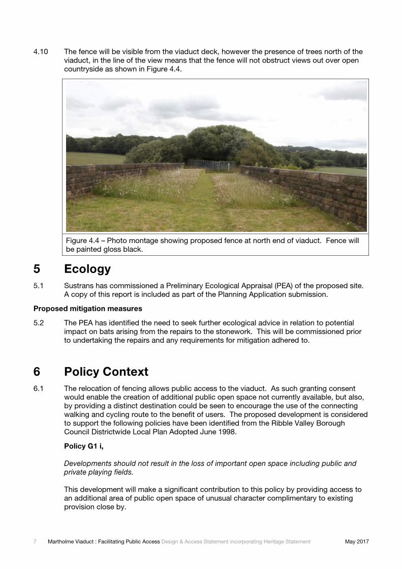
6.1 The relocation of fencing allows public access to the viaduct. As such granting consent
would enable the creation of additional public open space not currently available, but also,
by providing a distinct destination could be seen to encourage the use of the connecting
walking and cycling route to the benefit of users. The proposed development is considered
to support the following policies have been identified from the Ribble Valley Borough
Council Districtwide Local Plan Adopted June 1998.
Policy G1 i,
Developments should not result in the loss of important open space including public and private playing fields.
This development will make a significant contribution to this policy by providing access to
an additional area of public open space of unusual character complimentary to existing
provision close by.

8 Martholme Viaduct : Facilitating Public Access Design & Access Statement incorporating Heritage Statement May 2017
POLICY ENV14 : ARCHAEOLOGICAL AND HISTORIC HERITAGE
In considering development proposals, the Borough Council will apply a presumption in favour of the preservation of ancient monuments and other nationally important archaeological remains and their settings. The case for preservation of archaeological remains will be assessed having regard to the intrinsic importance.
This proposal seeks to enable access to one of the Borough Council’s listed structures for
the enjoyment of the public.
POLICY T12 : CYCLING
There are sections of the disused railway line between Great Harwood and Padiham and between Preston and Longridge where traffic-free links from the urban areas to the Ribble Valley countryside could be created as finances permit.
The proposal seeks to permit public access to Martholme Viaduct as a permissive right of
way for pedestrians and cyclists. While no works are envisaged beyond the relocation of
boundary fencing and minor stonework repairs by opening the viaduct to the public in the
manner proposed assists in the aspiration to create a through route from Great Harwood to
Padiham utilising the former railway formation.
7 Access
7.1 Access to the viaduct can only be taken from land currently in the ownership of Lancashire
County Council and the path created by them over the adjoining former railway line
formation. By relocating the fence as proposed the public could enjoy access to the
viaduct. It is not intended that a public right of way be created. Access over the viaduct
would be created as a permissive path.
7.2 The proposed works only improve the accessibility of the deck of the viaduct. The
accessibility of the site is still limited by the nature and condition of the access available
over land adjoining the viaduct and outside the control of the applicants.
Construction and maintenance access
7.3 Sustrans’ sister charity, Railway Paths Limited owns Martholme Viaduct. As a part of their
title access rights are reserved over the adjoining former railway formation for the repair
and maintenance of the viaduct structure. Access would be subject to the agreement of
the adjoining land owners.
7.4 Following completion of the proposed works access for the maintenance of the deck area
of the viaduct would generally be over the existing paths to the south of the viaduct.
Maintenance of the deck area would be continue to be undertaken using hand tools and/or
manually operated equipment.
8 Further information
8.1 This Design and Access Statement should be read in conjunction with the other documents
and drawings submitted with the planning application, as listed in Appendix A. If further
details are required please contact the applicant:
Sustrans, Fifth Floor, Hanover House, 30-32 Charlotte Street, Manchester, M1 4FD
0161 923 6050 [email protected]

Martholme Viaduct : Facilitating Public Access Design & Access Statement incorporating Heritage Statement May 2017
Appendix A – Schedule of Planning Application
Documents
The following documents and drawings are submitted with the Planning Application and Listed
Building Consent for the Martholme Viaduct: Facilitating public access development. All of this
information is submitted in pdf format. Please contact the Applicant if paper copies are required.
Title Original size and
colour
Documents
NW20-B30-RE-01 Design and Access Statement (incorporating Heritage
Statement)
A4 colour
NW20-B30-RE-02 Preliminary Ecological Appraisal A4 colour
Drawings
NW20-B30-DR-01 General Arrangement (including location plan) A3 colour

Martholme Viaduct : Facilitating Public Access Design & Access Statement incorporating Heritage Statement May 2017
Appendix B – Martholme Viaduct Listing Entry
MARTHOLME VIADUCT
List Entry Summary
This building is listed under the Planning (Listed Buildings and Conservation Areas) Act 1990
as amended for its special architectural or historic interest.
Name: MARTHOLME VIADUCT
List entry Number: 1362005
Location
MARTHOLME VIADUCT, MARTHOLME LANE
The building may lie within the boundary of more than one authority.
County: Lancashire
District: Hyndburn
District Type: District Authority
Parish: Non Civil Parish
County: Lancashire
District: Ribble Valley
District Type: District Authority
Parish: Read
National Park: Not applicable to this List entry.
Grade: II
Date first listed: 09-Mar-1984
Date of most recent amendment: Not applicable to this List entry.
Legacy System Information
The contents of this record have been generated from a legacy data system.

Martholme Viaduct : Facilitating Public Access Design & Access Statement incorporating Heritage Statement May 2017
Legacy System: LBS
UID: 183874
Asset Groupings
This list entry does not comprise part of an Asset Grouping. Asset Groupings are not part of
the official record but are added later for information.
List entry Description
Summary of Building
Legacy Record - This information may be included in the List Entry Details.
Reasons for Designation
Legacy Record - This information may be included in the List Entry Details.
History
Legacy Record - This information may be included in the List Entry Details.
Details
The asset was previously listed twice also under List entry 1072078, in the parish of Read. this
entry was removed from the list on 6th May 2015.
GREAT HARWOOD MARTHOLME LANE SD 73 SE 3/71 Martholme Viaduct - - II
Viaduct carrying Great Harwood loop line of Lancashire and Yorkshire Railway over River
Calder, 1870-77 (Engineer, Sturges Meek). Sandstone rubble. Ten 40ft. span 65ft.high rounded
arches on slightly curved line. Impost band and solid parapet. History: originally planned as
wooden viaduct, but design in stone substituted before building; contractors (Thomas Stone &
Son) executed work only on condition that coal measures beneath were purchased. Line closed
1957.
Listing NGR: SD7515133865
Selected Sources Legacy Record - This information may be included in the List Entry Details
National Grid Reference: SD7515133865
Martholme Viaduct : Facilitating Public Access Design & Access Statement incorporating Heritage Statement May 2017
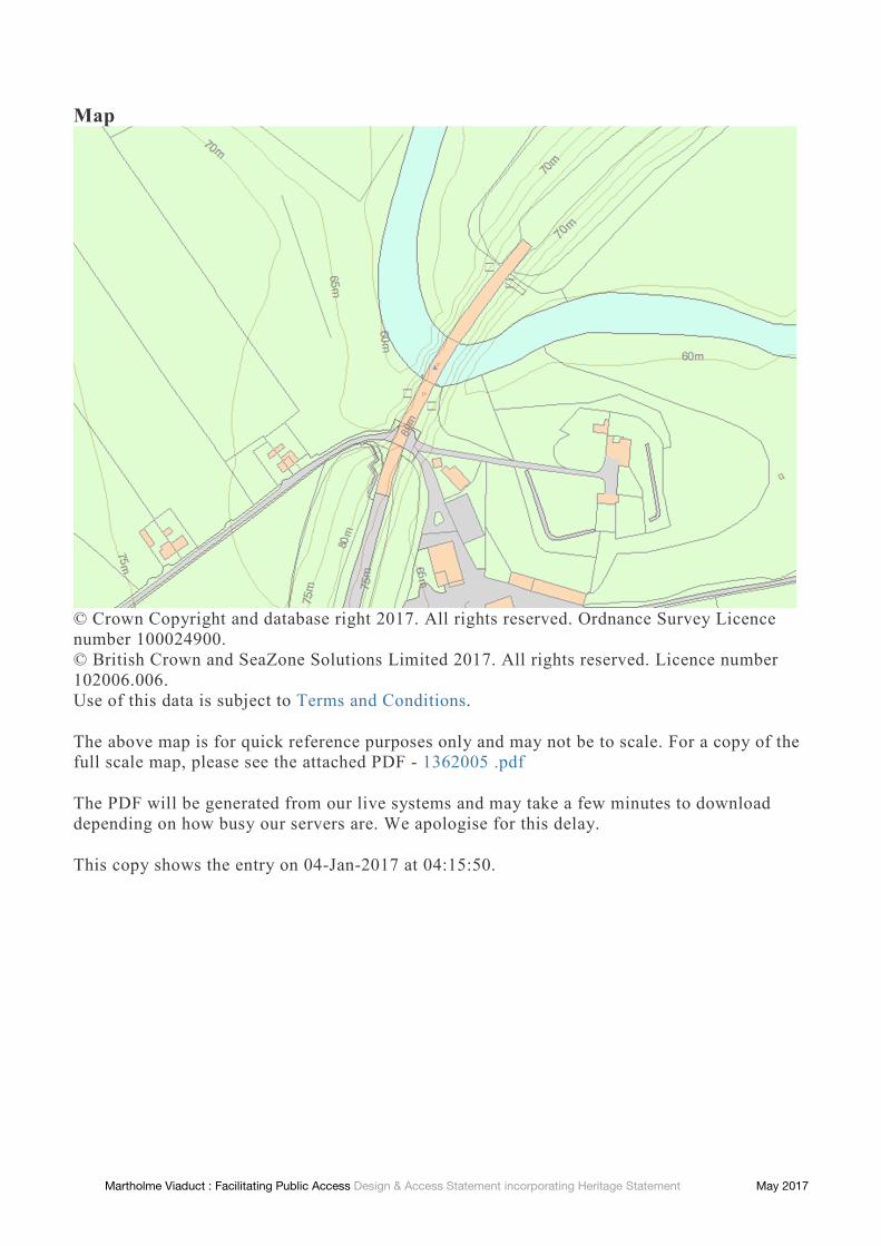
Map
© Crown Copyright and database right 2017. All rights reserved. Ordnance Survey Licence
number 100024900.
© British Crown and SeaZone Solutions Limited 2017. All rights reserved. Licence number
102006.006.
Use of this data is subject to Terms and Conditions.
The above map is for quick reference purposes only and may not be to scale. For a copy of the
full scale map, please see the attached PDF - 1362005 .pdf
The PDF will be generated from our live systems and may take a few minutes to download
depending on how busy our servers are. We apologise for this delay.
This copy shows the entry on 04-Jan-2017 at 04:15:50.