maps of the cd-rom: multimedial history of hungary and finland lászló zentai (hungary) 1/28 maps...
TRANSCRIPT
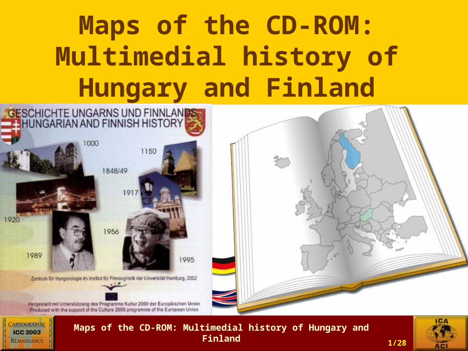
Maps of the CD-ROM: Multimedial history of Hungary and Finland
László Zentai (Hungary)1/28
Maps of the CD-ROM:Multimedial history ofHungary and Finland

Maps of the CD-ROM: Multimedial history of Hungary and Finland
László Zentai (Hungary)2/28
The European Commission „Culture 2000” Programme has financed this project. The Institute of Finnu-Ugric Studies, Hamburg University (Germany) was the coordinator of this project and the collaborators were mostly historians:
• University of Rostock, Historical Institute and Institute of Multimedia and Dataprocessing in Earth Sciences, Germany
• University of Jyväskylä, Department of History, Finland
• New Sorbonne University, Hungarian Institute, Paris, France
• Hungarian Institute of Culture, Berlin, Germany
• Eötvös Loránd University, Department of Cartography, Budapest, Hungary
Maps of the CD-ROM: Multimedial history of Hungary and Finland
László Zentai (Hungary)3/28
What were the reasons to choose these two countries?
• Finland is a relatively new, Hungary is a prospective member of the European Union (Finland – 1995, Hungary – 2004).
• Both countries are at the Eastern edge of the European Union.
• Both countries differ from their neighbours in their language (Finno-Ugric), so they arrived the Union with a special cultural heritage.
• Similarities and differences – Northern Europe and Central Europe.

Maps of the CD-ROM: Multimedial history of Hungary and Finland
László Zentai (Hungary)4/28
Maps of the CD-ROM: Multimedial history of Hungary and Finland
László Zentai (Hungary)5/28
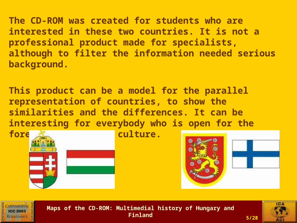
The CD-ROM was created for students who are interested in these two countries. It is not a professional product made for specialists, although to filter the information needed serious background.
This product can be a model for the parallel representation of countries, to show the similarities and the differences. It can be interesting for everybody who is open for the foreign history and culture.

Maps of the CD-ROM: Multimedial history of Hungary and Finland
László Zentai (Hungary)6/28
This was not a commercial product, so we chose a simple format (HTML):
to allow the users to easily utilize the elements for their own purpose (text, graphics, sound, movie together or separately): making their own presentation etc.;
to help the team work: the different elements of the CD-ROM were developed parallelly in different places (countries).

Maps of the CD-ROM: Multimedial history of Hungary and Finland
László Zentai (Hungary)7/28
Cartographic difficulties:•The area of Finland is much larger than the area of
Hungary (during the long term history the area of the two countries has changed – the Hungarian Kingdom was about three times larger than today).
•Hungary is a landscape orientated country (and during its history the borders and the area have changed significantly, but the orientation was always similar), Finland is rather a portrait.
•The history of Hungary was very stirring (starting from the Roman times through the Middle Ages and recent years). The country was occupied by Mongols, Turkish, Habsburgs, Russians, so it gives the cartographers good chances to make maps of certain periods.
•The history of Finland was relatively less exciting (most events happened on the southern part only), so it was not easy to find events that were worth showing in historical maps.
Nevertheless, we had to balance the content of the CD-ROM for all different elements: text, photo, map, sound, video.

Maps of the CD-ROM: Multimedial history of Hungary and Finland
László Zentai (Hungary)8/28
In context of map design, further details are discussed and determined:
• For an easier survey, the named maps should not be divided but be scrollable if necessary (we had only 1-2 maps with scroll bars).
• The maps used in particular chapters or subchapters should include simple information. These maps are not scholarly products and the users are probably not interested intensively, they would rather want an overview of the historical periods.
• The names of places are to be presented in the corresponding official names of the period. Only the names of countries and waters as well as legends are to be translated.
• The HTML structure offers a good solution to represent large images, especially maps. The “sensitive maps” function doesn‘t seem necessary because of the limited content.
• Because of didactic reasons, the basic maps of the various periods should be in the same scale. Theoretically this decision is correct but during their 1000 years of history the size of the countries has changed frequently (especially Hungary).
Maps of the CD-ROM: Multimedial history of Hungary and Finland
László Zentai (Hungary)9/28
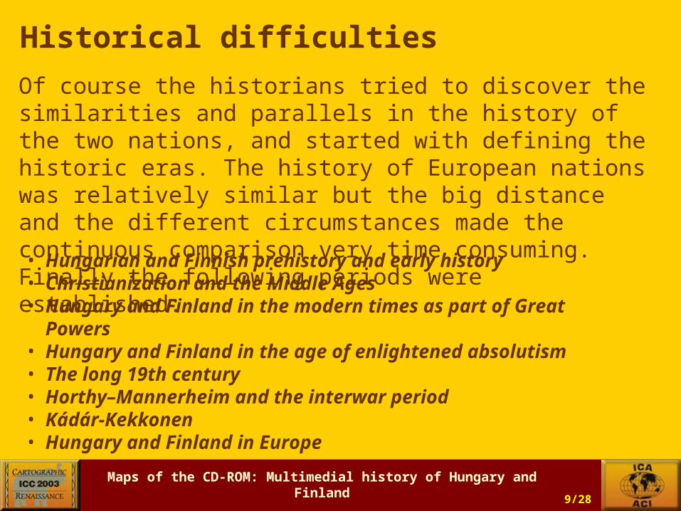
Historical difficulties
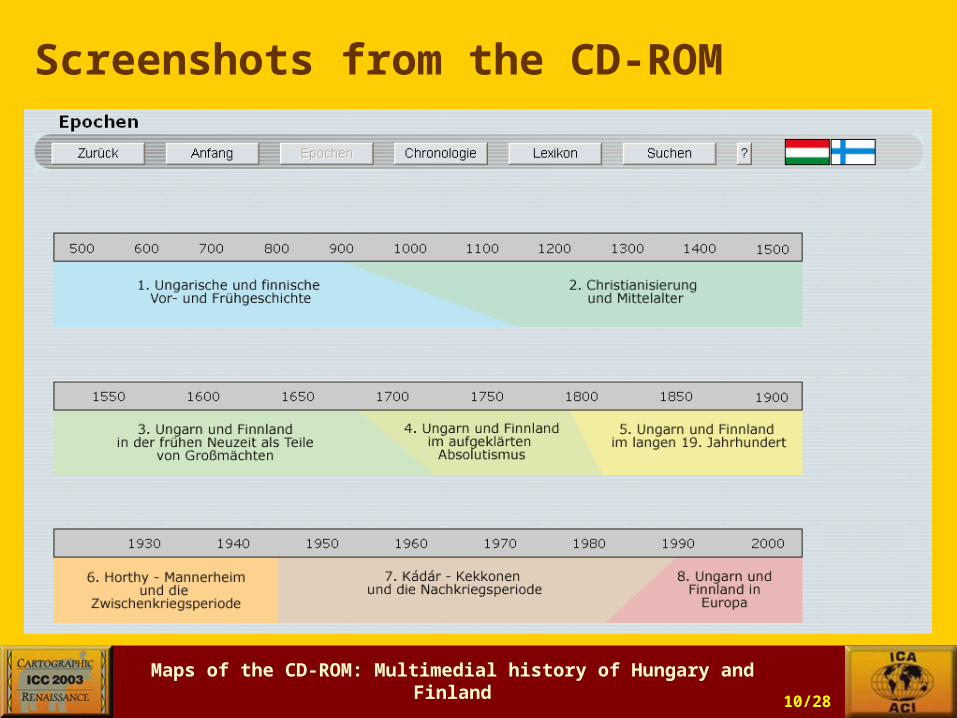
Of course the historians tried to discover the similarities and parallels in the history of the two nations, and started with defining the historic eras. The history of European nations was relatively similar but the big distance and the different circumstances made the continuous comparison very time consuming. Finally the following periods were established:• Hungarian and Finnish prehistory and early history• Christianization and the Middle Ages• Hungary and Finland in the modern times as part of
Great Powers• Hungary and Finland in the age of enlightened
absolutism• The long 19th century• Horthy–Mannerheim and the interwar period• Kádár-Kekkonen• Hungary and Finland in Europe
Maps of the CD-ROM: Multimedial history of Hungary and Finland
László Zentai (Hungary)10/28
Screenshots from the CD-ROM

Maps of the CD-ROM: Multimedial history of Hungary and Finland
László Zentai (Hungary)11/28
Screenshots from the CD-ROM

Maps of the CD-ROM: Multimedial history of Hungary and Finland
László Zentai (Hungary)12/28
Screenshots from the CD-ROM

Maps of the CD-ROM: Multimedial history of Hungary and Finland
László Zentai (Hungary)13/28
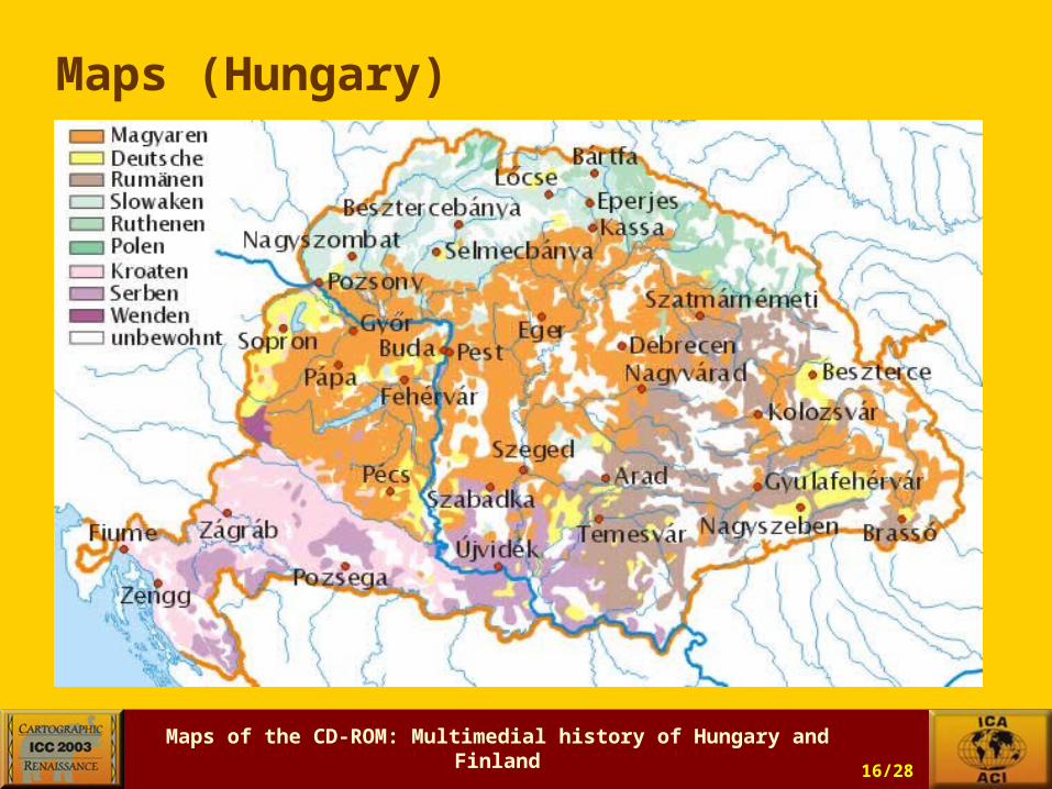
Maps (Hungary)

Maps of the CD-ROM: Multimedial history of Hungary and Finland
László Zentai (Hungary)14/28
Maps (Hungary)

Maps of the CD-ROM: Multimedial history of Hungary and Finland
László Zentai (Hungary)15/28
Maps (Hungary)
Maps of the CD-ROM: Multimedial history of Hungary and Finland
László Zentai (Hungary)16/28
Maps (Hungary)

Maps of the CD-ROM: Multimedial history of Hungary and Finland
László Zentai (Hungary)17/28
Maps (Hungary)

Maps of the CD-ROM: Multimedial history of Hungary and Finland
László Zentai (Hungary)18/28
Maps (Hungary)
Maps of the CD-ROM: Multimedial history of Hungary and Finland
László Zentai (Hungary)19/28
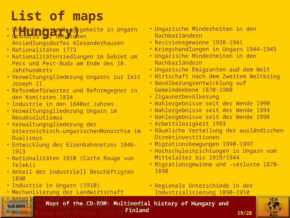
List of maps (Hungary) • Deutsche Besiedlungsgebeite in Ungarn
• Grundriß der deutschen Ansiedlungsdorfes Alexanderhausen
• Nationalitäten 1773• Nationalitätensiedlungen im Gebiet um Pécs
und Pest-Buda am Ende des 18. Jahrhunderts• Verweltungsgliederung Ungarns zur Zeit
Joseph II.• Reformbefürworter und Reformgegner in den
Komitaten 1834• Industrie in den 1840er Jahren• Verwaltungsgliederung Ungarn im
Neoabsolutismus• Verwaltungsgliederung der österreichisch-
ungarischenMonarchie im Dualismus• Entwicklung des Eisenbahnnetzes 1846-1913• Nationalitäten 1910 (Carte Rouge von Teleki)• Anteil der industriell Beschäftigten 1890• Industrie in Ungarn (1910)• Mechanisierung der Landwirtschaft• Anteil der Analphabeten (1890)• Anteil der jüdischen Bevölkerung (1910)• Auswanderung nach Übersee 1899-1913• Vorschläge der Alliierten für die Grenzziehung
Ungarns• Territoriale Forderungen der Nachbarländer• Friedensvertrag von Trianon
• Ungarische Minderheiten in den Nachbarländern
• Revisionsgewinne 1938-1941• Kriegshandlungen in Ungarn 1944-1945• Ungarische Minderheiten in den
Nachbarländern• Ungarische Emigranten aud dem Welt• Wirtschaft nach dem Zweitem Weltkrieg• Bevölkerungsentwicklung auf Gemeindeebene
1870-1980• Zigaunerbevölkerung• Wahlergebnisse seit der Wende 1990• Wahlergebnisse seit der Wende 1994• Wahlergebnisse seit der Wende 1998• Arbeitslosigkeit 1993• Räumliche Verteilung der ausländischen
Direktinvestitionen• Migrationsbewgungen 1990-1997• Hochschuleinrichtungen in Ungarn vom
Mittelalter bis 1919/1944• Migrationsgewinne und -verluste 1870-1890
• Regionale Unterschiede in der Industrialisierung 1890-1910

Maps of the CD-ROM: Multimedial history of Hungary and Finland
László Zentai (Hungary)20/28
Maps (Finland)

Maps of the CD-ROM: Multimedial history of Hungary and Finland
László Zentai (Hungary)21/28
Maps (Finland)

Maps of the CD-ROM: Multimedial history of Hungary and Finland
László Zentai (Hungary)22/28
Maps (Finland)
Maps of the CD-ROM: Multimedial history of Hungary and Finland
László Zentai (Hungary)23/28
Maps (Finland)

Maps of the CD-ROM: Multimedial history of Hungary and Finland
László Zentai (Hungary)24/28
Maps (Finland)

Maps of the CD-ROM: Multimedial history of Hungary and Finland
László Zentai (Hungary)25/28
List of maps (Finland) • Medieval Churches and Monasteries
• Swedish settlements in Finland• Crusades to Finland• The Boundary of the Treaty in Nöteborg in
1323• Medieval towns• The Hansa in the area of the Baltic Sea• State Border after the Peace Treaty in
Teusina 1595• Historical Counties• The New Savo Settlements of the 16th
century• The Border-line of Stolbova Peace Treaty
1617• The Swedish Campaign during the Thirty
Years War• New towns• Tar-burning in Finland• The Border of Uusikaupunki Peace Treaty,
1721• The Border of Turku Peace Treaty• Roads in Finland in the end of the Swedish
rule (1807)• The Border of Hamina Peace Treaty -
Autonomous Finland
• The Saimaa Canal and its sphere of influence
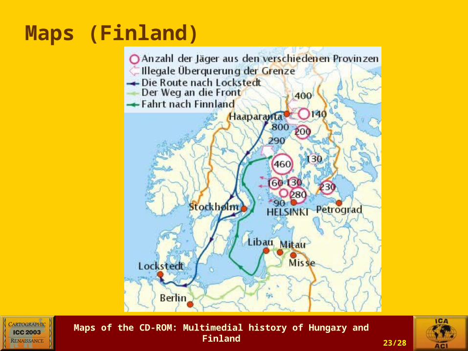
• Railroads in 1917• Emigration to North-America• The Route of Jaegers to Germany• Saw mills• Lönnrot's Travels• Red and White Finland: Front Line in
1918• The Route of the German Baltic
Division in 1918• Popular Movements during the Great
Depression• The Plan of Attack of the Red Army in
November, 1939• Borders of Finland in 1940• The German Army in Finland 1941-
1944• Front Lines of the Continuation War,
1941-1944• Border of Finland after the Paris Peace
Treaty, 1947• The War in Lapland, 1944-1945• The Settlement of the Evacuees
Maps of the CD-ROM: Multimedial history of Hungary and Finland
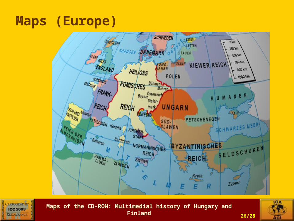
László Zentai (Hungary)26/28
Maps (Europe)

Maps of the CD-ROM: Multimedial history of Hungary and Finland
László Zentai (Hungary)27/28
Maps (Europe)
Maps of the CD-ROM: Multimedial history of Hungary and Finland
László Zentai (Hungary)28/28
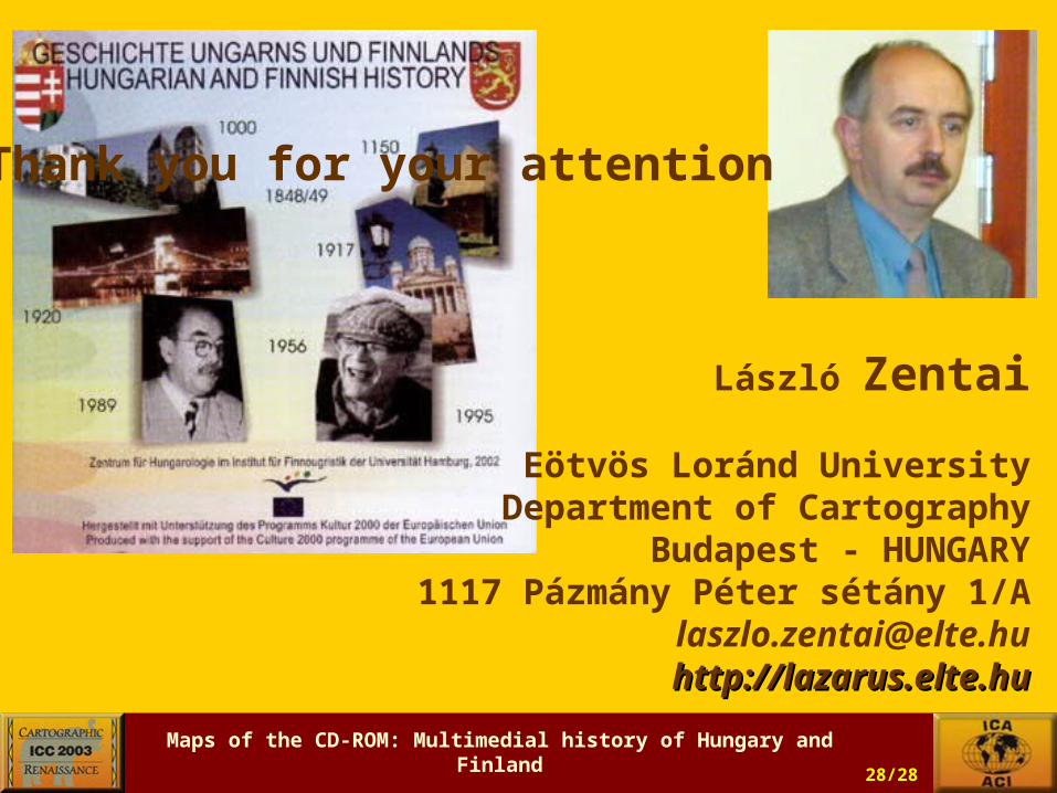
László Zentai
Eötvös Loránd University Department of Cartography
Budapest - HUNGARY1117 Pázmány Péter sétány 1/A
[email protected]://lazarus.elte.huhttp://lazarus.elte.hu
Thank you for your attention