local plan proposed submission consultation
TRANSCRIPT
South Kesteven District Council Local Plan - Representation Form
Local Plan Proposed Submission consultation
From 11th June to 23rd July
The Proposed Submission Local Plan sets out the strategic vision, objectives and spatial strategy for the District, as well as the planning policies which will guide future development. The Plan looks ahead to 2036 and identifies the main areas throughout South Kesteven where development should take place, along with areas of the District will be protected from change. It establishes policies and guidance, to ensure local development is built in accordance with the principles of sustainable development. The Plan has a number of allocations in which contribute towards the deliverability of the Plan’s strategic vision. This stage is the final representation stage before the Local Plan and all evidence based documents are submitted to the Secretary of State for an independent public examination. At this stage in the consultation process, comments should relate to issues of legal and procedural compliance, the “soundness” of the local Plan and the duty to co-operate. There is an accompanying FAQ regarding the regulation 19 consultation on the Council’s webpage - www.southkesteven.gov.uk/newlocalplan How to Respond. Responses should be formed around the information set out within the consultation documents. These include the Proposed Submission Local Plan, Policies maps and other evidence based background documents which can be found on the Local Plan webpage. You can respond to the Document in the following ways.
Email this completed representation form to [email protected]
Post the completed representation form to the Planning Policy Team, South Kesteven District Council Offices, St Peters Hill, Grantham, NG31 6PZ
All representations will be made publicly available, and must be received by 5pm on the 23rd of July. Any responses received after then will not be considered. This form has two parts. Please fill in a separate sheet for each representation you wish to make. Part A is for your personal details. Part B is your representation(s).
South Kesteven District Council Local Plan - Representation Form
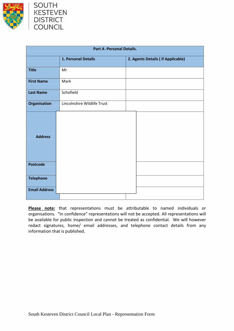
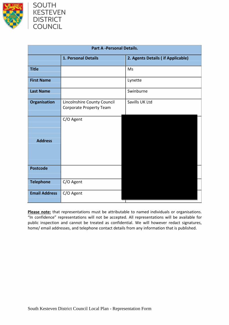
Part A -Personal Details.
1. Personal Details 2. Agents Details ( if Applicable)
Title Mr Click here to enter text.
First Name Mark Click here to enter text.
Last Name Schofield Click here to enter text.
Organisation Lincolnshire Wildlife Trust Click here to enter text.
Address
Banovallum House Manor House Street Horncastle Lincolnshire
Click here to enter text.
Postcode LN9 5HF Click here to enter text.
Telephone 01507 526667 Click here to enter text.
Email Address [email protected] Click here to enter text.
Please note: that representations must be attributable to named individuals or organisations. “In confidence” representations will not be accepted. All representations will be available for public inspection and cannot be treated as confidential. We will however redact signatures, home/ email addresses, and telephone contact details from any information that is published.

PART B – YOUR REPRESENTATION (Please use a separate sheet for each representation)
3) Which part of the Local Plan does this representation relate to?
Document Section
Publication Local Plan
Page numbers (s) 184
Paragraph Number (s) Click here to enter text.
Policy LV-H12
Local Plan Policies Map
Inset Number Click here to enter text.
Policy Click here to enter text.
Other evidence based Document
Name of Document
Click here to enter text.
4 ) Do you consider the Proposed Submission Local Plan is:
Legally Compliant Yes
No
Sound* Yes
No
Complies with Duty to Cooperate Yes
No
* The considerations relating to a development plan being sound are explained in the
National Planning Policy Framework (paragraph 182) – these relate to the plan being
positively prepared, justified, effective and consistent with national policy.
5) If you consider the Proposed Submission Local Plan is unsound, on which grounds do you consider the document to be unsound?
Positively prepared
Justified
Effective
Consistent with National Policy
South Kesteven District Council Local Plan - Representation Form
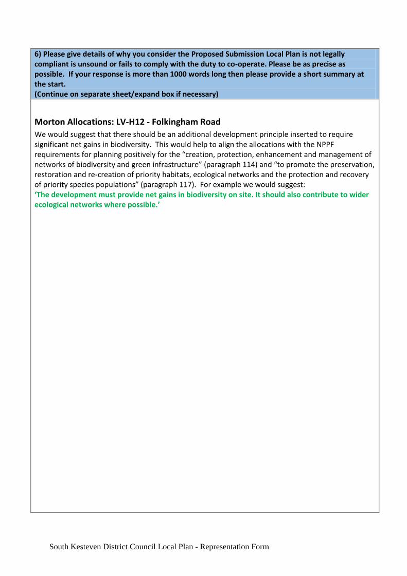
6) Please give details of why you consider the Proposed Submission Local Plan is not legally compliant is unsound or fails to comply with the duty to co-operate. Please be as precise as possible. If your response is more than 1000 words long then please provide a short summary at the start. (Continue on separate sheet/expand box if necessary)
Morton Allocations: LV-H12 - Folkingham Road
We would suggest that there should be an additional development principle inserted to require significant net gains in biodiversity. This would help to align the allocations with the NPPF requirements for planning positively for the “creation, protection, enhancement and management of networks of biodiversity and green infrastructure” (paragraph 114) and “to promote the preservation, restoration and re-creation of priority habitats, ecological networks and the protection and recovery of priority species populations” (paragraph 117). For example we would suggest: ‘The development must provide net gains in biodiversity on site. It should also contribute to wider ecological networks where possible.’
South Kesteven District Council Local Plan - Representation Form
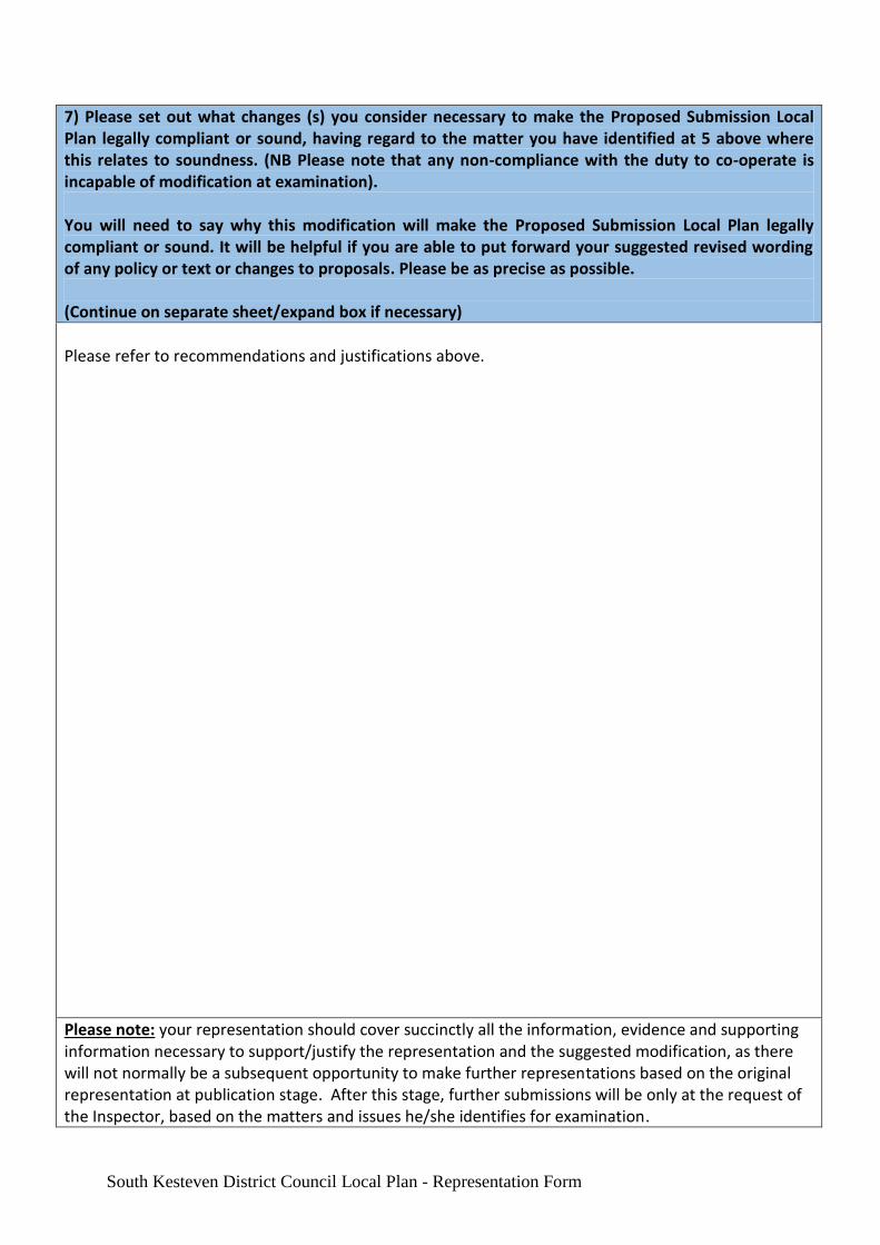
7) Please set out what changes (s) you consider necessary to make the Proposed Submission Local Plan legally compliant or sound, having regard to the matter you have identified at 5 above where this relates to soundness. (NB Please note that any non-compliance with the duty to co-operate is incapable of modification at examination). You will need to say why this modification will make the Proposed Submission Local Plan legally compliant or sound. It will be helpful if you are able to put forward your suggested revised wording of any policy or text or changes to proposals. Please be as precise as possible. (Continue on separate sheet/expand box if necessary)
Please refer to recommendations and justifications above.
Please note: your representation should cover succinctly all the information, evidence and supporting information necessary to support/justify the representation and the suggested modification, as there will not normally be a subsequent opportunity to make further representations based on the original representation at publication stage. After this stage, further submissions will be only at the request of the Inspector, based on the matters and issues he/she identifies for examination.
South Kesteven District Council Local Plan - Representation Form
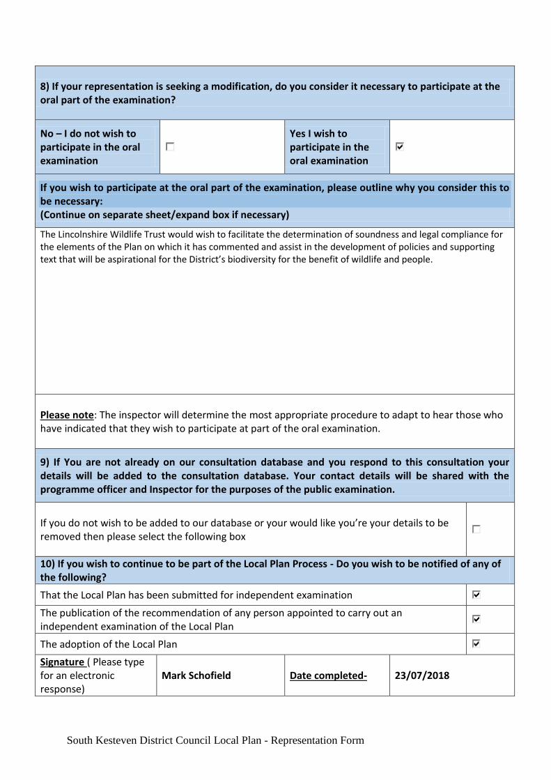
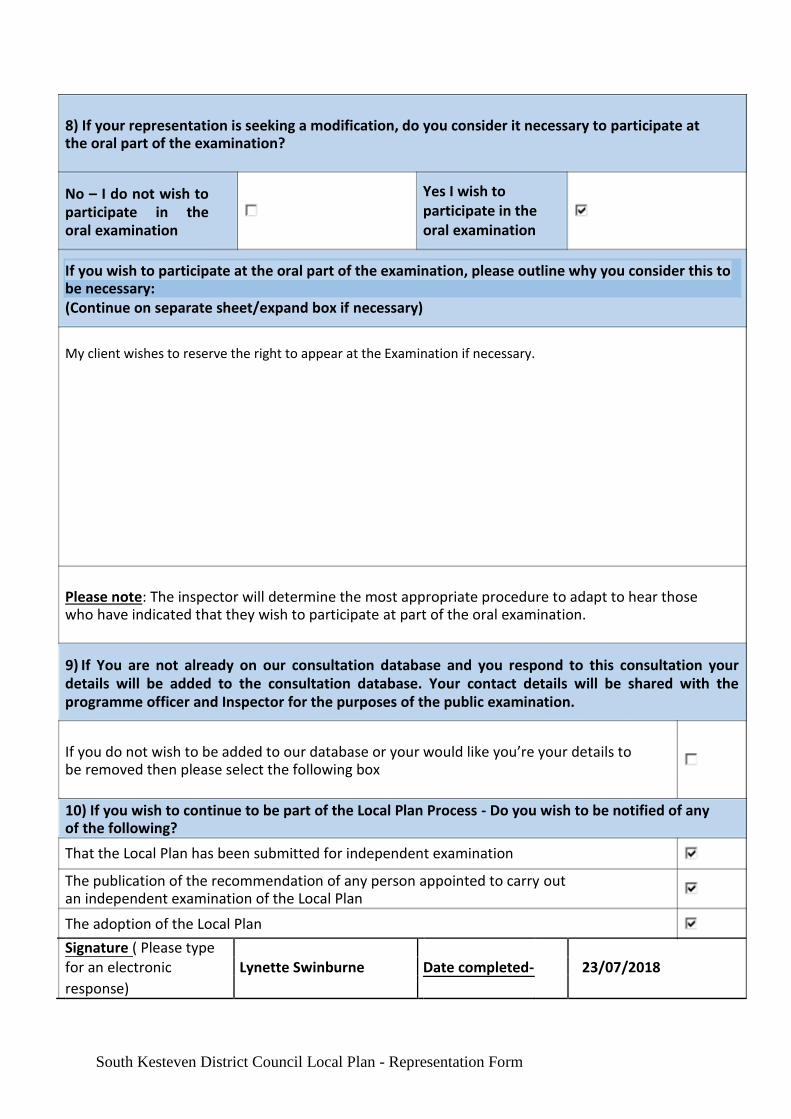
8) If your representation is seeking a modification, do you consider it necessary to participate at the oral part of the examination?
No – I do not wish to participate in the oral examination
Yes I wish to participate in the oral examination
If you wish to participate at the oral part of the examination, please outline why you consider this to be necessary: (Continue on separate sheet/expand box if necessary)
The Lincolnshire Wildlife Trust would wish to facilitate the determination of soundness and legal compliance for the elements of the Plan on which it has commented and assist in the development of policies and supporting text that will be aspirational for the District’s biodiversity for the benefit of wildlife and people.
Please note: The inspector will determine the most appropriate procedure to adapt to hear those who have indicated that they wish to participate at part of the oral examination.
9) If You are not already on our consultation database and you respond to this consultation your details will be added to the consultation database. Your contact details will be shared with the programme officer and Inspector for the purposes of the public examination.
If you do not wish to be added to our database or your would like you’re your details to be removed then please select the following box
10) If you wish to continue to be part of the Local Plan Process - Do you wish to be notified of any of the following?
That the Local Plan has been submitted for independent examination
The publication of the recommendation of any person appointed to carry out an independent examination of the Local Plan
The adoption of the Local Plan
Signature ( Please type for an electronic response)
Mark Schofield Date completed- 23/07/2018
Local Plan
Proposed Submission consultation
From 11th
June to 23rd
July The Proposed Submission Local Plan sets out the strategic vision, objectives and spatial strategy for the District, as well as the planning policies which will guide future development. The Plan looks ahead to 2036 and identifies the main areas throughout South Kesteven where development should take place, along with areas of the District will be protected from change. It establishes policies and guidance, to ensure local development is built in accordance with the principles of sustainable development. The Plan has a number of allocations in which contribute towards the deliverability of the Plan’s strategic vision.
This stage is the final representation stage before the Local Plan and all evidence based documents are submitted to the Secretary of State for an independent public examination. At this stage in the consultation process, comments should relate to issues of legal and procedural compliance, the “soundness” of the local Plan and the duty to co-operate. There is an accompanying FAQ regarding the regulation 19 consultation on the Council’s webpage - www.southkesteven.gov.uk/newlocalplan
How to Respond. Responses should be formed around the information set out within the consultation documents. These include the Proposed Submission Local Plan, Policies maps and other evidence based background documents which can be found on the Local Plan webpage.
You can respond to the Document in the following ways.
Email this completed representation form to [email protected] Post the completed representation form to the Planning Policy Team, South Kesteven District Council Offices, St Peters Hill, Grantham, NG31 6PZ
All representations will be made publicly available, and must be received by 5pm on the 23
rd of July. Any responses received after then will not be considered.
This form has two parts. Please fill in a separate sheet for each representation you wish to make. Part A is for your personal details. Part B is your representation(s).
South Kesteven District Council Local Plan - Representation Form
Part A -Personal Details.
1. Personal Details 2. Agents Details ( if Applicable)
Title Click here to enter text. Ms
First Name Click here to enter text. Lynette
Last Name Click here to enter text. Swinburne
Organisation Lincolnshire County Council Savills UK Ltd
Corporate Property Team
C/O Agent Stuart House
City Road
Peterborough
PE1 1QF
Address
Postcode Click here to enter text. PE1 1QF
Telephone C/O Agent 01733 209943
Email Address C/O Agent [email protected]
Please note: that representations must be attributable to named individuals or organisations. “In confidence” representations will not be accepted. All representations will be available for public inspection and cannot be treated as confidential. We will however redact signatures, home/ email addresses, and telephone contact details from any information that is published.
South Kesteven District Council Local Plan - Representation Form
PART B – YOUR REPRESENTATION
(Please use a separate sheet for each representation)
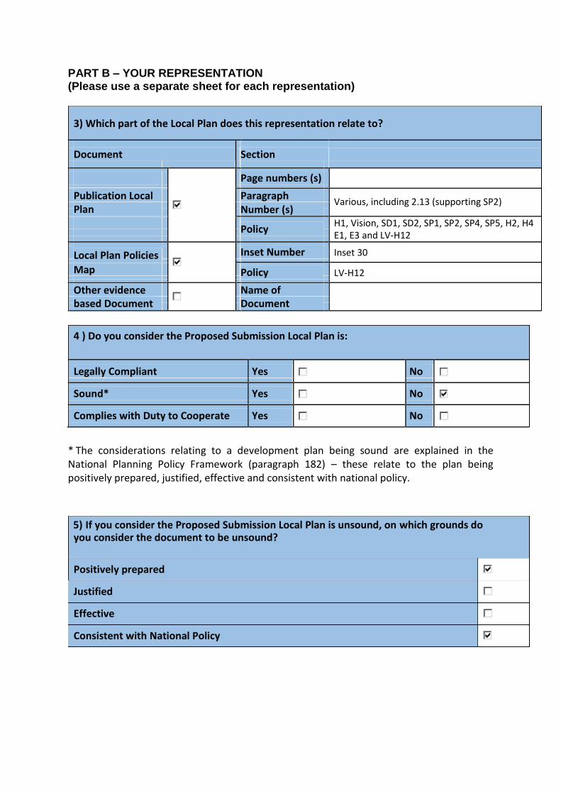
3) Which part of the Local Plan does this representation relate to?
Document Section
Page numbers (s) Click here to enter text.
Publication Local Paragraph Various, including 2.13 (supporting SP2)
Plan
Number (s)
Policy
H1, Vision, SD1, SD2, SP1, SP2, SP4, SP5, H2, H4
E1, E3 and LV-H12
Local Plan Policies Inset Number Inset 30
Map Policy LV-H12
Other evidence Name of Click here to enter text.
based Document
Document
4 ) Do you consider the Proposed Submission Local Plan is:
Legally Compliant Yes No
Sound* Yes No
Complies with Duty to Cooperate Yes No
* The considerations relating to a development plan being sound are explained in the National Planning Policy Framework (paragraph 182) – these relate to the plan being positively prepared, justified, effective and consistent with national policy.
5) If you consider the Proposed Submission Local Plan is unsound, on which grounds do you consider the document to be unsound?
Positively prepared
Justified
Effective
Consistent with National Policy
6) Please give details of why you consider the Proposed Submission Local Plan is not legally compliant is unsound or fails to comply with the duty to co-operate. Please be as precise as possible. If your response is more than 1000 words long then please provide a short summary at the start. (Continue on separate sheet/expand box if necessary)
Please refer to covering letter
South Kesteven District Council Local Plan - Representation Form
7) Please set out what changes (s) you consider necessary to make the Proposed Submission Local Plan legally compliant or sound, having regard to the matter you have identified at 5 above where this relates to soundness. (NB Please note that any non-compliance with the duty to co-operate is incapable of modification at examination).
You will need to say why this modification will make the Proposed Submission Local Plan legally compliant or sound. It will be helpful if you are able to put forward your suggested revised wording of any policy or text or changes to proposals. Please be as precise as possible.
(Continue on separate sheet/expand box if necessary)
Please refer to covering letter
Please note: your representation should cover succinctly all the information, evidence and supporting information necessary to support/justify the representation and the suggested modification, as there will not normally be a subsequent opportunity to make further representations based on the original representation at publication stage. After this stage, further submissions will be only at the request of the Inspector, based on the matters and issues he/she identifies for examination.
South Kesteven District Council Local Plan - Representation Form
8) If your representation is seeking a modification, do you consider it necessary to participate at the oral part of the examination?
No – I do not wish to participate in the oral examination
Yes I wish to
participate in the
oral examination
If you wish to participate at the oral part of the examination, please outline why you consider this to be necessary: (Continue on separate sheet/expand box if necessary)
My client wishes to reserve the right to appear at the Examination if necessary.
Please note: The inspector will determine the most appropriate procedure to adapt to hear those who have indicated that they wish to participate at part of the oral examination.
9) If You are not already on our consultation database and you respond to this consultation your details will be added to the consultation database. Your contact details will be shared with the programme officer and Inspector for the purposes of the public examination.
If you do not wish to be added to our database or your would like you’re your details to be removed then please select the following box
10) If you wish to continue to be part of the Local Plan Process - Do you wish to be notified of any of the following?
That the Local Plan has been submitted for independent examination
The publication of the recommendation of any person appointed to carry out an independent examination of the Local Plan
The adoption of the Local Plan
Signature ( Please type
for an electronic Lynette Swinburne Date completed- 23/07/2018
response)
South Kesteven District Council Local Plan - Representation Form

23rd
July 2018
bc
LNRU303323/LS
Planning Policy Team Lynette Swinburne
South Kesteven District Council E: [email protected]
St Peters Hill DL: 01733 209 943
Grantham F: 01733 894 649
Lincolnshire Stuart House, City Road, Peterborough PE1 1QF NG31 6PZ
T: 01733 567 231
savills.co.uk
By email only
Dear Sir or Madam,
South Kesteven Local Plan 2011 to 2036: Proposed Submission Local Plan (Regulation 19) Representations on behalf of Lincolnshire County Council Corporate Property Team Policy H1: Housing Allocations
Site Reference: LV-H12 (Land East of Folkingham Road, Morton) Inset Map 30: Morton
Savills (UK) Ltd (Rural, Energy & Projects), is instructed by our client, Lincolnshire County Council (Corporate Property Team), to submit a representation in response to the South Kesteven Local Plan to 2036: Proposed Submission. The representation is made in respect of the above site within Morton. The site was identified as a housing allocation within the July 2017 Consultative Local Plan for 70 dwellings. Policy H1: Housing Allocations and proposed allocation LV-H12
We fully support the Council’s proposed allocation of LV-H11 ‘Folkingham Road’, the proposed housing
allocation being considered sound. Below, the site is considered against the tests within the NPPG1,
confirming that it is suitable, available and achievable for development purposes. Suitable
Encouraging growth in sustainable settlements within rural areas is considered to be in accordance with The Framework and draft NPPF (March 2018). In particular, paragraph 14 requires that Local Planning Authorities positively seek opportunities to meet the development needs of their area, whilst paragraph 55 outlines that to promote sustainable development in rural areas, housing should be located where it will enhance or maintain the vitality of rural communities. It is therefore important that the emerging Local Plan pursues a development strategy that allows for the growth of villages, alongside the larger urban extensions as a means of ensuring their long term sustainability.
The proposed allocation represents a logical but proportionate expansion of the village envelope and will help to address local housing needs.
The site, which has a combined site area of approximately 4.6 hectares, is located to the centre of the village where it borders existing housing development to the south. The site is currently greenfield land but sits adjacent to the village envelope.
1 Paragraph: 019 Reference ID: 3-019-20140306; Paragraph: 020 Reference ID: 3-020-20140306; and Paragraph: 021 Reference ID: 3-021-20140306
Offices and associates throughout the Americas, Europe, Asia Pacific, Africa and the Middle East. Savills (UK) Limited. Chartered Surveyors. Regulated by RICS. A subsidiary of Savills plc. Registered in England No. 2605138. Registered office: 33 Margaret Street, London, W1G 0JD
a
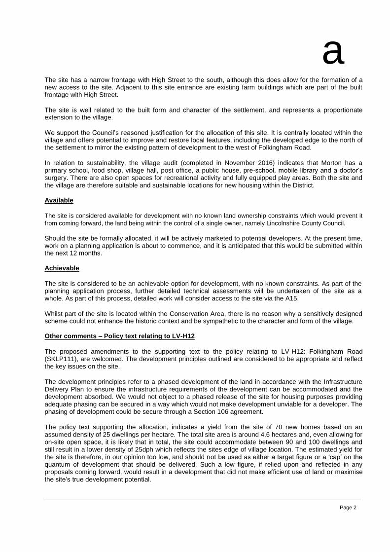
The site has a narrow frontage with High Street to the south, although this does allow for the formation of a new access to the site. Adjacent to this site entrance are existing farm buildings which are part of the built frontage with High Street.
The site is well related to the built form and character of the settlement, and represents a proportionate extension to the village.
We support the Council’s reasoned justification for the allocation of this site. It is centrally located within the village and offers potential to improve and restore local features, including the developed edge to the north of the settlement to mirror the existing pattern of development to the west of Folkingham Road.
In relation to sustainability, the village audit (completed in November 2016) indicates that Morton has a primary school, food shop, village hall, post office, a public house, pre-school, mobile library and a doctor’s surgery. There are also open spaces for recreational activity and fully equipped play areas. Both the site and the village are therefore suitable and sustainable locations for new housing within the District.
Available
The site is considered available for development with no known land ownership constraints which would prevent it
from coming forward, the land being within the control of a single owner, namely Lincolnshire County Council.
Should the site be formally allocated, it will be actively marketed to potential developers. At the present time, work on a planning application is about to commence, and it is anticipated that this would be submitted within the next 12 months.
Achievable
The site is considered to be an achievable option for development, with no known constraints. As part of the planning application process, further detailed technical assessments will be undertaken of the site as a whole. As part of this process, detailed work will consider access to the site via the A15.
Whilst part of the site is located within the Conservation Area, there is no reason why a sensitively designed scheme could not enhance the historic context and be sympathetic to the character and form of the village.
Other comments – Policy text relating to LV-H12
The proposed amendments to the supporting text to the policy relating to LV-H12: Folkingham Road (SKLP111), are welcomed. The development principles outlined are considered to be appropriate and reflect the key issues on the site.
The development principles refer to a phased development of the land in accordance with the Infrastructure Delivery Plan to ensure the infrastructure requirements of the development can be accommodated and the development absorbed. We would not object to a phased release of the site for housing purposes providing adequate phasing can be secured in a way which would not make development unviable for a developer. The phasing of development could be secure through a Section 106 agreement.
The policy text supporting the allocation, indicates a yield from the site of 70 new homes based on an assumed density of 25 dwellings per hectare. The total site area is around 4.6 hectares and, even allowing for on-site open space, it is likely that in total, the site could accommodate between 90 and 100 dwellings and still result in a lower density of 25dph which reflects the sites edge of village location. The estimated yield for the site is therefore, in our opinion too low, and should not be used as either a target figure or a ‘cap’ on the quantum of development that should be delivered. Such a low figure, if relied upon and reflected in any proposals coming forward, would result in a development that did not make efficient use of land or maximise the site’s true development potential.
Page 2

a
Summary
As noted above, there are no significant adverse impacts with regards to the delivery of the site for residential development. We therefore consider the site to be suitable and deliverable for future residential development and should therefore continue to be allocated for housing in the new Local Plan.
Page 3
a
South Kesteven Local Plan 2011 to 2036: Proposed Submission Local Plan (Regulation 19) Representations on behalf of Lincolnshire County Council Corporate Property Team Comments on wider policies of the Proposed Submission Local Plan
We refer you to our comments in relation to the Consultative Draft, made in August 2017, included in full in
Appendix 1. However, please note our additional comments below:
2036 Vision for South Kesteven Comments remain as set out in response to Consultative Draft Local Plan 2017. We support the vision for South Kesteven in that it allows for growth within the network of towns and villages, including Barrowby, according to their size, and seeks to provide a range of accessible services in a good environment. This will be achieved through, amongst other things, the creation of the right balance of jobs, housing, services and infrastructure together with ensuring that new development is sustainable in terms of location, use and form. The vision also accounts for the need to balance the competing interests of development with the protection and enhancement of the natural and built environment, including through the need to mitigate the negative impacts of development. As such, we consider the 2036 vision for South Kesteven to be compliant with the National Planning Policy Framework (NPPF).
Outside the four main towns, the vision focuses new development within villages containing good levels of services and facilities, having regard to their environmental and infrastructure capacity and the desire to safeguard existing services and employment. The vision seeks to retain the diversity and vitality of rural communities through well planned and carefully managed development to allow village to have sufficient jobs and homes for local people.
It is considered that this vision is in line with the NPPF and particular accords with paragraphs 54 and 55 of the Framework. Furthermore, as set out in the National Planning Policy Guidance (NPPG), it is important to recognise the particular issues facing rural areas in terms of housing supply and affordability, and the role of housing in supporting the broader sustainability of villages and smaller settlements. As such, we consider the 2036 vision for South Kesteven to be complaint with the NPPF.
Policy SD1: Presumption in Favour of Sustainable Development It is considered that this vision is in line with the NPPF and particular accords with paragraphs 54 and 55 of the Framework. Furthermore, as set out in the National Planning Policy Guidance (NPPG), it is important to recognise the particular issues facing rural areas in terms of housing supply and affordability, and the role of housing in supporting the broader sustainability of villages and smaller settlements. As such, we consider the 2036 vision for South Kesteven to be complaint with the NPPF.
Policy SD2: The Principles of Sustainable Development in South Kesteven We welcome the current wording of the policy and consider that it is in accordance with national policy (paragraph 173 of the NPPF in particular). Policy SP1: Spatial Strategy We welcome the proposals to deliver sites over and above the Objectively Assessed Need which will allow for flexibility over the plan period.
Policy SP2: Settlement Hierarchy We remain concerned about the wording of the second bullet point in this policy, specifically where it refers to support for the development of sustainable sites within the built up part of the town and ‘appropriate’ edge of settlement extensions.
Our previous comments centred on the lack of definition in relation to the use of ‘appropriate’ in relation to the development of sites. Clarity has been provided in supporting paragraph 2.13, which now states:
“Development proposals on the edge of a settlement will only be supported in the following specific circumstances: where they are supported by clear evidence of substantial support from the local community or; where they form a Rural Exceptions scheme which meets a proven local need for
Page 4
a
affordable homes. In all cases the site must be well located to the existing built form, substantially enclosed and where the sites edge is clearly defined by a physical feature that also acts as a barrier to further growth (such as a road). The proposal should not visually extend building into the open countryside.”
This approach reflects that in emerging Policy SP4 ‘Development on the Edge of Settlements’ and our comments as part of the previous consultation remain pertinent in the context of SP2. We remain of the view that the policy is not reasonable or practical.
Whilst not wishing to undervalue the importance of community consultation, a development proposal that is consistent with all other criteria under this policy should not be deemed to be unacceptable on account of there not being substantial community support. The term ‘substantial support’ is too ambiguous and the inclusion of criteria that requires the support of third parties is highly irregular and is unlikely to satisfy the tests of soundness or reasonableness.
Furthermore, in those settlements identified as suitable locations for growth, especially in the Market Towns, this
policy requirement seems to be unnecessarily restrictive, placing a disproportional burden on developers in
locations which South Kesteven have identified as important locations for growth. Infill within the settlement
boundary is not always possible at a scale which is sustainable due to limited infill opportunities, and constraints
associated with brownfield land. Therefore, we are concerned that this restrictive approach to development on the
edge of settlements may have an adverse impact on the delivery of housing in these areas.
The previous wording of the supporting text in the Consultative Draft 2017, whilst ambiguous in relation to the use of ‘appropriate development’ did at least provide some criteria as a starting point to define locations which may be physically more suitable for growth on the edge of settlements. This included the suggestion that those sites where, “its edge is clearly defined by a physical feature that also acts as a barrier to further growth (such as a road)”, may be appropriate for new housing.
Therefore, it is considered that the supporting text to the policy should be amended to remove the text in paragraph 2.13 because it is not considered to be sound as it is not in accordance with paragraph 55 of the NPPF.
SP3 ‘Infill Developments’ We support Policy SP3 in that it provides an appropriate range of criteria for the consideration of proposals for infill development in all settlements, and is consistent with policy advice within the NPPF.
SP4 ‘Development on the Edge of Settlements’ Please refer to our comments in relation to SP2.
Pre-application engagement with the community is good practice for many types of development, and is often a
means of gaining useful input into the development of a scheme. To simply have a policy requirement to obtain
‘substantial support’ from the local community or support from the Town, Parish Council or Neighbourhood Plan
Group/Forum does not recognise the value of the engagement process and how it can be used to shape and
modify proposals. Whilst engagement with the community is generally supported as part of the application (or pre-
application) process, a policy which has a requirement for ‘(substantial) support’ at its
Page 5
a
heart, is considered to be too binary and not in the spirit of the presumption in favour of sustainable development, which is the golden thread running through the NPPF (as noted in paragraph 14).
We would agree that all other criteria listed in the first part of policy SP4 are fair and in the interests of securing appropriate development that respects the scale, form and pattern of the settlement. We also agree with the policy’s criteria relating to rural exception sites for affordable housing.
SP5 Development in the Open Countryside No additional comments. Concerns remain about the differentiation between this policy and development which may be considered acceptable under SP4.
Whilst we would support the intentions of policy SP5 to restrict development in the open countryside to specific development proposals, we would recommend the policy be revised to make it distinguishable from SP4 relating to sites on the edge of settlements (urban fringe).
H2: Affordable Housing Contributions Viability is a critical concern for most development sites and can be an impediment to housing delivery. Viability can
be marginal particularly when accounting for abnormal costs, other requirements of the plan (open space provision,
etc.), and a blanket affordable housing requirement. Consequently, the ability to determine the delivery of
affordable housing on a ‘subject to viability basis’ is absolutely essential. Amendments to the wording of the policy
since the previous Consultative Draft in 2017 are welcomed, particularly to make reference to unforeseen abnormal
costs on some sites or those with exceptionally low completed development values.
We therefore consider the principles of Policy H2 to be ‘sound’ and welcome the approach which acknowledges that there will be circumstances where developments may need to provide a lower amount of affordable housing.
H4: Meeting All Housing Needs We support the policy which encourages an appropriate mix of housing that meets the current and future needs of households in the District. With regard to housing types, although it is important to plan for a wide housing mix throughout the District to ensure that all needs are catered for, it can be unviable to dictate housing mix on smaller development sites and potentially lead to a site becoming undeliverable.
Therefore, large scale developments being promoted should utilise the evidence provided by the SHMA, ensuring a mix of housing is being provided, - although should not be dictated by it - whilst allowing small housing sites to come forward independently, as these sites can easily become unviable if too many onerous requirements and planning obligations are placed up on them.
Page 6
a
Notwithstanding the above comments relating to viability, the policy is considered to be in general conformity with the advice within paragraph 50 of the NPPF.
Conclusion
I trust this letter clarifies my client’s position in relation to the Proposed Submission Local Plan and the policies
within. I would be grateful if you could keep me informed in relation to the next stages of the Local Plan process.
Yours faithfully,
Lynette Swinburne MRTPI Associate Director (Planning), Rural, Energy & Projects
Page 7
a
Appendix 1: Representations to South Kesteven Consultative Draft Local Plan, 2017
Page 8
Lincolnshire County Council August 2017
Representations to South Kesteven Local Plan
Consultative Draft Local Plan – July 2017 Land East of Folkingham Road, Morton
savills.co.uk
Land East of Folkingham Road, Morton
August 2017 1
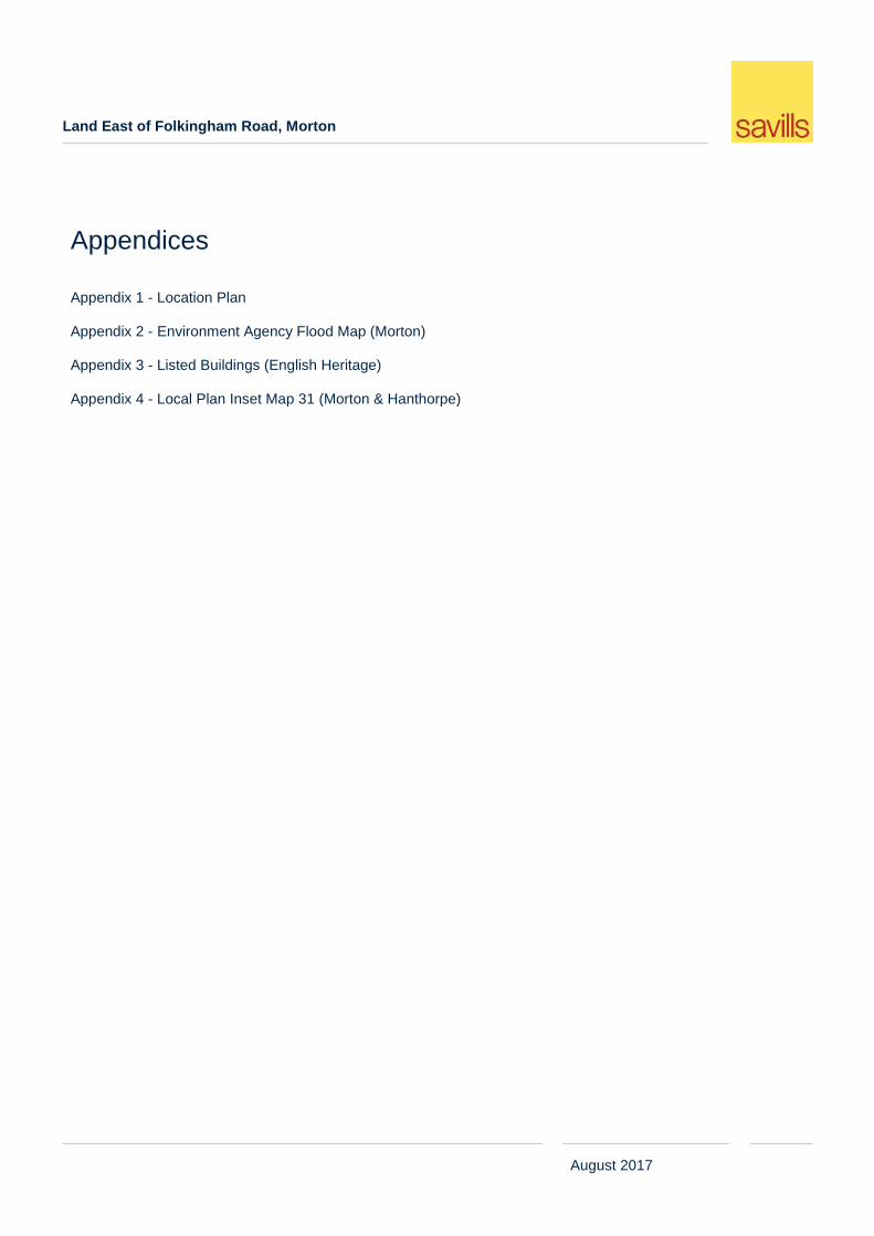
Appendices
Appendix 1 - Location Plan Appendix 2 - Environment Agency Flood Map (Morton) Appendix 3 - Listed Buildings (English Heritage) Appendix 4 - Local Plan Inset Map 31 (Morton & Hanthorpe)
Land East of Folkingham Road, Morton
August 2017 1
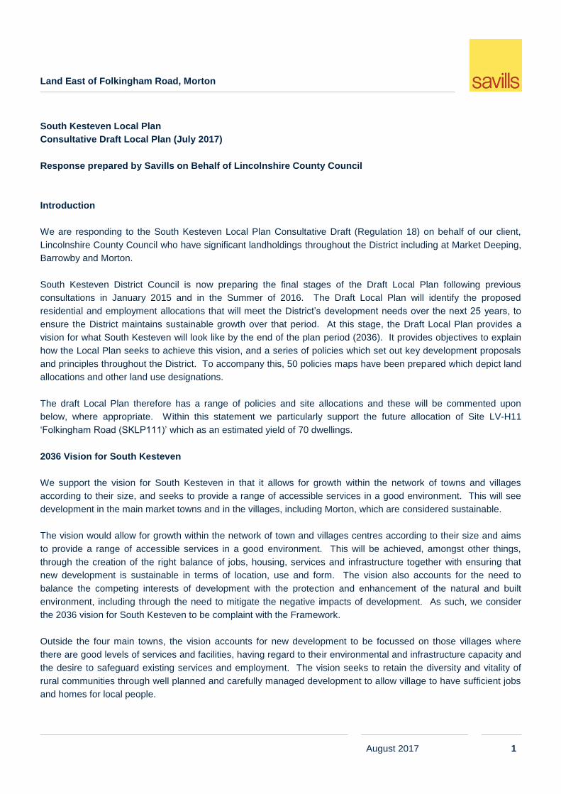
South Kesteven Local Plan
Consultative Draft Local Plan (July 2017)
Response prepared by Savills on Behalf of Lincolnshire County Council
Introduction
We are responding to the South Kesteven Local Plan Consultative Draft (Regulation 18) on behalf of our client,
Lincolnshire County Council who have significant landholdings throughout the District including at Market Deeping,
Barrowby and Morton.
South Kesteven District Council is now preparing the final stages of the Draft Local Plan following previous
consultations in January 2015 and in the Summer of 2016. The Draft Local Plan will identify the proposed
residential and employment allocations that will meet the District’s development needs over the next 25 years, to
ensure the District maintains sustainable growth over that period. At this stage, the Draft Local Plan provides a
vision for what South Kesteven will look like by the end of the plan period (2036). It provides objectives to explain
how the Local Plan seeks to achieve this vision, and a series of policies which set out key development proposals
and principles throughout the District. To accompany this, 50 policies maps have been prepared which depict land
allocations and other land use designations.
The draft Local Plan therefore has a range of policies and site allocations and these will be commented upon
below, where appropriate. Within this statement we particularly support the future allocation of Site LV-H11
‘Folkingham Road (SKLP111)’ which as an estimated yield of 70 dwellings.
2036 Vision for South Kesteven
We support the vision for South Kesteven in that it allows for growth within the network of towns and villages
according to their size, and seeks to provide a range of accessible services in a good environment. This will see
development in the main market towns and in the villages, including Morton, which are considered sustainable.
The vision would allow for growth within the network of town and villages centres according to their size and aims
to provide a range of accessible services in a good environment. This will be achieved, amongst other things,
through the creation of the right balance of jobs, housing, services and infrastructure together with ensuring that
new development is sustainable in terms of location, use and form. The vision also accounts for the need to
balance the competing interests of development with the protection and enhancement of the natural and built
environment, including through the need to mitigate the negative impacts of development. As such, we consider
the 2036 vision for South Kesteven to be complaint with the Framework.
Outside the four main towns, the vision accounts for new development to be focussed on those villages where
there are good levels of services and facilities, having regard to their environmental and infrastructure capacity and
the desire to safeguard existing services and employment. The vision seeks to retain the diversity and vitality of
rural communities through well planned and carefully managed development to allow village to have sufficient jobs
and homes for local people.
Land East of Folkingham Road, Morton
August 2017 2
It is considered that this vision is in line with The Framework (NPPF) and particular accords with paragraphs 54
and 55 of the NPPF. Furthermore, as set out in the National Planning Policy Guidance (NPPG), it is important to
recognise the particular issues facing rural areas in terms of housing supply and affordability, and the role of
housing in supporting the broader sustainability of villages and smaller settlements. As such, we consider the 2036
vision for South Kesteven to be complaint with the Framework.
Policy SD1 ‘Presumption in Favour of Sustainable Development’
We support the policy in that it is consistent with Paragraph 14 of the NPPF which gives a presumption in favour of
sustainable development and allows for the grant of permission where the development plan is absent, silent or
relevant policies are out-of-date, providing there are no adverse impacts that outweigh the benefits and that the
development is not contrary to specific policies within the Framework.
Policy SD2 ‘The Principles of Sustainable Development in South Kesteven’
We support the principle of the policy as it seeks to ensure development comes forward in a sustainable manner in
order to minimise the impact on climate change and contribute towards creating a strong, stable and more diverse
economy. However, Policy SD2 implies a sequential test approach to the assessment of proposals for
development on greenfield land which is not consistent with the NPPF, when considered as a whole. The use of
brownfield land is encouraged and supported by the NPPF but there is no specific policy test requiring a developer
to demonstrate that there is no available or suitable brownfield land.
In the context of boosting the supply of housing, and ensuring there is sufficient supply of housing to meet the
future housing needs of the District, there should be no ‘brownfield first’ approach to development, although it is
agreed that development on brownfield land should be encouraged.
Brownfield sites often have particular environmental constraints that impact on the viability and deliverability of
development schemes and this is not reflected within the policy text.
We would therefore recommend the omission of the text ‘before the development of new greenfield land’. Whilst
we support the use of brownfield land we are against the application of a sequential test which might otherwise
require a developer to prove that there are no other suitable brownfield sites available. This would only add further
cost and delays for developers and hinder the delivery of housing.
In summary, the draft text implies that a sequential approach will be applied and this is not consistent with the
NPPF, nor does it reflect the advice at paragraph 173 of the Framework regarding the viability and deliverability of
development.
Policy SP1 ‘Spatial Strategy’
We support the Spatial Strategy which re-enforces the 2036 vision for South Kesteven and allows for growth in the
four market towns as well as within the larger villages, including Barrowby and Morton. The policy sets out the
plan-led approach to accommodating future development and states that ‘all allocations proposed in the plan are
the most suitable and sustainable development options’ which is consistent with policy advice within the NPPF, and
which we support.
Land East of Folkingham Road, Morton
August 2017 3
We note the support for ‘making the most efficient use of previously developed land (where possible)’ and would
again recommend that this is not included as a ‘sequential test’ when considering development proposals involving
greenfield land.
Finally, the policy states that ‘decisions on investment in services and facilities, and on the location and scale of
new development, will be taken on the basis of the Settlement Hierarchy’ which we support. This further ensures
that new development is genuinely plan-led.
Whilst the policy provides an indication of the number of dwellings that will be required within the District over the
plan period up to 2036, the policy does not indicate how the total number of dwellings will be distributed across the
various settlement tiers, i.e. across the sub-regional centre, the market towns or the villages. The absence of a
more detailed housing distribution creates a degree of uncertainty about the amount of development that is
expected to be brought forward within the various tiers and settlement themselves.
In summary, we support SP1 but consider it fails to properly identify the spatial distribution of housing across the
settlement hierarchy.
Policy SP2 ‘Settlement Hierarchy’
The policy establishes that the majority of development will be focused in Grantham in order to strengthen its role
as a Sub-Regional Centre. Following this, the policy directs development to the three market towns, including ‘The
Deepings’, providing that such development does not compromise the nature and character of the settlement. The
policy states that priority will be given to the delivery of sustainable sites within the built up part of the town and
appropriate edge of settlement extensions.
Beyond the towns listed above, the policy allows for appropriate development in the larger villages which include
Morton, providing the nature and character of the settlement is not compromised. Unlike the part of the policy which
deals with market towns, the policy text relating to the villages does not identify what is meant by ‘appropriate
development’ and whether this would include the development of sites within and on the edge of the settlement.
Whilst we therefore support the spirit of the policy, in that it allows for development within the villages and helps to
ensure their sustainability, the policy is imprecise in that it does not specify the form of development that will be
supported.
Following on from our comments in relation to Policy SP1, there is no further explanation within SP2 as to how the
amount of new housing will be distributed across the settlement hierarchy. This creates a degree of uncertainty
about the amount of development that is expected to be brought forward across the settlements.
In summary, we support SP2 but consider it fails to identify what is meant by appropriate development in the
villages and does not properly identify the spatial distribution of housing across the settlement hierarchy.
SP3 ‘Infill Developments’
We support policy SP3 in that it provides an appropriate range of criteria for the consideration of proposals for infill
development in all settlements, and is consistent with policy advice within the NPPF.
Land East of Folkingham Road, Morton
August 2017 4
SP4 ‘Development on the Edge of Settlements’
We support Policy SP4 in that it allows for development on the edge of a settlement, which are in accordance with
all other relevant Local Plan. Such a policy would allow for the growth of a settlement through housing or other
uses which supported the vitality of the community and, in the case of housing, helped to support existing services
which contribute to the sustainability of the settlement. This is particularly important for rural communities which
are reliant on essential local facilities to maintain their vitality and reflects policy guidance at paragraph 55 of the
NPPF.
Notwithstanding the above, we contend that criteria i) of the policy is not reasonable or practical in that it requires a
proposal to demonstrate clear evidence of ‘substantial support from the local community through an appropriate,
thorough and proportionate pre-application community consultation exercise.’ Whilst we do not wish to undervalue
the importance of community consultation, a development proposal that is consistent with all other criteria under
this policy should not be deemed to be unacceptable on account of there not being substantial support. The term
‘substantial support’ is too ambiguous and the inclusion of criteria that requires the support of third parties is highly
irregular and is unlikely to satisfy the tests of soundness or reasonableness. We consider this aspect of the policy
is unlikely to be supported by an Inspector at examination.
We would agree that all other criteria listed in the first part of policy SP4 (i.e. criteria ii – v) is fair and in the interests
of securing appropriate development that respects the scale, form and pattern of the settlement. We would also
agree with the policy’s criteria relating to rural exception sites for affordable housing.
SP5 ‘Development in the Open Countryside’
The policy relates to development in the open countryside but the text does not distinguish such development from
proposals that may otherwise be considered acceptable under SP4, which, being on the edge of settlements are
also within the countryside. Whilst this is a technical point, the policy could be revised to distinguish and clarify its
application to those sites which are in the countryside but not on the edge of settlements (urban fringe locations).
Whilst we would support the intentions of policy SP5 to restrict development in the open countryside to specific
development proposals, we would recommend the policy be revised to make it distinguishable from SP4 relating to
sites on the edge of settlements (urban fringe).
E1 ‘Strategic Employment Sites’
Being a village, there are no employment allocations for Morton, but there are proposed allocations within the
neighbouring town of Bourne to the south.
We support the objectives of Policy E1 and the proposed strategic employment site (ref. BO.SE1) in relation to
Bourne and consider that it is complementary to the proposed housing allocation on land to the east of Folkingham
Road, Morton. Through significant employment growth this helps to strengthen Bourne’s role as a market town and
would also increase the demand for new housing through additional employment in the area. This further ensures
sustainable development by reducing the need to travel.
Land East of Folkingham Road, Morton
August 2017 5
E2 ‘Employment Allocations’
In addition to the strategic allocation mentioned above, Policy E2 seeks to allocate other significant employment
land in Bourne which will further contribute to the sustainability of this market town which we support. The
proposed allocation will be complimentary to the proposed housing allocation at Morton and will ensure sustainable
development by locating new housing close to new areas of employment, and minimising the need to travel. This
is in accordance with the NPPF.
E3 ‘Expansion of Existing Businesses and Protection of Existing Employment Sites’
We support the objectives of Policy E3 in that they seek to protect and allow for the expansion of existing
employment sites in Bourne which helps to support its role as a market town. The support for existing businesses
and the protection of existing employment sites will help to maintain levels of employment in Bourne and ensure its
sustainability.
H1 ‘Affordable Housing’
We do not contest that affordable housing is an important element of the Local Plan and that there is a need which
the Council will aim to meet during the Plan period. However, it is vital for a Local Planning Authority to give
consideration to the cumulative impact of policies such as design standards, affordable housing, infrastructure
requirements (CIL) and sustainability measures, amongst others.
The Viability Testing Local Plans (June, 2012) paper seeks that Local Plans provide a high level assurance that the
policies within the plan are set in a way that is compatible with economic viability of the development required
within the plan. The Council should avoid opportunities to impede the delivery of development and its associated
viability through overly high affordable housing requirements. The provision of 35% affordable housing on sites of
11 or more dwellings, across the District, is a comparably high contribution and its universal application fails to take
account of conditions within different market areas.
Consideration is also necessary in terms of the treatment of threshold land values - the value at which a typical
willing landowner is likely to release land for development added to landowner expectations. The Framework at
paragraph 173 requires local planning authorities to take account of the level of ‘competitive return’ to a willing
landowner and all additional costs. Failure to acknowledge and respond to this constraint, significantly increases
the risk of sufficient housing land being released over the plan period.
Viability is a critical concern for most development sites and can be an impediment to housing delivery. Viability
can be marginal particularly when accounting for abnormal costs, other requirements of the plan (open space
provision, etc.) and a blanket affordable housing requirement. Consequently, the ability to determine the delivery of
affordable housing on a ‘subject to viability basis’ is absolutely essential. There is an this opportunity to include
such a provision within the wording of the policy.
Land East of Folkingham Road, Morton
August 2017 6
This policy should be underpinned by reference to viability testing on a site-by-site basis. The Council should avoid
a situation where policy stifles the delivery of housing, particularly in rural areas and on challenging sites. We
therefore consider the principles of Policy H1 to be ‘sound’ although we would offer caution regarding the
application of such a high ‘blanket’ requirement that fails to reflect individual market areas and in relation to smaller
and/or challenging sites.
H3 ‘Meeting All Housing Needs’
We support the policy which encourages an appropriate mix of housing that meets the current and future needs of
households in the District. With regard to housing types, although it is important to plan for a wide housing mix
throughout the District to ensure that all needs are catered for, it can be unviable to dictate housing mix on smaller
development sites and potentially lead to a site becoming undeliverable. Therefore, large scale developments
being promoted should utilise the evidence provided by the SHMA, ensuring a mix of housing is being provided
whilst allowing small housing sites to come forward independently as these sites can easily become unviable if too
many onerous requirements and planning obligations are placed up on them.
Notwithstanding the above comments relating to viability, the policy is considered to be in general conformity with
the advice within paragraph 50 of the NPPF.
DE1 ‘Promoting Good Quality Design’
As it is considered to be in accordance with Section 7 of the NPPF, we support Policy DE1 as good design is
essential to ensure that development complements and enhances the existing environment whilst utilising a site to
help address development needs and demands. As set out in the NPPG, achieving good design is about creating
places, buildings, or spaces that work well for everyone, look good, last well, and will adapt to the needs of future
generations. As such, we find this policy ‘sound’.
It is vital, however, that schemes remain deliverable and that the Council does not place onerous requirements on
development schemes which could potentially make them unviable.
Larger Village Allocations
Morton - LV-H11: Folkingham Road (SKLP111)
We fully support the Council’s proposed allocation of LV-H11 ‘Folkingham Road’ which is land owned by
Lincolnshire County Council. It is considered that the proposed housing allocation at Low Road (as identified on
page 157 of the consultation document) is suitable, achievable and deliverable. Furthermore the proposed
allocation represents a logical but proportionate expansion of the village envelope and will help to address local
housing needs.
The site, which has a combined site area of approximately 4.6 hectares, is located to the centre of the village
where it borders existing housing development to the south. The site is currently greenfield land and located but
adjacent to the village envelope.
Land East of Folkingham Road, Morton
August 2017 7
The site has a narrow frontage with High Street to the south although this does allow for the formation of a new
access to the site. Adjacent to this site entrance are existing farm buildings which are part of the built frontage with
High Street. The site opens out to the rear end and would sit behind existing properties and their rear gardens.
The site is partly bordered by existing dwellings to the west and to a significant extent by Folkingham Road
together with boundary planting. The northern boundary is not well defined on the ground although there are
remnants of a former field boundary with further open agricultural land to the north. The west site boundary also
borders existing development and an open field to the east. The boundary between the site and the field to the
west is defined by a hedgerow.
The site is well related to the built form and character of the settlement and represents a proportionate extension to
the village. We support the Council’s reasoned justification for the allocation of this site which is centrally located
within the village and offers potential to improve and restore local features including the developed edge to the
north of the settlement to mirror the existing pattern of development to the west of Folkingham Road.
In regards sustainability, the village audit (completed in November 2016) indicates that Morton has a primary
school, food shop, village hall, post office, a public house, pre-school, mobile library and a doctor’s surgery. There
are also open spaces for recreational activity and fully equipped play areas. The village is therefore a sustainable
location for additional new housing.
The policy text supporting the allocation, indicates a yield from the site of 70 new homes based on an assumed
density of 25 dwellings per hectare. The total site area is around 4.6 hectares and, even allowing for on-site open
space, it is likely that the total site could accommodate between 90 and 100 dwellings and still result in a lower
density of 25dph which reflects the sites edge of village location. The estimated yield for the site is therefore, in our
opinion too low, and should not be used as either a target figure or a ‘cap’ on the quantum of development that
should be delivered. Such a low figure, if relied upon and reflected in any proposals coming forward, would result
in a development that did not make efficient use of land or maximise the site’s true development potential.
In regards to constraints, the site has been classified as Grade 2 agricultural land which is considered by Natural
England to fall within what is deemed the ‘best and most versatile’. However, due to the location of the site
adjacent to residential development and the small size of the land. These factors limit the ability for the land to use
it characteristics to be as versatile as possible and will have limiting factors on the cropping potential of the land.
According to the Environment Agency online flood maps (see Appendix 2) , the site is located within Flood Zone 1
and therefore has a low risk of flooding.
There are a number of listed buildings located adjacent to the site and these are shown by the list entries at
Appendix 3. The two nearest listed buildings are nos. 12 and 19 High Street. No. 19 lies on the north side of High
Street to the immediate west of the potential site access whilst no.12 lies to the south side of the street opposite the
site access. Despite the proximity of these two listed buildings to the site, there is no reason why the development
of the site for housing purposes should have any direct impact upon these listed buildings or their setting. Given
the adjacent farm buildings at the site frontage, it is likely that any new development would sit behind the site
frontage and be separated from listed buildings fronting High Street. The impact of new development would
therefore be limited.
Land East of Folkingham Road, Morton
August 2017 8
The relevant Inset Map (no.31) of the emerging Local Plan (see Appendix 4) shows the proposed site allocation in
relation to other constraints, including the designated Conservation Area boundary (outlined in brown). This
designation impacts the southern part of the site relative to ‘Home Farm’ but excludes the large open field to the
north of the site. This constraint therefore mainly impacts the southern part of the site and whilst it does not
preclude any development, the design and layout of the proposals should take account of the need to preserve or
enhance the character of the Conservation Area. A sensitive development proposal will therefore be necessary,
where it relates to the designated part of the site but also in locations adjacent to the Conservation Area so that the
setting of the Conservation Area is not negatively impacted.
Notwithstanding the designation of part of the site within the Conservation Area, there is no reason why a
sensitively designed scheme could not enhance the Conservation Area or be sympathetic to the character and
form of the village.
Policy Text Supporting Allocation
The policy text supporting the allocation does acknowledge the need the potential impact upon heritage assets, as
discussed above, and the desirability for a low-density residential scheme. There is no reason why this
development principle cannot be addressed in the design and layout of the proposals. Similarly, the masterplan for
the site could include the adjacent farm buildings to ensure a more comprehensive development can be achieved.
The development principles for the site also mention the need to provide suitable and sensitive boundary treatment
to the northern boundary of the site to help screen views of the development to the north. This would be taken
account of through the detailed design of development for the site to ensure a natural landscape boundary to this
part of the site. This could be designed to reflect the existing boundary treatment to the north of the Millfield Road
development to the west side of Folkingham Road.
The development principles also include the preparation of a Design Code for the site to ensure the development
achieved a good, high quality design. It is unclear who will produce the Design Code, and whether this will be a
collaborative effort, but Lincolnshire County Council as owners wish to be involved in this process to ensure that
the Code reflects the owner’s aspirations for the site and any potential developer. Without such involvement there
is a danger that too many restrictions could make the site unviable or unattractive to a developer.
The site has a frontage with High Street and there is already a site access to Home Farm. Within the site frontage
there should be sufficient scope to achieve a suitable vehicular access to the site. Notwithstanding this however,
there should also be scope to take access direct from the A15 to the west. This would allow for a secondary or
emergency access and as such this should not be discounted by the development principles supporting the
emerging allocation.
Finally, the development principles refer to a phased development of the land in accordance with the Infrastructure
Delivery Plan to ensure the infrastructure requirements of the development can be accommodated and the
development absorbed. We would not object to a phased release of the site for housing purposes providing
adequate phasing can be secured in a way which would not make development unviable for a developer. The
phasing of development could be secure through a Section 106 agreement.
Land East of Folkingham Road, Morton
August 2017 9
Summary
As such it is likely that there are no significant adverse impacts with regard to the delivery of the site for residential
development and any technical issues can be address through a future planning application. We therefore
consider the site to be suitable and deliverable for future residential development and should therefore continue to
be allocated for housing in the new Local Plan.
Whilst we fully support the future allocation of the site for housing our primary concern is with regard to the revised
yield suggested in the Consultative Draft Local Plan. Through our own analysis, we are of the opinion that the site,
can accommodate between 90-100 units. Increasing the yield for the allocation to ‘up to 100 units’ would provide
greater flexibility and help ensure the deliverability of the allocation.
We consider that an appropriate layout and design reflecting the location of the site on the edge of the
village can be achieved with up to 100 dwellings across the entire allocation. As such, whilst we continue
to fully support the allocation of site ‘LV-H11: Folkingham Road’ for residential development, we
respectfully request that the Council consider the further information provided within this submission, with
a view to increasing the indicative yield.
We would welcome further detailed discussions with the relevant planning officers in respect of the delivery of the
site in due course.

Land East of Folkingham Road, Morton
Appendix 1 - Location Plan
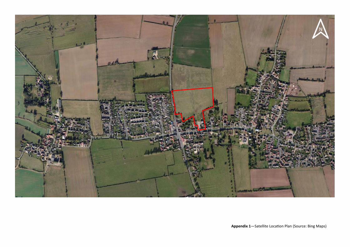
Appendix 1—Satellite Location Plan (Source: Bing Maps)
Land East of Folkingham Road, Morton
Appendix 2 - Environment Agency Flood Map (Morton)
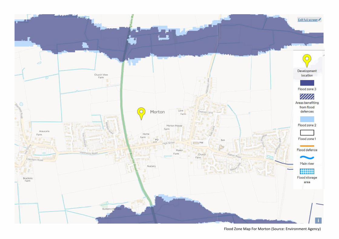
Flood Zone Map For Morton (Source: Environment Agency)
Land East of Folkingham Road, Morton
Appendix 3 - Listed Buildings (English Heritage)
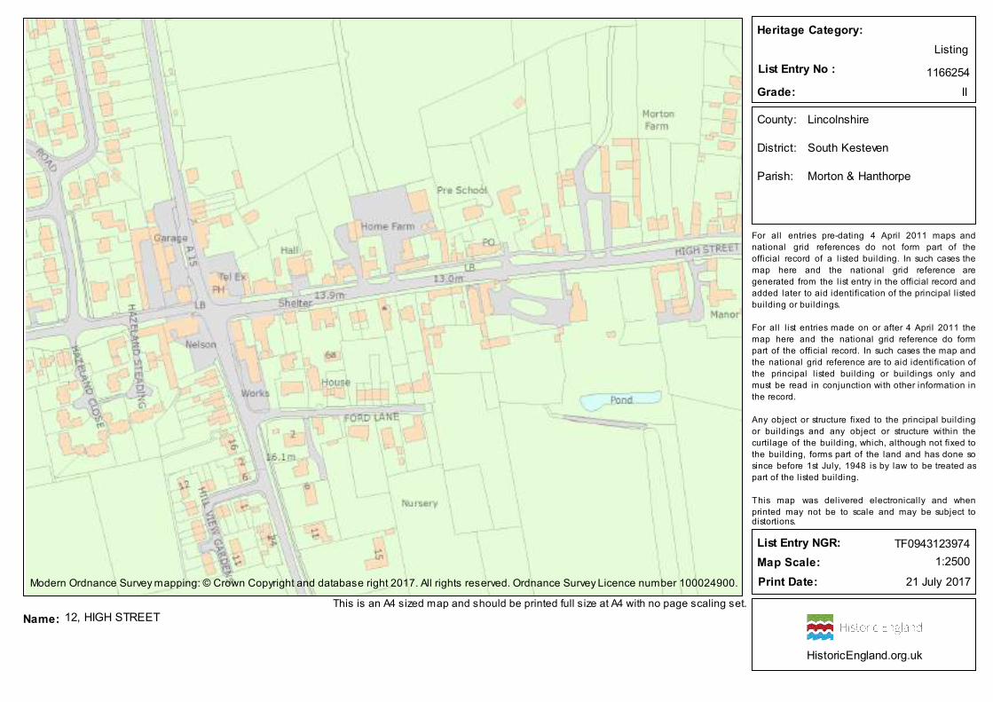
Heritage Category:
Listing
List Entry No : 1166254
Grade: II
County: Lincolnshire
District: South Kesteven
Parish: Morton & Hanthorpe
For all entries pre-dating 4 April 2011 maps and
national grid references do not form part of the
official record of a l isted building. In such cases the
map here and the national grid reference are
generated from the list entry in the official record and
added later to aid identification of the principal l isted
building or buildings.
For all l ist entries made on or after 4 April 2011 the
map here and the national grid reference do form
part of the official record. In such cases the map and
the national grid reference are to aid identification of
the principal l isted building or buildings only and
must be read in conjunction with other information in
the record.
Any object or structure fixed to the principal building
or buildings and any object or structure within the
curti lage of the building, which, although not fixed to
the building, forms part of the land and has done so
since before 1st July, 1948 is by law to be treated as
part of the listed building.
This map was delivered electronically and when
printed may not be to scale and may be subject todistortions.
List Entry NGR: TF0943123974
1:2500Map Scale:
21 July 2017Print Date:Modern Ordnance Survey mapping: © Crown Copyright and database right 2017. All rights reserved. Ordnance Survey Licence number 100024900.
12, HIGH STREETThis is an A4 sized map and should be printed full size at A4 with no page scaling set.
Name:
HistoricEngland.org.uk
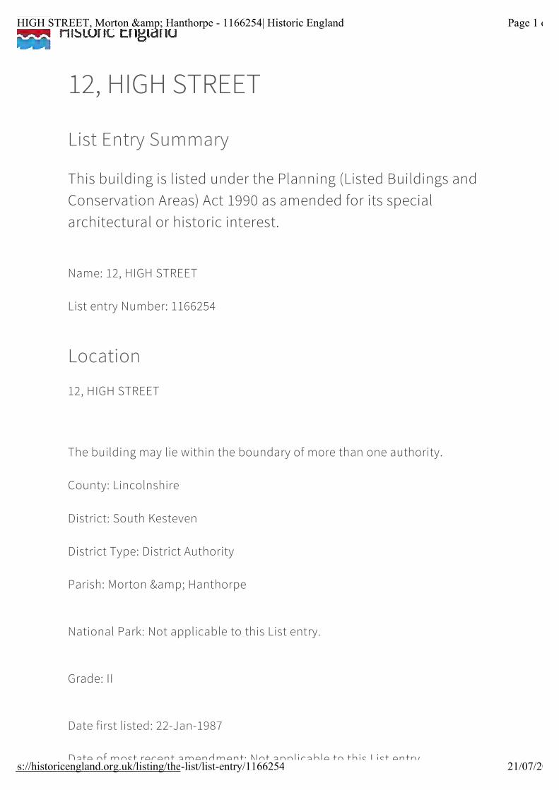
12, HIGH STREET
List Entry Summary
This building is listed under the Planning (Listed Buildings and Conservation Areas) Act 1990 as amended for its special architectural or historic interest.
Name: 12, HIGH STREET
List entry Number: 1166254
Location
12, HIGH STREET
The building may lie within the boundary of more than one authority.
County: Lincolnshire
District: South Kesteven
District Type: District Authority
Parish: Morton & Hanthorpe
National Park: Not applicable to this List entry.
Grade: II
Date first listed: 22-Jan-1987
Date of most recent amendment: Not applicable to this List entry.
Page 1 of 12, HIGH STREET, Morton & Hanthorpe - 1166254| Historic England
21/07/2017https://historicengland.org.uk/listing/the-list/list-entry/1166254
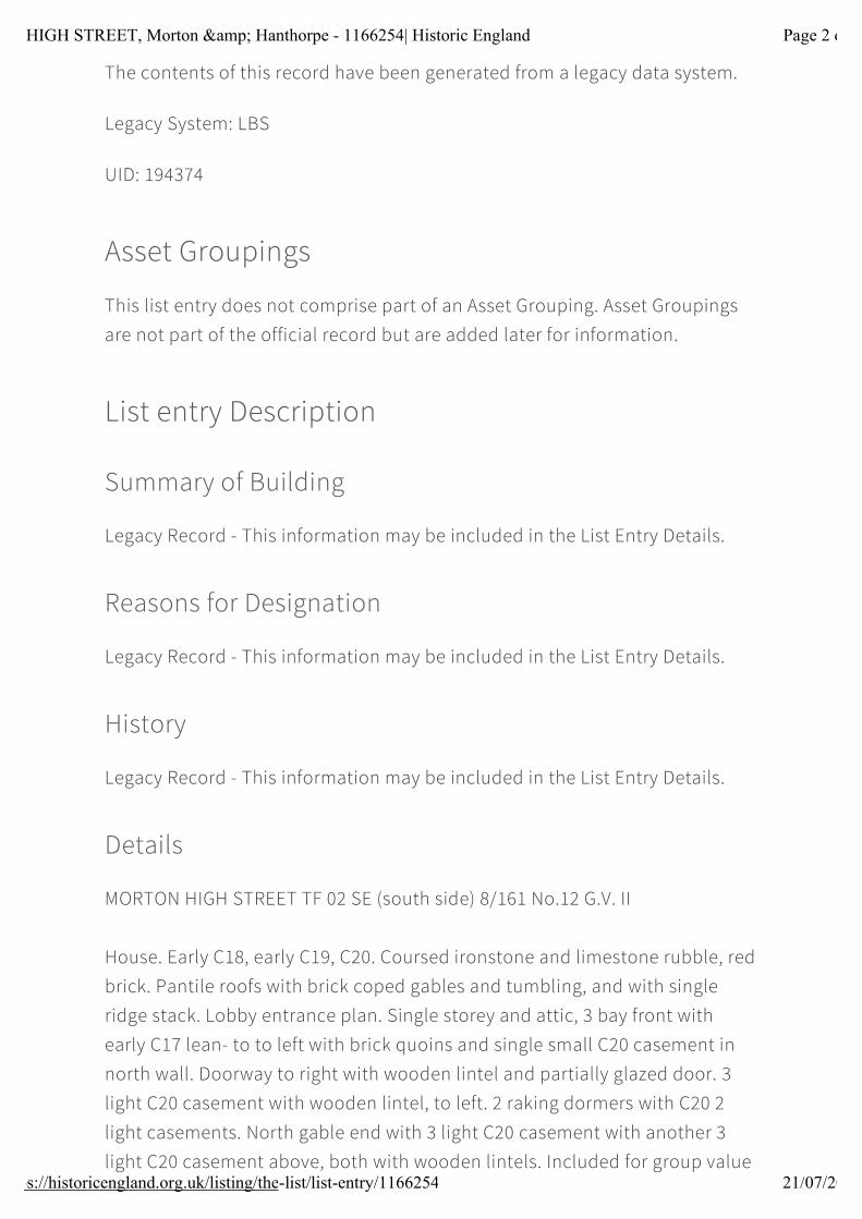
Legacy System Information
The contents of this record have been generated from a legacy data system.
Legacy System: LBS
UID: 194374
Asset Groupings
This list entry does not comprise part of an Asset Grouping. Asset Groupings are not part of the official record but are added later for information.
List entry Description
Summary of Building
Legacy Record - This information may be included in the List Entry Details.
Reasons for Designation
Legacy Record - This information may be included in the List Entry Details.
History
Legacy Record - This information may be included in the List Entry Details.
Details
MORTON HIGH STREET TF 02 SE (south side) 8/161 No.12 G.V. II
House. Early C18, early C19, C20. Coursed ironstone and limestone rubble, red brick. Pantile roofs with brick coped gables and tumbling, and with single ridge stack. Lobby entrance plan. Single storey and attic, 3 bay front with early C17 lean- to to left with brick quoins and single small C20 casement in north wall. Doorway to right with wooden lintel and partially glazed door. 3 light C20 casement with wooden lintel, to left. 2 raking dormers with C20 2 light casements. North gable end with 3 light C20 casement with another 3 light C20 casement above, both with wooden lintels. Included for group value
Page 2 of 12, HIGH STREET, Morton & Hanthorpe - 1166254| Historic England
21/07/2017https://historicengland.org.uk/listing/the-list/list-entry/1166254

only.
Listing NGR: TF0943123974
Selected Sources
Legacy Record - This information may be included in the List Entry Details
National Grid Reference: TF0943123974
Map
© Crown Copyright and database right 2017. All rights reserved. Ordnance Survey Licence number 100024900.© British Crown and SeaZone Solutions Limited 2017. All rights reserved. Licence number 102006.006.Use of this data is subject to Terms and Conditions (https://historicengland.org.uk/terms/website-terms-conditions/).
The above map is for quick reference purposes only and may not be to scale. For a copy of the full scale map, please see the attached PDF - 1166254 .pdf(http://mapservices.HistoricEngland.org.uk/printwebservicehle/StatutoryPrint.svc/155925/HLE_A4L_Grade|HLE_A3L_Grade.pdf)
Page 3 of 12, HIGH STREET, Morton & Hanthorpe - 1166254| Historic England
21/07/2017https://historicengland.org.uk/listing/the-list/list-entry/1166254
The PDF will be generated from our live systems and may take a few minutes to download depending on how busy our servers are. We apologise for this delay.
This copy shows the entry on 21-Jul-2017 at 04:38:30.
End of official listing
Page 4 of 12, HIGH STREET, Morton & Hanthorpe - 1166254| Historic England
21/07/2017https://historicengland.org.uk/listing/the-list/list-entry/1166254
Heritage Category:
Listing
List Entry No : 1062727
Grade: II
County: Lincolnshire
District: South Kesteven
Parish: Morton & Hanthorpe
For all entries pre-dating 4 April 2011 maps and
national grid references do not form part of the
official record of a l isted building. In such cases the
map here and the national grid reference are
generated from the list entry in the official record and
added later to aid identification of the principal l isted
building or buildings.
For all l ist entries made on or after 4 April 2011 the
map here and the national grid reference do form
part of the official record. In such cases the map and
the national grid reference are to aid identification of
the principal l isted building or buildings only and
must be read in conjunction with other information in
the record.
Any object or structure fixed to the principal building
or buildings and any object or structure within the
curti lage of the building, which, although not fixed to
the building, forms part of the land and has done so
since before 1st July, 1948 is by law to be treated as
part of the listed building.
This map was delivered electronically and when
printed may not be to scale and may be subject todistortions.
List Entry NGR: TF0941824005
1:2500Map Scale:
21 July 2017Print Date:Modern Ordnance Survey mapping: © Crown Copyright and database right 2017. All rights reserved. Ordnance Survey Licence number 100024900.
19, HIGH STREETThis is an A4 sized map and should be printed full size at A4 with no page scaling set.
Name:
HistoricEngland.org.uk
19, HIGH STREET
List Entry Summary
This building is listed under the Planning (Listed Buildings and Conservation Areas) Act 1990 as amended for its special architectural or historic interest.
Name: 19, HIGH STREET
List entry Number: 1062727
Location
19, HIGH STREET
The building may lie within the boundary of more than one authority.
County: Lincolnshire
District: South Kesteven
District Type: District Authority
Parish: Morton & Hanthorpe
National Park: Not applicable to this List entry.
Grade: II
Date first listed: 22-Jan-1987
Date of most recent amendment: Not applicable to this List entry.
Page 1 of 19, HIGH STREET, Morton & Hanthorpe - 1062727| Historic England
21/07/2017https://historicengland.org.uk/listing/the-list/list-entry/1062727
Legacy System Information
The contents of this record have been generated from a legacy data system.
Legacy System: LBS
UID: 194367
Asset Groupings
This list entry does not comprise part of an Asset Grouping. Asset Groupings are not part of the official record but are added later for information.
List entry Description
Summary of Building
Legacy Record - This information may be included in the List Entry Details.
Reasons for Designation
Legacy Record - This information may be included in the List Entry Details.
History
Legacy Record - This information may be included in the List Entry Details.
Details
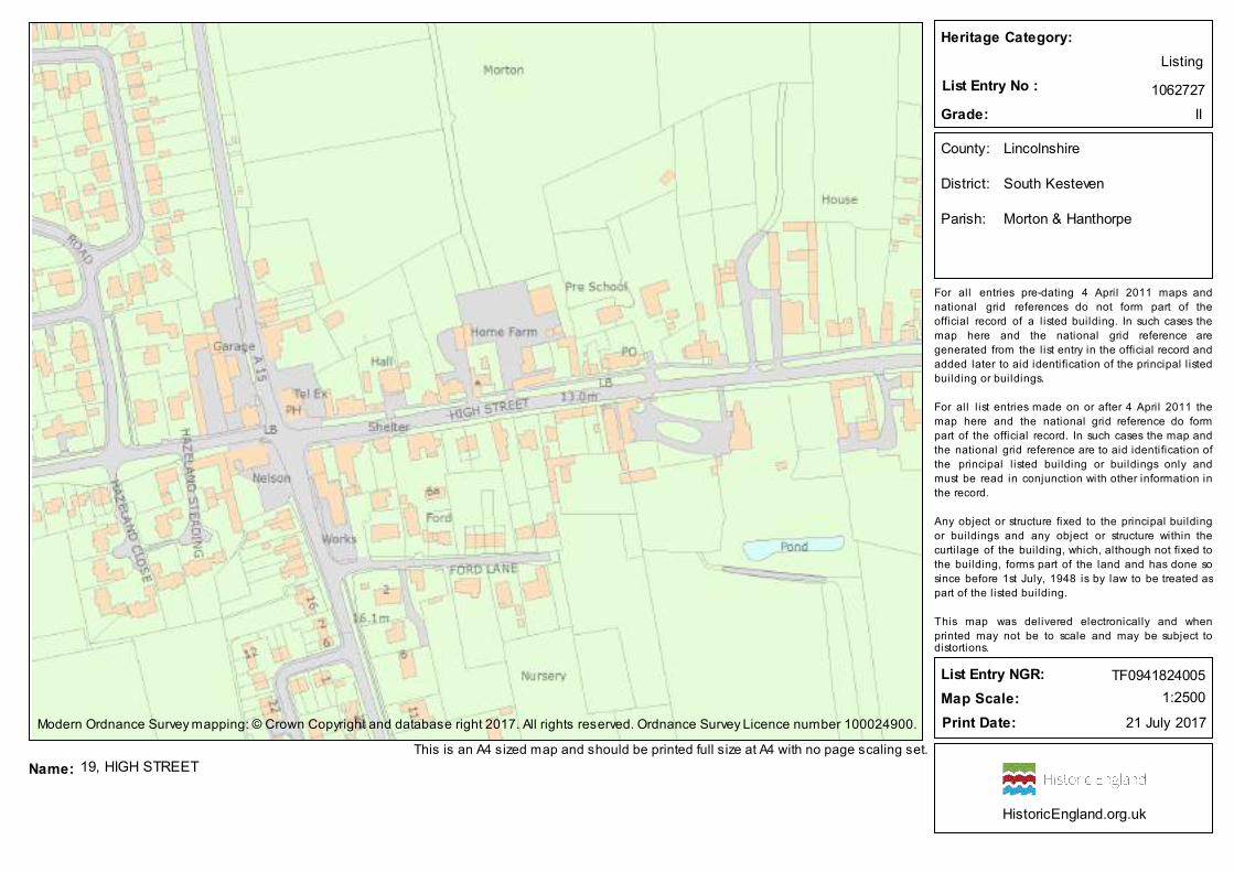
MORTON HIGH STREET TF 0824-0924 (north side) 9/153 No.19 G.V. II
Farmhouse. Mid C18, C20. Coursed limestone rubble, some limestone ashlar. Collyweston tile roof with single gable and ridge stacks. L-plan. 2 storey, 2 bay east front with large quoins and doorway to right with quoined surround, ashlar rectangular lintel, overlight and panelled door. 3 light casement to left with wooden lintel. Fragmentary line of quoins in between belonging to earlier doorway. 3 light casement above to left, and 2 light casement to right, both with wooden lintels. 2 bay south side with 2 three light casements and a
Page 2 of 19, HIGH STREET, Morton & Hanthorpe - 1062727| Historic England
21/07/2017https://historicengland.org.uk/listing/the-list/list-entry/1062727
single 3 light casement above to left, all with wooden lintels.
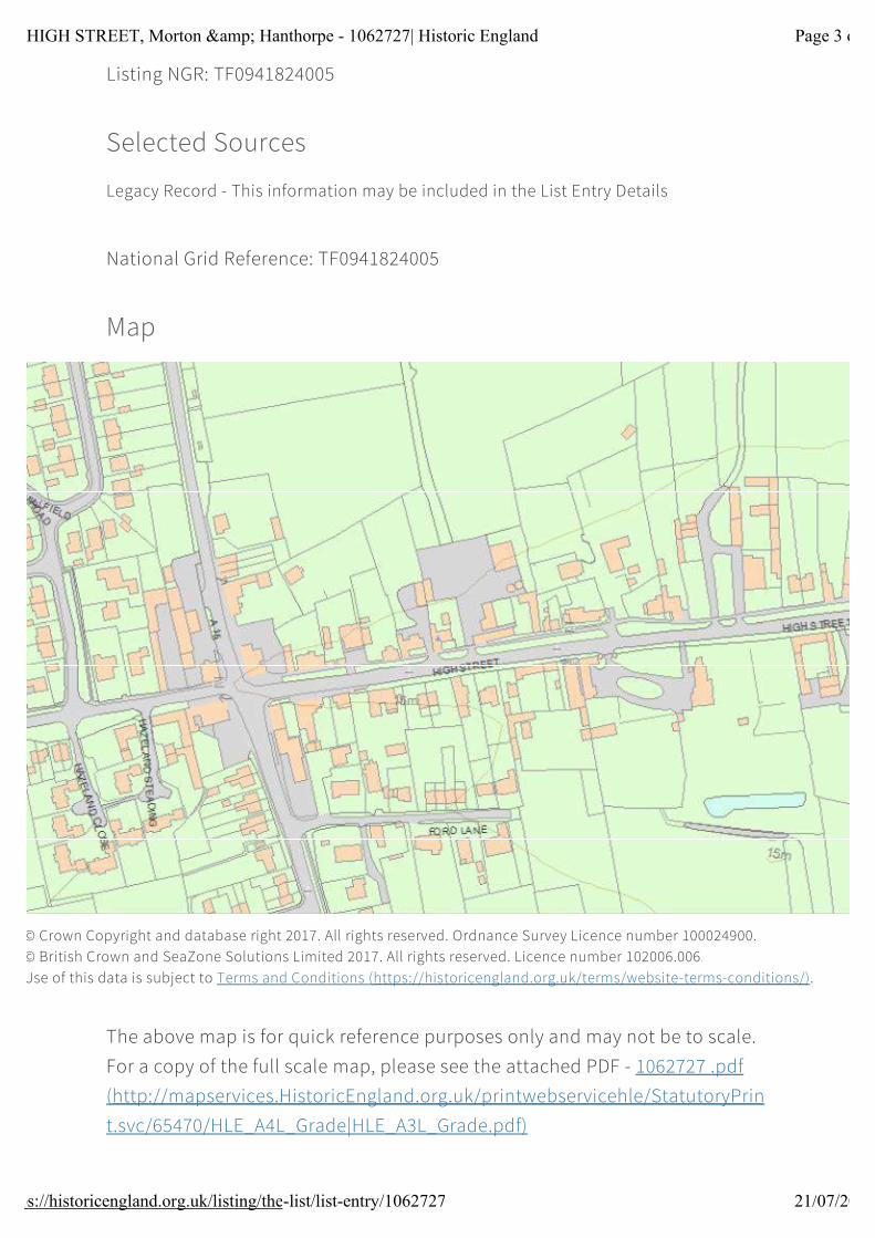
Listing NGR: TF0941824005
Selected Sources
Legacy Record - This information may be included in the List Entry Details
National Grid Reference: TF0941824005
Map
© Crown Copyright and database right 2017. All rights reserved. Ordnance Survey Licence number 100024900.© British Crown and SeaZone Solutions Limited 2017. All rights reserved. Licence number 102006.006.Use of this data is subject to Terms and Conditions (https://historicengland.org.uk/terms/website-terms-conditions/).
The above map is for quick reference purposes only and may not be to scale. For a copy of the full scale map, please see the attached PDF - 1062727 .pdf(http://mapservices.HistoricEngland.org.uk/printwebservicehle/StatutoryPrint.svc/65470/HLE_A4L_Grade|HLE_A3L_Grade.pdf)
Page 3 of 19, HIGH STREET, Morton & Hanthorpe - 1062727| Historic England
21/07/2017https://historicengland.org.uk/listing/the-list/list-entry/1062727
The PDF will be generated from our live systems and may take a few minutes to download depending on how busy our servers are. We apologise for this delay.
This copy shows the entry on 21-Jul-2017 at 04:34:01.
End of official listing
Page 4 of 19, HIGH STREET, Morton & Hanthorpe - 1062727| Historic England
21/07/2017https://historicengland.org.uk/listing/the-list/list-entry/1062727
Land East of Folkingham Road, Morton
Appendix 4 - Local Plan Inset Map 31 (Morton & Hanthorpe)

46
1
2
Corner
12
60
Brackens
Old Penny
Hollow
15
FARTHINGS FOLD
Sixpenny
Farm
2
Ha penny
2929a
Cottage
Cornaways
Threepenny
The Orchard
62
Piece
23 1
20
10
66
27a
256
3
48
8a
HANTHORPE ROAD
EDEN
HAM R
OAD
39
22
8STAINFIELD ROAD
THE G
ROVE
8
18
1
2
1
45
THE CRESCENT
10
1
43
14
35
16
14
5
The
20 12
22
15
25
47
Byre
DRLA
BURN
UM
3
3
The Barn
STAINFIELD ROAD
11
15
2
LONG
MEAD
OWS
21
11
14
LARKS RISE18
15
8
25
24
2
The Carriage Barn
4
Pooh Corner
16
6
1
15
8
3
12
6
Nelson
Farm
16
1
HIGH STREET
Granary
8
14
HANTHORPE ROAD
Tel Ex
1
Bunkers Hill
6
20
Ford
13
15
191
2
26
22
TheCedars
STATION ROADHall
5
WAY
9
3
11
WHEELWRIGHT
2
CLOSE
11
22
The Vicarage
2
SADDLER DRIVE
15
7
19
Shelter
4
The
Lord
FORD LANE
2
1
WAGGONERS
33
17
6
The Old Vicarage
Brook House
7
5
(PH)
NEEDHAM ROAD
20
20
8
25
32
5
12
2
30 1
11
11
12
BOURNE ROAD
The Bungalow
Farm
10
Manor
5
4
27
House
The Rookery
2
3
7
1
42
FarmWorks
43
15
Bells
Hall
22
JUBILEE CLOSE
65
A 15 25
23
26
18
47
2
47
Shelter
55
44
89
44
57
13
6
45
5
71
17
71a
69
93
23
5
(PH)
12
3
35
61
27
91
15
36
8
1
Home Farm
59
Lane Farm
3
ROAD
5
7320
THE BROADWAY
12
El Sub Sta
ST JO
HN'S
CLOS
E
25
30
21
77
FOLK
INGHA
M ROA
D
17
6
28
1
Church View Farm
69a
47
7
7
48
12
22
9
69
HIGH STREET
1
14
45
43
67a
Church
6
37
10
3
49
36
THE P
ADDO
CK
4963
51
32
PO
20
36
31
32
1
67
7
Bladon
59
37
3
39
2
61
359
55
12
31
16
71
2
29
27
1
Pentlands
12
2
18
St John
55
15
Silos
the Baptist's
MILLFIELD
7
Five
10a
29
ORCH
ARD C
LOSE
19
22
LANE
76
CLOSE
7
30
22
Pumping
23
54
57
WAVERLY
14
24
32
251
41
1
VIEW
6
12
17
24
CLOSE
2
Springfields
7
11
9
STATION ROAD
1
MEADOW
1
6
14
45
28a
PRIMROSE
THE SIDINGS
1
2
Sewage
45a
31
74
11
6
8
6
48b
3038
38
16
8082
50a
11
12
1
21
Station
12
VIOLET
TEMPLEMEADS
12
CLOSE
55
12
43
WAY
15
The Brambles
18
49
8
40
21
28
ROSEHIP ROAD
26
62
48
44
CLOSE
3
12
7
102
14
6 El Sub Sta
17
41
46
41a
PADD
INGTO
N
18
19
19
1
19
5
9
2
1
16
48a
30a
50
24
2
47
1
9
1
44
15
VICTORIA GROVE
MOOR
GATE
2
23
21
12
1
9
14
51
29
11
36
4
CLOS
E
34
19
17
25
47
2
El Sub Sta
12
36
36
11
5
14
22
6
36
15
5238
WATERLOO
57
11
PICCA
DILLY
WAY
261
10
18
27
17
DRIVE
10
41
22
HAZELAND CLOSE
2
6
3
2
5
HAZELAND STEADING
1
31
TheFarmstead
44a
6
OLD S
TATION
YARD
MEASURES CLOSE
3
11
1
1
73
2
14
29b
Morton
BAKE
RS
Gunbury House
House
Church
Farm
PICCADILLY WAY
WAY
71b
37a
13
Aldon House
Garage
34
The Rafters
15
1 Parkers Place
17
4
EAST
LANE
1
5
40
PEARCES LANE
HACONBY
BarnButchers
1a
21
73a
3Barley Court
1
3131a
33
47
Morton
Tank
Tank
6
24
16
22
HILL VIEW GARDENS
1
KNOTTSCLOSE
CLAR
KS CL
OSE
6a
1
21
11
28
22
126
2
3a
126
9
2
4
11
2
15
11
6
71a
71
CLOSE
24
24a
1
22
CHURC
H VIEW
24
5
Sta
22a
16
10
El Sub
29
18a
16a
27
27b
2
84
12
1816
HouseGrove
79
25
Sawmill
C of E
Primary School
Morton
39 FarmAraucaria
37
3
4
1
Morton 2
HouseBarns
EAST
LANE
(Track
)
Pre-School
(controlled)
19
23
8a
33
LV H11
3235
0032
4000
3245
00508500 509000 509500 510000 510500
Inset map 31:Local Plan to 2036 - Policies Map: Consultation DraftSouth Kesteven District Council
© Crown copyright and database right 2017. Ordnance Survey Licence number 100018662. © Natural England copyright 2017. Information licensed under the Open Government Licence v3.0. © Greater Lincolnshire Nature Partnership 2017.
Morton & Hanthorpe
0 500250 Metres