lnapl deep below the water table – how did it get … · contaminant hydrogeology hydrocarbons...
TRANSCRIPT
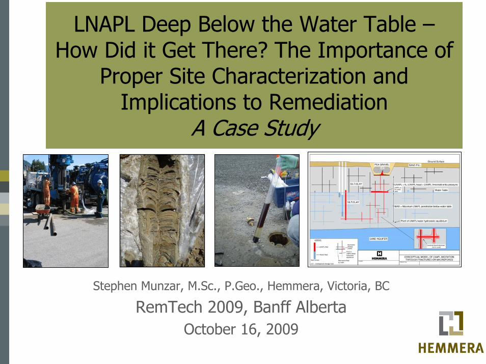
LNAPL Deep Below the Water Table –How Did it Get There? The Importance of
Proper Site Characterization and Implications to Remediation
A Case Study
Stephen Munzar, M.Sc., P.Geo., Hemmera, Victoria, BC
RemTech 2009, Banff AlbertaOctober 16, 2009

Presentation Outline
• Introduction• Site Background / History• Historic Investigation / Remediation
Work• Site Geology• Physical Hydrogeology• Contaminant Hydrogeology• LNAPL Conceptual Model• Implications to Site Investigation
and Remediation

Introduction
Some definitions:LNAPL – light non-aqueous phase liquid e.g. gasoline, diesel, crude oilUSTs – underground storage tank
Common misconception:Gasoline or LNAPL, expected to float on waterThis presentation highlights a case study where this is not the case
From: toxics.usgs.gov
http://www.omccanada.ca/
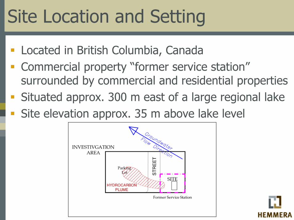
Site Location and Setting
Located in British Columbia, CanadaCommercial property “former service station”surrounded by commercial and residential propertiesSituated approx. 300 m east of a large regional lakeSite elevation approx. 35 m above lake level
Site Background/History
Single-family residence from the early 1920s to early 1960sCommercial service station from 1962 to 2005Decommissioned in 2005 and is currently unpaved and vacant
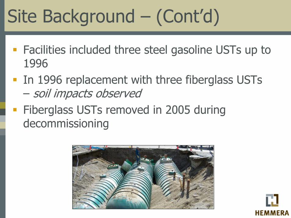
Site Background – (Cont’d)
Facilities included three steel gasoline USTs up to 1996In 1996 replacement with three fiberglass USTs – soil impacts observedFiberglass USTs removed in 2005 during decommissioning
Historic Investigation/Remediation Work
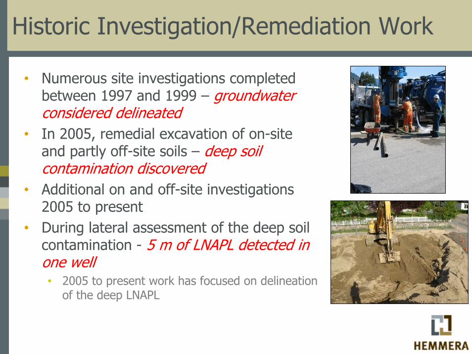
• Numerous site investigations completed between 1997 and 1999 – groundwater considered delineated
• In 2005, remedial excavation of on-site and partly off-site soils – deep soil contamination discovered
• Additional on and off-site investigations 2005 to present
• During lateral assessment of the deep soil contamination - 5 m of LNAPL detected in one well• 2005 to present work has focused on delineation
of the deep LNAPL

Investigation/Remediation Locations
A
A
~120 m
Local Surficial Geology
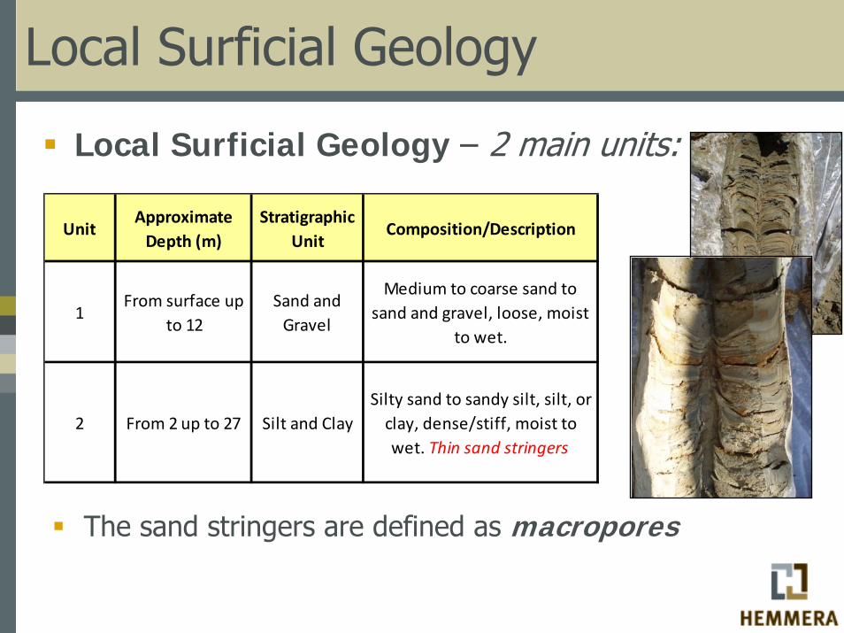
Local Surficial Geology – 2 main units:
UnitApproximate Depth (m)
Stratigraphic Unit
Composition/Description
1From surface up
to 12Sand and Gravel
Medium to coarse sand to sand and gravel, loose, moist
to wet.
2 From 2 up to 27 Silt and ClaySilty sand to sandy silt, silt, or clay, dense/stiff, moist to wet. Thin sand stringers
The sand stringers are defined as macropores
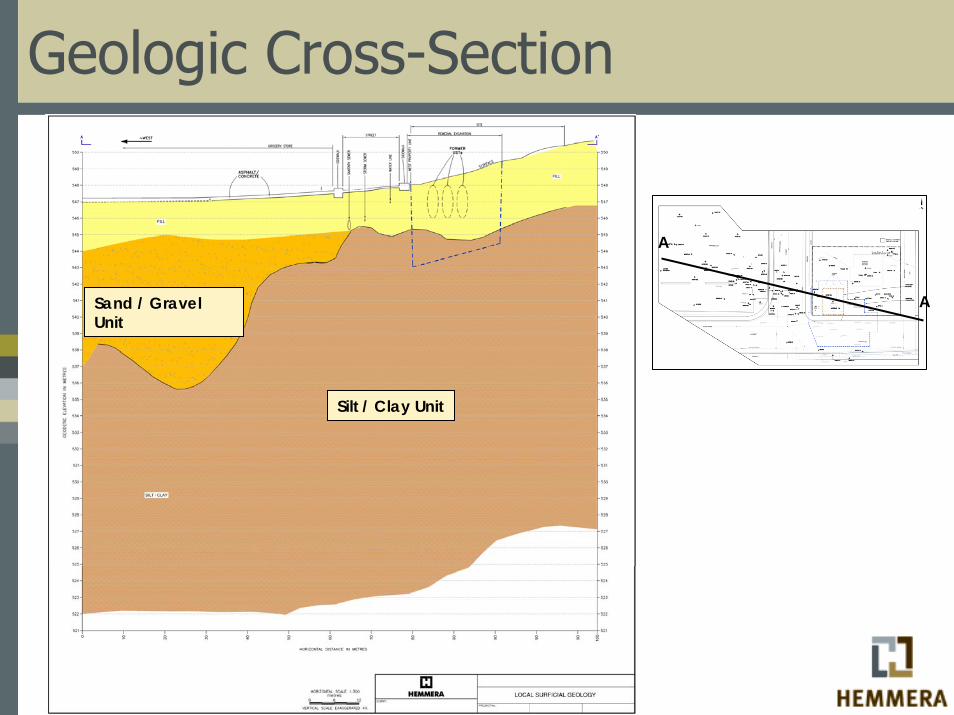
Geologic Cross-Section
Sand / Gravel Unit
Silt / Clay Unit
A
A
Physical Hydrogeology
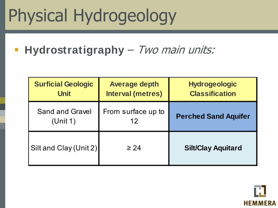
Hydrostratigraphy – Two main units:
Sand and Gravel (Unit 1)
From surface up to 12
Perched Sand Aquifer
Silt and Clay (Unit 2) ≥ 24 Silt/Clay Aquitard
Surficial Geologic Unit
Hydrogeologic Classification
Average depth Interval (metres)

Silt/Clay Aquitard
Perched Sand Aquifer
Hydrostratigraphic Units
Physical Hydrogeology (Cont’d)
Unit Hydraulic Conductivity – K
Aquitard: 8.5x10⁻⁹ to 6.2x10⁻⁷ m/sec
Perched Aquifer: 1x10⁻⁴ m/sec
Physical Hydrogeology (Cont’d)
Physical Groundwater Flow – Key Characteristics:
Hydraulic head distributions suggest strong channelized flow within the aquitardStrong vertical hydraulic gradients in aquitard (0.1 to 0.5) much greater than horizontalVertical gradients generally decrease towards the westGroundwater flows generally towards the west-northwestGroundwater levels in the aquitard fluctuate up to and over 3 m

Local Groundwater Flow
Groundwater Flow

Contaminant Hydrogeology
Hydrocarbons “gasoline” found in the following phases:
1. Residual NAPL in soil2. LNAPL resting at the water table surface within the
aquitard3. LNAPL saturating macropores at depths up to 10
metres below the water table within the aquitard4. Dissolved phase hydrocarbons associated with the
above
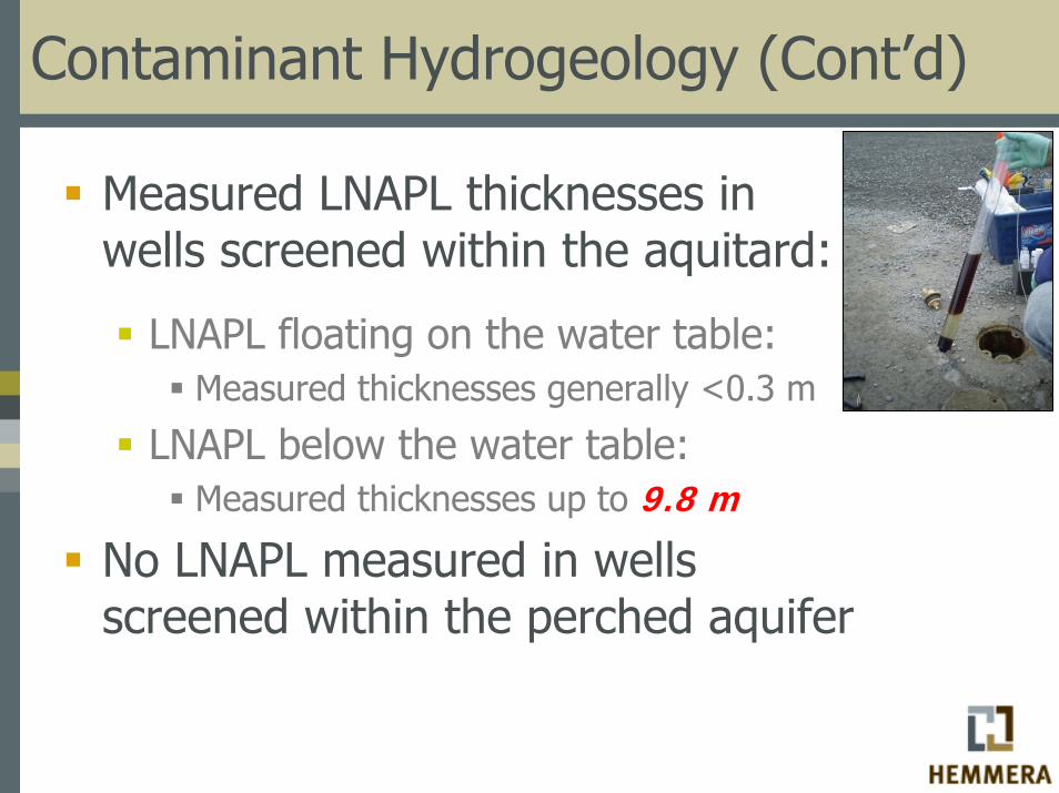
Contaminant Hydrogeology (Cont’d)
Measured LNAPL thicknesses in wells screened within the aquitard:
LNAPL floating on the water table:Measured thicknesses generally <0.3 m
LNAPL below the water table:Measured thicknesses up to 9.8 m
No LNAPL measured in wells screened within the perched aquifer
Contaminant Hydrogeology (Cont’d)
Key Points:
LNAPL measured deep below water table is not an artifact of a LNAPL depressed water tableLNAPL below water table is confined within thin macroporesFine grained soil adjacent to the macropores exhibit limited to no residual hydrocarbons i.e. “low concentrations”
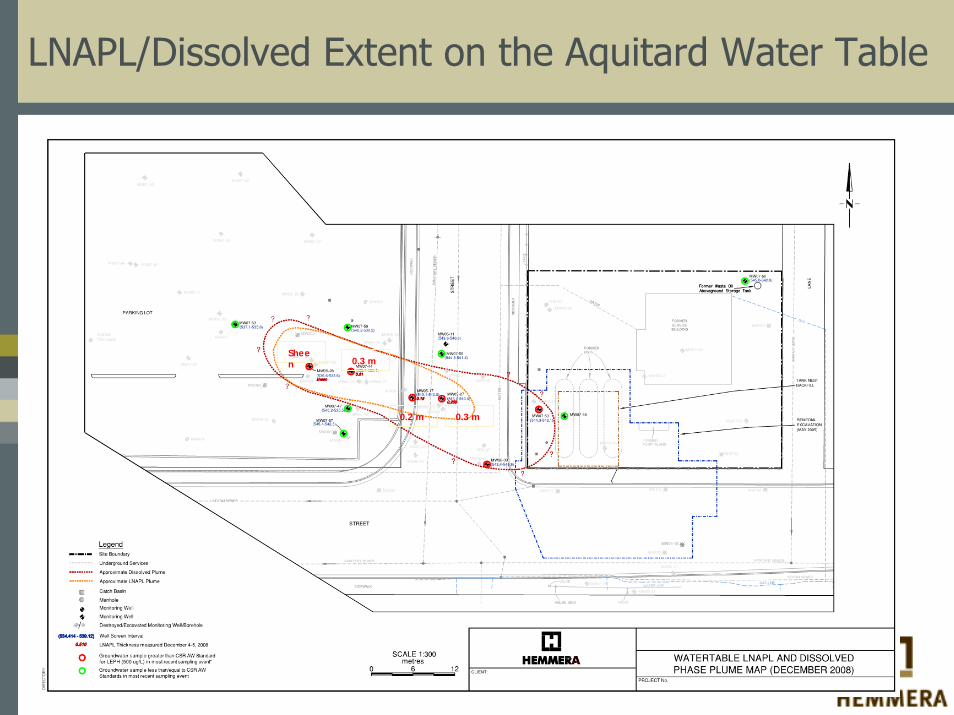
LNAPL/Dissolved Extent on the Aquitard Water Table
0.3 m
0.2 m 0.3 m
Sheen

LNAPL below the Aquitard Water Table
Sheen
4.9 m
8.4 m
3.3 m
5.8 m
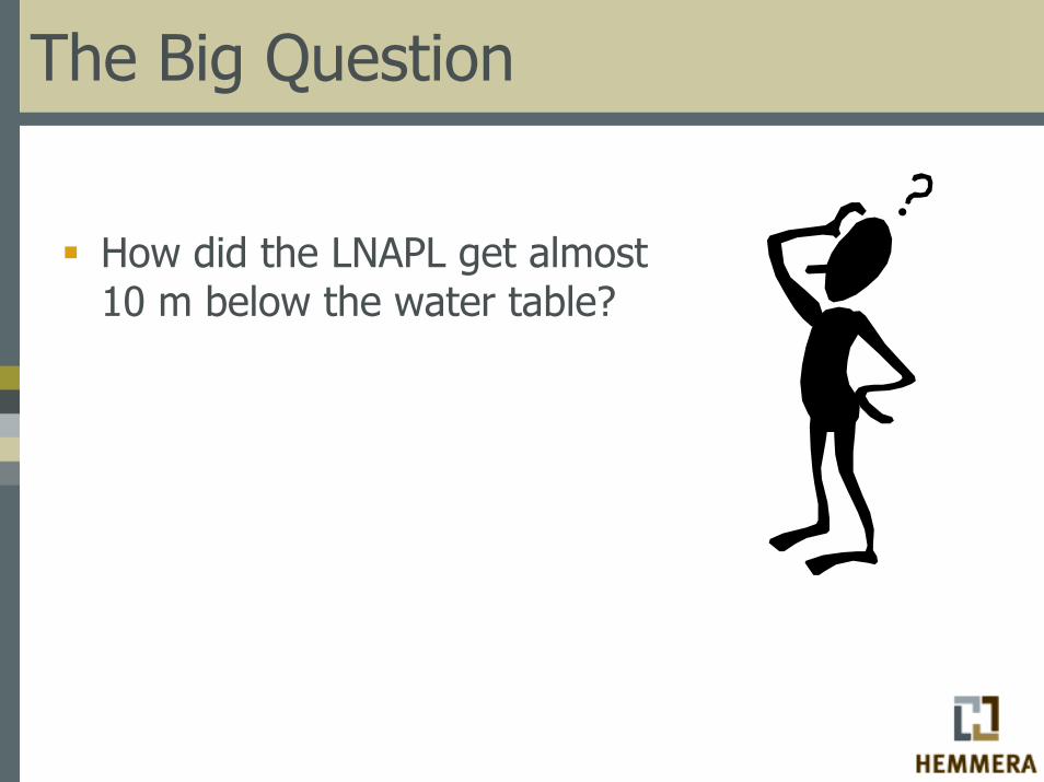
The Big Question
How did the LNAPL get almost 10 m below the water table?

Early LNAPL Conceptual Models
Upon reaching the capillary fringe or water table surface, LNAPL spread as a continuous layer in the shape of a pancake “the pancake model”Assumed that the LNAPL mass was interconnected and saturation within the pore space was near 100%Did not consider capilliarity
Source: Ballestero et al. 1994
This model cannot explain how LNAPL migrated 10 m below the water table !!!

More Recent LNAPL Conceptual Model
LNAPL rests largely below the water table analogous to an “iceberg” (API, 2003)The shape, depth of penetration and margins of the LNAPL mass are dependant on capillary pressureLNAPL saturations are much lower than 100% -LNAPL generally occupies the larger poresLNAPL can penetrate below the water table depending on thickness of NAPL and capillary pressureThere are certain circumstances where LNAPL can penetrate several meters below water table:
Fractures or macropores in fine grained soils (Adlamski et al. 2005)Fractured bedrock aquifers (Hardisty et al. 2003)
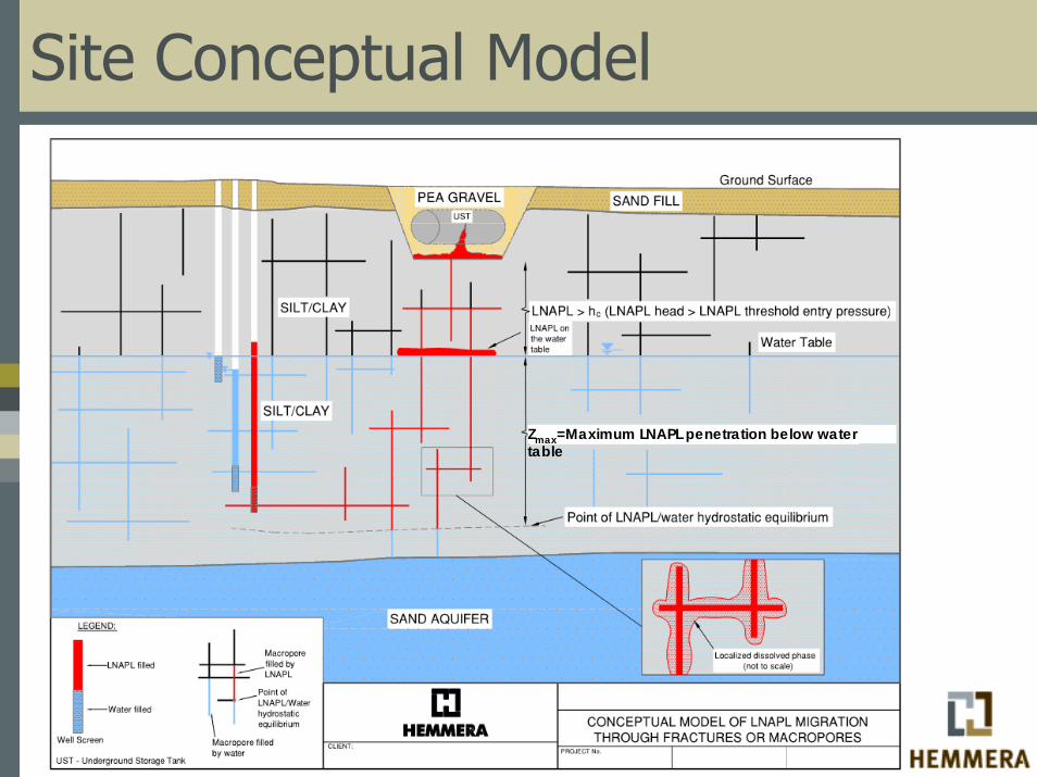
Site Conceptual Model
Zmax=Maximum LNAPL penetration below water table
Site Conceptual Model - Explained
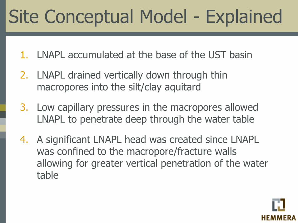
1. LNAPL accumulated at the base of the UST basin
2. LNAPL drained vertically down through thin macropores into the silt/clay aquitard
3. Low capillary pressures in the macropores allowed LNAPL to penetrate deep through the water table
4. A significant LNAPL head was created since LNAPL was confined to the macropore/fracture walls allowing for greater vertical penetration of the water table

Site Conceptual Model - Explained
5. Strong downward vertical hydraulic gradients greater than LNAPL buoyancy further acted as a driving force pushing the LNAPL downward
Minimum downward vertical gradient required according Mercer and Cohen, 1990:
∆h/∆z = (ρNAPL- ρwater)/ρwater = 0.23Measured vertical gradients in source area ∆h/∆z=0.5
Site Conceptual Model - Explained
In summary:
Three main factors contributing to LNAPL penetration:
1.Large LNAPL pressure or LNAPL head;2.Low capillary pressures in macropores; and 3.Strong downward vertical hydraulic gradients.
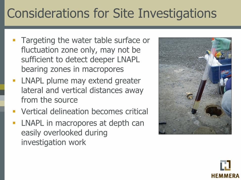
Considerations for Site Investigations
Targeting the water table surface or fluctuation zone only, may not be sufficient to detect deeper LNAPL bearing zones in macroporesLNAPL plume may extend greater lateral and vertical distances away from the sourceVertical delineation becomes criticalLNAPL in macropores at depth can easily overlooked during investigation work
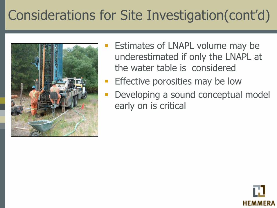
Considerations for Site Investigation(cont’d)
Estimates of LNAPL volume may be underestimated if only the LNAPL at the water table is consideredEffective porosities may be lowDeveloping a sound conceptual model early on is critical
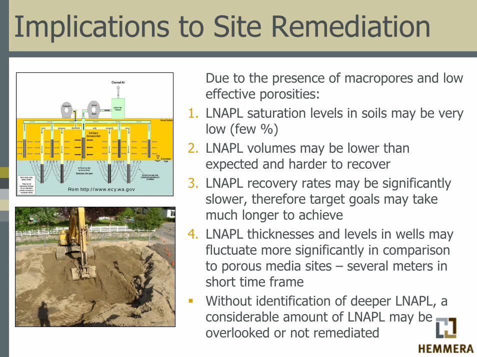
Implications to Site Remediation
Due to the presence of macropores and low effective porosities:
1. LNAPL saturation levels in soils may be very low (few %)
2. LNAPL volumes may be lower than expected and harder to recover
3. LNAPL recovery rates may be significantly slower, therefore target goals may take much longer to achieve
4. LNAPL thicknesses and levels in wells may fluctuate more significantly in comparison to porous media sites – several meters in short time frameWithout identification of deeper LNAPL, a considerable amount of LNAPL may be overlooked or not remediated
From http://www.ecy.wa.gov
Questions? Thank You!
Stephen Munzar, M.Sc., P.Geo.Hydrogeologist, Hemmera, Victoria, BC, [email protected]