little rock’s central high school neighborhood historic ... · little rock’s central high...
TRANSCRIPT
Little Rock’s Central High SchoolNeighborhood Historic District
By Sandra Taylor Smithand Anne Wagner Speed
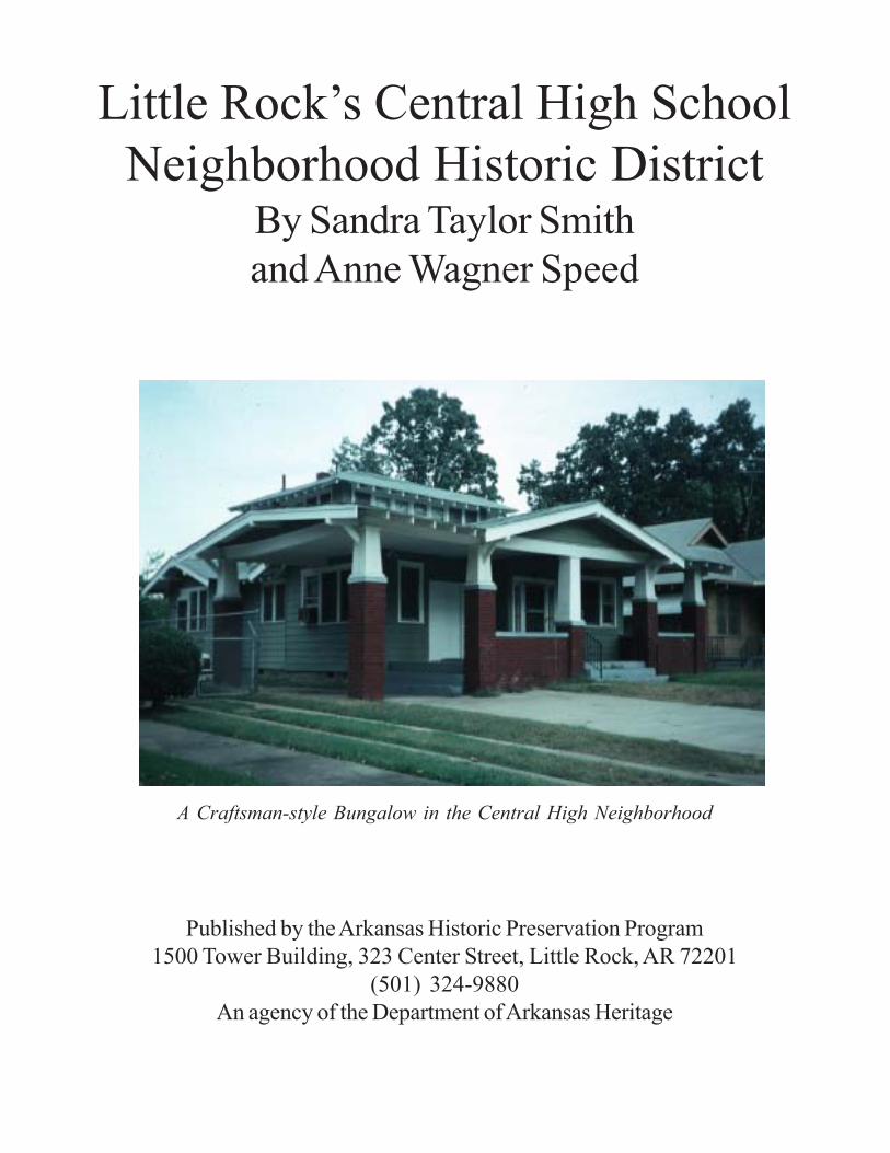
A Craftsman-style Bungalow in the Central High Neighborhood
Published by the Arkansas Historic Preservation Program1500 Tower Building, 323 Center Street, Little Rock, AR 72201
(501) 324-9880An agency of the Department of Arkansas Heritage

Little Rock’sCentral High School
NeighborhoodHistoric District
This volume is one of a series developed by the Arkansas Historic Preservation Program for theidentification and registration of the state’s cultural resources. For more information, write the AHPPat 1500 Tower Building, 323 Center Street, Little Rock, AR 72201, call (501) 324-9880[TDD 501-324-9811], or send e-mail to [email protected]
The Arkansas Historic Preservation Program is the agency of the Department of Arkansas Heritageresponsible for the identification, evaluation, registration and preservation of the state’s culturalresources. Other agencies in the department are the Arkansas Arts Council, the Delta CulturalCenter, the Old State House Museum, Historic Arkansas Museum, the Arkansas Natural HeritageCommission, and the Mosaic Templars Cultural Center.
Written 1996; Published 1999

ContentsOrigins of the Central High School Neighborhood 3
Northwestern Additions 6
The Flower Garden 8
Improved Services 11
Schools and Churches 15
The Central High School Neighborhood Historic District 17
Architectural Significance of the Central High School Neighborhood 18
Queen Anne 19
Colonial Revival 20
American Foursquare 22
Plain Traditional 24
Craftsman 24
Craftsman Bungalow 24
“Period Houses” 26
English Revival 26
Spanish Revival 27
Minimal Traditional 27
Other Stylistic Influences 28
Commercial 28
Churches 28
Schools 28
Central High School 29
Central High School Neighborhood Significance 30
Bibliography 31
Endnotes 34
2

Origins of the Central High School Neighborhood
Ever since the National Guard troops moved onto the Central High School campus on September 2, 1957, inorder to block the admission of nine black students, the neighborhoods surrounding this buff-brick buildinghave been overshadowed by a historical event that happened nearly 80 years after the property was firstplatted for residential development. In the intervening years, the fields, forests and countryside of the acreagejust west of the “Original City of Little Rock” had changed from “a capital place for a picnic and big enoughfor half the families of town to go at once without disturbing each other” to fully developed neighborhoods ofmixed use, eclectic architecture and diverse population.1
The entire district is part of Section 9, Township 1 North, Range 12 West. The Centennial Addition encom-passes the northeastern portion. In this largest addition, there are several subdivisions, notably Allis andDickinson and Aiken’s along the western edge and Parish’s and portions of Fulk’s subdivision along thesouthern boundary. The southeastern section includes Fleming and Bradford Addition, Moore and PenzelAddition, Sheldon’s Addition and the Oak Terrace Addition, which includes the M.A. Myers subdivision.The Park Addition, which developed around West End Park, the site of Central High School, is also includedin the district.
Centennial Addition is, by far, the largest of the additions in Section 9. This 160-acre parcel of land was firstgranted to William Wilson by the U.S. government in a land patent dated June 24, 1811. In October 1834,Wilson and his wife Eliza sold the land for $400 to Benjamin Johnson.2 Thirty-three years later, a judgementrendered in Pulaski County Circuit Court against Matilda Johnson, Benjamin Johnson’s widow, in a “contractof trust,” transferred ownership of the land to Ambrose H. Sevier to settle debts.3 Sevier had become a“player” in his new community soon after his move to Little Rock in 1821. He represented Pulaski County inthe state legislature from 1823-27 and the territory in the U.S. Congress for nine years thereafter. He wasthen elected to the U.S. Senate, where he served until 1847.4
At this time, according to deed records, the property was divided into city lots and blocks. The followingyear, in a contract of sale dated March 21, 1868, Sevier sold 160 acres to John Faust for $8,000.5 Accordingto city directories, Captain John W. Faust was a lawyer and real estate agent with a downtown office on EastMarkham and a home on West Third.6 His obituary notes that he died in 1879 after a protracted illness ofmalarial fever.7 His colleagues in the Bar Association adopted a resolution applauding his distinguishedprofessional life and commending him as a “friend of progress, growth and enlightenment.”8
Numerous additional transactions occurred in the 1870s among the heirs of original owners and real estatebrokers wanting to purchase the tract for residential development. On March 23, 1877, the Commissioners ofPulaski County Chancery Court platted the land as Centennial Addition with 43 blocks of two sizes;9 blocks1-6, 8, 19, 21-32, 34-39 are square in configuration and considerably smaller than blocks 7, 20, 33, 40, 41, 42and 43.
Two transactions in the mid-1870s resulted in the purchase of smaller portions of this tract by J.H. Barton andRollins A. Edgarton.10 On January 9, 1875, Barton acquired property with the execution of a judgment by theCircuit Court. Barton, “whose name (was) a synonym for enterprise,” served on the Little Rock UniversityBoard and as president of Beach Abstract Company; he also maintained a real estate business that specializedin the “...building of homes on vacant lots and selling them to the poor on small monthly payments. He (was)widely known and respected as the friend of the laboring man.”11 He later moved to Richmond, Virginia.
R.A. Edgarton also received attention in the publications of the time. Goodspeed offers a succinct butthorough biography, which notes his Vermont origins, his work, his military service and his eventual decisionto settle in Little Rock.12 After serving as a Union Army sergeant in the 72nd Ohio, “he was granted the firstpermit to discharge army officers to trade in Little Rock” and decided to locate a mercantile business in Little
3
Rock, which he maintained until 1870 when he was commissioned receiver of public monies for the LittleRock district by President U.S. Grant.13 He held this position for four years until he was appointed postmas-ter by President Chester A. Arthur. He was elected secretary of the Little Rock Cooperage Company in 1879.It is interesting to note that Logan Roots, who served with Barton on the Little Rock University Board, alsoserved on the Cooperage Company board as treasurer.14 It is possible that Edgarton met Barton through hisassociation with Logan Roots, though his additional work as vice-president of the Exchange Bank of LittleRock and president of Baring Cross Bridge Company suggests a very active, civic-minded individual whowas probably well connected and familiar with many of Little Rock’s business leaders.
In this way, Edgarton typifies one kind of 19th-century real estate developer. Though his objectives wereclearly monetary, his interest in the development of his adopted city’s residential areas was complemented bya commitment to other civic concerns. Few of these early developers focused solely on land development.One surmises that it was too risky or simply not lucrative enough to engage in exclusively.
On January 29, 1883, deed books record that blocks 33 and 43 of Centennial Addition were replatted byJames Barton and Edgarton.15 Block 33 was divided into 40 residential lots measuring approximately 151' by50' with smaller end lots with dimensions of 151' by 37'. Block 43, where the lots were oriented with east-west frontage rather than the north-south orientation of Block 33, contained lots of comparable size. It was acommon practice to dedicate most public street and alleyways for public use.16 In some instances, however, ifall lots of a given block were owned by a single individual or institution, alleys and, at times, streets were notmade accessible as public thoroughfares.
Allis and Dickinson was a subdivision of modest proportions within Centennial Addition consisting of 24 lotsof similar size, about 50' by 140'. The 13 lots fronting onto West Sherman (now Schiller) between 14th and16th streets were somewhat shallower, measuring about 128 feet long, but of comparable width. Deedrecords note that all streets were to remain open and unobstructed with full public access.
The partners in this four-block development platted on March 26, 1892, as “Allis and Dickinson Supplementto Centennial Addition” included W.W. Dickinson, H.G. Allis, N. Rupperle and George Naylor. The nameindicates that the first two investors had the majority stake in the project. At the time of the platting HoraceAllis was a nonresident investor. He lived in St. Louis and was comptroller and assistant to the president ofthe St. Louis, Arkansas and Texas Railway.17 Previously, he had served on the Board of Directors of FirstNational Bank and as president of the Capital Street Railway. He was described in a profile in the local paperas “one of the most successful financiers in the South or West.”18
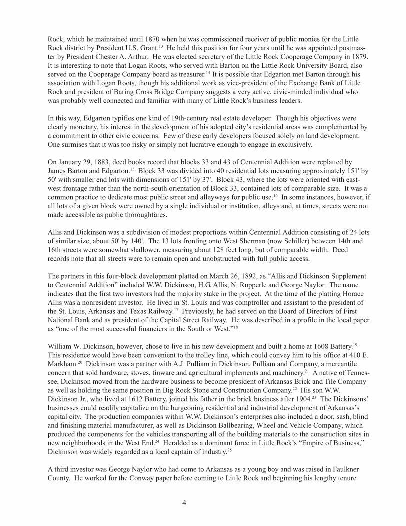
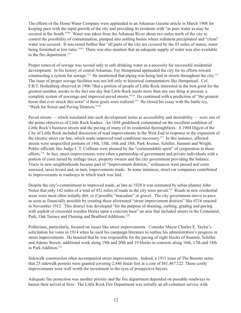
William W. Dickinson, however, chose to live in his new development and built a home at 1608 Battery.19
This residence would have been convenient to the trolley line, which could convey him to his office at 410 E.Markham.20 Dickinson was a partner with A.J. Pulliam in Dickinson, Pulliam and Company, a mercantileconcern that sold hardware, stoves, tinware and agricultural implements and machinery.21 A native of Tennes-see, Dickinson moved from the hardware business to become president of Arkansas Brick and Tile Companyas well as holding the same position in Big Rock Stone and Construction Company.22 His son W.W.Dickinson Jr., who lived at 1612 Battery, joined his father in the brick business after 1904.23 The Dickinsons’businesses could readily capitalize on the burgeoning residential and industrial development of Arkansas’scapital city. The production companies within W.W. Dickinson’s enterprises also included a door, sash, blindand finishing material manufacturer, as well as Dickinson Ballbearing, Wheel and Vehicle Company, whichproduced the components for the vehicles transporting all of the building materials to the construction sites innew neighborhoods in the West End.24 Heralded as a dominant force in Little Rock’s “Empire of Business,”Dickinson was widely regarded as a local captain of industry.25
A third investor was George Naylor who had come to Arkansas as a young boy and was raised in FaulknerCounty. He worked for the Conway paper before coming to Little Rock and beginning his lengthy tenure
4
with the Arkansas Democrat as writer, then city editor and vice-president of the Arkansas Democrat Com-pany.26 Virtually nothing could be found to identify Rupperle or his involvement with his investment part-ners.
The Parish Supplement to Centennial Addition is a single block, number 43, which was platted on January 29,1886 by W.N. Parish.27 It consisted of 36 lots of similar size measuring approximately 50' of street front and140 feet deep with lots facing Wolfe, Battery and West Spring (now Summit) streets between 18th Street andWright Avenue. According to city directories, Parish managed William S. Hutt, Staple and Fancy Groceries at213 Main.28 Unlike Barton, Edgarton or Dickinson, Parish was typical of the smaller investor whose focuswas far narrower, and investment — and risk — was smaller.
The Aiken subdivision of Block 7 of Centennial Addition was platted on July 8, 1889, by Susan N. and AaronG. Aiken.29 The tract’s boundaries follow 12th Street on the north, 14th Street on the south, West Spring onthe west and the alley between West Sherman (Spring) and Schiller on the west. Aaron Aiken operated alumber and furniture manufacturing facility at 12th and Spring and lived nearby at 1210 Wolfe Street.30
The Aikens had purchased the full block from Silas N. Marshall.31 Marshall had come to Little Rock fromMissouri and became actively identified with the business development of the city, accumulating large realestate interests and a lucrative fire insurance business.32 Before moving to California, where he died in 1913,Marshall had lived between Wolfe and Battery on West 9th Street within blocks of the Aiken subdivision.33
The last supplemental subdivision of Centennial Addition was platted on April 14, 1890, by F.M. Fulk andFlorence Fulk as the Fulk Subdivision of Blocks 40 and 41.34 Recorded in County Record Book 29, the areawas comprised of 40 lots between 18th and 19th street (now Wright Avenue) and Wolfe and Battery as well as40 additional lots within the same north-south boundaries, but between Bishop on the west and Pulaski on theeast. Many of the lots facing Wolfe, Marshall, Bishop and High Streets measured 50 by 150 feet; those facing19th Street were 50 feet by 110 to 116 feet, and the 10 lots along the eastern edge were narrow and deep withdimensions of 30 feet by 233 feet. No explanation is known to explain this variety in lot size. One concludesthat varied lot sizes appealed to a commensurately varied clientele.
W.W. Dickinson, Jr.,whose father devel-oped part of theCentral High SchoolNeighborhood, livedin this house at 1612Battery St. (AHPPPhoto)
5

The developer, Francis Marion Fulk, was described in the Arkansas Gazette as “one of the wealthiest and bestknown citizens of Little Rock.”35 He maintained an office in the Fulk Building, which he built, and lived at220 Spring Street in the previously developed East End.36 He was one of the largest real estate holders in thecity.37 A self-made man, he had come penniless to Arkansas from Licking County, Ohio, in 1870. Initially hetaught school and sought work as a carpenter and mason. With his earnings, he was able to buy a stand at the5th Street Market between Louisiana and Main. This venture grew into a substantially larger business, whichprovided the resources to invest in real estate speculation. Fulk also practiced law along with his real estateinterests, not an uncommon combination of vocations among Little Rock land speculators. At the time of hisdeath in 1910, Fulk had substantial holdings in the downtown business district as well as two tracts of land,measuring 120 acres each west of the original city and valued at $150,000. In addition, he owned 500 lotsscattered over the city, which were largely unimproved tracts.
Northwestern Additions
The northwestern portion of the Central High Neighborhood Historic District includes Park Addition, whichwas originally platted as McDonald and Wheeler Addition on June 4, 1873, by John Faust, who was respon-sible for Centennial Addition.38 The eastern portion of McDonald and Wheeler Addition was replatted inMay 1889 by Florence M. Fulk and the Pulaski Land Company, the Fulks’ real estate development corpora-tion.39 The earlier addition included Barton, Dennison, Rice, McDonald and Wheeler streets. These streetswere renamed in the later plat as Park, Dennison, Rice and Thayer streets. Name changes were a commonsubject of city ordinances in the late 19th and early 20th century period of development.
The land on which these developments were platted was originally received as a land patent to Jacob Brownin 1834.40 Brown had an illustrious military career and, in fact, died on the battlefield in the Mexican War.At the time of his death, he owned large tracts of land in Saline, Conway, Desha and Arkansas counties andseveral lots in downtown Little Rock near the intersection of Main and Markham streets.41
The portion of property in section 9 associated with Jacob Brown was sold to Alexander McDonald byBrown’s heirs, Mrs. Stewart Van Vleet and Mrs. Samuel P. Moore.42 Alexander McDonald was a decidedlyundistinguished one-term senator from Arkansas whom the Arkansas Gazette described as “utterly unqualifiedfor the high position of United States Senate.”43 A former member of McDonald, Fuller and Sells, Indiancontractors, the former senator, a Pennsylvania native, had settled in Arkansas in 1863, became president ofthe Merchant’s National Bank of Little Rock (later the First National Bank) and “was considered the richestman in the state.”44 He built the McDonald-Wait-Newton House, now known as the Packet House, onCantrell Road, in 1870-71 and had sold it by the mid-1870s. He died in 1903 in Long Beach, New Jersey.45
In 1873, John Faust acquired McDonald’s west-end holdings, though the Van Vleet and Moore familiesretained a portion of their inherited lands.46
Park Addition, whose name, no doubt, was derived from West End Park around which it developed, consistedof 23 blocks of basically similar size with exceptions at the east and west ends of the park. It is noteworthythat West End Park and later Central High School, which is built on the park’s original site, have provided thedefining element of these neighborhoods from their inception to the present time.
Block 21 of Park Addition became Greenhaw Subdivision in November 1910.47 C.O. Brack and Frank P.Greenhaw were the developers.48 Greenhaw had purchased the property from Brack a year earlier. Describedas a “substantial capitalist in Little Rock,” Greenhaw, a native Arkansan, had served in the Confederate armyand as a state senator. His first mercantile venture was a grocery store at the corner of Gaines and 16thstreets, which he sold at a significant profit. Another store was opened subsequently at Park and 16th streets.Though his own home was at the corner of 14th and Booker, he was noted for “making the best improvementson this property” in order for it to become “one of the most attractive sections of the capitol city.”49
6

Brack was born in Little Rock in 1846. His parents were Swiss immigrants to the city and built a home ontwo lots at 5th and Main. Though his real estate ventures were successful, he is best known as the capitolcity’s first candy manufacturer.50
South of the Park Addition is Adams Addition, which is not included in the district but whose developerHoward Adams and his development company, the West End Land and Improvement Company, had an impacton the neighborhoods addressed in this nomination. Specifically, Adams, in association with W.B. Worthenand John B. Jones, built the “old dummy line” to West End Park, which provided transportation from the WestEnd to downtown Little Rock.51
The southeast quarter of Section 9 includes Moore and Penzel Addition, Sheldon Addition, Fleming andBradford Addition, Oak Terrace Addition and two blocks of McCarthy’s Addition. A Spanish and French landclaim recorded in the Arkansas Gazette in 1826 notes Looney Price’s association with this tract.52 Many yearsand many transactions later, the land in the east 1/2 of the southeast 1/4 was acquired by the Electric AdditionCompany, which in turn sold it to Capitol Construction and Investment Company in March 1892.53 H.G.Fleming and Capitol Construction, of which he was president, platted the property that same month asFleming and Bradford Addition.54 The investment company owned all of this property except for five acres inthe northwest corner, which had been retained by L.W. Coy in 1891 in the original purchase by the ElectricAddition Company.55 Coy’s ownership of blocks 3 and 4 is noted on the addition’s plat. Its boundaries wereWright Avenue on the north to 25th Street and John Sellers Braddock’s property on the south and PulaskiStreet to Wolfe on the east and west. Comparable in size to Park Addition, Fleming and Bradford Additioncontained well over 200 lots with approximate dimensions of 50 by 140 feet.
Henry G. Fleming was a real estate “dealer,” to use the parlance of the time, and engineer for the MissouriPacific system.56 He was born in Vermont in 1851, entered railroad service in 1871, holding various positionsin the West and Southwest until 1891, when he was made superintendent of the Cotton Belt Railroad. In1892, he became manager of the Little Rock Traction and Electric Company. He built a home for himselfnear his addition at the corner of 23rd and High streets.57 His partner, H.P. Bradford, is another elusive figureabout whom little information could be located except that he served as secretary of the Capitol Constructionand Investment Company.58
Located between 19th and 21st streets and Wolfe and Adams (now Park) is a tract platted by City Real EstateCompany as Moore and Penzel Addition in July 1889.59 The principal figures involved in this developmentwere Col. John Moore and Charles P. Penzel.60 “One of the most prominent financiers of Arkansas,” Penzelwas a native of Bohemia and had come to the United States in 1857.61 He founded the German National Bankin 1874 and served as its first president, as well as serving twice as president of the Exchange National Bank.He was also director in the Little Rock Railway and Electric Company.62 Penzel’s stature in the businesscommunity is underscored by the roster of prominent Little Rock leaders who were honorary pallbearers athis funeral. The list reads like a “who’s who” in the capital city: Joseph W. Honse, William F. Woodruff,Peter Hotze, George Reichardt, R.H. Parham, George B. Rose, H.G. Parker, R.J. Polk, Walter Wittenberg andP.K. Roots.
Penzel’s partner, Col. John Moore, was born in Pulaski County and raised in Searcy.63 In 1871 he opened alaw office in Little Rock. He served as reporter of the Supreme Court of Arkansas for six years followed byan eight-year stint as chairman of the State Central Committee for the Democratic Party. He also served aspresident of the state bar association from 1908-9.64 His son, Blakely Moore, also speculated briefly in realestate, but died suddenly at 26 after completing only a few projects.65
This addition, as platted, was one of the most unvaried in perimeter configuration and lot dimension. It wascomposed of eight blocks containing 22 lots each; each lot measured 25 by 132 feet. Each alleyway was 16-feet wide and each public street 50 feet in width.
7

The O.F. Sheldon Addition is contiguous along a portion of the southern boundary of the Moore-Penzel tract.The addition was recorded on April 9, 1892.66 City directories indicate that Orin Sheldon operated a dairy onacreage near 21st Street between Battery and Spring (Summit).67 He maintained a residence on the sameproperty.68 The 1913 Sanborn map reveals that the addition remained largely undeveloped years after itsoriginal plat was drawn up. Indeed, the map shows that a farmstead at the location of the Sheldon dairy farmwas still in place and operating in 1913.
In striking contrast to the regularity of the Moore-Penzel Addition is the imaginative layout of the OakTerrace Addition. Its lyrical name is also a variation on the practice of naming tracts after the developer,significant features (Park) or events (Centennial).
The addition was platted four separate times on property first occupied in the 1870s by Milton L. Rice whowas a state senator, president of the Cairo and Fulton Railroad, and carpetbagger lawyer.69 Rice built aresidence on the 12-acre site, which was about a mile from the city limits at the time of its construction. Riceleft Little Rock in 1880.70 His property was later purchased by H.A. Bowman, a real estate developer.71
Bowman arrived in Little Rock from Ohio the same year Rice left. He operated a lumber business prior to hisreal estate speculation. The Bowmans first lived on Spring between 3rd and 4th streets, then built a home at1624 Broadway, moving later to 1415 Broadway.72
The Flower Garden
The first version of the plat included the addition’s “signature” or centerpiece, the Flower Garden. As deedbook notations indicate, the developer intended for the city to maintain the flower garden and lawn. The parkwas intended for public enjoyment, but “if not used and maintained as such this Grant shall cease and the land[would] return to the owners of the lots.”73 In 1916, the owners were H.A. Bowman, G.H. Kimball, Carl Voss,A.S. Ragoski and M.E. Dunaway.74
Another original feature of this addition were the construction guidelines specified in the text accompanyingthe plat map. The developer enumerated the size of prospective residences (“no owner to erect a bldg. lessthan 2 stories in height”), cost (not less than $3,000) and siting (“no bldg. within less than 75 feet of thesidewalk and less than 15 feet from the lot line.”)75 This kind of specificity was unprecedented in the WestEnd and was more like the restrictive covenants imposed on property owners in some of the Pulaski Heightsadditions. Moreover, the Bowmans required that the future sales of lots could not be transacted without thepermission of the Board of Trustees. The composition of this board was not specified.
Not surprisingly, the lot sizes in this addition were considerably larger than those nearby; in some instances,they were more than double or triple in scale. The lots facing the originally elliptical flower garden were 100feet wide and more than 250 feet deep. Subsequent renditions simply truncated the flower garden and createda tract of two characters. The northern portion maintained the original generous median providing open spaceand plantings as a buffer between two rows of commodious lots. The lower half, which now allowed for theextension of 21st Street through the property was of a more typical grid design with lots of standard 50- by132-foot dimensions. One concludes that the changes Bowman made as they appeared on the May 1903 platwere a nod to practicality and profitability. Clearly, the sale of 24 smaller lots would generate more revenue,more quickly than the original eight large lots encompassing the bottom half of the flower garden. The onlyapparent change in the plat of 1904 is the specification of private walks and private drives along the centralmedian, now called a Flower Park.
On May 27, 1907, all of blocks 5, 6 and 9 and a portion of 7 and 8 of Sheldon Addition were replatted as anextension of Oak Terrace.76 Streets and alleys were dedicated, as usual, to the public, though all railroadprivileges were reserved. The four property owners involved were H.A. Bowman, S.A. Dunne, J.K. Riffel
8
and Lewis Rhoton.77 Bowman’s involvement comes as no surprise in light of his involvement with the threeearlier plats of Oak Terrace. S.A. Dunne is a new name on the real estate scene and one who remains amystery.78
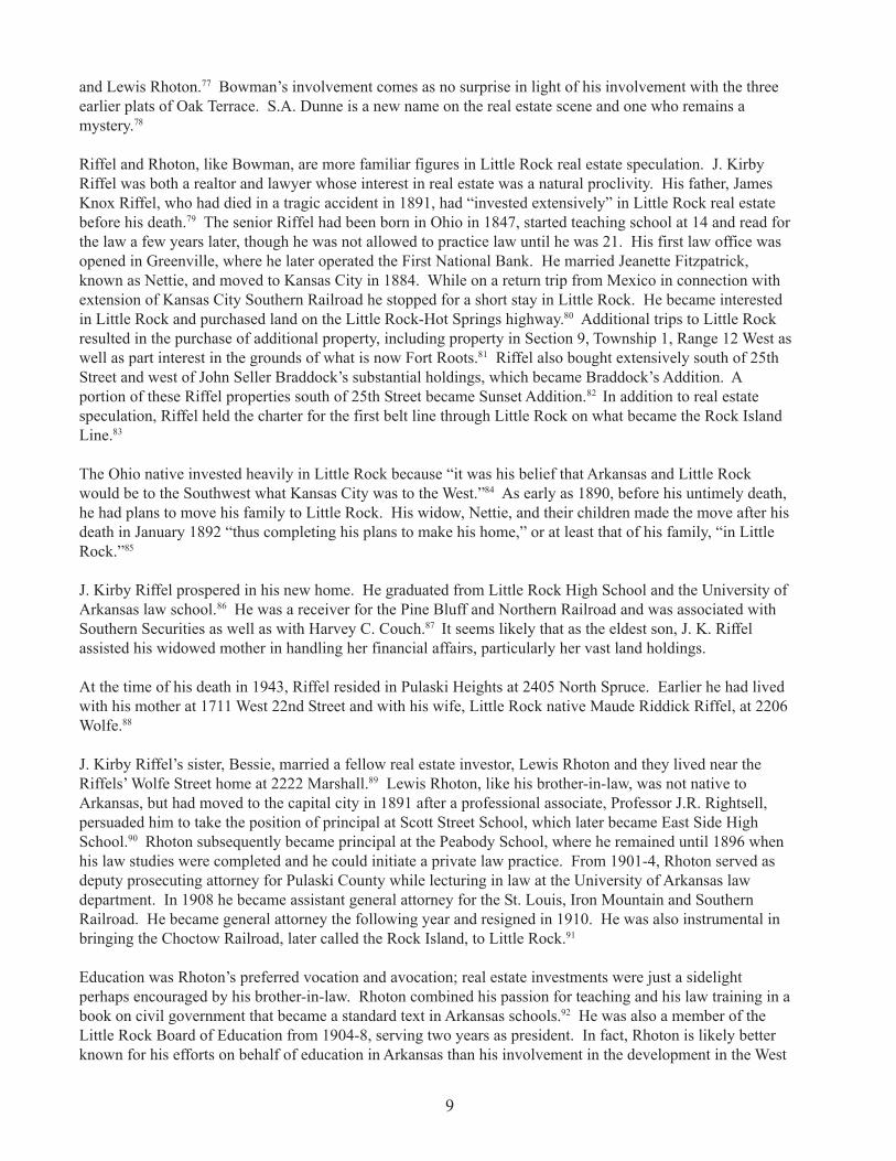
Riffel and Rhoton, like Bowman, are more familiar figures in Little Rock real estate speculation. J. KirbyRiffel was both a realtor and lawyer whose interest in real estate was a natural proclivity. His father, JamesKnox Riffel, who had died in a tragic accident in 1891, had “invested extensively” in Little Rock real estatebefore his death.79 The senior Riffel had been born in Ohio in 1847, started teaching school at 14 and read forthe law a few years later, though he was not allowed to practice law until he was 21. His first law office wasopened in Greenville, where he later operated the First National Bank. He married Jeanette Fitzpatrick,known as Nettie, and moved to Kansas City in 1884. While on a return trip from Mexico in connection withextension of Kansas City Southern Railroad he stopped for a short stay in Little Rock. He became interestedin Little Rock and purchased land on the Little Rock-Hot Springs highway.80 Additional trips to Little Rockresulted in the purchase of additional property, including property in Section 9, Township 1, Range 12 West aswell as part interest in the grounds of what is now Fort Roots.81 Riffel also bought extensively south of 25thStreet and west of John Seller Braddock’s substantial holdings, which became Braddock’s Addition. Aportion of these Riffel properties south of 25th Street became Sunset Addition.82 In addition to real estatespeculation, Riffel held the charter for the first belt line through Little Rock on what became the Rock IslandLine.83
The Ohio native invested heavily in Little Rock because “it was his belief that Arkansas and Little Rockwould be to the Southwest what Kansas City was to the West.”84 As early as 1890, before his untimely death,he had plans to move his family to Little Rock. His widow, Nettie, and their children made the move after hisdeath in January 1892 “thus completing his plans to make his home,” or at least that of his family, “in LittleRock.”85
J. Kirby Riffel prospered in his new home. He graduated from Little Rock High School and the University ofArkansas law school.86 He was a receiver for the Pine Bluff and Northern Railroad and was associated withSouthern Securities as well as with Harvey C. Couch.87 It seems likely that as the eldest son, J. K. Riffelassisted his widowed mother in handling her financial affairs, particularly her vast land holdings.
At the time of his death in 1943, Riffel resided in Pulaski Heights at 2405 North Spruce. Earlier he had livedwith his mother at 1711 West 22nd Street and with his wife, Little Rock native Maude Riddick Riffel, at 2206Wolfe.88
J. Kirby Riffel’s sister, Bessie, married a fellow real estate investor, Lewis Rhoton and they lived near theRiffels’ Wolfe Street home at 2222 Marshall.89 Lewis Rhoton, like his brother-in-law, was not native toArkansas, but had moved to the capital city in 1891 after a professional associate, Professor J.R. Rightsell,persuaded him to take the position of principal at Scott Street School, which later became East Side HighSchool.90 Rhoton subsequently became principal at the Peabody School, where he remained until 1896 whenhis law studies were completed and he could initiate a private law practice. From 1901-4, Rhoton served asdeputy prosecuting attorney for Pulaski County while lecturing in law at the University of Arkansas lawdepartment. In 1908 he became assistant general attorney for the St. Louis, Iron Mountain and SouthernRailroad. He became general attorney the following year and resigned in 1910. He was also instrumental inbringing the Choctow Railroad, later called the Rock Island, to Little Rock.91
Education was Rhoton’s preferred vocation and avocation; real estate investments were just a sidelightperhaps encouraged by his brother-in-law. Rhoton combined his passion for teaching and his law training in abook on civil government that became a standard text in Arkansas schools.92 He was also a member of theLittle Rock Board of Education from 1904-8, serving two years as president. In fact, Rhoton is likely betterknown for his efforts on behalf of education in Arkansas than his involvement in the development in the West
9

End.
The northern half of Block 10 of Oak Terrace was platted on July 11, 1905 as M.A. Myers subdivision.Virtually nothing could be found on M.A. Myers, after whom the tract is named, or John W. Myers, ArthurMyers or Merritt Raymond Myers, investors in the project. The now familiar name of H.A. Bowman is seenlater in deed books recording transactions in Block 10. In fact, on May 28, 1907, Bowman purchased aportion of this block to add to his other holdings.93
Blocks 9 and 10 of McCarthy’s Additions are the last tracts included in the historic district. Platted on July10, 1890 by W.W. Bolling, George W. Clark and Ed Cornish, most of the addition is south of 25th Street.94
J.H. McCarthy, after whom the addition is named, was one of the owners of a grocery store, McCarthy andJoyce, on East Markham Street.95 The following year, the same pair, McCarthy and Joyce, left the grocerybusiness and became involved in a cotton warehouse under the same name.96 No city directories exist for theyears between 1887 and 1903 when the McCarthy clan were involved in a general construction businesscalled McCarthy and Reichardt.97 John H. Sr., John H. Jr., James T. and Patrick were all employed there.98
One surmises that the family chose to change their vocations again and engage in real estate speculation andconstruction.
Of the three individuals involved in the platting of these 24 lots, Cornish is clearly the most renowned. Abanker and real estate speculator, Cornish built a home at 1806 Arch St. in 1915.
A native Arkansan, Cornish began his career as a bookkeeper for Wolf and Company, a clothing concern.99 In1900 he organized a banking and real estate firm with J.E. England called Cornish and England. The firmdissolved in 1904. The July 1890 platting date indicates that this transaction preceded Cornish’s first realestate dealings with England by nearly a decade. However, it is noteworthy that J.E. England is recorded asthe witness to the 1890 transaction.100
Little Rock Central High School is the centerpiece and namesake of the Little Rock historic districtthat was listed on the National Register of Historic Places on August 16, 1996. (AHPP Photo)
10

Cornish left his real estate partnership to join the American Bank, which merged in 1911 with the GermanNational Bank. The latter, as noted previously, had been founded in 1874 by fellow developer CharlesPenzel. Cornish served as vice president of the German Trust. During World War I, German National Bankand the German Trust changed their names to American National Bank and American Trust Company, likelyin response to anti-German sentiment. Two years later, they consolidated with the Bank of Commerce andTrust Company, the largest financial institution in the state and one under the leadership of Ed Cornish.
Cornish was also a stockholder in the Merchant’s Lighting Company, a public service corporation, which, in1913, “operated the only underground distribution system for light and power purposes in the south,” distrib-uting 1,008 horsepower and “furnishing light service of 30,000 50 watt equivalent” to Little Rock businessesand homes.101 Cornish later suffered financial reverses and committed suicide in 1928.102
Cornish was only 19 years old when this 1890 transaction took place. It is possible, therefore, that hispartners, Bolling and Clark, on whom there is scant information, were similarly young and inexperienced, butsufficiently ambitious to invest in real estate on a small scale. Though literally no information could be foundabout Bolling, there was a young man named George W. Clark who was a contemporary of Cornish’s in LittleRock. According to city directories, Clark held a succession of jobs including deputy sheriff (1880), clerkwith the County and Probate Court (1886), assistant secretary at a lumber company (1895), president of theYMCA Association (1899), auditor at the People’s Building and Loan Association (1902-3), auditor for alocal attorney (1906) and by 1910 an auditor with Citizen’s Building and Loan Association.103 His employ-ment history, like Cornish, suggests an ambitious young man intent on improving himself and moving up theprofessional ladder. This profile is befitting someone willing to take risks to make money in real estatespeculation.
Less than a year after platting, Cornish sold his interest in lots 4-10 of Block 9 to his partners.104 Contiguouslots 1, 2, 11 and 12, which formed a substantial tract, were sold to Morris Cohn, a merchant who operated adry goods and clothing store and whose name remains familiar in Little Rock retailing today.105 Block 10 ofMcCarthy’s Addition became the site of James Mitchell School, an elementary school designed in 1908-10 byThomas Harding Jr.
Improved services
Like its suburban neighbor, Pulaski Heights, this mid-town portion of Little Rock was developed as amenitieslike streetcar lines, water and sewage service, paved streets and sidewalks, electricity and fire protection wereextending beyond existing city limits. Indeed, real estate speculators depended upon the availability of these“conveniences” to expedite the growth of these new neighborhoods.
Safe drinking water is the single most important ingredient necessary to the growth of any city and its outly-ing areas. Little Rock had struggled for years with limited success to provide its citizens with this commod-ity. As one writer reflected in 1936, the city had been using Arkansas River water “to the annoyance, incon-venience and discomfort of its patrons.”106 Efforts to obtain better water were championed by the HomeWater Company, which was formed in 1877. An ordinance recorded in 1880 and enacted in March 1881noted that the company enjoyed “the privilege of laying water mains and pipes in and under all the streets andalleys and public places” of Little Rock.107 Indeed, an apt example of the newly available water service is a1904 ordinance that noted the provision for hydrants and piping in areas of Centennial Addition; notably,eight-inch pipe was to be laid on Battery from 9th to 14th, west on 14th to Park, south on Park to 17th, east on17th to Battery, south on Battery to 19th, east on 19th to High, and north on High to 13th.108 The piping waslaid as neighborhoods grew and as resources allowed.
11
The efforts of the Home Water Company were applauded in an Arkansas Gazette article in March 1908 forkeeping pace with the rapid growth of the city and providing its residents with “as pure water as may besecured in the South.”109 Water was taken from the Arkansas River about two miles north of the city tocontrol the possibility of contamination, pumped into settling basins where sediment precipitated and “clean”water was secured. It was noted further that “all parts of the city are covered by the 85 miles of mains, waterbeing furnished at low rates.”110 There was also mention that an adequate supply of water was also availableto the fire department.111
Proper removal of sewage was second only to safe drinking water as a necessity for successful residentialdevelopment. In his history of central Arkansas, Fay Hempstead applauded the city for its efforts towardconstructing a system for sewage.112 He mentioned that piping was being laid in streets throughout the city.113
The issue of proper sewage facilities was not left only to historical commentators like Hempstead. Col.F.B.T. Hollenberg observed in 1906 “that a portion of people of Little Rock interested in the best good for thegreatest number, awoke to the fact one day that Little Rock needs more than any one thing at present, acomplete system of sewerage and improved paved streets.”114 He continued with a prediction of “the greatestboom that ever struck this town” if these goals were realized.115 He closed his essay with the battle cry,“Work for Sewer and Paving Districts.”116
Paved streets — which translated into such development terms as accessibility and desirability — were one ofthe prime objectives of Little Rock leaders. An 1894 guidebook commented on the excellent condition ofLittle Rock’s business streets and the paving of many of its residential thoroughfares. A 1904 Digest of theCity of Little Rock included discussion of road improvements in the West End in response to the expansion ofthe electric street car line, which made improved road conditions necessary.117 In this instance, affectedstreets were unspecified portions of 14th, 15th, 16th and 18th, Park Avenue, Schiller, Summit and Wright.Public officials like Judge C.T. Coffman were pleased by the “commendable spirit” of cooperation in theseefforts.118 In fact, street improvements were often a partnership of government and private individuals with aportion of costs raised by millage taxes, property owners and the city government providing the balance.Tracts in new neighborhoods became part of “improvement districts,” ordinances were passed and costsassessed, taxes levied and, in turn, improvements made. In some instances, street car companies contributedto improvements in roadways in which track was laid.
Despite the city’s commitment to improved roads, as late as 1928 it was estimated by urban planner JohnNolen that only 142 miles of a total of 452 miles of roads in the city were paved.119 Roads in new residentialareas were most often initially dirt, or if possible “macadam” or gravel. The city government strove to paveas soon as financially possible by creating these aforenoted “street improvement districts” like #216 enactedin November 1912. This district was developed “for the purpose of draining, curbing, grading and pavingwith asphalt or creosoted wooden blocks upon a concrete base” an area that included streets in the Centennial,Park, Oak Terrace and Fleming and Bradford Additions.120
Politicians, particularly, focused on issues like street improvements. Consider Mayor Charles E. Taylor’ssolicitation for votes in 1914 when he used his campaign literature to outline his administration’s progress instreet improvements. He boasted that he was responsible for the paving of eight blocks of Summit, Schillerand Adams Streets, additional work along 19th and 20th and 19 blocks in concrete along 16th, 17th and 18thin Park Addition.121
Sidewalk construction often accompanied street improvements. Indeed, a 1911 issue of The Booster notesthat 25 sidewalk permits were granted covering 2,446 linear feet at a cost of $41,467.122 These costlyimprovements were well worth the investment in the eyes of prospective buyers.
Adequate fire protection was another priority and the fire department depended on passable roadways tohasten their arrival at fires. The Little Rock Fire Department was initially an all-volunteer service with
12
undependable equipment, personnel and water sources. The LRFD, with its volunteer force, made its firstresponse call to an alarm on May 2, 1867.123 The fire protection team responded to two more fires that year,according to department histories. By 1889, the city council had authorized $7,000 to buy an electric boxalarm system, which remained in service for 55 years.124 City ordinance #396, dated November 24, 1892,mandated the establishment of a full-time fire protection force, though it was not fully operational until1899.125 At the turn of the century, as the West End began to grow, the fire department could boast of 30 menin eight companies, one steamer, three horse wagons, 5,000 feet of hose and 20 horses.126 Fire station #3 wasopened at 3515 West 12th in 1911 as a two-story structure. It was torn down in 1940 and rebuilt at the samelocation.127
The alarm boxes of this electric alarm system, including Fire Alarm Box #7 at 20th and Wolfe and another at12th and Battery, were connected to St. Andrew’s Cathedral and when a box was pulled, the cathedral’s bellwould toll the box’s number.128
In 1888, electric lighting was becoming a reality for some downtown businesses.129 That year, 72 electricstreet lights were installed. Gas lighting, however, remained the primary means to illuminate residentialneighborhoods at the time. According to an 1893 digest of ordinances, the Pulaski Gas Light Company wasentrusted with the responsibility of providing “a bright, clear and steady light” for the city’s residents.”130
Companies like the Little Rock Railway and Electric Company were diligent in their efforts to make electric-ity a reality for both business and home owners. By 1913, in fact, their power house contained 8,250 horse-power capacity produced by “mammoth steam turbines, operated 24 hours a day.”131 According to sources atthe time, the “uniform, constant and uninterrupted service” provided by these steam turbines “has been themeans of encouraging the people of Little Rock to take advantage of every possible convenience connectedwith the use of electricity, and as a result, many homes are equipped with modern electrical appliances.”132
Though “every modern electrical appliance” was not commonplace, some conveniences like street lightingwere. By 1920, according to a mayor’s report, the street lighting department maintained over 163 miles ofcircuits and 846 Magnetite lamps with more desperately needed to accommodate new neighborhoods.133
An accessible transportation system was another essential component in the formula for a successful residen-tial development beyond a convenient walking distance from downtown. By 1894, as described in a promo-tional brochure, the “City of Roses” had 20 miles of “equipped electric road with motors and trailers runningon rapid schedule.”134 The author further noted, “...the road bed and rolling stock are in good condition andthe facilities are such that easy access is had to any of the parks and pleasure resorts, or to any part of thecity.”135
Ordinances in 1904 included plans for track extensions to existing lines from downtown along 9th and 15thStreets. One route followed a path north of West End Park while the other expanded beyond the service to thepark south along Park and Schiller to 25th Street along the western edge of Oak Terrace Addition.136 Linessouth along Pulaski already provided access south to potential residents of the Fleming and Bradford Addi-tion. It is important to remember that though some improvements were in place and many others were in theplanning stages, the West End was still largely undeveloped in the early 20th century. Indeed, Mrs. H. W.Smith, daughter of U. M. Rose, recalled that when her sister and brother-in-law W. W. Dickinson built theirhouse at 16th and Battery, “he was so far out in the woods...he had a permit to carry a pistol because thenearest neighbor was at 9th and High.”137
By 1913, as noted in an Arkansas Gazette publication called “Book of Arkansas,” the Little Rock Railway andElectric Company offered excellent service to the West End. Their 15th Street line, for instance, “traversedthe southwest portion of the city, pass[ing] through the most fashionable residential district.”138 The West 9thStreet service traveled south before terminating at Wonderland Park, which was situated on the bluff over-
13
looking Fourche Bayou. The Highland Line, whose route went from the Rock Island Depot through thebusiness section to the State Hospital for Nervous Disorders on the western edge of the city, was one of themost heavily used.139
One of the most appealing results of streetcar line expansion was the development of public parks at theterminus of the newly opened lines. Though Deuell Park and Glenwood Park, developed in 1877 and 1879respectively, were among Arkansas’s first trolley parks, West End Park soon followed.140 Built in 1885 at whatwas then a mile from the western edge of original Little Rock, West End Park was the brainchild of the LittleRock Traction and Electric Company. H.G. Allis, president of the company and one of the developers of theAllis and Dickinson Addition, was adamant about making the park “second to none of the private parks in thecountry.”141
The park was bordered by 14th and 16th streets on the north and south and Park and Jones on the east andwest. As noted earlier, it was not uncommon for street names to be changed subsequent to original platting.Jones Street, for instance, had been formerly known as Kramer Street after a former mayor of the same namewho had been a noted supporter of parks.142 This six block site has been described as a densely woodedsetting and photographs attest to this description.143 Its forested appeal must have motivated its developers toretain as many of its natural attractions as possible. In its heyday, the park boasted of a lake suitable forboating, an appealing array of man-made facilities including a pavilion for dancing, a bicycling track, a rollercoaster and a baseball field.144 Paid admission was required and, apparently, well worth the price.145
The first amateur baseball games were played in the park in 1893 and by the century’s end baseball hadbecome the principal attraction at the park. Its status as Little Rock’s premier baseball park was enhancedwhen Association or Baseball Park, located in the block bordered by High and Victory Streets between 11thand 12th, was closed and West End Park became the home for the Little Rock Baseball Association. Thoughthe park’s site is now the campus of Central High School, formerly Little Rock High School, the westernportion of the grounds are still used for practice fields. Quigley Stadium stands on the former location ofKavanaugh Field.
After the Little Rock Street Railway Company opened Forest Park in 1904, it opted to sell West End Park tothe city.146 The sale was negotiated in 1907 for $30,000, though the city officials did not actually pay therequested amount until six years later.147 The use of the park tapered off, becoming “largely inactive” by 1912and increasingly deteriorated.148 In 1922, the practice fields were reestablished as Civitan Park, which in turnceased to exist when Central High School was built in 1927.149
The location of parks at the end of trolley lines underscores the business savvy of real estate developers, civicleaders and local businessmen, often the very same individuals. These men, and occasionally women (thoughgenerally females involved in real estate were spouses of land speculators), recognized that a park was themost effective advertisement for an area platted for development. Initially, a park could draw prospectivebuyers to the area and subsequently would enhance the appeal of the neighborhood after the purchase hadbeen made.
Real estate agents or “dealers” were quick to accentuate in their newspaper promotions the enticing featureslike paved roads, city water, sewerage or proximity to street car service. Consider an advertisement appearingin the local paper in 1909 commending a home on 24th Street for its “elegant location” and “high and dry,paved streets.”150 Another advertisement ran in the April 1 issue of the Arkansas Gazette. It described a homeat the corner of 16th and Summit “finished in exquisite taste (with) mantles, city water, sewage, bath etc.”151
Moreover, the text continued, the residence had “seven large rooms and pantry, porches etc. concrete walkand curbing laid.”152 Nearby, another small house was available at 1411 Park Ave. This house’s attributes, asenumerated in the newspaper, included five rooms, fruit trees and concrete walks and was available for$1,600, nearly $5,000 less than the $6,000 price tag of the Summit Street house.153
14

As advertisements reveal, during the first decades of the 20th century, a modest frame house in the West Endcould typically be purchased for $2,000 or less while $5,000 to $7,000 was the usual asking price for thelarger, two-story homes on some of the more prosperous streets like Summit, Marshall, Wolfe and Battery.Outbuildings were occasionally included in the sale of a West End property. For example, an advertisementfrom September 1913 reads: “1504 Summit Avenue, 6 room house, barn, well, near school, one block fromcar line.”154
Schools and Churches
Proximity to educational facilities, at all levels, elementary, junior high and high school was yet anotherenticement to buyers. For white West End homeowners, Centennial Elementary, designed by ThomasHarding and built at 16th and Wolfe in 1893; West Side Junior High School, a Theo Sanders design built intwo phases beginning in 1917; the James Mitchell School, completed by 1910 according to plans by ThomasHarding Jr., son of the Centennial School architect; and, of course, Central High School or, at the time of itscompletion in 1927, Little Rock Senior High School and Junior College, provided excellent and convenientchoices for those choosing to live in this part of town. Black residents could attend Capitol Hill Elementaryat 11th and Wolfe which was originally a school for white children. Arkansas Baptist College was availableto African Americans for higher education needs.
Neighborhood churches were also an integral part of the development in the West End. Unfortunately onlyone of the congregations retains a historic structure. Winfield Methodist Church, a formidable communitypresence in the West End, at one time proudly boasting of sponsoring the oldest Boy Scout troop west of theMississippi, replaced its original buildings in the 1960s. The congregation has now moved even further westto Napa Valley Road. Asbury Methodist Church, another beloved community partner, was compelled toreplace its sanctuary in 1958 and to build a new education building even earlier in 1949. St. Bartholomew’sCatholic Church, in contrast, remains a stable presence in the Centennial Addition. The church of thisAfrican-American Catholic congregation was first located at 8th and Gaines and moved to 16th and Marshall
Saint Bartholomew’s Catholic Church,1622 Marshall St. (AHPP Photo)
in 1911. The first church was constructed at this time.When it came close to collapsing, construction of a newchurch began, and in the fashion of a New England Congre-gationalist church, the building of a new rectory accompa-nied the church construction. The church complex includestwo additional structures that both contribute to the historicand architectural fabric of the West End. The Craftsman-styled convent was dedicated on November 8, 1925, and theSt. Bartholomew School Building was completed in 1949.
For the prospective buyer who was looking for a businessas well as a residential property, the classified advertise-ment of May 18, 1909 would have been appealing. It notedthe availability of a “store or dwelling on West 12th.”155
The building had four rooms, an attic and full lot, alloffered for less than $2,000.156 Just in case the terms werenot sufficiently enticing, the seller added, “there is no betterplace to start up a small business, as 12th Street is one ofthe best in the city and 3 blocks from the Railroad Sta-tion.”157 This home and business combination was stillappealing in 1936 when a property at 2923 West 17th St.was offered. The seller exclaimed, “Your house andbusiness combined, 2 lots, good West End location, a
15

corner, big trading area, residence has 5 rooms with store room attached.”158
Proximity to the railroad station, changing houses and tracks made the West End an appealing neighborhoodfor employees of the numerous railroad companies that served Little Rock, particularly those employed byMissouri-Pacific and the Rock Island lines.159 It is important to remember that as “a distribution center for theSouthwest,” Little Rock was an important railroad hub.160
An advertisement from the April 27, 1919, issue of the Arkansas Gazette specifically called to “railroad men[and] traveling salesmen” to consider homes in the Schiller Avenue area161 or, for those in management andwith bigger budgets, to ponder the purchase of 1016 West 21st. This house was particularly well-equippedwith nine rooms, electric lights, gas, sewer, city water and furnace heat.162
When 1518 Summit St. was for sale a few years after the stock market crash of 1929, other features wereemphasized. Notably, the seller suggested that the seven-room home could be adapted for two families andfurther noted that the paved street was “paid up” and the location close to the street car line.163
On July 7, 1940, an ad describing the same house was placed in the local paper. It ran: “Two story frame-onchoice lot close to transportation and walking distance from senior high school. Has two baths and could beconverted into a duplex if desired.”164 A “bargain” at $9,250 and available at the same time was 2209 Battery.The two-story, tiled-roof house had “fine luxurious rooms” and “exceptional closets.”165 Situated on a doublelot, it had an insulated attic and basement with a new central heating plant.166
Railroad employees as well as traveling salesmen have been noted as property owners in the West End. Arange of other professions were also represented in these neighborhoods, according to city directories andformer residents. Among the African-American denizens, common occupations included clergymen, barbers,chauffeurs, mail carriers and clerks, cooks and maids. Some of their white neighbors were similarly em-ployed while others were lawyers, doctors, dentists, teachers and businessmen.
Though realtors at this time used adjectives like “select” or “splendid” to describe the neighborhoods of theWest End, the individuals who grew up there choose other terms. “Middle class,” “a family neighborhood”,“not elite” more accurately summarize the way former residents describe the neighborhood of their youth,whether it was in the 1910s, 1920s, 1930s, 1940s, 1950s or even 1960s. Dee Brown, for example, a well-known writer who spent a number of years in the mid-1920s on Schiller Street reflects on the diversity of theWest End in his memoir, “When The Century Was Young.” He notes that “Today, several of us would beclassified as members of `blue collar’ families, but in that time and place the concept of middle class had notyet evolved.”167 Included in Brown’s “gang,” for instance, were the sons of a preacher, a doctor, an engineer, abarber and a merchant.
Those who grew up in the West End remember it for its familial atmosphere, its tree-shaded charm and its“cleanliness.”168 These informants conclude that the neighborhood was uniformly well kept and the homeswell cared for because most of the residents were the home owners. Perhaps home owners outnumberedrenters because real estate dealers were eager to sell homes in these neighborhoods — eager enough to makethe terms financially feasible for a large number of prospective buyers. For example, consider a March 1908advertisement from the Arkansas Gazette that was titled emphatically, “Buy a Home”. Each of the numerouslistings that followed began with the same question, “Why Pay Rent?”169 One such listing was a house onBishop Street, which was “a brand new, stylishly designed cottage, containing a parlor, dining room, two bedrooms, a fully equipped bath room, with hot and cold water” and was available for $2,100 or $100 cash downpayment and $20 per month.170 The real estate brokers, clearly, were willing to make the terms so attractivethat a prospect would rather buy than rent. It is interesting that a souvenir brochure of 1902 had noted earlierthat “a larger percentage of the laboring classes own homes in Little Rock than in any other city of corre-sponding size.”171
16

An informative review of Little Rock’s residential neighborhoods was provided in a real estate propertysurvey completed in 1940. The study noted that the available rental properties in the West End were in thetop half of those available citywide, ranging from $20-$30 per month north of Central High School, $30-$40east and south of the school to the highest monthly cost of $50 or more per month in the Oak Terrace Addi-tion.172 Though there were rental units available on some of the West End’s blocks, the predominance of homeownership and its tangible impact on the character of this area should be underscored. Conversely, thepredominance of rental properties currently is reflected in the deterioration of many of the district’s homes.
Another notable factor in defining the character of the West End is the residents’ commitment to their neigh-borhoods. In the same 1940 housing study, statistics on duration of owner occupancy were included. Theserevealing figures indicate that a West End resident typically lived in his or her home for 10 to 19 years and incertain blocks along Battery, Schiller, Summit and Wolfe, many homeowners had lived at the same addressfor more than two decades.173 Not surprisingly, this stability had a positive impact on real estate values at thistime. Indeed, its valuation was similar to the Heights and Hillcrest neighborhoods further west with propertyvaluations ranging from $2,000 to $4,000 for the most modest dwellings around the high school, to a morecharacteristic $4,000 to $8,000 on other blocks, and the most expensive homes along Battery in Oak Terracerepresenting the most costly homes of $8,000 to $20,000.174 The West End could not claim any homes in thehighest bracket noted in the study. These homes cost more than $20,000 and were located on Edgehill, whichremains one of Little Rock’s most expensive addresses.
As explained in another study completed a year later and sponsored by the Urban League of Greater LittleRock, “there are, rather curiously, no widespread ‘black belts.’”175 The writer noted further, “even in the so-called Negro sections, white persons conduct restaurants, grocery and clothing stores, and, in some instances,live in adjoining dwellings.176 And, conversely, even in largely “white” neighborhoods like the West End,African Americans were a component of the residential fabric. City directories and informants concur, thatthere were “pockets” of African-American families that lived in these neighborhoods, particularly along JonesStreet, Dennison and Park. An interesting pattern of integration, as early as the turn of the century, is appar-ent from the city directory listings. Many of the African-American residents, in fact, were employed by whitefamilies who lived within walking distance in the same neighborhood.
Over time and in the absence of zoning, intrusions have had an impact on the neighborhood. Similarly,“white flight” into neighborhoods farther west beginning after World War II and quickening in the 1960s haveadded to the changes in the district’s stability, character and reputation. The greatest threat to theneighborhood’s architectural integrity is deterioration due to transient residents, inadequate maintenance,demolition necessitated by deterioration, the modification of homes to accommodate larger numbers offamilies and the prevalent application of artificial siding. The activism of neighborhood groups like theCentral High Neighborhood Association and the endorsement of the City of Little Rock has initiated hard-fought improvements in these historic neighborhoods. This district whose centerpiece, Central High School,is such an integral part of our nation’s collective consciousness about integration and race relations, offers aclear picture on a more parochial scale of a working- and middle-class neighborhood in the first half of thiscentury where African-American and whites were neighbors.
The Central High School Neighborhood Historic District
The Central High School Neighborhood Historic District was listed on the National Register of HistoricPlaces on August 16, 1996. Boundary determinations of the Central High Neighborhood Historic Districtwere based on a comprehensive three-year survey of every structure in an area defined by Dr. Martin LutherKing Jr. Drive on the east, Jones Street on the west, West 12th Street on the north, and Roosevelt Road on thesouth. The survey was sponsored by the City of Little Rock and funded by Certified Local Governmentgrants from the Arkansas Historic Preservation Program, an agency of the Department of Arkansas Heritage.
17

In selecting the Central High Neighborhood Historic District boundaries, the ratio of contributing to non-contributing structures was a prime consideration. Although some of the areas contiguous to the NationalRegister nomination boundaries are historically a part of the neighborhood, these areas were excluded fromthe district because the number of noncontributing structures was unacceptably high. In general the areasaround the perimeters of the district are commercial veins and major traffic arteries which have seen dramaticchanges in the past 30 years and no longer present a contiguous historic streetscape.
Boundaries of the district roughly are Dr. Martin Luther King Jr. Drive on the east, mid-block between Riceand Jones Street on the west in the northern portion of the district and Schiller Street on the west in the areasouth of Wright Avenue, West 12th Street on the north and Roosevelt Road on the south.
The area known as the “Central High Neighborhood” is located directly to the west of the “Original City ofLittle Rock.” Additions to the City of Little Rock in this area are laid out in a basic grid pattern. There are824 extant buildings included in the Central High Neighborhood Historic District. The majority of these arehistoric buildings, of which 796 are residential. Four schools, two churches and 22 commercial buildings arealso located in the district.
The majority of the development in the Central High Neighborhood falls into two distinct eras. In the yearsbetween 1900 and 1914, 316 (38 percent) of the buildings in the district were constructed. The other signifi-cant period of construction followed World War I, most notably between 1920 and 1930, when 274 (33percent) of the buildings were constructed.
Of the 824 properties in the district, 423 (51 percent) are contributing historic structures, 288 (35 percent) arenoncontributing historic structures (altered or synthetically sided) and 113 (14 percent) are noncontributingbuildings constructed since 1947.
Architectural Significance of the Central High School Neighborhood QHistoric District
The Central High Neighborhood Historic District is largely residential in composition and is bisected byWright Avenue, the historic commercial corridor through the area. Though the platting of additions had takenplace between 1877 and 1919, little building occurred in the “West End” of Little Rock until the late 1890s.In fact, there was such limited construction activity that the tracts west of the “Original City of Little Rock”did not warrant inclusion in the Sanborn Fire Insurance maps of the city until 1897.
Around 1870, however, carpetbagger Milton Rice had built an imposing home, known as Oak Grove, on 12acres among the rolling hills west of the Little Rock city limits. When constructed the house was a textbookexample of the Gothic Revival style, featuring picturesque characteristics of that style, including a tower,steep gables and pointed arches. Although greatly altered from its original appearance, the Gothic style toweris still visible. A contributing structure in the Central High Neighborhood, the Rice-Bowman House, locatedat 2015 South Battery St. is the earliest extant structure in the district and is significant in its architecturalrepresentation of its style derivation as well as historic association with development of the neighborhood.
The only deviation from the typical grid street pattern and standard-size lot in the Central High neighborhoodis found in the 2000 block of Battery. When Rice’s land was platted as Oak Terrace Addition by its newowner, H.A. Bowman, a “Flower Garden” running through the center of Battery Street was planned. In theactual development of the addition, the public green space was confined to the 2000 block of Battery. Here, acentral median spans the length of the block.
In the 1870s and 1880s Rice’s neighbors primarily included farms like Orin Sheldon’s dairy operation (onproperty sold to him by Rice), West End Park, and open fields and forest. It was the mid 1890s before any
18

significant construction of homes in the Central High neighborhood began.
Growth was so rapid in the early part of the century that many additions were platted within just a few yearsof each other; consequently, particular building types are not confined to single additions in the district.However, most of the 27 buildings constructed before 1900 lie in the portion of the neighborhood to the northof Wright Avenue.
The buildings in the Central High Neighborhood Historic District reflect the varied popular tastes in architec-ture during the period 1890-1946; the district’s versatility is characterized in its eclectic strain of ColonialRevival, Craftsman and several variations of Plain Traditional styling.
Queen Anne
Five houses in the Central High Neighborhood Historic District represent the Queen Anne/Eastlake style ofarchitecture. Constructed c. 1903, each of these houses displays some Colonial Revival detailing, indicativeof the transitional movement away from Queen Anne to Colonial Revival styling at the turn of the century.Houses at 1219 Park, 1914 Marshall and 1400 Battery reflect the Queen Anne style in their irregular plan,decorative wood shingles, and extensive use of fanciful woodwork.
The Martin A. Sharp House at 1422 Summit is the Central High neighborhood’s lone extant example of alarge two-story, Queen Anne-style house. The Sharp House features stylistic characteristics such as steep,multi-plane roofline with a dominant front-facing gable, decorative wood shingles and a wrap-around porchwith delicate spindlework.
Of the five Queen Anne style houses in the district, the only noncontributing example is the house at 2014West 16th Street, which has been covered in synthetic siding.
The Martin A. SharpHouse at 1422Summit St. reflectsthe Queen Annestyle of architecture.(AHPP Photo)
19
Colonial Revival
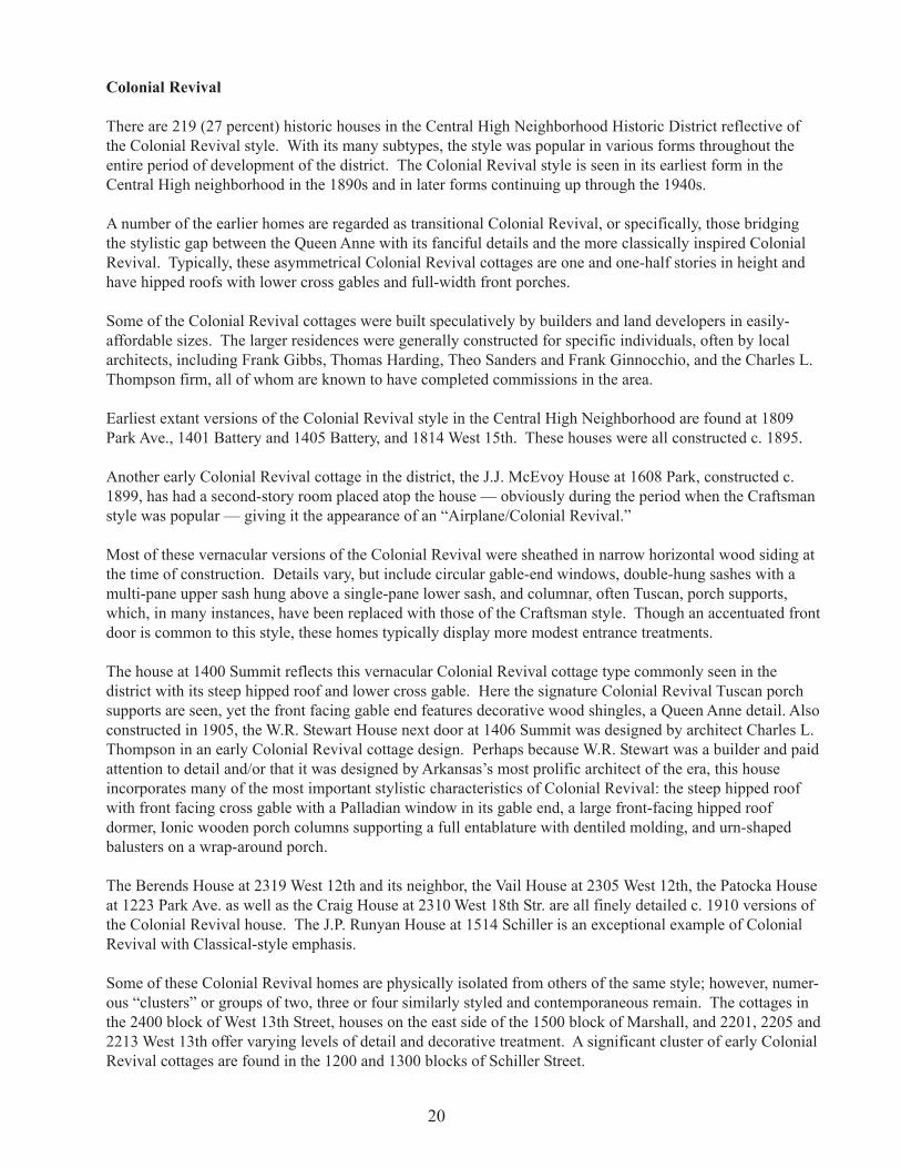
There are 219 (27 percent) historic houses in the Central High Neighborhood Historic District reflective ofthe Colonial Revival style. With its many subtypes, the style was popular in various forms throughout theentire period of development of the district. The Colonial Revival style is seen in its earliest form in theCentral High neighborhood in the 1890s and in later forms continuing up through the 1940s.
A number of the earlier homes are regarded as transitional Colonial Revival, or specifically, those bridgingthe stylistic gap between the Queen Anne with its fanciful details and the more classically inspired ColonialRevival. Typically, these asymmetrical Colonial Revival cottages are one and one-half stories in height andhave hipped roofs with lower cross gables and full-width front porches.
Some of the Colonial Revival cottages were built speculatively by builders and land developers in easily-affordable sizes. The larger residences were generally constructed for specific individuals, often by localarchitects, including Frank Gibbs, Thomas Harding, Theo Sanders and Frank Ginnocchio, and the Charles L.Thompson firm, all of whom are known to have completed commissions in the area.
Earliest extant versions of the Colonial Revival style in the Central High Neighborhood are found at 1809Park Ave., 1401 Battery and 1405 Battery, and 1814 West 15th. These houses were all constructed c. 1895.
Another early Colonial Revival cottage in the district, the J.J. McEvoy House at 1608 Park, constructed c.1899, has had a second-story room placed atop the house — obviously during the period when the Craftsmanstyle was popular — giving it the appearance of an “Airplane/Colonial Revival.”
Most of these vernacular versions of the Colonial Revival were sheathed in narrow horizontal wood siding atthe time of construction. Details vary, but include circular gable-end windows, double-hung sashes with amulti-pane upper sash hung above a single-pane lower sash, and columnar, often Tuscan, porch supports,which, in many instances, have been replaced with those of the Craftsman style. Though an accentuated frontdoor is common to this style, these homes typically display more modest entrance treatments.
The house at 1400 Summit reflects this vernacular Colonial Revival cottage type commonly seen in thedistrict with its steep hipped roof and lower cross gable. Here the signature Colonial Revival Tuscan porchsupports are seen, yet the front facing gable end features decorative wood shingles, a Queen Anne detail. Alsoconstructed in 1905, the W.R. Stewart House next door at 1406 Summit was designed by architect Charles L.Thompson in an early Colonial Revival cottage design. Perhaps because W.R. Stewart was a builder and paidattention to detail and/or that it was designed by Arkansas’s most prolific architect of the era, this houseincorporates many of the most important stylistic characteristics of Colonial Revival: the steep hipped roofwith front facing cross gable with a Palladian window in its gable end, a large front-facing hipped roofdormer, Ionic wooden porch columns supporting a full entablature with dentiled molding, and urn-shapedbalusters on a wrap-around porch.
The Berends House at 2319 West 12th and its neighbor, the Vail House at 2305 West 12th, the Patocka Houseat 1223 Park Ave. as well as the Craig House at 2310 West 18th Str. are all finely detailed c. 1910 versions ofthe Colonial Revival house. The J.P. Runyan House at 1514 Schiller is an exceptional example of ColonialRevival with Classical-style emphasis.
Some of these Colonial Revival homes are physically isolated from others of the same style; however, numer-ous “clusters” or groups of two, three or four similarly styled and contemporaneous remain. The cottages inthe 2400 block of West 13th Street, houses on the east side of the 1500 block of Marshall, and 2201, 2205 and2213 West 13th offer varying levels of detail and decorative treatment. A significant cluster of early ColonialRevival cottages are found in the 1200 and 1300 blocks of Schiller Street.
20

Another application of the Colonial Revival style found in the Central High Neighborhood is to a shotgunform. Examples of this modest, working class house type with Colonial Revival details are seen at 1204,1216, 1314 and 1318 Park.
The Dutch Colonial style is seen in the houses located at the c. 1895 R. M. Miles House at 1622 Park, 1700and 1704 Park, 1412 Schiller, 1612 West 23rd, and 1505 West 22nd, all constructed between 1903 and 1914.This subtype of the Colonial Revival style house are most often one story in height with steeply-pitchedgambrel roofs containing almost a full second story, and feature shed dormers. A full-width porch is some-times included under the main roof line or added with a separate roof. These houses represent the mostcommon form of Dutch Colonial house design from about 1895 to 1915 with a front facing gambrel roof andcross gambrel at the rear.
The Allen C. Wilson House at 1411 Summit, designed by Eli Blout, has an exemplary illustration of anotherof the Colonial Revival style’s characteristic features, a bay window. This house also has a pedimenteddormer, reiterating the pediment of the gable end, a classically detailed porch and a fan light in the gable end.It is noteworthy that Wilson was the sole resident of the house from its construction in 1903 to the 1960s.
The Alfred J. Mercer House at 1500 South Battery, constructed in 1907, and the Bain House at 1508/10Battery, constructed in 1914, provide renditions of the Colonial Revival on a more substantial scale andpossibly were architect-designed. A notable feature of the Mercer House is a two-story ancillary with steeple.A brick version of the two-story transitional Colonial Revival is the house at 1902 Schiller. Constructed in1912, this house with its Queen Anne massing and graceful wrap-around porch displays its Colonial Revivaldetails in Tuscan porch supports and Palladian windows.
The Vail House at 2305 West12th St. is a ca. 1910 Colo-nial Revival-style residence.(AHPP Photo)
21

Other of these two-story early Colonial Revival houses are seen at 2309 Battery, 1411 Summit, and 1423Summit. The houses at 1904 Battery, 1922 Battery, and 2000 Battery are excellent examples of the turn-of-the-century versions of the style.
The J.B. Wells House at 1717-1719 Park is an interesting contrast to the single-family cottages. Constructedc. 1912 as a duplex, its twin pedimented gables clearly express its status as a two-family dwelling.
The building boom in the neighborhood in the 1920s saw a new type of Colonial Revival house come intopopularity. These houses were usually two-story with side gables and small, classically detailed entrances.Examples are found in the Shaw House at 1622 Battery constructed in 1925, the house at 1421 South Park,constructed in 1922, the Joseph N. Dillard House at 2021 Summit and the Ralph Sutton House at 2100Summit.
Designed by the Little Rock architectural firm of Sanders and Ginocchio in 1926, the James H. Penick Houseat 1623 Summit displays some Federal styling, particularly at the entrance. Penick, who commissioned thedesign of this house, lived here until 1960, making no changes to its original appearance.
Simplification of the style typical until after World War II is illustrated by the c. 1939 houses located at 2108Marshall and 2218 Wolfe. The 2218 Wolfe house is a variation of the Garrison Colonial form with its sec-ond-story overhang.
Of the 219 extant Colonial Revival style houses in the district, 101 are contributing.
American Foursquare
Forty-four houses in the Central High neighborhood represent the house form that has come to be known asthe “American Foursquare.” Typically, Colonial Revival-, Craftsman- or Prairie-style decorative details are
The DutchColonial-styleR.M. MilesHouse at1622 ParkAve. (AHPPPhoto)
22

seen on these houses. The Foursquare is characterized by simple square or rectangular two-story plans, low-pitched hipped roofs, and one-story, full-width front porches.
Exemplary versions of the American Foursquare in the Central High neighborhood are seen on both sides ofthe 2300 block of Summit.
The Pugh House at 2323 Battery is a c. 1913 version of the Foursquare. As one of the earliest forms of thePrairie style, the frame house features the square plan with hipped roof and one-story porch on a symmetricalfacade. In contrast, the American Foursquare style house next door at 2311 Battery features a wrap-aroundporch supported by heavy stone columns. Constructed in 1917, this version of the Foursquare is clearlyindicative of the beginning of the popularity of the Craftsman style.
The houses at 1800, 1810 and 1814 Park are of the American Foursquare style with strong Craftsman charac-teristics, as seen in the exposed rafter ends, Craftsman form gable roof, brick porch balustrade and porchsupports.
One of the outstanding houses of this style is the William L. Rogoski House at 2417 Marshall. With itsAmerican Foursquare plan, the design of the house incorporates Colonial Revival design in its arched windowin the gable end of a front facing dormer, and Craftsman influence in its tiled roof. Situated on one of the
The ca. 1913 Pugh House at 2323 Battery St. is an American Foursquare house with Prairie-styleinfluences. (AHPP Photo)
23

highest points in the area, the Rogoski House is a showpiece in the Central High neighborhood.
Of the 44 American Foursquare houses in the district, 30 are contributing.
Plain Traditional
A large number of houses with no particular stylistic influence are found in the district. Most of these 134buildings were constructed from the period 1940 to 1990. These buildings sometimes incorporate identifiablestylistic ornament, usually of the Craftsman style, such as seen in the house at 1620 West 21st Street. Housesat 1500 and 1503 West 21st display English Revival-style influence in steep, front-facing gables, while housesat 1615 West 14th and 1516 West 19th are faintly indicative of the Colonial Revival style in their use ofClassical elements.
Only 29 of these properties are contributing to the historic significance of the Central High Neighborhood.The fact that construction continued through the 1970s — albeit at a slow pace — underlines the fact that theneighborhood remained viable. However, eight structures have been built in the district boundaries since1980.
Craftsman
The influence of the Craftsman style is the most discernible in the neighborhood, with a total of 329 (40percent) buildings of this style found in the Central High Neighborhood Historic District. The majority of theCraftsman homes, institutional buildings such as the St. Bartholomew Convent at 1601 Marshall, and apart-ment buildings were constructed between 1915 and 1925, another significant growth period in the neighbor-hood.
Structures displaying Craftsman features such as low-pitched, gabled roofs accentuated by a wide, unenclosedeave overhang with exposed roof rafters, as well as tapered square columns or pedestal porch supports, arefound throughout the district. Unlike the predominantly wooden Colonial Revival vernacular cottages, mostof the larger versions of this style were built in brick, stucco and stone.
Large, high-style versions of Craftsman design seen in the Central High Neighborhood Historic District arenumerous. A number of these are architect-designed. These homes offer the expected exposed rafters andgenerous overhang. They also combine materials with the use of stone, brick, stucco and wood.
The John J. Healey House at 2010 Wolfe was designed by prominent architect Charles L. Thompson in 1927.Constructed in 1915, the M.E. Dunnaway House at 2022 Battery was listed on the National Register in theCharles L. Thompson and Associates thematic grouping. Other noteworthy large Craftsman houses arelocated at 2209 Battery and 1603 West 24th. A grouping of three significant Craftsman houses is located onthe west side of the 2100 block of Battery.
Craftsman Bungalow
Of the 329 Craftsman-style buildings in the district, 174 are Craftsman Bungalows. The American CraftsmanBungalow became the “cottage” of the early decades of the 20th century. It began as a small Craftsman housebut acquired a wide diversity of stylistic influences, with specific examples reflecting the influence of manypopular American architectural styles. The American Bungalow adapted itself to widely divergent environ-mental and climatic conditions, made use of numerous kinds of local building materials and ranged in sizefrom rambling weekend retreats to small, low-income residences. The rapid growth of the Central Highneighborhood in the 1920s brought about a need for small affordable housing and a number of CraftsmanBungalows were constructed and are scattered throughout the area.
24

Although there are many different types of Bungalows within the Central High Neighborhood HistoricDistrict, a common theme in their design links them. The Bungalow is set low to the ground; it nestles intoand becomes part of its environment. The house at 1702 West 24th is an example of the compatibility of theBungalow with its setting. Inspired by the Craftsman-type bungalow designs of California architects Greeneand Greene in the early part of the 20th century, these simple bungalows were popularized by extensivepublicity. Dozens of Craftsman Bungalow pattern books were published. Several companies, including Searsand Roebuck, offered house kits with precut packages of lumber that could be shipped to the constructionsite. Due to the availability and affordability of the Craftsman Bungalow house, it became the small housedesign of choice throughout the country, becoming the “cottage” of the 1910s and 1920s. Although muchsimpler versions of their two-story, high-style counterparts, the Bungalows in the Central High neighborhoodemploy the same Craftsman characteristics: the use of rustic materials on the exterior, and the low-pitchedroof with wide eaves and extended rafter tails.
The earliest form of Craftsman Bungalow in the Central High area is the front-facing, steeply pitched gabled-roof type. Examples of this type are seen in the houses at 2304 Wolfe and 1614 West 22nd, both constructedc. 1914.
Another characteristic Bungalow type emphasizes rustic qualities. These are, for the most part, painted adark, natural color and feature rustic materials (usually rough-cut wood and fieldstone). The house at 1414Summit, constructed in 1923, displays this rustic emphasis through its dark-stained narrow weatherboard andcobble-stone porch supports and balustrade.
Versions of the cross-gabled roof type Bungalows, most often associated with “California Bungalows,” areseen in the houses at 2000 and 2008 Summit. A group of three of this type of Bungalow is found in the 2000block of West 18th and another group in the 2300 block of West 17th. These houses all incorporate multipleroof planes, Oriental-like flared roof lines, and prominent triangular knee braces supporting wide eaves withextended rafter tails.
A variation of the “California Bungalow” features a single second-story room affording a panoramic of thesky, hence the name “Airplane.” The house at 2010 Summit displays this characteristic hipped-roof, second-story room with wide eaves and accentuated exposed rafter ends along with the typical trellised porte cochereand short, battered columns on brick piers. An outstanding group of “Airplane Bungalows” is found in the1700 block of West 24th, particularly the Simon House at 1702 West 24th. Virtually unaltered since itsconstruction in 1922, this house is a textbook example of the Craftsman style, incorporating such elements asthe trellised-roof porte cochere, porch columns on piers, and the second-story room. The multiple roof planesand bands of windows accentuate the horizontal emphasis of this house.
The Craftsman style of architecture was the most popular choice of design for the approximately 20 multi-family buildings in the Central High Neighborhood Historic District. Although in deteriorated condition, thetwo Witherspoon-Runyan Apartment buildings in the 2000 block of Wright Avenue display the characteristicCraftsman horizontal emphasis with bands of windows across the second floor and wide eaves. The SeniorHigh Apartments at 1423 Schiller with its low, almost flat hipped roof expresses the Craftsman style with itswide eaves and sets of large paired braces. A row of five Craftsman-inspired duplexes is located in the 1600block of West 22nd. These buildings are all two-story brick structures and derive their Craftsman styleappearance from various uses of textured-brick, stone, stucco and wood in their construction.
Sixty-seven percent of the Craftsman buildings in the district are contributing to the historic district. Theremaining 33 percent are noncontributing largely due to the application of non-original wall materials.
25

“Period Houses”
An eclectic flavor of design emerged across the nation in the 1920s. Building design began incorporatingmany of the “romantic” styles of the past and were fluently constructed in this period. English and Spanishinfluences were incorporated into some of the historic styles of these picturesque houses. Although construc-tion of this style house in the Central High neighborhood did occur (18 “Period Houses” are extant in thedistrict), it was a considerably less popular style than in other neighborhoods in the city, such as the Hillcrestneighborhood.
English Revival
Of particular note is the Warren Lenon House at 2005 West 16th Str., which was constructed in the mid-1890sbut remodeled by Charles L. Thompson to its present English Revival-style appearance in 1918. Anotherlarge version of the English Revival style found in the district is the Max Mayer House at 2016 Battery,constructed 1924-28. The Stifft House, constructed in 1923 at 1920 Marshall, is a striking one-and-one-halfstory house with stucco wall material and a prominent tiled, clipped-gabled roof.
Smaller versions typical of the English Revival style are best characterized as “English Cottages.” One of themost popular house styles in America from 1920 through the 1940s, examples are seen in the houses at 2117and 2119 West 17th. These small vernacular examples feature steep pointed gables and decorative use ofstone around entries.
The Warren Lenon House at 2005 West 16th St. was remodeled in the English Revival style in 1918 by notedarchitect Charles L. Thompson. (AHPP Photo)
26

Spanish Revival
There are four buildings in the Central High Neighborhood Historic District constructed with Spanish influ-ence. An outstanding example of this type is the small house at 1919 West 21st St. Stucco walls, terraces andpatios, flat roofs with raised tile ridged parapets, arcaded wing walls, and decorative use of ceramic tilesexemplify the 1920s period adaptation of the historic Spanish style. Other residential period Spanish Revivalresidences are located at 1504 West 22nd and 1400 Battery.
The Central High School National Historic Site visitor center, located in an old gas station at the southwestcorner of West 14th Street and Park Avenue, across the street from Central High School, expresses Spanishstyle influence with its stucco walls, arched gas bay, tiled roof parapet ridge and multi-colored tile roof. The
This small house at 1919 West 21st St. is an excellent example of Spanish Revival architecture.(AHPP Photo)
commercial building at 1719 Wright Avenue features use of tiled parapets and decorative ceramic tile pat-terns.
Minimal Traditional
The designs seen in Depression-era homes 1930-40 attempt to reflect the various revival styles, but lackdecorative detail. Roof pitches are generally low and eaves are close. Built in the 1930s and interrupted byWorld War II, this is the same type of house that was built in large numbers in tract-housing developmentsfollowing the war. Examples of this type house in the Central High neighborhood are found at 2108Marshall, 2423 Wolfe and 1601 West 19th Street.
27

Other Stylistic Influences
The Richardsonian Romanesque style is well represented by the LaVerne Dome House at 1709 Park Street.This architecturally significant house, constructed c. 1907, is two-stories in height, constructed of rusticatedstone and is distinguished by a turret on the front, or west, elevation.
The Isidoro Beaumont House at 1624 West 23rd has slight Italianate influence with its sets of large bracketssupporting the wide eaves of the central, hipped-roof portion of the house.
The houses at 1921 West 22nd and 2004 West 22nd are companion Classical Revival structures. These two-story frame houses feature dominant two-story pedimented porches with dentil motif supported by two-story,Ionic-capped columns. Constructed in 1920, these houses are unique in the Central High neighborhood.
The Whitney A. Harb House at 1868 Summit is one of three houses in the district displaying Prairie-styleinfluence in its design. Constructed c. 1920, the Harb House displays the open eave with enclosed rafters thatis typical of this style, contrasting with the open eave with exposed rafters that is found in contemporaneousCraftsman houses in the area.
Commercial
While the Central High Neighborhood Historic District is a predominantly residential area, the limitedcommercial development, particularly along the former streetcar-line roadways of 12th and 14th Streets andWright Avenue, displays an array of modest architectural detail. There are only 22 commercial buildingslocated in the district. Most were constructed in the 1920s and are one-story brick buildings that blend withtheir residential surroundings. Typical of the low-key commercial building in the area is the Capel Buildingat 2121/2123 West 16th, constructed in 1926, and the Ogilive Drug Store Building at 1200-1202 Dennison St.Although noncontributing due to alterations, the building at 2324 Wright Ave. typifies early 20th-centurycommercial styling with its clipped corner, brick facade, glass storefronts and parapeted cornice.
Churches
Neighborhood churches were an integral part of the neighborhood development in the West End of LittleRock. The original building of St. Bartholomew’s Catholic Church at 1622 Marshall was constructed in 1911and replaced by the current structure in 1931; the congregation remains an important part of the Central Highneighborhood. This simple building is reminiscent of the small church building commonly found in NewEngland with its two-story steeple tower entrance. Although covered with synthetic siding, the churchmaintains its basic historic appearance and is an important part of the Central High neighborhood.
The small frame Craftsman-influenced church building at 1868 Wolfe was constructed c. 1917. This churchbuilding features double-hung sash, stained-glass windows with Gothic-arch, single-pane stained-glasswindows above. A steeple rests atop this picturesque building.
Schools
Like churches, schools contributed to the stability and architectural interest of the neighborhood. The firstschool constructed in the neighborhood was the Centennial School, designed in 1893 by the architect ThomasHarding in the Romanesque Revival style; unfortunately, only a corner tower remains. The Main Building ofArkansas Baptist College, constructed in 1893, reflects the Second Empire style. Listed on the NationalRegister in 1976, this building remains a viable part of the college campus.
28

West Side Junior High School at 1300 Marshall, designed by Theo Sanders in 1917 and built in two phases, isa three-storied classical composition that commands the entire block between 13th and 14th streets andMarshall and Wolfe streets. The entrance bay facing Marshall Street is defined by an entablature, pilastersand a pair of Tuscan columns flanking a set of double doors with transom.
The James Mitchell School at West 24th and Battery streets was built in 1908-10 as designed by ThomasHarding, Jr., son of the Centennial School architect. Its entrance portico with four oversized engaged col-umns sets a tone of monumentality in its residential surroundings.
Central High School
Of monumental historic and architectural significance, Little Rock’s Central High School is known world-wide for its role in the 1957 school desegregation crisis.
When constructed in 1927, this Gothic Revival style building was named “The Most Beautiful High SchoolBuilding in the Country.” Designed by Little Rock architect John Parks Almand in association with five otherlocal architects, Little Rock Central High School (originally Little Rock High School) opened in the fall of1927. Listed on the National Register in August 1977, Central High School was designated Little Rock’s firstNational Historic Landmark on May 20, 1982. Still the largest and most architecturally and historicallysignificant high school in Arkansas, Central High School is the most important structure in the neighborhoodand its presence was the catalyst for preservation efforts in the blocks surrounding it.
The majority of the buildings in the Central High Neighborhood Historic District are in fair to good condi-tion. Inner city deterioration has taken its toll on some portions of the district. There are a few properties thathave fallen into deteriorated condition and are abandoned. Absentee ownership has created many problemsfor the neighborhood, as those properties are sometimes not well maintained or carefully leased. Despite these
Westside Junior High School, 300 Marshall St. (AHPP Photo)
29

pockets of deterioration, the streetscape of the Central High Neighborhood Historic District remains largelyintact. Its architecture and historical development assure its place in Little Rock history.
Although the area has deteriorated considerably in the last few years, a strong neighborhood association hassuccessfully captured the attention of Little Rock city government and a preservation plan for the area is inthe planning stages. Plans are being developed for a Central High Museum* and it is well acknowledged thatin addition to the role Little Rock’s Central High School played in an event of national significance, thehistoric building stock in the Central High Neighborhood offers an enlightening architectural view of amiddle- and working-class neighborhood in Little Rock during the first three decades of this century.
Central High School Neighborhood Significance
The West End neighborhoods of mid-town Little Rock are defined by a momentous historical event thatoccurred 80 years after the property was initially platted for development. In fact, 86 percent of all of thestructures were already built 10 years before the “crisis” at Central High School brought the city and theracially charged situation to national prominence. The importance, or perhaps notoriety, that these neighbor-hoods gain from their association with such a nationally significant event does not diminish their illuminatinghistoric development, representative of the growth in the first half of this century of a middle- and working-class neighborhood of mixed use (residential, commercial, educational and religious) and, ironically, to someextent interracial composition. The architecture of the neighborhood — overwhelmingly Colonial Revivaland Craftsman in style — is reflective of the principal growth periods, 1899-1910 and 1911-30, respectively(though the overall period of significance is 1890-1946). Moreover, the variation in building scale anddecorative detailing seen throughout the district expresses the demographic and socioeconomic variety of itsresidents.
*That museum has since been developed and now houses the Central High School National Historic Site visitor center.
30
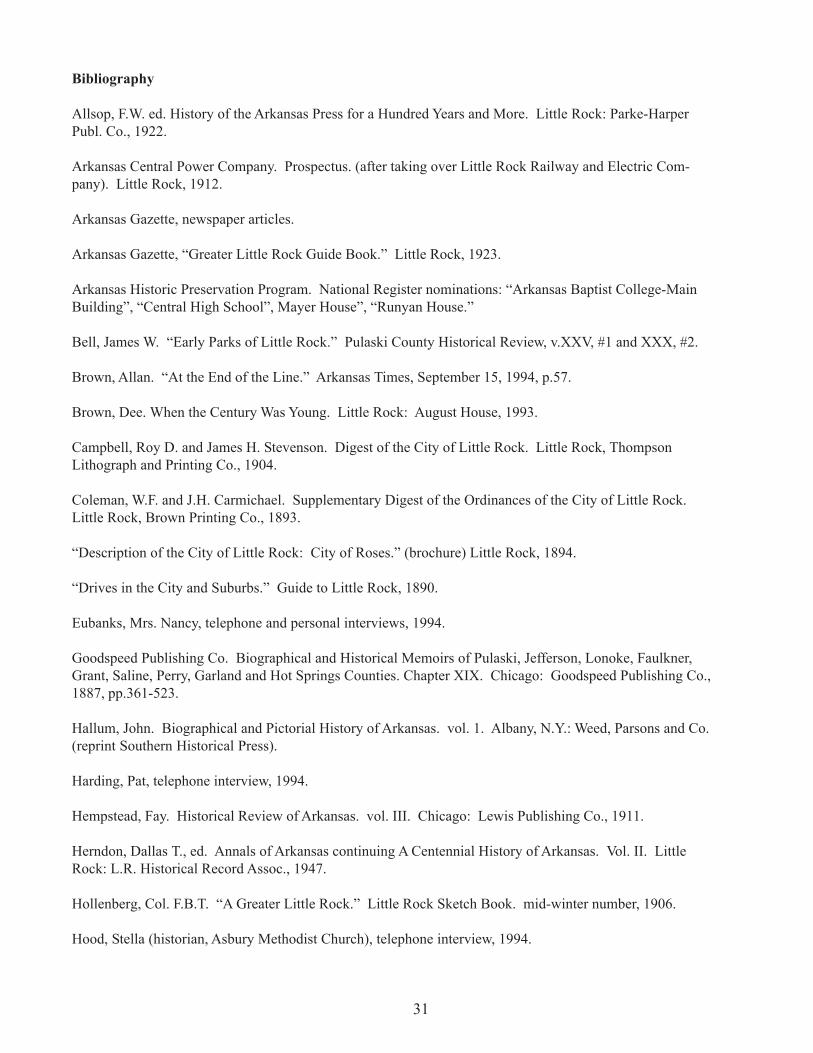
Bibliography
Allsop, F.W. ed. History of the Arkansas Press for a Hundred Years and More. Little Rock: Parke-HarperPubl. Co., 1922.
Arkansas Central Power Company. Prospectus. (after taking over Little Rock Railway and Electric Com-pany). Little Rock, 1912.
Arkansas Gazette, newspaper articles.
Arkansas Gazette, “Greater Little Rock Guide Book.” Little Rock, 1923.
Arkansas Historic Preservation Program. National Register nominations: “Arkansas Baptist College-MainBuilding”, “Central High School”, Mayer House”, “Runyan House.”
Bell, James W. “Early Parks of Little Rock.” Pulaski County Historical Review, v.XXV, #1 and XXX, #2.
Brown, Allan. “At the End of the Line.” Arkansas Times, September 15, 1994, p.57.
Brown, Dee. When the Century Was Young. Little Rock: August House, 1993.
Campbell, Roy D. and James H. Stevenson. Digest of the City of Little Rock. Little Rock, ThompsonLithograph and Printing Co., 1904.
Coleman, W.F. and J.H. Carmichael. Supplementary Digest of the Ordinances of the City of Little Rock.Little Rock, Brown Printing Co., 1893.
“Description of the City of Little Rock: City of Roses.” (brochure) Little Rock, 1894.
“Drives in the City and Suburbs.” Guide to Little Rock, 1890.
Eubanks, Mrs. Nancy, telephone and personal interviews, 1994.
Goodspeed Publishing Co. Biographical and Historical Memoirs of Pulaski, Jefferson, Lonoke, Faulkner,Grant, Saline, Perry, Garland and Hot Springs Counties. Chapter XIX. Chicago: Goodspeed Publishing Co.,1887, pp.361-523.
Hallum, John. Biographical and Pictorial History of Arkansas. vol. 1. Albany, N.Y.: Weed, Parsons and Co.(reprint Southern Historical Press).
Harding, Pat, telephone interview, 1994.
Hempstead, Fay. Historical Review of Arkansas. vol. III. Chicago: Lewis Publishing Co., 1911.
Herndon, Dallas T., ed. Annals of Arkansas continuing A Centennial History of Arkansas. Vol. II. LittleRock: L.R. Historical Record Assoc., 1947.
Hollenberg, Col. F.B.T. “A Greater Little Rock.” Little Rock Sketch Book. mid-winter number, 1906.
Hood, Stella (historian, Asbury Methodist Church), telephone interview, 1994.
31

Jackson, Vernon, personal interview, 1994.
Little Rock Chamber of Commerce. The Booster (newssheet), August 4, 1911.
Little Rock and Argenta, 1888.
Little Rock, City Directories, 1871-1975 (various publishing companies).
Little Rock “City of Roses”. Choctaw, Oklahoma and Gulf Railroad Company, 1902-3.
Little Rock City of Roses: Picturesque and Descriptive. (brochure). The Art Publishing Co., n.d.
Little Rock Fire Department. Essay on the history of the department, pp.17-27.
Little Rock Railway and Electric Company. April 15, 1905, vol. 1, #1. (brochure).
Mayor’s Message and Report of City Officers. Little Rock: 1904-7, 1919-20, 1927-28.
McAlester, Virginia and Lee. A Field Guide to American Houses. New York: Alfred A. Knopf, 1984.
Nichols, Marquis, telephone interview, 1994.
Nolen, John with Hale J. Walker and Justin Hartzog. City Plan: Little Rock, Arkansas, 1930. Cambridge,Mass.: 1930.
———, Report on a Park System for Little Rock, 1910. Cambridge, Mass.: 1913.
Overran, R.E. “Little Rock’s Water Supply.” First Annual Report of the Little Rock Municipal Water Works.(year ending Dec. 31, 1936).
Penick, Carroll, personal interview, 1994.
Penick, Virginia, personal interview, 1994.
Plain Facts About Our City. (brochure), 1914.
Pulaski County, Deed Books and Plat Maps. Standard Abstract Co.
Pulaski County Planning Board. Real Estate Property Survey and Low Income Housing Survey. Little Rock,1940.
“Ordinances and Resolutions.” Digest of the City of Little Rock, 1904.
“Report of Judge C.T. Coffman to the Pulaski County Levying Court.” Pulaski County Historical Review.vol. XVI #3, September 1968, pp.31-41.
Richey, M.M. (historian, Winfield Methodist Church), telephone interview, 1994.
Roy, F. Hampton and Charles Witsell, Jr. with Cheryl Nichols. How We Lived: Little Rock as an AmericanCity. Little Rock: August House, 1984.
32
Smith, Mrs. Hay Watson. “Life in Little Rock in the 1880’s” Pulaski County Historical Review, vol. 5, #4,p.69.
Tabor, Mrs. Edward, personal interview, 1994.
Taylor, Charles E. Plain Facts About Our City (brochure), 1914.
Urban League of Greater Little Rock, compiled by Writer’s Program of Works Project Administration of theState of Arkansas. Survey of Negroes in Little Rock and North Little Rock. 1941.
Who’s Who in Little Rock: An Accurate Record of Men and Woman of Little Rock, Prominent in VariousLines of Civic Activity, 1921. Little Rock: Who’s Who Publ., New Era Press, 1921.
33

Endnotes
1 "Guide to Little Rock”, 1890, p.57. 2 Ibid. 3 Ibid. 4 John Hughs Reynolds, ed., Publications of Arkansas Historical Association, vol. 1, p.232. 5 Deed book, #5, Standard Abstract, Section 9, Township 1, Range 12, March 21, 1868 (Book J2, p.112).Note: all deed book citations are from Standard Abstract, which generously allowed access to its books.Parenthetical book and page notations reflect those recorded in the notations of deed books or plat maps cited. 6 Little Rock City Directory, 1871, p.65. 7 Arkansas Gazette (hereafter Gazette), September 24, 1879. 8 Gazette, September 25, 1979. 9 Centennial Addition Plat, March 23, 1877. (Book G3, p.256). 10 Deed book #5, January 9, 1875. (Book C3, p.607); January 26, 1875 (Book D, p.185). 11 Little Rock City Directory, 1887, p.363. Also, Goodspeed, Memoirs of Central Arkansas, p.406 andLittle Rock and Argenta, 1888, p.121. He built a “model residence” in the Queen Anne style for himself at3rd and Chester in 1886. Gazette, February 19, 1886. 12 Ibid., p.445. Also, Gazette, November 27, 1900. 13 Ibid. 14 Little Rock City Directory, 1887, p. 215. 15 Barton and Edgarton Subdivision of Centennial Addition, January 29, 1883, (Book 8, p. 265). 16 This practice is evident from similar notations found on many of the original plat maps reviewed atStandard Abstract Company. 17 Gazette, June 3, 1891; December 8, 1898. 18 Ibid., June 3, 1891. 19 Little Rock City Directory, 1895, p. 174. 20 Little Rock City Directory, 1887, p. 69. 21 Ibid. 22 Who’s Who In Little Rock, 1921, p. 51. 23 Ibid. 24 Ibid. 25 Gazette, September 8, 1907, p. 3. 26 Ibid., January 13, 1897. Also, F.W. Allsop, History of the Arkansas Press for a Hundred Years andMore, p. 606. According to the city directory of 1895, Naylor resided at 2029 W. 16th St. 27 Parish Subdivision Plat, July 29, 1886 (Book 4, p. 111). 28 Little Rock City Directory, 1895-6, p. 387. 29 Aiken Subdivision Plat, July 8, 1889 (Book 29, p.590; Book 27, p. 192). 30 Little Rock City Directory, 1887, 1895. 31 Deed book, #19, January 7, 1882 (Book 7, p. 197). 32 Gazette, February 25, 1913. 33 Ibid. 34 Fulk Subdivision Plat, April 14, 1890 (Book 29, p. 280). 35 Gazette, March 25, 1910. 36 Little Rock City Directory, 1887, p.90; 1895-96, p. 211. 37 Biographical information from aforementioned obituary and Dallas T. Herndon, A Centennial Historyof Arkansas, vol. II, p. 714. 38 McDonald and Wheeler Plat, June 4, 1873 (Book AB, p. 297). 39 Park Addition Plat, May 6, 1889. 40 Deed Book, #5, February 10, 1834. 41 Gazette, July 28, 1918. 42 Deed Book, #5, January 6, 1871 (Book P2, p. 461).
34

43 Gazette, May 31, 1868, p. 2. 44 Gazette, December 15, 1903. 45 Ibid. 46 Deed Book, #5, June 4, 1873, (Book B3, p. 9). 47 Deed Book, #36A, March 23, 1919; November 19, 1910 (Book 101, p. 110). 48 Ibid. 49 Fay Hempstead, Historical Review of Arkansas, vol. II, pp. 660-1. 50 Ibid., p. 798. Also, Gazette, July 26, 1927. 51 Adams Addition Plat, April 1888 (Book 21, p. 624). 52 Gazette, March 27, 1826. 53 Deed Book #5, July 3, 1891 (Book 33, p. 340); March 25, 1892 (Book 37, p. 72). 54 Fleming and Bradford Addition Plat, March 24, 1892 (Book 37, p. 89). 55 Deed Book, #5, July 3, 1891; March 25, 1892. 56 Gazette, May 15, 1908, p. 7. 57 Ibid. 58 Little Rock City Directory, 1890, p. 136. 59 Moore and Penzel Plat, July 18, 1889 (Book 27, p. 224). 60 Ibid. 61 Gazette, February 17, 1906, p. 1. 62 Ibid., February 20, 1901, p. 7. 63 Hempstead, vol. III, p. 1508. 64 Herndon, vol. II, p. 82. 65 Gazette, June 19, 1909, p. 7. 66 O.F. Sheldon Plat, April 9, 1892 (Book 37, p. 205). Milton Rice had sold 30 acres to Orin Sheldonearlier as recorded on June 10, 1873, Deed Book B3, p. 24. 67 Little Rock City Directory, 1887, p. 227. 68 Ibid. 69 Oak Terrace Addition Plat, July 10, 1897 (Book 53, p. 300); May 27, 1903 (Book 75, p. 598); May 5,1904 (Book 80, p. 89). 70 National Register nomination, “Mayer House,” (September 7, 1994), p. 5. 71 Deed Book, #5, December 10, 1896 (Book 49, p. 635); July 10, 1901 (Book 67, p. 339). 72 Gazette, July 21, 1935. 73 Deed Book, 36A, April 28, 1916. 74 Oak Terrace Plat, April 28, 1916; also Deed Book #36A, April 28, 1916 (Book 121, p. 612). 75 Ibid. 76 Deed Book, 36A, Oak Terrace, May 27, 1907 (Book 1, p. 52). 77 Ibid. 78 According to the 1902-3 city directory, Mrs. Sarah A. Dunne managed the New Orleans restaurant onWest 5th and lived at the same address (p. 164). Patrick Dunne, according to a 1910 directory, lived at 2300Wolfe (p. 193). This address is located within the tract platted in 1907 by S.A. Dunne. 79 Gazette, January 15, 1942. 80 Ibid., April 24, 1938. 81 Ibid. 82 Ibid. 83 Ibid. 84 Ibid. 85 Ibid. 86 Ibid. February 3, 1943. 87 Ibid. 88 Little Rock City Directory, 1906. 89 Who’s Who In Little Rock, 1921, p. 115.
35

90 Ibid., p. 114. 91 Gazette, November 12, 1939. 92 Arkansas and Its People, p. 230. 93 M.A. Myers Subdivision, Deed Book, 35A, July 11, 1905. 94 Deed Book, 35A, May 28, 1907 (Book 96, p. 163). H.A. Bowman sold this property to J.K. Riffel andMerritt Myers two months later on July 7, 1907 (Book 93, p. 364). 95 Little Rock City Directory, 1886, p. 257. 96 Ibid., 1887, p. 158. 97 Ibid., 1902-3, p. 314. 98 Ibid. 99 Gazette, November 6, 1928. 100 Deed Book 35A, July 10, 1890 (Book 31, p. 615) 101 Book of Arkansas, 1913, p. 1928. 102 Gazette, November 6, 1928. 103 Little Rock City Directory, dates as noted. 104 Deed Book, 35A, July 8, 1891. 105 Ibid. 106 R.E. Overman, “Little Rock’s Water Supply,” First Annual Report of the Little Rock Municipal WaterWorks, p. 3. 107 Ordinances and Resolutions, 1904, “Sec. 2024: Waterworks Franchise-Grant to Home Water Co.”, p.391. 108 Ibid. Mr. Marquis Nichols who lived at 1813 Jones Street from 1919-1923 recalls that his home hadno interior water hookup, but a reliable water source was provided by a hydrant outside the house. 109 Gazette, March 1, 1908. 110 Ibid. 111 Ibid. 112 Hempstead, History of Arkansas, p. 510. 113 Ibid. 114 Col. F.B. T. Hollenberg, “A Greater Little Rock”, Little Rock Sketch Book, 1906, n.p. 115 Ibid. 116 Ibid. 117 Ordinances and Resolutions. Section 2019, “Street Railway Franchise-Grant to Little Rock Tractionand Electric Company of Right to Construct, Operate and Maintain a Street Railway System,” p. 382. 118 "Report of County Judge C.T. Coffman to Pulaski County Levying Court” as reprinted in PulaskiCounty Historical Review, vol. XVI, #3, September 1968, p. 31. 119 John Nolen, “Traffic Problems and Improved Public Safety,” City Plan, Little Rock, Arkansas, 1928,p. 7. 120 Small Manuscript Collection, Box XXV, #21, Arkansas History Commission, re: Street ImprovementDistrict #216, November 4, 1912. 121 Charles E. Taylor, “Plain Facts About Our City” (brochure), 1914, p. 12. 122 "Leads Last Year,” The Booster, vol. 1, #6, August 4, 1911 (p. 3, text not paginated). 123 "History”, Little Rock Fire Department, 1981, p. 17. 124 Ibid. 125 Ibid. 126 Ibid. 127 Ibid., p. 20 128 Hempstead, p. 510. 129 Ibid. 130 W.F. Coleman and J.H. Carmichael, Supplemental Digest of the Ordinances of the City of Little Rock,p. 244. 131 Book of Arkansas, 1913, p. 111.
36
132 Ibid. 133 Mayor’s Message and Report of City Officers, 1919-20, Little Rock, AR. p. 85. 134 "Description of the City of Little Rock, City of Roses,” 1894, p. 18. 135 Ibid. 136 "Ordinances and Resolutions”, 1904, p. 382. 137 Mrs. Hay Watson Smith, “Life in Little Rock in the 1880’s”, Pulaski County Historical Review, vol. 5,#4, p. 69. 138 Book of Arkansas, 1913, p. 111. 139 Ibid. 140 Allan Brown, “At the End of the Line”, Arkansas Times, September 15, 1994, p. 57. 141 James W. Bell, “The Early Parks of Little Rock, Part I”, Pulaski County Historical Review, vol. XXV,#1, Spring 1982, p. 21. 142 Ibid. 143 Ibid. Also photograph from “Little Rock: City of Roses: Picturesque and Descriptive”, 1890, n.p. 144 Bell, p. 21. 145 Ibid. 146 Ibid. 147 Ibid. 148 Ibid. 149 Ibid. 150 Gazette, May 5, 1909. 151 Ibid., April 1, 1906. 152 Ibid. 153 Ibid. 154 Ibid., September 13, 1913. 155 Gazette, May 18, 1909. 156 Ibid. 157 Ibid. 158 Ibid., July 1, 1936. 159 Telephone interview, October 26, 1994, Marquis Nichols. 160 Arkansas Gazetteer, 1898-9, Little Rock, AR., p. 291. 161 Gazette, April 27, 1919. 162 Ibid. 163 Ibid., May 5, 1932. 164 Ibid., July 7, 1940. 165 Ibid. 166 Ibid. 167 Dee Brown, When The Century Was Young, p. 57. 168 Marquis Nichols, Mrs. James Penick, Mrs. Edward Tabor and Mrs. N. Eubanks all noted the “cleanli-ness” and well-kept appearance of the neighborhood. 169 Gazette, March 1, 1908. 170 Ibid. 171 Ibid. 172 Little Rock: City of Roses, (souvenir brochure), 1902, p. 4. 173 Pulaski County Planning Board, Real Estate Property Survey and Low Income Housing Survey, 1940,figure 36, p. 42. 174 Ibid., figure 32, p. 40. 175 Ibid., figure 27, p. 33. 176 Urban League of Little Rock, Survey of Negroes in Little Rock and North Little Rock, compiled byWriter’s Program of Works Administration, 1941, p. 61.
37