leica mobilematrix - leica geosystems · leica mobilematrix the evolution of mobile gis leica...
TRANSCRIPT

Leica MobileMatriXThe Evolution ofMobile GIS
Leica MobileMatriXThe Evolution of Mobile GIS
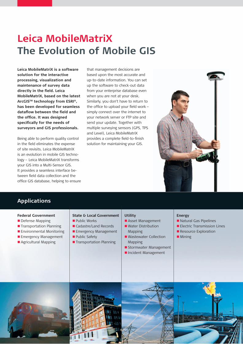
Leica MobileMatriX is a software solution for the interactive processing, visualization and maintenance of survey data directly in the field. Leica MobileMatriX, based on the latest ArcGISTM technology from ESRI®, has been developed for seamless dataflow between the field and the office. It was designed specifically for the needs of surveyors and GIS professionals.
Being able to perform quality control
in the field eliminates the expense
of site revisits. Leica MobileMatriX
is an evolution in mobile GIS techno
logy – Leica MobileMatriX transforms
your GIS into a MultiSensor GIS.
It provides a seamless interface be
tween field data collection and the
office GIS database, helping to ensure
that management decisions are
based upon the most accurate and
uptodate information. You can set
up the software to checkout data
from your enterprise database even
when you are not at your desk.
Similarly, you don’t have to return to
the office to upload your field work –
simply connect over the internet to
your network server or FTP site and
send your update. Together with
multiple surveying sensors (GPS, TPS
and Level), Leica MobileMatriX
provides a complete fieldtofinish
solution for maintaining your GIS.
State & Local Government n Public Works
n Cadastre/Land Records
n Emergency Management
n Public Safety
n Transportation Planning
Utility n Asset Management
nWater Distribution
Mapping
nWastewater Collection
Mapping
n Stormwater Management
n Incident Management
Energy nNatural Gas Pipelines
n Electric Transmission Lines
n Resource Exploration
nMining
Applications
Federal Government nDefense Mapping
n Transportation Planning
n Environmental Monitoring
n Emergency Management
n Agricultural Mapping

that is measured. Leica MobileMatriX
fills the gap between surveying and GIS
by using survey points to position the
vertices that define the geometry of
feature class objects.
Multiple Feature EditingCreating more than one feature
with just one measurement ensures
economic field practices. This editing
concept uses one survey point to
extend or create multiple features
with different thematic meanings.
The flexibility of multiple feature
editing enables the user to perform
complex surveying actions with
immediate visual feedback for quality
and completeness control. The result is
a dataset that is topologically correct.
Benefits
Survey Data Management – More Than One CoordinateLeica MobileMatriX stores all computed
and imported coordinates with their
quality information in the Geodatabase
and allows the user to decide which
coordinate to use. This eliminates losing
old information and permits continuous
navigation through computations.
Computation Network AnalystLeica MobileMatriX creates and stores it‘s
dependencies between computations,
points and measurements, which allows
the user to easily trace the computation
network.
Seamless Dataflow and Easy Data ExchangeAll survey data measured in the
field is automatically stored into
the ESRI Geodatabase format,
eliminating the need for data
conversion when moving data
between Leica MobileMatriX and
ESRI’s ArcGIS applications. To ensure
maximum compatibility with all
systems, Leica MobileMatriX allows
the user to interact with data from
different sources, like CAD systems,
Shapefiles and Raster Data.
Unrivalled Data Collection MethodsSurvey Features offer an easy
way to map geodatabase feature
classes. When surveying with Leica
MobileMatriX, a survey feature will be
created for each realworld object
Leica MobileMatriXA Multi-Sensor GIS
Leica MobileMatriX is the first
mobile GIS that gives you the
freedom to incorporate multiple
surveying instruments for accurately
maintaining your geodatabase. Leica
MobileMatriX uses precision mea
surements from GPS sensors, total
stations, digital levels and laser
rangefinders to capture and update
feature classes. Survey processing
functions are available in the field,
and thus data acquisition and
revision cycles are significantly
simplified. You get the benefits of
realtime visualization and quality
control, multiple feature editing and
the ability to update TINs and DEMs
with survey measurements. Leica
MobileMatriX – a MultiSensor GIS.
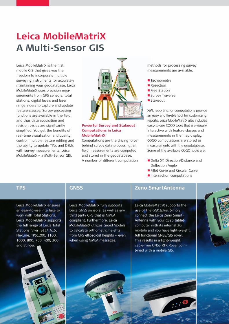
Powerful Survey and Stakeout Computations in Leica MobileMatriXComputations are the driving force
behind survey data processing; all
field measurements are computed
and stored in the geodatabase.
A number of different computation
methods for processing survey
measurements are available:
n Tacheometry
n Resection
n Free Station
n Survey Traverse
n Stakeout
XML reporting for computations provide
an easy and flexible tool for customizing
reports. Leica MobileMatriX also includes
easytouse COGO tools that are visually
interactive with feature classes and
measurements in the map display.
COGO computations are stored as
measurements with the geodatabase.
Some of the available COGO tools are:
nDelta XY, Direction/Distance and
Deflection Angle
n Fillet Curve and Circular Curve
n Intersection computations
TPS
Leica MobileMatriX ensures
an easytouse interface to
work with Total Stations.
Leica MobileMatriX supports
the full range of Leica Total
Stations: Viva TS11/TA15,
FlexLine, TPS1200, 1100,
1000, 800, 700, 400, 300
and Builder.
GNSS
Leica MobileMatriX fully supports
Leica GNSS sensors, as well as any
third party GPS that is NMEA
compliant. Furthermore, Leica
MobileMatriX utilizes Geoid Models
to calculate orthometric heights
from GPS ellipsoidal heights – even
when using NMEA messages.
Zeno SmartAntenna
Leica MobileMatriX supports the
use of the GG02plus. Simply
connect the Leica Zeno Smart
Antenna with your CS25 tablet
computer with its internal 3G
module and you have lightweight,
full functional GNSS/GIS rover.
This results in a lightweight,
cablefree GNSS RTK Rover com
bined with a mobile GIS.
Wireless Sensor Communication Between Sensor and TabletPCInstead of cables to connect the
TabletPC with the sensor, wireless
communication like a Bluetooth®
(or Radio) connection between the
TabletPC and sensor is also possible.
Leica Familiarity and Sensor Configuration
Laser Rangefinders
Leica MobileMatriX supports the
Vectronix Vector IV, the Leica
LaserRangefinder, the Leica
DISTO. Laser rangefinders are
an excellent compliment to a
GPS sensor for measuring
hidden points or recording
interior measurements.
(position/height and quality informa
tion, DOP values, UTC time, …). The
current GPS location can be option
ally displayed on the map and hence
provides realtime location informa
tion relative to mapped features.
Additional quality information like
Float or Fixed solution is stored with
the computed coordinates. Along
with these functions, many other
features also exist.
Digital Level
Reliable 3D modeling in a GIS
begins with accurate Z coordi
nates. For this purpose, Leica
MobileMatriX can interface with
digital levels to establish or update
features with accurate height
information. Height Modernization
is the transformation of feature
positions with accurate and reliable
heights from GPS sensors in
conjunction with high precision
leveling techniques.
Leica MobileMatriX as a TPS DataloggerAll of the powerful tools associated
with the TPS instrument are also
available in Leica MobileMatriX.
Such tools include Imaging, ATR,
PowerSearch, steering the TPS
instrument using a virtual joystick,
eccentric measurements, moving
the instrument to a specific map
location, flash the current Hz Angle
and much more. Decide yourself if
you want to call the measurement at
the TPS or in Leica MobileMatriX.
With this functionality you can use
Leica MobileMatriX either at the
instrument or at the pole for one
man surveying.
Leica MobileMatriX as a GPS DataloggerUsing GNSS, a window displays status
information from the GNSS sensor
Revision and UpdatesRevising or updating an existing map or database using
traditional survey workflows is well known to be time
consuming. Most areas have been surveyed beyond 80%
and only need periodic updates. With Leica MobileMatriX,
the user can automate the checkout of data from the
enterprise database, make the necessary edits with new
survey measurements, and then automate the checkin
of updates to reconcile with the enterprise. This signifi
cantly reduces the amount of office time needed to
maintain the database.
Leica MobileMatriXField to Finish
Traditionally, surveyors rely on
sketches, measurements and feature
codes produced by field crews to
create maps and models of topo
graphic and manmade features
found on a project site. Back in the
office, surveyors will recreate the
site using the details from the field
sketches and processed data.
If there are problems with a survey,
a revisit of the site may be necessary
to rectify them. If the field work is
interpreted incorrectly, the situation
may become even worse, opening
the door for claims of professional
liability. Leica MobileMatriX uniquely
addresses these concerns with real
time drafting and quality control
while in the field. Leica MobileMatriX
quickly and accurately draws,
symbolizes and connects features in
the map display from realtime
survey measurements. Since there
is no need to postprocess the field
work, and the user can see the final
product on screen, there should be
no need for expensive site revisits.
You “see” what you survey.
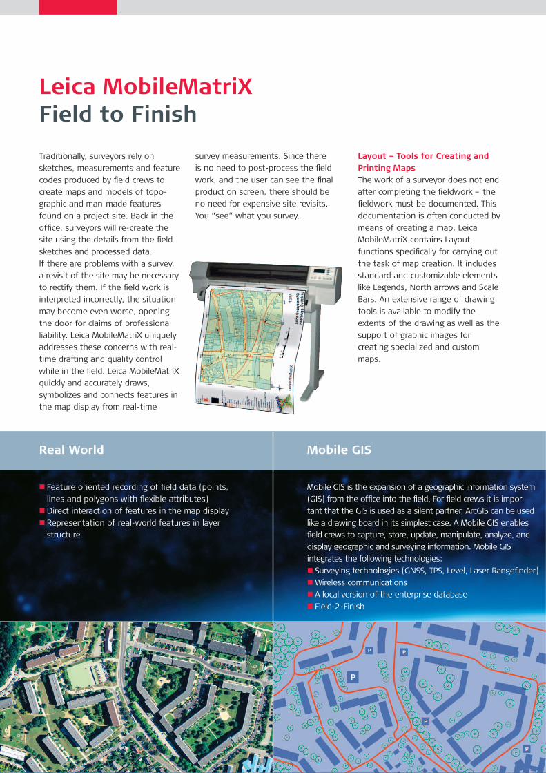
Layout – Tools for Creating and Printing MapsThe work of a surveyor does not end
after completing the fieldwork – the
fieldwork must be documented. This
documentation is often conducted by
means of creating a map. Leica
MobileMatriX contains Layout
functions specifically for carrying out
the task of map creation. It includes
standard and customizable elements
like Legends, North arrows and Scale
Bars. An extensive range of drawing
tools is available to modify the
extents of the drawing as well as the
support of graphic images for
creating specialized and custom
maps.
Real World
n Feature oriented recording of field data (points,
lines and polygons with flexible attributes)
nDirect interaction of features in the map display
n Representation of realworld features in layer
structure
Mobile GIS
Mobile GIS is the expansion of a geographic information system
(GIS) from the office into the field. For field crews it is impor
tant that the GIS is used as a silent partner, ArcGIS can be used
like a drawing board in its simplest case. A Mobile GIS enables
field crews to capture, store, update, manipulate, analyze, and
display geographic and surveying information. Mobile GIS
integrates the following technologies:
n Surveying technologies (GNSS, TPS, Level, Laser Rangefinder)
nWireless communications
n A local version of the enterprise database
n Field2Finish
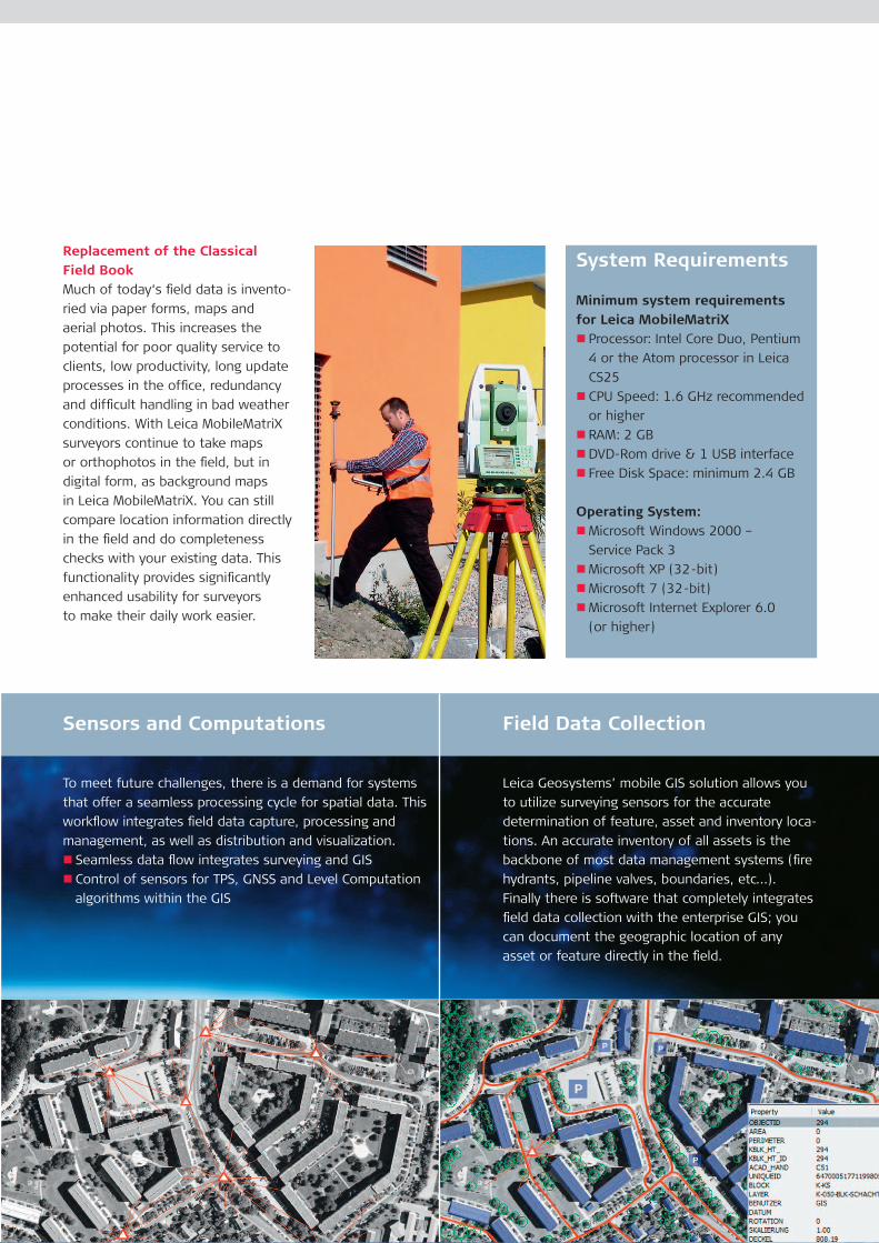
Replacement of the Classical Field BookMuch of today‘s field data is invento
ried via paper forms, maps and
aerial photos. This increases the
potential for poor quality service to
clients, low productivity, long update
processes in the office, redundancy
and difficult handling in bad weather
conditions. With Leica MobileMatriX
surveyors continue to take maps
or orthophotos in the field, but in
digital form, as background maps
in Leica MobileMatriX. You can still
compare location information directly
in the field and do completeness
checks with your existing data. This
functionality provides significantly
enhanced usability for surveyors
to make their daily work easier.
System Requirements
Minimum system requirements for Leica MobileMatriX
n Processor: Intel Core Duo, Pentium
4 or the Atom processor in Leica
CS25
n CPU Speed: 1.6 GHz recommended
or higher
n RAM: 2 GB
nDVDRom drive & 1 USB interface
n Free Disk Space: minimum 2.4 GB
Operating System: nMicrosoft Windows 2000 –
Service Pack 3
nMicrosoft XP (32bit)
nMicrosoft 7 (32bit)
nMicrosoft Internet Explorer 6.0
(or higher)
Field Data Collection
Leica Geosystems’ mobile GIS solution allows you
to utilize surveying sensors for the accurate
determination of feature, asset and inventory loca
tions. An accurate inventory of all assets is the
backbone of most data management systems (fire
hydrants, pipeline valves, boundaries, etc…).
Finally there is software that completely integrates
field data collection with the enterprise GIS; you
can document the geographic location of any
asset or feature directly in the field.
Sensors and Computations
To meet future challenges, there is a demand for systems
that offer a seamless processing cycle for spatial data. This
workflow integrates field data capture, processing and
management, as well as distribution and visualization.
n Seamless data flow integrates surveying and GIS
n Control of sensors for TPS, GNSS and Level Computation
algorithms within the GIS
Leica Geosystems AG Heerbrugg, Switzerland
www.leica-geosystems.com
Whether you have to map the location of a power pole, the run of a pipeline
or the area of a farm; whether you are downtown or out in the country;
whether you want to collect new features, or update and maintain the data
from your Geographic Information System: For collecting, verifying and
updating geographic data, Leica Geosystems offers the right solution – with
seamless data exchange between field system and office, for GIS workflow,
no matter which software performs your daily work.
When the data really counts, Leica Geosystems offers the right combination
of hardware and software: Fieldproven tough sensors use uptodate
technologies, such as terrestrial data collection with satellite navigation, Total
Stations, distance measurement tools, rangefinders or levels. And the wide
range of software solutions for field and office usage is compatible, scalable
and flexible. For accuracy and reliability where and whenever you need it.
When it has to be right.
Leica CS25 Datasheet
Leica Zeno GG02plusDatasheet
Leica Zeno GG01Datasheet
Total Quality Management – our commitment to total customer satisfaction.
Ask your local Leica Geosystems dealer for more information about our TQM program.
The Bluetooth® word mark and logos are owned by Bluetooth SIG, Inc. and any use of such marks by Leica Geosystems AG is under license. Other trademarks and trade names are those of their respective owners.
ArcGIS™ is a registered trademark of Environmental System Research Institute Inc. Redlands, USA. ESRI® word mark is owned by ESRI Inc, USA. Other trademarks and brand names belong to their respective owners.
Illustrations, descriptions and technical data are not binding. All rights reserved. Printed in Switzerland – Copyright Leica Geosystems AG, Heerbrugg, Switzerland, 2007. 742270en – 12.13 – galledia
Leica Viva TS15Product brochure
Leica DNAProduct brochure