(lac) system for wilderness planning
TRANSCRIPT

United States Department of Agriculture
Forest Service
Intermountain Forest and Range Experiment Station Ogden, UT 84401
General Technical Report INT-176
January 1985
The Limits of Acceptable Change (LAC) System for Wilderness Planning
George H. Stankey David N. Cole Robert C. Lucas Margaret E. Petersen Sidney S. Frissell
i

THE AUTHORS GEORGE H. STANKEY is a research social scientist with the Wilderness Management Research Work Unit at the Intermountain Station's Forestry Sciences Laboratory in Missoula, Mont. He received his Ph.D. in geography from Michigan State University in 1970. He is the author of a number of publications on wilderness and recreation management. DAVID N. COLE is a research ecologist with Systems for Environmental Management, P.O. Box 3776, Missoula, Mont. He is working cooperatively with the Intermountain Station's Wilderness Management Research Work Unit at the Forestry Sciences Laboratory in Missoula. Dr. Cole received his Ph.D. in geography from the University of Oregon in 1977. He has written several papers on wilderness campsite impacts and their management. ROBERT C. LUCAS is principal research social scientist and project leader of the Intermountain Station's Wilderness Management Research Work Unit at the Forestry Sciences Laboratory in Missoula. He has been with the Station since 1967. Dr. Lucas received his B.S., M.A., and Ph.D. from the University of Minnesota in 1957, 1959, and 1962, respectively. He also studied at the Free University of West Berlin, Germany, and at the University of Chicago. He has authored numerous publications dealing with wilderness management. MARGARET E. PETERSEN is a research forester at the Intermountain Station's Forestry Sciences Laboratory in Missoula. She received her M.S. in forestry from Oregon State University in 1980. Her interests include recreation use measurement, theories of visitor satisfaction, and visitor management techniques. SIDNEY S. FRISSELL is associate dean and professor of applied ecology and recreation management at the University of Montana School of Forestry. He holds a Ph.D. in forestry from the University of Minnesota. He has authored a number of papers on recreation and wilderness management.
ii

SUMMARY
This paper describes the Limits of Acceptable Change (LAC) system, a framework for establishing ac-ceptable and appropriate resource and social condi-tions in recreation settings. The LAC has been devel-oped in response to the need of managers for a means of coping with increasing demands on recreational areas in a visible, logical fashion. The LAC also represents a reformulation of the recreational carrying capacity concept, with the primary emphasis now on the conditions desired in the area rather than on how much use an area can tolerate.
The LAC is not a new idea. It is, however, the latest step in a continuing effort to improve wildland recrea-tion management through definition of more explicit, measurable objectives. Nine steps are involved in the overall process.
Step 1 involves identification of area concerns and issues. In addition to legal guidelines and organiza-tional policy, management of an area needs to reflect area-specific features and values in order that the role of the area at both regional and national levels can be assessed.
In step 2, opportunity classes are defined and described. Opportunity classes represent subunits of the area where different conditions are provided, thereby increasing the diversity of the area. These differences are measured through indicators, identified in step 3, representing resource and social conditions for which management is striving. Indicators should be capable of quantitative measurement.
In step 4, the existing condition of the resource and social conditions is inventoried. These data are recorded and mapped, and serve as the basis for the definition, in step 5, of standards for each indicator in each opportunity class. Basing the standard on inven-tory data helps ensure realism and also clarifies the nature and extent of management activity that will be required to achieve standards.
Step 6 involves identification of alternative alloca-tions of the area among the various opportunity classes. Because different allocations will require different types of management, step 7 requires an analysis of the various costs and benefits of each al-ternative, in terms of environmental impacts and im-pacts on visitors as well as administrative costs.
In step 8, the costs and benefits of each alternative are evaluated and a final alternative is selected. This final selection will reflect the responsiveness of the al-ternative to the issues and concerns identified in step 1 and the management requirements identified in step 7.
Step 9 involves implementation of the selected alter-native and establishment of a monitoring program. Monitoring is particularly important as it provides feedback on the effectiveness of the management ac-tions employed, alerting managers to the need to con-sider more rigorous application or the use of other measures.
To demonstrate how these nine steps can lead to an effective management program, a hypothetical case example is described.
iii

CONTENTS Page
Introduction ........................................................ 1 Recreational Impacts—Focus of the LAC Process ........................................................ 1 The LAC Process ................................................ 2 The Procedure ...................................................... 3 Step 1: Identify Area Issues and Concerns .............................................................. 4 Step 2: Define and Describe Opportunity Classes ................................................................. 6 Step 3: Select Indicators of Resource and Social Conditions ................................................. 9 Step 4: Inventory Existing Resource and Social Conditions ............................................... 11 Step 5: Specify Standards for Resource and Social Indicators for Each Opportunity Class ..................................................................... 12 Step 6: Identify Alternative Opportunity Class Allocations Reflecting Area Issues and Concerns and Existing Resource and Social Conditions ......................................... 14 Step 7: Identify Management Actions for Each Alternative ........................................................... 16 Step 8: Evaluation and Selection of a Preferred Alternative ........................................... 18 Step 9: Implement Actions and Monitor Conditions ........................................................... 19 Establishing Use Limits ...................................... 20 An Application of the Planning Process ........... 21 Step 1: Identify Area Issues and Concerns .............................................................. 21 Step 2: Define and Describe Opportunity Classes .................................................................. 22 Step 3: Select Indicators of Resource and Social Conditions ................................................ 23 Step 4: Inventory Existing Resource and Social Conditions ................................................ 25 Step 5: Specify Standards for Resource and Social Indicators for Each Opportunity Class ...................................................................... 29 Step 6: Identify Alternative Opportunity Class Allocations Reflecting Area Issues and Concerns and Existing Resource and Social Conditions ......................................... 30 Step 7: Identify Management Actions for Each Alternative ........................................................... 32 Step 8: Evaluation and Selection of a Preferred Alternative ........................................... 33 Step 9: Implement Actions and Monitor Conditions ............................................................ 33 Summary .............................................................. 34 References ............................................................. 34
iv
The Limits of Acceptable Change (LAC) System for Wilderness Planning
George H. Stankey David N. Cole Robert C. Lucas Margaret E. Petersen Sidney S. Frissell
Recreational Impacts—Focus of the LAC Process
INTRODUCTION A major goal of wilderness management is to maintain or restore the
qualities of naturalness and solitude. These qualities, however, are threatened by a variety of human-induced changes from within as well as outside wilderness boundaries. For example, growth in wilderness recreation use, averaging over 4 percent annually for the past 15 years (Petersen 1981), has made protection of these qualities difficult. Similarly, external impacts, such as air and water pollution, threaten these values.
Changes from recreation use could be eliminated if all such use was pro-hibited. Recreation, however, is a recognized, legitimate use of wilderness and, with a few minor exceptions, such prohibitions are neither possible nor feasible. Even substantial reductions in use are of limited practicality, given that even light use can produce substantial impacts, particularly on vegetation and soils. And, even if eliminating recreation use were possible, human-induced change from nonrecreation sources, both within and outside the area, would remain a problem.
The challenge is not one of how to prevent any human-induced change, but rather one of deciding how much change will be allowed to occur, where, and the actions needed to control it. In this paper, we propose the Limits of Acceptable Change (LAC) system in which the amount of change to be allowed is defined explicitly by means of quantitative standards, the appropriate management actions needed to prevent further change are identified, and procedures for monitoring and evaluating management performance are established.
The LAC process requires managers to define desired wilderness conditions and to undertake actions to maintain or achieve these conditions. A variety of influences affect these desired conditions, including recreation, fire control, grazing, and mining. Modern methods of fire detection and control, for example, have led to major departures from natural succes-sional patterns. Implementation of wilderness fire management plans, however, is gradually leading to a restoration of fire to a role more closely resembling natural historic patterns. Grazing and mining impacts can be severe, especially on a local scale, but overall they are minor. For example, a national survey of wilderness managers revealed that seldom were non-recreational uses a source of problems in more than 10 percent of the areas surveyed. On the other hand, recreation-related problems, either social or biophysical, were a problem in anywhere between one-fourth and three-fourths of the areas (Washburne and Cole 1983).
1

Thus, our emphasis is on the management of recreational impacts. Recreation use occurs in virtually all wildernesses, whereas many of the so-called "allowable but nonconforming" uses are restricted to only some areas. Recreation is a value endorsed in the definition of wilderness; specific legal provisions legitimize mining and grazing, but they are clearly exceptions to the general purposes of wilderness. Moreover, nonrecrea-tional uses are protected by law and are covered by administrative guidelines; therefore, a land manager's responses to such uses are limited.
Finally, legislative and administrative guidelines on wilderness manage-ment emphasize the need to deal with recreation use and its associated im-pacts on wilderness values. For example, in the regulations implementing the National Forest Management Act (NFMA), Section 219.18(a) states that the portion of forest plans providing direction for wilderness management will: "provide for limiting and distributing visitor use of specific portions in accord with periodic estimates of the maximum levels of use that allow natural processes to operate freely and that do not impair the values for which wilderness areas were created" (Federal Register 1982).
Despite having taken the position that recreation is an appropriate focus of concern for the LAC system, we want to emphasize that we recognize that wilderness management involves more than recreation. The 1964 Wilderness Act reminds us that wilderness is to be managed in such a manner "so as to provide for the protection of these areas (and) the preservation of their wilderness character." The Act goes on to say that "wilderness areas shall be devoted to the public purposes of recreational, scenic, scientific, educational, conservation, and historical use." Clearly, recreation is only one of the purposes of wilderness and is a purpose that can be served only to the extent that the essential wilderness character of the area is protected. Managers are faced, therefore, with the dilemma of having to accommodate human use yet preserving an area's wilderness quality. The LAC process outlined in this paper is intended to provide a framework for dealing with this dilemma.
THE LAC PROCESS The LAC process gives primary attention to the wilderness conditions that
exist and that are judged acceptable. Managers are interested in achieving certain conditions and in the relative effects of different management actions to achieve those conditions. Because use levels are of limited value in predicting either social or ecological impacts (Washburne 1982), this process focuses on defining what management actions are needed to achieve certain wilderness conditions. In summary, the process requires deciding what kind of wilderness conditions are acceptable, then prescribing actions to protect or achieve those conditions.
Explicit recognition of the importance of providing diverse wilderness conditions and the implementation of management actions to achieve or maintain conditions is also an important part of the LAC process. Given that any use produces at least some impact, the process requires managers to identify where, and to what extent, varying degrees of change are appropriate and acceptable. The conditions that characterize a particular type of opportunity and that distinguish it from others are specified by measurable objectives defining limits of acceptable change (Lime 1970; Frissell and Stankey 1972).
2

The Procedure
The LAC process consists of four major components: (1) the specification of acceptable and achievable resource and social conditions, defined by a series of measurable parameters; (2) an analysis of the relationship between existing conditions and those judged acceptable; (3) identification of management actions necessary to achieve these conditions; and (4) a program of monitoring and evaluation of management effectiveness. These four components are broken down into nine steps to facilitate application.
This process can substantially improve wilderness management. For Forest Service managers it will satisfy several NFMA mandates: it follows general planning guidelines, establishes a monitoring program, and, where necessary, provides estimates of maximum levels of use. The basic features of the planning process can also be applied to wildernesses managed by other Federal and State agencies.
The LAC approach to wilderness planning is not a new idea. It represents the latest step in efforts to improve definition of both inputs to and outputs from the planning process. It derives from a management-by-objectives (MBO) approach to planning and is conceived of as a dynamic, continuing process. Such an approach is described in Hendee and others (1978) and is related to the design capacity idea discussed by Godin and Leonard (1977) and to the framework described by Frissell and others (1980).
The planning procedure consists of a series of interrelated steps leading to development of a set of measurable objectives that define desired wilderness conditions (see fig. 1). It also identifies the management actions necessary to maintain or achieve those conditions.
As presented here, the LAC is only a conceptual process—not policy. It requires field application by managers who will, through their experience, modify it and improve upon it. From such experience, wilderness management agencies will be better able to incorporate the LAC into their particular resource management decisionmaking machinery.
PLANNING SYSTEM
Figure 1.—The Limits of Acceptable Change (LAC) planning system.
3

STEP 1: IDENTIFY The purpose of step 1 is to identify those public issues and managerial AREA ISSUES AND concerns that relate to (1) distinctive features and characteristics of the CONCERNS wilderness area and (2) the relationship of the individual area to other
units of the wilderness system and to nonwilderness areas offering primitive recreation opportunities. General management direction for every wilderness is based on the Wilderness Act, related legal guidelines, and organizational policy. This step builds on that foundation, refining management direction to deal with the specific situation in each area. In step 1, managers could consider matters such as:
1. Does the area contain outstanding ecological, scientific, recreational, educational, historic, or conservation values that warrant special attention?
2. Does the area provide critical habitat for threatened or endangered species?
3. Has public input identified areas or issues that merit special attention?
4. Do land uses on contiguous areas represent situations requiring special management attention (are timber harvests planned, are changes in access likely)?
5. Are there existing or potential nonconforming uses in the area that will require special attention?
6. Are there regional and/or national issues that need consideration: a. What is the availability of wilderness and dispersed recreation
opportunities in the planning region? b. What is the regional demand for wilderness and dispersed
recreation? c. Are the physical-biological features of the area found elsewhere in
the region or does it possess unique features? d. Are the types of recreation opportunities offered by the area avail
able in other wildernesses or does the area offer opportunities not found elsewhere (are opportunities for long-distance backcountry horse riding available in many other areas or just this one)?
Answers to such questions help managers identify the values of the area and its role in the region and in the Wilderness System. For example, in a large wilderness with a stable grizzly bear population and a healthy eco-system to support it, managers might emphasize ecosystem protection and minimize human disturbance. In another area, management direction might feature maintenance of outstanding opportunities for horse use (fig. 2). Establishing such area-specific direction maximizes the diversity of resource and social conditions provided by the Wilderness System.
There will be varying abilities to answer these questions and varying levels of detail developed in response to them. Managers should remember that the purpose here is to gain a better understanding of the role of the area in a larger regional setting and not let the inability to perform a comprehensive analysis hold up completion of the step.
Some issues and concerns identified in step 1 might be incompatible. For example, managers might identify solitude as a major value in the area, while there is public support for increased access. There is no simple way of resolving such conflicts. The inevitable diversity of tastes and preferences highlights the importance of examining individual wildernesses within a regional framework. In step 6, managers can accommodate these diverse concerns as they allocate the area to different opportunity classes.
4

Figure 2.—Some areas may provide special provisions for horse use.
In summary, step 1 involves the following purposes, processes, and products:
PURPOSE • To identify features or values of particular concern to be maintained
or achieved • To identify specific locations of concern • To provide a basis for the establishment of management objectives • To guide the allocation of land to different opportunity classes
PROCESS • Identify issues raised during public involvement • Identify concerns raised by resource managers, planners, and
policymakers • Review agency policy • Analyze regional supply and demand • Analyze opportunities in the area from a regional and national
perspective
PRODUCT • Narrative writeup identifying unique values and special opportunities
to be featured in area's management and problems requiring special attention
5

6
STEP 2: DEFINE AND DESCRIBE OPPORTUNITY CLASSES
In step 2, we define a series of opportunity classes for the wilderness. An opportunity class provides a qualitative description of the kinds of resource and social conditions acceptable for that class and the type of management activity considered appropriate. Opportunity classes are not on-the-ground allocations, nor are they derived from specific conditions found within the area. They are, instead, hypothetical descriptions of the range of conditions that managers consider likely to be maintained or restored in the area. The opportunity class definition provides a rationale against which the appropriateness of indicators (step 3), standards (step 5), and management actions (step 7) can be tested.
The designation of opportunity classes follows the basic Recreation Op-portunity Spectrum (ROS) system (USDA Forest Service n.d.; Buist and Hoots 1982; Driver and Brown 1978; Clark and Stankey 1979a). As presently used, the ROS defines six classes: Primitive; Semiprimitive Non-motorized; Semiprimitive Motorized; Roaded Natural; Rural; and Urban. Typically within wilderness areas, the Primitive and Semiprimitive Non-motorized classes would apply. In general terms, these two classes can be characterized as follows:
Primitive Area is characterized by essentially unmodified natural environment of fairly large size. Interaction between users is very low and evidence of other users is minimal. The area is managed to be essentially free from evidence of human-induced restrictions and controls. Motorized use within the area is not permitted.
Semiprimitive Nonmotorized Area is characterized by a pre-dominantly natural or natural-appearing environment of moderate-to-large size. Inter-action between users is low, but there is often evidence of other users. The area is managed in such a way that minimum onsite controls and restrictions may be present, but are subtle. Motor-ized use is not permitted.
These setting descriptions are broad and within each it is possible to describe several subclasses. For example, at major entry points, use levels can be relatively high, with fairly frequent contact among parties. Similarly, resource impacts can be moderately substantial in these areas. Elsewhere in the same wilderness there are areas where few visit and where ecological conditions are almost undisturbed. Between these extremes there is a continuum of conditions, all within the wilderness. It would be very difficult to eliminate this internal variability, short of a highly regulated system of entry. Thus, managers need to consider provision of a range of conditions within wilderness boundaries to achieve resource and social objectives.
Step 2 requires managers to select and name a set of opportunity classes that reflect the range of conditions they wish to provide in the area. In small areas, perhaps only one class would suffice, while in large areas, perhaps four to six would be needed. In choosing classes, managers need to consider both the range of conditions that exist as well as the conditions they might want to achieve.
7
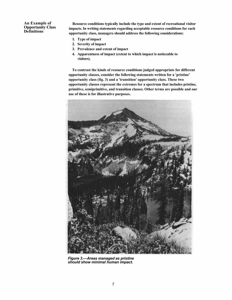
An Example of Opportunity Class Definitions
Resource conditions typically include the type and extent of recreational visitor impacts. In writing statements regarding acceptable resource conditions for each opportunity class, managers should address the following considerations:
1. Type of impact 2. Severity of impact 3. Prevalence and extent of impact 4. Apparentness of impact (extent to which impact is noticeable to
visitors).
To contrast the kinds of resource conditions judged appropriate for different opportunity classes, consider the following statements written for a 'pristine' opportunity class (fig. 3) and a 'transition' opportunity class. These two opportunity classes represent the extremes for a spectrum that includes pristine, primitive, semiprimitive, and transition classes. Other terms are possible and our use of these is for illustrative purposes.
Figure 3.—Areas managed as pristine should show minimal human impact.
8
Pristine Resource impacts are minimal; restricted to minor temporary loss of vegetation where camping occurs and along some travel routes. Impacts typically recover on an annual basis and are subtle in nature, generally not apparent to most visitors.
Transition Resource impacts found in many locations and some can be substantial in a few places such as near major entry points. Impacts often persist from year to year. May be substantial loss of vegetation and soil at some sites. Impacts are readily apparent to most visitors.
Social conditions must also be covered in the description. Hence, managers should consider levels and types of encounters occurring in the opportunity class. Specifically, the description should address:
1. Extent of interparty contact 2. Location of interparty contact. Again, to compare conditions in a pristine opportunity class with those in a
transition opportunity class, consider the following:
Pristine Few, if any, contacts with other groups. Contact limited to trails; camping out of sight and sound of others almost always possible.
Transition Contact with others moderately frequent. Fairly high level of interparty contact can occur, both while on the trail and while camped.
Such descriptions describe very different kinds of social settings for these two opportunity classes. They indicate that the pristine opportunity class will provide high levels of solitude while the transition opportunity class is an area of use concentration and fairly frequent contact.
Finally, managers need to provide descriptive statements of managerial conditions. The managerial condition is an especially important part of the description because it establishes a framework for what will be done to achieve resource and social conditions. A clear description of appropriate management conditions is important because standards will not be prescribed in step 5 as they are for desired resource and social conditions. Why? Because management conditions deal primarily with the means by which the resource and social conditions, as expressed in the standards, will be achieved. A carefully developed description addresses the following kinds of management issues:
1. Presence of management personnel 2. Onsite versus offsite management strategies 3. Site modification 4. Rules and regulations on behavior.

Comparing the managerial settings in the pristine opportunity class with
those in the transition opportunity class, the descriptors might read as follows:
STEP 3: SELECT INDICATORS OF RESOURCE AND SOCIAL CONDITIONS
Pristine Direct onsite management of visitors not practiced. Little or no evidence of site management. Necessary rules and regulations communicated to visitors outside the area. Little evidence of management personnel.
Collectively, these narrative descriptions of the resource, social, and managerial conditions for each opportunity class constitute the management objectives for the area. They describe the conditions sought in the wilderness and serve as criteria for identifying what and where specific management actions are needed (Hendee and others 1978). These objectives serve throughout the process to determine what types of information are needed, what standards need to be developed, the appropriateness of various activities, and what management actions need to be instituted.
Transition Extensive use of onsite manage-ment and site modification. Rules and regulations enforced with signs and management personnel in the area. Sub-stantial use of regulations to influence visitor behavior.
The purpose, process, and product of step 2 can be summarized as follows: PURPOSE
• To facilitate the provision and maintenance of inter- and intra-area diversity
PROCESS • Review information collected during step 1 concerning area issues
and concerns and select number and names of opportunity classes PRODUCT
• Narrative descriptions of resource, social, and managerial conditions defined as appropriate and acceptable for each opportunity class
The preceding two steps provide managers with generalized descriptors of the desired condition. In step 3, we move on to identify indicators-specific variables—that, singly or in combination, are taken as indicative of the condition of the overall opportunity class. Such measures allow managers to unambiguously define desired conditions and to assess the effectiveness of various management practices.
To develop these more specific statements, managers need to first review the broadly defined issues and concerns in step 1 that require attention. For example, there might be concern with issues such as excessive use levels along trails in the area or with the amount of biophysical impact at campsites. We can describe these broad categories of issues or concerns as factors. The following list covers likely topics:
Suggested Resource and Social Factors Resource
1. Trail conditions 2. Campsite conditions 3. Water quality 4. Air quality 5. Wildlife populations
Social 1. Solitude while traveling 2. Campsite solitude 3. Conflicts between visitors with
different travel methods 4. Conflicts regarding party size 5. Noise 6. Threatened and endangered species
7. Range condition
9

Within these broad categories, however, managers will need to identify one or
more indicators that reflect the overall condition of the factor. For example, campsite condition encompasses a number of concerns; what specific indicators should be selected for measurement? Criteria that can help guide selection of indicators would include:
1. The indicator should be capable of being measured in cost-effective ways at acceptable levels of accuracy.
2. The condition of the indicator should reflect some relationship to the amount and/or type of use occurring.
3. Social indicators should be related to user concerns. 4. The condition of the indicator should be, at least potentially, responsive to
management control. Thus, indicators that could be used to measure campsite condition might
include total area of bare ground, number of damaged trees in the campsite area, soil compaction, or a composite index reflecting overall campsite condition. For a factor such as campsite encounters, indicators might include the number of other persons camped within sight or sound or the total number of sites located within some unit area.
There are many publications that are useful in identifying indicators and in deciding how information on that indicator can best be collected. A general discussion of the concept of indicators is found in Van der Smissen (1975). For campsite conditions, readers are urged to review Frissell (1978); Hendee and others (1976); Cole (1981, 1982, 1983); Cole and Schreiner (1981); Cole and Dalle-Molle (1982); Bratton and others (1978); Parsons and MacLeod (1980). Resource conditions along trails are discussed in Dale and Weaver (1974); Weaver and Dale (1978); Leonard and Whitney (1977); Cole (1982); Cole and Schreiner (1981); Helgath (1975). Publications on water quality include Barton (1969); McFeters (1975); Silverman and Erman (1979); Taylor and Erman (1979, 1980); King (1971); Stanley and others (1979). Sanitation impacts are discussed in Leonard and Plumley (1979); Stanley and others (1979); Temple and others (1980, 1982). Discussions of wildlife impacts are in Ream (1979, 1980); Neil and others (1975).
Many papers explore the question of acceptable and appropriate contact levels along trails and at the campsite. Examples would include Stankey (1973, 1980); Lee (1977); Absher and Lee (1981); Bultena and others (1981); West (1981); Schreyer and Roggenbuck (1978); Shelby (1980). Helpful information on how such information might be collected is found in Leonard and others (1980); Shechter and Lucas (1978). Discussion of conflicts concerning noise levels can be found in Dailey and Redman (1975); Clark and Stankey (1979b); Harrison and others (1980).
Probably no single indicator constitutes a comprehensive measure; it will reflect only a portion of what the objective seeks to achieve. For example, if provision of outstanding opportunities for solitude is the objective, managers might use indicators such as the number of interparty contacts while on the trail or while at the campsite. If, for example, interparty contacts can be held to two or less per day while traveling, the objective of providing outstanding opportunities for solitude presumably has been attained. Other factors, such as whether contact is with a horse or hiker party, also influence whether or not the objective is achieved. Thus, two or more indicators can be used as a way of comprehensively measuring performance in terms of the objectives.
10

STEP 4: INVENTORY EXISTING RESOURCE AND SOCIAL CONDITIONS
It is important to select indicators that relate as directly as possible to the objective. For example, managers might select use density (visitor-days per 1,000 acres or hectares) as the indicator for a solitude objective. Varying density levels would be specified as standards for the different opportunity classes. The linkage between density and subsequent interparty contact levels is indirect and weak, however, especially for dispersed recreation opportunities. Thus, the choice of density as an indicator would be less useful than a contact indicator directly related to solitude.
In summary, step 3 involves the following: PURPOSE
• Identify specific variables to guide inventory process (step 4) • Provide basis for identifying where and what management actions are
needed PROCESS
• Review information outlined in descriptions (step 2) • Review issues and concerns regarding specific conditions identified in
step 1 and select factors that reflect these issues and concerns PRODUCT
• List of measurable resource and social indicators (preferably quantifiable)
The inventory is guided by the indicators selected in step 3. The indicators specify the variable) s) inventoried; they also identify the unit of analysis. For example, managers might be concerned about water quality. In selecting indicators that will define water quality standards, they might select coliform counts in lakes or streams adjacent to campsites. Thus, the resulting water quality inventory has a specific focus that defines what data are to be collected and where. During the inventory, data need to be collected that provide information on the coliform counts throughout the area.
To be of value to managers, the inventory must be conducted in an objective and systematic fashion. If not, the data will be of limited value.
Inventory data provide managers with the range of conditions of the in-dicators. Such information can be recorded directly onto base maps, providing easy analysis of its spatial patterns. This will be helpful when, in step 6, managers consider different allocations of opportunity classes across the area, as it facilitates comparison between existing conditions and those defined as acceptable for an opportunity class.
Resource inventories can be conducted at different levels of detail. Often, managers will have inventory data from previous fieldwork or they may have partially completed inventory data (fig. 4). While it is obviously most desirable to have an up-to-date comprehensive inventory of the condition of the selected indicators, managers may have to work with data that are less than complete or current. Where this is the case, the limits of the data should be carefully documented and an improved database should be a priority in scheduling the monitoring phase in step 9.
Step 4, in summary, involves the following: PURPOSE
• Knowing the range of conditions helps establish meaningful standards
• Helps in decisions on allocations of land to different opportunity classes
11
• Critical step to knowing where and what management actions will be needed

12
PROCESS • and map resulting information PRODUCT • wilderness
Figure 4.—I
nventorying campsite condition is an important step in the LAC system.
STEP 5: SPECIFY STANDARDS FOR RESOURCE AND SOCIAL INDICATORS FOR EACH OPPORTUNITY CLASS
Standards Follow Descriptors
In step 5, the task is to assign quantitative or highly specific measures to the indicators. This greater specificity is obtained by establishing standards—measurable aspects of the indicators defined in step 3. These standards provide a base against which a particular condition can be judged as acceptable or not.
Using data collected in step 4, it is possible to specify standards that describe the acceptable and appropriate conditions for each indicator in each opportunity class. Setting standards is a judgmental process; how-ever, the process is logical, traceable, and subject to public review.
Standards are not just idealistic goals; they are conditions that managers feel can be achieved over a reasonable time. In some cases, standards might be merely statements of current conditions. In other cases, standards can be written to purposively direct modification of wilderness conditions, typically, but not necessarily, towards a more natural state.
Basically, then standards should be stringent enough to be meaningful, but not so stringent they cannot be attained.
Three general guidelines apply to the process of establishing standards:
The qualitative descriptions developed in step 2 provide clues as to the kinds of conditions characterizing each opportunity class. For example, if

13
a description written for a "transition" zone suggests that "contacts are fairly frequent while traveling," managers could use the inventory data to help specify how "fairly frequent" might be quantitatively defined. The inventory data might show that contact levels on trails near major entry points average 10 to 15 parties per day. These data could be utilized to help set the standard for the "average contacts with others per day" indicator to define the transition opportunity class.
It is important that the standards not routinely accommodate existing conditions. For example, there will be places where existing conditions have deteriorated to the point that they no longer represent acceptable wilderness conditions, despite the area's legal classification. In such cases, managers are legally bound to restore these areas to a condition that is, at the minimum, acceptable in wilderness. The LAC process in no way condones maintenance of conditions unacceptable in wilderness. And, even if existing conditions are judged as minimally acceptable, managers should seek opportunities to improve them through establishment of more stringent standards.
In formulating standards, there needs to be a balance between using existing conditions to lend realism to the specific standards on the one hand, and using professional judgment along with public input to set the standards at levels that can lead to an improvement in conditions.
Standards Describe a
Range of Conditions As one moves across the opportunity classes for any given indicator, the standards should describe a logical progression or gradation of conditions. For example, managers might select "other parties camped within sight or sound at night" as an indicator for solitude. In the pristine opportunity class, the description might read "very high chances for solitude." For this class, a standard of "no other parties camped within sight or sound" might be prescribed. Then, moving on to the other opportunity classes and remembering that the intent is to provide a logical progression or gradation of conditions relative to this particular indicator, managers might set standards of "no more than 1," "no more than 2," and "no more than 4," for the primitive, semiprimitive, and transition opportunity classes, respectively.
On occasions, the standards set for an indicator might be shared by two or more opportunity classes; however, they will be distinguished by other indicators. For example, the standards set for an indicator such as "number of other parties camped within sight or sound" might be the same for the "primitive" and "semiprimitive" opportunity classes. Shared standards are particularly appropriate where the range of conditions is low. Again, the descriptors will help managers decide when shared standards should be adopted.
While a progression of standards across opportunity classes will be typical, there might be certain conditions that apply areawide and that do not discriminate between classes. Examples include air quality and water quality. Also, baseline standards might prescribe conditions that must be met in all areas; namely, under no situation could a condition in a wilderness fall below this baseline standard. Regionwide standards have been implemented in Forest Service Regions 2 and 6 and provide managers with a clear guideline as to minimum performance standards. Such baseline standards do not preclude more stringent standards within individual areas.

14
Standards Express the Typical Situation
STEP 6: IDENTIFY ALTERNATIVE OPPORTUNITY CLASS ALLOCATIONS REFLECTING AREA ISSUES AND CONCERNS AND EXISTING RESOURCE AND SOCIAL CONDITIONS
Standards are often best expressed in terms of probabilities. For example, a standard for daily contacts while traveling in the primitive opportunity class might be expressed as: "Interparty contact levels on the trail will not exceed two per day on at least 90 percent of the days during the summer use period." This recognizes the fact that the high degree of resource and social variability in a complex wilderness system often makes specific, absolute standards unrealistic.
Choosing indicators and writing standards are crucial steps as they, to a great extent, determine the future character of the wilderness. Public input, research information, and managerial experience will be helpful guides. There is no need, however, to be paralyzed by concerns as to whether the "right" indicators have been chosen or whether the standards are "correct." As noted earlier, the process is judgmental and state of the art (Clark 1982). Because monitoring and evaluation are an integral part of this procedure, management will be able to revise indicators and standards in response to improved information. Moreover, the judgments are made in a visible fashion so that they can be reviewed by others.
In summary, step 5 involves the following: PURPOSE
• To provide a means whereby it is possible to evaluate where and what management actions are needed by permitting comparison of existing conditions with those defined as acceptable for each indicator in each opportunity class
PROCESS • Review opportunity class descriptions developed in step 2 • Analyze inventory data collected in step 4 for each indicator
PRODUCT • A table of specific (quantified where possible) measures of acceptable
conditions for each indicator in each opportunity class
The objective in step 6 is to decide what resource and social conditions (in the form of specific standards) are to be maintained or achieved in specific areas of the wilderness. This is a prescriptive step (it is concerned with establishing what should be), and input from both managers and the public should be used to make these decisions. Step 6 initially involves an analysis of the inventory data collected in step 4, along with the area issues and concerns identified in step 1. These issues and concerns, however, do not prescribe what should be done. They have to be balanced against the realities of what exists, as revealed by the maps of existing condition for each indicator, as well as what is possible in terms of agency resources.
Maps of alternative opportunity classes, reflecting both area issues and concerns and existing resource and social conditions, result from step 6. Some issues might prove mutually contradictory ("increase opportunities for easier access into most portions of the wilderness" and "provide greater opportunities for solitude"). Managers could respond in a variety of ways. They might attempt to provide the full range of opportunity classes in sufficient amounts to satisfy the varying demands. Or, they might elect to manage primarily for only a couple of the opportunity classes, on the grounds that the other classes are adequately represented elsewhere in the region. Finally, they might propose a variety of manage-

15
The LAC Process and the Concept of Nondegradation
ment alternatives that reflect a range of opportunity class mixes. Through such variations, it would be possible to offer a diverse range of conditions for public review and consideration.
The relationship of the LAC process to the concept of nondegradation merits special comment. One possible opportunity class allocation might involve a decision to allow a change in resource or social conditions. Managers might accommodate higher use levels in an area where current resource conditions show little human modification. To let use levels rise will mean that resource conditions will deteriorate from their currently pristine character. Similarly, current low levels of contact among recreationists likely will rise.
The nondegradation concept calls for maintenance of present resource conditions if they equal or exceed minimum standards and the restoration of below-minimum levels. Applied to wilderness, the concept seeks to prevent degradation of current naturalness and solitude in each wilderness and to restore substandard settings to minimum levels (Hendee and others 1978). Thus, a management alternative such as that outlined above apparently would violate the nondegradation concept.
While accepting the essential features of the nondegradation concept, there are some important related issues that need to be considered. First, a major rationale underlying application of the concept to wilderness is to prevent the conditions found in some heavily used wildernesses (fig. 5) serving as the minimally acceptable level to which other areas would be allowed to deteriorate. In other words, these heavily impacted areas were not to serve as a precedent for conditions elsewhere.
Figure 5.—Heavily impacted campsites detract from the wilderness experience.

STEP 7: IDENTIFY MANAGEMENT ACTIONS FOR EACH ALTERNATIVE
Second, with rigorous application of the nondegradation concept, current conditions would set a base below which standards could not be set (they could be set higher). Future recreational demands thus could not be ac-commodated in opportunity classes where current conditions are very high, as the impacts associated with this demand would result in the standards being exceeded.
While application of the nondegradation concept throughout a wilderness would ensure long-term preservation of areas where pristine conditions currently exist, it would also accelerate the imposition of stringent management actions, such as rationing.
Protection of pristine conditions is important, particularly because once lost, such conditions cannot be regained in any reasonable time span. At the same time, to never allow conditions to become more impacted than at present imposes certain implications and costs on managers and visitors alike. It is our view that alternatives that involve acceptance of increased impact levels be carefully considered. The LAC process facilitates such consideration by outlining the various costs and benefits and by identifying what management actions will be needed to accomplish objectives.
In summary, step 6 involves the following: PURPOSE
• A step toward defining what resource and social conditions will be provided in different parts of the wilderness
• Provision of allocation alternatives for public review and evaluation PROCESS
• Review information obtained from area issues and concerns, step 1
• Review information contained in opportunity class descriptions, step 2
• Review information derived from inventory of existing conditions of indicators, step 4
PRODUCT • Maps and tabular summaries of alternative opportunity class
allocations
After alternative packages of opportunity classes have been formulated, managers need to identify the differences, if any, that exist between current conditions (inventoried in step 4) and the standards (identified in step 5). This will identify places where problems exist and what management actions are needed. Then managers need to consider what actions will be instituted to achieve the conditions specified by each alternative and to evaluate the costs and appropriateness of implementing these actions. If an alternative calls for a set of opportunity areas that closely match the current situation, the management actions needed to achieve this might not be too costly. On the other hand, if a major change is proposed, the needed management might involve considerable costs.
Where existing conditions are better than standards, there is little need for change in management, although there might be a need to evaluate whether existing actions should be changed or eliminated. Where conditions are close to or substantially worse than standards, managers must consider new actions.
16
For any given alternative, there likely will be a number of possible management actions that could be undertaken to achieve the standards. The qualitative descriptions for each opportunity class developed in step 2

serve as guidelines as to whether or not a particular management action is appropriate. However, these descriptions are not iron-clad rules—they are guidelines, not standards. As a general rule, apply the "principle of mini-mum regulation" (Hendee and others 1978); use only that level of control necessary to achieve a specific objective.
If existing resource and social conditions are consistent with the oppor-tunity class designation, then the management actions typically should be consistent with that designation. If, on the other hand, the existing resource and social conditions differ from those desired, then the management actions needed to achieve those standards, consistent with the necessity and minimum regulation proviso, should be employed, even if they are not consistent with the management condition descriptor written in step 2.
For example, if a currently heavily impacted area were to be converted to a pristine condition, intensive management would be needed. Such a program might include restrictions on where and how long visitors could camp, restriction of recreational stock, and closures of certain areas (fig. 6). Normally, such actions would be inappropriate in the pristine opportunity class, but without such measures it would be difficult to achieve management objectives in any reasonable time span. Hence, more restrictive management is imposed until appreciable gains are made toward achieving the standards.
Figure 6.—Camping areas may be closed to allow revegetation.
17

STEP 8: EVALUATION AND SELECTION OF A PREFERRED ALTERNATIVE
Managers should remember that standards define minimally acceptable conditions sought in an area. Nevertheless, such standards do not preclude providing protection in part of an opportunity class above that specified by the standards. Many areas consist of frequently visited valley-bottom trail corridors bounded by trailless, relatively pristine valley walls. By maintaining conditions better than the standard requires, further diversity in wilderness conditions is achieved.
In summary, step 7 involves the following: PURPOSE
• Step toward evaluating the costs of implementing each alternative • Step toward selecting a specific management program
PROCESS
• Review the managerial condition portion of the opportunity class description defining the appropriate types of actions
• Analyze the differences between existing conditions and those defined as acceptable by the standards
• Analyze the alternative management actions for bringing existing conditions in line with standards
PRODUCT • List or map of all places where existing conditions are worse than
standard and identification of what management actions would best bring conditions up to standard
The selection of a preferred alternative will reflect the evaluation of both managers and concerned citizens. There is no simple formula regarding how such a decision is made. Some questions to guide this selection are:
1. What user groups are affected and in what ways (does it facilitate or restrict use by certain groups)?
2. What values are promoted and which are diminished? 3. How does a particular alternative fit into the regional and/or
national supply and demand considerations? Does the alternative contribute a unique kind of wilderness setting to the system?
4. What is the feasibility of managing the areas as prescribed, given constraints of personnel, budgets, etc.?
In the analysis of the alternatives, a variety of costs need to be considered. These would include the financial costs (personnel, materials), information costs (costs associated with acquiring information needed to implement actions), opportunity costs associated with not carrying out a proposed action, and other resource and social costs. These latter costs are difficult to quantify, particularly in monetary terms, but they are extremely important (Lucas 1982).
While it is difficult to measure the costs and benefits of the various al-ternatives, their presence or absence usually can be identified. For example, managers usually can identify the kinds of costs (e.g., increased impacts on vegetation) and benefits (e.g., increased opportunities for solitude) associated with a management action. Even though it is difficult to measure their extent, recognition of their existence will improve the ability of managers and citizens to evaluate the alternative.
18
Deciding what constitutes the "best" alternative is obviously not easy. Information on the issues identified above should clarify the costs and benefits associated with each alternative. In addition, public participation plays an important role in selecting a final alternative. Public participation

STEP 9: IMPLEMENT ACTIONS AND MONITOR CONDITIONS
ensures that important issues in the area have been identified and dealt with. Because the LAC focuses on conditions, and because the costs and benefits associated with achieving the different alternatives have been identified, public groups will be able to focus their comments on specific assumptions, actions, or areas in the alternatives. It will also enable different groups to better understand how different alternatives affect their own interests. In summary, step 8 involves the following: PURPOSE
• To finalize opportunity class allocations and a specific management program to achieve this allocation
PROCESS • Analyze resource, social, and managerial costs—what are they, who
pays, what alternatives exist, etc. • Analyze resource and social benefits—what are they, who receives
them, etc. PRODUCT
• Final allocation of opportunity classes and selection of a management program
With selection of an alternative and its associated management program, the program must be implemented and its performance assessed. Monitoring provides systematic feedback on how well management actions are working and identifies trends in condition that require new actions. This is not a new step. Rather, it consists of periodically reassessing existing conditions (the inventory process described in step 4) and describing the difference between those conditions and the standards.
A major concern with monitoring is how frequent it should be. Ideally, all indicators addressed by standards would be frequently monitored area-wide. Given budgetary constraints, however, certain indicators will be monitored less frequently than others and certain areas will be less closely monitored than others.
Generally, priorities for monitoring should consider situations where: (1) conditions were very close to standards at the time of the last assessment, (2) rates of resource or social change are judged to be the highest, (3) the quality of the data base is poorest, (4) the understanding of management action effects is poorest, or (5) there have been unanticipated changes in factors such as access, adjacent land uses, etc.
The results of monitoring will help evaluate program effectiveness and improve future programs. If monitoring shows that conditions remain better than standards, then current actions can be maintained until monitoring shows that standards will likely be exceeded. If monitoring shows that previously acceptable conditions have deteriorated and now exceed stan-dards, then new actions are called for. If conditions had previously exceeded standards and monitoring shows they still do so, then the actions can be judged ineffective, at least within the time since initiated.
19
An action might prove ineffective for various reasons. Perhaps the action was appropriate, but its implementation was not effective or the programs have not had enough time to work. Trends reflected in the monitoring data should indicate where the problem lies. Monitoring should yield feedback regarding the value of certain management actions in solving particular kinds of problems. For example, use rationing might have been
prescribed to solve a problem of too many sites impacted by camping. If monitoring shows no decrease in the number of sites, very likely the problem and its causes have not been adequately defined. On the other hand, if conditions are improving, then perhaps the action just needs more time. The next round of monitoring will tell.
Managers need to be alert to changes in external circumstances that could affect the resource and social conditions within the wilderness. This would include such things as external access systems, adjacent land uses, population growth, or the relative availability of alternative types of recreational opportunities. In some cases, impacts stemming from such alterations can be coped with through different management actions. In the case of major changes, fundamental alterations in area management objectives might need to be considered. In summary, step 9 involves the following: PURPOSE
• To implement a management program to achieve the objectives of the selected alternative
• To provide periodic, systematic feedback regarding the performance of the management program
PROCESS • Periodically reinventory condition of indicators—essentially a repeat
of step 4 • Compare indicator conditions with standards (repeat of step 8, but
only for the final alternative) • Analyze performance of management program
PRODUCT • Summary of relationship between existing conditions and standards
for all indicators in all opportunity classes • Where necessary, recommendations of needed changes in management
program in order to obtain satisfactory progress toward bringing ex-isting conditions up to standards
ESTABLISHING USE LIMITS
Direct restriction of use numbers is an important and legitimate management action that will need to be employed at times in some areas in order to achieve certain conditions. The obvious question confronting managers, however, is how and where can use limits be established in a defensible and meaningful way?
If conditions under current use are well within established standards, it is difficult to project how much more use could be accommodated before the rising level of impact reached the standards. This is simply because our understanding of the relationship between use and impact is so poor. Not only would any such number be close to meaningless, but also the very existence of a figure purported to represent the capacity could contribute to a false sense of security that, as long as present use was below it, everything was all right. Moreover, when conditions are well within standards, there is no pressing need to formulate a specific numerical capacity. All that needs to be said is that capacity is greater than current use (Washburne 1982).
If existing conditions are close to, or have reached, one or more of the standards, we are alerted to a need to undertake some kind of management action. Usually some action other than a limit on use numbers will suffice, such as increased efforts to get visitors to practice minimum im-
20

21
Step 1: Identify Area Issues and Concerns
pact camping. If other actions will not suffice, however, or if the standards have been exceeded by a wide margin, then use limits need to be imposed.
If existing conditions are close to those described in the area standards, then managers reasonably can assume that current use levels approximate capacity: the numerical capacity would be set at a level close to the current use level. Monitoring will help demonstrate if this assumption was valid. If conditions worsen, then that use level must be reduced.
In reducing use, managers should examine the specific indicators for which standards have been exceeded. This should help determine the level of the reduction. Ultimately, however, this will be a trial-and-error process. If daily trail encounters are twice the standard, managers might initially reduce use to half its present level. Monitoring will help fine-tune the needed use level.
Discussion of the LAC process has focused largely on its technical details. It is important, however, to recognize that the process takes place in a political environment in which different interests with different views and values seek to achieve the goals important to them. Planning is inherently a political process. Although the LAC process and the associated data are important aspects of the planning effort, they are only a part, and planners will need to use sensitivity and judgment to make the process successful.
Success is also tied to continued public participation. There is much ex-pertise among public groups, and at each step in the process planners should seek to involve the public, both as a way of obtaining important in-formation and as a way of developing support for and understanding of the process. Such participation can occur in a variety of ways, including meetings, workshops, and task forces. Ultimately, the specific technique for securing participation is less important than the recognition that such participation is important and necessary.
AN APPLICATION OF THE PLANNING PROCESS The following example provides a step-by-step illustration of the LAC
process. The process is applied to a hypothetical area, the Imagination Peaks Wilderness, and focuses on the concepts, rather than the specifics, of a real wilderness. We have incorporated characteristics of several real areas into the example, however, to keep it realistic and challenging.
A background description of Imagination Peaks Wilderness includes area issues and concerns identified by managers and various public groups.
Imagination Peaks Wilderness is well known regionally, but less so na-tionally. It is one of eight wildernesses in the region, two of which are less than 100 miles away. One of the close wildernesses is smaller, used mainly by summer hikers. The other nearby wilderness is larger, but has fewer lakes and is more lightly used, with moderate hunting and horse use. The wilderness is medium sized (75,000 acres [30 000 ha]), and receives a fair amount of use. Last year, reports showed 50,000 RVD's (12-hour recreation visitor-days), largely due to visitors from a medium-sized town (35,000 population) as well as a college town (85,000) within an hour's drive of Im-agination Peaks. One large city (200,000) is located about a 4-hour drive away. In the summer, recreational use is concentrated on the western end, which receives about 70 percent of visitor use, 80 percent of it by hikers.
Step 2: Define and Describe Opportunity Classes
During the fall, the concentration of use shifts northeast, with increasing use by hunters pursuing the fairly large elk herd. About half of the fall visitors use horses.
The summer use concentration on the western side is primarily the result of scattered lakes, most containing trout. Two lakes offer good fishing for California golden trout, a nonnative species introduced in the late 1940's. Compounding the problem of concentrated use are the easy access routes to these two lakes. Cliff Lake is only 2 miles (3 km) from the trail-head, and Granite Lake is 4 miles (6 km). A primary reason for low use on the eastern side appears to be more the lack of lakes and long, arduous distances rather than less scenic beauty.
Imagination Peaks has three legally licensed outfitters that use horses. They serve summer visitors, but operate mainly in the fall. There has been some illegal outfitter use in the northeastern portion of the wilderness. Two valleys on the eastern side are critical habitat for the endangered russet-toed ferret and a threatened plant, the furtive phlox, neither of which are found elsewhere in the region.
Imagination Peaks has a history of fire, with the first documented fires sweeping through in the 1830's. Intensive fire suppression measures began about 1920. A new fire management plan calls for fire resuming its role as an important natural ecological process. Mainly as a result of past fire suppression activities, the wilderness is extensively trailed, but some valleys and a few lake basins lack trails and are in essentially pristine condition. Keeping these lakes and their settings pristine is a concern of managers and some of the public.
The wilderness has low mineral potential and future mining is unlikely. However, commercial grazing exists, with two allotments for sheep totaling about 2,000 AUM's (animal unit months). Some wildlife competition occurs and there appears to be some conflict between visitors and sheep. Logging outside the wilderness is scheduled near the eastern boundary. The wilderness managers are concerned about the potential for easier access.
Public input has identified increasing use and crowding as a problem, es-pecially in the westside lake basins. Some of the public feel that persons with a "purist" concept of wilderness are being displaced by the growing use. Management historically has been lighthanded and indirect in dealing with use problems because of concerns with more regulatory techniques.
Although four opportunity classes have been used in many other areas, only three were selected in the Imagination Peaks. This was because the area is not particularly large or unusually diverse, and public input suggested that four classes was confusing.
The three classes were named "semiprimitive," "primitive," and "pris-tine." The primitive and pristine are subclasses of the ROS primitive class.
Choosing class names was a struggle; the final choice fully satisfied no one. Names for wilderness opportunity classes can carry heavy connotations. Thus, some people felt "semiprimitive" sounded like watered-down wilderness (even though the ROS system clearly puts much wilderness in this class). "Pristine" sounded like an advertisement and some feared it would attract use.
22

23
Step 3: Select Indicators of Resource and Social Conditions
A description of the resource, social, and managerial conditions for each class was developed:
1. The "semiprimitive" class will include those popular recreation areas with well-used trail systems to major destinations, usually lakes. Fairly numerous campsites, including a few that are substantially impacted, can be expected to be seen around lakes. Opportunities for solitude will be moderate; interparty contacts will be relatively high much of the time, both on the trails and at campsites. Some parties will camp out of sight and sound of other parties, but this will not be common during the main use season. Challenge will be low to moderate. Management presence will be higher than in other classes, with some regulations for visitor behavior, and both offsite and onsite management strategies will be employed.
2. The "primitive" class will provide good opportunities for solitude and evidence of recreational use will be only moderately numerous and ap parent. Modest numbers of campsites with intermediate degrees of impact will be expected. Visitor contacts on the trail will be moderate, and contacts at the campsite will be fairly low, with parties often camped in isolation. Challenge will be moderate. Management presence will be felt mainly through indirect channels, but personnel will be present onsite at times.
3. The "pristine" class is at the far end of the spectrum from the semi- primitive class. It is not visitor oriented and places high priority on the protection of the wilderness resource. Campsites will be few in number, widely separated, and will be so little impacted that most will recover within 1 year. Outstanding opportunities for solitude are provided. Inter party contacts will be very few while traveling, and rare to nonexistent at the campsite. Challenge will be high. There is very little management presence. Offsite education and access modification will be the main visitor management opportunity with an absolute minimum of regulations. Most of the class is trailless.
After the establishment of three opportunity classes, factors of resource and social conditions were selected to describe the classes more precisely; then for each factor, one or more indicators were chosen (see the following tabulation). Indicators were purposely oriented toward those which could be quantified such as multiple trails, degree of forage utilization, and number of encounters with other recreationists. For six factors, nine indicators that were important for the preservation of Imagination Peaks Wilderness were identified. It is recognized that better indicators may evolve later through monitoring.
Factors and Indicators Considered for the Imagination Peaks Wilderness
Factor SOCIAL A. Solitude while traveling
B. Campsite solitude
RESOURCE C. Trail conditions
D. Campsite conditions
E. Range conditions F. Threatened and endangered
species
1. 2. 3. 4. 5. 6. 7. 8. 9.
Indicator
Number of other parties met per day while traveling Number of other parties camped within sight or sound per day
Percent of trail system miles (km) with multiple trails Percent of trail system miles (km) with severe erosion (en-trenchment of over 4 ft2 [1.3 m2] cross-section) and/or very muddy, boggy areas 10 ft (3 m) or longer Number of campsites per 500-acre (200-ha) area (a circle 1 mile [1.6 km] in diameter) Square feet (m2) of devegetated area within any 5-acre (2-ha) circle Condition class rating (a com-posite rating based on the severity of a number of impacts on the campsite, with class 1 very minimally impacted and class 5 severely impacted (Cole 1983; Frissell 1978) Degree of forage utilization Population trend for threatened and endangered species (associated with probable human causes)
These factors and indicators relate logically to the descriptions of each opportunity class and are consistent with the issues and concerns identified, as well as with the Wilderness Act and agency policy.
To keep the example simple and brief, just one social factor—campsite solitude—and its indicator and one resource factor—campsite conditions— and its three indicators will be discussed.
These two factors were chosen because of their importance. Research has shown campsite solitude to be particularly significant to wilderness visitors (Stankey 1973). Visitors express a strong preference for few other campers nearby, usually preferring none at all. Thus the indicator chosen refers to numbers of other camper groups in the vicinity of which campers would be aware. It is relevant in the Imagination Peaks because camper use, especially at many of the westside lakes, is often heavy, and was an issue identified by both managers and visitors.
Campsites are the main area where recreation impacts to the environment occur (most trail impacts result from construction). Campsites can proliferate greatly. They are usually in key locations near attractions where they are conspicuous to visitors. Visitors spend much of their time
24

25
Step 4: Inventory Existing Resource and Social Conditions
at campsites, so a large part of their experience can be influenced by campsite conditions.
The three indicators address the major aspects of campsite impacts: (1) The density of campsites indicates the number and concentration of campsites—the extent of proliferation of impacts, in effect, as seen from the air. (It also reflects opportunities for campsite solitude, of course.) The 500-acre (200-ha) frame of reference was chosen as a reasonable-sized area to be concerned with at one time. This would be about a 1-mile (1.6-km) diameter circle, which is about the size of typical lake basin destination areas in the Imagination Peaks. Campsites could be mapped and density checked by sliding a clear overlay with a 500-acre (200-ha) circle on it over the map, counting the largest number of campsites that can be enclosed in the circle. (Whenever the number of campsites changes, the new number is recorded. This means the same campsite may be counted more than once because the circles may overlap.) (2) Size of devegetated area indicates amount of area showing the most common type of recreational impact, as seen by a person walking into the campsite or through a cluster of closely spaced or coalescing campsites within a 5-acre (2-ha) block. The indicator could have referred to individual campsites, but often sites are not separate and distinct, and a concern for cumulative effects in a localized area led to choice of a 5-acre (2-ha) circle as a frame of reference. A 5-acre (2-ha) circle is about 530 feet (about 165 m) in diameter. (3) Condition class rating indicates severity of a variety of impacts—exposed roots, damaged trees, bare soil exposure, and nonnative plant invaders.
All three indicators are concerns in the Imagination Peaks. Some of the popular lakes have large numbers of campsites around them. There, and especially in some of the hunting camps, large core areas have lost almost all vegetation. Some popular locations have numerous clustered campsites with substantial aggregate impacts. Some campsites, both some of the large ones and a few of the smaller ones, have severe impacts such as felled trees and exposed roots.
To inventory the existing conditions in Imagination Peaks, wilderness rangers were given tally sheets to keep track of the nine indicators chosen. All areas of the wilderness were covered. Particularly for the social indicators, attention was directed toward obtaining encounter figures during peak and low periods to obtain the full range of occurrences. Location and condition of campsites and encounters at the campsite were mapped in the office after the use season was completed. The map (fig. 7) shows the location, devegetated area, and condition class of campsites identified for one of the popular lakes, Cliff Lake.
The Cliff Lake campsite map shows a large number of campsites (20) and high concentrations on the two points. The south and east sides of the lake have more campsites than does the west side, although the condition on these two sides of the lake does not appear to be too bad, except on the two points. There are no class 5 highly impacted sites, but only one class 1 very lightly impacted site.
Campsite density at Cliff Lake, as recorded by counting campsites located inside a sliding 500-acre (200-ha) circle, is shown below:
Number of campsites in 500-acre (200-ha) circle = 20 Number of times tallied = 1
26
—— — TRAIL
▲ CAMPSITE
600 SQUARE FT. OF OEVEGETATED AREA
(3) CONDITION CLASS RATING
5 2 7 ' \ 5-ACRE CIRCLE
Figure 7.—Campsite distribution, devegetated area, and condition class ratings for Cliff Lake, Imagination Peaks Wilderness.
The number of campsites in different condition classes in the Cliff Lake area were tallied as follows:
Number Campsite of times
class condition tallied 1 1 2 5 3 9 4 5 5 0
Total devegetated area was measured within 5-acre (2-ha) circles in the office, working with the data recorded on the map. The tally was as follows:
Total devegetated Number area within a 5-acre of times
(2-ha) circle tallied 0 1
200 1 350 1 450 1 500 1 750 1 950 1
3,600 (3 sites on base of the western point) 1 3,800 (4 sites on the southeastern point) 1 4,400 (5 sites on tip of the western point) 1
As the 5-acre (2-ha) circle was slid across the map, a tally was recorded every time a different group of campsites was enclosed. This meant that some campsites in close clusters fell in several groups, and their devegetated area added to the total of several tallies. This happened on the western point for example. (The same inclusion of a campsite in more than one tally can happen for campsite density.) For isolated campsites (at least 530 feet [165 m] from another campsite), such as the one on the eastern side of the lake, the results using the 5-acre (2-ha) circle are identical to a standard based on individual campsites.
Data on campsite encounters were also collected by the wilderness rangers. Because of terrain and forest cover, some of the campsites are screened from others. The groupings of campsites within which campers would be aware of other campers were identified in the field and mapped, as shown on figure 8. There are six groupings, some of which overlap, as also occurred with the sliding circles. Within each grouping, the total number of occupied camps that each of the camper groups would be aware of was tallied, as shown in figure 8. (This number is equal to the total number of occupied campsites in the grouping minus one, because each party encounters all the other parties, except their own.) These were the numbers recorded in the wilderness rangers' notebooks on each of the six occasions when they observed Cliff Lake in the evening or early morning when most campers were present. Six checks for six groupings produced a total of 36 observations. Average numbers of camp encounters for each of the six campsites groupings, based on the six checks, are also shown. The results were tallied thus:
27

„. — _.— TRAIL
▲ CAMPSITE
X--X - GROUPING OF CAMPSITES VISIBLE FROM OTHER CAMPSITES NUMBER OF ENCOUNTERS PER CAMPSITE GROUPING,(AS VIEWED FROM ONE CAMPSITE,FOR EACH OF THE 6 DAYS' ENCOUNTERS WERE OBSERVED.) (2.2) AVERAGE NUMBER OF ENCOUNTERS OBSERVED PER CAMPSITE GROUPING
ON THE 6 DAYS OBSERVED.
Figure 8.—Numbers of visitor encounters at campsites, Cliff Lake, Imagination Peaks Wilderness.
28

Step 5: Specify Standards for Resource and Social Indicators for Each Opportunity Class
Inventorying conditions resulted in a few surprises for some of the managers. There were more campsites, especially on the western side of the Imagination Peaks Wilderness, than originally thought, but fewer were in poor condition than expected. Camp encounters in most areas were less than expected, but some camping areas had tallies of up to five encounters per night, and several areas averaged over two. With these points in mind, the managers drafted campsite encounter standards considered to uphold the quality of the wilderness while being attainable.
Opportunit class Factor Indicator Standard
Semi- Campsite No. of camp Two encounters or less per primitive solitude encounters/ night for at least party/day 90 percent of the tallies during the main use seasonPrimitive Campsite No. of camp One encounter or less per solitude encounters/ night for at least 90 party/day percent of the tallies during the
main use seasonPristine Campsite No. of camp No encounters for at least solitude encounters/ 90 percent of the tallies party/day during the main use season
Standards were next developed for campsite conditions, as follows:
29
Opportunity class Factor Indicator Standard
Semi- Campsite Camps per Not more than 15 sites in any 500 primitive 500 acres acres (200 ha) (200 ha) Devegetated Not over 2,500 ft2 (245 m2) area/5 acres (2 ha) Condition No class 5 sites; not more than class three class 4 sites in any 500 acres (200 ha)Primitive Campsite Camps per Not more than eight sites in any
conditions 500 acres 500 acres (200 ha) (200 ha) Devegetated Not over 1,000 ft2 (100 m2) area/5 acres (2 ha) Condition No class 5 sites; not more than class one class 4 site in any 500 acres (200 ha) Pristine Campsite Camps per Not more than two campsites in
conditions 500 acres any 500 acres (200 ha) (200 ha) Devegetated Not over 200 ft2 (19 m2) area/5 acres (2 ha) Condition No class 4 or 5 sites; not more class than one class 3 site in anv 500
acres (200 ha)

Step 6: Identify Alternative Opportunity Class Allocations Reflecting Area Issues and Concerns and Existing Resource and Social Conditions
Two alternative allocations of opportunity classes were developed. One was oriented more toward wilderness recreational use, the other more toward resource preservation. The managers felt two alternatives adequately dealt with the area issues and concerns, and reflected existing conditions.
Managers decided to keep the management areas they had used in the past. It seemed to facilitate the conceptualization of the areas as specific opportunity classes and also helped managers deal with specialized management actions for problem areas. Management areas were defined mainly by topographic features and use patterns (fig. 9). Management areas 7, 8, and 9 represent the highest use areas in the Imagination Peaks. Area 4 represents the critical habitat for the furtive phlox and the russet-toed ferret. Areas 10, 1, 2, 3, and 4 represent the best elk habitat. Sheep grazing is confined to areas 5, 6, and 7.
Figure 9.—Management areas delineated on the basis of landform and use patterns, Imagination Peaks Wilderness.
30

31
Figures 10 and 11 show the distribution of opportunity classes accordingly for each of the two alternatives. Figure 10 (which is oriented toward recreational uses) shows that management areas 1, 2, 7, 8, and 9 were categorized as semiprimitive areas, largely because of their existing use patterns and attractions (area 1 contains most elk hunter camps, with most of the remainder in 2). Areas 3, 5, 6, and 10 were categorized as primitive areas. Area 10 will present some difficulty because the use is higher than the standard for this class. Areas 5 and 6 may have some problems meeting the range utilization standard because of domestic sheep grazing. Management areas 4 and 11 were classified as pristine, area 4 primarily due to critical habitat for threatened and endangered species that cannot tolerate much use, and area 11 because of several trailless, seldom visited lakes.
Figure 11 reflects an ecological preservation orientation and as such incorporates most of the eastern portion (areas 3, 4, and 5) plus area 10 into the pristine class. Management areas 2 and 7 are shifted to the primitive category. This is feasible but will require intensive management. Areas 8 and 9 are left as semiprimitive, because they offer no unique or excessively fragile habitats and are popular attraction sites for visitors.
Figure 10.—Recreationally oriented opportu-nity classification, Imagination Peaks Wilderness.
Figure 11.—Ecologically oriented opportunity classification, Imagination Peaks Wilderness.
32
Step 7: Identify Management Actions for Each Alternative
In order to identify the management actions in depth for each alternative, it seemed clearer to show how two management areas fared under both alternatives. Following is a discussion of the proposed management actions for management areas 3 and 9.
A major problem in management area 9 (semiprimitive class under both alternatives) is the large number of campsites, many of which are substantially impacted. A number of alternative management actions might be taken to mitigate this problem, including reducing use, minimum impact education, site closure, and relocation of camping to more durable locations. Specific actions selected are to:
1. Only allow campfires at certain designated sites distributed so that no more than one such site is located in any 5 acres (2 ha).
2. Permanently close and rehabilitate about half of the more impacted campsites so that no 500-acre (200-ha) area has more than 15 sites, and aggregate devegetated area in campsite clusters does not exceed 2,500 ft2
(245 m2). 3. At the two most popular lakes, encourage some camping to shift to
durable benches above the lakes, which also offer spectacular views. 4. Intensive minimum impact education campaigns will be incorporated
into the next season using rangers, field offices, brochures, and workshops for special target groups.
5. Increase management presence onsite to encourage no new campsite development except on the benches.
6. The popular golden trout which reproduce poorly will not be restocked, and future stocking will be with native cutthroat trout. This will result in a more natural ecosystem and probably some reduction in visits.
Such a program is preferable to either rationing use, which restricts recreational opportunities and may not correct the campsite impact problem, or heavy-handed regulations that completely eliminate opportunities for having campfires. This is consistent with the objectives of providing opportunities for recreational use of lake basins and minimizing management obtrusiveness.
To reduce the number of campsite encounters so the standard is not violated, either total use in the area must be reduced or visitors within the area must be more widely distributed. The situation is complicated by the existence of two trailless lakes in adjacent area 11 which managers want to keep in a pristine condition. Consequently, distributing use within the management area is undesirable. Some increased dispersal will occur as a result of the campsite policies just outlined. The decision in this case is to encourage dispersal to management areas 7 and 8 where increased use appears unlikely to violate standards. However, monitoring of the consequences of these altered use patterns will be crucial.
Under the more recreation-oriented alternative, area 3 is in the primitive class. It has two outfitter hunting camps off the only trail in the area an< half a dozen other campsites. All standards are currently met, although some by only a narrow margin. Management actions would be (1) building new trails; (2) after logging nearby (outside the wilderness) is completed, close the roads to vehicle traffic to avoid easier access; (3) stress minimum impact camping education, targeting hunters and horsemen; (4) attempt t eliminate illegal outfitter operations.
Step 8: Evaluation and Selection of a Preferred Alternative
Step 9: Implement Actions and Monitor Conditions
Under the ecological orientation alternative, the management action would not vary for area 9, which is still classified semiprimitive. This is not the case for management area 3. In the ecological orientation, area 3 becomes pristine. Several standards are presently exceeded. The more intensive management actions for this alternative include (1) termination of permits for outfitter camps (move them to area 2); (2) closure of one class 4 site and one class 3 where there now are three sites in a 500-acre (200-ha) area, leaving just one class 2 site; (3) reduce maintenance of the one trail and develop a new spur trail in area 2 to provide an attractive alternative; and (4) intensify minimum camping education.
Evaluation and selection of the preferred alternative resulted in the de-velopment and choice of a modified version of the recreational alternative. The high costs associated with reducing use necessary to achieve the ecologically oriented alternative in the Imagination Peaks were felt to be excessive and not in the public's best interest. Other wildernesses in the region appear to be more appropriate for an emphasis on ecological preservation. From public involvement, area 10 was converted to the pristine class to further the goal of keeping some lake basins very natural. This northwestern corner is quite isolated, has poor access, and current light use. There was a strong public reaction against removing the California golden trout, as fishing is one of the popular reasons for visiting Imagination Peaks, and the golden trout has received a lot of publicity. Despite this, managers recommend gradual replacement of exotic species with native species in more remote Granite Lake, and continued efforts to educate the public on the reasons this action should be taken later in Cliff Lake.
33
Beginning with the next field season, actions will be implemented. In our example, management areas 7, 8, and 9 will receive high priority because of their associated problems. A monitoring program will also be implemented. Every 3 years in the more heavily used and impacted areas existing conditions will be systematically monitored and compared to the standards. This will be done every 5 years in the more remote and lightly used areas where problems are currently minor. Wilderness rangers will be responsible for this task in addition to periodic checking to suggest whether full-scale monitoring should be done sooner than planned in response to problems. Some conditions that can be monitored easily in the course of performing regular duties, such as recording newly developed campsites and observing numbers of campsites occupied within sight of one another, will be checked continuously. Because the standards have been chosen with the best knowledge we have, but may not necessarily be the best for the situation, managers will retain the flexibility to modify them as the monitoring of conditions and apparent effectiveness of management actions seem to indicate.
34
SUMMARY
The LAC process emphasizes explicit statements of objectives. Diversity in resource and social conditions is promoted by the definition of three different opportunity classes. Field conditions are examined to determine standards that are feasible but that will protect wilderness conditions. Management actions can then be designed to bring conditions back to their desired state or assure that they stay in the desired state, for each of several alternative allocations to opportunity classes. An alternative is chosen and implemented. Monitoring provides the feedback necessary to periodically modify management actions or, in some cases, standards or objectives. The public is involved throughout the process.
The preceding example illustrates the flexibility of the LAC process. Many alternative courses of action are open to the wilderness manager. Limiting numbers of users to a carrying capacity is just one possible solution. Choosing the best management approach involves judgment and is dependent upon good information—about desired conditions, current condi-tions, and the consequences of alternative management actions. Attention is focused on critical problems at specific locations. By working through the process, managers should be able to avoid restricting and regulating visitors except when and where truly necessary.
REFERENCES Absher, James D.; Lee, Robert G. Density as an incomplete cause of
crowding in backcountry settings. Leisure Sciences. 4: 231-248; 1981. Barton, Michael A. Water pollution in remote recreational areas. Journal of
Soil and Water Conservation. 24: 132-134; 1969. Bratton, Susan Power; Hickler, Matthew G.; Graves, James H. Visitor impact
on backcountry sites in Great Smoky Mountains. Environmental Management. 2: 431-442; 1978.
Buist, Leon J.; Hoots, Thomas A. Recreation opportunity spectrum approach to resource planning. Journal of Forestry. 80: 84-86; 1982.
Bultena, Gordon; Albrecht, Donald; Womble, Peter. Freedom versus control: a study of backpackers' preferences for wilderness management. Leisure Sciences. 4: 297-310; 1981.
Clark, Roger N. Promises and pitfalls of the ROS in resource management. Australian Parks and Recreation. May 1982: 9-13.
Clark, Roger N.; Stankey, George H. The recreation opportunity spectrum: a framework for planning, management, and research. General Technical Report PNW-98. Portland, OR: U.S. Department of Agriculture, Forest Service, Pacific Northwest Forest and Range Experiment Station; 1979a. 32 p.
Clark, Roger N.; Stankey, George H. Determining the acceptability of recreational impacts: an application of the outdoor recreation opportunity spectrum. In: Ittner, R.; Potter, D. R.; Agee, J. K.; Anschell, S., eds. Recreational impact on wildlands. R-6-001-1979. Portland, OR: U.S. Department of Agriculture, Forest Service, Pacific Northwest Region; 1979b: 32-42.
Cole, David N. Monitoring the condition of wilderness campsites. Research Paper INT-302. Ogden, UT: U.S. Department of Agriculture, Forest Service, Intermountain Forest and Range Experiment Station; 1983. 10 p.
Cole, David N. Wilderness campsite impacts: effect of amount of use. Research
Paper INT-284. Ogden, UT: U.S. Department of Agriculture, Forest Service, Intermountain Forest and Range Experiment Station; 1982. 34 p.
Cole, David N. Managing ecological impacts at wilderness campsites: an evaluation of techniques. Journal of Forestry. 79: 86-89; 1981.
Cole, David N.; Dalle-Molle, John. Managing campfire impacts in the back-country. General Technical Report INT-135. Ogden, UT: U.S. Department of Agriculture, Forest Service, Intermountain Forest and Range Experiment Station; 1982. 16 p.
Cole, David N.; Schreiner, Edward G. S. Impacts of backcountry recreation: site management and rehabilitation—an annotated bibliography. General Technical Report INT-121. Ogden, UT: U.S. Department of Agriculture, Forest Service, Intermountain Forest and Range Experiment Station; 1981. 58 p.
Dailey, Tom; Redman, Dave. Guidelines for roadless area campsite spacing to minimize impact of human-related noises. General Technical Report PNW-35. Portland, OR: U.S. Department of Agriculture, Forest Service, Pacific Northwest Forest and Range Experiment Station; 1975. 20 p.
Dale, D.; Weaver, T. Trampling effects on vegetation of the trail corridors of north Rocky Mountain forests. Journal of Applied Ecology. 11: 767-772; 1974.
Driver, Beverly L.; Brown, Perry J. The opportunity spectrum concept and behavioral information in outdoor recreation resource supply inventories: a rationale. In: Lund, G. H.; LaBau, V. J.; Ffolliott, P. F.; Robinson, D. W., tech. coords. Integrated inventories of renewable natural resources. General Technical Report RM-55. Fort Collins, CO: U.S. Department of Agriculture, Forest Service, Rocky Mountain Forest and Range Experiment Station; 1978: 24-31.
Federal Register. Rules and regulations: national forest system and resource management planning; 47: 7690; 1982.
Frissell, Sidney S. Judging recreation impacts on wilderness campsites. Journal of Forestry. 76: 481-483; 1978.
Frissell, Sidney S.; Lee, Robert G.; Stankey, George H.; Zube, Ervin H. A framework for estimating the consequences of alternative carrying capacity levels in Yosemite Valley. Landscape Planning. 7: 151-170; 1980.
Frissell, Sidney S.; Stankey, George H. Wilderness environmental quality: search for social and ecological harmony. Proceedings of the Society of American Foresters. 1972: 170-183.
Godin, Victor B.; Leonard, Raymond E. Design capacity for backcountry recreation management planning. Journal of Soil and Water Conservation. 32: 161-164; 1977.
Harrison, Robin T.; Clark, Roger N.; Stankey, George H. Predicting impact of noise on recreationists. ED&T Project No. 2688. San Dimas, CA: U.S. Department of Agriculture, Forest Service, San Dimas Equipment Development Center; 1980. 32 p.
Helgath, Sheila F. Trail deterioration in the Selway-Bitterroot Wilderness. Research Note INT-193. Ogden, UT: U.S. Department of Agriculture, Forest Service, Intermountain Forest and Range Experiment Station; 1975. 15 p.
35

36
Hendee, John C; Clark, Roger N.; Hogans, Mack L.; Wood, Dan; Koch, Russell W. Code-A-Site: a system for inventory of dispersed recreational sites in roaded areas, backcountry, and wilderness. Research Paper PNW-209. Portland, OR: U.S. Department of Agriculture, Forest Service, Pacific Northwest Forest and Range Experiment Station; 1976. 33 p.
Hendee, John C; Stankey, George H.; Lucas, Robert C. Wilderness management. Miscellaneous Publication No. 1365. Washington, DC: U.S. Department of Agriculture, Forest Service; 1978. 381 p.
King, John. The effects of recreational use on water quality in the vicinity of campsites in the Boundary Waters Canoe Area. St. Paul, MN: University of Minnesota; 1971. 125 p. M.S. thesis.
Lee, Robert G. Alone with others: the paradox of privacy in wilderness. Leisure Sciences. 1: 3-20; 1977.
Leonard, R.E.; Echelberger, H. E.; Plumley, H. J.; VanMeter, L. W. Management guidelines for monitoring use on backcountry trails. Research Note NE-286. Broomall, PA: U.S. Department of Agriculture, Forest Service, Northeastern Forest Experiment Station; 1980. 20 p.
Leonard, R. E.; Plumley, H. J. Human waste disposal in eastern backcountry. Journal of Forestry. 77: 349-352; 1979.
Leonard, R. E.; Whitney, A. M. Trail transect: a method for documenting trail changes. Research Paper NE-389. Upper Darby, PA: U.S. Department of Agriculture, Forest Service, Northeastern Forest Experiment Station; 1977. 8 p.
Lime, David W. Research for determining use capacities of the Boundary Waters Canoe Area. Naturalist. 21: 8-13; 1970.
Lucas, Robert C. Recreation regulations—when are they needed? Journal of Forestry. 80: 148-151; 1982.
McFeters, Gordon A. Microbial studies of a high alpine water supply used for recreation. Bozeman, MT: Montana State University; 1975. 12 p. Final report to the National Park Service.
Neil, P. H.; Hoffman, R. W.; Gill, R. B. Effects of harassment on wild animals—an annotated bibliography of selected references. Denver, CO: Colorado State Division of Wildlife; 1975. 21 p.
Parsons, David J.; MacLeod, Susan A. Measuring impacts of wilderness use. Parks. 5: 8-12; 1980.
Petersen, Margaret E. Trends in recreational use of National Forest wilderness. Research Note INT-319. Ogden, UT: U.S. Department of Agriculture, Forest Service, Intermountain Forest and Range Experiment Station; 1981. 3 p.
Ream, Catherine H. Impacts of backcountry recreationists on wildlife: an annotated bibliography. General Technical Report INT-81. Ogden, UT: U.S. Department of Agriculture, Forest Service, Intermountain Forest and Range Experiment Station; 1980. 62 p.
Ream, Catherine H. Human-wildlife conflicts in backcountry: possible solu-tions. In: Ittner, R.; Potter, D. R.; Agee, J. K.; Anschell, S., eds. Recrea-tional impact on wildlands. R-6-001-1979. Portland, OR: U.S. Department of Agriculture, Forest Service, Pacific Northwest Region; 1979: 153-163.
Schreyer, Richard; Roggenbuck, Joseph W. The influence of experience ex-pectations on crowding perceptions and social-psychological carrying ca-pacities. Leisure Sciences. 1: 373-394; 1978.

37
Shechter, Mordechai; Lucas, Robert C. Simulation of recreational use for park and wilderness management. Johns Hopkins University Press; 1978. 220 p.
Shelby, Bo. Crowding models for backcountry recreation. Land Economics. 56: 43-55; 1980.
Silverman, G.; Erman, D. C. Alpine lakes in Kings Canyon National Park, California: baseline conditions and possible effects of visitor use. Journal of Environmental Management. 8: 73-87; 1979.
Stankey, George H. A comparison of carrying capacity perceptions among visitors to two wildernesses. Research Paper INT-242. Ogden, UT: U.S. Department of Agriculture, Forest Service, Intermountain Forest and Range Experiment Station; 1980. 34 p.
Stankey, George H. Visitor perception of wilderness recreation carrying ca-pacity. Research Paper INT-142. Ogden, UT: U.S. Department of Agriculture, Forest Service, Intermountain Forest and Range Experiment Station; 1973. 34 p.
Stanley, J. T.; Harvey, H. T.; Hartesveldt, R. J. A report on the wilderness impact study. San Francisco, CA: The Sierra Club; 1979. 290 p.
Taylor, Timothy P.; Erman, Don C. The littoral bottom fauna of high ele-vation lakes in Kings Canyon National Park. California Fish and Game. 66: 112-119; 1980.
Taylor, T. P.; Erman, D. C. The response of benthic plants to past levels of human use in high mountain lakes in Kings Canyon National Park, California, U.S.A. Journal of Environmental Management. 9: 271-278; 1979.
Temple, Kenneth L.; Camper, Anne K.; Lucas, Robert C. Potential health hazard from human wastes in wilderness. Journal of Soil and Water Con-servation. 37: 357-359; 1982.
Temple, Kenneth L.; Camper, Anne K.; McFeters, Gordon A. Survival of two enterobacteria in feces buried in soil under field conditions. Applied Environmental Microbiology. 40: 794-797; 1980.
U.S. Department of Agriculture, Forest Service. ROS users guide. Washington, DC: U.S. Department of Agriculture, Forest Service; n.d. 38 p.
van der Smissen, Betty. Indicators of change in the recreation environment—a national research symposium. Penn State HPER Series No. 6. State College, PA: Pennsylvania State University, College of Health, Physical Education and Recreation; 1975. 471 p.
Washburne, Randel F. Wilderness recreational carrying capacity: are num-bers necessary? Journal of Forestry. 80: 726-728; 1982.
Washburne, Randel F.; Cole, David N. Problems and practices in wilderness management: a survey of managers. Research Paper INT-304. Ogden, UT: U.S. Department of Agriculture, Forest Service, Intermountain Forest and Range Experiment Station; 1983. 56 p.
Weaver, T.; Dale, D. Trampling effects of hikers, motorcycles, and horses in meadows and forests. Journal of Applied Ecology. 15: 451-457; 1978.
West, Patrick C. On-site social surveys and the determination of social carrying capacity in wildland recreation management. Research Note NC-264. St. Paul, MN: U.S. Department of Agriculture, Forest Service, North Central Forest Experiment Station; 1981. 4 p.
* GOVERNMENT PRINTING OFFICE: 1988 - 573039 / 61054
38
Stankey, George H.; Cole, David N.; Lucas, Robert C; Petersen, Margaret E.; Frissell, Sidney S. The Limits of Acceptable Change (LAC) system for wilderness planning. General Technical Report INT-176. Ogden, UT: U.S. Department of Agriculture, Forest Service, Intermountain Forest and Range Experiment Station; 1985. 37 p. A wilderness management-by-objectives planning system is outlined.
Through identification of standards, acceptable wilderness conditions are defined and appropriate management actions formulated. A case example is provided.
KEYWORDS: wilderness management, carrying capacity, wilderness planning, limits of acceptable change

39
The Intermountain Station, headquartered in Ogden, Utah, is one o'f eight regional experiment stations charged with providing scientific knowledge to help resource managers meet human needs and protect forest and range ecosystems.
The Intermountain Station includes the States of Montana, Idaho, Utah, Nevada, and western Wyoming. About 231 million acres, or 85 percent, of the land area in the Station territory are classified as forest and rangeland. These lands include grasslands, deserts, shrublands, alpine areas, and well-stocked forests. They supply fiber for forest industries; minerals for energy and industrial development; and water for domestic and industrial consumption. They also provide recreation opportunities for millions of visitors each year.
Field programs and research work units of the Station are maintained in:
Boise, Idaho
Bozeman, Montana (in cooperation with Montana State University)
Logan, Utah (in cooperation with Utah State University)
Missoula, Montana (in cooperation with the University of Montana)
Moscow, Idaho (in cooperation with the University of Idaho)
Provo, Utah (in cooperation with Brigham Young University)
Reno, Nevada (in cooperation with the University of Nevada)