iupui remote sensing projects in the caribbean: hispaniola ... · in the caribbean: hispaniola and...
TRANSCRIPT

IUPUI Remote Sensing Projects
in the Caribbean:
Hispaniola and the Satellite Atlas of the Caribbean
IUPUI Remote Sensing Projects
in the Caribbean:
Hispaniola and the Satellite Atlas of the Caribbean
Jeff WilsonIUPUI GeographySeptember 2005
Jeff WilsonIUPUI GeographySeptember 2005
• Wilson, J., T. Brothers, and E. Marcano. 2000. Visual interpretation of land cover contrasts along the Haitian/Dominican border from satellite imagery. Caribbean Geography, 11(1): 7 -19. *, **
• Wilson, J., T. Brothers, and E. Marcano. 2001. Remote sensing of spatial and temporal vegetation dynamics in Hispaniola: A comparison of Haiti and the Dominican Republic. Geocarto International, 15(2): 5-17. *
• Hernández-Leal, P., M. Arbeloa, J. Wilson and A. Díaza. 2005. Analysis of vegetation patterns in the Hispaniola island using AVHRR data. Advances in Space Research, in press.
• Brothers, T., J. Wilson, and O. Dwyer. The Caribbean from Above: A Geographic Appreciation of an Island Mosaic. Miami: Caribbean Studies Press, in progress. **
Funding: The National Geographic Society *IUPUI Office for Professional Development **
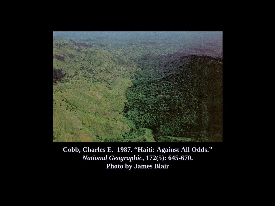
Cobb, Charles E. 1987. “Haiti: Against All Odds.”National Geographic, 172(5): 645-670.
Photo by James Blair
Cobb, Charles E. 1987. “Haiti: Against All Odds.”National Geographic, 172(5): 645-670.
Photo by James Blair
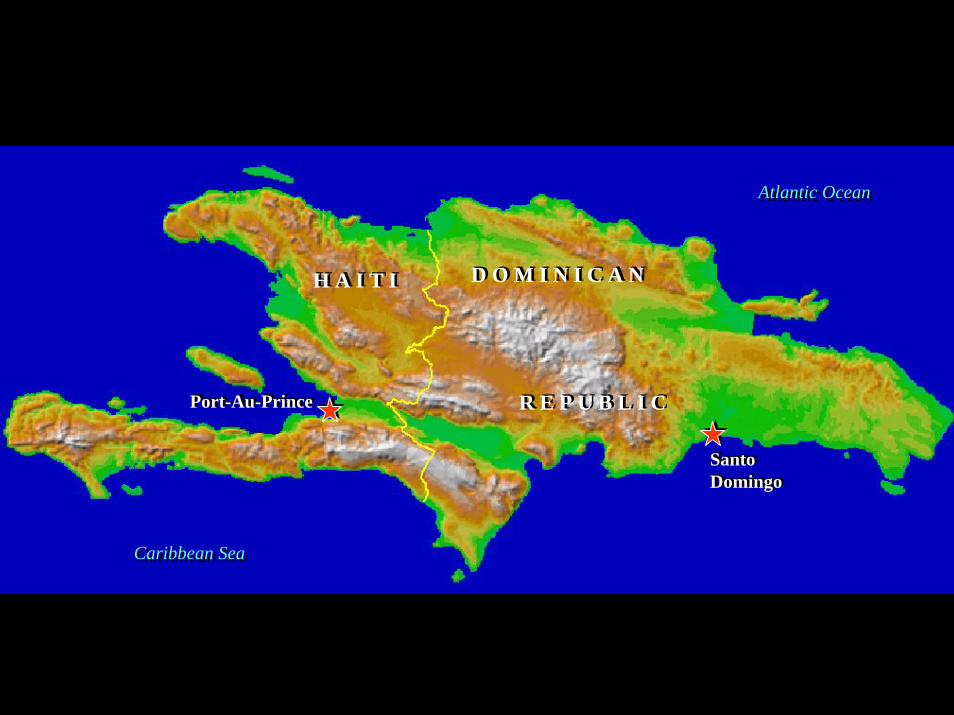
Atlantic OceanAtlantic Ocean
Caribbean SeaCaribbean Sea
D O M I N I C A ND O M I N I C A NH A I T IH A I T I
Port-Au-PrincePort-Au-Prince
SantoDomingoSantoDomingo
R E P U B L I CR E P U B L I C
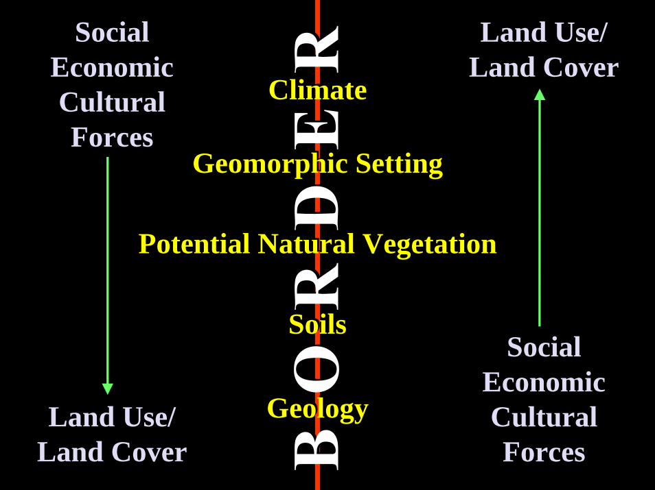
Climate
Geomorphic Setting
Potential Natural Vegetation
Soils
Geology
Climate
Geomorphic Setting
Potential Natural Vegetation
Soils
Geology
SocialEconomicCulturalForces
Land Use/Land Cover
SocialEconomicCulturalForces
Land Use/Land Cover
Land Use/Land Cover
SocialEconomicCulturalForces
Land Use/Land Cover
SocialEconomicCulturalForces
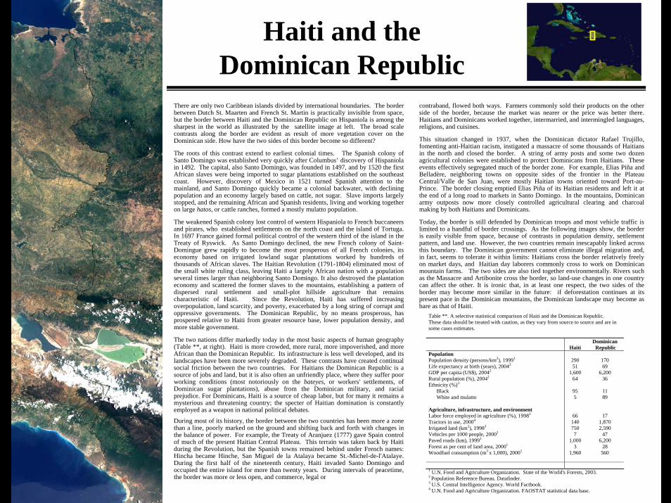
Haiti and the Dominican Republic
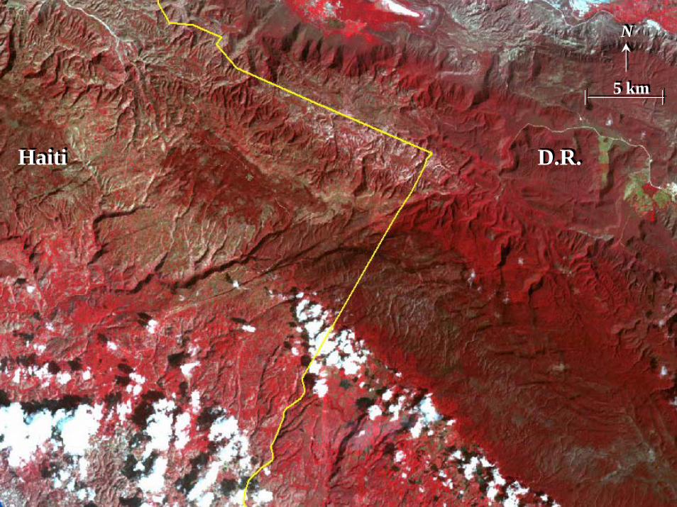
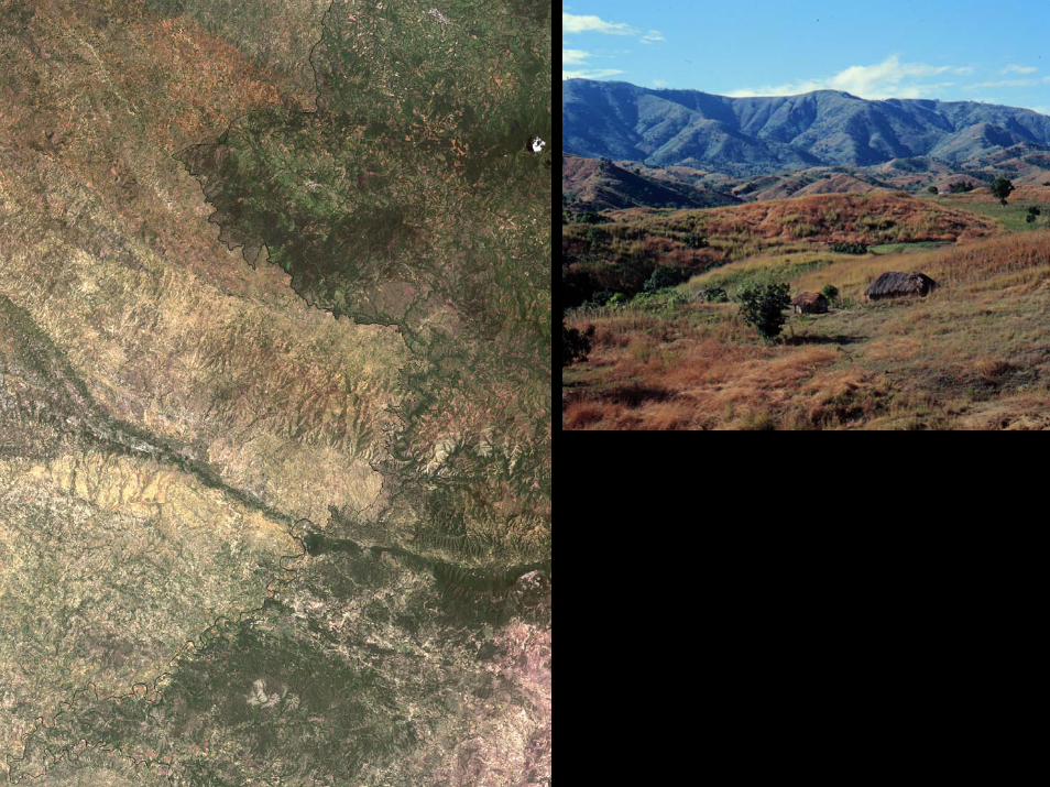
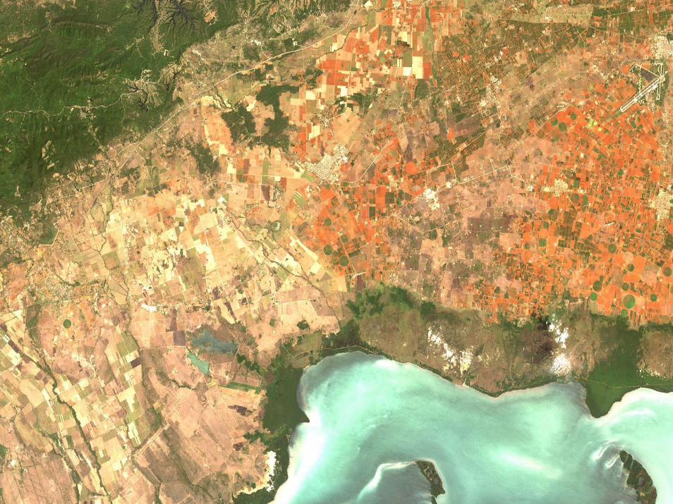
There are only two Caribbean islands divided by international boundaries. The border between Dutch St. Maarten and French St. Martin is practically invisible from space, but the border between Haiti and the Dominican Republic on Hispaniola is among the sharpest in the world as illustrated by the satellite image at left. The broad scale contrasts along the border are evident as result of more vegetation cover on the Dominican side. How have the two sides of this border become so different?
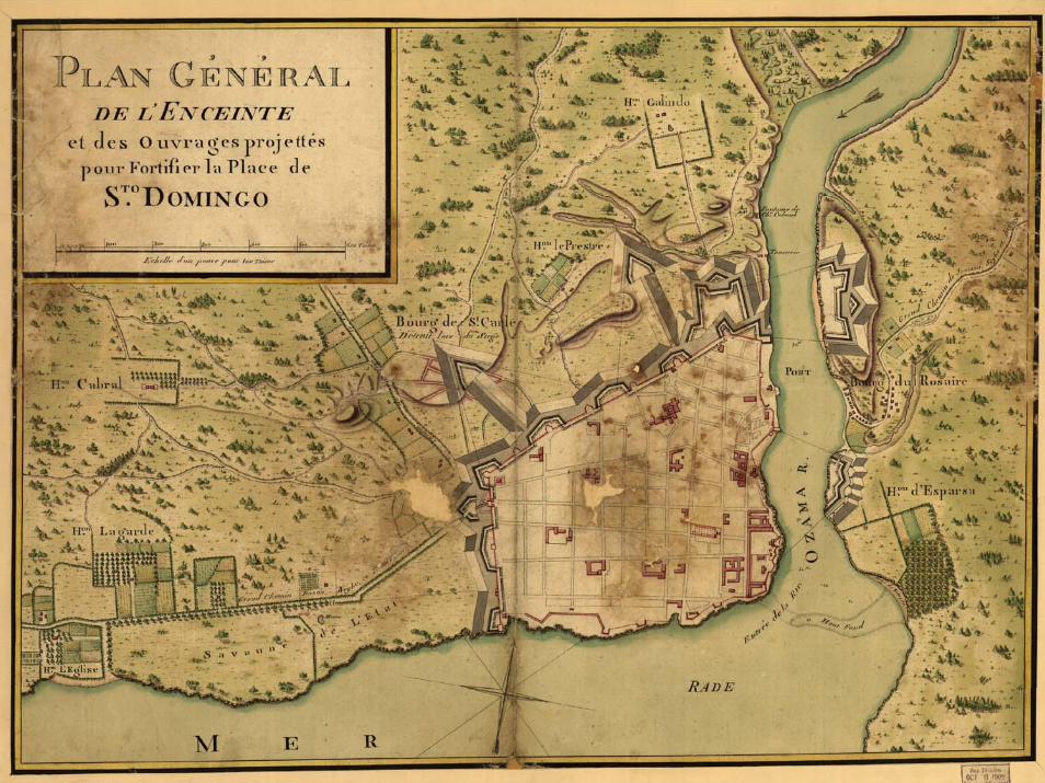
The roots of this contrast extend to earliest colonial times. The Spanish colony of Santo Domingo was established very quickly after Columbus’ discovery of Hispaniola in 1492. The capital, also Santo Domingo, was founded in 1497, and by 1520 the first African slaves were being imported to sugar plantations established on the southeast coast. However, discovery of Mexico in 1521 turned Spanish attention to the mainland, and Santo Domingo quickly became a colonial backwater, with declining population and an economy largely based on cattle, not sugar. Slave imports largely stopped, and the remaining African and Spanish residents, living and working together on large hatos, or cattle ranches, formed a mostly mulatto population.
The weakened Spanish colony lost control of western Hispaniola to French buccaneers and pirates, who established settlements on the north coast and the island of Tortuga. In 1697 France gained formal political control of the western third of the island in the Treaty of Ryswick. As Santo Domingo declined, the new French colony of Saint-Domingue grew rapidly to become the most prosperous of all French colonies, its economy based on irrigated lowland sugar plantations worked by hundreds of thousands of African slaves. The Haitian Revolution (1791-1804) eliminated most of the small white ruling class, leaving Haiti a largely African nation with a population several times larger than neighboring Santo Domingo. It also destroyed the plantation economy and scattered the former slaves to the mountains, establishing a pattern of dispersed rural settlement and small-plot hillside agriculture that remains characteristic of Haiti. Since the Revolution, Haiti has suffered increasing overpopulation, land scarcity, and poverty, exacerbated by a long string of corrupt and oppressive governments. The Dominican Republic, by no means prosperous, has prospered relative to Haiti from greater resource base, lower population density, and more stable government.
The two nations differ markedly today in the most basic aspects of human geography (Table **, at right). Haiti is more crowded, more rural, more impoverished, and more African than the Dominican Republic. Its infrastructure is less well developed, and its landscapes have been more severely degraded. These contrasts have created continual social friction between the two countries. For Haitians the Dominican Republic is a source of jobs and land, but it is also often an unfriendly place, where they suffer poor working conditions (most notoriously on the bateyes, or workers' settlements, of Dominican sugar plantations), abuse from the Dominican military, and racial prejudice. For Dominicans, Haiti is a source of cheap labor, but for many it remains a mysterious and threatening country; the specter of Haitian domination is constantly employed as a weapon in national political debates.
During most of its history, the border between the two countries has been more a zone than a line, poorly marked on the ground and shifting back and forth with changes in the balance of power. For example, the Treaty of Aranjuez (1777) gave Spain control of much of the present Haitian Central Plateau. This terrain was taken back by Haiti during the Revolution, but the Spanish towns remained behind under French names: Hincha became Hinche, San Miguel de la Atalaya became St.-Michel-de-l'Atalaye. During the first half of the nineteenth century, Haiti invaded Santo Domingo and occupied the entire island for more than twenty years. During intervals of peacetime, the border was more or less open, and commerce, legal or
contraband, flowed both ways. Farmers commonly sold their products on the other side of the border, because the market was nearer or the price was better there. Haitians and Dominicans worked together, intermarried, and intermingled languages, religions, and cuisines.
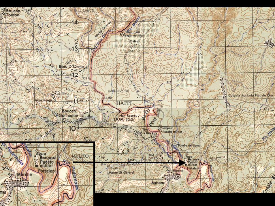
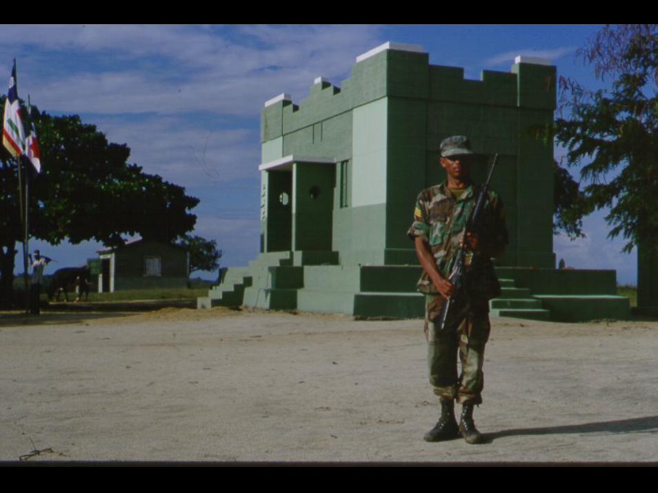
This situation changed in 1937, when the Dominican dictator Rafael Trujillo, fomenting anti-Haitian racism, instigated a massacre of some thousands of Haitians in the north and closed the border. A string of army posts and some two dozen agricultural colonies were established to protect Dominicans from Haitians. These events effectively segregated much of the border zone. For example, Elias Piña and Belladère, neighboring towns on opposite sides of the frontier in the Plateau Central/Valle de San Juan, were mostly Haitian towns oriented toward Port-au-Prince. The border closing emptied Elias Piña of its Haitian residents and left it at the end of a long road to markets in Santo Domingo. In the mountains, Dominican army outposts now more closely controlled agricultural clearing and charcoal making by both Haitians and Dominicans.
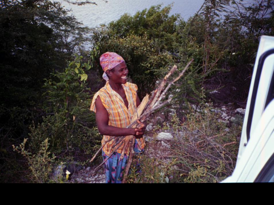
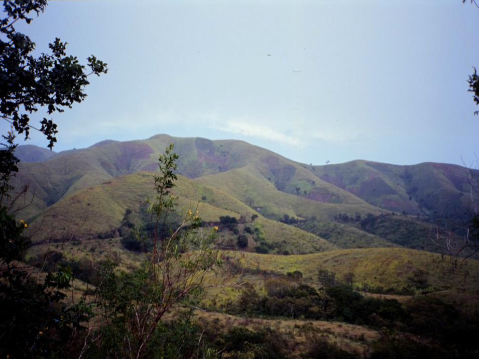
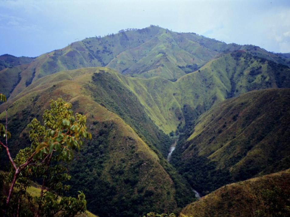
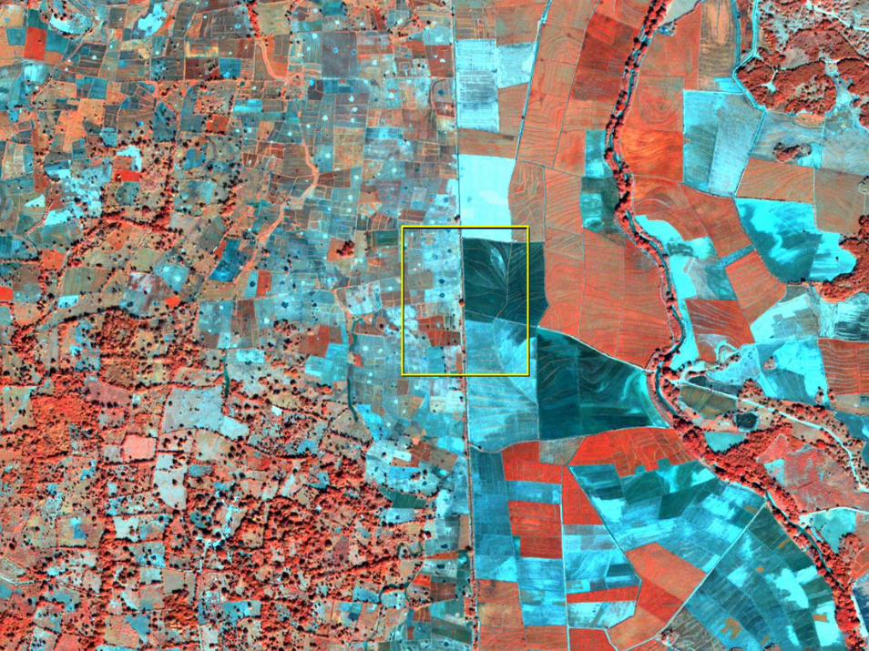
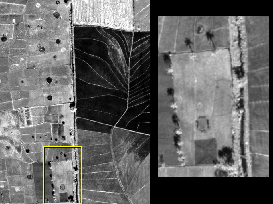
Today, the border is still defended by Dominican troops and most vehicle traffic is limited to a handful of border crossings. As the following images show, the border is easily visible from space, because of contrasts in population density, settlement pattern, and land use. However, the two countries remain inescapably linked across this boundary. The Dominican government cannot eliminate illegal migration and, in fact, seems to tolerate it within limits: Haitians cross the border relatively freely on market days, and Haitian day laborers commonly cross to work on Dominican mountain farms. The two sides are also tied together environmentally. Rivers such as the Massacre and Artibonite cross the border, so land-use changes in one country can affect the other. It is ironic that, in at least one respect, the two sides of the border may become more similar in the future: if deforestation continues at its present pace in the Dominican mountains, the Dominican landscape may become as bare as that of Haiti.
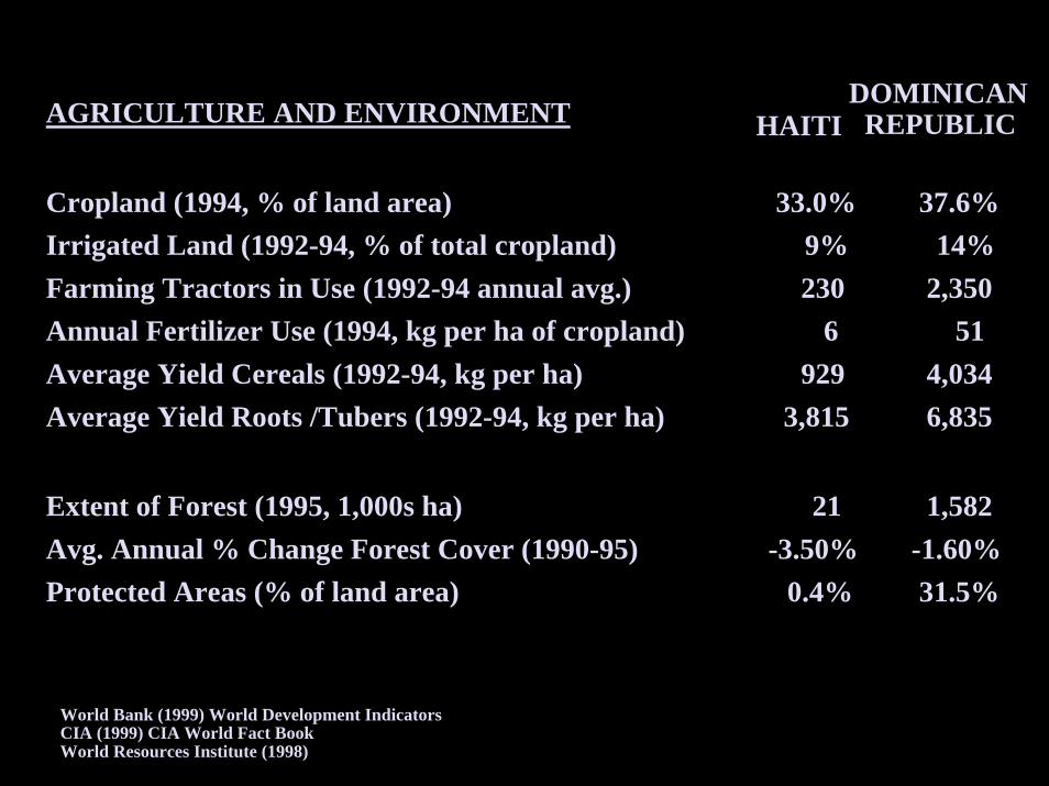
Table **. A selective statistical comparison of Haiti and the Dominican Republic. These data should be treated with caution, as they vary from source to source and are in some cases estimates.
Haiti Dominican Republic
Population Population density (persons/km2), 19991
290
170
Life expectancy at birth (years), 20042 51 69 GDP per capita (US$), 20042
Rural population (%), 20042 1,600
64 6,200
36 Ethnicity (%)3
Black
White and mulatto
95 5
11 89
Agriculture, infrastructure, and environment Labor force employed in agriculture (%), 19983
Tractors in use, 20004
Irrigated land (km2), 19983
Vehicles per 1000 people, 20002
Paved roads (km), 19993
Forest as per cent of land area, 20001
66 140 750
7 1,000
3
17 1,870 2,590
47 6,200
28 Woodfuel consumption (m3 x 1,000), 20001 1,960 560
1 U.N. Food and Agriculture Organization. State of the World's Forests, 2003. 2 Population Reference Bureau. Datafinder. 3 U.S. Central Intelligence Agency. World Factbook. 4 U.N. Food and Agriculture Organization. FAOSTAT statistical data base.
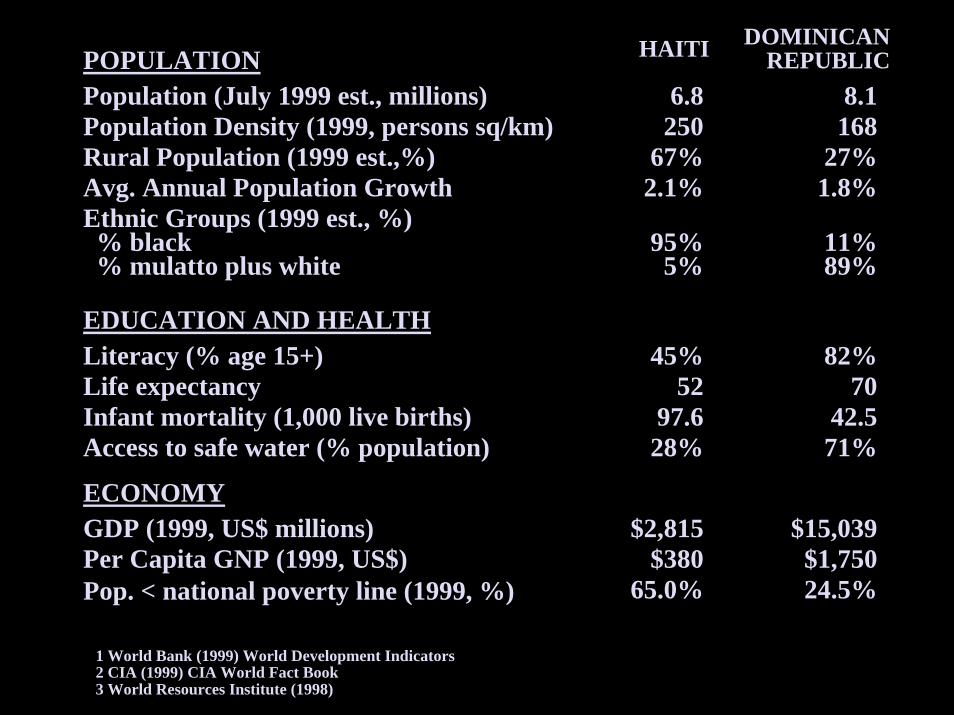
1 World Bank (1999) World Development Indicators1 World Bank (1999) World Development Indicators2 CIA (1999) CIA World Fact Book2 CIA (1999) CIA World Fact Book3 World Resources Institute (1998)3 World Resources Institute (1998)
HAITIHAITI DOMINICANDOMINICANREPUBLICREPUBLICPOPULATIONPOPULATION
Population (July 1999 est., millions)Population (July 1999 est., millions)Population Density (1999, persons sq/km)Population Density (1999, persons sq/km)Rural Population (1999 est.,%)Rural Population (1999 est.,%)Avg. Annual Population Growth Avg. Annual Population Growth Ethnic Groups (1999 est., %)Ethnic Groups (1999 est., %)% black% black% mulatto plus white% mulatto plus white
6.86.8250250
67%67%2.1%2.1%
8.18.1168168
27%27%1.8%1.8%
95%95%5%5%
11%11%89%89%
EDUCATION AND HEALTHEDUCATION AND HEALTHLiteracy (% age 15+)Literacy (% age 15+)Life expectancyLife expectancyInfant mortality (1,000 live births)Infant mortality (1,000 live births)Access to safe water (% population)Access to safe water (% population)
45%45%5252
97.697.628%28%
82%82%7070
42.542.571%71%
ECONOMYECONOMYGDP (1999, US$ millions)GDP (1999, US$ millions)Per Capita GNP (1999, US$)Per Capita GNP (1999, US$)Pop. < national poverty line (1999, %)Pop. < national poverty line (1999, %)
$2,815$2,815$380$380
65.0%65.0%
$15,039$15,039$1,750$1,75024.5%24.5%
World Bank (1999) World Development IndicatorsWorld Bank (1999) World Development IndicatorsCIA (1999) CIA World Fact BookCIA (1999) CIA World Fact BookWorld Resources Institute (1998)World Resources Institute (1998)
AGRICULTURE AND ENVIRONMENTAGRICULTURE AND ENVIRONMENT
Cropland (1994, % of land area)Cropland (1994, % of land area)Irrigated Land (1992-94, % of total cropland)Irrigated Land (1992-94, % of total cropland)Farming Tractors in Use (1992-94 annual avg.)Farming Tractors in Use (1992-94 annual avg.)Annual Fertilizer Use (1994, kg per ha of cropland)Annual Fertilizer Use (1994, kg per ha of cropland)Average Yield Cereals (1992-94, kg per ha)Average Yield Cereals (1992-94, kg per ha)Average Yield Roots /Tubers (1992-94, kg per ha)Average Yield Roots /Tubers (1992-94, kg per ha)
33.0%33.0%9%9%230230
66929929
3,8153,815
37.6%37.6%14%14%
2,3502,3505151
4,0344,0346,8356,835
Extent of Forest (1995, 1,000s ha)Extent of Forest (1995, 1,000s ha)Avg. Annual % Change Forest Cover (1990-95)Avg. Annual % Change Forest Cover (1990-95)Protected Areas (% of land area)Protected Areas (% of land area)
2121-3.50%-3.50%
0.4%0.4%
1,5821,582-1.60%-1.60%31.5%31.5%
HAITIHAITIDOMINICAN DOMINICAN
REPUBLICREPUBLIC
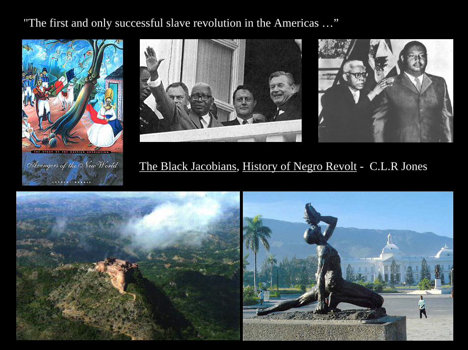
"The first and only successful slave revolution in the Americas …”
The Black Jacobians, History of Negro Revolt - C.L.R Jones

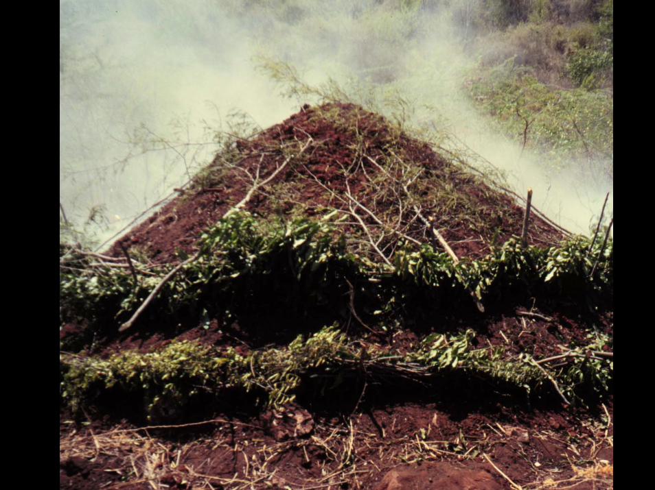
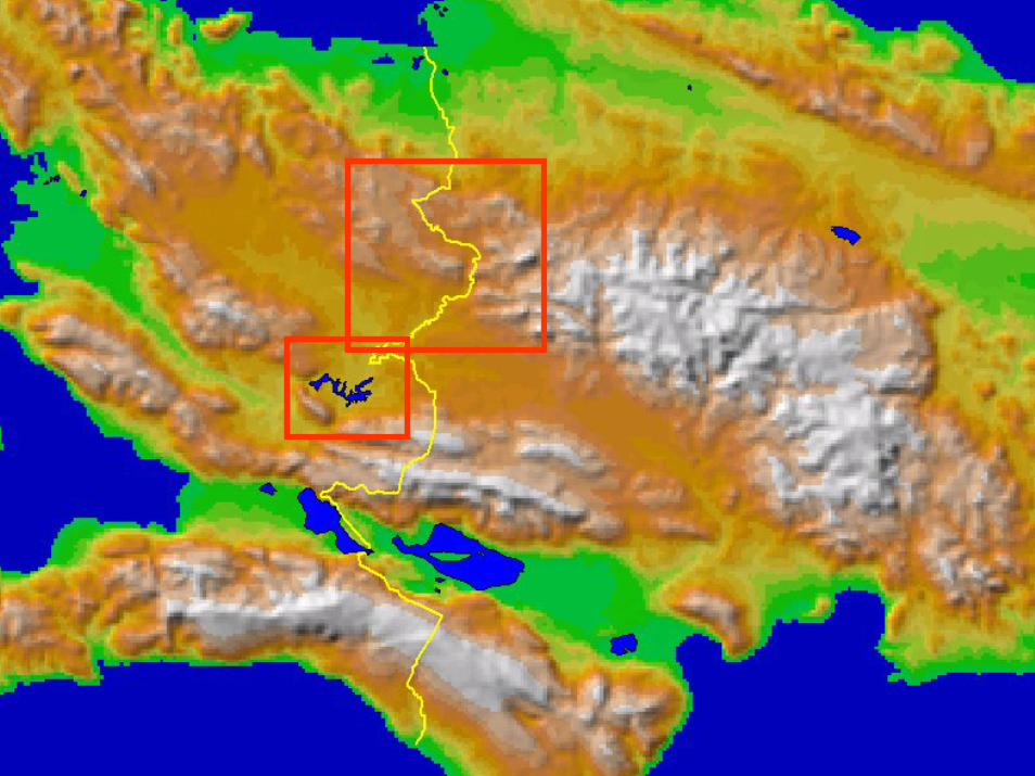
Bosque Seco(dry forest)

Caribbean Sea
Haiti
DominicanRepublic
5 km
N

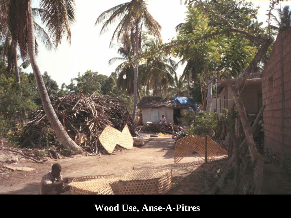
Wood Use, Anse-A-Pitres
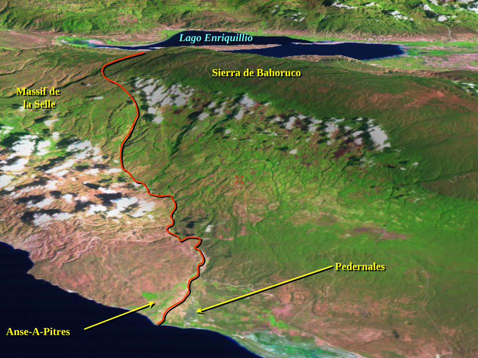
PedernalesPedernales
Anse-A-PitresAnse-A-Pitres
Sierra de BahorucoSierra de Bahoruco
Massif de la Selle
Massif de la Selle
Lago EnriquillioLago Enriquillio
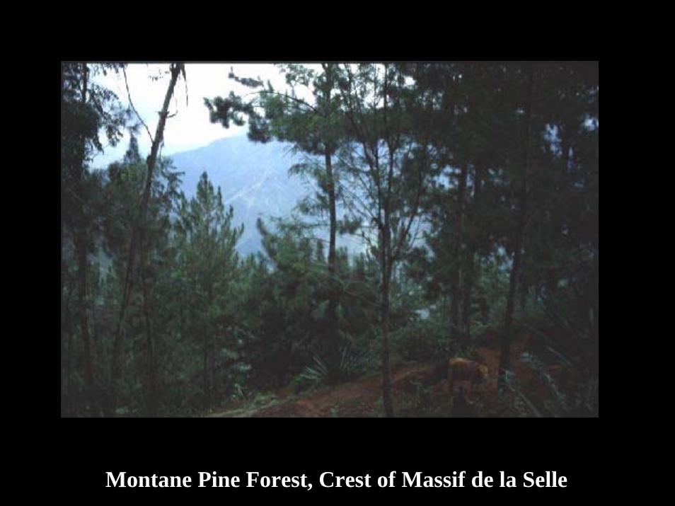
Montane Pine Forest, Crest of Massif de la Selle
5 km5 km
NN
HaitiHaiti D.R.D.R.
NN

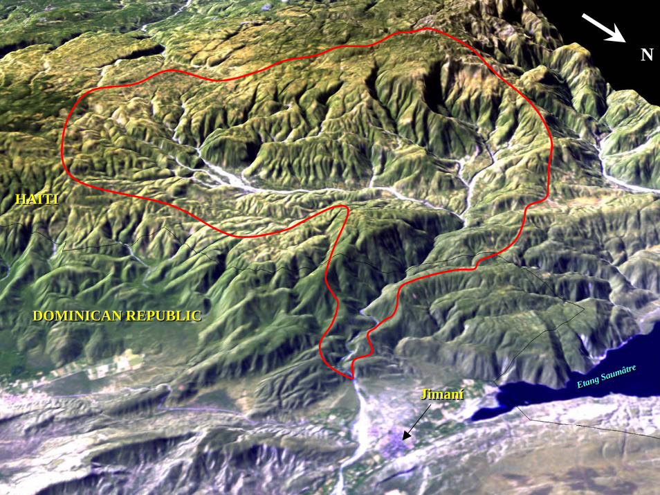
JimaníJimaní
DOMINICAN REPUBLICDOMINICAN REPUBLIC
HAITIHAITI
Etang Saumâtre
Etang Saumâtre
NN

5 km
N

Artibonite Reservoir 1986(Lac de Peligre)
2 km
N
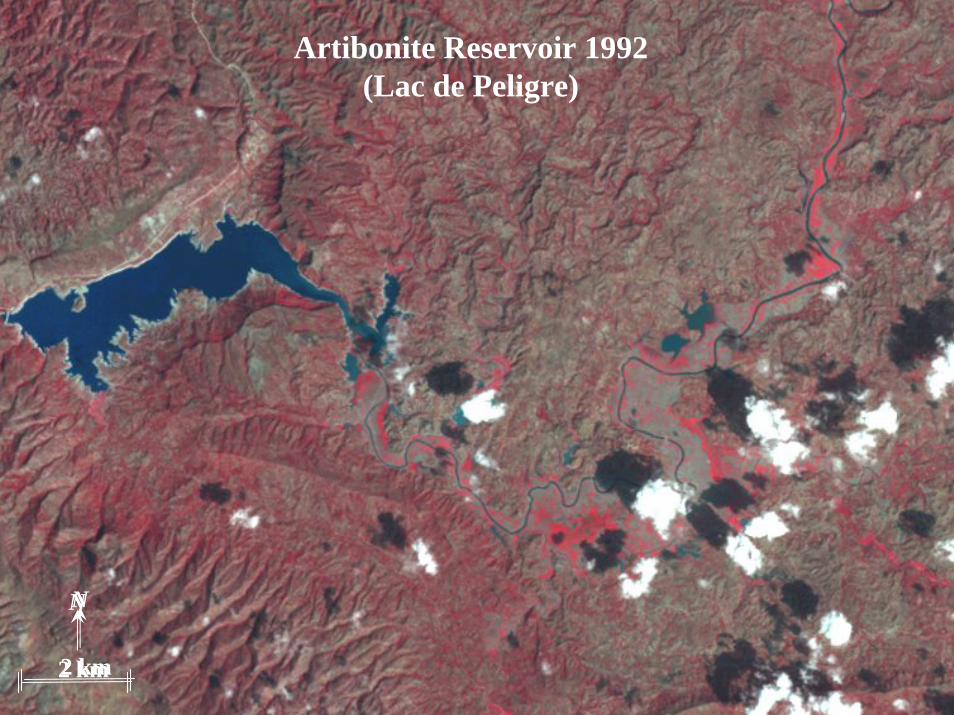
Artibonite Reservoir 1992(Lac de Peligre)
2 km2 km
NN
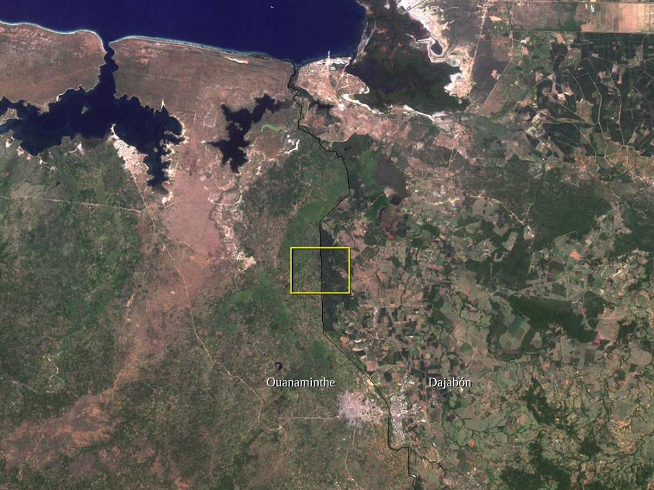
DajabónDajabónOuanamintheOuanaminthe

Atlas of the Caribbean
• ~ 80 – 100 pages• Spring 2007• Full Color – Soft Cover ($)• English, Spanish, French, Creole?• Variety of remote sensing and GIS data
• Landsat, MODIS, Space Shuttle/Station Astronaut Photography, QuickBird, SRTM, etc…
• Part I – Introduction• The Caribbean as a Region• Interpretation and Sources of Imagery
• Part II – Physical Environment• Terrain, Climate, Soils, Oceanography, Marine and Terrestrial Natural
Communities, Natural Hazards
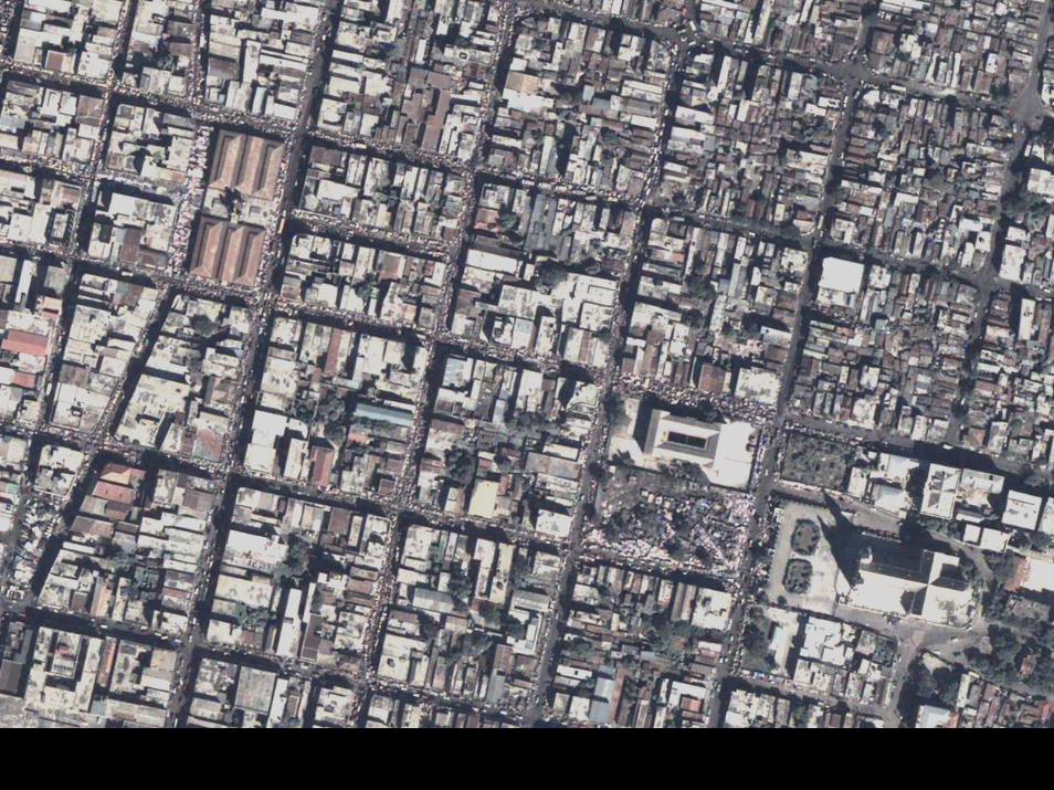
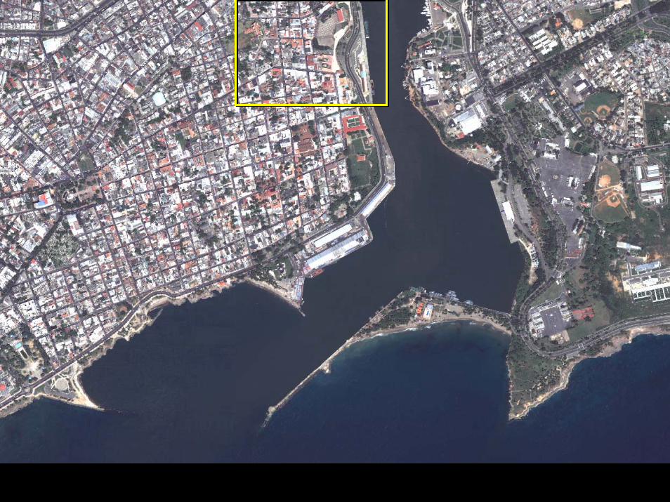
• Part III – Human Environment• Rural/Agricultural, Urban Landscapes, Commerce/Industry/Tourism, Borders
• Part IV – Human/Environment Interactions (Human Impacts)• Colonial Systems, Coastal Modification, Deforestation, Invasive Species


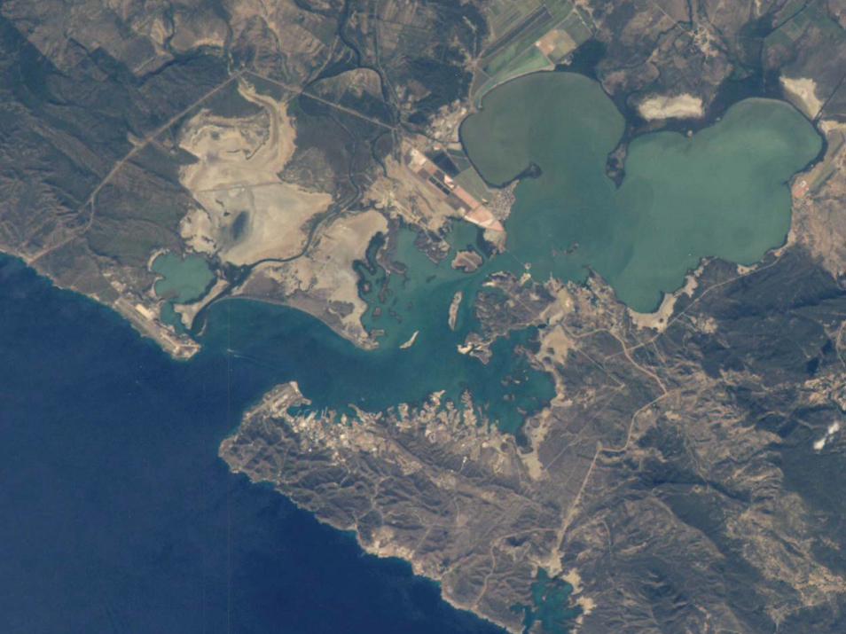
International Space Station Photograph

International Space Station Photograph – color enhanced


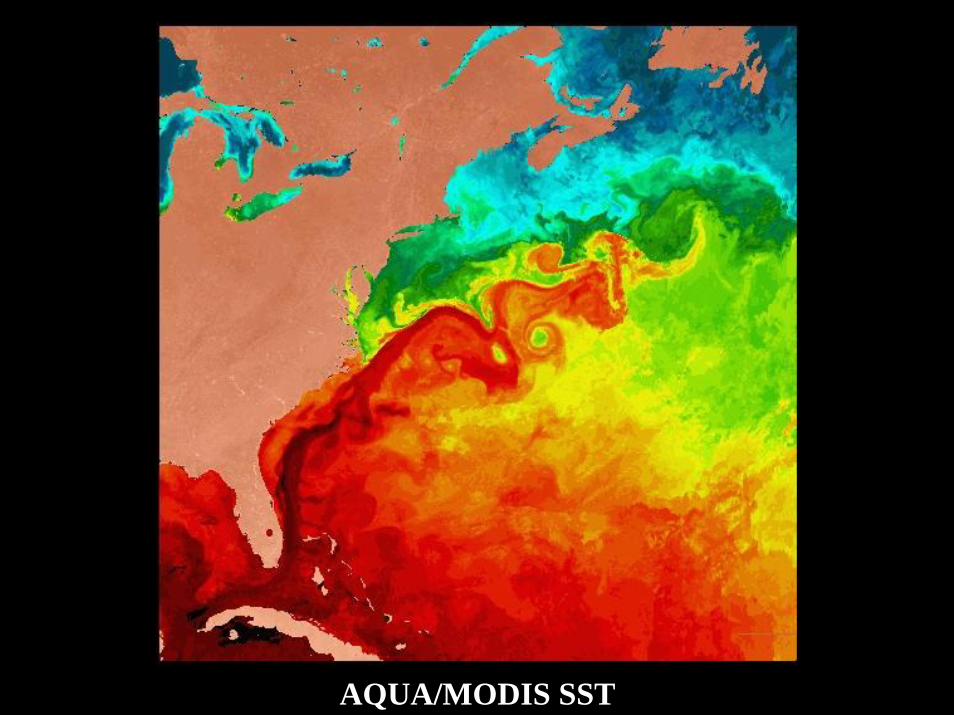
AQUA/MODIS SST

AQUA Chlorophyll Concentration

Thank You!
Questions?