implications of the fluvial history of the wacheqsa river for hydrologic engineering and water use...
TRANSCRIPT

Implications of the Fluvial History of
the Wacheqsa River for Hydrologic
Engineering and Water Use at Chavín
de Huántar, Peru
Daniel A. Contreras1,* and David K. Keefer2
1Archaeology Center, Stanford University, P.O. Box 20446, Stanford, CA 943092U.S. Geological Survey, 345 Middlefield Rd., Menlo Park, CA 94025
Channeling of water through a variety of architectural features represents a significant engi-neering investment at the first millennium B.C. ceremonial center of Chavín de Huántar in thePeruvian Central Andes. The site contains extensive evidence of the manipulation of water,apparently for diverse purposes. The present configuration of the two local rivers, however,keeps available water approximately 9 m below the highest level of water-bearing infrastruc-ture in the site. Geomorphic and archaeological investigation of the fluvial history of theWacheqsa River has revealed evidence that the Chavín-era configuration of the WacheqsaRiver was different. A substantially higher water level, likely the result of a local impound-ment of river water caused by a landslide dam, made the provision of water for the hydro-logic system within the site a more readily practical possibility. We review what is known ofthat system and argue that the fluvial history of the Wacheqsa River is critical to understandingthis aspect of hydrologic engineering and ritual practice at Chavín. This study demonstratesthe relative rapidity and archaeological relevance of landscape change in a dynamic environ-ment. © 2009 Wiley Periodicals, Inc.
INTRODUCTION
The geomorphic history of the lower reach of the Wacheqsa River is demonstra-bly complex and important to archaeological interpretation of the first millenniumB.C. site of Chavín de Huántar. The Wacheqsa River is a glacier-fed, perennial, fourth-order stream located high on the eastern slope of the Peruvian Andes, draining a smallcatchment in the southern Cordillera Blanca. Its headwaters originate at approxi-mately 4500 m asl on the slopes of Nevado Huantsan and neighboring peaks, fromwhence it drops 1400 m in approximately 15 km. Ultimately, the Wacheqsa feedsinto the Mosna River in the upper reaches of the valley known as the Callejón deConchucos. At the confluence of these two rivers is the archaeological site of Chavínde Huántar, a monumental complex dating primarily to the first millennium B.C.The Callejón de Conchucos is a steep valley characteristic of the eastern slope of the
Geoarchaeology: An International Journal, Vol. 24, No. 5, 589–618 (2009)© 2009 Wiley Periodicals, Inc.Published online in Wiley Interscience (www.interscience.wiley.com). DOI:10.1002/gea.20279
*Corresponding author; E-mail: [email protected].

Cordillera Blanca. The Wacheqsa and Mosna rivers meet at approximately 3180 m asl,while the surrounding ridges, less than 5 linear km away, reach 4500 m asl.
Exposed stratigraphy on the south bank of the Wacheqsa indicates that the riverbed was situated 6–8 m higher in the Chavín period than at present; archaeologicalfeatures and radiocarbon-dated organic material recovered from the same exposuredate this elevated river level to within the last 3000 years. We discuss here the geo-morphic evidence for this elevated river level, the chronology and probable cause ofthe river-bed elevation, and the implications of the fluvial history of the WacheqsaRiver for understanding water management at Chavín de Huántar.
The monumental center of Chavín, located on the valley floor, is a complex ofstone-faced platform mounds, terraces, and sunken plazas (see Figure 1) dating toapproximately 1200–500 B.C.1 (though the chronology remains debated; see Kembel &Rick, 2004:62; Burger, 2008). One of only a handful of monumental highland sitesfrom this early period, Chavín has been a focus of archaeological research in theAndes since Julio C. Tello’s 1919 visit, and it remains central to the understanding ofPeruvian culture history (Burger, 1992; Lumbreras, 1989; Tello, 1943, 1960). Mostrecently, John Rick has directed a Stanford University–based project at the site, ofwhich this research is part, since 1996 (Kembel & Rick, 2004; Rick, 2005, 2008; Ricket al., 1998). This long research history has produced some disagreements regardingthe details of Chavín’s chronology and the sociopolitical mechanisms underlying itsrise, but there is broad archaeological consensus that the site served as a ceremo-nial center (Burger, 1992; Lumbreras, 1989; Rick, 2005, 2008; Tello, 1960).
The platform mounds at Chavín incorporate a complex and interconnected systemof subsurface galleries that have been home to some of the most spectacular archae-ological finds at the site (see Lumbreras, 1993; Rick, 2008). These galleries have nowbeen mapped in detail and provide valuable information about the site’s construc-tion history (Kembel, 2001, 2008). The architecturally elaborate core containing thesegalleries, 7 ha in total area, is set in a landscape heavily modified by fills, retaining walls,and megalithic terraces (comprising approximately another 13 ha (Contreras, 2007).In addition, the site and its near periphery are also honeycombed with smaller sub-surface constructions: ventilators, drains, and canals. Most of these are yet to bemapped, but they are sufficiently documented that Richard Burger, drawing on the par-tially published work of two Peruvian hydrologic engineers (Lumberas, Gonzalez, &Lieataer, 1976), was able to cite a figure of nearly 1000 m as a linear measure of knownwater-bearing channels at the site (Burger, 1992:141). Given the limited accessibilityof many of these features, and those documented since, this estimate should beregarded as a minimum.
This water-bearing infrastructure is testament to the significance of water at thesite. The two local rivers and reliable seasonal rainfall provided adequate water foragricultural purposes, and water also served as ritual element and practical hazard.As we discuss below, water appears to have played a significant role in ritual prac-tice at Chavín, and high seasonal rainfall provided a significant engineering challenge.
CONTRERAS AND KEEFER
GEOARCHAEOLOGY: AN INTERNATIONAL JOURNAL, VOL. 24, NO. 5590
1 All dates are given in calibrated radiocarbon years.

GEOARCHAEOLOGY: AN INTERNATIONAL JOURNAL, VOL. 24, NO. 5
IMPLICATIONS OF THE FLUVIAL HISTORY OF THE WACHEQSA RIVER
591
Figure 1. Chavín de Huántar and its surroundings, including features discussed in the text. Site sectorsare labeled in uppercase.

Moreover, the steep local landscape was (and is) prone to landslides when saturated(Tello, 1945; Turner, Knight, & Rick, 1999).
The water-bearing features at Chavín comprise an interpretive problem for tworeasons. First, as we discuss below, the water-bearing infrastructure at Chavín evi-dently outstrips drainage needs—that is, the capacity of the site’s water-bearingchannels exceeds any amount of water likely to be naturally introduced into the site.Second, the present configuration of the two rivers that flank the site of Chavín issuch that the reaches of river adjacent to the site are significantly below the highestwater-bearing infrastructure. The Wacheqsa River, for topographic reasons the onlypotential source of water that might have been brought into the site by canal, cur-rently flows past the site at a modest grade in a narrow canyon with a bed roughly9 m below the highest water-bearing channel, implying the prehistoric need for along and difficult-to-engineer canal unless the river bed in Chavín times was higherthan it is at present.
Whereas examples of such canal construction are not uncommon in Andean pre-history, dating from as early as the fifth millennium B.C. (Dillehay, Eling, & Rossen,2005; for later examples see Farrington, 1980; Kosok, 1965; Kus, 1984; Ortloff, Moseley, &Feldman, 1982; Petersen, 1985, inter alia), no evidence of a prehistoric canal divert-ing water from the Wacheqsa River has been found at Chavín to date, in spite of thelong investigative history at the site. In this paper we explore a possible explana-tion for this situation using geomorphic and stratigraphic evidence for changes in thelocal elevation and gradient of the Wacheqsa River during the Late Holocene, dur-ing which time the ceremonial center was built, utilized, and abandoned.
We detail here evidence suggesting that the Chavín-era configuration of theWacheqsa River was notably different from the modern one, and discuss the archae-ological significance of such an interpretation. After summarizing the evidence forwater use at Chavín, we describe the local geomorphology, and then turn to the his-tory of the Wacheqsa River, reviewing the archaeological and geomorphic evidencethat suggests the level of the Wacheqsa River was in Chavín times 6–8 m higher. Wediscuss this data, and suggest that the most probable cause was an impoundment ofwater on the Wacheqsa River, likely caused by a landslide dam. Such an elevatedriver level would have made the provision of water for the architecture of the mon-umental core much easier than it appears today.
WATER USE IN THE CEREMONIAL CENTER
As noted above, the ceremonial center of Chavín consists of a core of monumentalbuildings and a near periphery consisting of a heavily modified landscape. The mon-umental core is made up of an array of platform mounds faced with large blocks ofquartzite, fine-grained sandstone, and granite, and filled with angular rock fragmentsin a prepared clayey matrix. These platform mounds originally ranged up to 10 m inheight and were extensively decorated with finely carved lithic art.
The area contains a profusion of water-bearing features of various sizes, manystill unmapped, ranging from enclosed drains as small as 20 � 20 cm to enclosedcanals large enough to allow a person to walk upright through them (Burger, 1992;
CONTRERAS AND KEEFER
GEOARCHAEOLOGY: AN INTERNATIONAL JOURNAL, VOL. 24, NO. 5592

Kembel, 2001, 2008). We here use the term “gallery” to refer to a subsurface con-struction not intended to transport water, while “canal” refers to features designedfor water movement and “drain” specifically to features intended to remove waterfrom the site or one of its structures. Where the design function of the feature is notclear, we refer to it as a water-bearing channel.
In addition to those features in the structures of the monumental core, water-bearing channels are also present in the site’s near periphery, and they have been doc-umented in the West Field, South Area, Wacheqsa, and La Banda sectors (see Figure 1for the location of site sectors and locations of water features); water-bearing fea-tures have in fact been found in nearly every area excavated at Chavín. The landscapein which the ceremonial center is embedded, as discussed in detail by Contreras(2007), was extensively engineered. The landscape modifications included not onlyconstruction of megalithic terracing and deposition of massive amounts of levelingfill but also construction of associated water-bearing channels, erection of walls torestrict both local rivers, and rerouting of the channel of the Mosna River (Contreras,2007; Rick, 2005; Rick & Contreras, 2006). Part of this infrastructure included theevident diversion of river water to provide flow for the elaborate system of sub- andintra-monument canals. The only possible source of this water, given local topogra-phy and geomorphology, is a point on the Wacheqsa River approximately 300 m westof the monumental core.
Like other features of the modified landscape, the canals and drains at Chavínappear to have had multiple purposes. Modern conservation problems demonstratethat during the wet season (December–April), seepage of water into the gallerieswithin Chavín’s structures can be a problem, and thus at least some of these water-bearing features were likely designed to drain rainwater from the structures. Burgernotes that the drainage system was well constructed and engineered, and was ableto “accommodate even the most severe local [rainfall] conditions” (1992:142).However, as discussed below, the local catchment draining directly into the monu-mental core is small, with a total area of little more than 1 km2, and the likely amountof rainwater is not such sufficient to explain the profusion of features—averageannual rainfall in Chavín today is only 800–900 mm (Burger, 1982:5; Diessl, 2004:38),and regional paleoclimate records suggest that precipitation amounts in the CentralAndes were probably similar 3000 years ago (e.g. Sandweiss et al., 2001; Thompsonet al., 1995).
The scale and profusion of the water-bearing features have led to suggestions thatin addition to their practical drainage function they served ritual purposes. Lumbreras(Lumbreras, Gonzalez, & Lieataer, 1976) proposed that at least one water-transportfeature in the site—the canal that runs under the staircase on the east side of StructureB (see Figure 1)—was designed for acoustic effect, as water running through thissmall canal would have created a deep roar in the Lanzón Gallery. This multivalencehas an obvious parallel in the site’s built landscape, which includes terraces andplatforms constructed to specifications that exceed what would be necessary forsimple persistence. Rather than erecting casual, utilitarian fieldstone walls to cap-ture slope sediments and manage erosion (as local agriculturalists do today), Chavín’sbuilders constructed large filled platforms and walls of massive, often partly shaped,
GEOARCHAEOLOGY: AN INTERNATIONAL JOURNAL, VOL. 24, NO. 5
IMPLICATIONS OF THE FLUVIAL HISTORY OF THE WACHEQSA RIVER
593

stone blocks. Water management within the monument itself thus seems to havebeen both practically imperative and ritually significant: While drainage of the sunkenplazas and the interior galleries remains a conservation issue today, the intricatenetwork of canals and drains far exceeds what is necessary for simple drainage.
While prior work (Lumbreras, Gonzalez, & Lieataer, 1976; Burger, 1992; Kembel,2008) has documented nearly 1000 meters of subsurface channels, much of the sys-tem of canals and drains at Chavín de Huántar still remains poorly defined due to thelogistical difficulties of trying to map the small and enclosed subsurface spaces.Where the system has been explored and documented in detail, the multiple inten-tions of its construction have been apparent. For example, the Rocas drain, intowhich many of the site’s smaller drains feed, stretches from immediately off thesoutheastern quadrant of the Circular Plaza approximately eastward, crossing underthe northwestern corner of the Square Plaza and the southeastern corner of theSquare Plaza’s North Flanking Mound before eventually emptying into the MosnaRiver (Figure 1). The Rocas drain has been the subject of two major archaeologicalinvestigations: Its upper portion was excavated by Hernán Amat as part of theLumbreras/Amat project between 1966 and 1973 (Lumbreras & Amat Olazabal, 1966),and more recently the Stanford Project has been excavating, clearing, and conserv-ing the lower portion of the canal (Kembel & Rick, 2004). Like the canal associatedwith the Lanzón Gallery, the Rocas drain was evidently multifunctional.2 It is muchlarger than needed to move any amount of water that might have drained through it(Figure 2) and had at least two formally constructed entryways (Kembel & Rick,2004).
It is clear, then, that Chavín’s builders were concerned with the movement ofwater throughout the complex, evidently for multiple reasons. What has been poorlyunderstood is how—given modern topographic constraints—water was divertedinto this system of water-bearing features.
GEOLOGY AND GEOMORPHOLOGY
The principal elements of the valley geomorphology around the monumental cen-ter are steep slopes thinly covered with colluvium, alluvial fans created by smalltributary drainages perpendicular to the valley axis, and earth flow complexes extend-ing from high up the valley walls to the valley floor (Figure 3). Bedrock outcrops—generally clearly bedded and heavily folded—are also scattered throughout the val-ley at all elevations. These consist of Lower Cretaceous deposits of the OyónFormation (the majority of the lower and mid-valley) and the Goyllarisquizga Group(Chimú, Santa, and Carhuaz formations) higher in the valley. The Oyón Formationconsists of siltstones, and sandstones in strata 5–30 cm thick, interbedded with strataof anthracite (Cobbing et al., 1996:74). Ascending toward the ridges, one moves from
CONTRERAS AND KEEFER
GEOARCHAEOLOGY: AN INTERNATIONAL JOURNAL, VOL. 24, NO. 5594
2 This highlights the ways in which the site’s construction blurs the distinction between canal and drain.The Lanzón canal, for instance, serves to drain water from Structure B, but much of the water it trans-ported was apparently deliberately introduced to that structure. The Rocas drain, conversely, served pri-marily to convey water from the site into the Mosna River, but seems to have served as a ceremonialwaterway in addition to a simple drain.

the Oyón Formation into the Chimú, Santa, and Carhuaz formations. These consist,respectively, of white, quartzitic sandstones in massive layers 1–3 m thick (ChimúFormation), blue-gray limestones, 10 cm to 1 m thick (Santa Formation), and cementedsilty clays (Carhuaz Formation) (Cobbing et al., 1996:83–90; Turner, Knight, & Rick,1999:48).3
The large landslides in the valley around Chavín may be separated into two typeson the basis of their surficial morphology: relatively shallow earth flow complexeswhose movement is primarily translational, and deep-seated rotational slumps. Themajority of the landslides are of the former type; a massive landslide at the northern
GEOARCHAEOLOGY: AN INTERNATIONAL JOURNAL, VOL. 24, NO. 5
IMPLICATIONS OF THE FLUVIAL HISTORY OF THE WACHEQSA RIVER
595
Figure 2. Cleared segment of the Rocas drain, looking roughly northwest, at the northern edge of theSquare Plaza. Step visible in foreground at right is the opening of a formally constructed stair (nowblocked) that descended from the surface into the Rocas drain.
3 The practical implication of this in archaeological terms is the ready availability of quartzite and sand-stone construction material that tended to readily fracture in relatively rectilinear blocks. Conversely, thelimestone and granite employed in construction had to be imported from at least 3 and 15 km distant,respectively (see Turner, Knight, & Rick, 1999:54–55).

CONTRERAS AND KEEFER
Figure 3. Geomorphic map of area. Drawn from fieldwork by the authors, with reference to Turner,Knight, and Rick (1999).

extreme of the valley, which dammed the Mosna River before Chavín’s settlement(Contreras, 2007; Turner, Knight, & Rick 1999), provides an example of the lattertype. Distinctive morphological characteristics for either type are the main scarp atthe landslide’s upper limit, a main body of material displaced downslope (typicallylonger than it is wide for earth flows and wider than it is long for slumps), a zone ofdepletion, and a zone of accumulation (for an idealized schematic, see Cruden &Varnes, 1996:Figure 3-3; also Keefer & Johnson, 1983:Figure 4).4
These varied large landslides form only part of the valley topography. The geo-morphic units identified by surface mapping (Figure 3) include, in addition to themajor elements of the large landslides (Qls and Qlsa), the alluvial plain on whichthe modern town is located (Qoal), talus slopes (Qtl) and bedrock covered by thin
GEOARCHAEOLOGY: AN INTERNATIONAL JOURNAL, VOL. 24, NO. 5
IMPLICATIONS OF THE FLUVIAL HISTORY OF THE WACHEQSA RIVER
597
Figure 4. Detail of West Field, showing location of hypothesized landslide, excavations in the WestField, and features discussed in the text.
4 For a full description of earth flow morphology, see Keefer and Johnson (1983:8–17) and Cruden andVarnes (1996:40–41).

colluvium (b/c). The valley slopes are also dissected by small drainages that formsmall alluvial fans as they descend into the valley (Qaf). The topography of the val-ley walls is the result of the activity of the large landslides coupled with the variableresistance of the bedrock—the resistant quartzite forming prominent fins while themore easily eroded rocks of other types form the more moderately inclined colluvialslopes between them. Shallow debris slides, rock falls, and accumulated talus areassociated with the steep slopes underlain by well-indurated bedrock.
Chavín lies immediately south of the mouth of the Wacheqsa River, which flowseastward out of the Cordillera Blanca to join the north-flowing Mosna River. Theglacier-fed Wacheqsa, whose fluvial history is our focus here, flows reliably evenduring the dry season, draining a watershed of about 118 km2.
In 1945, a large debris flow originating high in the watershed descended the Wacheqsavalley, burying the archaeological site and part of the adjacent town under as much as4 m of material (Indacochea G. & Iberico M., 1947). The valley floor in the vicinity ofthe site is underlain by this deposit (not shown in Figure 3 as it obscures all other geo-morphic units in the immediate vicinity of the site) as well as by recent alluvium (Qyal).Also present are remnant alluvial terraces, stranded by the downcutting Mosna River(Qt). As discussed by Contreras (2007), the area surrounding the archaeological site(and probably the area under the modern town, though it remains little investigated)has also been heavily modified by human activity in the last three millennia.
STRATIGRAPHY AND INTERPRETATIONS
Our field investigations of stratigraphy were concentrated in the area west of themonumental core of Chavín and immediately south of the Wacheqsa River—herereferred to as the West Field (see Figure 1). This area has been recognized since atleast Julio C. Tello’s visits to the site (beginning 1919) as containing Chavín-era con-struction. Two megalithic east–west trending walls (terrace facades in current appear-ance), constructed of quartzite blocks in a style similar to that of the structures inthe monumental core, are currently visible on the surface (A and B in Figure 4), asis one drain feeding northward into the Wacheqsa River (C in Figure 4). Furtherarchitecture, as well as the sediment stratigraphy central to the research presentedhere, is visible in the river cut at the northern limit of the West Field.
Our fieldwork, carried out from 2004 through 2006, served to reconstruct the his-tory of the Wacheqsa channel over the last 4000 years and to define its implicationsfor Chavín’s inhabitants. Turner and colleagues (Turner, Knight, & Rick, 1999:50)and our regional-scale mapping (Figure 3) agree in depicting the West Field area asbeing underlain by a spatially diverse array of earth flow and alluvial deposits inaddition to bedrock thinly covered by colluvium. Additional and more detailed datacome from strata exposed by the Wacheqsa River along the northern flank of theWest Field (Figures 1, 4, 5). As much as 8 m of stratigraphy are exposed along the south bank of the river there, displaying both natural and archaeological strata(Figure 5). Characterization of this stratigraphy comes from multiple sources. Theseinclude documentation and description of visible features, correlation of visiblestrata with data from a 4 � 4 m excavation unit 5 m south of the river cut (Unit
CONTRERAS AND KEEFER
GEOARCHAEOLOGY: AN INTERNATIONAL JOURNAL, VOL. 24, NO. 5598

GEOARCHAEOLOGY: AN INTERNATIONAL JOURNAL, VOL. 24, NO. 5
IMPLICATIONS OF THE FLUVIAL HISTORY OF THE WACHEQSA RIVER
599
Fig
ure 5
.St
rati
grap
hy o
f U
nits
CdH
-WF
-10/
10A
and
CdH
-WF
-11.
See
Tab
les
I an
d II
for
det
ails
. Pro
file
s ar
e to
sca
le a
nd o
ffse
t to
ref
lect
the
irdi
ffer
ing
elev
atio
ns.

CONTRERAS AND KEEFER
Table I. Stratigrapic descriptions for WF-10/10A.
Unit Texture Deposit Type
A Surficial slopewash, primarily derived from the 1945 debris flow. Surficial slopewashAbundant roots and organic material.
10–1 Somewhat reworked diamicton of 1945 debris flow. Dark grey Diamicton/debris flowmatrix with clasts of angular pebbles up to 3 cm on long axes.No sorting or alignment.
10–2 Fine light-brown matrix with abundant clasts of angular gravel, Colluvium?up to 3 cm on long axes. No alignment or sorting of clasts.
10–3 Lens of fine-grained grey sediment. Colluvium?
10–4 Organic rich matrix with abundant of angular and subangular Cultural or colluvium?cobbles, up to 8 cm on long axes. Deposit occasionally but not exclusively clast supported.
10–5 Fairly loose and organic-rich matrix with abundant angular and Cultural or colluvium?subangular clasts, up to 20 cm on long axes. No sorting, but some alignment of clasts with long axes horizontal.
10–6 Compact clayey matrix containing clasts of angular large gravel. Cultural?No sorting or alignment.
10–7 Compact, clayey matrix with abundant angular clasts up to Cultural?20 cm on long axes.
10–8 Compact clayey matrix with scattered clasts of angular cobbles. Cultural?10–9 Compact fine-grained matrix with scattered angular clasts up to Cultural—fill
20 cm on long axes.
10–10 Compact matrix containing scattered clasts of gravel Cultural—fill(some angular), up to 3 cm on long axes; a few larger angular clasts up to 30 cm on long axes.
10–11 Loose clayey grey-brown matrix containing matrix-supported Culturalsubangular and round cobbles, 4–12 cm on long axes; no alignment.
10–12 Compact, clayey matrix with clasts of angular and subangular Cultural—fillcobbles up to 20 cm on long axes. Clasts grade in size upwardfrom bottom to top of deposit, with the larger cobbles concentrated in the upper portion and generally aligned with long axes horizontal.
10–13 Silty organic-rich dark-gray matrix with subangular clasts up to Cultural10 cm on long axes; no alignment.
10–14 Matrix-supported deposit with mixed angular and rounded Cultural—probable clasts, from large pebbles and cobbles up to 10 cm on long cultural fill deposit axes, with a few boulders (up to 50 cm on long axes). Some intended to levelalignment of long axes horizontally. ground surface; lower
contact is irregular (follows surface of Unit B), while upper is level.
B Matrix varying in composition from sandy silt to gravel with Diamicton/debris flowabundant matrix-supported clasts of both angular and rounded cobbles and boulders, up to 90 cm on long axes. No sorting or alignment, no cultural material, and no sign of soil formation atupper contact. Same as the basal deposit in WF-11 and WF-12.

CdH-WF-07,5 excavated in 2005; see Figure 4), and a series of cleaned 1-m-wide pro-files in the exposed streamcut (investigated in 2006).
As Figure 5 demonstrates, these profiles are both heterogeneous and internallycomplex. The architectural stratigraphy visible in WF-10/10A and WF-12 correlateswell with that excavated approximately 5 m to the south in WF-07/07A, whereasWF-11 does not display any corresponding architectural strata at comparable ele-vations. We focus here on WF-10/10A and WF-11, as the stratigraphy of WF-11 andthe contrast between these two exposures are of most interest. The strata visible inWF-12 are consistent with those in WF-10/10A.
All materials but the lowermost stratum exposed within this streamcut are youngerthan approximately 2000 B.C., based on archaeological content. Artifacts and/orconstruction material (wall fragments and exposed artificial fill) appear in, orinterbedded with, all strata except the lowest. Given the established archaeologicalchronology of the valley, such material provides a terminus post quem date of 1800B.C., if not later (the appearance of ceramics in the valley, though poorly dated, isunlikely to be before 1800 B.C., given the dates of the earliest ceramics at other high-land sites).
The lowest visible stratum appears in WF-10, WF-10A, WF-11, and WF-12. The topof this stratum is offset downward approximately 1.5 m between WF-10A andWF-11, a distance of only about 3 m. This basal stratum (B in Figure 5) consists of afine matrix varying in composition from sandy silt to gravel with abundant angular androunded clasts. These matrix-supported clasts range up to 45 cm on their long axes,and are not sorted or aligned; no cultural material is present in the deposit. We inter-pret this deposit as a diamicton resultant from a pre-Chavín period debris flow; lackof sorting and clast size suggest a high-energy event similar to the well-documented1945 debris flow (Indacochea G. & Iberico M., 1947; Spann, 1947). The base of this stra-tum is nowhere visible; we are only able to judge it to be 2–7 m thick on the basis ofthe depth of deposit visible and the elevation of exposed bedrock not far downstream.Following this rapid depositional event the river channel was approximately 114 m asd(meters above site datum), or circa 6 m above the current channel level (Figure 6a).
Above the basal stratum is a divergence in stratigraphy between WF-10/10A (con-taining archaeological deposits) and WF-11 (lacking archaeological deposits). Thestrata exposed in WF-11 may be grouped (in ascending order from the basal layerdescribed above) into colluvium (11-11 through 11-8), alluvium (11-7 through 11-5,and 11-1), and a mixture of colluvium and alluvium (11-2 and A) (see Table II andFigures 5 and 7). Units 11-4 and 11-3 may be either colluvium or alluvium.
Strata 11-11 through 11-8 are matrix-supported deposits of fine (clay to fine sand)sediment, with scattered, predominantly small, clasts. No bedding or sorting is vis-ible in any of these strata, and none of the clasts are aligned, leading us to interpretthese as colluvial deposits. Stratigraphic units 11-11, 11-10, and 11-9 all include sin-gle fragments of Chavín-period ceramics, and charcoal recovered from 11-11 yieldeda date of 997–815 cal B.C. (see Table III). While the ceramics are scarce and not
GEOARCHAEOLOGY: AN INTERNATIONAL JOURNAL, VOL. 24, NO. 5
IMPLICATIONS OF THE FLUVIAL HISTORY OF THE WACHEQSA RIVER
601
5 Investigation units of the Stanford Project at Chavín follow a site-sector-unit (e.g. CdH-WF-10 is read asChavín de Huántar–West Field–Unit 10) naming scheme; hereafter this will be abbreviated to sector-unit.

CONTRERAS AND KEEFER
GEOARCHAEOLOGY: AN INTERNATIONAL JOURNAL, VOL. 24, NO. 5602
Table II. Stratigraphic descriptions for WF-11.
Unit Texture Deposit Type
A Surficial slopewash, primarily derived from the 1945 debris flow. Surficial slopewashAbundant roots and organic material.
11–1 Clast-free sands and silts. Some bedding visible. Alluvium
11–2 Loose, mostly clast-supported layer of angular cobbles; matrix of Colluviumdark gray sandy silt.
11–3 Matrix of compact sandy silt, with some clay, supporting clasts of Alluvium or colluviumangular and subangular pebbles and cobbles, 4–10 cm on long axes.No bedding, sorting, or alignment of clasts.
11–4 Clast-supported gravel with angular pebbles up to 3 cm on long axes. Alluvium or colluviumNo bedding or alignment.
11–5 Clast-supported layer of well-sorted angular to subangular pebbles Alluviumand cobbles, 3–10 cm on long axes. Fine silty gray matrix. Some alignment of clasts with long axes horizontal.
11–6 Large clasts up to 45 cm on long axes, both angular and rounded, Alluviumin matrix of gravels with pebbles up to 5 cm on long axes. Matrix is poorly bedded and coarsens upward; clasts are generally aligned with long axes horizontal. Deposit is matrix supported.
11–7 Large clasts to 45 cm on long axes, both angular and rounded. AlluviumDensely packed, but matrix supported, in a matrix that is predominantly silt, with some sand and gravel. In some parts of the deposit horizontal bedding of matrix is visible. Some alignment of clasts with long axes horizontal.
11–8 Fine matrix of sandy silt with moderately abundant angular and Colluviumsubangular clasts, ranging in size from gravel to 10 cm on long axes. Some sorting of clasts with more larger clasts near the top ofthe unit, but no bedding or alignment. Deposit is matrix supported.
11–9 Fine grey matrix (gravelly and sandy silt) with unsorted pebble-size Colluviumclasts up to 3 cm on long axes, both angular and rounded. No bedding. Deposit is matrix supported. One included Chavín-period ceramic fragment.
11–10 Fine matrix of sandy silt with abundant rounded and angular clasts, Colluviumranging from pebble-sized to 40 cm on long axes. Deposit is matrix supported. One included Chavín-period ceramic fragment.
11–11 Fine gray matrix, varying from clay to fine sand, with occasional Colluviumclasts up to 4 cm on long axes, mixed angular and subangular to rounded. No bedding, sorting, or alignment. Deposit is matrix supported. One included Chavín-period ceramic fragment. One radiocarbon date of 997–815 B.C. from a charcoal sample [two-sigma range of 2805 � 37 B.P. (AA 75394; charcoal; d13C � �25.4%)].
B Fine matrix varying in composition from sandy silt to gravel with Diamicton/debris flowabundant matrix-supported angular and rounded clasts, up to 45 cm on long axes. No sorting or alignment, no cultural material.Same as basal deposit in WF-10/10A and WF-12.

GEOARCHAEOLOGY: AN INTERNATIONAL JOURNAL, VOL. 24, NO. 5
IMPLICATIONS OF THE FLUVIAL HISTORY OF THE WACHEQSA RIVER
603
Figure 6a. River channel recently filled with the diamicton of a substantial debris flow (B in Figure 4and Tables I and II), raising river to a level of �114 m asd (meters above site datum). Basal elevation ofdiamicton unknown, but not lower than 107 m asd, based on bedrock exposures downstream.
Figure 6b. Diamicton partially displaced by a rotational landslide in the West Field, blocking the riverchannel. These landslide deposits bear Chavín-period cultural material.

CONTRERAS AND KEEFER
GEOARCHAEOLOGY: AN INTERNATIONAL JOURNAL, VOL. 24, NO. 5604
Figure 6c. River makes its way across landslide dam deposit once impoundment is of sufficient depthto raise water level to top of landslide dam.
Figure 6d. With landslide dam in place, the river begins an aggrading phase, and as the channel wandersacross the irregular surface of the landslide dam alluvial and possibly colluvial deposits (11-7 through 11-3 in Figure 4 and Table II) begin to collect atop the landslide deposit. The level of these deposits contin-ues to rise as more material is deposited, eventually reaching a level of �116 m asd.

GEOARCHAEOLOGY: AN INTERNATIONAL JOURNAL, VOL. 24, NO. 5
IMPLICATIONS OF THE FLUVIAL HISTORY OF THE WACHEQSA RIVER
605
Figure 6e. Colluvium (11-2 in Figure 4 and Table II) is deposited atop the southern alluvial layers; theseare capped by a final layer of alluvium (11-1 in Figure 4 and Table II).
Figure 6f. River downcuts through the landslide dam, draining pond, establishing a consistent gradientof �2.4% from the mouth of the canyon to the juncture with the Mosna River. In this phase the riverreaches its early-20th-century level of �110 m asd. The river’s northerly course relative to the west fieldat this point is due to a landslide of uncertain age �500 m upstream of the West Field that diverts the rivercourse as far to the north as the bedrock fins encountered there allow.

diagnostic to a specific temporal phase, they do appear to be Chavín-period (attrib-utable on the basis of one characteristic Chavín neckless jar rim fragment), indi-cating that deposition is unlikely to have occurred earlier than about 1200 B.C. (a likely“earliest possible” date for Chavín; see Kembel, 2008; Kembel & Rick, 2004; Rick,2008). As previously mentioned, ceramics are extremely unlikely to have been pres-ent in the valley before about 1800 B.C. Thus, the single radiocarbon date and the mul-tiple ceramic fragments provide a terminus post quem date between 1200 and 800B.C. for the deposition of these layers.
Strata 11-7 through 11-3 contrast strongly with the underlying material (Table II).Stratigraphic units 11-7 and 11-6 are matrix-supported and contain large angular androunded clasts in matrices of finer (silt through gravel), bedded material. Clasts in bothdeposits are generally aligned with their long axes horizontal. Stratigraphic unit 11-5 is a well-sorted and clast-supported deposit of angular to sub-angular pebbles andcobbles in a silty matrix; a few included clasts are significantly larger (up to 50 cm onlong axes), and some horizontal alignment of clasts along long axes is visible. In con-trast, 11-4 is a clast-supported deposit of gravel without visible bedding, alignment,or sorting. Unit 11-3 is a matrix-supported deposit similarly lacking in bedding, sort-ing, or alignment. Whereas stratigraphic units 11-7 through 11-5 are clearly alluvialdeposits based on bedding, alignment of clasts, sorting, texture, and fabric, there issome ambiguity in the cases of 11-4 and 11-3, which may be either alluvium or collu-vium. The ambiguity stems from the absence of visible bedding, sorting, or alignment;
CONTRERAS AND KEEFER
GEOARCHAEOLOGY: AN INTERNATIONAL JOURNAL, VOL. 24, NO. 5606
Figure 6g. Following the 1945 debris flow, upstream of the West Field the river cuts back south through thelandslide deposit mentioned in Figure 6f and assumes a more southerly course adjacent to the West Field,cutting the modern agricultural field there and downcutting farther to its modern level of �108 m asd.

while the matrix and clasts resemble the underlying alluvial strata, the arrangementis distinct. Strata 11-7 through 11-3 lack evidence of disturbance of the stratigraphy,and clearly seem to postdate the underlying colluvial strata.
The uppermost three strata at WF-11 consist of a mixture of colluvium, alluvium,and recent slopewash. Unit 11-2 is a colluvial deposit composed of loose, clast-sup-ported angular cobbles in a matrix of sandy silt, interpreted to be of colluvial origin.Unit 11-1 consists of poorly bedded sands and silts, inferred to be alluvial on thebasis of the clear bedding and lack of organic material. This unit is capped by shal-low slopewash (Unit A), primarily derived from the 1945 debris flow.
Although only separated by 3 m, stratigraphy above the basal diamicton at WF-10/10A (Table I) is strikingly different from that at WF-11. None of the deposits thatwe interpret as alluvial at WF-11 are visible in WF-10/10A, placing their western limitjust to the west of WF-11. In contrast, the alluvial deposits are visible for a distanceof approximately 80 m to the east (see Figure 7).
Above the basal diamicton (Stratum B in Tables I and II and Figure 5) in WF-10/10A are a series of cultural fills (10-14 through 10-9), interpreted as such due totheir mixture of angular and rounded clasts, generally fine and compact matrices, andrelationship to architectural remains. Architectural style and elevation link these
GEOARCHAEOLOGY: AN INTERNATIONAL JOURNAL, VOL. 24, NO. 5
IMPLICATIONS OF THE FLUVIAL HISTORY OF THE WACHEQSA RIVER
607
Figure 7. Groups of strata described on the basis of the deposits visible in WF-11: (1) diamicton, (2) col-luvial deposits reworked by landslide, (3) high-energy alluvial deposits, (4) low-energy alluvial deposits,and (5) colluvium.

CONTRERAS AND KEEFER
GEOARCHAEOLOGY: AN INTERNATIONAL JOURNAL, VOL. 24, NO. 5608
Tab
le I
II.
Rad
ioca
rbon
dat
es r
efer
ence
d in
the
tex
t.
Sam
ple
Cor
rect
edF
rom
ToF
rom
ToSa
mpl
eU
nit
Mat
eria
l14
C A
ged
13C
(%
)(B
.C.)
(B.C
.)%
(B.C
.)(B
.C.)
%
AA
694
46W
F-0
7A F
17 L
3AW
ood
char
coal
2644
�45
23.2
�0.
181
859
668
.20%
841
540
95.4
0%A
A 6
9447
WF
-07A
F17
L3B
Woo
d ch
arco
al27
12�
4223
.6 �
0.1
892
793
68.2
0%91
177
295
.40%
AA
753
94W
F-1
1 L1
1W
ood
char
coal
28
05 �
3725
.4 �
0.1
927
833
68.2
0%99
781
595
.40%
Cal
ibra
ted
usin
g O
xCal
4.0
.5 (
Bro
nk R
amse
y, 1
995,
200
1, 2
007)
and
SH
Cal
04 S
outh
ern
Hem
isph
ere
atm
osph
eric
cur
ve (
McC
orm
ac e
t al
., 20
04).

cultural features to architecture excavated 5 m to the south in WF-07 that has beenpositively identified as Chavín-period and dated to pre-750 B.C. Above Unit 10-9 area series of deposits (10-8 through 10-2) whose identifications are less certain; theseunits generally consist of a compact matrix containing disordered angular clasts.These may represent either post-Chavín fills or colluvium, but none of their char-acteristics suggest that they are alluvial in origin. The uppermost deposits (10-1 andA) are the diamicton of the 1945 debris flow and surficial slopewash, respectively.
The stratigraphic sequence in WF-11—particularly the alluvial strata so high abovethe modern river—and the disjunct in stratigraphy between WF-11 and WF-10/10A—particularly the offset in Stratum B—imply a significantly different past landscape,and require explanation. We interpret the alluvial strata as indicative of a signifi-cantly elevated Wacheqsa River, the dating of which we discuss above. The disjunctbetween WF-11 and WF-10/10A is less clearly interpretable, but we argue that the mostprobably cause is the occurrence of a rotational landslide following the depositionof the diamicton (Stratum B in WF-10/10A and WF-11). Such a landslide would explainthe elevated river level, and is suggested by several pieces of evidence.
The most salient feature, and the first that drew our attention, is the contrast instratigraphy between WF-11 and WF-10/10A. The two are only approximately 3 m apart,but with the exception of the basal diamicton (B in Tables I and II and Figure 5) anduppermost slopewash (A in Tables I and II and Figure 5), their stratigraphies are dis-tinct. A downward offset of approximately 1.5 m from west to east in Stratum B isparticularly notable. This offset, we suggest, marks the western edge of the rota-tional landslide—posited above—that caused the disjunct between WF-10 and WF-11.The eastern edge of the landslide does not display such clear stratigraphic offsetbut is visible as a break in slope. In addition to this stratigraphic evidence, a head scarpis visible approximately 60 m upslope (at upper right in Figure 8). Thus, both strati-graphic and topographic evidence are suggestive of a landslide. As Figure 3 demon-strates, landslides generally are common in the area.
Such a landslide (about 100 m wide at its toe and 60 m in length (slope distance)would have disturbed the West Field (Figures 1, 4, 9) and dammed the WacheqsaRiver where the river course is constrained by exposed fins of quartzite bedrock tothe north (Figure 10). In addition to reworking the diamicton of the earlier debris flow,this landslide in the West Field evidently blocked the river channel, raising the waterlevel to at least 114 m asd (or higher, as evidenced by the elevated alluvial depositsvisible in WF-11; Figure 5 and Table II). The deposits of comparable elevation in WF-10 show no evidence of fluvial activity; we hypothesize the absence of alluvialdeposits in WF-10 to be the result of lateral shift in the position of the river channelbetween the time of deposition of the basal diamicton and the fluvial deposition ofUnits 11-7 and above. There is abundant evidence throughout the area that the localriver channels are frequently shifted or completely dammed by landslides. Thisprocess is both inferred from topographic evidence—e.g., the Mosna-damming land-slide that created the plain north of the modern town of Chavín (see Turner, Knight, &Rick, 1999; Contreras, 2007)—and historically attested (see Tello, 1945:775).
The colluvial deposits visible in WF-11 (11-11 through 11-8 in Figure 5 and Table II),which we infer were displaced by the landslide, contain included cultural material
GEOARCHAEOLOGY: AN INTERNATIONAL JOURNAL, VOL. 24, NO. 5
IMPLICATIONS OF THE FLUVIAL HISTORY OF THE WACHEQSA RIVER
609

CONTRERAS AND KEEFER
GEOARCHAEOLOGY: AN INTERNATIONAL JOURNAL, VOL. 24, NO. 5610
Figure 8. Hypothesized landslide (outlined in white); note head scarp at upper right. Units WF-10/10Aand WF-11 are visible at right.
Figure 9. Schematic cross-section through the West Field, looking roughly ESE, showing the hypothe-sized landslide. Location of section is indicated in Figures 1 and 3.

and provide a terminus post quem date for the initial deposition of those strata ofmost probably 1200–800 B.C. and 1800 B.C. at the earliest (see above). The excavationof Unit WF-07, approximately 5 m south of Units WF-10/10A and WF-11 (Figure 4),provides a further temporal constraint for the occurrence of this inferred landslide.The unit revealed substantial and wholly intact architecture with a terminus ante
quem date centered on approximately 800 B.C. (see Table III), based on age deter-minations from wood charcoal recovered from a central hearth deposit in a well-preserved plastered structure (see Contreras, 2009). As the intact architecture iswithin the boundaries of the landslide, it demonstrates that the landslide predatedthis construction episode, which is at the same level as the most substantial con-struction visible in WF-10/10A (Figure 5). The landslide, thus, evidently occurredbetween 1800 and 750 B.C. (using the extremes of the date range), and most likelyoccurred between 1200 and 800 B.C., given the chronology of the pre-landslide col-luvial deposits in WF-11 and the post-landslide architecture in WF-07.
The first signs of construction activity after the landslide are of foundational con-struction fill visible in WF-10/10A, as the surface of the debris flow diamicton wasleveled and the first of several walls was constructed on it (Figure 5, Units 10-14
GEOARCHAEOLOGY: AN INTERNATIONAL JOURNAL, VOL. 24, NO. 5
IMPLICATIONS OF THE FLUVIAL HISTORY OF THE WACHEQSA RIVER
611
Figure 10. Quartzite fins north of the Wacheqsa River (river course visible as the line of eucalyptustrees in the middle ground); the most prominent of these (indicated in white) mark the hypothesizedlocation of the landslide dam. The West Field is visible at the lower right; the monumental core lies fur-ther east, out of the photo to the right.

through 10-12). That fill is visible only to the west of the landslide deposit and doesnot cross the contact. The colluvial deposits that we suggest were moved by thelandslide (visible in WF-11 as Units 11-10 and 11-11) are at the same level as thisconstruction. These deposits in WF-10/10A provide additional chronological infor-mation: The lack of evident deposition or soil formation prior to the construction onthe diamicton surface suggests that these three events—debris flow (Figure 6a),rotational landslide (Figure 6b), and leveling fill—occurred in a relatively short spanof time.
HISTORY OF THE WACHEQSA RIVER
The inferred damming of the Wacheqsa River that occurred around 1000 B.C. andproduced the elevated fluvial deposits exposed in WF-11 would have enabled thediversion of water into the ceremonial core of Chavín de Huántar. Evidence dis-cussed in the previous section indicates that that the damming resulted from a land-slide.6 Following its evident damming, the Wacheqsa River made its way across thelandslide deposit, locally aggrading in some areas up to thicknesses of about 2 mand maximum elevations of about 116 m asd on what was almost certainly a highlyirregular surface.
Downriver, approximately 80 m to the east, the elevated fluvial deposits disappearfrom the visible stratigraphy. Moreover, the level of the architectural fragments visi-ble in the exposure above the river’s south bank drops to nearly the level of the mod-ern river. This dramatic offset in architecture, combined with the elevated alluvialdeposits described above, suggest that the landslide dammed the river where itscourse is pinched by exposed bedrock fins to the north (Figures 9, 10) and that down-river of this feature the river’s level was close to what it is today. Continued slope-fail-ure and slopewash activity during this period is evidenced by the colluvium (11-2 inFigure 5 and Table II) deposited atop these alluvial layers. The interfingering of allu-vium and colluvium evident in the depositional sequence of these upper deposits sug-gests that colluvial deposition began while the landslide dam was still present.
The persistence of this inferred landslide dam into the post-Chavín period is sug-gested by the absence of any Chavín-period architecture or material culture in anystrata above the fluvial deposits; they are overlain by the same colluvial strata thatcap Chavín-period strata to the east and west. Eventually, however, the WacheqsaRiver downcut through the landslide dam and established a consistent gradient of2.4% from the mouth of the canyon to the juncture with the Mosna River. While theabsence of archaeological features above the alluvial strata or as low as the modernriver level suggests that this downcutting occurred after the end of the Chavín period(i.e., post-500 B.C.), no other evidence is present that would date that event. Duringthis downcutting phase the river reached its early-20th-century level of 110 m asd(Figure 6f). The river’s northerly course relative to the West Field at this point intime is due to another landslide, of uncertain age, about 500 m upstream of the West
CONTRERAS AND KEEFER
GEOARCHAEOLOGY: AN INTERNATIONAL JOURNAL, VOL. 24, NO. 5612
6 Alternative explanations are ruled out because the site is below the altitude of glacial deposits in theregion, there is no local geomorphic evidence for tectonic uplift, and there is no evidence for a manmadedam (nor likelihood of such an engineering undertaking at this date).

Field, which diverted the river course as far to the north as the bedrock fins encoun-tered there allow. An abandoned channel north of the current one indicates the con-tinuing shifts in channel position; local oral history testifies to flow in this northernchannel as recently as the 1960s.
Colluvial deposition continued following this alluvial downcutting, as evidencedby the series of uppermost deposits that span the disjunction between fluvial depositsto the west and the cultural deposits to the east (visible in WF-10/10A; Unit A inFigure 5 and Tables I and II). Also in this most recent period, the Wacheqsa River cutback south through the landslide deposit upstream of the West Field and assumeda more southerly course adjacent to the West Field, cutting the modern agriculturalfield there and downcutting farther to its modern level of approximately 108 m asd(Figure 6g). Those colluvial deposits are capped by the deposit of the 1945 debris flow(known locally as an aluvión) that flowed through the West Field and left an approx-imately 30-cm-thick deposit.7 The uppermost deposits visible in Figure 5 (Unit A)are reworked 1945 debris-flow material, generally heavily disturbed by erosion andconstruction of the site perimeter tapial (rammed-earth) wall by the Instituto Nacionalde Cultura.
DISCUSSION
A combination of stratigraphic, geomorphic, and archaeological data documentsthe complex history of the Wacheqsa River and has significant implications for watercontrol at Chavín de Huántar. The modern course of the Wacheqsa River wouldrequire that a canal be diverted at least 400 m upstream of the monumental core inorder to reach the elevation of the highest of the water-bearing features documentedin the West Field and the monumental core. As Burger pointed out in his discussionof the function of the entire gallery system: “In order for such a system to operateduring the dry season, water would have to be channeled up to the roof of the OldTemple from an intake on the Huacheqsa River” (Burger, 1992:143). There is no evi-dence that such a canal ever existed. Moreover, the modern canal that suppliesWacheqsa water to the modern town of Chavín de Huántar has its intake about 1 kmupstream and is tunneled through bedrock. Owing to the slope steepness and bedrockoutcropping in this area, any ancient canal would have required a similar construc-tion, which, based on all available evidence, is highly unlikely to have been under-taken during that era in the Andean region, and in any case would have left visibleevidence.
An explanation for how water was provided to the monumental core lies insteadin the region’s active geomorphology. As we have described here, geomorphic andarchaeological investigations of stratigraphic exposures on the south side of theWacheqsa River (Figure 1), combined with excavations in the West Field itself,demonstrate that the level of the Wacheqsa River in the West Field area was 6–8 m
GEOARCHAEOLOGY: AN INTERNATIONAL JOURNAL, VOL. 24, NO. 5
IMPLICATIONS OF THE FLUVIAL HISTORY OF THE WACHEQSA RIVER
613
7 Farther east (in the monumental core, for example), where the debris flow was spreading laterally andlosing energy, diamicton deposits of up to 5 m have been observed in excavation profiles (Turner, Knight, &Rick 1999:52).

higher during the period of Chavín’s construction and use, as evidenced by alluvialmaterial exposed high above the current river bed, and this evidence suggests that the source of water for the extensive hydrologic system within the monumentwas the Wacheqsa River. We infer that the elevated river level was due to a landslidedam.
Based on archaeological and radiocarbon age control, we additionally infer thatthe river remained elevated for at least 1000 years before the river cut through thelandslide dam down to its modern level. Such long-lasting behavior is well within the established parameters of landslide dams, as a global survey (Costa & Schuster,1987:13–14) found that landslide dams may last for as long as several thousand years,depending on many factors.
The fluvial history of the Wacheqsa River described here thus suggests that itwould have been possible for Chavín’s engineers to draw water from the WacheqsaRiver via a short (approximately 200 m) canal in order to supply the monumentalcore. While no evidence of an intake canal crossing the West Field has yet beenfound, most Chavín-period architecture in the area was buried by subsequent culturaland natural deposition, and such a canal could easily remain hidden. This is in con-trast to the area west of the West Field, where any canal drawing water from fartherup the Wacheqsa River would have had to traverse a steep slope thinly covered withcolluvium and/or involved tunneling, and should thus have left visible traces.
The ability to draw water directly from the Wacheqsa River less than 200 mupstream of the monumental core (and below the narrow canyon neck) would havemade an abundant supply of water for the water-bearing architectural features ofthe site available year-round. This adds credence to arguments (Lumbreras, Gonzalez,& Lieataer, 1976; Rick, 2008) that the architecture of water management at the siteexceeds what was necessary for drainage of wet-season rainwater.
The evident importance of water in ritual practice at Chavín may thus be deducedfrom the water-bearing channels within the temple complex as well as inferred fromthe broader Andean cultural context, in which water was commonly of great religiousand ceremonial significance. Elaborate ritual manipulation of water is well docu-mented in sites spanning the geography and chronology of the Central Andes [e.g.,Kuntur Wasi (Onuki, 1995), Wari (Isbell & McEwan, 1991), Tiwanaku (Kolata, 1993),and many Inca examples (e.g., MacLean, 1987; Wright, McEwan, & Wright, 2006)]. Inthe pre-Hispanic Andes generally, the manipulation of water was apparently a sig-nificant religious act and its control a powerful statement of ritual power.
CONCLUSIONS
Our findings have identified a significantly higher past elevation of the channel ofthe Wacheqsa River, evidenced by alluvial deposits exposed high within the cutstreamcut on the south side of the river. This elevated channel was likely caused bya landslide dam, and would have provided a source for the provision of water to theCeremonial Core of Chavín de Huántar. The associated sequence of geomorphicevents we describe here is temporally constrained to have occurred before 1945,when the diamicton of the 1945 debris flow was deposited, and after the beginnings
CONTRERAS AND KEEFER
GEOARCHAEOLOGY: AN INTERNATIONAL JOURNAL, VOL. 24, NO. 5614
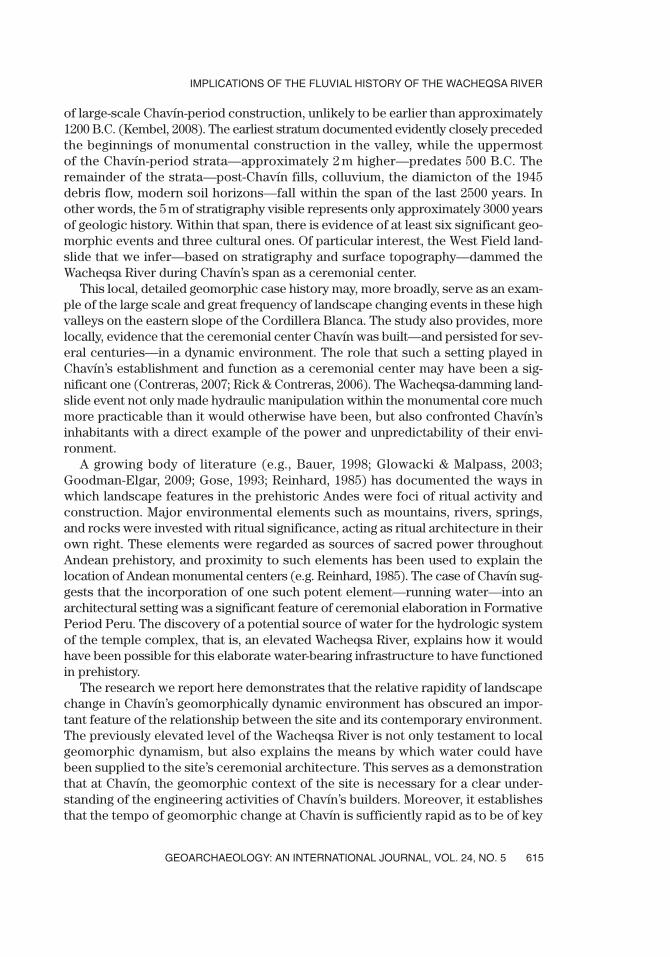
of large-scale Chavín-period construction, unlikely to be earlier than approximately1200 B.C. (Kembel, 2008). The earliest stratum documented evidently closely precededthe beginnings of monumental construction in the valley, while the uppermost of the Chavín-period strata—approximately 2 m higher—predates 500 B.C. Theremainder of the strata—post-Chavín fills, colluvium, the diamicton of the 1945debris flow, modern soil horizons—fall within the span of the last 2500 years. Inother words, the 5 m of stratigraphy visible represents only approximately 3000 yearsof geologic history. Within that span, there is evidence of at least six significant geo-morphic events and three cultural ones. Of particular interest, the West Field land-slide that we infer—based on stratigraphy and surface topography—dammed theWacheqsa River during Chavín’s span as a ceremonial center.
This local, detailed geomorphic case history may, more broadly, serve as an exam-ple of the large scale and great frequency of landscape changing events in these highvalleys on the eastern slope of the Cordillera Blanca. The study also provides, morelocally, evidence that the ceremonial center Chavín was built—and persisted for sev-eral centuries—in a dynamic environment. The role that such a setting played inChavín’s establishment and function as a ceremonial center may have been a sig-nificant one (Contreras, 2007; Rick & Contreras, 2006). The Wacheqsa-damming land-slide event not only made hydraulic manipulation within the monumental core muchmore practicable than it would otherwise have been, but also confronted Chavín’sinhabitants with a direct example of the power and unpredictability of their envi-ronment.
A growing body of literature (e.g., Bauer, 1998; Glowacki & Malpass, 2003;Goodman-Elgar, 2009; Gose, 1993; Reinhard, 1985) has documented the ways inwhich landscape features in the prehistoric Andes were foci of ritual activity andconstruction. Major environmental elements such as mountains, rivers, springs, and rocks were invested with ritual significance, acting as ritual architecture in theirown right. These elements were regarded as sources of sacred power throughoutAndean prehistory, and proximity to such elements has been used to explain thelocation of Andean monumental centers (e.g. Reinhard, 1985). The case of Chavín sug-gests that the incorporation of one such potent element—running water—into anarchitectural setting was a significant feature of ceremonial elaboration in FormativePeriod Peru. The discovery of a potential source of water for the hydrologic systemof the temple complex, that is, an elevated Wacheqsa River, explains how it wouldhave been possible for this elaborate water-bearing infrastructure to have functionedin prehistory.
The research we report here demonstrates that the relative rapidity of landscapechange in Chavín’s geomorphically dynamic environment has obscured an impor-tant feature of the relationship between the site and its contemporary environment.The previously elevated level of the Wacheqsa River is not only testament to localgeomorphic dynamism, but also explains the means by which water could havebeen supplied to the site’s ceremonial architecture. This serves as a demonstrationthat at Chavín, the geomorphic context of the site is necessary for a clear under-standing of the engineering activities of Chavín’s builders. Moreover, it establishesthat the tempo of geomorphic change at Chavín is sufficiently rapid as to be of key
GEOARCHAEOLOGY: AN INTERNATIONAL JOURNAL, VOL. 24, NO. 5
IMPLICATIONS OF THE FLUVIAL HISTORY OF THE WACHEQSA RIVER
615

archaeological relevance. The case of Chavín additionally illustrates that in dynamicgeomorphic environments, detailed study of the site’s geomorphic history is nec-essary for accurate archaeological interpretation. Significant differences betweenpresent and past landscapes may render interpretations based on modern land-scapes difficult if not misleading.
The fieldwork involved in this research was carried out as part of John Rick’s ongoing Stanford Universityresearch project at Chavín de Huántar, and we thank him for his support and generosity. Funding for themajor season of field research in 2005 was provided by a National Science Foundation Doctoral DissertationImprovement Grant (#0532350), with additional support from a Stanford School of Humanities andSciences Graduate Research Opportunity Grant, and an Amherst College Memorial Fellowship. TheExplorers Club Exploration Fund and a Lewis and Clark Field Scholar Grant from the AmericanPhilosophical Society provided funding for follow-up work in 2006. We were also, of course, supportedin the field by colleagues, students, and local residents too numerous to name. Particularly deserving ofmention for their help are Maria Mendoza, Christian Mesia, Patricia Quiñonez, and Franklin Romero; theexcavation itself would have been impossible without the expert work of Zósimo Melgarejo, ÁlvaroLlanos, and many others. The Stanford Archaeological Project was possible thanks to the approval andsupport of the national (Lima) and regional (Huaraz) offices of Peru’s Instituto Nacional de Cultura. Thetext of this article has been much improved thanks to the constructive criticism of Kenneth Lajoie, JohnRick, Robert Schuster, three anonymous reviewers, and the editors.
REFERENCES
Bauer, B.S. (1998). The sacred landscape of the Inca: The Cusco ceque system. Austin: University of TexasPress.
Bronk Ramsey, C. (1995). Radiocarbon calibration and analysis of stratigraphy: The OxCal program.Radiocarbon, 37, 425–430.
Bronk Ramsey, C. (2001). Development of the radiocarbon calibration program OxCal. Radiocarbon, 43,355–363.
Bronk Ramsey, C. (2007). OxCal v4.0.5 (software).Burger, R.L. (1982). Pojoc and Waman Wain: Two Early Horizon villages in the Chavin heartland. Ñawpa
Pacha, 20, 3–40.Burger, R.L. (1992). Chavín and the origins of Andean civilization. London: Thames and Hudson, Ltd.Burger, R.L. (2008). Chavín de Huántar and its sphere of influence. In H. Silverman & W. H. Isbell (Eds.),
Handbook of South American archaeology (pp. 681–703). New York, Springer.Cobbing, J., Sanchez F., A., Martinez V., W., & Zarate O., H. (1996). Geología de los cuadrángulos de Huaraz,
Recuay, La Unión, Chiquian y Yanahuanca. Lima: INGEMMET.Contreras, D.A. (2007). Sociopolitical and geomorphologic dynamism at Chavín de Huántar, Peru.
Unpublished Ph.D. dissertation, Stanford University, Palo Alto, CA.Contreras, D.A. (2009, in press). A Mito-style chamber at Chavín de Huántar: Dating and implications. Latin
American Antiquity.Costa, J.E., & Schuster, R.L. (1987). The formation and failure of natural dams. Open-File Report 87-392.
Washington, DC: U.S. Geological Survey.Cruden, D.M., & Varnes, D.J. (1996). Landslide types and processes. In A.K. Turner & R.L. Schuster (Eds.),
Landslides: Investigation and mitigation (pp. 36–75). Transportation Research Board National ResearchCouncil Special Report 247. Washington, DC: National Academy Press.
Diessl, W. (2004). Huantar, San Marcos, Chavín: Sitios arqueológicos en la Sierra de Ancash. Lima: InstitutoCultural Runa.
Dillehay, T.D., Eling, H.H., Jr., & Rossen, J. (2005). Preceramic irrigation canals in the Peruvian Andes.Proceedings of the National Academy of Sciences, 102, 17241–17244.
Farrington, I.S. (1980). The archaeology of irrigation canals, with special reference to Peru. WorldArchaeology, 11, 287–305.
CONTRERAS AND KEEFER
GEOARCHAEOLOGY: AN INTERNATIONAL JOURNAL, VOL. 24, NO. 5616

Glowacki, M., & Malpass, M.A. (2003). Water, huacas, and ancestor worship: Traces of a sacred Wari land-scape. Latin American Antiquity, 14, 431–448.
Goodman-Elgar, M. (2009). Places to partake: Chicha in the Andean landscape. In J. Jennings & B. Bowser(Eds.), Drink, power, and society in the Andes. Gainesville: Florida University Press (in press).
Gose, P. (1993). Segmentary state formation and the ritual control of water under the Incas. ComparativeStudies in Society and History, 35, 480–514.
Indacochea G., A.J., & Iberico M., M. (1947). Aluvionamiento de Chavín de Huantar el 17 de Enero de1945. Boletin de la Sociedad Geologica del Peru, 20, 21–28.
Isbell, W.H., & McEwan, G.F. (Eds.). (1991). Huari administrative structure: Prehistoric monumental archi-tecture and state government. Washington, DC: Dumbarton Oaks Research Library and Collection.
Keefer, D.K., & Johnson, A.M. (1983). Earth flows: Morphology, mobilization, and movement. U.S. GeologicalSurvey Professional Paper No. 1264.
Kembel, S.R. (2001). Architectural sequence and chronology at Chavín de Huántar, Perú. Unpublished Ph.D.dissertation, Stanford University.
Kembel, S.R. (2008). The architecture at the monumental center of Chavín de Huántar: Sequence, trans-formations, and chronology. In W.J. Conklin & J. Quilter (Eds.), Chavín: Art, architecture, and culture(pp. 35–84). Washington, DC: Cotsen Institute.
Kembel, S.R., & Rick, J.W. (2004). Building authority at Chavín de Huántar: Models of social organizationand development in the initial period and Early Horizon. In H. Silverman (Ed.), Andean archaeology(pp. 51–76). Malden, MA: Blackwell Publishing.
Kolata, A.L. (1993). The Tiwanaku. Cambridge: Blackwell.Kosok, P. (1965). Life, land and water in Ancient Peru. New York: Long Island University Press.Kus, J.S. (1984). The Chicama-Moche canal: Failure or success? An alternative explanation for an incom-
plete canal. American Antiquity, 49, 408–415.Lumbreras, L.G. (1989). Chavín de Huántar en el nacimiento de la civilización Andina. Lima: Instituto
Andino de Estudios Arqueologicos.Lumbreras, L.G. (1993). Chavín de Huántar: Excavaciones en la galería de las ofrendas. Mainz: Verlag
Philipp von Zabern.Lumbreras, L.G., & Amat Olazabal, H. (1966). Informe preliminar sobre las galerias interiores de Chavín.
Revista del Museo Nacional, 34, 143–197.Lumbreras, L.G., Gonzalez, C., & Lieataer, B. (1976). Acerca de la función del sistema hidraúlico de Chavín.
Lima: Museo de Arqueología y Antropología.MacLean, M.G.H. (1987). Sacred land, sacred water: Inca landscape planning in the Cuzco area. Ph.D.
dissertation, University of California, Berkeley.McCormac, F.G., Hogg, A.G., Blackwell, P.G., Buck, C.E., Higham, T.F.G., & Reimer, P.J. (2004). SHCal04
Southern Hemisphere calibration, 0-11.0 cal kyr BP. Radiocarbon, 46, 1087–1192.Onuki, Y. (Ed.). (1995). Kuntur Wasi y Cerro Blanco: Dos sitios del formativo en el norte del Perú. Tokyo:
Hokusen-sha.Ortloff, C.R., Moseley, M.E., & Feldman, R.A. (1982). Hydraulic engineering aspects of the Chimu Chicama-
Moche intervalley canal. American Antiquity, 47, 572–595.Petersen, G. (1985). Cumbemayo: Acueducto arqueológico que cruza la divisoria continental. In F. Silva
Santisteban, W. Espinoza Soriano, & R. Ravines (Eds.), Historia de Cajamarca, I: Arqueología (pp. 97–100). Lima: Instituto Nacional de Cultura.
Reinhard, J. (1985). Chavín and Tiahuanaco: A new look at two Andean ceremonial centers. NationalGeographic Research Review, 1, 395–422.
Rick, J.W. (2005). The evolution of authority and power at Chavín de Huántar, Peru. In K.J. Vaughn, D. Ogburn, & C.A. Conlee (Eds.), Foundations of power in the prehispanic Andes. ArcheologicalPapers of the American Anthropological Association, 14.
Rick, J.W. (2008). Context, construction and ritual in the development of authority at Chavín de Huántar.In W.J. Conklin & J. Quilter (Eds.), Chavín: Art, architecture and culture (pp. 3–34). Los Angeles:Cotsen Institute.
Rick, J.W., & Contreras, D.A. (2006). Natural sources of power and emerging authority at Chavín deHuántar. Religious Authority and Ritual Architecture in Prehispanic South America Symposium atthe 71st Annual Meeting of the Society for American Archaeology. San Juan, Puerto Rico.
GEOARCHAEOLOGY: AN INTERNATIONAL JOURNAL, VOL. 24, NO. 5
IMPLICATIONS OF THE FLUVIAL HISTORY OF THE WACHEQSA RIVER
617

Rick, J.W., Kembel, S. R., Rick, R.M., Kembel, J.A. (1998). La arquitectura del complejo ceremonial deChavín de Huántar: Documentación tridimensional y sus implicancias. In P. Kaulicke (Ed.), Perspectivasregionales del periodo formativo en el Peru (pp. 181–214). Lima: Pontificia Universidad Católica delPeru, Fondo Editorial.
Sandweiss, D.H., Maasch, K.A., Burger, R.L., Richardson, J.B., III, Rollins, H.B., & Clement, A. (2001).Variation in Holocene El Niño frequencies: Climate records and cultural consequences in ancientPeru. Geology, 29, 603–606.
Spann, H.J. (1947). Informe sobre el origen de la catástrofe de Chavín de Huantar. Boletin de la SociedadGeologica del Peru, 20, 29–33.
Tello, J.C. (1943). Discovery of the Chavín Culture in Perú. American Antiquity, 9, 135–160.Tello, J. C. (1945). Historia de los desbordamientos de los rios Pukcha y Mosna. Archivo Tello de la
Universidad Nacional Mayor de San Marcos, Lima, 775–777.Tello, J.C. (1960). Chavín: Cultura matriz de la civilización Andina. Lima: Imprenta de la Universidad de
San Marcos.Thompson, L.G., Mosley-Thompson, E., Davis, M.E., Lin, P.-N., Henderson, K.A., Cole-Dai, J., et al. (1995).
Late glacial stage and Holocene tropical ice core records from Huascaran, Peru. Science, 269, 46–50.Turner, R.J.W., Knight, R.J., & Rick, J.W. (1999). Geological landscape of the pre-Inca archaeological site
at Chavin de Huantar, Peru. Current Research 1999-D, Geological Survey of Canada, 47–56.Wright, K.R., McEwan, G. F., Wright, R.M. (2006). Tipon: Water engineering masterpiece of the Inca empire.
Reston, VA: American Society of Civil Engineers.
Received 14 March 2008
Accepted 2 April 2009
Scientific editing by Gary Huckleberry
CONTRERAS AND KEEFER
GEOARCHAEOLOGY: AN INTERNATIONAL JOURNAL, VOL. 24, NO. 5618