iaia stokes hernick 22april2015
TRANSCRIPT
Carrie Stokes
USAID
Charles Hernick
The Cadmus Group, Inc.
1
Who Else Cares About Environmental Information?
Identifying More Stakeholders by Enhancing Environmental Impact Assessment with Geospatial Technology
Presented at the International Association for Impact Assessment
Session 40 Collecting/Visually Communicating Data
22 April 2015
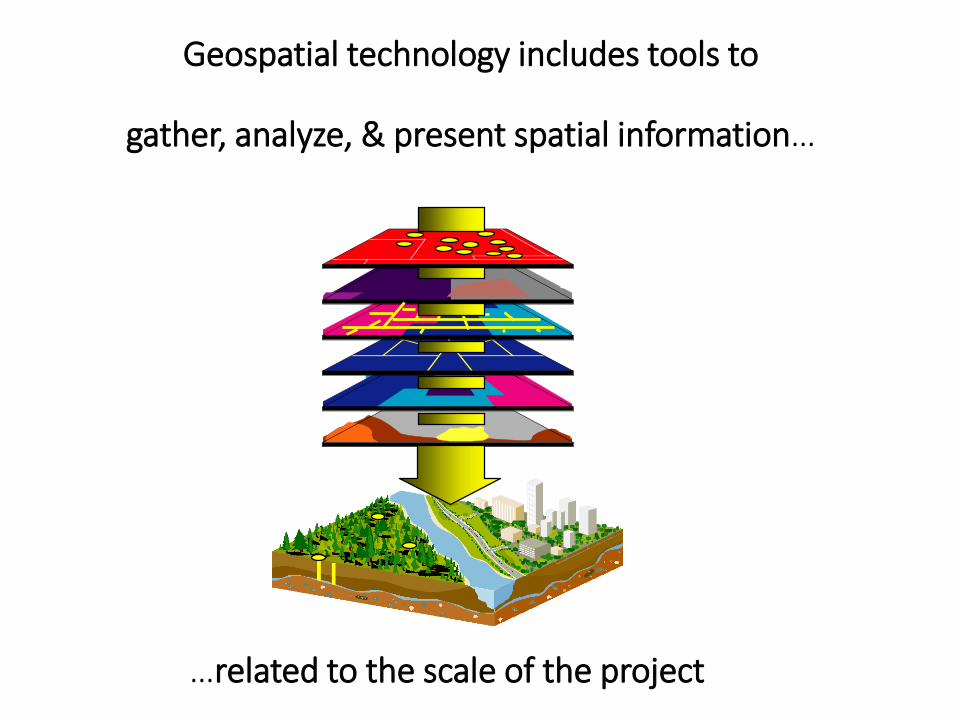
Geospatial technology includes tools to
gather, analyze, & present spatial information…
…related to the scale of the project
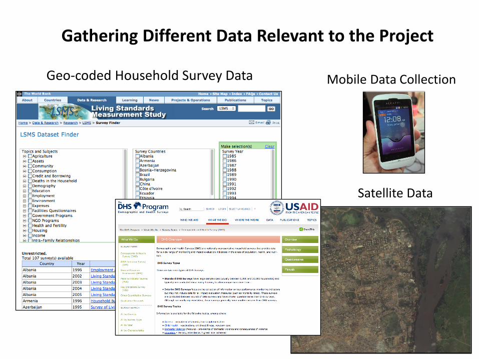
Gathering Different Data Relevant to the Project
3
Geo-coded Household Survey Data
Satellite Data
Mobile Data Collection
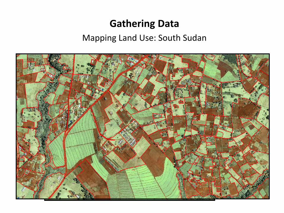
Gathering Data
Mapping Land Use: South Sudan
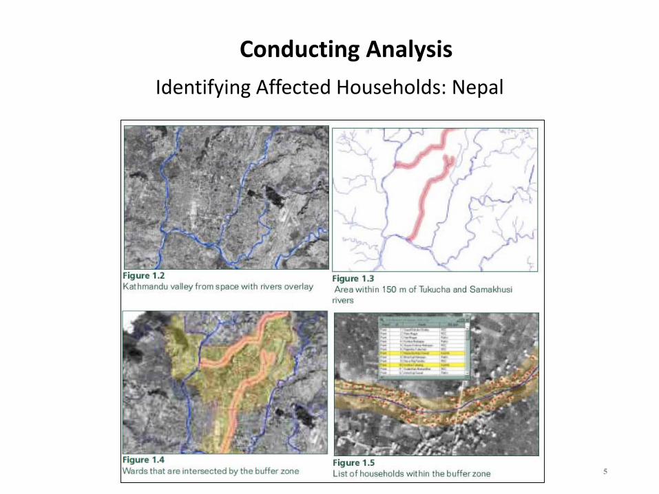
Conducting Analysis
5
Identifying Affected Households: Nepal
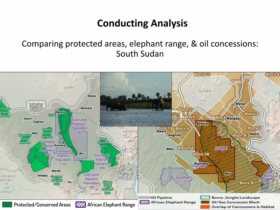
Conducting Analysis
6
Comparing protected areas, elephant range, & oil concessions: South Sudan
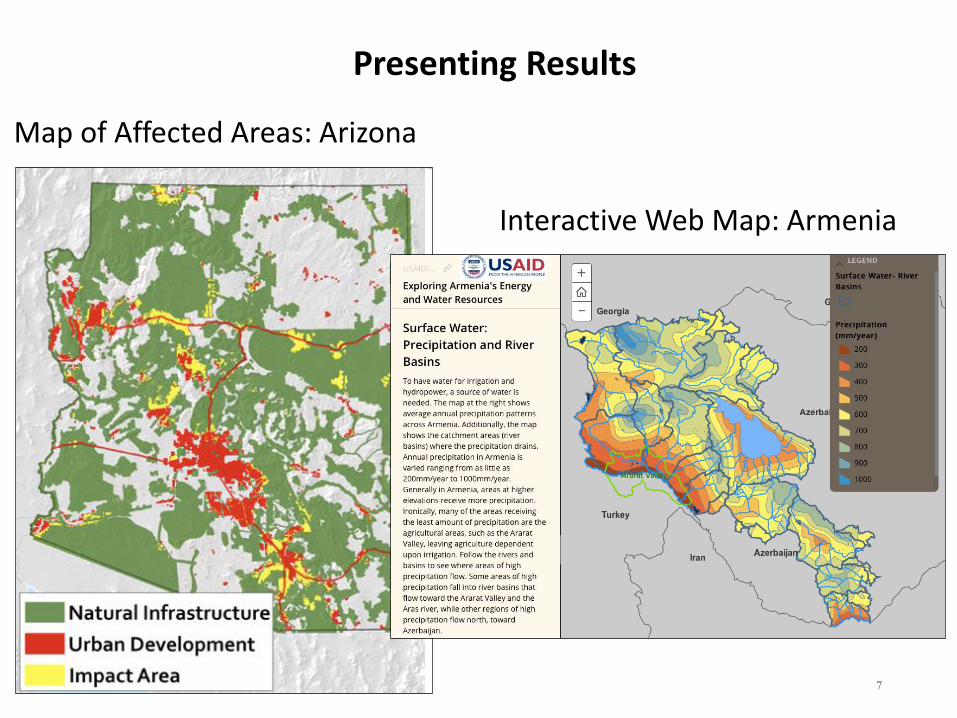
Presenting Results
7
Map of Affected Areas: Arizona
Interactive Web Map: Armenia
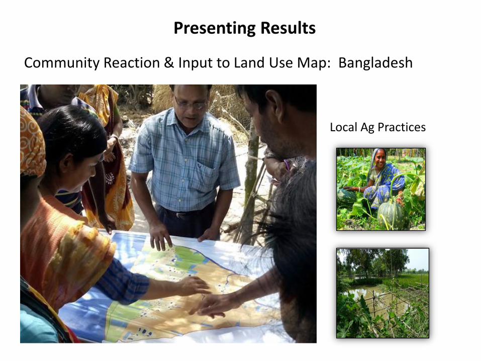
Presenting Results
Community Reaction & Input to Land Use Map: Bangladesh
Local Ag Practices
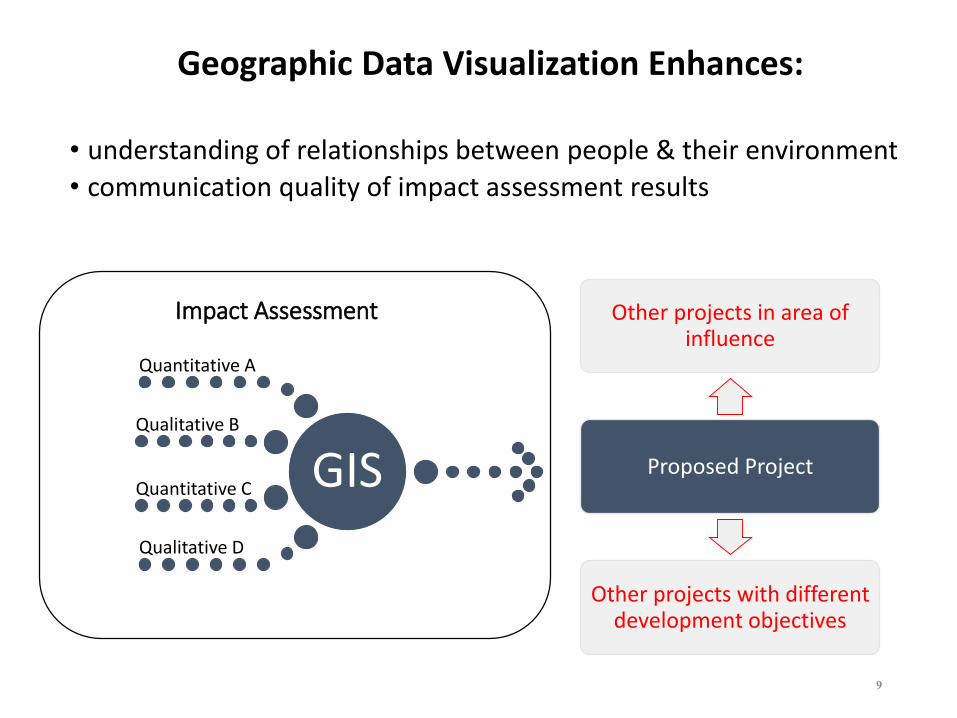
Impact Assessment
GIS
Quantitative A
Qualitative B
Quantitative C
Qualitative D
Other projects in area of influence
Proposed Project
Other projects with different development objectives
9
Geographic Data Visualization Enhances:
• understanding of relationships between people & their environment
• communication quality of impact assessment results