historical gis as a community resource: the vision of britain through time project paul s. ell...
Post on 21-Dec-2015
218 views
TRANSCRIPT

Historical GIS as a Historical GIS as a community resource: the community resource: the vision of Britain through vision of Britain through
time projecttime project
Paul S. EllPaul S. EllCentre for Data Digitisation Centre for Data Digitisation
and Analysisand AnalysisQueen’s University BelfastQueen’s University Belfast
[email protected]@qub.ac.uk

GBH GIS - The Academic GBH GIS - The Academic ResourceResource
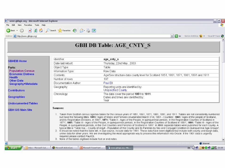
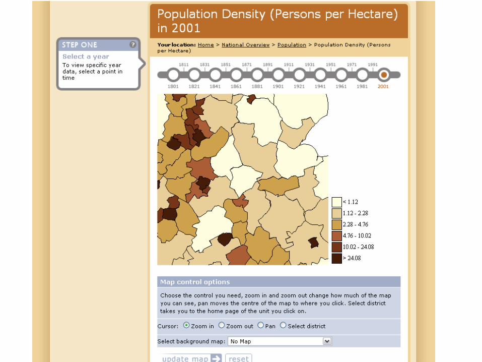
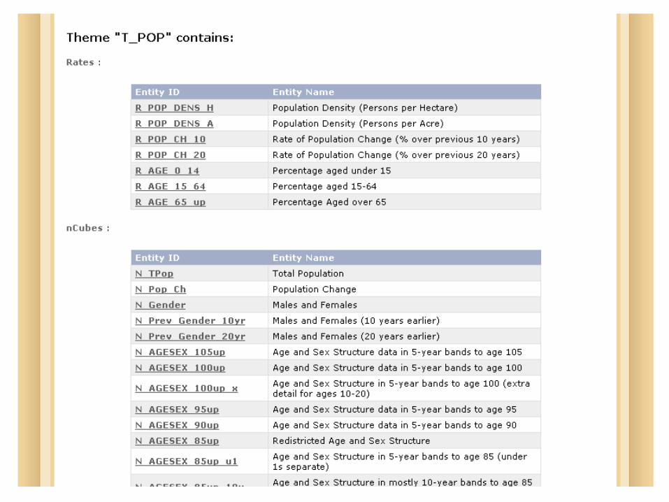
The first national historical GIS to be copletedThe first national historical GIS to be copleted Time-variant administrative boundaries from 1860sTime-variant administrative boundaries from 1860s 20+ million data values mostly from censuses 20+ million data values mostly from censuses
(excluding derived data)(excluding derived data) Runs in ArcGISRuns in ArcGIS Components available from UKBorders and AHDS Components available from UKBorders and AHDS
HistoryHistory Scholarly outputs from the GIS – CUP, Scholarly outputs from the GIS – CUP, Historical Historical
GeographyGeography, county atlas, , county atlas, Historical MethodsHistorical Methods, , Journal of Journal of the Royal Statistical Societythe Royal Statistical Society etc etc
NoNo funds to make the resource accessible funds to make the resource accessible

Towards an e-cultural atlasTowards an e-cultural atlas
$1,500,000 grant from NOF-$1,500,000 grant from NOF-DigitisationDigitisation
Funding started early 2002Funding started early 2002 Three year project which finished Three year project which finished
early 2005early 2005 See See www.visionofbritain.org.ukwww.visionofbritain.org.uk

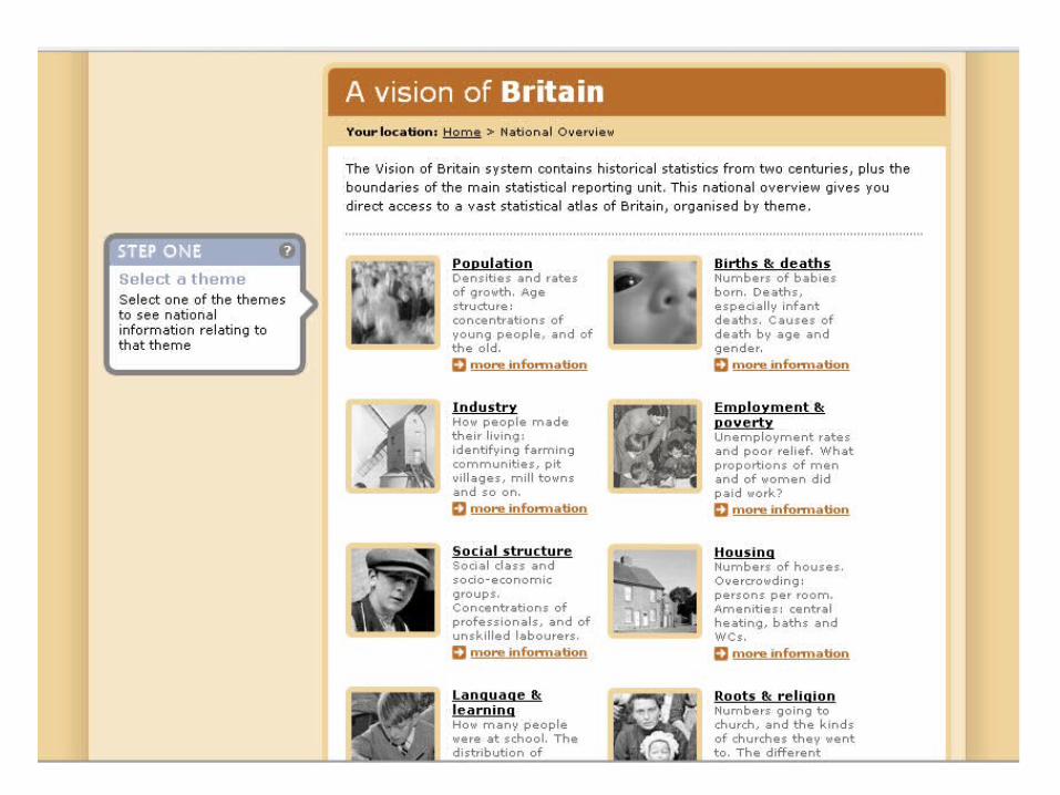
Content of the AtlasContent of the Atlas
Core is our existing boundary GIS Core is our existing boundary GIS and statistical datasetsand statistical datasets
This core is heavily disguised!This core is heavily disguised! Much additional information added Much additional information added

Additional census dataAdditional census data

Reports with each censusReports with each census

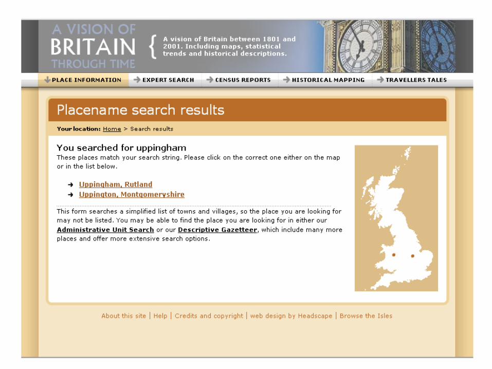
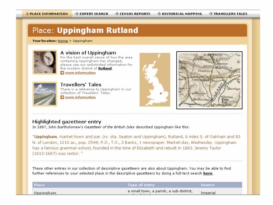
Historical GazetteersHistorical Gazetteers

Travellers’ TalesTravellers’ Tales
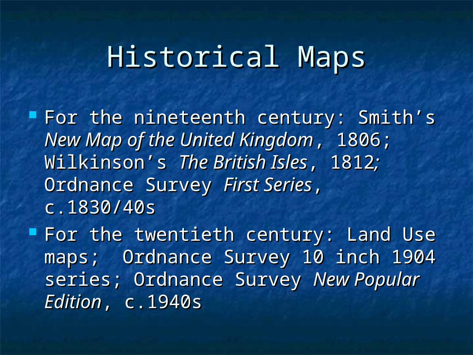
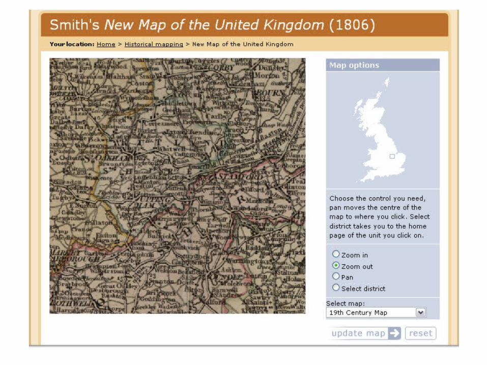
Historical MapsHistorical Maps
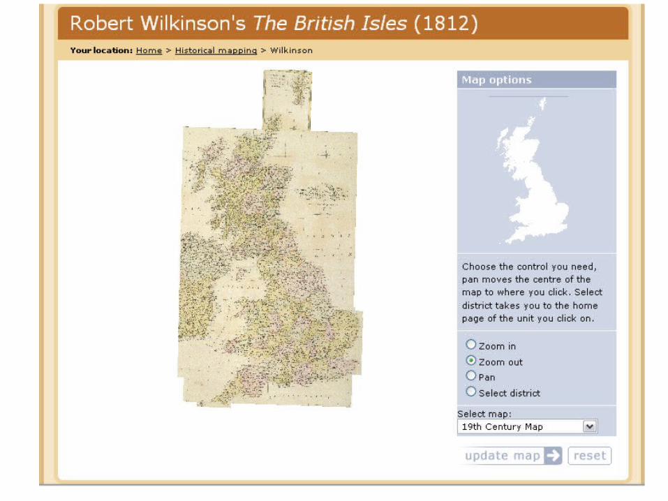
For the nineteenth century: Smith’s For the nineteenth century: Smith’s New New Map of the United KingdomMap of the United Kingdom, 1806; , 1806; Wilkinson’s Wilkinson’s The British IslesThe British Isles, 1812, 1812; ; Ordnance Survey Ordnance Survey First SeriesFirst Series, , c.1830/40sc.1830/40s
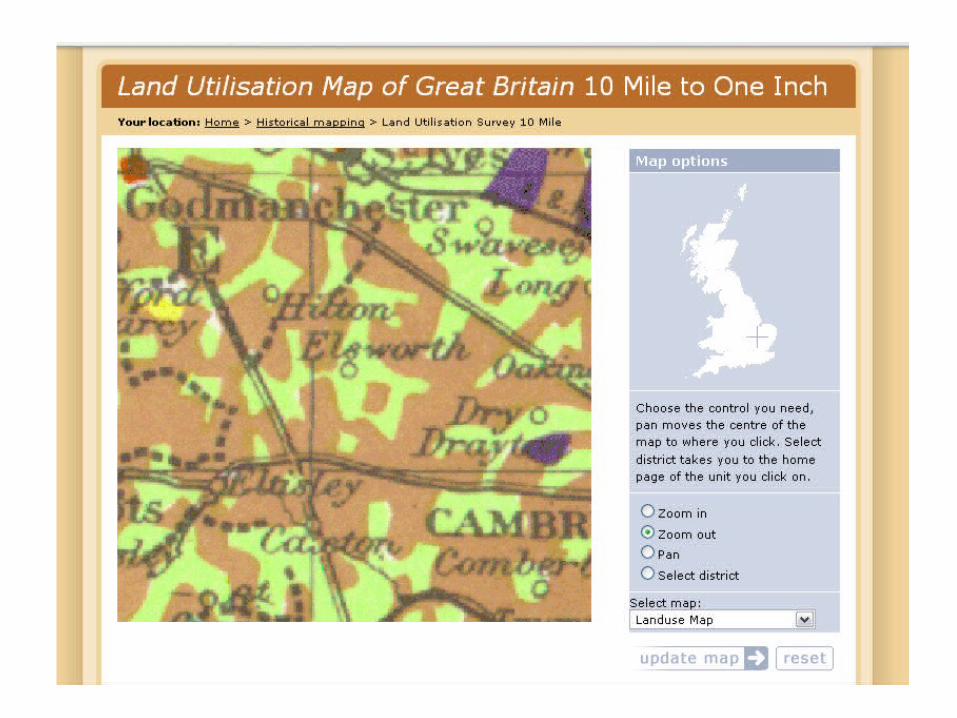
For the twentieth century: Land Use For the twentieth century: Land Use maps; Ordnance Survey 10 inch 1904 maps; Ordnance Survey 10 inch 1904 series; Ordnance Survey series; Ordnance Survey New Popular New Popular EditionEdition, c.1940s, c.1940s

The websiteThe website
www.visionofbritain.org.ukwww.visionofbritain.org.uk

Historical mapsHistorical maps


Census reportsCensus reports


Historical GazetteersHistorical Gazetteers


Travellers’ TalesTravellers’ Tales


An integrated resourceAn integrated resource


MappingMapping


Expert interfaceExpert interface
Scholars should probably go to AHDS Scholars should probably go to AHDS History and UKBorders to get the History and UKBorders to get the ArcGIS compatible dataArcGIS compatible data
Vision of Britain websiteVision of Britain website


Who was involved…Who was involved…


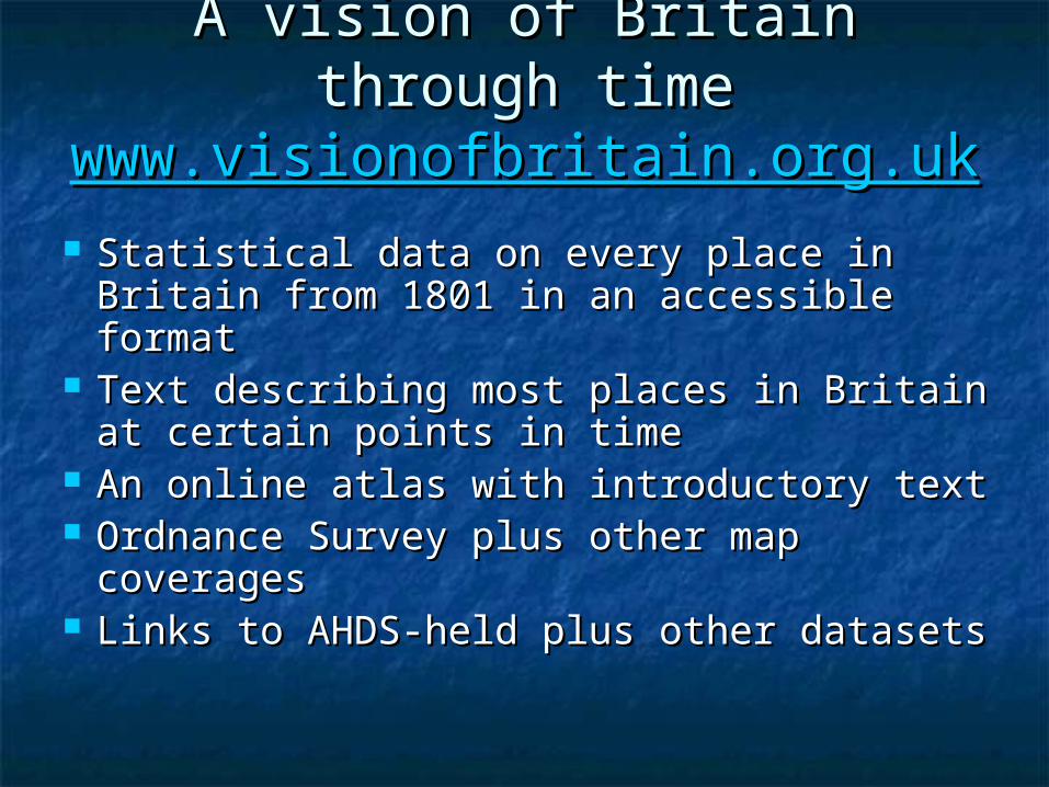
A vision of Britain through timeA vision of Britain through timewww.visionofbritain.org.ukwww.visionofbritain.org.uk
Statistical data on every place in Statistical data on every place in Britain from 1801 in an accessible Britain from 1801 in an accessible formatformat
Text describing most places in Britain Text describing most places in Britain at certain points in timeat certain points in time
An online atlas with introductory textAn online atlas with introductory text Ordnance Survey plus other map Ordnance Survey plus other map
coveragescoverages Links to AHDS-held plus other datasetsLinks to AHDS-held plus other datasets