geovia surpac - 3ds.com · surpac at a base metal operation. view drillholes, under-ground...
TRANSCRIPT
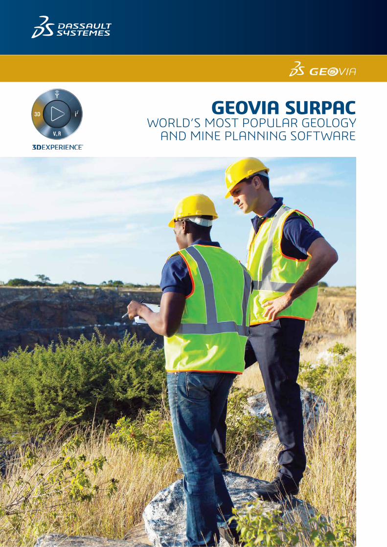
GEOVIA SURPACWORLD’S MOST POPULAR GEOLOGY
AND MINE PLANNING SOFTWARE
INTEGRATED GEOLOGY, RESOURCE MODELING, MINE PLANNING AND PRODUCTION
BENEFITS• Comprehensive tools include: drillhole data management,
geological modeling, block modeling, geostatistics, mine design, mine planning, resource estimation, and more.
• Increased time savings with compliance to company-specific processes.
• Software ease-of-use quickly ensures staff develops an understanding of the system and project data quickly.
• Modular and easily customized to adapt to changing needs.
• Interface with common file formats from Aerial Survey, Photogrammetry, GIS, CAD and other systems.
• Multilingual support: English, Chinese, Russian, Spanish and French.
GEOVIA Surpac™ is the most widely used software system of its kind in the world, supporting open pit and underground mining operations and exploration projects in more than 120 countries. Surpac enables mining practitioners to quantify and evaluate mineral deposits and to plan the efficient extraction of reserves.
GEOLOGICAL AND RESOURCE MODELINGEnabling geologists to determine the physical characteristics of a deposit with limited information is a key capability of Surpac, which harnesses powerful 3D graphics, geostatistics, and an integrated modeling environment.
Data management
• Employ sophisticated database tools to store, manage and review drilling data.
• Interface to any popular database product and work in real time while connected to that data.
• View and output sections quickly and easily using drillholes and existing topographic or pre-modeled data.
• Work with textured wireframe objects from scanned or photogrammetry sources to enable direct 3D geological mapping of contacts, boundaries and surfaces.
3DEXPERIENCE Platform Integration
Surpac introduces to you the powerful collaboration and data management capabilities of the 3DEXPERIENCE platform, enabling a central repository for storage and sharing of Surpac data, file versioning, and check in/check out.
From Surpac, you can upload files to the platform to share with stakeholders who can also view the files directly on the platform. Designed for mining professionals of all levels, GEOVIA POWER’BY enables zero distance between departments, sites and companies for effective collaboration.
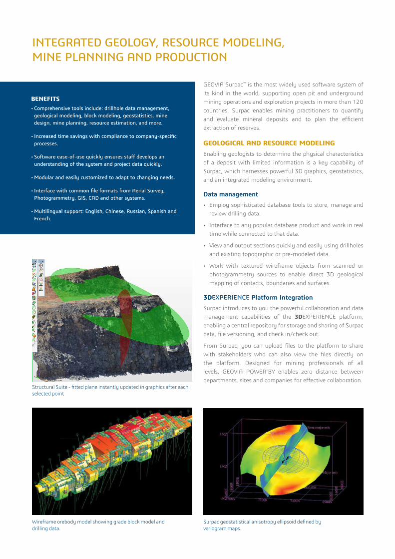
Wireframe orebody model showing grade block model and drilling data.
Surpac geostatistical anisotropy ellipsoid defined by variogram maps.
Structural Suite - fitted plane instantly updated in graphics after each selected point
Estimation and modeling
• Surpac contains outstanding tools for sample compositing and geostatistics.
• Variogram modeling includes variogram fans and dynamic lag adjustment to help identify the best variograms for data.
• Estimation tools include an interface to GSLIB for both normal kriging and conditional simulation options.
• Comprehensive 3D wireframing tools enable the development of a truly representative model of any orebody.
• Surpac block modeling tools cover an extensive range of functionality and are easy to use. With multiple cores, validating a model and generating any level of report can be done quicker than ever.
Structural Suite
Extract and visualize orientations directly from drillholes, analyze surface gradients, and visually create planes from point clouds or textured meshes and view them on a stereographic projection.
MINE PLANNINGWhether creating designs and plans for open pit or underground operations, Surpac provides engineers with all the tools they need. In this integrated environment, designs can be created to maximize ore recovery, while complying with project constraints such as cut- off grade, economic limits and ground stability.
• Data from various sources can be viewed and incorporated into plans to support feasibility projects.
• Different pieces of information can be viewed simultaneously to ensure designs are within the physical constraints of the mining area and to maximize the economic extraction of a resource.
• Data can be used directly from other software package formats with Surpac’s sophisticated Data Plug-ins.
• Interact with all mine design data: drillholes; existing orebody and surface models; optimized pit shells; block and grid models, colored by grade distribution; and many more.
• Step through planes, delineate stope boundaries to create design solids and then divide these solids into practical mining shapes quickly and easily with underground stope design tools.
Stope OptimizationThe new stope optimization capabilities provides underground engineers the ability to automate the generation of stope designs for a variety of underground mining methods. Mining engineers can rapidly generate multiple design options and analyze these to select the most optimal design whilst ensuring it adheres to mining constraints.
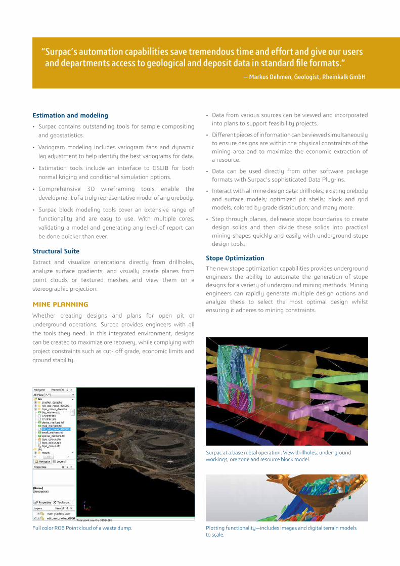
Surpac at a base metal operation. View drillholes, under-ground workings, ore zone and resource block model.
Plotting functionality—includes images and digital terrain models to scale.
Full color RGB Point cloud of a waste dump.
“Surpac’s automation capabilities save tremendous time and effort and give our users and departments access to geological and deposit data in standard file formats.”
— Markus Oehmen, Geologist, Rheinkalk GmbH
©20
17 D
assa
ult S
ystè
mes
. All
righ
ts re
serv
ed. 3
DEX
PER
IEN
CE®
, the
Com
pass
icon
, the
3D
S lo
go, C
ATI
A, S
OLI
DW
OR
KS, E
NO
VIA
, DEL
MIA
, SIM
ULI
A, G
EOVI
A, E
XALE
AD
, 3D
VIA
, 3D
SWYM
, BIO
VIA
, NET
VIB
ES, I
FWE
and
3DEX
CITE
are
com
mer
cial
trad
emar
ks o
r reg
iste
red
trad
emar
ks o
f Das
saul
t Sys
tèm
es, a
Fre
nch
“soc
iété
eur
opée
nne”
(Ver
saill
es C
omm
erci
al R
egis
ter #
B 3
22 3
06 4
40),
or it
s su
bsid
iari
es in
the
Uni
ted
Stat
es a
nd/o
r oth
er c
ount
ries
. All
othe
r tra
dem
arks
are
ow
ned
by th
eir r
espe
ctiv
e ow
ners
. Use
of a
ny D
assa
ult S
ystè
mes
or
its
subs
idia
ries
trad
emar
ks is
sub
ject
to th
eir e
xpre
ss w
ritt
en a
ppro
val.
Our 3DEXPERIENCE® platform powers our brand applications, serving 12 industries, and provides a rich portfolio of industry solution experiences. Dassault Systèmes, the 3DEXPERIENCE® Company, provides business and people with virtual universes to imagine sustainable innovations. Its world-leading solutions transform the way products are designed, produced, and supported. Dassault Systèmes’ collaborative solutions foster social innovation, expanding possibilities for the virtual world to improve the real world. The group brings value to over 210,000 customers of all sizes in all industries in more than 140 countries. For more information, visit www.3ds.com.
Europe/Middle East/AfricaDassault Systèmes10, rue Marcel DassaultCS 4050178946 Vélizy-Villacoublay CedexFrance
AmericasDassault Systèmes175 Wyman StreetWaltham, Massachusetts02451-1223USA
Asia-PacificDassault Systèmes K.K.ThinkPark Tower2-1-1 Osaki, Shinagawa-ku,Tokyo 141-6020Japan
MINE PRODUCTIONSurpac is used at mine sites throughout the world for mine production, providing integrated applications for mining engineers, geologists and mine surveyors, ensuring clear plans, effective communication and consistent data utilization. The software manages borehole, blasting and survey information, while linking to other databases used at mining operations.
Modern survey practices are supported through a proprietary high performance point cloud engine that allows users to work with point clouds of any size from aerial, vehicle and terrestrially based systems.
Mine survey and ore control• Calculate and validate volumes quickly.
• Compare kriged models against raw drillhole data to optimize reserve extraction.
• Produce high quality to-scale maps of any relevant project information.
• Road and pit design tools are geared towards surveying setout, ensuring the necessary details required by earth movers are marked out accurately.
• Integrated resource models, pit designs and survey data results in up-to-date ore markouts and dig plans with grade and tonnage reports.
Automated workflows• Highlight end-of-month reconciliations and reporting
problems through the simple automation of comparison reports using Surpac’s macro tools.
• Automate repetitive grade control and plotting tasks using macro functionality, customizable to company-specific processes and data flows.
• Develop new functions using the scripting language embedded within Surpac and assign routines to customized menu bars to better manage work flows.
EXTEND YOUR CAPABILITIES WITH THESE GEOVIA SYSTEMS
GEOVIA Whittle™: Economic analysis and optimizationGEOVIA Whittle is the world’s most popular and effective life-of-mine scheduling, optimization and analysis system for open pit mines. Mine planners depend on the system to help them maximize NPV, balance schedules, and to optimize blends and stockpiles. With results that are trusted by the financial community, Whittle is also used in pre-feasibility and feasibility studies.
GEOVIA MineSched™: Surface and underground schedulingGEOVIA MineSched provides scheduling for surface and underground mines of all sizes and types. It incorporates a broad set of built-in functionality, proven scheduling algorithms, and multiple output results such as graphics and charts. MineSched creates schedules that improve productivity and profits beyond what could be achieved by manual scheduling.
For more information email [email protected] or visit www.3ds.com/products-services/geovia/products/surpac