geomorphology and landslide hazard models - ags (hk · 1 geomorphology and landslide hazard models...
TRANSCRIPT
1
Geomorphology and Landslide Hazard Models
Steve Parry
GeoRisk Solutions
Key component of interpreting geomorphology and therefore hazard at a site is the use of API
The purpose of this talk is not to try and teach you API
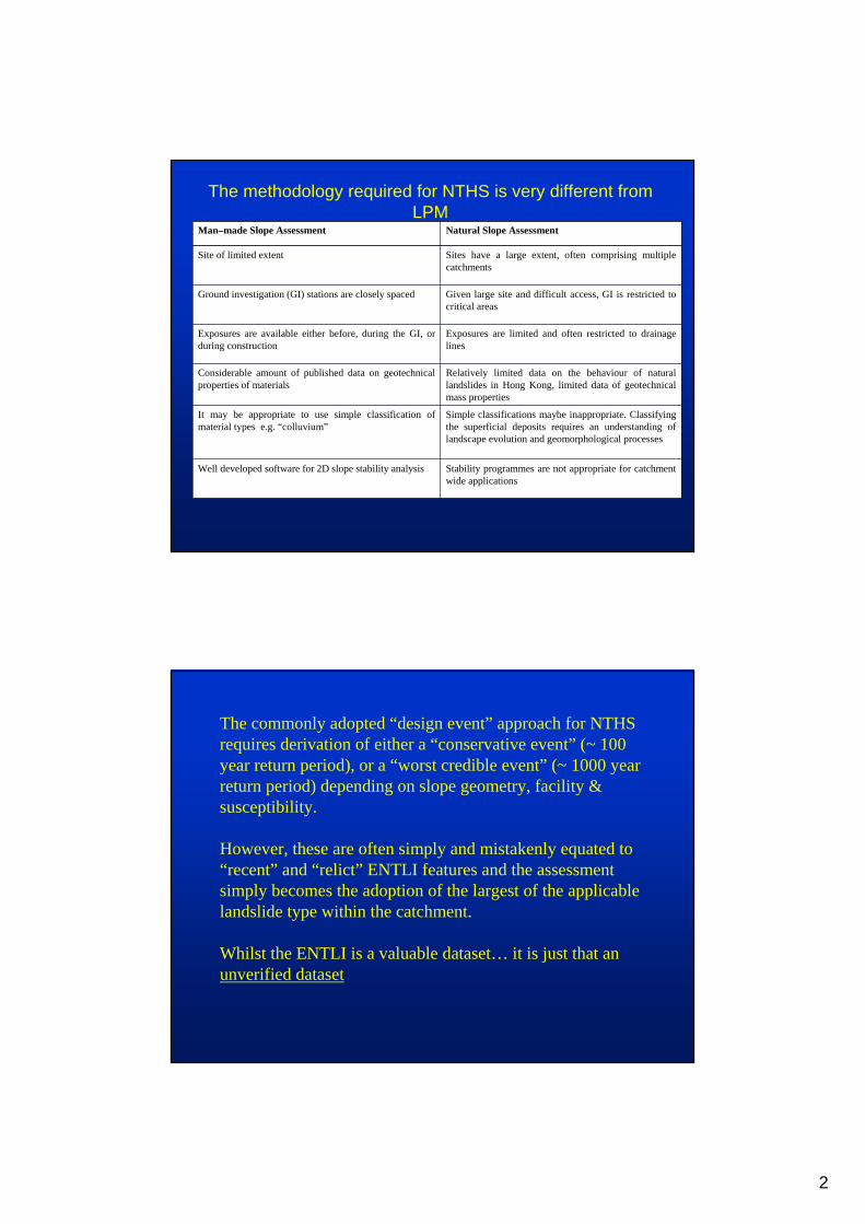
Buy the AGS book – it shows the components of API. However it will not teach you how to carry out a geomorphological interpretation
That requires geomorphological training and experience
2
Stability programmes are not appropriate for catchment wide applications
Well developed software for 2D slope stability analysis
Simple classifications maybe inappropriate. Classifying the superficial deposits requires an understanding of landscape evolution and geomorphological processes
It may be appropriate to use simple classification of material types e.g. “colluvium”
Relatively limited data on the behaviour of natural landslides in Hong Kong, limited data of geotechnical mass properties
Considerable amount of published data on geotechnical properties of materials
Exposures are limited and often restricted to drainage lines
Exposures are available either before, during the GI, or during construction
Given large site and difficult access, GI is restricted to critical areas
Ground investigation (GI) stations are closely spaced
Sites have a large extent, often comprising multiple catchments
Site of limited extent
Natural Slope AssessmentMan–made Slope Assessment
The methodology required for NTHS is very different from LPM
The commonly adopted “design event” approach for NTHS requires derivation of either a “conservative event” (~ 100 year return period), or a “worst credible event” (~ 1000 year return period) depending on slope geometry, facility & susceptibility.
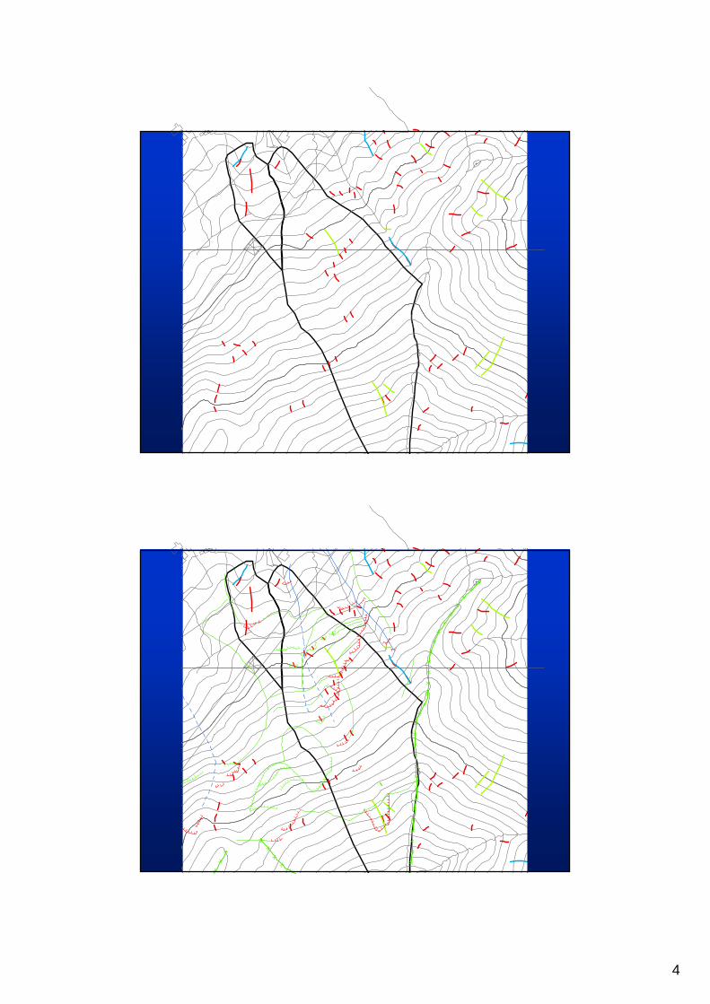
However, these are often simply and mistakenly equated to “recent” and “relict” ENTLI features and the assessment simply becomes the adoption of the largest of the applicable landslide type within the catchment.
Whilst the ENTLI is a valuable dataset… it is just that an unverified dataset
3
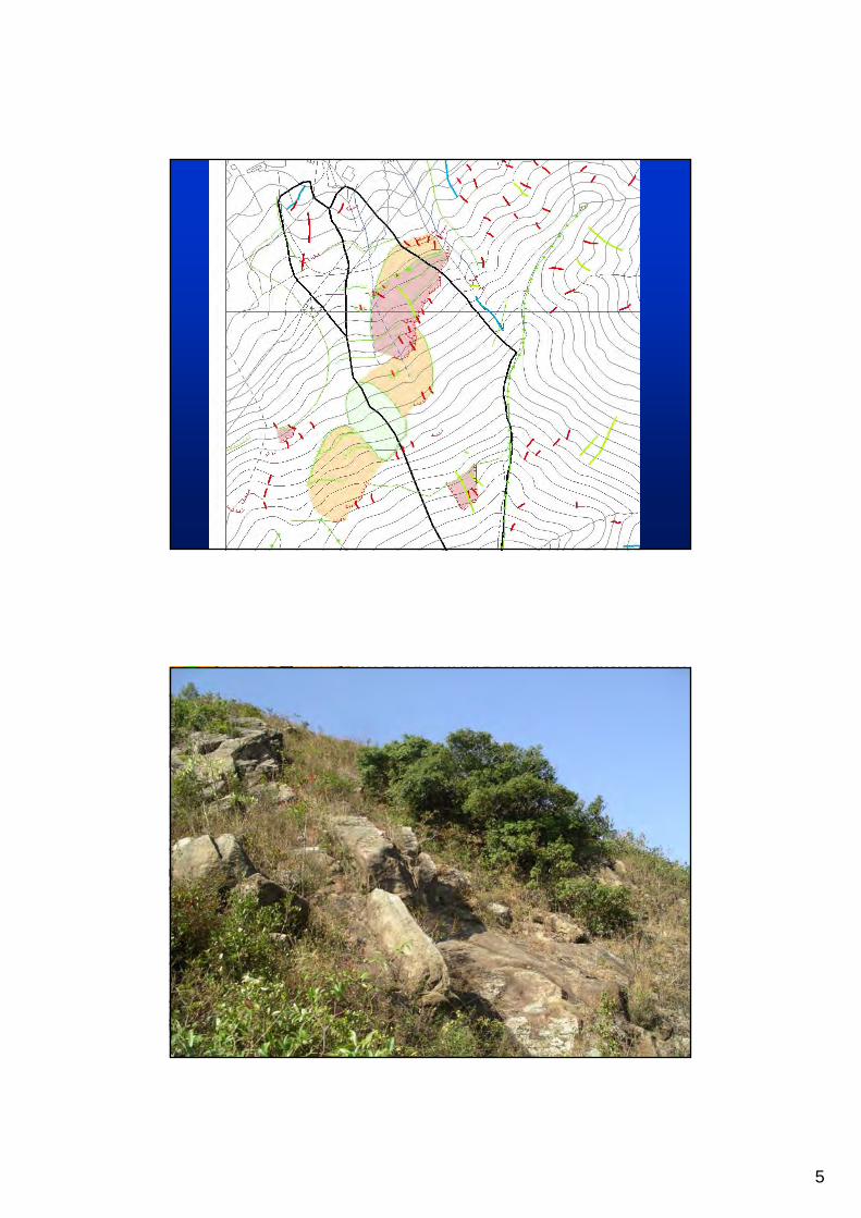
ENTLI
Given the project constraints (over 105,000 aerial photographs were reviewed in 16 months) the interpreters could only examine for relatively clear evidence of landslides e.g. obvious scarps, with very little time available to consider geomorphological settings, often critical with respect to the identification of older degraded and possibly landslide related features
None of the features were field verified
“Relict” landslidesIt should be noted that some of the large “relict” landslides are possible 10s of thousands of years old i.e. considerably outsidethe required 1:1000-yr event requirement
Even absolute dating can be problematic. A landslide at TsingShan was age dated which gave a range of ages from 44,000 to 1200 BPyears.
However, field mapping subsequently confirmed that it is an active slow-moving, landslide
4
..
..
..
.
..
..
.
.
..
..
.
.
..
.
.
..
.
..
.
.
.
.
.
.
.
. .
.
.
.
.
.
.
..
..
..
.
.
.
.
. . .
.
..
..
..
..
..
..
.
..
.
.
.
.
..
.
.
.
.
.
.
.
..
..
..
..
.
..
.
.
.
.
.
.
.
.
.
.
.
.
.
.
..
..
.
.
. . .
.
.
.
.
.
.
..
. . . ..
.
.
.
.
. . . . . .
.
.
..
..
..
..
.
.
XX
X
XX
XX
XX
XX
XX
XX
XX
XX
XX
XX
XX
XX
XX
X
..
.
.
.
.
.
.
.
..
..
..
.
..
..
..
..
..
.
.
..
..
.
.
.
.
.
.
..
.
.. . .
. . . . . .
XX
X
XX
XX
X
5
6
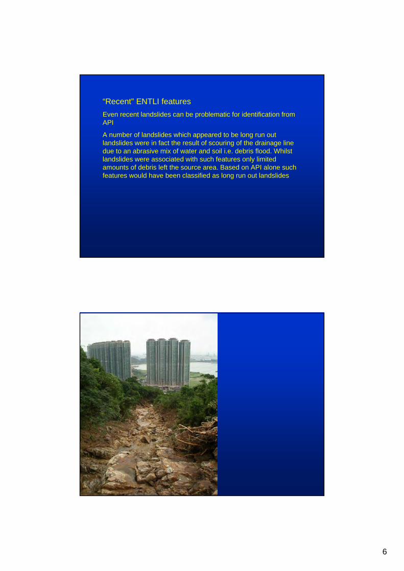
“Recent” ENTLI featuresEven recent landslides can be problematic for identification from API
A number of landslides which appeared to be long run out landslides were in fact the result of scouring of the drainage line due to an abrasive mix of water and soil i.e. debris flood. Whilst landslides were associated with such features only limited amounts of debris left the source area. Based on API alone such features would have been classified as long run out landslides
7
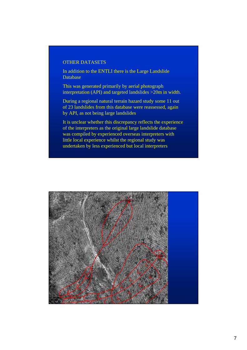
OTHER DATASETS
In addition to the ENTLI there is the Large Landslide Database
This was generated primarily by aerial photograph interpretation (API) and targeted landslides >20m in width.
During a regional natural terrain hazard study some 11 out of 23 landslides from this database were reassessed, again by API, as not being large landslides
It is unclear whether this discrepancy reflects the experience of the interpreters as the original large landslide database was compiled by experienced overseas interpreters with little local experience whilst the regional study was undertaken by less experienced but local interpreters
8
9
“is the study of the forms of the surface of the earth, their origin, the processes involved in their development, the properties of the materials of which they are made and predictions about their future form, behavior and status”
(D Brunsden, 5th Glossop Lecture, 2002)
What is “Geomorphology”?
Complex interrelationship between :
1. Geology
- rock type
- structure
- weathering
2. Geomorphology
- landscape evolution
- surface processes
10
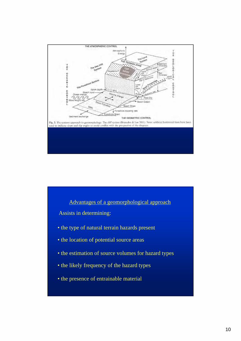
Advantages of a geomorphological approach
• the type of natural terrain hazards present
• the presence of entrainable material
• the estimation of source volumes for hazard types
• the location of potential source areas
Assists in determining:
• the likely frequency of the hazard types
11
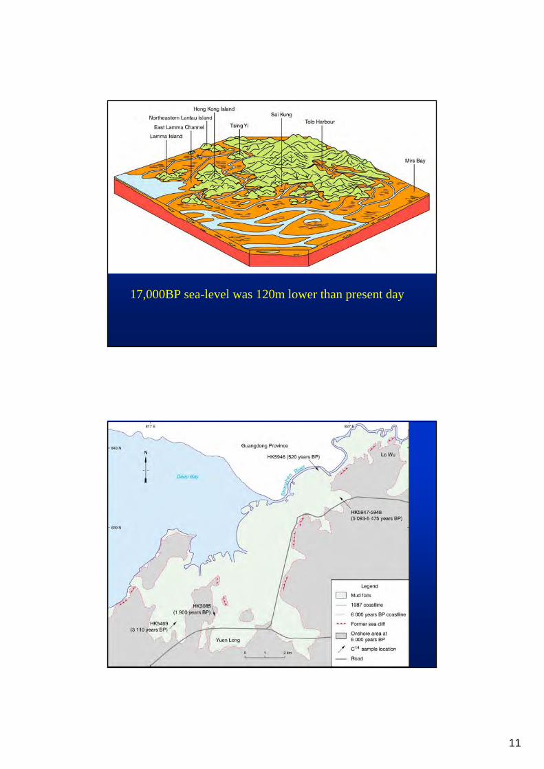
17,000BP sea-level was 120m lower than present day
12
13
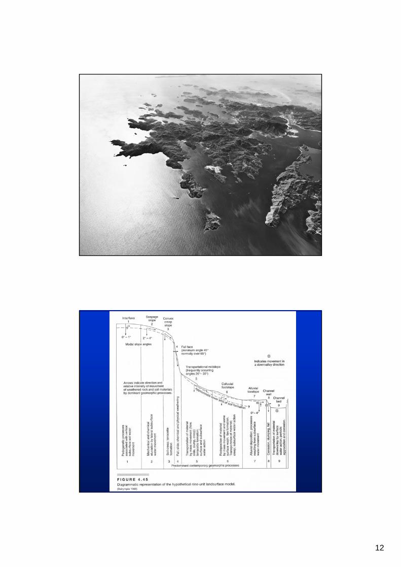
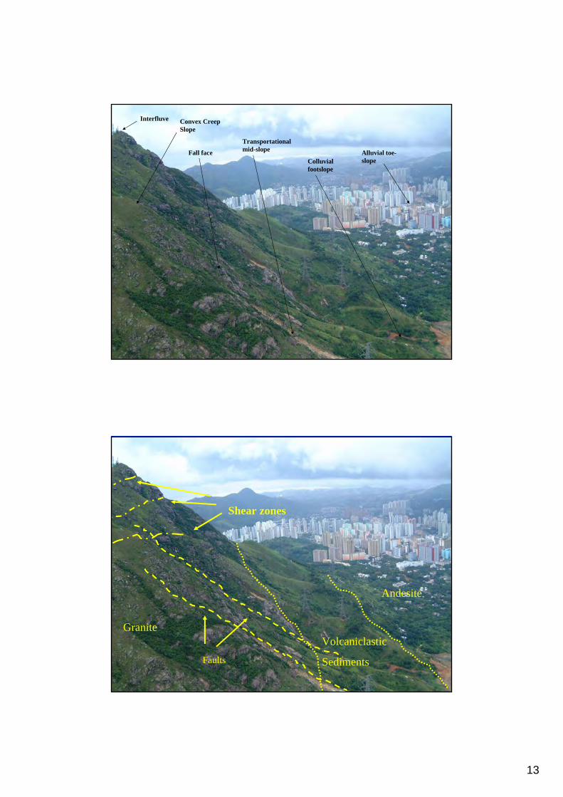
Interfluve Convex Creep Slope
Fall face
Transportational mid-slope
Colluvial footslope
Alluvial toe-slope
Andesite
Volcaniclastic
Sediments
Shear zones
Faults
Granite
14
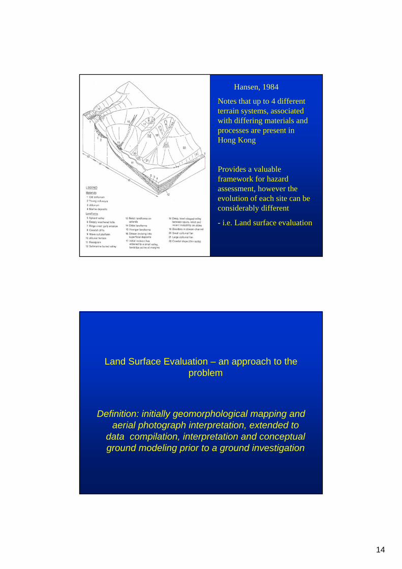
Hansen, 1984
Notes that up to 4 different terrain systems, associated with differing materials and processes are present in Hong Kong
Provides a valuable framework for hazard assessment, however the evolution of each site can be considerably different
- i.e. Land surface evaluation
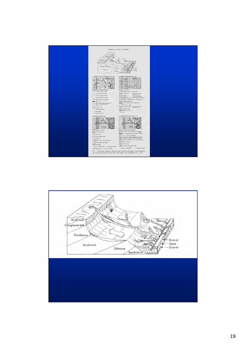
Land Surface Evaluation – an approach to the problem
Definition: initially geomorphological mapping and aerial photograph interpretation, extended to
data compilation, interpretation and conceptual ground modeling prior to a ground investigation
15
Two Approaches
(a) Land Classification• identification of landscape patterns, mainly from API• typically to land facets scale• regional surveys in developing countries• Hong Kong (GASP, Brand et al. 1982)
(b) Land Surface MappingGeomorphological maps showing:•typically to land elements scale,•nature and properties of their materials•characteristics of the processes which formed them
NTHS require an understanding of both
Land Classification
16
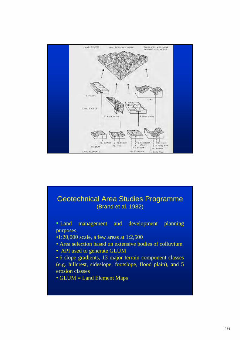
Geotechnical Area Studies Programme(Brand et al. 1982)
• Land management and development planning purposes•1:20,000 scale, a few areas at 1:2,500• Area selection based on extensive bodies of colluvium• API used to generate GLUM• 6 slope gradients, 13 major terrain component classes (e.g. hillcrest, sideslope, footslope, flood plain), and 5 erosion classes• GLUM = Land Element Maps
17
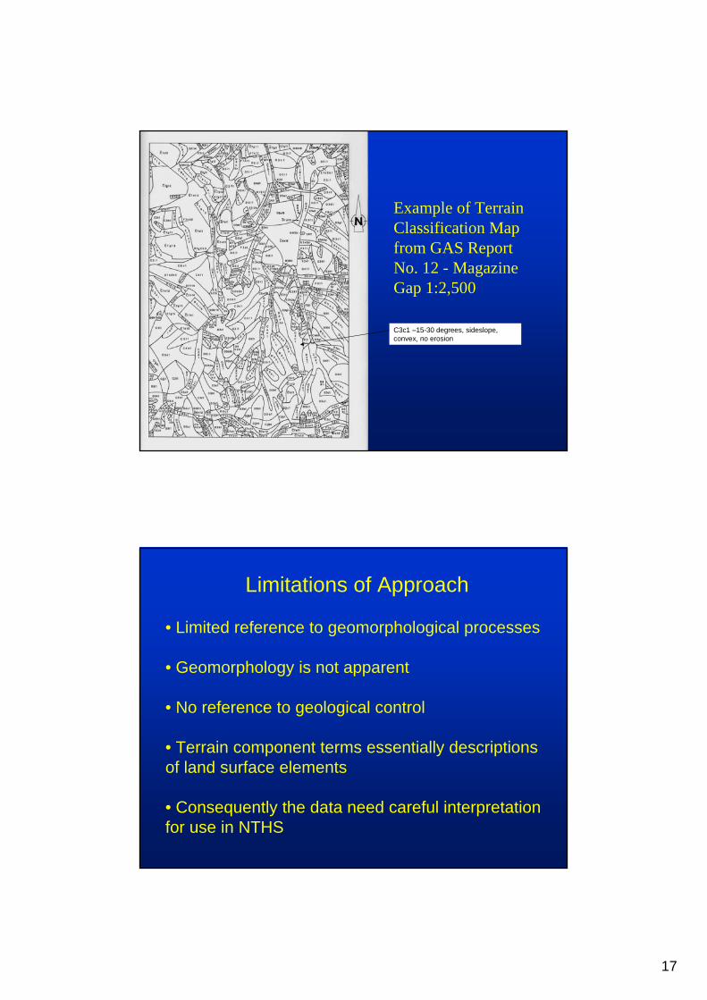
Example of Terrain Classification Map from GAS Report No. 12 - Magazine Gap 1:2,500
C3c1 –15-30 degrees, sideslope, convex, no erosion
Limitations of Approach
• Limited reference to geomorphological processes
• Geomorphology is not apparent
• No reference to geological control
• Terrain component terms essentially descriptions of land surface elements
• Consequently the data need careful interpretation for use in NTHS
18
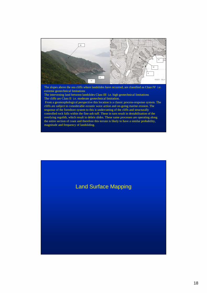
IV
III
II
IV
III
II
The slopes above the sea cliffs where landslides have occurred, are classified as Class IV i.e. extreme geotechnical limitations The intervening land between landslides Class III i.e. high geotechnical limitationsThe cliffs are Class II i.e. moderate geotechnical limitation.From a geomorphological perspective this location is a classic process-response system. The
cliffs are subject to considerable oceanic wave action and on-going marine erosion. The response of the foreshore system to this is undercutting of the cliffs and structurally controlled rock falls within the fine-ash tuff. These in turn result in destabilisation of the overlying regolith, which result in debris slides. These same processes are operating along the entire section of coast and therefore this terrain is likely to have a similar probability, magnitude and frequency of landsliding.
Land Surface Mapping
19
20
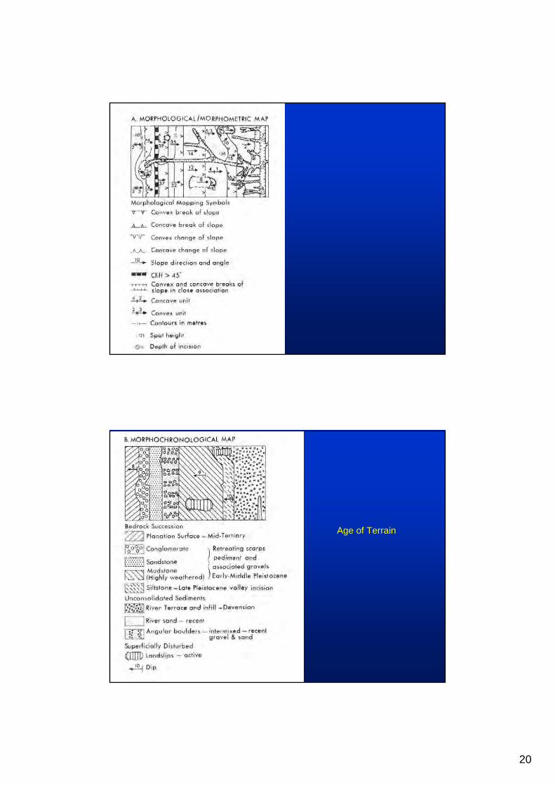
Age of Terrain
21
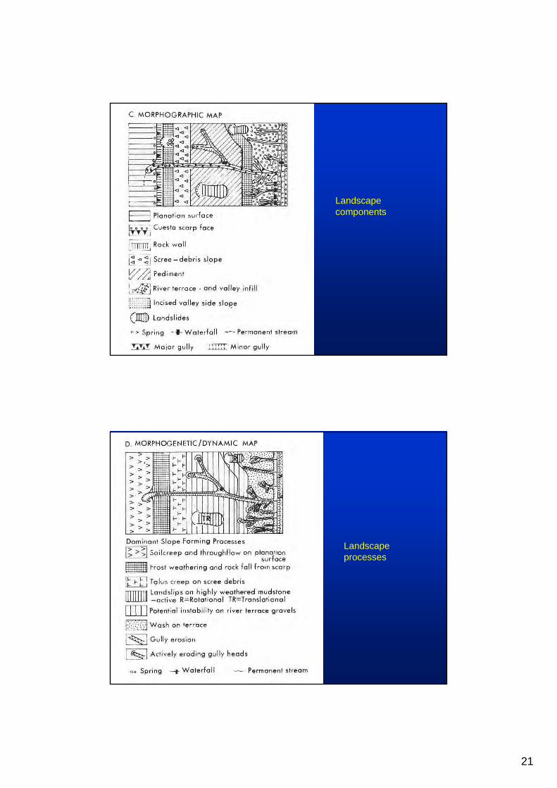
Landscape components
Landscape processes

22
Many APIs focus on site histories and when geomorphological mapping is carried out it simply shows rudimentary morphological data
Assessments are often restricted to site boundaries. Landforms do not evolve in isolation and in order to develop a model a sufficient large area has to be studied
There is limited experience of geomorphological mapping in Hong Kong and even less experience with respect to developing models of landscape evolution
Geomorphological boundaries derived from API are not verified in the field
23
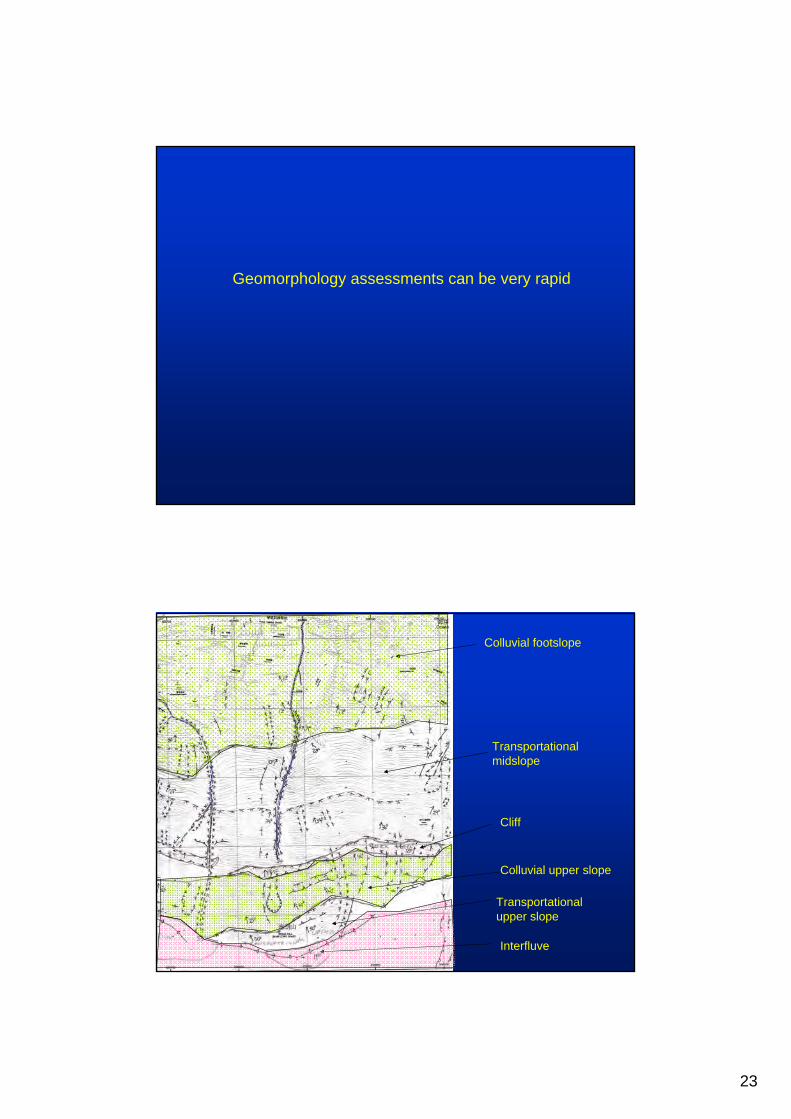
Geomorphology assessments can be very rapid
Colluvial footslope
Transportational upper slope
Interfluve
Colluvial upper slope
Transportational midslope
Cliff
24
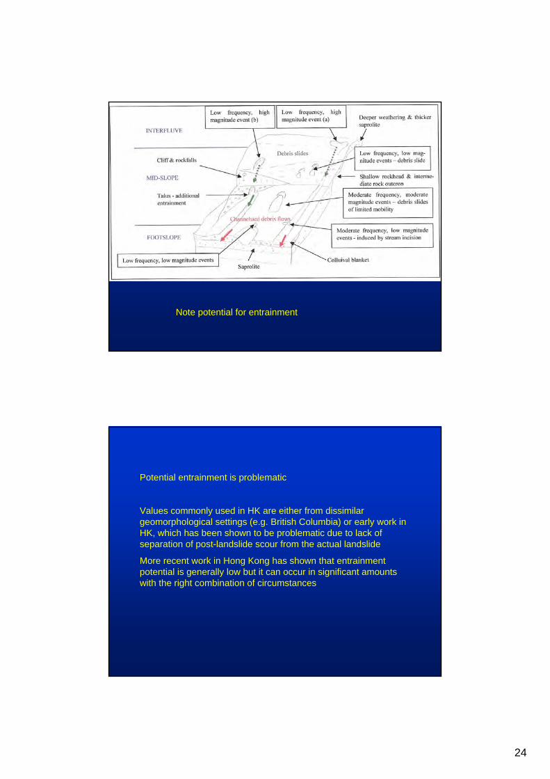
Note potential for entrainment
Potential entrainment is problematic
Values commonly used in HK are either from dissimilar geomorphological settings (e.g. British Columbia) or early work in HK, which has been shown to be problematic due to lack of separation of post-landslide scour from the actual landslide
More recent work in Hong Kong has shown that entrainment potential is generally low but it can occur in significant amounts with the right combination of circumstances
25
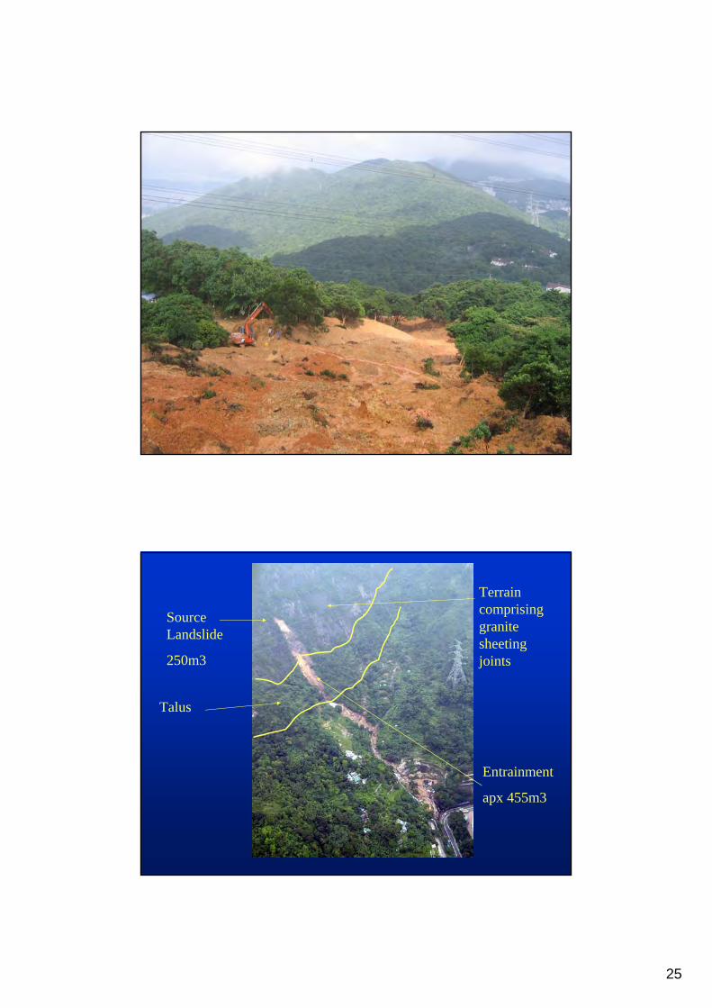
Terrain comprising granite sheeting joints
Talus
Entrainment
apx 455m3
Source Landslide
250m3
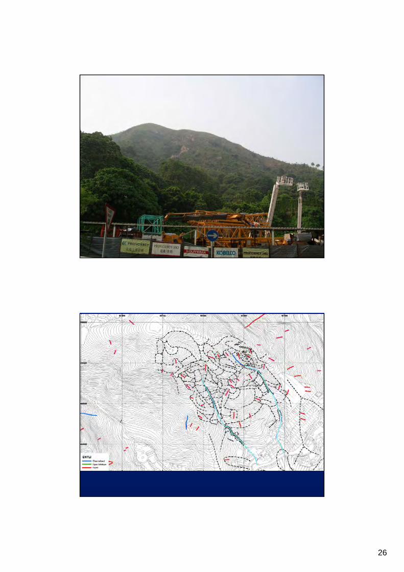
26
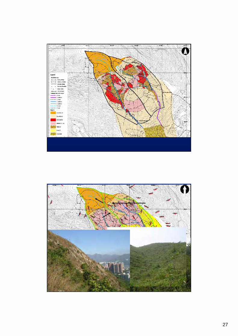
27
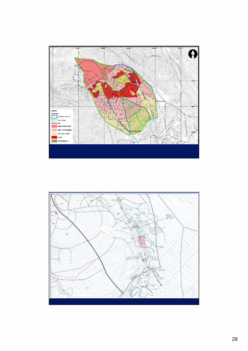
28
29
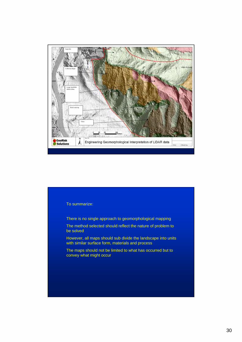
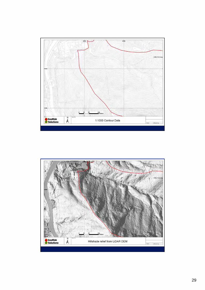
30
Saprolite
Rock outcrop
Colluvial drape
Large landslide debris lobes
Talus
To summarize:
There is no single approach to geomorphological mapping
The method selected should reflect the nature of problem to be solved
However, all maps should sub divide the landscape into units with similar surface form, materials and process
The maps should not be limited to what has occurred but to convey what might occur