gdal/ogr. gdal/ogr gdal/ogr : frank warmerdam tools for reading, writing, and processing gdal -...
TRANSCRIPT

GDAL/OGRGDAL/OGR

GDAL/OGRGDAL/OGR
GDAL/OGR : Frank WarmerdamGDAL/OGR : Frank Warmerdam
Tools for reading, writing, and processingTools for reading, writing, and processing GDAL - Geospatial Data Abstraction LibraryGDAL - Geospatial Data Abstraction Library
RasterRaster OGR - OpenGIS Simple Features ReferenceOGR - OpenGIS Simple Features Reference
VectorVector

GDAL/OGRGDAL/OGR
Started in 1998 by Frank Warmerdam as a sole Started in 1998 by Frank Warmerdam as a sole developerdeveloper
Now a project under OSGeo's umbrellaNow a project under OSGeo's umbrella
Has ~20 contributing developersHas ~20 contributing developers

A Workhorse for a lot of GIS's!A Workhorse for a lot of GIS's!
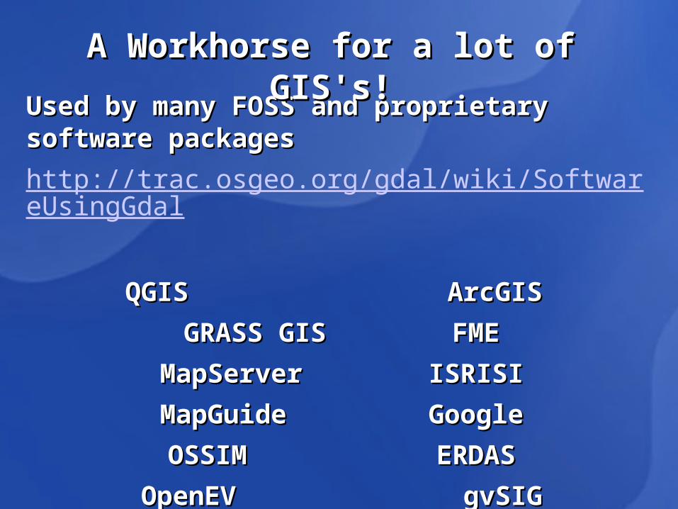
Used by many FOSS and proprietary software packagesUsed by many FOSS and proprietary software packages
http://trac.osgeo.org/gdal/wiki/SoftwareUsingGdal
QGIS QGIS ArcGIS ArcGIS
GRASS GISGRASS GIS FMEFME
MapServerMapServer ISRISIISRISI
MapGuideMapGuide GoogleGoogle
OSSIMOSSIM ERDASERDAS
OpenEV OpenEV gvSIGgvSIG
A Workhorse for a lot of GIS's!A Workhorse for a lot of GIS's!

A Workhorse for a lot of A Workhorse for a lot of GIS's!GIS's!
Also available as command line utilities via:Also available as command line utilities via: OsGeoOsGeo FWTools – Frank Warmerdam toolsFWTools – Frank Warmerdam tools

Corporate SponsorsCorporate Sponsors

OGROGRTools for manipulating Tools for manipulating vector datavector data
Over 40 vector data Over 40 vector data formats supportedformats supported
Commandline UtilitiesCommandline Utilitiesogrinfoogrinfo - Lists information about - Lists information about an OGR supported data source an OGR supported data source ogr2ogrogr2ogr - Converts simple - Converts simple features data between file features data between file formats formats ogrtindexogrtindex - Creates a tileindex - Creates a tileindex
OGR Vector Formats
Format Name Code Creation
Arc/Info .E00 (ASCII) Coverage
AVCE00 No
AutoCAD DXF DXF Yes
Comma Separated Value (.csv)
CSV Yes
ESRI Personal GeoDatabase
PGeo No
ESRI ArcSDE SDE No
ESRI Shapefile ESRI Shapefile Yes
GeoRSS GeoRSS Yes
GML GML Yes
GPX GPX Yes
GRASS GRASS No
KML KML Yes
Mapinfo File MapInfo File Yes
Microstation DGN DGN Yes
MySQL MySQL No
Oracle Spatial OCI Yes
EPIInfo .REC REC No
SDTS SDTS No
U.S. Census TIGER/Line TIGER No

GDALGDALTools for manipulating Tools for manipulating raster dataraster data
Over 100 raster data Over 100 raster data formats supportedformats supported
GDAL Raster Formats
Long Format Name Code Creation Georeferencing
Arc/Info ASCII Grid AAIGrid Yes Yes
Microsoft Windows Device Independent Bitmap (.bmp) BMP Yes Yes
ERMapper Compressed Wavelets (.ecw) ECW Yes Yes
Erdas Imagine Raw EIR No Yes
ENVI .hdr Labelled Raster ENVI Yes Yes
Graphics Interchange Format (.gif) GIF Yes NoGRASS Rasters GRASS No Yes
Erdas Imagine (.img) HFA Yes YesJPEG JFIF (.jpg) JPEG Yes Yes
JPEG2000 (.jp2, .j2k) JPEG2000 Yes Yes
JPEG2000 (.jp2, .j2k) JP2MrSID Yes YesPortable Network Graphics (.png) PNG Yes NoArcSDE Raster SDE No Yes
USGS ASCII DEM (.dem) USGSDEM Yes YesGDAL Virtual (.vrt) VRT Yes Yes
OGC Web Coverage Server WCS No Yes
WKTRaster WKTRaster No Yes
OGC Web Map Server WMS No Yes

GDAL Command Line UtilitiesGDAL Command Line Utilities
gdalinfogdalinfo - report information about a file. - report information about a file. gdal_translategdal_translate - Copy a raster file, with control of output - Copy a raster file, with control of output format. format. gdaladdogdaladdo - Add overviews to a file…pyramids - Add overviews to a file…pyramidsgdalwarpgdalwarp - Warp an image into a new coordinate system. - Warp an image into a new coordinate system. gdal_contourgdal_contour - Contours from DEM. - Contours from DEM. gdaldemgdaldem - Tools to analyze and visualize DEMs. - Tools to analyze and visualize DEMs. rgb2pct.pyrgb2pct.py - Convert a 24bit RGB image to 8bit paletted. - Convert a 24bit RGB image to 8bit paletted. pct2rgb.pypct2rgb.py - Convert an 8bit paletted image to 24bit RGB. - Convert an 8bit paletted image to 24bit RGB.

GDAL Command Line UtilitiesGDAL Command Line Utilities
gdal_merge.pygdal_merge.py - Build a quick mosaic from a set of images. - Build a quick mosaic from a set of images. gdal_rasterizegdal_rasterize - Rasterize vectors into raster file. - Rasterize vectors into raster file. gdaltransformgdaltransform - Transform coordinates. - Transform coordinates. nearblacknearblack - Convert nearly black/white borders to exact - Convert nearly black/white borders to exact value. value. gdal_gridgdal_grid - Create raster from the scattered data. - Create raster from the scattered data. gdal_polygonize.pygdal_polygonize.py - Generate polygons from raster. - Generate polygons from raster. gdal_sieve.pygdal_sieve.py - Raster Sieve filter. - Raster Sieve filter. gdal_fillnodata.pygdal_fillnodata.py - Interpolate in nodata regions. - Interpolate in nodata regions. gdal-configgdal-config - Get options required to build software using - Get options required to build software using GDAL. GDAL.
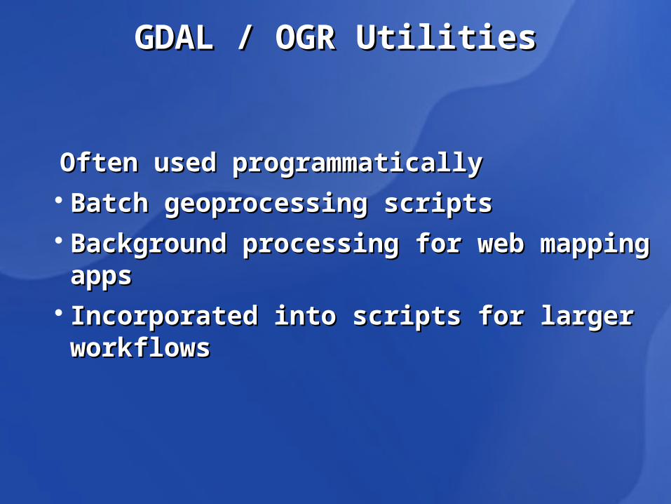
GDAL / OGR UtilitiesGDAL / OGR Utilities
Often used programmaticallyOften used programmatically Batch geoprocessing scriptsBatch geoprocessing scripts Background processing for web mapping appsBackground processing for web mapping apps Incorporated into scripts for larger workflowsIncorporated into scripts for larger workflows

AvailabilityAvailabilityPackagesPackages
FWToolsFWTools
OSGeo4WOSGeo4W
DesktopsDesktops
Used by QGIS, GRASS, etc.Used by QGIS, GRASS, etc.
Operating SystemsOperating Systems
Windows (32 & 64 bit), MAX OS X, LinuxWindows (32 & 64 bit), MAX OS X, Linux
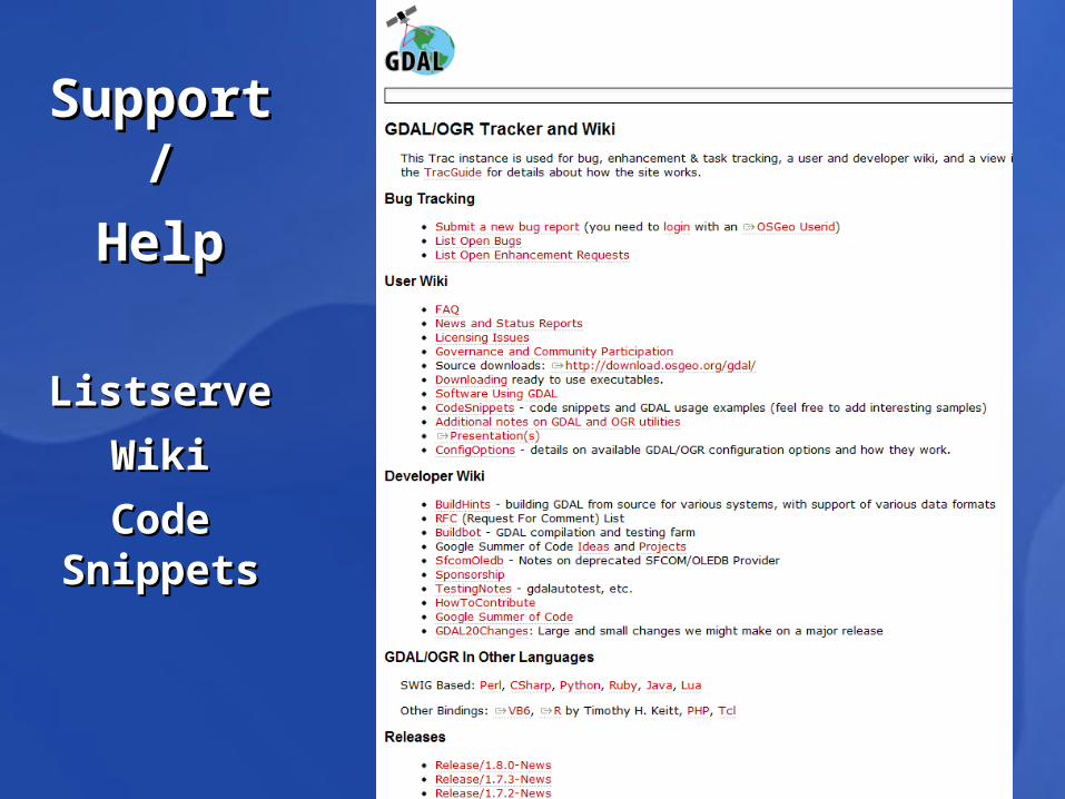
Support/Support/HelpHelp
ListserveListserve
WikiWiki
Code SnippetsCode Snippets

Support/Support/HelpHelp
Utility Utility DocumentationDocumentation

In Class GDAL/OGR ExerciseIn Class GDAL/OGR Exercise