fb winds: new name, old product - aviation weather · 1 november 2005 noaa’s national weather...
TRANSCRIPT

1
November 2005 NOAA’s National Weather Service Volume 4, Number 3
Mission StatementTo enhance aviation safety by
increasing the pilot’s knowledge ofweather systems and processes andNational Weather Service productsand services.
Managing Editor: Michael [email protected]
Editor/Layout: Melody Magnus [email protected]
Editor: Deborah Lavine
In this Issue:
Tips for RecognizingReliable, AccurateWeather Sources
Meteorology Behind theTAF: Area ForecastDiscussion
5
7
When’s the Next Front?Would you like an email alert when a
new edition of The Front is published?Write [email protected].
FB Winds: New Name, Old ProductBy Scott C. Dennstaedt, FAA Certified Flight [email protected]
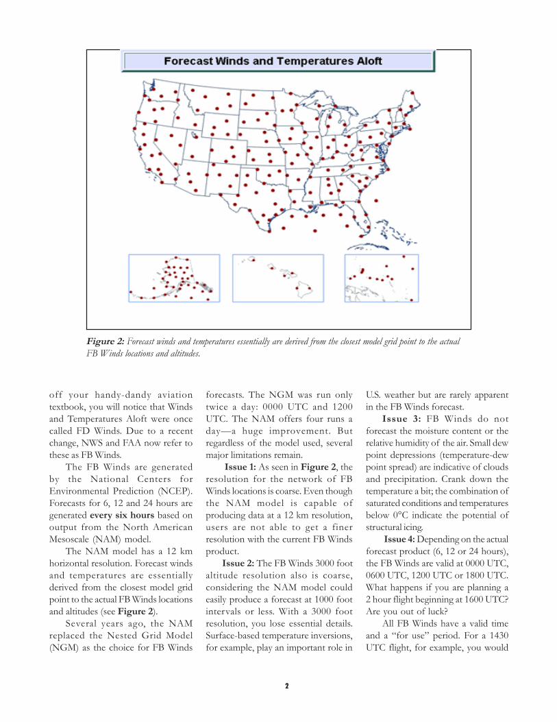
Figure 1: The resolution for network of FB Winds locations is course.
Winds and temperatures aloftforecasts (FB Winds) have been partof a pilot’s preflight routine for sometime now. They are the “official”forecast of upper level winds andtemperatures in the FAA view.
The FB Winds are provided aspart of a standard briefing when youcall an automated f light servicestation (AFSS). Similarly, the FBWinds are used when you plan a flight
with DUATs. How are the FB Windsgenerated and why do pilots feel theyare often wrong?
Pilots have been using theseforecasts for years and complainingabout their inaccuracy for almost aslong. You must appreciate thelimitations of this particular forecastproduct to understand why somepilots are unhappy with it. First, let’sdiscuss a little recent history. If you dust
2
Figure 2: Forecast winds and temperatures essentially are derived from the closest model grid point to the actualFB Winds locations and altitudes.
off your handy-dandy aviationtextbook, you will notice that Windsand Temperatures Aloft were oncecalled FD Winds. Due to a recentchange, NWS and FAA now refer tothese as FB Winds.
The FB Winds are generatedby the National Centers forEnvironmental Prediction (NCEP).Forecasts for 6, 12 and 24 hours aregenerated every six hours based onoutput from the North AmericanMesoscale (NAM) model.
The NAM model has a 12 kmhorizontal resolution. Forecast windsand temperatures are essentiallyderived from the closest model gridpoint to the actual FB Winds locationsand altitudes (see Figure 2).
Several years ago, the NAMreplaced the Nested Grid Model(NGM) as the choice for FB Winds
forecasts. The NGM was run onlytwice a day: 0000 UTC and 1200UTC. The NAM offers four runs aday—a huge improvement. Butregardless of the model used, severalmajor limitations remain.
Issue 1: As seen in Figure 2, theresolution for the network of FBWinds locations is coarse. Even thoughthe NAM model is capable ofproducing data at a 12 km resolution,users are not able to get a finerresolution with the current FB Windsproduct.
Issue 2: The FB Winds 3000 footaltitude resolution also is coarse,considering the NAM model couldeasily produce a forecast at 1000 footintervals or less. With a 3000 footresolution, you lose essential details.Surface-based temperature inversions,for example, play an important role in
U.S. weather but are rarely apparentin the FB Winds forecast.
Issue 3: FB Winds do notforecast the moisture content or therelative humidity of the air. Small dewpoint depressions (temperature-dewpoint spread) are indicative of cloudsand precipitation. Crank down thetemperature a bit; the combination ofsaturated conditions and temperaturesbelow 0°C indicate the potential ofstructural icing.
Issue 4: Depending on the actualforecast product (6, 12 or 24 hours),the FB Winds are valid at 0000 UTC,0600 UTC, 1200 UTC or 1800 UTC.What happens if you are planning a2 hour flight beginning at 1600 UTC?Are you out of luck?
All FB Winds have a valid timeand a “for use” period. For a 1430UTC flight, for example, you would

3
Figure 3. Valid times of each of the FB Winds products available for each run of the NAM model.
still have to use the 6-hour FB forecastvalid at 1200 UTC. This forecast isavailable for use between 0800 UTCand 1500 UTC. There is a hugepotential problem here.
Figure 3 describes the valid timesof the FB Winds products availablefor each run of the NAM model. TheNAM model is run four times a day:
♦ Shortly after 0000 UTC♦ Shortly after 0600 UTC♦ Shortly after 1200 UTC♦ Shortly after 1800 UTC
I say “shortly after” because themodel is not started until the raw inputdata (observations) is completelycollected. Finally, the FB Winds areposted a little more than 2 hours afterthese approximate start times.
Now back to the example. Let’ssay you are planning a departure at1430 UTC. The current FB Windsproduct is the 6-hour forecast fromthe 0600 UTC model run.
Here’s the important statement:The product is only valid at 1200UTC; however, it is for use between0800 UTC and 1500 UTC.
Let’s say a frontal system isforecast to pass through your plannedroute around 1300 UTC. Will the FBWinds and temperatures be accurate
for your route? This uncertainty is themain issue driving pilots to believethere is an error in the forecast.
Taking the example a bit further,let’s say the winds at 6,000 feet areforecast to be 180° at 17 knots with atemperature of 12°C. Remember, thisforecast is valid at 1200 UTC.
Due to the frontal passage at 1300UTC, the observed winds at 6,000feet shift around to 275° at 33 knots,and the temperature drops to 6°C.
Is the original forecast a bad one?Not necessarily. Remember it was validat 1200 UTC.
Will your flight plan be accurate?Not if you used the latest FB Windsforecast. This becomes moresignificant if you are making long trips.You could easily use up most of yourfuel reserves.
Instrument pilots also may makepoor decisions based on thetemperature forecasts for icingpotential if these limitations are notunderstood.
Will NCEP amend the FB in thiscase? There isn’t an amendmentcriterion; therefore, NCEP will notamend these forecasts.
What can you do to plan a moreaccurate flight? Here are four simpleprecautions:
♦ Understand the limitationsdescribed above.
♦ Examine any new observed datafrom pilot reports that mayprovide you with a more recentestimation of the winds andtemperatures.
♦ Take note of changing weatherconditions and factor those intoyour flight plan.
♦ Use a different forecast model.
The Rapid Update Cycle (RUC2)model is run hourly (not every 6-hours)and will provide an hourly analysis aswell as 1, 2, 3, 6, 9 and 12 hourforecasts. As weather conditionschange, the model will incorporatethese weather changes into a newforecast every hour.
Moreover, you are not limited tojust the FB Winds stations. You canchoose any airport with a three-letteridentifier and determine the winds andtemperatures aloft.
Figure 4 is an example of aSkew-T log P diagram from theForecast Systems Laboratory. Thediagram represents RUC modelforecast data: temperature, winds anddew point.
Note the wind barbs on the rightside. As you move the cursor up anddown in the center of this Java-based

4
Figure 4: is an example of a Skew-T log P diagram from the Forecast Systems Laboratory (FSL).
interactive diagram each wind barb tothe right is highlighted in black,representing the wind speed anddirection at that pressure altitude.
In this sample, a 3-hour forecastvalid at 1900 UTC for Duluth(KDLH), the cursor was placed at7,858 feet (769 mb) of pressurealtitude. The winds are forecast to be281° (true) at 18 knots. Thetemperature at this altitude is forecastto be 10.9°C.
The graphical wind speed diagramto the far right allows you to choosethe altitude with the least head windor the greatest tail wind. For example,for a westerly route through KDLH,the winds are about 5 knots less at6,500 ft than at 4,500 feet.
I am not suggesting that you puntthe FB Winds forecast; however, withthe RUC forecast you can get a muchmore current forecast with a finerresolution in the horizontal andthe vertical.
Go to http://www-frd.fsl.noaa.gov/mab/soundings/javaand give it a try. If it isn’t clear, sendme an email and I’ll try to clarify itfurther.
BiographyScott C. Dennstaedt is an FAA
Certified Flight Instructor and teachesaviation weather workshopsnationwide. You can reach him [email protected].

5
Tips for Recognizing Reliable Weather Sources
Lisa Glikbarg, CFII/Aircraft [email protected]
The sun is shining, the air is warm,and the skies are clear. It looks likeanother perfect day to fly. The smellof jet fuel and Avgas move across theairfield as pilots are out and aboutcompleting their walk-a-rounds andfirst-flight-of-the-day checks. Theweather looks good and the first planeis off and rolling down therunway.
Back in the FBO, apilot walks into the weatherroom for one last lookbefore he too departs. Hewalks past the television,glancing at the local weather, past thecommercial weather productcomputers and stops at the telephone.
He looks around for pen andpaper while he picks up the phone anddials 1-800-WXBRIEF. Listening tothe menu he presses “1,” then hears“All briefers are currently busy. Pleasestay on the line for the next availablebriefer.”
A few pilots walk in while hewaits, some watch the televisionbroadcast, some surf the Internet,others consult the weather productscomputer before walking back out.The telephone begins to ring. Thebriefer picks up, and the pilot asks fora standard weather briefing along hisroute of flight.
Federal Aviation Regulationsrequire that each pilot in commandshall, before beginning a flight, becomefamiliar with all available informationconcerning that flight, including flightsunder IFR or not in the vicinity of anairport, weather reports and forecastsFAR 91.103:
http://ecfr.gpoaccess. gov/cgi/t/t e x t / t e x t - i d x ? c = e c f r & s i d=84473f22382403150c7526f0bc4df21c&rgn=div8&view=text&node=14:2.0.1.3.10.2.4.2&idno=14
In a 2003 NWS survey, 250 pilotsand aircraft dispatchers were asked a
series of questions pertaining toaviation weather services. Respondentswere questioned on what types ofweather products or information theytypically use, which weather productsthey rely on the most, and how theytypically obtain their aviation weatherinformation.
The survey results showed thatfew pilots were alike in how they obtainweather information before a flight.Answers included:
♦ Flight service stations (FSS)♦ Internet access to METARs, TAFs,
radar and satellite images♦ TV predictions and forecasts.
The development of enhancedcommunications capabilities offers thegeneral aviation pilot access to avariety of government andcommercial weather resources. Newsensor systems, algorithms andforecast models make it essential pilotsevaluate the reliability and accuracy ofa weather product or service beforeuse in preflight planning.
Government agencies such as theFAA and NWS, with the support ofthe National Center for AtmosphericResearch and the Forecast SystemsLaboratory, have developed a processknown as Aviation WeatherTechnology Transfer (AWTT). Thisprocess ensures user needs and
technical and operational readinessrequirements are met before newweather products are released forpilots and operators use.
Commercial agencies, such as localtelevision stations, private weathervendors and other Web sourcesoffering aviation weather do notusually partake in the AWTTcomprehensive process and may notmeet the FAA/NWS quality controlstandards. These vendors may provideseemingly good weather informationfrom radar, satellite and groundfacilities, but their products reliabilityand accuracy are not monitored orregulated.
The FAA cautions pilots againstusing unfamiliar products and offersa series of simple questions to helpevaluate the reliability and accuracy ofunfamiliar weather services andproducts.
The Aeronautical InformationManual, Section 7-1-3, Use of AviationWeather Products, suggests asking thefollowing questions to evaluate thereliability and accuracy of a weathersource:

6
Figure 1. NOAA CONUS Weather Map
♦ Is the service or productapplicable for aviation use?
• Does the product orservice provide datausable in aeronauticalweather decision-making?
• Does the product orservice fail to provide datanecessary to make criticalaeronautical weatherdecisions?
♦ Does the service provide dataor products produced byapproved aviation weatherinformation sources?
• Is the data or productmodified?
• If so, is the modificationprocess described and isthe final product in aconfiguration that supportsaeronautical weather decision-making?
♦ Are the weather productsprofessionally developed andproduced or quality-controlled bya qualified aviation meteorologist?
♦ Does the provider’s qualityassurance plan include the capabilityto monitor generated products andcontain a procedure to correctdeficiencies as they are discovered?
♦ Is the product output consistentwith original data sources?
♦ Is the product compliant withapplicable RTCA, Inc., Society ofAutomotive Engineers (SAE) andInternational Civil Aviationorganization (ICAO) standards?
♦ Are education and training materialssufficient to enable users to use thenew product effectively?
♦ Are the following key elements ofthe product intuitive and easy forthe user to interpret?
• Type of data or product• Currency or age of data or
product• Method for displaying and
decoding the data or product• Location or mapping of data
♦ Is the product suitable for use,considering potential pilotmisunderstandings due to:
• Complexity of the product• Nonstandard display• Incorrect mapping or display
of data• Incorrect overlay of weather
data with other data• Inappropriate display of
missing data• Missing, inaccurate time/date
stamp on product
By answering these questionsbefore using unfamiliar weatherproducts or services, you will be ableto make an informed decision onwhether a product meets therequirements of FAR 91.103.
The increasing availability ofweather services and products to theGA pilot make it essential that youevaluate the reliability and accuracy ofeach product or service. The FAA andNWS, with the support of NationalCenter for Atmospheric Research andthe Forecast Systems Laboratory,continue to develop and implementreliable and accurate weather productsusing the AWTT process.
Some familiar products areavailable at 1-800-WXBRIEF orwww.aviationweather.gov andother Web sources. It is not the FAA’sintent, by providing these guidelineswithin the AIM, to limit the use ofother sources, but to urge cautionbefore using unfamiliar products.
7
Meteorology Behind the TAF: Area Forecast Discussion
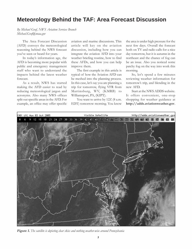
Figure 1. The satellite is depicting clear skies and nothing weather-wise around Pennsylvania
The Area Forecast Discussion(AFD) conveys the meteorologicalreasoning behind the NWS forecastyou’ve seen or heard for years.
In today’s information age, theAFD is becoming more popular withpublic and emergency managementstaff who want to understand theimpacts behind the latest weatherforecast.
As a result, NWS has startedmaking the AFD easier to read byreducing meteorological jargon andacronyms. Also many NWS officessplit out specific areas in the AFD. Forexample, an office may offer specific
aviation and marine discussions. Thisarticle will key on the aviationdiscussion, including how you canintegrate the aviation AFD into yourweather briefing routine, how to findthese AFDs, and how you can helpimprove them.
The first example in this article istypical of how the Aviation AFD canbe meshed into the planning process.In this case, let’s say you are planning atrip for tomorrow, flying VFR fromMartinsburg, WV, (KMRB) toWilliamsport, PA, (KIPT).
You want to arrive by 12Z (8 a.m.EDT) tomorrow morning. You know
the area is under high pressure for thenext few days. Overall the forecastboth on TV and radio calls for a niceday tomorrow, but it is autumn in thenortheast and the chance of fog canbe an issue. Also you noticed somepatchy fog on the way into work thismorning.
So, let’s spend a few minutesreviewing weather information fortomorrow’s trip, and blending in thenew AFD.
Start at the NWS ADDS website.It offers convenient, one-stopshopping for weather guidance athttp://adds.aviationweather.gov.
By Michael Graf, NWS Aviation Services [email protected]

8
Figure 2. The prog chart valid for tomorrow morning confirms high pressure over the region.
Start with the big picture by clickingon the satellite icon, then on the areaof interest on the U.S. map. This screenprovides a regional satellite clip to view.Remember to click on the Infra-Red(IR) option at night.
In Figure 1, the satellite depictsclear skies and no weather aroundPennsylvania. Now look at a surfaceforecast chart for tomorrow morning.Click on “Prog Charts” (Figure 2.)You expect to see the northeast underhigh pressure. And sure enough, it is.There is a system to the west but toofar away to be a concern. So the currentsatellite and forecast data agree with
the forecast; however, you’re stillconcerned about that morning fogwhich is highly terrain dependent. Youneed more information.
One aid is to look at METARs,or observations, from the past 24hours at several sites. This will help youdetermine the development and timingof fog in the area and whether it islikely to reform the next day.
The rule of thumb supporting thisthinking is that many places tendtowards similar fog conditions eachmorning if the weather patternremains consistent, like the case herewith high pressure. Also it’s good to
know which airports tend to fog insolidly and which don’t. Local terrainis such a big player in fog forecastingthat it’s worth a few seconds to seewhich surrounding airports wererelatively fog free and which were not.This quick routine helps develop agood backup plan.
At the ADDS site, go to theMETAR icon. Enter the identifieralong with the identifiers of severalsurrounding sites and click on the past24 hour’s option. Now let’s try anddecipher fog prone areas and fine-tuneyour backup plan in case KIPT isfogged in tomorrow morning.

9
KIPT indeed fogged in this morning and broke out late, rapidly going from IFR to VFR from about 11 a.m. to11:30 a.m. Based on our rule of thumb about weather repeating itself under high pressure, an 8 a.m. arrival fortomorrow morning may be optimistic.
KIPT 031554Z 00000KT 7SM SCT003 17/14 A3039 RMK AO2 SLP293 T01720139KIPT 031519Z 00000KT 3SM BR SCT003 14/13 A3040 RMK AO2KIPT 031507Z 00000KT 2SM BR BKN003 14/13 A3041 RMK AO2KIPT 031454Z 00000KT 1 1/4SM BR OVC001 13/13 A3042 RMK AO2 SLP300 T01280128 50007KIPT 031438Z 00000KT 1SM BR OVC001 13/12 A3042 RMK AO2KIPT 031354Z 00000KT 1/4SM FG VV001 13/12 A3042 RMK AO2 SLP301KIPT 031054Z 00000KT 1/4SM FG VV001 12/12 A3039 RMK AO2 SLP291KIPT 030954Z AUTO 00000KT 1/4SM FG VV001 12/12 A3038 RMK AO2 SLP288
Checking other sites from the morning, you see KABE (Allentown) was not as bad. The fog never really set up; itremained mainly shallow ground fog that cleared between 9 and 10 a.m. Assuming everything stays the same, KABEcould provide a decent alternate for tomorrow.
KABE 031451Z 00000KT 10SM CLR 21/12 A3043 RMK AO2 SLP303 T02060117KABE 031351Z 00000KT 6SM HZ CLR 17/11 A3043 RMK AO2 SLP305 T01720111KABE 031251Z 05004KT 3SM HZ CLR 14/11 A3042 RMK AO2 SLP302 T01390111KABE 031223Z 35003KT 3SM BR CLR 12/10 A3042 RMK AO2 TWR VIS 4KABE 031151Z 00000KT 1 1/2SM BR CLR 10/08 A3042 RMK AO2 TWR VIS 4 KABE 031051Z 36003KT 1 1/2SM BRCLR 09/08 A3040 RMK AO2 TWR VIS 4KABE 030951Z AUTO 00000KT 3SM BR CLR 09/08 A3040 RMK AO2 SLP292
KAVP (Wilkes-Barre/Scranton) has a nice local effect. The light, easterly winds in the early morning hours almostalways ensure little or no fog. This provides a good, solid alternate for planning.
KAVP 031454Z 29003KT 6SM HZ CLR 21/12 A3042 RMK AO2 SLP291 T02060117 KAVP 031354Z 02003KT 7SM CLR18/11 A3042 RMK AO2 SLP293 T01830111KAVP 031254Z 00000KT 6SM HZ CLR 15/11 A3042 RMK AO2 SLP292 T01500106KAVP 031154Z 11005KT 4SM HZ CLR 12/09 A3041 RMK AO2 SLP291 T01220094KAVP 031054Z 10005KT 5SM BR CLR 12/09 A3040 RMK AO2 SLP287 T01170094 $KAVP 030954Z AUTO 12006KT 5SM BR CLR 12/10 A3039 RMK AO2 SLP284
Look next at KCXY and KMDT (Harrisburg and Middletown). KCXY is close to the river and dense fog bankscould encroach on to the field. But in this case, while shallow ground fog did limit visibility for a time, the fog was goneby 9 a.m.-10 a.m. This field could be a toss up for an alternate tomorrow. Not being familiar with the local effects, I’llprobably look elsewhere for my back up plan.
KCXY 031556Z 10005KT 10SM CLR 22/12 A3040 RMK AO2 SLP295 T02220117KCXY 031456Z VRB03KT 6SM HZ CLR 21/12 A3042 RMK AO2 SLP301 T02060117 50004KCXY 031356Z 10004KT 6SM HZ CLR 18/11 A3043 RMK AO2 SLP305 T01780106
KCXY 031256Z 00000KT 2SM BR CLR 15/13 A3042 RMK AO2 SLP300 T01500128KCXY 031204Z 00000KT 2SM BR CLR 12/11 A3041 RMK AO2KCXY 031156Z 00000KT 2SM BR CLR 12/11 A3041 RMK AO2 SLP298 T01170106KCXY 031108Z 00000KT 1 3/4SM BR CLR 11/10 A3040 RMK AO2KCXY 031056Z AUTO 00000KT 3SM BR CLR 11/10 A3039 RMK AO2 SLP293
KMDT 031356Z 00000KT 5SM HZ CLR 17/12 A3042 RMK AO2 SLP300 T01720117KMDT 031256Z 00000KT 3SM HZ CLR 15/12 A3041 RMK AO2 SLP297 T01500122KMDT 031156Z 00000KT 2SM BR CLR 12/11 A3040 RMK AO2 SLP293 7////KMDT 031141Z 00000KT 1 3/4SM BR CLR 12/11 A3039 RMK AO2KMDT 031056Z 00000KT 2 1/2SM BR CLR 12/11 A3039 RMK AO2 SLP290KMDT 030956Z 00000KT 3SM BR CLR 12/11 A3038 RMK AO2 SLP287 T01170106
KLNS (Lancaster) Shallow ground fog with visibility limited, a rapid burn off towards 10 a.m. Possible alternate, sowill evaluate further after viewing the TAF and AFD.
10
Figure 4. State College, PA, Home page. Click on 7 Day Localunder Forecasts.
Figure 3. NWS Home page.
KLNS 031453Z VRB04KT 9SM CLR 21/11 A3042 RMK AO2 SLP300 T02060106 50005KLNS 031224Z 13003KT 3SM BR CLR 12/10 A3041 RMK AO2KLNS 031200Z 00000KT 1 1/4SM BR CLR 12/10 A3041 RMK AO2KLNS 031121Z 00000KT 3SM BR CLR 10/09 A3040 RMK AO2KLNS 031104Z 00000KT 1 1/4SM BR CLR 09/08 A3040 RMK AO2KLNS 031053Z 00000KT 2SM BR CLR 10/09 A3040 RMK AO2 SLP292 T01000089KLNS 030953Z 00000KT 1 3/4SM BR CLR 10/09 A3038 RMK AO2 SLP288KLNS KLNS 030933Z AUTO 00000KT 3SM BR CLR 11/09 A3038 RMK AO2KLNS 030924Z AUTO 00000KT 2 1/2SM BR CLR 11/09 A3038 RMK AO2
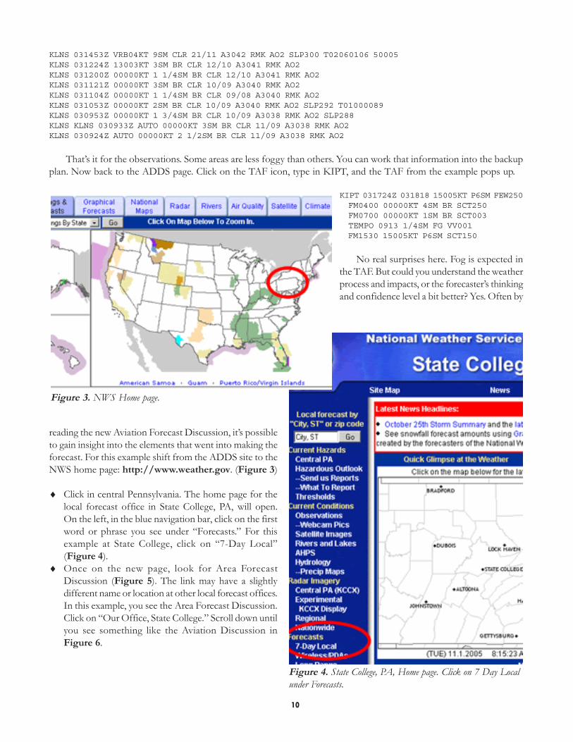
That’s it for the observations. Some areas are less foggy than others. You can work that information into the backupplan. Now back to the ADDS page. Click on the TAF icon, type in KIPT, and the TAF from the example pops up.
KIPT 031724Z 031818 15005KT P6SM FEW250 FM0400 00000KT 4SM BR SCT250 FM0700 00000KT 1SM BR SCT003 TEMPO 0913 1/4SM FG VV001 FM1530 15005KT P6SM SCT150
No real surprises here. Fog is expected inthe TAF. But could you understand the weatherprocess and impacts, or the forecaster’s thinkingand confidence level a bit better? Yes. Often by
reading the new Aviation Forecast Discussion, it’s possibleto gain insight into the elements that went into making theforecast. For this example shift from the ADDS site to theNWS home page: http://www.weather.gov. (Figure 3)
♦ Click in central Pennsylvania. The home page for thelocal forecast office in State College, PA, will open.On the left, in the blue navigation bar, click on the firstword or phrase you see under “Forecasts.” For thisexample at State College, click on “7-Day Local”(Figure 4).
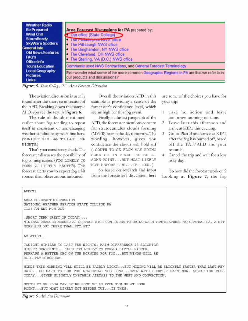
♦ Once on the new page, look for Area ForecastDiscussion (Figure 5). The link may have a slightlydifferent name or location at other local forecast offices.In this example, you see the Area Forecast Discussion.Click on “Our Office, State College.” Scroll down untilyou see something like the Aviation Discussion inFigure 6.
11
AFDCTP
AREA FORECAST DISCUSSIONNATIONAL WEATHER SERVICE STATE COLLEGE PA1128 AM EDT MON OCT
.SHORT TERM (REST OF TODAY)...MINIMAL CHANGES NEEDED AS SURFACE HIGH CONTINUES TO BRING WARM TEMPERATURES TO CENTRAL PA. A BITMORE SUN OUT THERE THAN…ETC…ETC
AVIATION...
TONIGHT SIMILAR TO LAST FEW NIGHTS. MAIN DIFFERENCE IS SLIGHTLYHIGHER DEWPOINTS...THUS FOG LIKELY TO FORM A LITTLE FASTER.PERHAPS A BETTER CHC ON TUE MORNING FOR FOG...BUT WINDS WILL BESLIGHTLY STRONGER.
WINDS THIS MORNING WILL STILL BE FAIRLY LIGHT...BUT MIXING WILL BE SLIGHTLY FASTER THAN LAST FEWDAYS...SO HARD TO SEE FOG LINGERING TOO LONG...EVEN WITH SHORTER DAYS NOW. SOME HIGH CLDSTODAY...GIVEN SLIGHTLY UNSTABLE AIRMASS TO THE WEST AND CONVECTION.
SOUTH TO SE FLOW MAY BRING SOME SC IN FROM THE SE AT SOMEPOINT...BUT MOST LIKELY NOT BEFORE TUE...IF THEN.
Figure 6. Aviation Discussion.
Figure 5. State College, PA, Area Forecast Discussion
The aviation discussion is usuallyfound after the short term section ofthe AFD. Breaking down this sampleAFD, you see the text in Figure 6.
The rule of thumb mentionedearlier about fog tending to repeatitself in consistent or non-changingweather conditions appears fine here.(TONIGHT SIMILAR TO LAST FEWNIGHTS.)
That’s your consistency check. Theforecaster discusses the possibility offog coming earlier. (FOG LIKELY TOFORM A LITTLE FASTER). Thisforecast alerts you to expect fog a bitsooner than observations indicated.
Overall the Aviation AFD in thisexample is providing a sense of theforecaster’s confidence level, whichseems high for this fog event.
Finally, in the last paragraph of theAFD, the forecaster mentions concernfor stratocumulus clouds forming(MVFR) later in the day tomorrow. Thewording, however, gives youconfidence the clouds will hold off(.SOUTH TO SE FLOW MAY BRINGSOME SC IN FROM THE SE ATSOME POINT...BUT MOST LIKELYNOT BEFORE TUE...IF THEN.)
So based on research and inputfrom the forecaster’s discussion, here
are some of the choices you have foryour trip:
1 Take no action and leavetomorrow morning on time.
2 Leave later this afternoon andarrive at KIPT this evening.
3 Go to Plan B and arrive at KIPTafter the fog has burned off, basedoff the TAF/AFD and yourresearch.
4 Cancel the trip and wait for a lessrisky day.
So how did the forecast work out?Looking at Figure 7, the fog

12
KIPT 041831Z 11007KT 7SM FEW019 21/16 A3034 RMK AO2KIPT 041754Z 16008KT 8SM OVC019 20/15 A3035 RMK AO2 SLP277 T02000150KIPT 041654Z 11005KT 8SM BKN017 20/15 A3037 RMK AO2 SLP284 T02000150KIPT 041638Z VRB05KT 8SM SCT017 19/15 A3038 RMK AO2KIPT 041554Z VRB04KT 5SM HZ OVC015 18/15 A3039 RMK AO2 SLP290KIPT 041501Z VRB03KT 4SM HZ OVC015 16/13 A3040 RMK AO2KIPT 041454Z 12003KT 2SM BR OVC015 15/13 A3040 RMK AO2 SLP296KIPT 041254Z 00000KT 1 1/4SM BR FEW002 OVC015 11/11 A3041 RMK AO2KIPT 041154Z 29003KT 1/4SM FG VV001 10/09 A3040 RMK AO2 SLP294KIPT 040943Z AUTO 00000KT 1/4SM FG OVC001 11/11 A3037 RMK AO2KIPT 040854Z AUTO 00000KT 1/2SM FG OVC001 11/10 A3036 RMK AO2 SLP280KIPT 040754Z AUTO 00000KT 2 1/2SM BR CLR 11/10 A3036 RMK AO2 SLP277KIPT 040707Z AUTO 00000KT 1 3/4SM BR BKN001 11/10 A3035 RMK AO2KIPT 040702Z AUTO 00000KT 2 1/2SM BR SCT001 11/11 A3036 RMK AO2KIPT 040654Z AUTO 00000KT 3SM BR BKN003 11/11 A3036 RMK AO2 SLP278KIPT 040615Z AUTO 00000KT 2SM BR BKN003 11/11 A3036 RMK AO2KIPT 040554Z AUTO 00000KT 1 3/4SM BR FEW003 11/11 A3036 RMK AO2KIPT 040454Z AUTO 00000KT 3SM BR BKN002 12/11 A3036 RMK AO2 SLP279KIPT 040439Z AUTO 00000KT 3SM BR SCT002 12/11 A3036 RMK AO2KIPT 040410Z AUTO 00000KT 2 1/2SM BR CLR 12/12 A3036 RMK AO2KIPT 040354Z AUTO 00000KT 4SM BR CLR 13/11 A3036 RMK AO2 SLP282
developed earlier in the morning thanit did yesterday, as the forecaster’saviation discussion mentioned. Ratherthan burning off quickly, however,the fog lifted and formed a MVFRceiling. This ceiling didn’t evaporateuntil 2:00 p.m.-2:30 p.m. EDT(Figure 7).
Knowing how the weatherpanned out, revisit your four choices:
1. Take no action and leavetomorrow morning on time. Poordecision. Forecasts are notperfect, but understanding thereasons the weather may occurputs you in a proactive stance.In this case, our research andthe aviation discussion are clearindicators that fog is likely.
2. Leave later thisafternoon and arrive at KIPTthis evening. By buildingflexibility into your trips,weather can sometimesbe factored out of theequation. Though leaving a dayearly could be an extremesolution, it’s not unrealistic toroute a trip a few hours earlierin the morning when theforecast indicates afternoonthunderstorms. Waiting few
hours until a cold front passes isanother example of avoiding badweather. This choice may be unrealisticin today’s busy world, but buildingflexibility into a plan allows a pilot tosidestep weather hazards common tofog, afternoon thunderstorms andfrontal weather.
3. By leaving later in themorning, you hope the fog will burnoff by the time you arrive. It did notwork out quite as planned but by
researching surrounding stations, youbuilt in realistic alternates.
4. Cancel the trip and wait foranother day with less risk. A hardchoice, but safety and sound decisionmaking based on our earlier reviewsshould never take a back seat whenpreparing your trips.
Figures 8-10 offer some moreexamples of the aviation AFD fromacross the country. Figure 8 is anexample from the Great Falls, MT,
Figure 7. MVFR Ceiling
.AVIATION...UPDATED 1820Z.FOG/LOW CLOUDS HAVE MOSTLY DISSIPATED AND IFR CEILINGS SHOULD END ATKHVR BY LATE AFTERNOON. OTHERWISE EXPECT CLOUDS GRADUALLYDISSIPATING LATER THIS AFTERNOON/EARLY EVENING EXCEPT FOR PORTIONSOF SW AND CNTRL MT. HIGH CLOUDS WILL BEGIN TO MOVE OVER THE AREA FROMTHE SW AFTER MIDNIGHT. SHOULD ALSO SEE SOME LIGHT DOWNSLOPE WINDSOVER THE PLAINS AFTER MIDNIGHT. WITH THOSE TWO FACTORS IN MIND LEFTFOG OUT OF TAFS FOR LATE TONIGHT/SAT MORNING. WOULD NOT RULE OUTPATCHY LIFR CONDITIONS NEAR KHVR AND KLWT TWDS 12Z.
KGTF 281725Z 281818 VRB06KT P6SM SCT060 BKN250 FM2100 22010KT P6SM SCT060 BKN250 FM0100 22008KT P6SM SCT100 FM1200 22010KT P6SM BKN250
KHVR 281725Z 281818 VRB03KT P6SM OVC005 FM2000 VRB06KT P6SM BKN250 TEMPO 2021 OVC006 FM0200 22006KT P6SM SKC FM1600 22010KT P6SM BKN250
Figure 8. Great Falls, MT

13
office. In this example, the forecasterdetails an improving scenario withTAFs through the day. Thenovernight, the forecaster conveyssome uncertainty with phrasessuch as:
WOULD NOT RULE OUT PATCHY LIFRCONDITIONS NEAR KHVR AND KLWTTWDS 12Z
These statements are almost like“buyer beware.” They can conveyuncertainty. This is new to users. In the
past, the TAF was always blackand white.
Now there is forecast reasoningor underlying local knowledge userscan draw from. Figure 9 is an examplefrom the Salt Lake office.
The SLC discussion covers the weather in more detail. It provides information on the weather and the trend, whichenhances the information of the TAF and local area. Figure 10 is one more example from the Detroit office.
.AVIATION...PRECIPITATION BAND WILL REMAIN OVER SLC THROUGH THIS MORNING.VISIBILITIES AT SLC DURING THIS TIME WILL REMAIN IN THE VFR RANGE. CEILINGSARE EXPECTED TO BE VFR AS WELL...BUT BELOW 6000FT AGL. THE PRECIPITATIONBAND IS EXPECTED TO MOVE EAST OF THE AREA BY NOON WITH RAIN TAPERING OFFEXCEPT FOR A FEW SHOWERS. CEILINGS WILL LIFT A BIT IN THE AFTERNOON BUT AREEXPECTED TO REMAIN NEAR 6000 FT AGL. WINDS WILL LIKELY STAY SOUTHERLYIN THE AFTERNOON AS PRECIPITATION CONTINUES SOUTH OF SLC.
KSLC 281732Z 281818 16007KT P6SM VCSH SCT040 BKN070 TEMPO 1822 -SHRA SCT020 BKN040 FM0200 15008KT P6SM SCT060 BKN100
Figure 9.Salt Lake City
.AVIATION...
DIURNAL CUMULUS/STRATO-CU WILL BE A BIT THICK IN MOIST...NORTHEASTFLOW OFF LAKE HURON. THIS WILL BE ESPECIALLY TRUE IN DTW/DET ANDWILL CARRY A TEMPO GROUP THIS AFTERNOON FOR A BROKEN CEILING AROUND3500 FEET. THAT WILL FADE QUICKLY THIS EVENING...WITH CLEAR SKIESAND LIGHT WINDS EXPECTED INTO SATURDAY.
KDET 281720Z 281818 04006KT P6SM SCT035 TEMPO 1822 BKN035 FM0200 VRB03KT P6SM SKC FM1400 24007KT P6SM SKC=
Figure 10.Detroit
In this example discussion, youcan see the reasoning for the clouds:
IN MOIST...NORTHEAST FLOW OFFLAKE HURON
It shows, in no uncertain terms,the weather improving:
THAT WILL FADE QUICKLY THISEVENING...WITH CLEAR SKIES ANDLIGHT WINDS EXPECTED INTOSATURDAY.
The aviation discussion is apowerful way for aviation users tounderstand the reasoning andconfidence behind today’s TAF. Bymaking the aviation discussion part ofthe briefing routine, it is possible to gainmore insight about weather patterns andresulting conditions that the TAF alonecannot define.
Most offices tend to keep the AreaForecast Discussions in about the samespot on their web sites as in the State
College example above. Or, use thefollowing link and look for the closestweather forecast office in the area ofinterest: http://www.weather.gov/view/validProds.php?prod=AFD
To provide comments on theaviation AFD to a local forecast office,go to, or try the office’s contactinformation at the bottom of theiroffice page, or email me [email protected].