erosion and depostition -...
TRANSCRIPT
EROSION AND DEPOSTITION
•- Changing Earth’s Surface -
CHANGING EARTH’S SURFACE—SHAPING
THE LAND
A. WEATHERING THE BREAKING
DOWN OF SOLID ROCK INTO SMALLER
PARTICLES.
B. EROSION: THE MOVEMENT OF THE
PRODUCTS OF WEATHERING FROM WHERE
THEY WERE FORMED TO A DIFFERENT
LOCATION.
C. DEPOSITION: THE ACCUMULATION
OF ERODED SEDIMENTS.
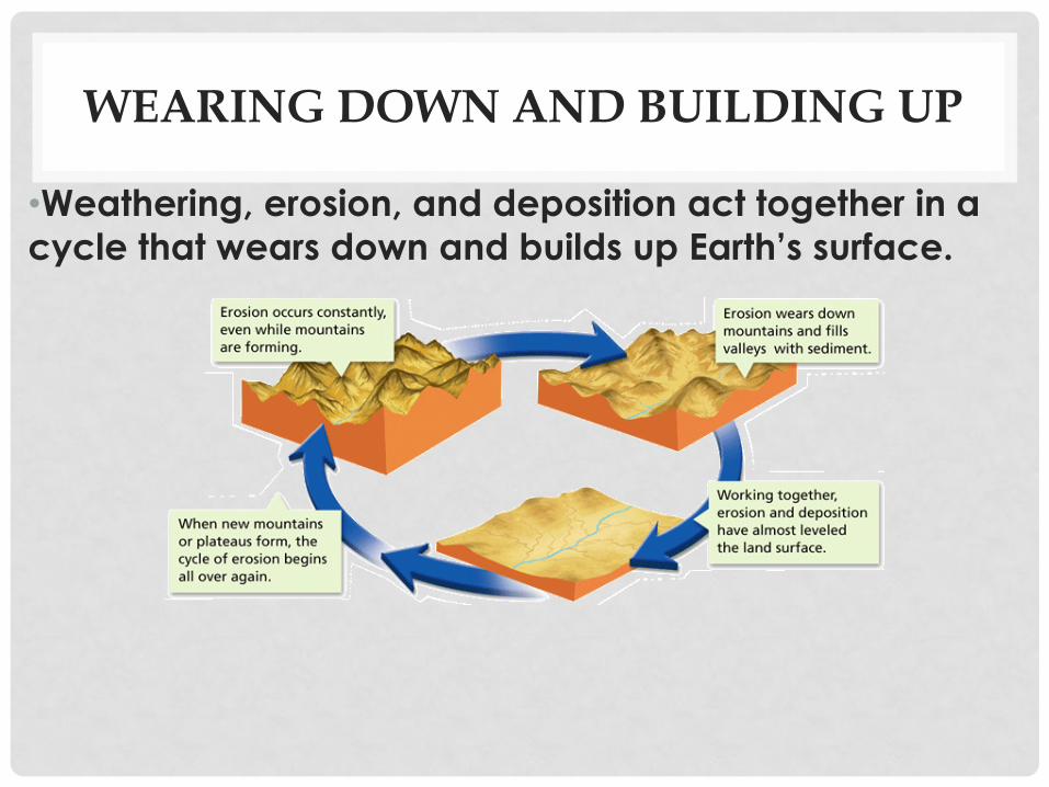
WEARING DOWN AND BUILDING UP
•Weathering, erosion, and deposition act together in a
cycle that wears down and builds up Earth’s surface.
AGENTS OF EROSION.
1. GRAVITY:
2. GLACIERS
3. WIND EROSION
4. WATER EROSION:
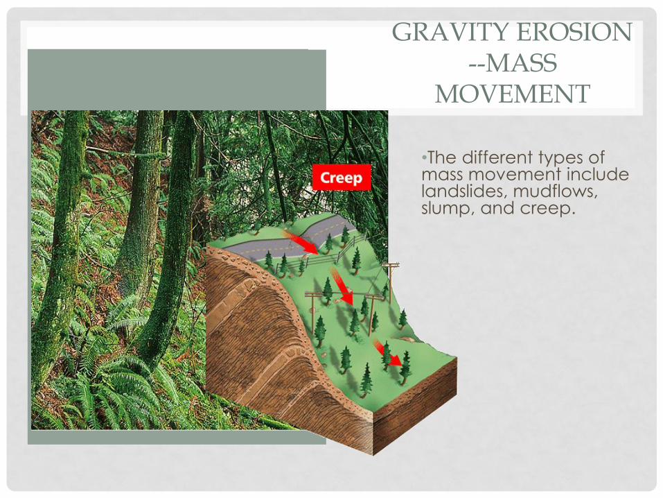
GRAVITY EROSION --MASS
MOVEMENT
•The different types of mass movement include landslides, mudflows, slump, and creep.

MASS MOVEMENT ACTIVITY
Website: phschool.com
Webcode: cfp-2031
Type of Mass
Movement Speed Slope
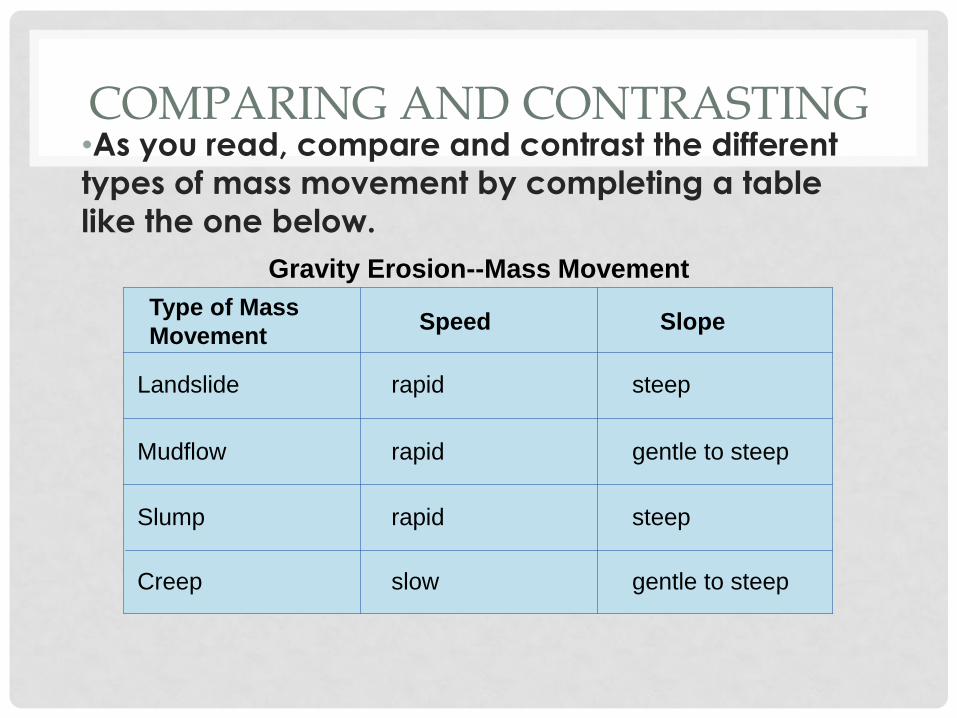
COMPARING AND CONTRASTING •As you read, compare and contrast the different
types of mass movement by completing a table
like the one below.
Landslide rapid steep
Mudflow rapid gentle to steep
Slump rapid steep
Creep slow gentle to steep
Gravity Erosion--Mass Movement
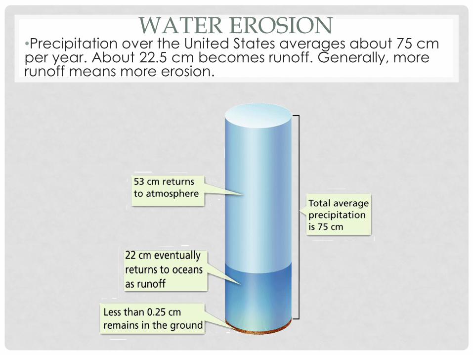
WATER EROSION •Precipitation over the United States averages about 75 cm per year. About 22.5 cm becomes runoff. Generally, more runoff means more erosion.
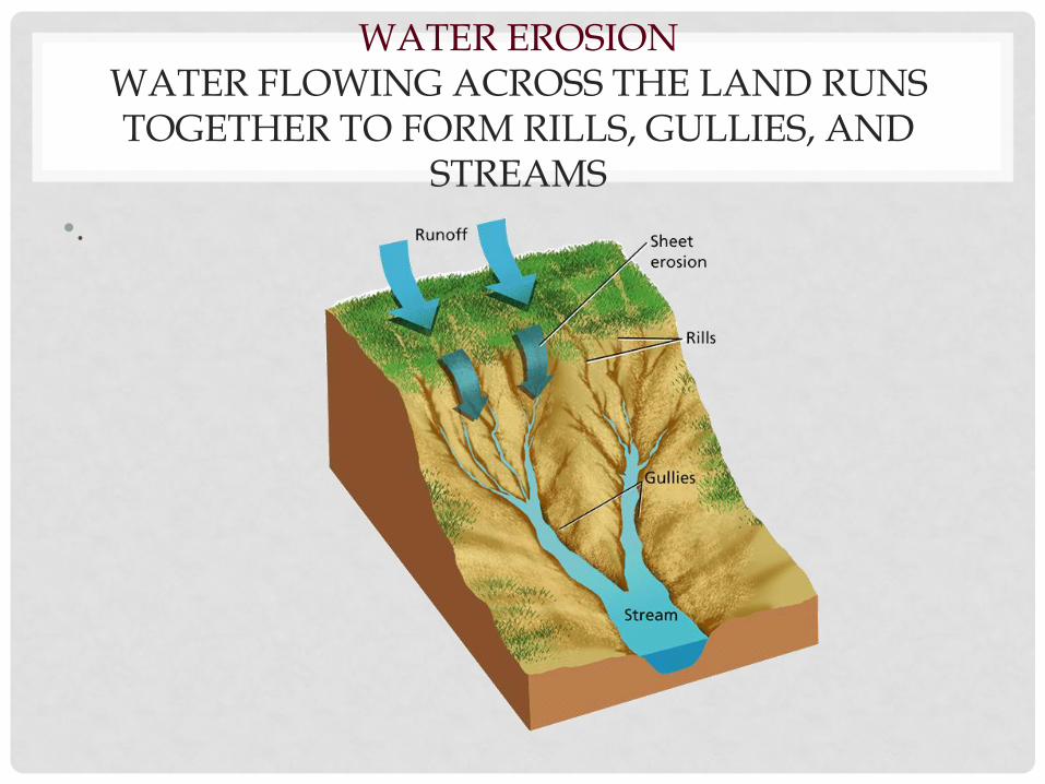
WATER EROSION WATER FLOWING ACROSS THE LAND RUNS TOGETHER TO FORM RILLS, GULLIES, AND
STREAMS
•.
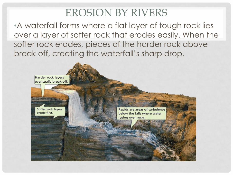
EROSION BY RIVERS •A waterfall forms where a flat layer of tough rock lies
over a layer of softer rock that erodes easily. When the
softer rock erodes, pieces of the harder rock above
break off, creating the waterfall’s sharp drop.
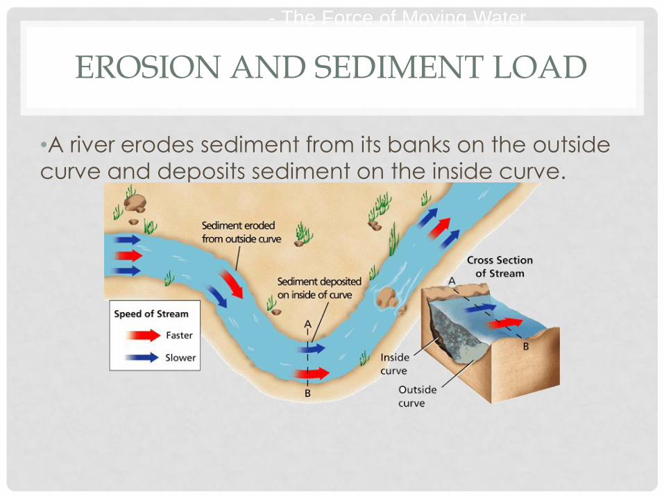
EROSION AND SEDIMENT LOAD
•A river erodes sediment from its banks on the outside
curve and deposits sediment on the inside curve.
- The Force of Moving Water
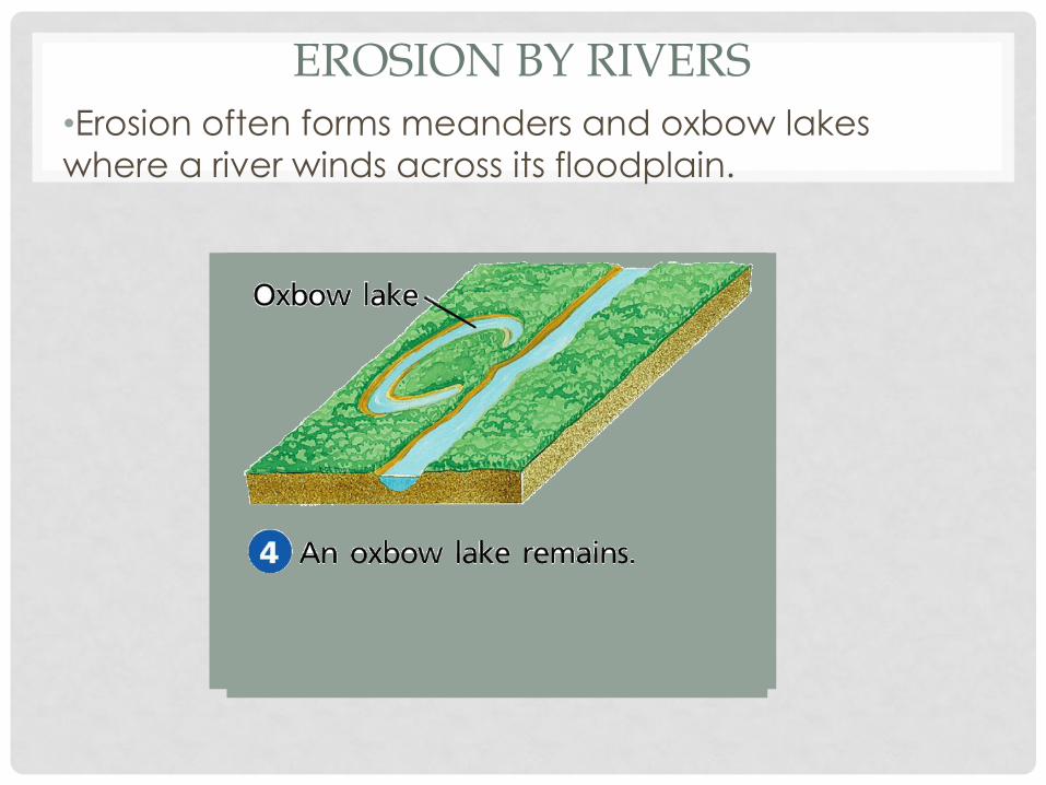
EROSION BY RIVERS •Erosion often forms meanders and oxbow lakes
where a river winds across its floodplain.
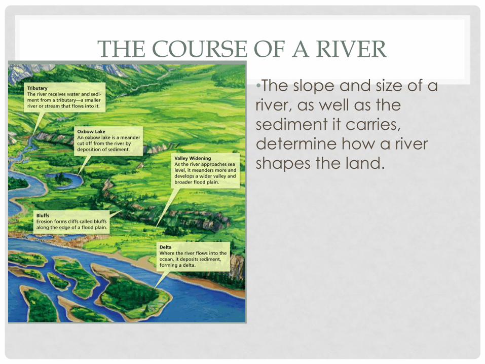
THE COURSE OF A RIVER
•The slope and size of a
river, as well as the
sediment it carries,
determine how a river
shapes the land.
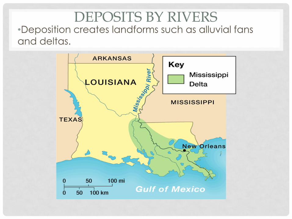
DEPOSITS BY RIVERS •Deposition creates landforms such as alluvial fans
and deltas.
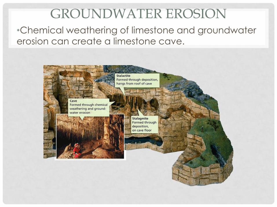
GROUNDWATER EROSION •Chemical weathering of limestone and groundwater
erosion can create a limestone cave.
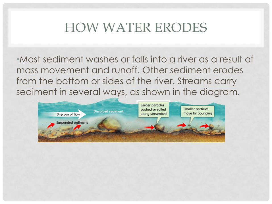
HOW WATER ERODES
•Most sediment washes or falls into a river as a result of
mass movement and runoff. Other sediment erodes
from the bottom or sides of the river. Streams carry
sediment in several ways, as shown in the diagram.
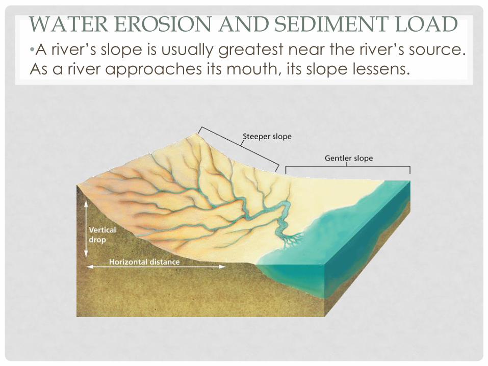
WATER EROSION AND SEDIMENT LOAD •A river’s slope is usually greatest near the river’s source.
As a river approaches its mouth, its slope lessens.
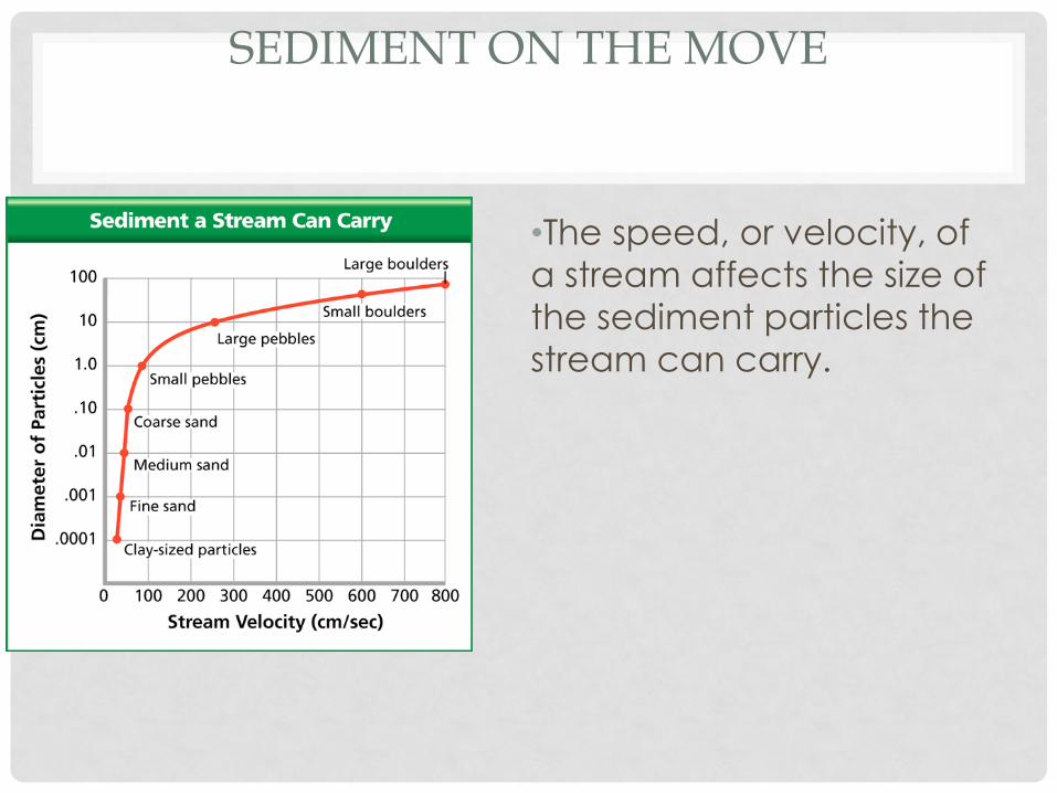
SEDIMENT ON THE MOVE
•The speed, or velocity, of
a stream affects the size of
the sediment particles the
stream can carry.
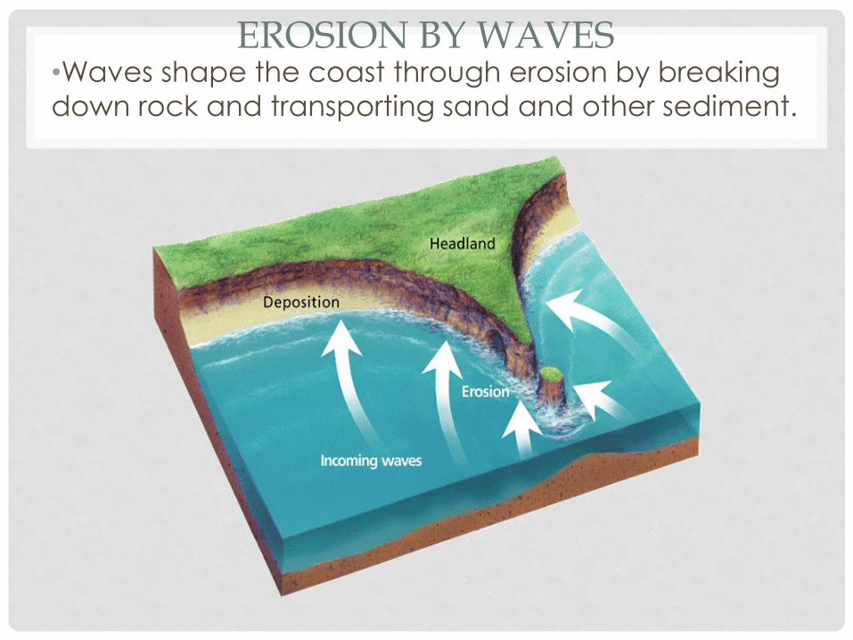
EROSION BY WAVES •Waves shape the coast through erosion by breaking
down rock and transporting sand and other sediment.
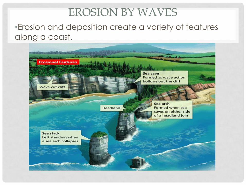
EROSION BY WAVES
•Erosion and deposition create a variety of features
along a coast.
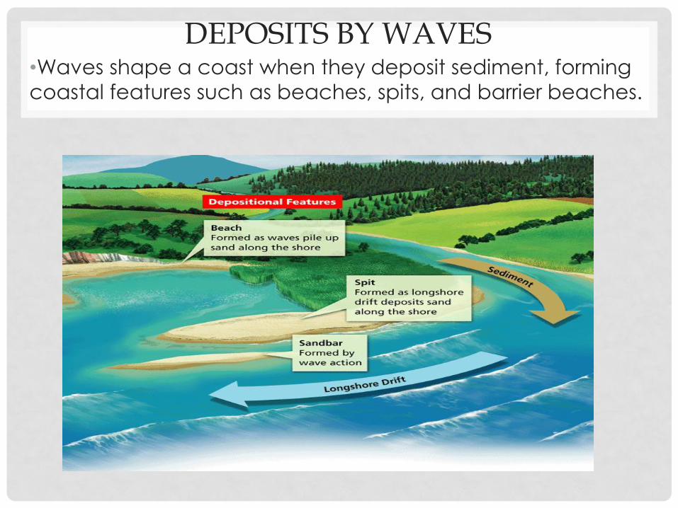
DEPOSITS BY WAVES •Waves shape a coast when they deposit sediment, forming
coastal features such as beaches, spits, and barrier beaches.
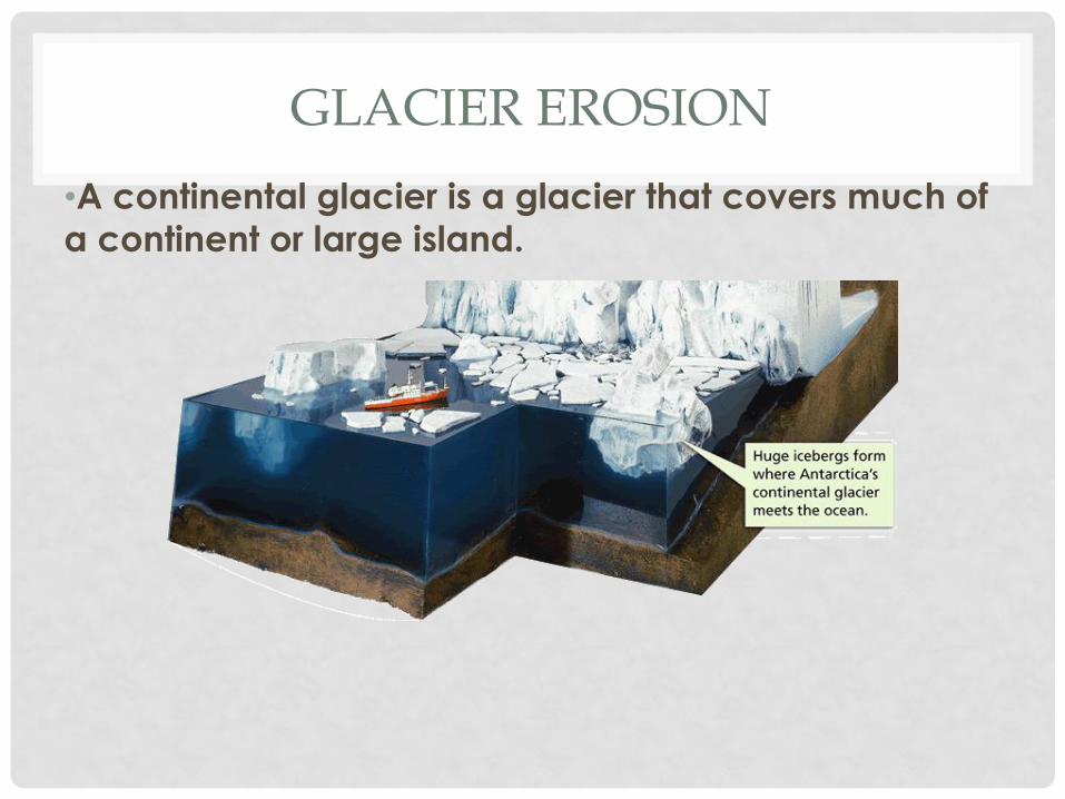
GLACIER EROSION
•A continental glacier is a glacier that covers much of
a continent or large island.
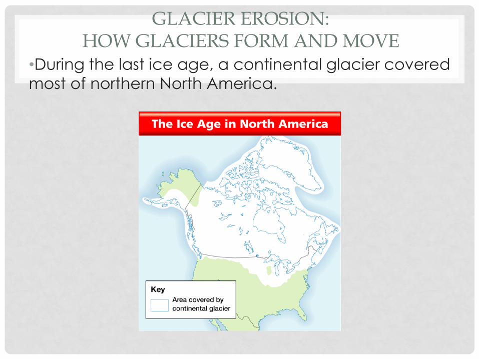
GLACIER EROSION: HOW GLACIERS FORM AND MOVE
•During the last ice age, a continental glacier covered
most of northern North America.
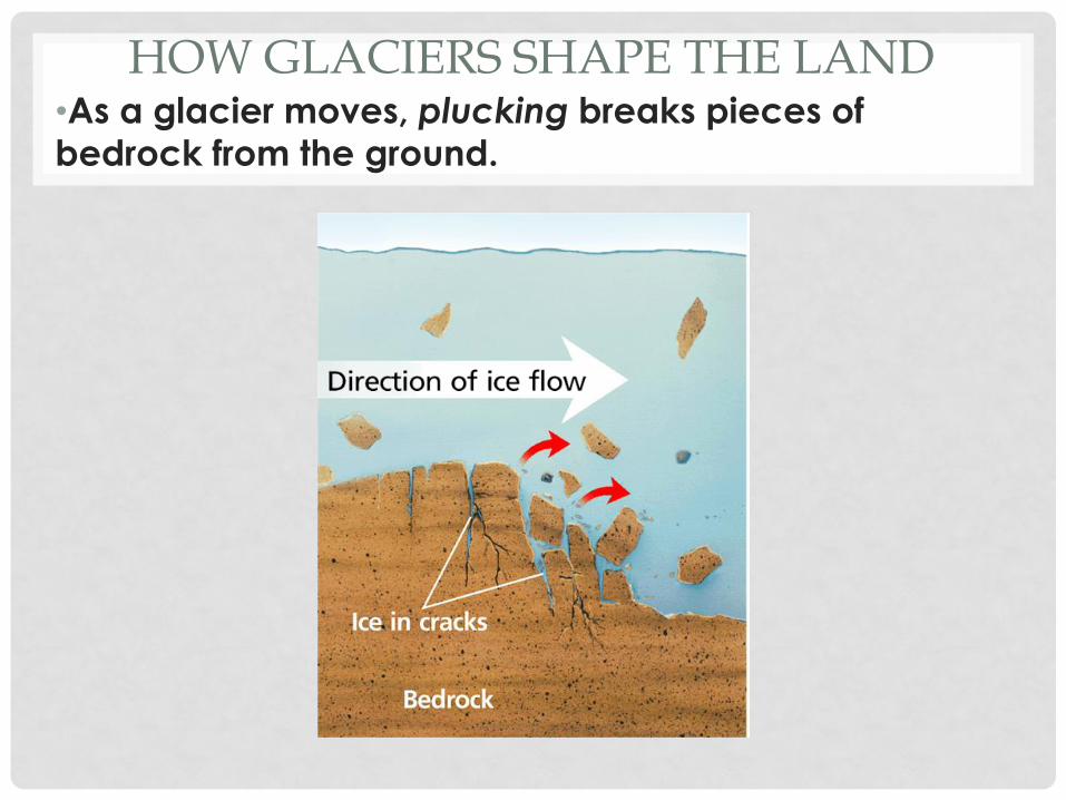
HOW GLACIERS SHAPE THE LAND •As a glacier moves, plucking breaks pieces of bedrock from the ground.
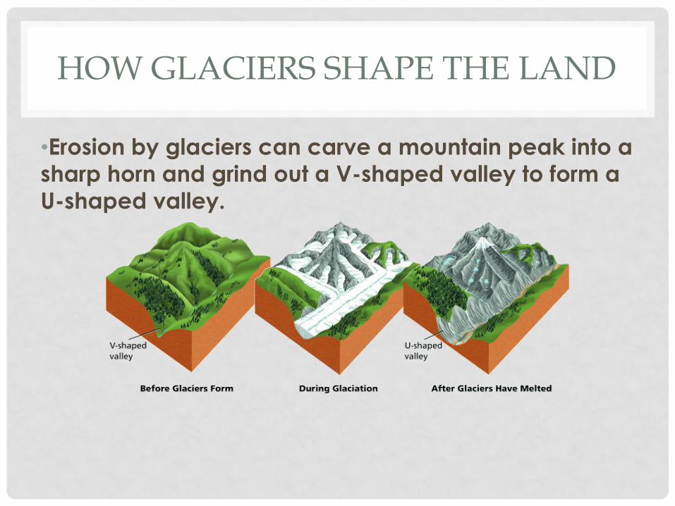
HOW GLACIERS SHAPE THE LAND
•Erosion by glaciers can carve a mountain peak into a
sharp horn and grind out a V-shaped valley to form a
U-shaped valley.
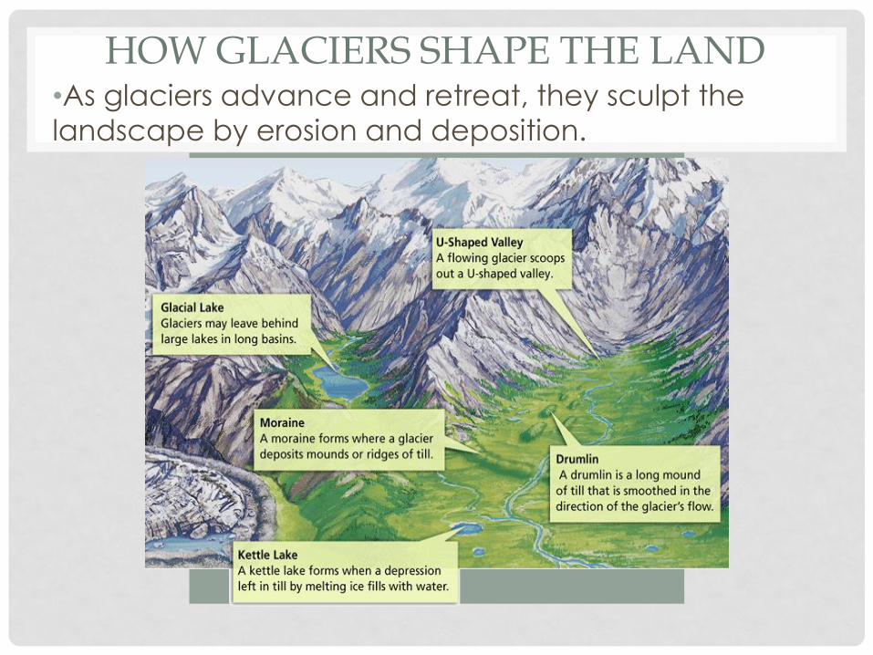
HOW GLACIERS SHAPE THE LAND •As glaciers advance and retreat, they sculpt the
landscape by erosion and deposition.
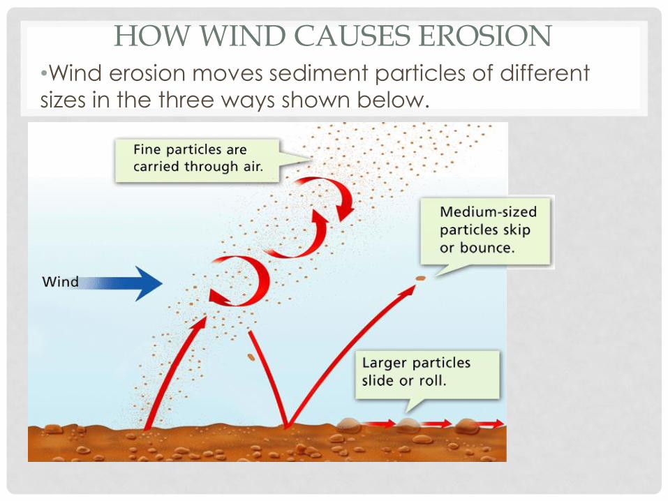
HOW WIND CAUSES EROSION •Wind erosion moves sediment particles of different
sizes in the three ways shown below.
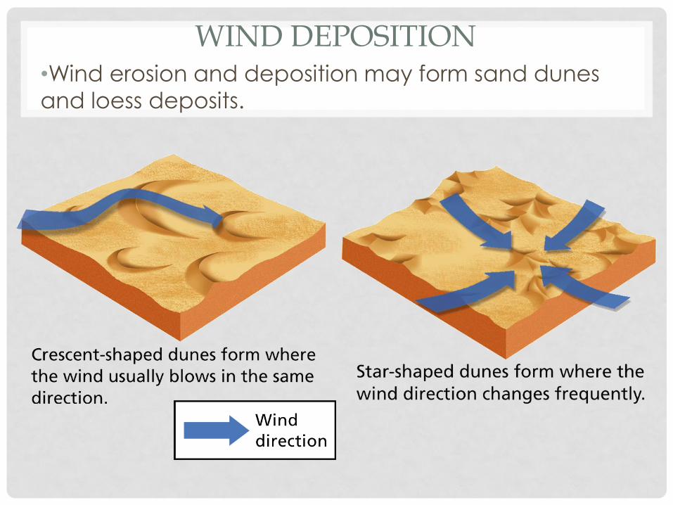
WIND DEPOSITION •Wind erosion and deposition may form sand dunes
and loess deposits.