epa’s geospatial metadata framework
DESCRIPTION
EPA’s Geospatial Metadata Framework. An Overview. FGDC Coordination Group Meeting February 12, 2008. Agenda. Background Drivers Initial Efforts Reason for Change Current EPA Metadata Suite Policy/Planning Framework Users/Community Technology Demonstration GeoData Gateway - PowerPoint PPT PresentationTRANSCRIPT
1
EPA’s Geospatial Metadata Framework
An Overview
FGDC Coordination Group Meeting February 12, 2008
2
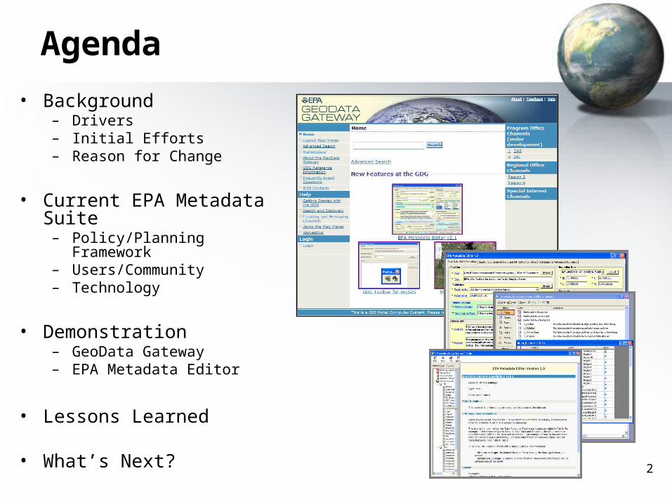
Agenda
• Background – Drivers– Initial Efforts– Reason for Change
• Current EPA Metadata Suite
– Policy/Planning Framework– Users/Community– Technology
• Demonstration– GeoData Gateway– EPA Metadata Editor
• Lessons Learned
• What’s Next?
3
Background
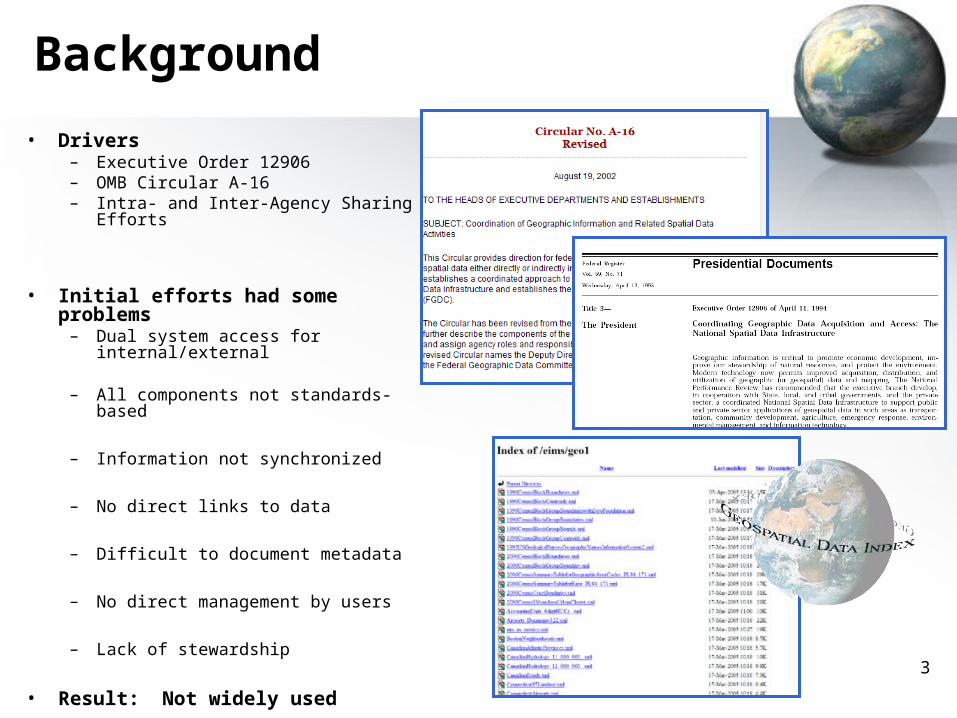
• Drivers – Executive Order 12906– OMB Circular A-16– Intra- and Inter-Agency Sharing
Efforts
• Initial efforts had some problems– Dual system access for
internal/external
– All components not standards-based
– Information not synchronized
– No direct links to data
– Difficult to document metadata
– No direct management by users
– Lack of stewardship
• Result: Not widely used
4
Background
• Desire for Change– EPA decided it needed to organize geospatial metadata
• EPA Metadata Workgroup (2005)– Business Rules: Define EPA’s Implementation of FGDC CSDGM
» EPA Regions and Programs represented» Agreed to an implementation and resulted in EPA Geospatial
Metadata Technical Specification
– Architecture: Define baseline and target architecture» Baseline identified holdings in central and Regional websites
(over 4,000 holdings identified)» Target included a standards-based integrated, dynamic system
5
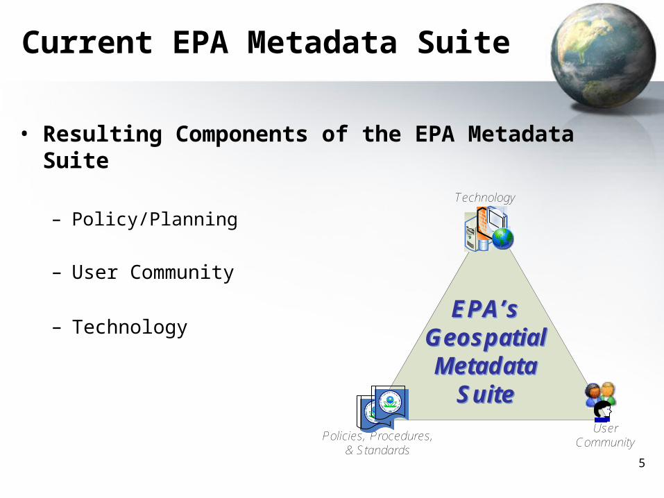
Current EPA Metadata Suite
• Resulting Components of the EPA Metadata Suite
– Policy/Planning
– User Community
– Technology
Technology
Policies, Procedures, & Standards
User Community
EPA’s Geospatial Metadata
Suite
EPA’s Geospatial Metadata
Suite
66
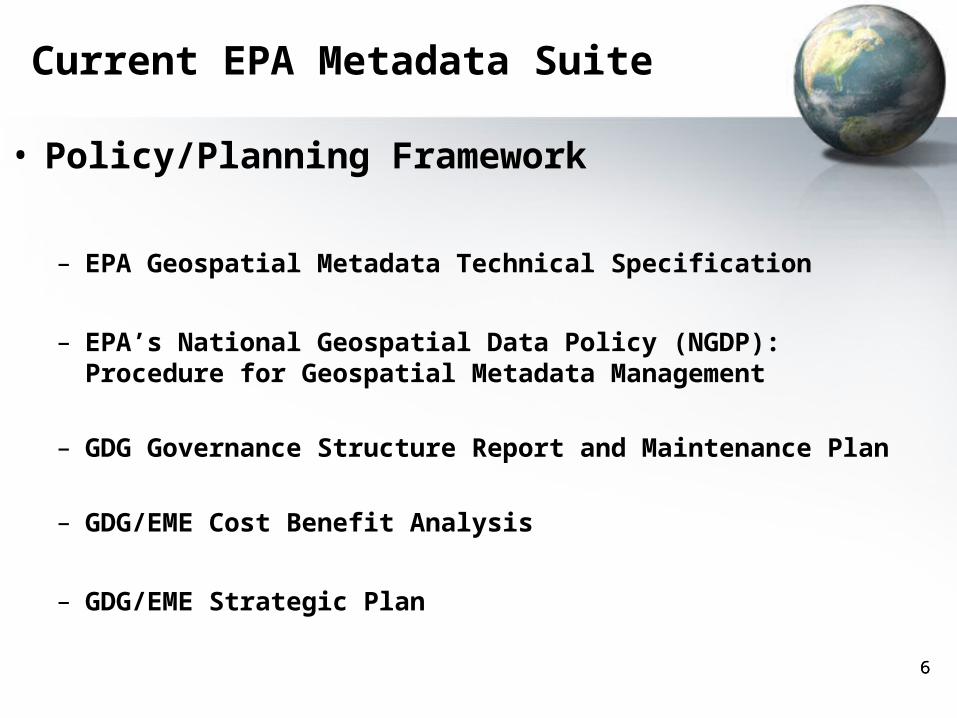
• Policy/Planning Framework
– EPA Geospatial Metadata Technical Specification
– EPA’s National Geospatial Data Policy (NGDP): Procedure for Geospatial Metadata Management
– GDG Governance Structure Report and Maintenance Plan
– GDG/EME Cost Benefit Analysis
– GDG/EME Strategic Plan
Current EPA Metadata Suite
7
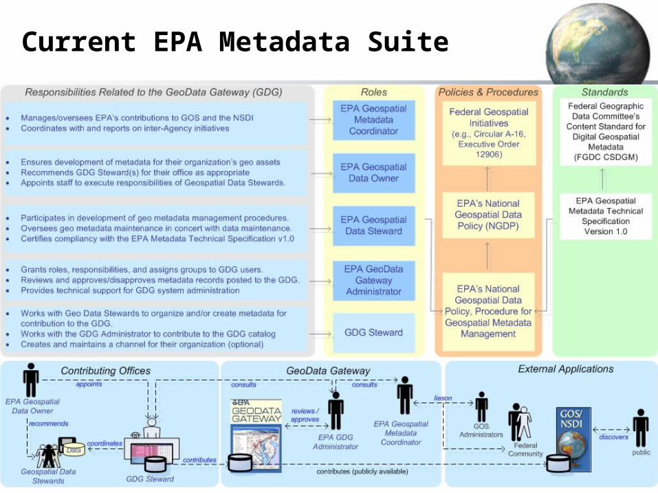
Current EPA Metadata Suite
8
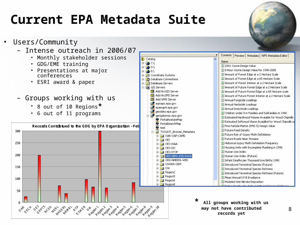
Records Contribtued to the GDG by EPA Organization - Feb 2008
0
50
100
150
200
250
300
• Users/Community– Intense outreach in 2006/07
• Monthly stakeholder sessions• GDG/EME training• Presentations at major conferences• ESRI award & paper
– Groups working with us• 8 out of 10 Regions*• 6 out of 11 programs
Current EPA Metadata Suite
* All groups working with us may not have contributed records yet
9
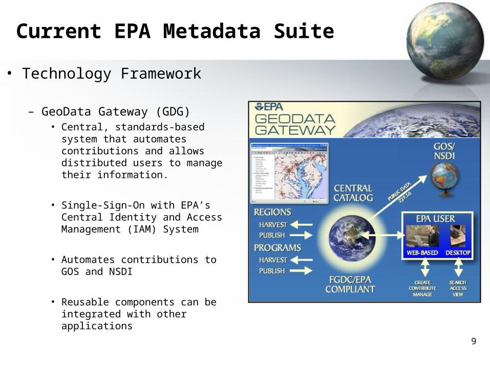
• Technology Framework
– GeoData Gateway (GDG)• Central, standards-based system
that automates contributions and allows distributed users to manage their information.
• Single-Sign-On with EPA’s Central Identity and Access Management (IAM) System
• Automates contributions to GOS and NSDI
• Reusable components can be integrated with other applications
Current EPA Metadata Suite
10
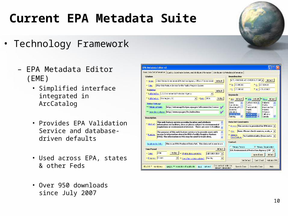
• Technology Framework
– EPA Metadata Editor (EME) • Simplified interface integrated
in ArcCatalog
• Provides EPA Validation Service and database-driven defaults
• Used across EPA, states & other Feds
• Over 950 downloads since July 2007
Current EPA Metadata Suite
11
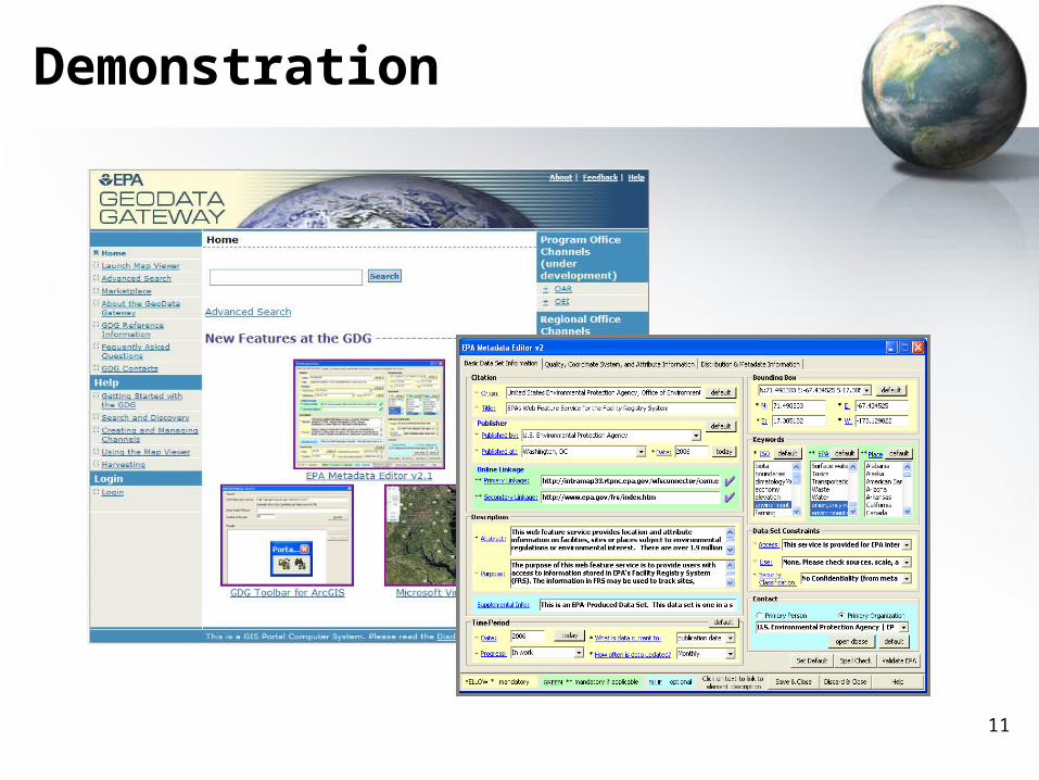
Demonstration
12
Lessons Learned• There have been a few bumps along the way…..
– Adopting Relatively New Technology• Often first to discover bugs• Not a large user base to draw on
– Performance & Reliability• Image & feature services inconsistent within Map Viewer components• Sometimes things just ‘stop’ working
– Integration with larger EPA Architecture • Need Service Level Agreements• Need to understand new responsibilities placed on other system owners in
advance!
– Use of COTS Product• Customization always a risk
– User Buy-in is Key• If users bought into system and understand what’s needed, they often put up with
imperfection.
13
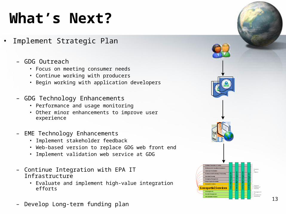
What’s Next?
• Implement Strategic Plan
– GDG Outreach• Focus on meeting consumer needs• Continue working with producers• Begin working with application developers
– GDG Technology Enhancements• Performance and usage monitoring• Other minor enhancements to improve user experience
– EME Technology Enhancements• Implement stakeholder feedback• Web-based version to replace GDG web front end• Implement validation web service at GDG
– Continue Integration with EPA IT Infrastructure• Evaluate and implement high-value integration efforts
– Develop Long-term funding plan
* Unique Regional Activities
Research & ScienceResearch & Science
Geospatial Services
Enforcement & Compliance AssistanceEnforcement & Compliance Assistance
Environmental Monitoring & ForecastingEnvironmental Monitoring & Forecasting
Clean-up & RestorationClean-up & Restoration
Pollution Prevention & ControlPollution Prevention & Control
Homeland SecurityHomeland Security
Services to Citizens
Support Delivery of Services
Management of Government ResourcesAdministrative ServicesAdministrative Services
IT ManagementIT Management
Records ManagementRecords Management
Emergency ManagementEmergency Management
Air
Qu
ali
ty M
an
ag
em
en
tA
ir Q
ua
lity
Ma
na
ge
me
nt
Wa
ter
Qu
ali
ty M
an
ag
em
en
tW
ate
r Q
ua
lity
Ma
na
ge
me
nt
La
nd
Qu
ali
ty M
an
ag
em
en
tL
an
d Q
ua
lity
Ma
na
ge
me
nt
Su
bs
tan
ce
Ma
na
ge
me
nt
Su
bs
tan
ce
Ma
na
ge
me
nt
14
For More Information:
• Michelle Torreano – GDG Project Manager & Agency Geospatial Metadata
Coordinator– 202-566-2141– [email protected]
• EPA’s National Geospatial Program– EPA Policies
• http://geodata.epa.gov/policies.html
– EPA Metadata Editor• http://geodata.epa.gov/eme.html