earth , sun, and moon interactions
DESCRIPTION
EARTH , SUN, and Moon Interactions. Understanding Climate and Weather What? Why and How?. Guide Questions . Why do we have night and day? What is a day/year? How does sunlight hit the Earth’s surface? (equator, poles) Why is it warmer at the equator and colder at the poles? - PowerPoint PPT PresentationTRANSCRIPT
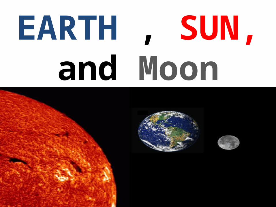
EARTH , SUN, and Moon Interactions
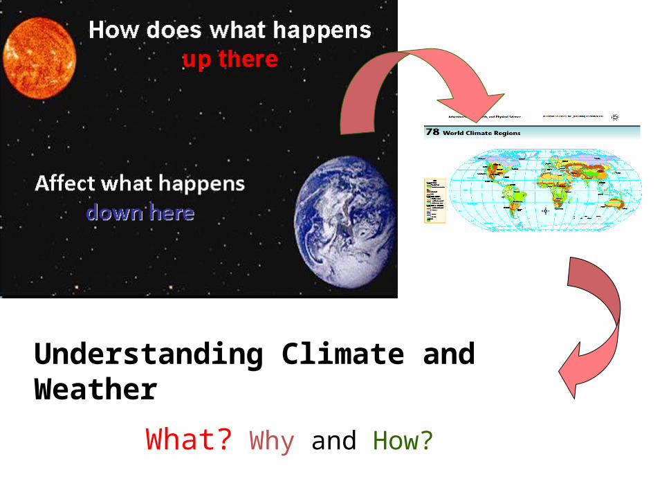
Understanding Climate and Weather
What? Why and How?

Guide Questions 1.Why do we have night and day?
2.What is a day/year?
3.How does sunlight hit the Earth’s surface? (equator, poles)
4.Why is it warmer at the equator and colder at the poles?
5.Why are there seasons?
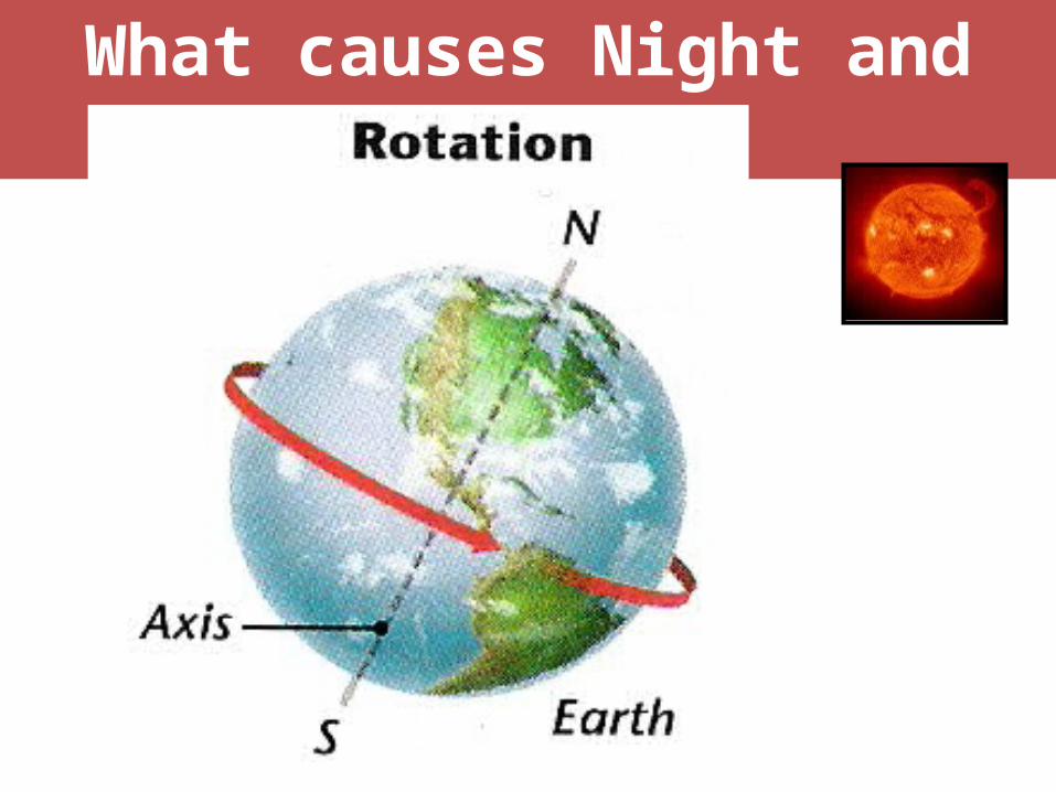
What causes Night and Day?
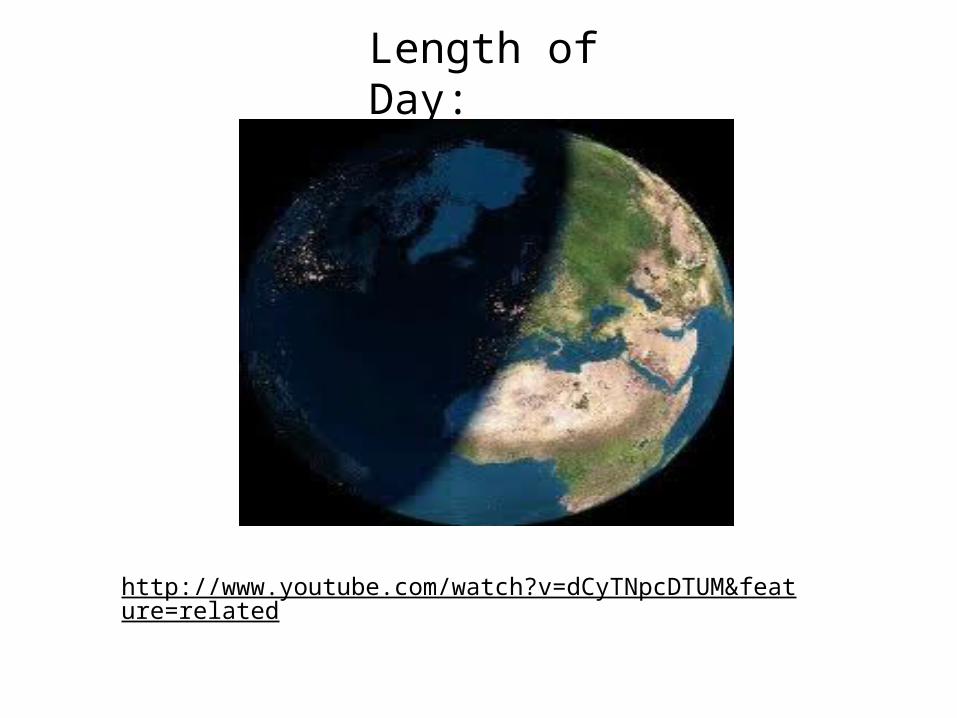
Length of Day:
http://www.youtube.com/watch?v=dCyTNpcDTUM&feature=related
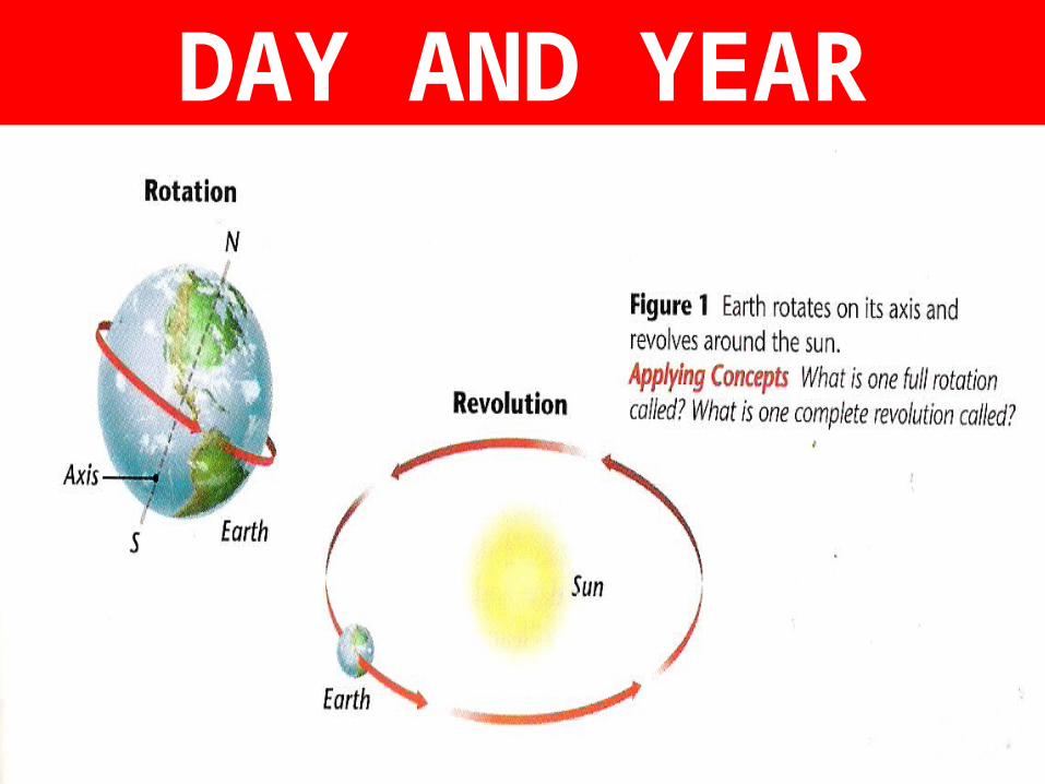
DAY AND YEAR
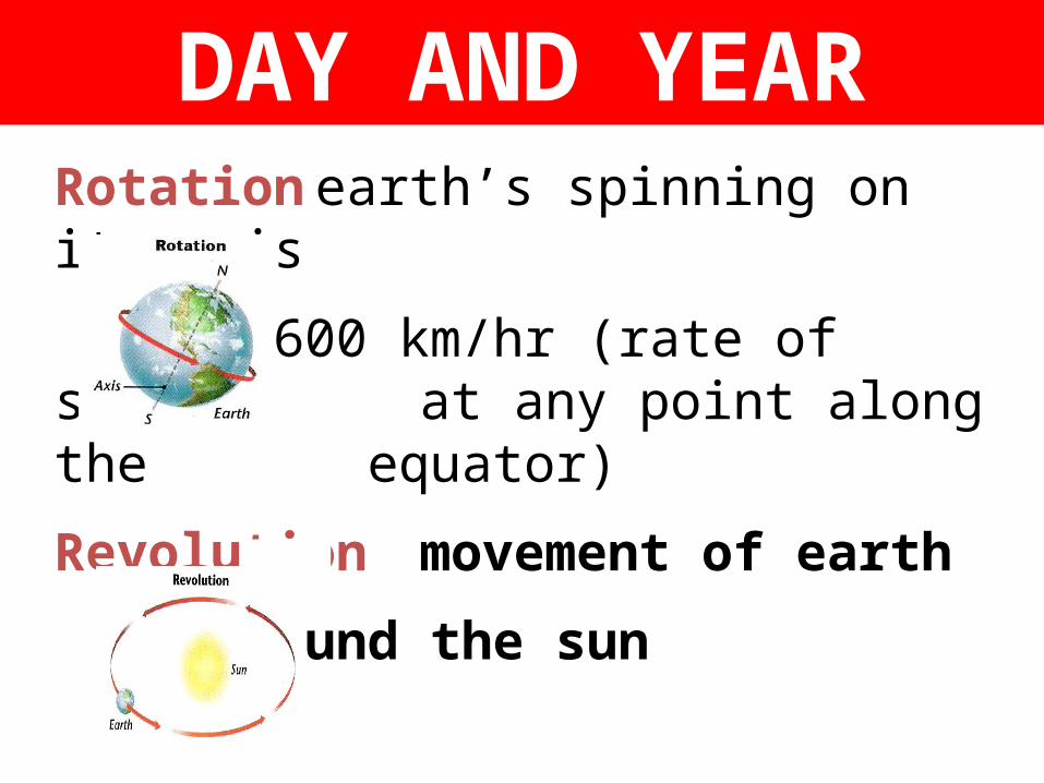
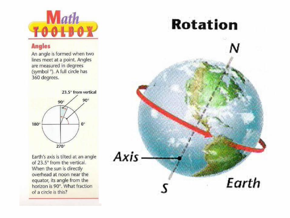
DAY AND YEARRotation earth’s spinning on its axis
1,600 km/hr (rate of spin at any point along the equator)
Revolution movement of earth
around the sun
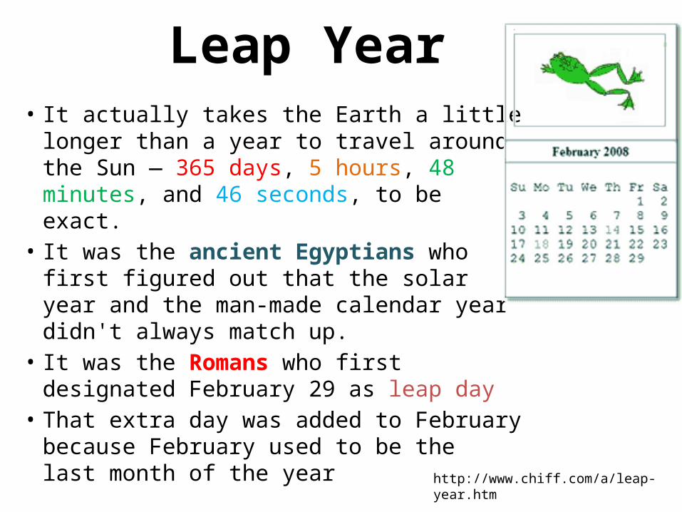
Leap Year• It actually takes the Earth a little longer than
a year to travel around the Sun — 365 days, 5 hours, 48 minutes, and 46 seconds, to be exact.
• It was the ancient Egyptians who first figured out that the solar year and the man-made calendar year didn't always match up.
• It was the Romans who first designated February 29 as leap day
• That extra day was added to February because February used to be thelast month of the year http://www.chiff.com/a/leap-year.htm
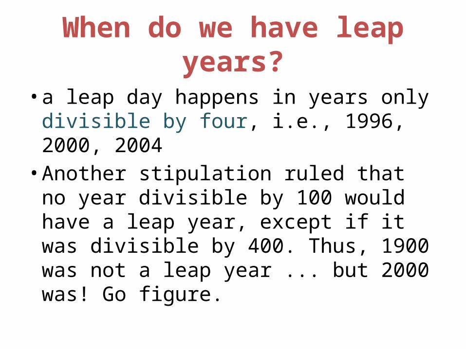
When do we have leap years?
• a leap day happens in years only divisible by four, i.e., 1996, 2000, 2004• Another stipulation ruled that no year
divisible by 100 would have a leap year, except if it was divisible by 400. Thus, 1900 was not a leap year ... but 2000 was! Go figure.
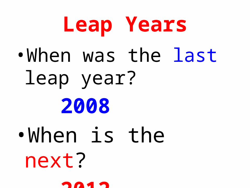
Leap Years•When was the last leap
year?2008
•When is the next?2012
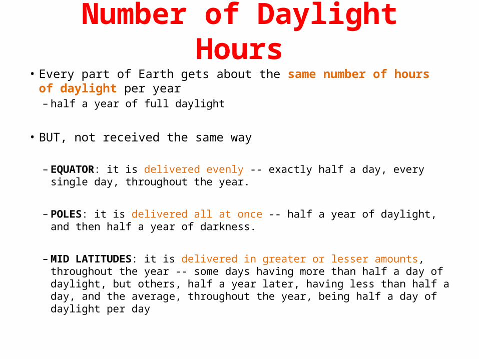
Number of Daylight Hours• Every part of Earth gets about the same number of hours of daylight per year
– half a year of full daylight
• BUT, not received the same way
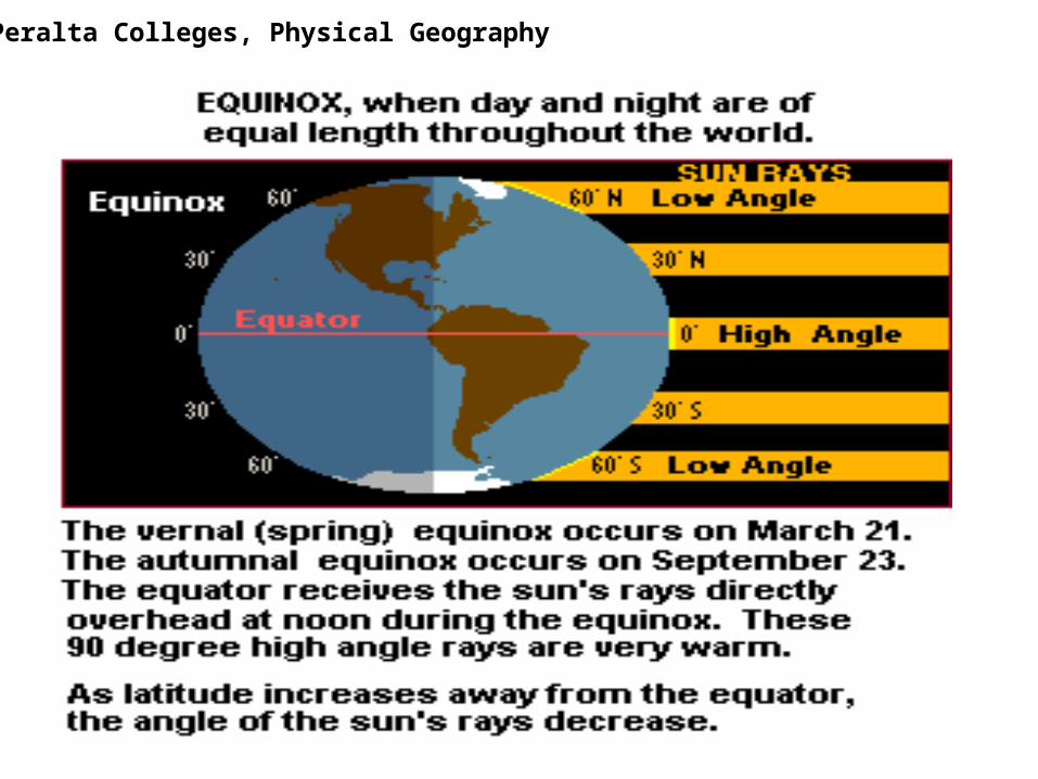
– EQUATOR: it is delivered evenly -- exactly half a day, every single day, throughout the year.
– POLES: it is delivered all at once -- half a year of daylight, and then half a year of darkness.
– MID LATITUDES: it is delivered in greater or lesser amounts, throughout the year -- some days having more than half a day of daylight, but others, half a year later, having less than half a day, and the average, throughout the year, being half a day of daylight per day
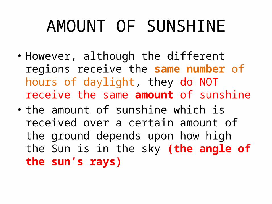
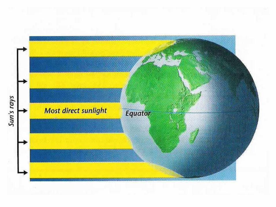
AMOUNT OF SUNSHINE
• However, although the different regions receive the same number of hours of daylight, they do NOT receive the same amount of sunshine
• the amount of sunshine which is received over a certain amount of the ground depends upon how high the Sun is in the sky (the angle of the sun’s rays)
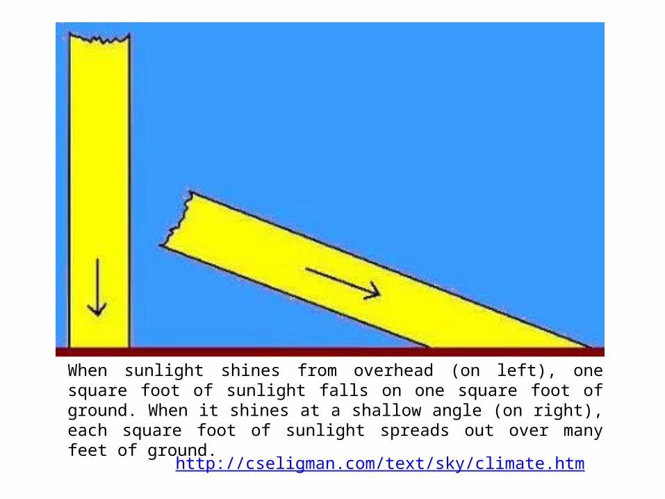
When sunlight shines from overhead (on left), one square foot of sunlight falls on one square foot of ground. When it shines at a shallow angle (on right), each square foot of sunlight spreads out over many feet of ground.
http://cseligman.com/text/sky/climate.htm
http://www.youtube.com/watch?v=95TtXYjOEv49 mins
Geography basics
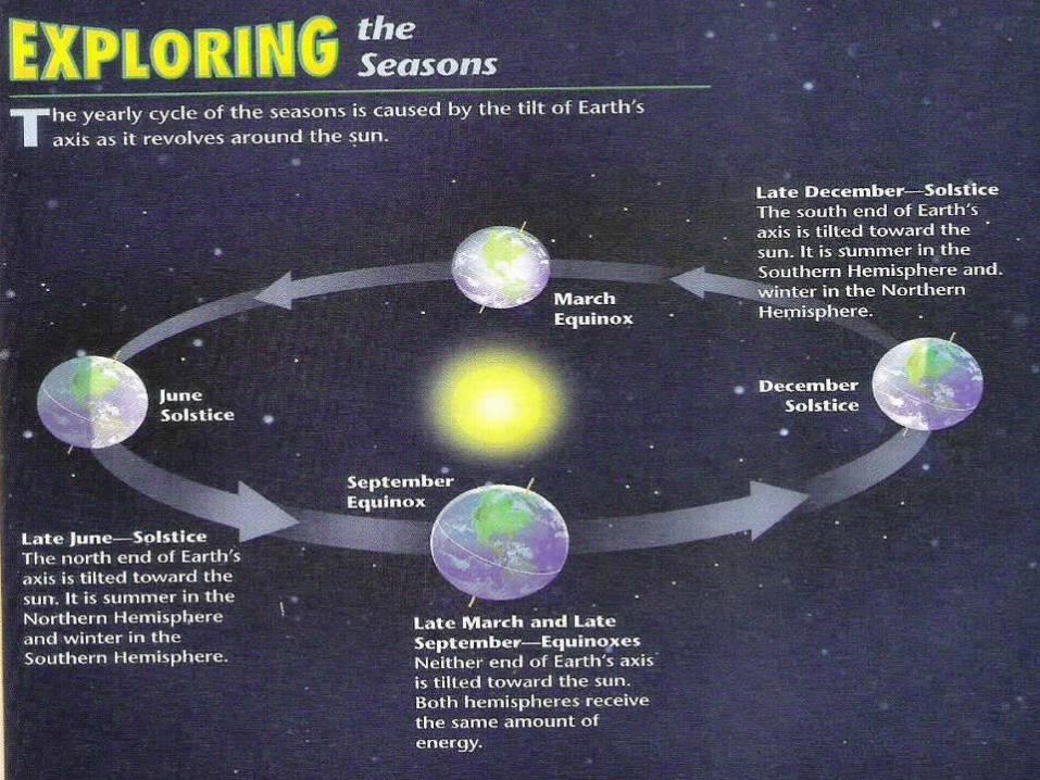
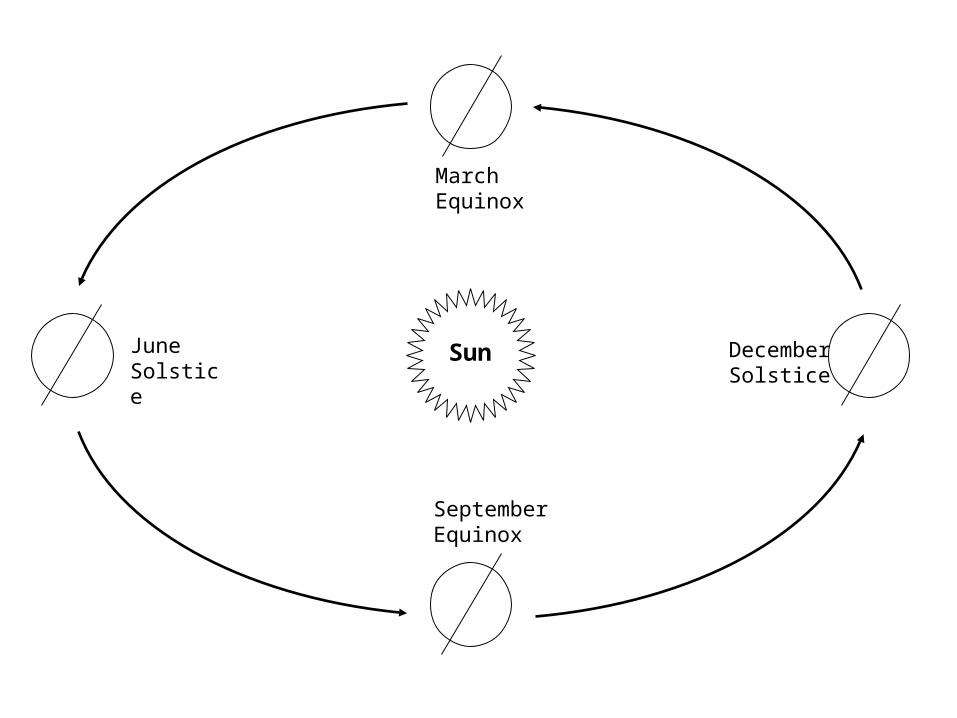
June Solstice
September Equinox
December Solstice
March Equinox
Sun
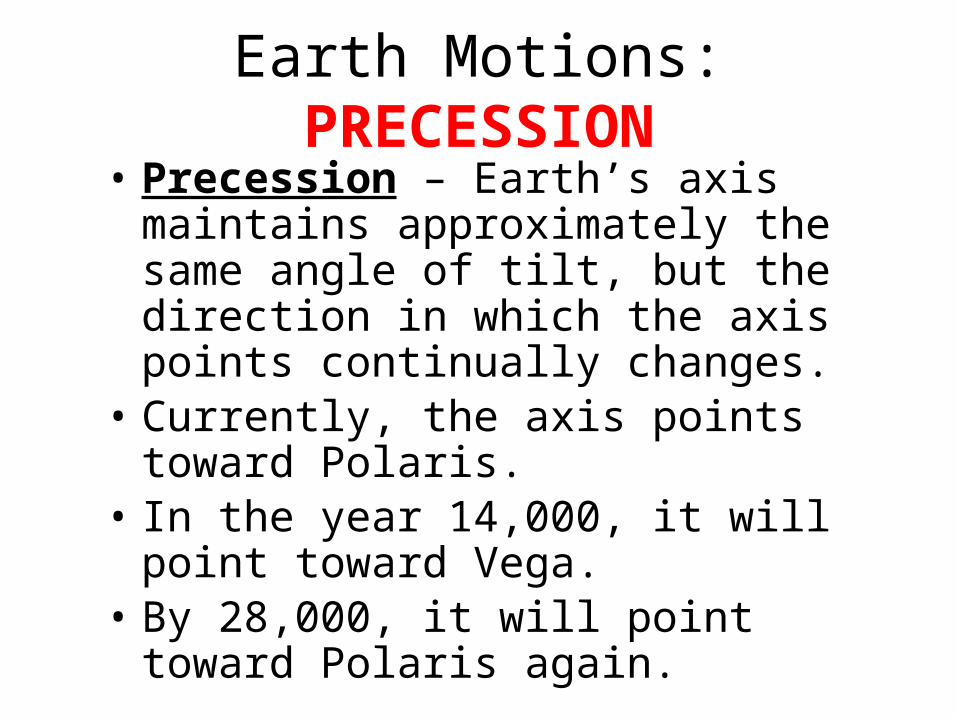
Earth Motions: PRECESSION• Precession – Earth’s axis maintains
approximately the same angle of tilt, but the direction in which the axis points continually changes.
• Currently, the axis points toward Polaris.• In the year 14,000, it will point toward
Vega.• By 28,000, it will point toward Polaris
again.
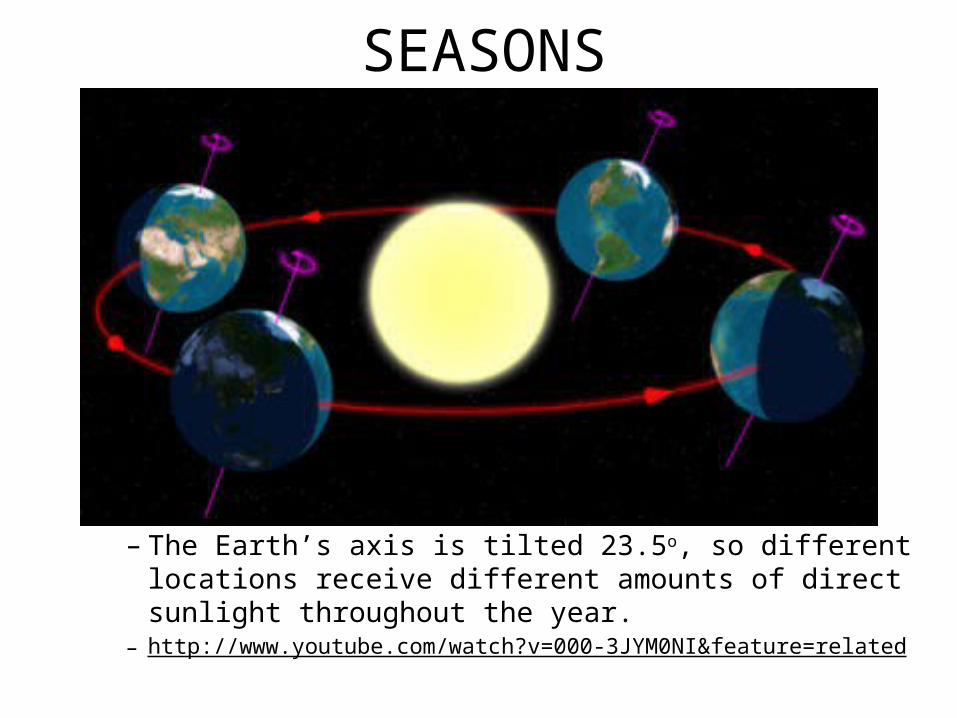
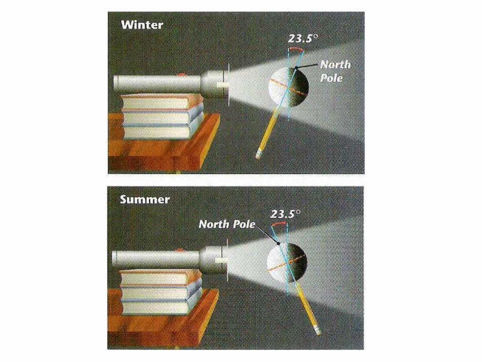
SEASONS
• We have seasons because:– The Earth’s axis is tilted 23.5o, so different locations
receive different amounts of direct sunlight throughout the year.
– http://www.youtube.com/watch?v=000-3JYM0NI&feature=related
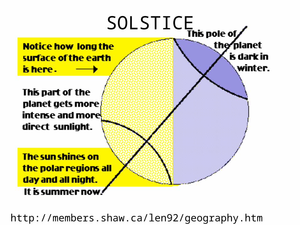
SOLSTICE
http://members.shaw.ca/len92/geography.htm
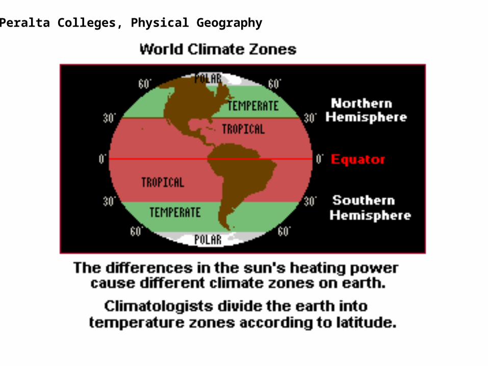
Peralta Colleges, Physical Geography
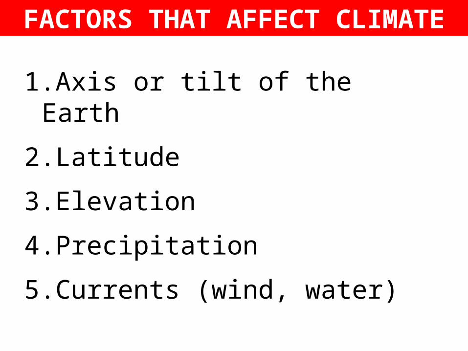
FACTORS THAT AFFECT CLIMATE
1.Axis or tilt of the Earth
2.Latitude
3.Elevation
4.Precipitation
5.Currents (wind, water)
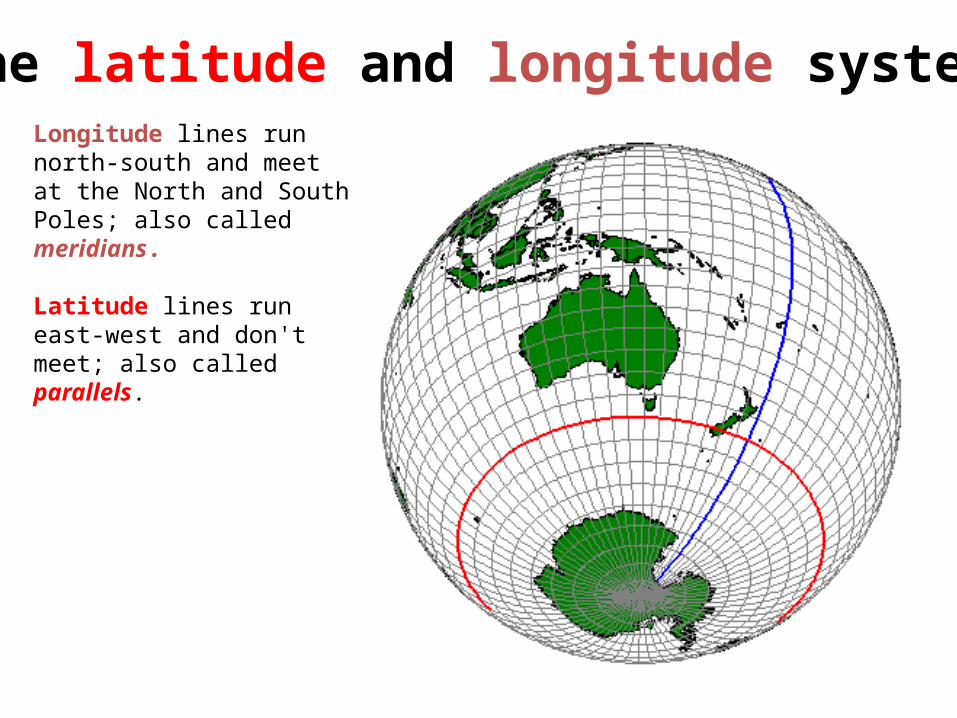
The latitude and longitude system
Longitude lines run north-south and meet at the North and South Poles; also called meridians.
Latitude lines run east-west and don't meet; also called parallels.
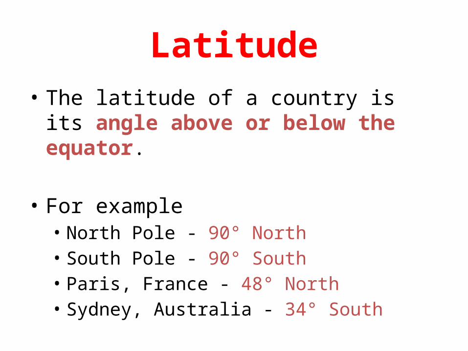
Latitude• The latitude of a country is its angle above or
below the equator.
• For example• North Pole - 90° North• South Pole - 90° South• Paris, France - 48° North• Sydney, Australia - 34° South

Latitude
Equator
Paris
48°
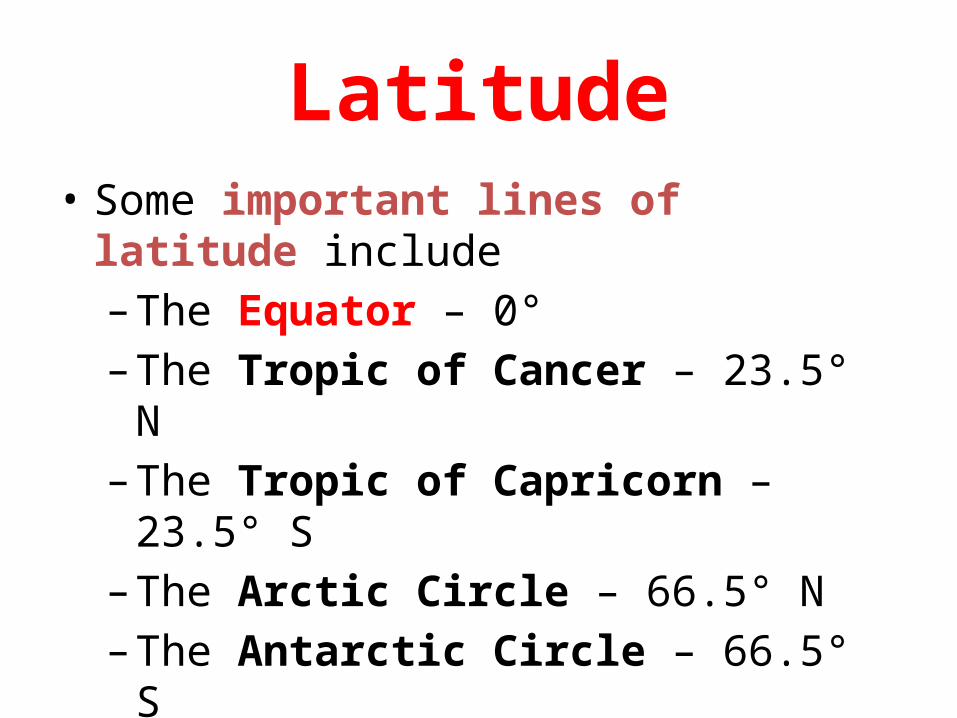
Latitude• Some important lines of latitude include– The Equator – 0°– The Tropic of Cancer – 23.5° N– The Tropic of Capricorn – 23.5° S– The Arctic Circle – 66.5° N– The Antarctic Circle – 66.5° S
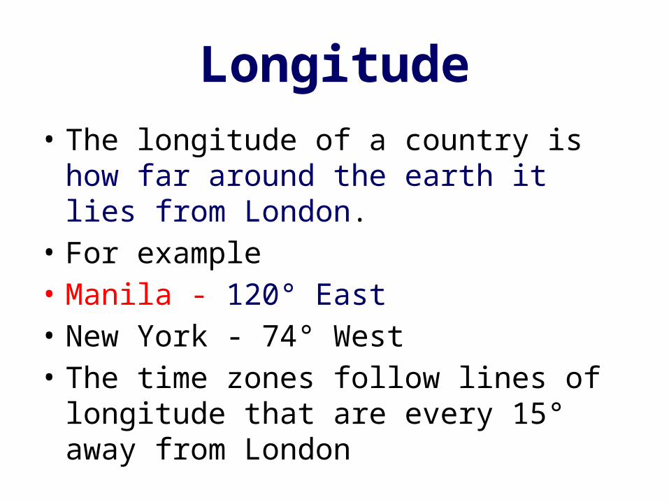
Longitude• The longitude of a country is how far around
the earth it lies from London.• For example• Manila - 120° East• New York - 74° West• The time zones follow lines of longitude that
are every 15° away from London
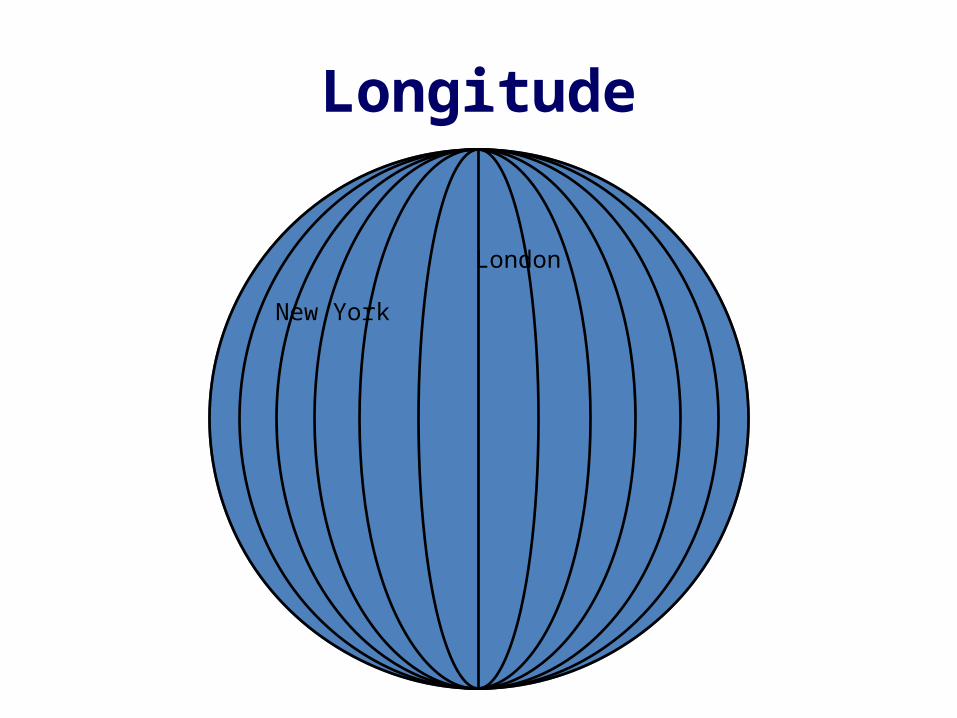
Longitude
London
New York
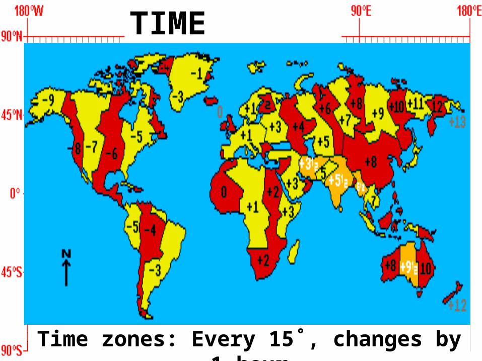
Time zones: Every 15˚, changes by 1 hour
TIME ZONES
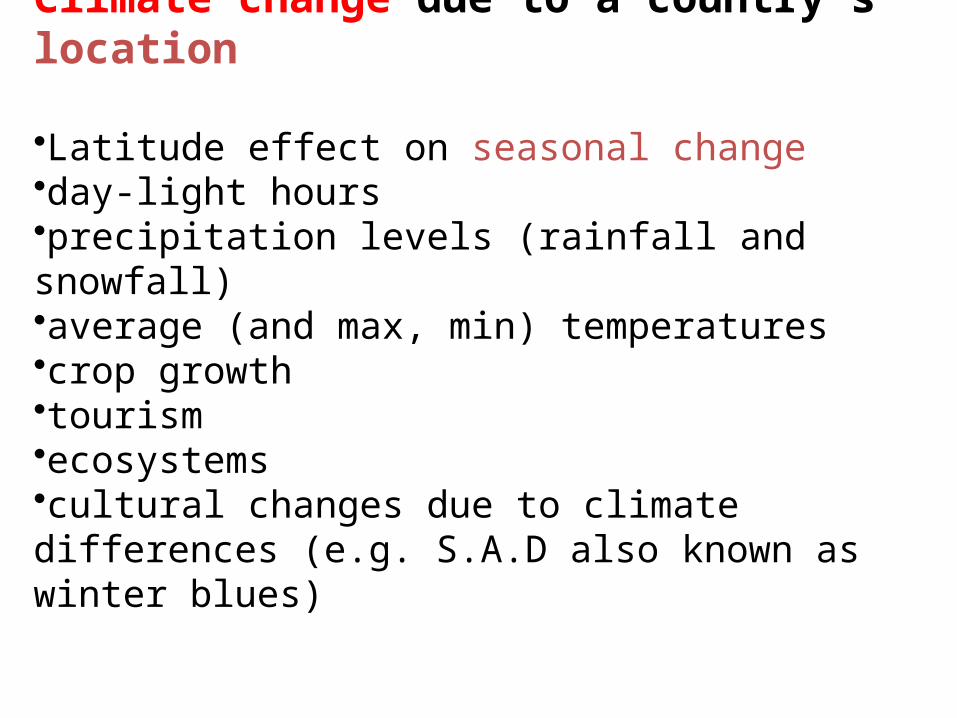
Climate change due to a country’s location
•Latitude effect on seasonal change •day-light hours •precipitation levels (rainfall and snowfall) •average (and max, min) temperatures •crop growth •tourism •ecosystems •cultural changes due to climate differences (e.g. S.A.D also known as winter blues)

Peralta Colleges, Physical Geography
