earth and marine sciences
TRANSCRIPT

ENVIRONMENT AND CLEANER PRODUCTION INSTITUTE
GENETIC ENGINEERING AND BIOTECHNOLOGY INSTITUTE
FOOD INSTITUTE
INSTITUTE OF CHEMICAL TECHNOLOGY
MATERIALS INSTITUTE
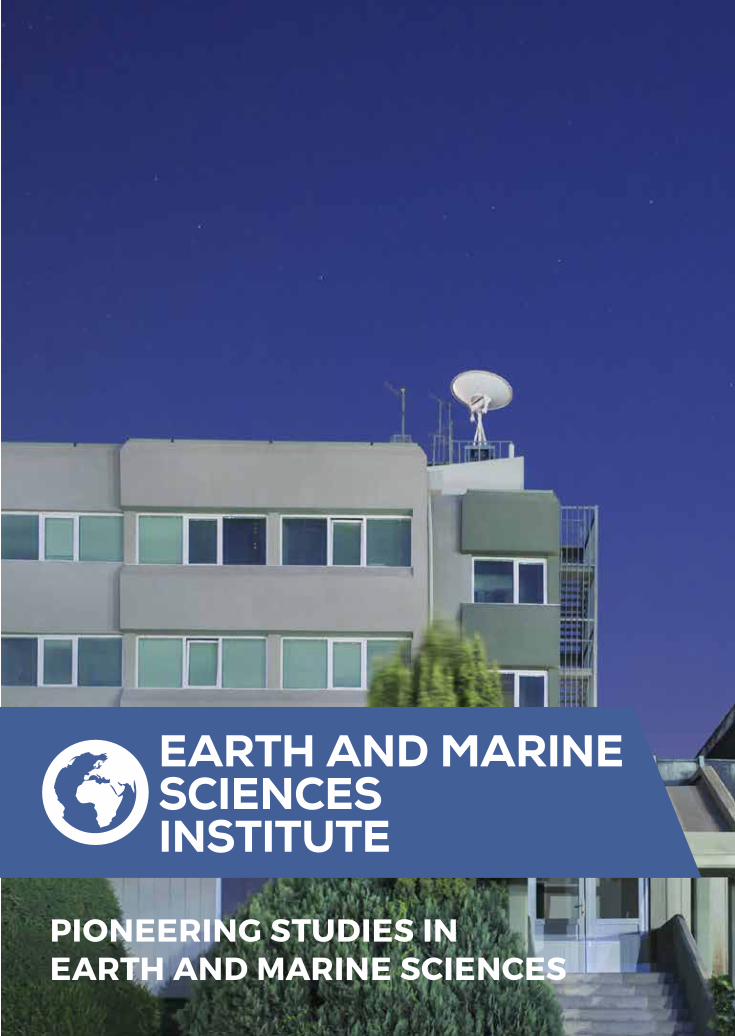
EARTH AND MARINE SCIENCES INSTITUTE
ENERGY INSTITUTE
EARTH AND MARINESCIENCES
INSTITUTE
MARMARARESEARCHCENTER

EARTH AND MARINE SCIENCESINSTITUTE
T: +90 (262) 677 29 00 - F: +90 (262) 641 23 09 E-mail: [email protected]
ENVIRONMENT AND CLEANER PRODUCTION INSTITUTE
T: +90 (262) 677 27 00 - F: +90 (262) 641 23 09 E-mail: [email protected]
ENERGY INSTITUTE
T: +90 (262) 677 33 00 - F: +90 (262) 641 23 09 E-mail: [email protected]
GENETIC ENGINEERING AND BIOTECHNOLOGY INSTITUTE
T: +90 (262) 677 32 00 - F: +90 (262) 641 23 09 E-mail: [email protected]
FOOD INSTITUTE
T: +90 (262) 677 38 00 - F: +90 (262) 641 23 09 E-mail: [email protected]
INTSTITUTE OF CHEMICAL TECHNOLOGY
T: +90 (262) 677 30 01 - F: +90 (262) 641 23 09 E-mail: [email protected]
MATERIALS INSTITUTE
T: +90 (262) 677 28 50 - F: +90 (262) 641 23 09 E-mail: [email protected]
EARTH AND MARINE SCIENCES INSTITUTE
41470 Gebze / KOCAELİ / TURKEYT: +90 (262) 677 20 00 - F: +90 (262) 641 23 09E-mail: [email protected]
EARTH AND MARINE SCIENCESINSTITUTE
PIONEERING STUDIES IN EARTH AND MARINE SCIENCES

EARTH AND MARINE SCIENCESINSTITUTE
Earth and Marine Sciences Institute has been a science and technology center conducting cutting-edge researches on natural hazards and resources with an accelerating pace since 1984. The Institute develops and coordinates multi-disciplinary projects with participation of universities and various private/governmental institutions. Along with the increasing availability of R&D funds in Turkey since the early 2000s, the Institute has been involved in competitively funded projects and has become a center of attraction in its areas of studies by bringing together and pioneering various private/governmental institutions and universities.
TÜBİTAKMARMARA RESEARCH CENTER Gebze CampusKOCAELİ

Active Tectonics Research Technologies01
02
03
Geophysical Imaging Technologies
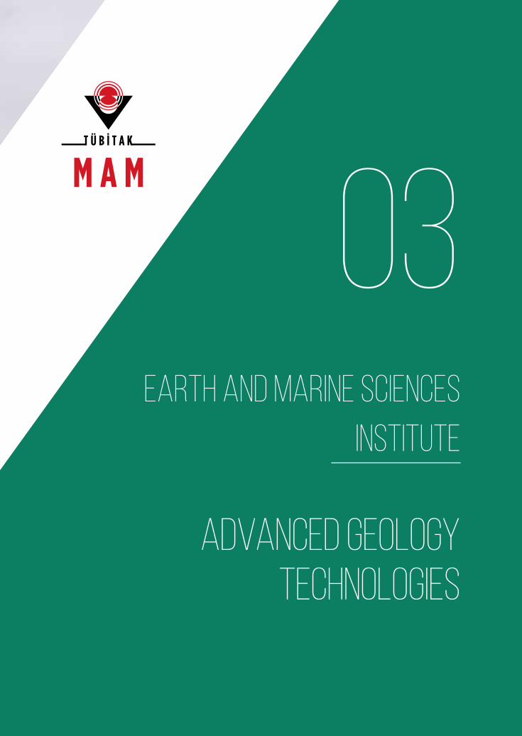
Advanced Geology Technologies
TÜBİTAK MARMARA RESEARCH CENTEREARTH AND MARINE SCIENCES INSTITUTE
FIELDS OF ACTIVITY

TÜBİTAK
MARMARARESEARCHCENTER
TÜBİTAK, the Scientific and Technological Research Council of Turkey, with its vision to be an innovative, guiding, participating and cooperating institution in the fields of science and technology, serves for the improvement of society’s life standards and for sustainable development of Turkey by supporting innovation through academic and industrial R&D studies, conducting research and development activities in accordance with national priorities and by determining the science and technology policies of Turkey.
Marmara Research Center (MAM) is one of the oldest and largest research centers of TÜBİTAK, and conducts applied research and development activities.
Earth and Marine Sciences Institute is one of the seven institutes of TÜBİTAK MAM, and conducts project-based studies in the field of geosciences.
mam.tubitak.gov.tr
EARTH AND MARINE SCIENCES INSTITUTE MARMARA RESEARCH CENTER4

MARMARA RESEARCH CENTER EARTH AND MARINE SCIENCES INSTITUTE 5
MAKES IT POSSIBLE TO ACHIEVE MORE

Expert R&D Staff 42%
PhD
31PERSONNEL
RESEARCHER
PROFILE25%
MSc
20%
BSc
10%
Technician
87%
Researcher
3%
Administrative Staff
Multidisciplinary Research Staff:• Geophysical Engineering • Geological Engineering• Geodesy and Photogrammetry
Engineering
• Physics Engineering
• Chemical Engineering
• Chemistry
6 EARTH AND MARINE SCIENCES INSTITUTE MARMARA RESEARCH CENTER

Turkey’s Largest R&D InfrastructureIn The Field
Digital Earthquake Monitoring Network
Measurement and Data Processing For Site Classification
Gravity Measurement and Data Processing
Active Tectonics Research Laboratory
Magnetic Gradiometry Measurement and Data Processing
Seismic Data Collection and Processing
GPS Data Collection and Processing
Magnetotelluric Measurement and Data Processing
National 1 MV Accelerated Mass Spectroscopy Laboratory
Remote Sensing and Geographic Information Systems Applications
7EARTH AND MARINE SCIENCES INSTITUTEMARMARA RESEARCH CENTER

MARMARA RESEARCH CENTER8 EARTH AND MARINE SCIENCES INSTITUTE

TECHNOLOGY DEVELOPMENT
AND APPLIED R&D
ACTIVITIES
MARMARA RESEARCH CENTER 9EARTH AND MARINE SCIENCES INSTITUTE


01
ACTIVE TECTONICS RESEARCH TECHNOLOGIES
EARTH AND MARINE SCIENCES INSTITUTE

MULTI-DISCIPLINARYEARTHQUAKE RESEARCHBY ADVANCED TECHNOLOGIES
12 EARTH AND MARINE SCIENCES INSTITUTE MARMARA RESEARCH CENTER

MULTI-DISCIPLINARYEARTHQUAKE RESEARCHBY ADVANCED TECHNOLOGIES
Multi-disciplinary Assessment and Modelling of Geological Hazards• Monitoring and modelling of earthquake, landslide,
volcano, tsunami and geothermal activities
• Province and country based seismic hazard assessment
• Geological and seismic hazard assessments for nuclear and geothermal power plants, dams, bridges, tunnels etc.
Earthquake Research• Seismotectonic Research
• Earthquake source modelling
• Crustal deformation, fault slip
• Earthquake cycle and stress interaction, long-term earthquake forecasting
• Paleoseismology
Postseismic Emergency Observations• Real-time earthquake aftershock studies
• Deformation monitoring by geodetic methods (GPS, PSinSAR, SAR, LIDAR)
• Coulomb stress modelling and earthquake triggering hazard
• Surface rupture and active fault mapping
ActiveTectonics ResearchTechnologies
13EARTH AND MARINE SCIENCES INSTITUTEMARMARA RESEARCH CENTER

In order to ensure dissemination of comprehensive partnership across Europe in earth sciences, the Institute has been involved in studies for an integrated cyber infrastructure that combines multi-disciplinary data coming from existing research infrastructure, observation networks and experimental laboratory studies. For instance, the Institute has been developing methods to determine the seismic hazard for Marmara Sea and surrounding area with space-based and terrestrial observations as part of the project (MARsite) on “New Directions in Seismic Hazard Assessment Through Focused Earth Observation in the Marmara Supersite”. This project aims to contribute to the minimization of the earthquake induced damages by creating new earth-science models for seismic hazards through integrated data.
Operation of Continuous Observation Networks For Geological Hazards
CONTINUOUS OBSERVATION NETWORKS

The studies for determining site assessment parameters for the site license of Sinop Nuclear Power Plant has been conducted in accordance with an international quality assurance program.
The main topics of the project include detailed observation of micro-earthquakes and earth deformations through seismological and geodetic networks, paleo-seismological studies to determine historic earthquakes on the faults, seismic reflection studies to characterize the fault structures at shallow depths, and oceanographic studies to introduce the details of Black Sea’s current system in the region. The basic design and construction of Sinop Nuclear Power Plant will be based on the data obtained with this project.
Research Studies For The Site Assessment Parameters of Sinop Nuclear Power Plant
SİNAR
As part of the Earthquake Aftershock Monitoring Project (DEPAR), the Earth and Marine Sciences Institute’s organizational structure has become capable of reaching the zone of an earthquake greater than MW=6.0 immediately after the main shock in any region of Turkey and establishing a temporary seismological monitoring network around the epicenter within 24 hours. The data collected from such seismological networks provide valuable information about the active faults in regions (as in the earthquakes in Ankara-Bala [2007] and Elazığ-Karakoçan [2010]). This information is shared with Disaster and Emergency Management Presidency (AFAD) in order to contribute to proper management of life saving activities.
Earthquake Aftershock Monitoring Project
DEPAR

Production capacities of geothermal reservoirs are highly variable, depending on the terrestrial, geological and geographical conditions of the site. Therefore, detailed Management Plans must be prepared for sustainable use of geothermal resources. The Institute develops projects to estimate the energy potentials and capacities of geothermal sites. With these projects, we will make an integrated implementation of the geological and geophysical methods for tourism-oriented operation of geothermal energy for the first time in Turkey.
Research on Geothermal Potential and Reservoir Capacity
GEOTHERMAL

02
GEOPHYSICAL IMAGING TECHNOLOGIES
EARTH AND MARINE SCIENCES INSTITUTE

GEOPHYSICALIMAGINGBY ADVANCEDTECHNOLOGIES
MARMARA RESEARCH CENTEREARTH AND MARINE SCIENCES INSTITUTE18

Shallow (<1km) Research Activities• Three dimensional imaging of coal seams, geological
storages, buried faults and archeological sites by seismic refraction/reflection, surface waves, microgravity, magnetic, electromagnetic and ground penetrating radar (GPR) methods.
• Engineering seismology, micro-zonation, site classification based on Vs30, Vp/Vs, bedrock depth
• Landslide, active fault mapping and monitoring, borehole geophysics, ground based SAR, LIDAR
Deep Research Activities • Studies on basin, crust and upper mantle structure by
active/passive seismic tomography, surface waves, receiver functions, anisotropy, gravity, magnetotelluric (MT) methods
• Geothermal reservoir imaging and monitoring by active/passive seismology, seismic, electromagnetic, gravity and magnetic methods
Marine geophysics• Sea bottom bathymetry
• Marine seismic, gravity and magnetic measurements
• Seismological observations of sea bottom
GeophysicalImaging Technologies
MARMARA RESEARCH CENTER 19EARTH AND MARINE SCIENCES INSTITUTE

The Institute continues its studies on urban transformation for Balıkesir Province after Kocaeli and Bursa Provinces. The studies focus on where and how an earthquake energy could be felt in the region considering the site properties of the province. Also, the activities of the existing and potential faults are continuously observed with the local seismological observation stations established in the scope of the project. Seismic Hazards of these fault systems, namely, how earthquakes would affect the regions, are determined with earthquake scenarios. The project’s outputs contribute much to the formation of an Earthquake Master Plan. It constitutes the background for engineering activities like planning residential areas, seismic reinforcement and design of buildings, and identifies the safe areas in all aspects as a basis for urban transformation.
Province Based Site Classification and Seismic Hazard Assessment
SEISMIC HAZARD
Within the scope of the project, the ground movements (landslides) are identified and their sliding surfaces/depths are classified in the research areas. In addition, we have monitored the landslides by various methods to determine their sizes, structures and mechanisms. Throughout the project, we have realized LIDAR surveys and mappings, GPS and ground-based SAR and PS-InSAR studies, geophysical site measurements, and drilled wells where we have made downhole inclinometer, piezometer and TDR measurements periodically.
Investigation, Monitoring and Assessment of Various Landslide Areas in Beylikdüzü and Büyükçekmece Districts
LANDSLIDE

We have monitored the lignite elongation in Soma Tertiary Basin, as the pilot study area, by integrated seismic methods. We have used a seismic vibrator with no harmful effect on environment in this method as a seismic source for the first time in Turkey; and achieved to minimize the need for drilling, which is widely applied in coal exploration activities, for fast and economical detection of lignite resources. This method can provide savings about 90% in cost and 75% in time in lignite exploration.
Determination of Coal Seam Elongation In Soma Tertiary Basin By Integrated Seismic Methods
COAL SEAM ELONGATION
03
ADVANCED GEOLOGY TECHNOLOGIES
EARTH AND MARINE SCIENCES INSTITUTE

GEOLOGICAL RESEARCHES BY ADVANCED TECHNOLOGIES
24 EARTH AND MARINE SCIENCES INSTITUTE MARMARA RESEARCH CENTER

GEOLOGICAL RESEARCHES BY ADVANCED TECHNOLOGIES
Advanced GeologyTechnologies
Geochemical Researches
• Natural gas, shale gas, coal gas
• Geothermal and water geochemistry
• Health hazards of geological origin
• Stable isotope studies
Marine Geology
• Sedimentology
• Continental shelf studies
• Gas hydrate
• Sea bottom classification
Dating By Accelerated Mass Spectroscopy (AMS)
• Geological, archeological, hydrological and climatological dating
25EARTH AND MARINE SCIENCES INSTITUTEMARMARA RESEARCH CENTER

NATIONAL 1MV AMS LABORATORY

Turkey’s First National 1MV Accelerated Mass Spectroscopy Laboratory has been established in the Earth and Marine Sciences Institute so as to contribute to geological
and archeological research. Thanks to this infrastructure, Turkey is now capable of dating research samples by Accelerated Mass Spectroscopy (AMS), which is currently the most
sensitive analysis method in the world. Radiocarbon method makes it possible to date organic samples tracing back up to 50.000 years ago, and on various rock samples tracing
back up to several million years ago, through the rare isotope analysis of longer half-life isotopes (10Be, 26Al and 41Ca). Also, as the first in the Middle East and Balkans, this
laboratory is expected to eliminate foreign dependency in the field, to pave the way for novel and multi-disciplinary research and to allow domestic production of strategic data on
Turkey’s cultural heritage, tectonic and environmental properties.
Establishment of National 1MV Accelerated Mass Spectroscopy Laboratory for Dating of Geological and Archeological Samples
AMS

TEST AND ANALYSIS SERVICES
Active Tectonics Research Laboratory Analyses
• Gravity measurements
• Seismic reflection data collection and evaluation
• Active multi channel 1-dimensional surface wave measurements (MASW)
• Passive multi channel 2-dimensional array based surface wave measurements (SPAC, FK)
• Microtremor H/V measurements
• Magnetic gradiometry measurements
• Continuous or campaign-type GPS measurements
• Magnetotelluric measurements
MARMARA RESEARCH CENTEREARTH AND MARINE SCIENCES INSTITUTE28

Accelerated Mass Spectroscopy Laboratory Analyses
• Carbon-14 dating by AMS
• Chemical pretreatment of samples like carbonized plants, seeds and woods, with standard acid-base-acid protocols and AMS dating
• Protein extraction from bone samples by ultrafiltration and AMS dating
• Alpha cellulose extraction from wood samples and age determination by AMS dating
• Chemical pretreatment of seashell samples and AMS dating
Tel: +90 (262) 677 21 90
E-mail: [email protected]
TÜBİTAK MARMARA RESEARCH CENTERIndustrial Services Unit
MARMARA RESEARCH CENTER 29EARTH AND MARINE SCIENCES INSTITUTE

OUR PIONEERING PROJECTS
2001-2003 2005 - 2008 2007 - 2008
2003-20052006-2008
2001-2004 2005 - 2010 2009 - 2015
2004-2006 2006 - 2009
Urgent Observational Studies For The Earthquake Risk In Marmara Region And Istanbul Metropolitan Area: Continuous Seismological Observation Network For
Marmara Region (MARSİS)
Site Classification and Seismic Hazard Assessment for Kocaeli
Province
Monitoring The Earthquake Activities of Marmara Region By Multi-disciplinary
Methods And Surveying Their Potential Effects On The Coastline/Shelf Ground of
Istanbul
Seismic Zonation and GIS Studies For Yalova City Center
Earthquake Aftershock Monitoring Project
(DEPAR)
Continuous GPS Observation Network of Marmara Region
Multi-disciplinary Investigation of Earthquake Mechanisms In Turkey’s Various Geostrategic Regions Having
High Risks of Earthquake But Different Tectonic Regimes (TÜRDEP)
Establishment of National 1MV Accelerated Mass
Spectroscopy Laboratory (AMS)
Frequent Observation-Driven Realistic Evaluation and Simulation of Interacting Geophysical Hazard
Triggers (FORESIGHT) – EU FP6
Project For Improving Seismological Observation Infrastructure In Marmara
Sea
MARMARA RESEARCH CENTER30 EARTH AND MARINE SCIENCES INSTITUTE

2009-2012 2011-2013
2010 - 2014 2012-2016
2009-2012 2012-2016 2015-2019
2010 - 20122013-2016
Determination of Coal Seam Elongation In Soma Tertiary Basin By Integrated Seismic Methods, and Surveying and Modelling of the Coal Gas Potential
Site Classification and Seismic Hazard Assessment for Bursa
Province
2014-2015 Imaging of Test System Site’s
Underground Structure By Geophysical Methods
European Plate Observing System (EPOS) - EU FP7
New Directions in Seismic Hazard Assessment Through Focused Earth
Observation in the Marmara Supersite (MARsite) - EU FP7
Investigation of Possible Active Faults In The Land Areas of Istanbul And Development of Landslide Detection And Monitoring
Methods Through Multi-disciplinary Studies On First Priority Landslide Areas
Research Studies For The Site Assessment Parameters of Sinop
Nuclear Power Plant
Site Classification and Seismic Hazard Assessment for
Balıkesir Province
“Seismology At School” Project (SİSMOKUL)
Investigation, Analysis And Monitoring of Various Landslide
Areas In Beylikdüzü And Büyükçekmece Districts (HEYZEP)
MARMARA RESEARCH CENTER 31EARTH AND MARINE SCIENCES INSTITUTE

For Further Information: www.mam.tubitak.gov.tr
OUR COOPERATION MODELSR&D PROJECTS WITH PRIVATE SECTOR COMPANIES
R&D PROJECTS WITH PUBLIC INSTITUTIONS
JOINT PROJECTS WITH INTERNATIONAL R&D INSTITUTIONS
TEST AND ANALYSIS SERVICES
TECHNOLOGY TRANSFER
• TÜBİTAK BILATERAL/MULTILATERAL COOPERATION PROJECTS
• EU PROJECTS
International Funding Programs
• TÜBİTAK ARDEB (1003, 1004, 1007)
• TÜBİTAK TEYDEB (1501, 1505, 1511)
National Funding Programs
If you have projects on which we can cooperate, please visit: dahaiyisimumkun.com/anket
OPEN DOOR POLICYFOR R&D COOPERATIONS

ENVIRONMENT AND CLEANER PRODUCTION INSTITUTE
GENETIC ENGINEERING AND BIOTECHNOLOGY INSTITUTE
FOOD INSTITUTE
INSTITUTE OF CHEMICAL TECHNOLOGY
MATERIALS INSTITUTE
EARTH AND MARINE SCIENCES INSTITUTE
ENERGY INSTITUTE
EARTH AND MARINESCIENCES
INSTITUTE
MARMARARESEARCHCENTER

EARTH AND MARINE SCIENCESINSTITUTE
41470 Gebze / KOCAELİ / TURKEYT +90 (262) 677 28 50F +90 (262) 641 23 09
EARTH AND MARINE SCIENCESINSTITUTE
TÜBİTAKMarmara Research Center