draft conservation area character appraisal and management ... appraisal.pdf · draft conservation...
TRANSCRIPT

ScoleDraft Conservation Area Character Appraisal and Management Guidelines
July 2017
Working with you, working for you

2. Scole Conservation Area Character Appraisal
ContentIntroduction
Historical Development
Character Assessment
Conservation Management Guidelines
Appendix 1(i) - Listed Buildings in Scole Conservation Area
Appendix 1(ii) - Unlisted Buildings in Scole Conservation Area which are oftownscape significance
Appendix 2 - Policy & Consultation
Appendix 3- Conservation Area Boundary
Appendix 4 - Historic Map
Appendix 5 - Streetscape
Appendix 6 - Natural Character
Scole Conservation Area Character Appraisal. 3
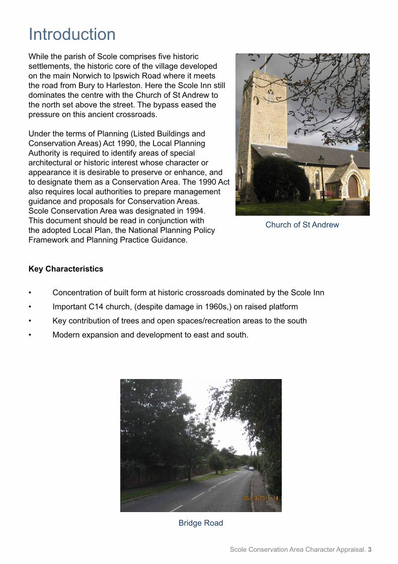
IntroductionWhile the parish of Scole comprises five historic settlements, the historic core of the village developed on the main Norwich to Ipswich Road where it meets the road from Bury to Harleston. Here the Scole Inn still dominates the centre with the Church of St Andrew to the north set above the street. The bypass eased the pressure on this ancient crossroads.
Under the terms of Planning (Listed Buildings and Conservation Areas) Act 1990, the Local Planning Authority is required to identify areas of special architectural or historic interest whose character or appearance it is desirable to preserve or enhance, and to designate them as a Conservation Area. The 1990 Act also requires local authorities to prepare management guidance and proposals for Conservation Areas. Scole Conservation Area was designated in 1994.This document should be read in conjunction with the adopted Local Plan, the National Planning Policy Framework and Planning Practice Guidance.
Key Characteristics
• Concentration of built form at historic crossroads dominated by the Scole Inn
• Important C14 church, (despite damage in 1960s,) on raised platform
• Key contribution of trees and open spaces/recreation areas to the south
• Modern expansion and development to east and south.
Church of St Andrew
Bridge Road

4. Scole Conservation Area Character Appraisal
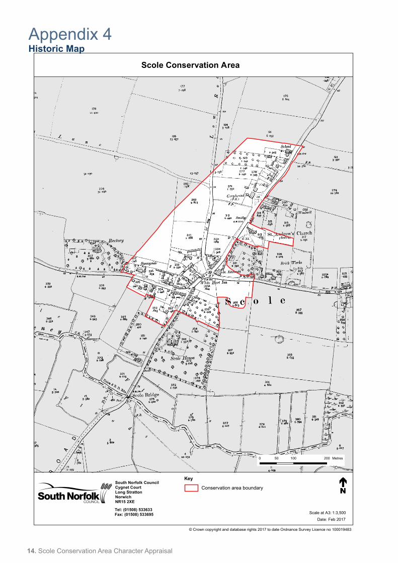
Historical Development (also see historic map in Appendix 4 page 14)
The parish of Scole is unusual in that it comprises five historic settlements, Frenze, Thorpe Parva, Billingford, Thelveton and Scole, although Scole itself has developed into the main centre, and provides the location of the conservation area.
There is evidence of Roman occupation in Scole and a small town developed where the major Roman Road from London crossed the River Waveney. Excavations in advance of the construction of the bypass revealed the remains of buildings, wells, industrial activities and burials. Coins were also found when a wall was built opposite the Scole Inn.
The parish of Scole was known as “Osmundeston” (Osmund’s Settlement) and is recorded as such in the Domesday Book. The name Scole does not appear until 1191.
The other settlements in the parish did not develop to a size comparable to Scole. St Andrew’s Church in Scole may have had its origins in the late Saxon period, but its core is mainly of late 13th or early 14th century date. In 1874, the church was thoroughly restored and re-seated to hold 240 people. Much of this good work was regrettably destroyed by fire in the 1960’s.
The centre of Scole developed around the Scole Inn, although there were a number of buildings already in this part of the village. The Inn was built in 1655 by John Peck and is described by Pevsner as one of the “most ambitious buildings in England erected specially for the purpose of offering hospitality to travellers”. To advertise the fact, a fabulous wooden sign reputedly costing £1057 was erected which extended across the road. In the 17th and 18th century, the Scole Inn, and the parish had regular visits by horse drawn services on route to Norwich or London. Purpose built stables were erected in 1829.
The Advent of the Great Eastern Railway affected the Scole Inn and it was sold in 1864 together with adjoining land comprising some 27 acres, for £670 to William Webb. He carried out various repairs and restorations. Further restoration in the 1920s restored the importance of the Inn, this time to car borne travellers.
The Thelveton Estate has long since been a major landowner in the area evidenced by with its distinctive buildings in the parish.
The population of the parish has fluctuated since 1911 when a total of 989 people lived in Scole. This fell to 870 in 1931, rising to 1088 in 1951 before falling again to 926 in 1971. Recent growth has stabilised the rate with 1128 in 1981, 1355 in 1991, 1339 in 2001, and 1367 in 2011. The completion of the bypass has made a difference. The absence of a constant flow of traffic has eased the environmental problems and afforded the opportunity for improvements both to spaces and buildings.
For this section, I am indebted to Mr L Mallows for the use of information contained in Jessie Mallow’s book on the history of Scole.
Scole Conservation Area Character Appraisal. 5
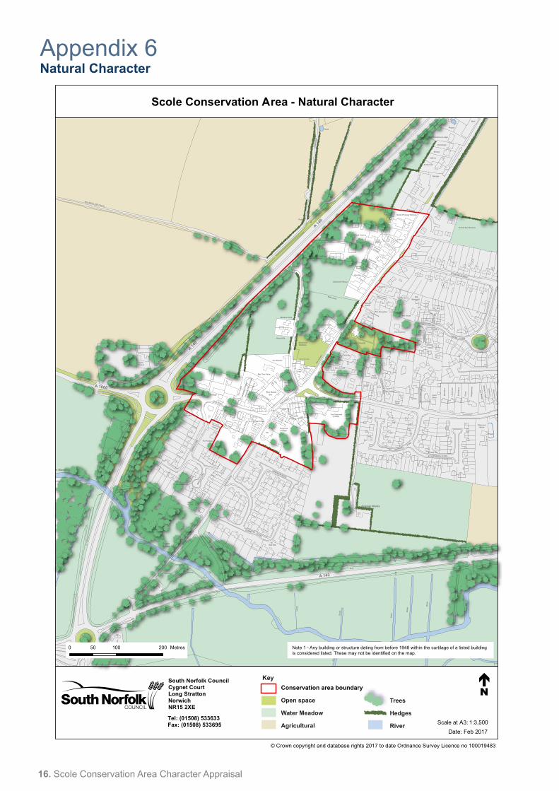
Character Assessment (also see Streetscape and Natural Character Map, Appendix 5 and 6, page 15 and 16)
Scole and setting
In area, Scole is one of the largest parishes in South Norfolk. Much of its character to the south is dominated by the landscape of the Waveney Valley with the A143 providing a platform from where extensive views can be enjoyed both to the north and south including, at one point, a good view of the Scole Inn. Elsewhere the landscape of the parish is typically “South Norfolk” with gently rolling countryside with pockets of trees and small woodlands. The new sections of the A140 and A143 have had a significant effect in fragmenting the parish, although the setting of the individual settlements have been relatively unaffected. With Scole itself, the bypass for the A140 runs for the most part in a cutting and it is only at the junction with Diss Road and a section by the termination of Low Road that its impact is most noticeable.
Conservation Area Boundary
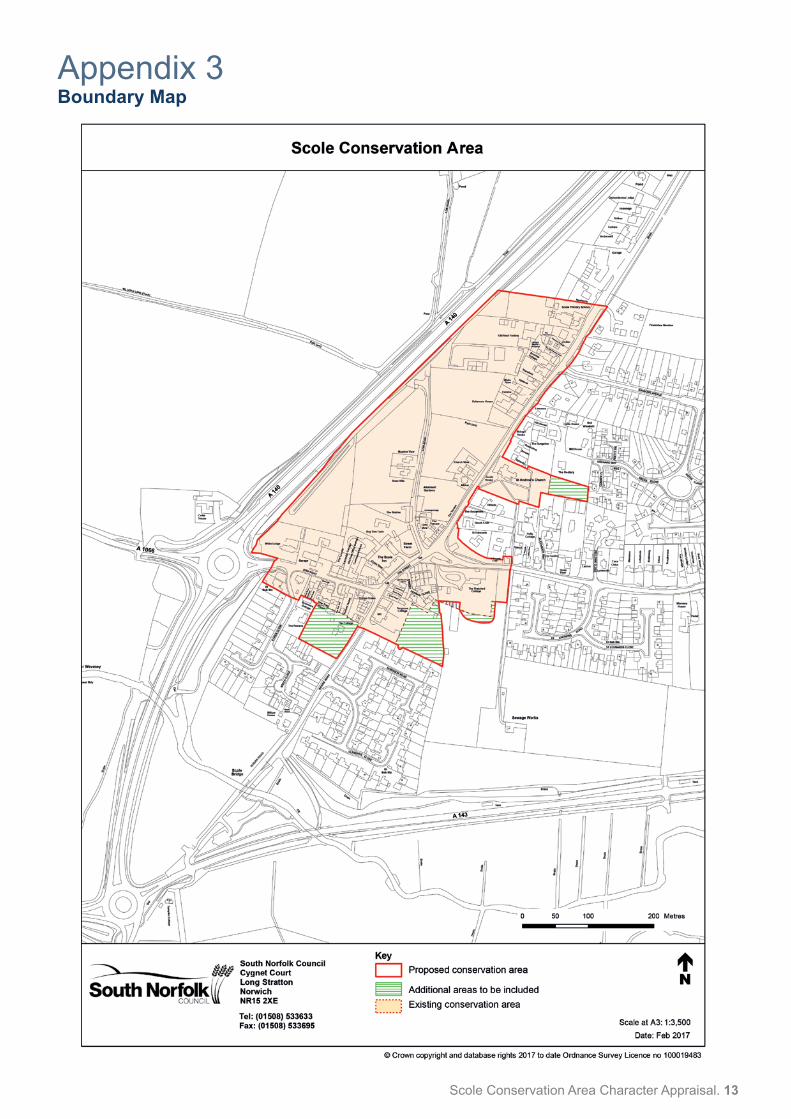
The boundary runs along the bypass on the west side, returning to include the frontage properties on the south side of Diss Road. The whole west side of Norwich Road is included as far as the school, while on the opposite side, the boundary follows the footpath breaking out only to include the church and the green at the junction with the old A143.Some revisions to the boundary are suggested with the addition of the extension to the churchyard, land to the east of the Crossways and The Cottage on Bridge Road. The water meadows and “green” areas to the south bordering on the river and the A140, while of significant landscape and recreational interest have not been suggested for inclusion.
Street patterns and historic grain
The historic grain generally follows a linear pattern along the former two main roads that pass through the village, with a concentration of buildings at their crossroads. The Church just north of the junction, is set on a raised platform which adds to its impact, while the nationally significant Scole Inn and its associated outbuildings, dominates the centre.Later building to the east and south now dominate the character of these areas which are just beyond the conservation boundaries.
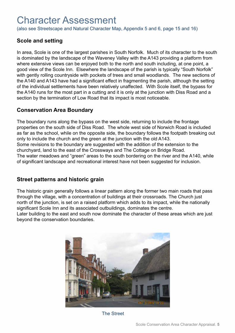
The Street
6. Scole Conservation Area Character Appraisal
Perambulation
There are 14 buildings listed as being of special architectural or historic interest and these are noted in Appendix 2(i) and on the accompanying map. The buildings considered to be of “townscape” interest are also shown.
Low RoadNow cut off by the bypass, this narrow country lane still retains its rural character. The south entrance is quite attractive, with a solid building line on one side, contrasting with the trees to Street Farm opposite. There is a good grouping of farm buildings beyond now converted to a dwelling. There is a charming gault brick “outbuilding” opposite. Beyond that the rural character is only broken by two new bungalows which have introduced certain ‘suburban’ features. There is an opportunity to plant in gaps in the hedgerow, and on land between Low Road and the bypass.
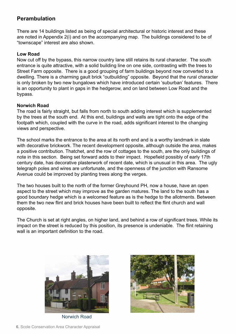
Norwich RoadThe road is fairly straight, but falls from north to south adding interest which is supplemented by the trees at the south end. At this end, buildings and walls are tight onto the edge of the footpath which, coupled with the curve in the road, adds significant interest to the changing views and perspective.
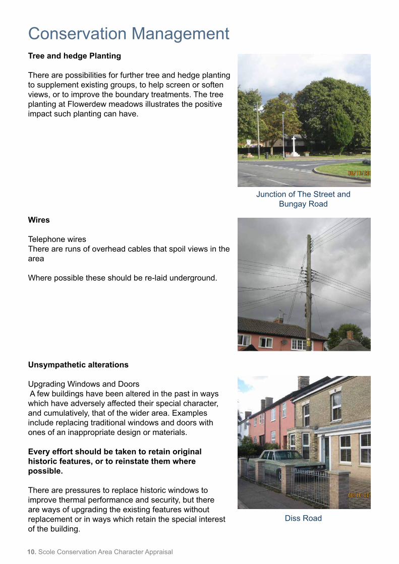
The school marks the entrance to the area at its north end and is a worthy landmark in slate with decorative brickwork. The recent development opposite, although outside the area, makes a positive contribution. Thatchet, and the row of cottages to the south, are the only buildings of note in this section. Being set forward adds to their impact. Hopefield possibly of early 17th century date, has decorative plasterwork of recent date, which is unusual in this area. The ugly telegraph poles and wires are unfortunate, and the openness of the junction with Ransome Avenue could be improved by planting trees along the verges.
The two houses built to the north of the former Greyhound PH, now a house, have an open aspect to the street which may improve as the garden matures. The land to the south has a good boundary hedge which is a welcomed feature as is the hedge to the allotments. Between them the two new flint and brick houses have been built to reflect the flint church and wall opposite.
The Church is set at right angles, on higher land, and behind a row of significant trees. While its impact on the street is reduced by this position, its presence is undeniable. The flint retaining wall is an important definition to the road.
Norwich Road
Scole Conservation Area Character Appraisal. 7
There are significant trees on the west side next to The Terrace, which is still a good range in a commanding position despite having lost some of their character through changes to doors and windows. They have retained their stout chimneys which are a dominant feature in the skyline, and a recurring feature elsewhere in the Conservation Area.
The road opens up at this point framed by the trees on the north side, next to the War memorial, and the grounds and boundary wall to The Thatched House opposite. Further trees could be considered on the “island”.
The oblique view of the Scole Inn is impressive with its remarkable brickwork, Dutch gables and ‘statue’ like chimneys. The present sign is of great interest, although the original sign, referred to in section 2, must have been very striking. The building appears in good condition. The removal of the effect of constant traffic brought about by the bypass must benefit the fabric.
The awkward entrance to the rear courtyard is worth negotiating - the rear of the Inn has much to offer, while the stables have been well converted into additional accommodation. Street Farmhouse completes the courtyard, although this view is not impressive. The barn adjoining is of a similar scale with a good timber frame and roof structure. The trees in the garden provide a welcome breathing space. There is a low wall to the road. Opposite the building of Ernest Seaman Close has been largely successful.
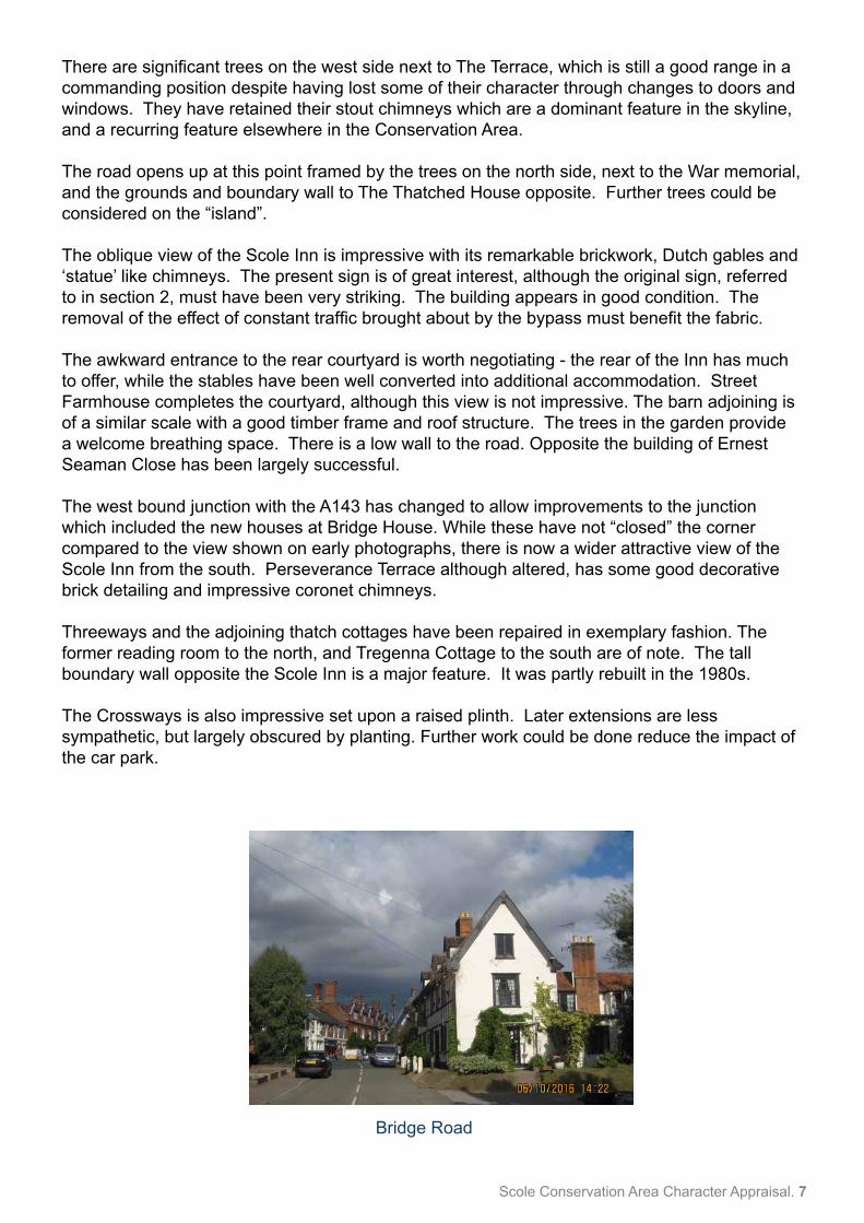
The west bound junction with the A143 has changed to allow improvements to the junction which included the new houses at Bridge House. While these have not “closed” the corner compared to the view shown on early photographs, there is now a wider attractive view of the Scole Inn from the south. Perseverance Terrace although altered, has some good decorative brick detailing and impressive coronet chimneys.
Threeways and the adjoining thatch cottages have been repaired in exemplary fashion. The former reading room to the north, and Tregenna Cottage to the south are of note. The tall boundary wall opposite the Scole Inn is a major feature. It was partly rebuilt in the 1980s.
The Crossways is also impressive set upon a raised plinth. Later extensions are less sympathetic, but largely obscured by planting. Further work could be done reduce the impact of the car park.
Bridge Road
8. Scole Conservation Area Character Appraisal
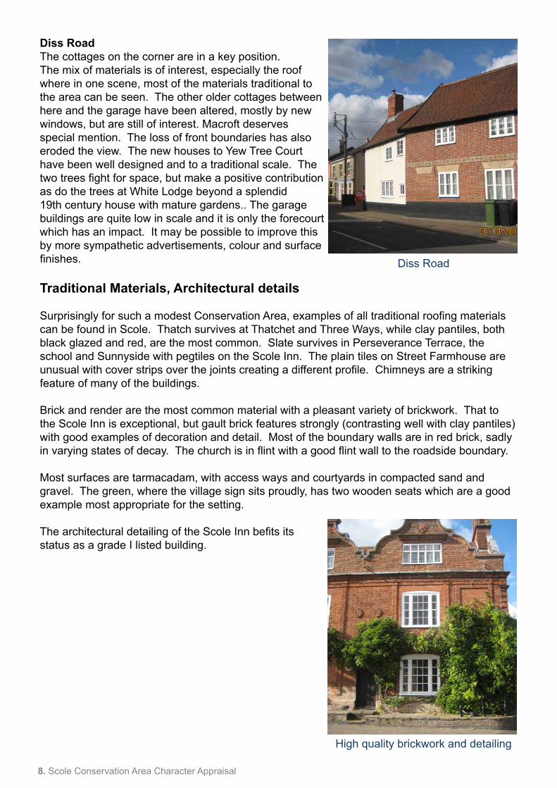
Diss RoadThe cottages on the corner are in a key position. The mix of materials is of interest, especially the roof where in one scene, most of the materials traditional to the area can be seen. The other older cottages between here and the garage have been altered, mostly by new windows, but are still of interest. Macroft deserves special mention. The loss of front boundaries has also eroded the view. The new houses to Yew Tree Court have been well designed and to a traditional scale. The two trees fight for space, but make a positive contribution as do the trees at White Lodge beyond a splendid 19th century house with mature gardens.. The garage buildings are quite low in scale and it is only the forecourt which has an impact. It may be possible to improve this by more sympathetic advertisements, colour and surface finishes.
Traditional Materials, Architectural details
Surprisingly for such a modest Conservation Area, examples of all traditional roofing materials can be found in Scole. Thatch survives at Thatchet and Three Ways, while clay pantiles, both black glazed and red, are the most common. Slate survives in Perseverance Terrace, the school and Sunnyside with pegtiles on the Scole Inn. The plain tiles on Street Farmhouse are unusual with cover strips over the joints creating a different profile. Chimneys are a striking feature of many of the buildings. Brick and render are the most common material with a pleasant variety of brickwork. That to the Scole Inn is exceptional, but gault brick features strongly (contrasting well with clay pantiles) with good examples of decoration and detail. Most of the boundary walls are in red brick, sadly in varying states of decay. The church is in flint with a good flint wall to the roadside boundary.
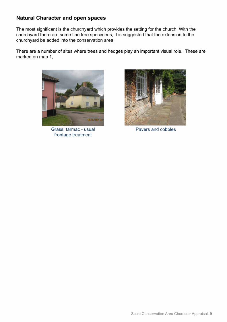
Most surfaces are tarmacadam, with access ways and courtyards in compacted sand and gravel. The green, where the village sign sits proudly, has two wooden seats which are a good example most appropriate for the setting.
The architectural detailing of the Scole Inn befits its status as a grade I listed building.
High quality brickwork and detailing
Diss Road
Scole Conservation Area Character Appraisal. 9
Natural Character and open spaces
The most significant is the churchyard which provides the setting for the church. With the churchyard there are some fine tree specimens, It is suggested that the extension to the churchyard be added into the conservation area.
There are a number of sites where trees and hedges play an important visual role. These are marked on map 1,
Grass, tarmac - usual frontage treatment
Pavers and cobbles
10. Scole Conservation Area Character Appraisal
Conservation ManagementTree and hedge Planting
There are possibilities for further tree and hedge planting to supplement existing groups, to help screen or soften views, or to improve the boundary treatments. The tree planting at Flowerdew meadows illustrates the positive impact such planting can have.
Wires
Telephone wiresThere are runs of overhead cables that spoil views in the area
Where possible these should be re-laid underground.
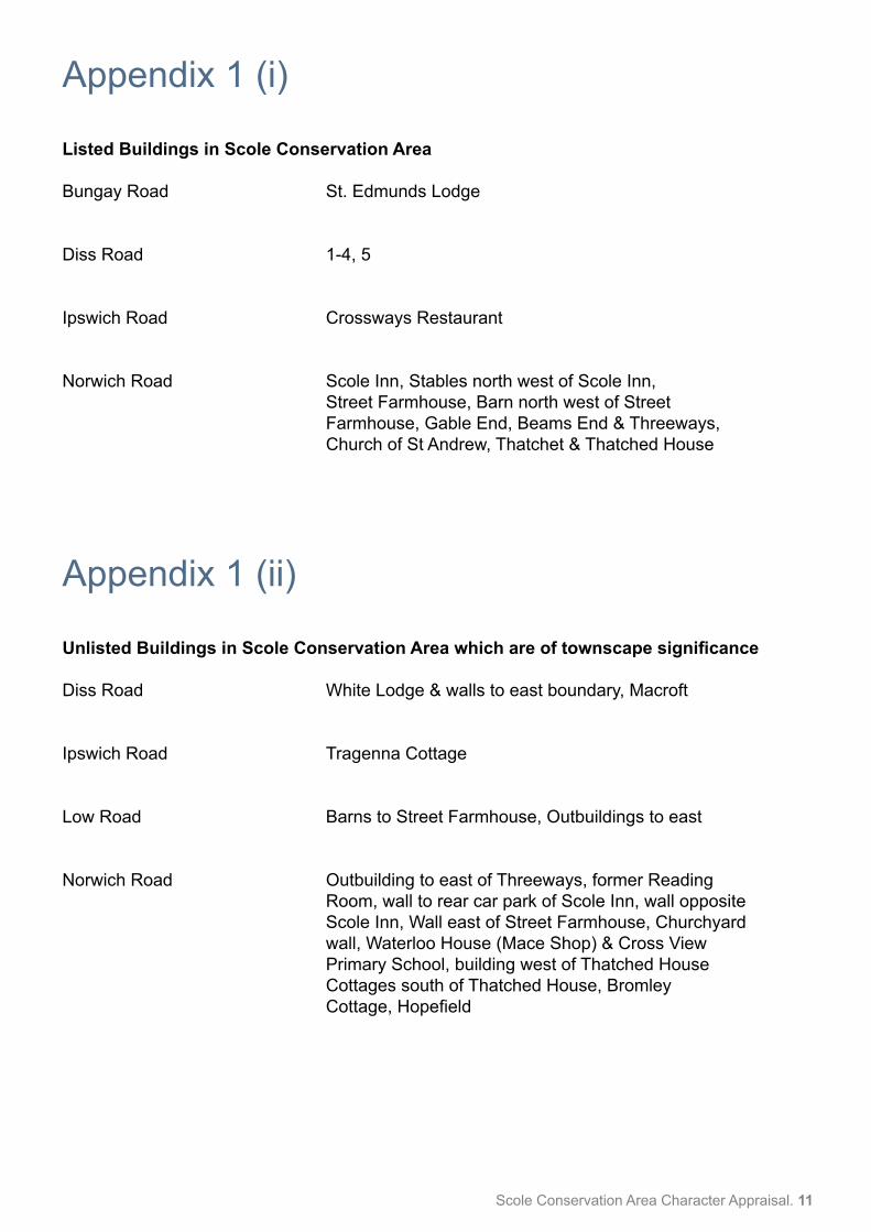
Unsympathetic alterations Upgrading Windows and Doors A few buildings have been altered in the past in ways which have adversely affected their special character, and cumulatively, that of the wider area. Examples include replacing traditional windows and doors with ones of an inappropriate design or materials.
Every effort should be taken to retain original historic features, or to reinstate them where possible.
There are pressures to replace historic windows to improve thermal performance and security, but there are ways of upgrading the existing features without replacement or in ways which retain the special interest of the building.
Junction of The Street and Bungay Road
Diss Road
Scole Conservation Area Character Appraisal. 11
Appendix 1 (i)
Listed Buildings in Scole Conservation Area
Bungay Road St. Edmunds Lodge
Diss Road 1-4, 5
Ipswich Road Crossways Restaurant
Norwich Road Scole Inn, Stables north west of Scole Inn, Street Farmhouse, Barn north west of Street Farmhouse, Gable End, Beams End & Threeways, Church of St Andrew, Thatchet & Thatched House
Appendix 1 (ii)
Unlisted Buildings in Scole Conservation Area which are of townscape significance
Diss Road White Lodge & walls to east boundary, Macroft
Ipswich Road Tragenna Cottage
Low Road Barns to Street Farmhouse, Outbuildings to east
Norwich Road Outbuilding to east of Threeways, former Reading Room, wall to rear car park of Scole Inn, wall opposite Scole Inn, Wall east of Street Farmhouse, Churchyard wall, Waterloo House (Mace Shop) & Cross View Primary School, building west of Thatched House Cottages south of Thatched House, Bromley Cottage, Hopefield
12. Scole Conservation Area Character Appraisal
Appendix 2PolicyPolicy background
In recent years, the approach to conservation area designation has changed considerably. It is now recognised that development plan policies, development control decisions, and proposals for the preservation or enhancement and the management of conservation areas, can best be achieved when there is a sound understanding of the special interest of the conservation area.
This position is reinforced as follows:
The Planning (Listed Buildings and Conservation Areas ) Act 1990 in section 66(1) makes it a duty of local authorities when considering applications to have special regard to the desirability of preserving a listed building or its setting or any features of special architectural or historic interest.
Under section 72 of the same Act, it is a duty with respect to any buildings or land in a conservation area, to pay special attention to the desirability of preserving or enhancing the character or appearance of that area.
Department for Communities and Local Government National Planning Policy Framework (NPPF) 2012
Paragraphs 126 to 141 cover “Conserving and enhancing the historic environment”.
Joint Core Strategy- Policy 2 : Promoting Good design
South Norfolk Local Plan The South Norfolk Local Plan Development Management Policies Document was adopted in 2015 and policy 4.10 covers Heritage Assets. Public Consultation
Public Consultation
This section to report the outcome of the public consultation being undertaken during July 2017.
Scole Conservation Area Character Appraisal. 13
Appendix 3Boundary Map
14. Scole Conservation Area Character Appraisal
Appendix 4Historic Map
© Crown copyright and database rights 2017 to date Ordnance Survey Licence no 100019483
0 100 20050 Metres
Scole Conservation Area
Date: Feb 20171:3,500Scale at A3:
KeySouth Norfolk CouncilCygnet CourtLong StrattonNorwichNR15 2XE
Tel: (01508) 533633Fax: (01508) 533695
Conservation area boundary

Scole Conservation Area Character Appraisal. 15
Appendix 5Streetscape
Co Const Bdy
MILLER'S LANE (Track)
Cedar
Sub Sta
House
20
CR
House
DISS ROAD
Garage
7
Cotta
ge
6
2
9
Com
mer
ce H
ouse
Sub Sta
Inn
32
28
18
Lime
5
Oaksmere House
Lodge
Shingle
The Bungalow
Thatched Cottage
4
1
1
6
1
1711
16
14
Pond
Ps
Well
The Wedge
47
23
34
CLOSE
River Waveney
El
2
White Lodge
BRID
GE RO
AD
Path (um)
2
Fulfo
rd H
ouse
The Cottage
Lave
nder
Cot
tage
24
1
Old
Pos
t Offi
ce C
otta
ge
SEAMAN CLOSE
GP
Post
Dra
in
The Thatched
House
Tank
Way
side
1
ANDREWS
1
2
Old
CO
MB
ER C
L11
2
1
7
14
1
Garage
7
Endl
ebur
y
18
6
Chi
ne
Whitley Lodge
Pond
Def
Scole
A 140
1
10
Court
Drain
10
El
The Scole
Bay Tree Farm
25
Beam Ends
Gable End
Rose Villa
View
LOW
RO
AD
25
St Edmunds
Quoin
Hilldene
Drain
The Gables
Linnaeus
The Old Brewers Arms
Hessians
Dra
in
8
1
Zodiac
13
5
Dra
in
11
12
9
5
ESS
61
CLOSE
26
24
2
Mayfield
Drai
n
16
12
BEEC
H CL
OSE
7
1a
The Rowans
New
Ros
e
Yew Tree
The
Peak
s
5
2
Inn
19
Old Reading
Drain
1
1
LOW
RO
AD
Drai
n
Beech Croft
Rose
Sewage Works
Uplands
St Andrew's Church
House
16
ST
14
ROAD
Windmill
ST LEONARDS CLOSE
4
Casa
156
8
21
28
54
Def
ROMAN ROAD
KARE
N CL
OSE
13
12
3
Mancroft
1Ye
w T
ree
Cott
5
17
ROBINSON ROAD
Three Ways
Room
The Stables
35
ERN
EST
Albion
Church View
Pond
Fernlea
Factory
Cottage
The
The Rectory
2
Dra
in
Lynton
Newlands
Lynmouth
1
Osmondeston Lodge
PRET
TY D
R
Dra
in
Drai
n
House
1
53
A 1066
House
Bridge
12a
Drai
n
Willow
4
1
The
Laur
els
CLEMENTS
Bridge House
7
1
Tregenna
THE STREET
Meadow View
6
A 140
A 143
The
Terra
ce
The Sycamore
St Edmunds
White
30
Valle
y Vi
ew
Brobec
2
Hill House
Bungalow
2
Mill House
El Sub Sta
FELLOW
S CLO
SE
5
2
ORCHARD WAY
2
Amberwell
Catkins
14
2
3
Shibas
52
Kent H
ouse
11
Beech
Cottage
8
11
15
Cross View
FarmStreet
7
Exchange Lodge
8
The
HillsideTra
ck
Highlands
Holly
Old Sack
Three
Tallis House
Scole Primary School
Dra
in
8
17
Wen
dens
2
Holmleigh
26
REEVE
Tang
lew
ood
Waveney
Timberlee
Tank
Turnpike Cottage
14
1
Sycamore
CLOSE
6
LB
Cottage
8
2
GardensAllotment
Terrace
Path (um)
Cottage
Old Sack Factory
33
42
Cottage
Restholme
Hopefield
23
28
ALEXA
ND
ERW
AY
6
Bromley
Bays
2
1
3
12
Chica
13
5
Labu
rnum
RANSOME AVENUE
Flowerdew Meadow
38
13
REEVE
© Crown copyright and database rights 2017 to date Ordnance Survey Licence no 100019483
0 100 20050 Metres
Scole Conservation Area - Streetscape
Date: Feb 20171:3,500Scale at A3:
South Norfolk CouncilCygnet CourtLong StrattonNorwichNR15 2XE
Tel: (01508) 533633Fax: (01508) 533695
Listed Buildings (see Note 1 above)
Note 1 - Any building or structure dating from before 1948 within the curtilage of a listed buildingis considered listed. These may not be identified on the map.
Unlisted buildings of townscape significance
Landmark building
Key
Conservation area boundary
Significant walls/railings
Key Views
16. Scole Conservation Area Character Appraisal
Appendix 6Natural Character
Co Const Bdy
MILLER'S LANE (Track)
Cedar
Sub Sta
House
20
CR
House
DISS ROAD
Garage
7
Cotta
ge
6
2
9
Com
mer
ce H
ouse
Sub Sta
Inn
32
28
18
Lime
5
Oaksmere House
Lodge
Shingle
The Bungalow
Thatched Cottage
4
1
1
6
1
1711
16
14
Pond
Ps
Well
The Wedge
47
23
34
CLOSE
River Waveney
El
2
White Lodge
BRID
GE RO
AD
Path (um)
2
Fulfo
rd H
ouse
The Cottage
Lave
nder
Cot
tage
24
1
Old
Pos
t Offi
ce C
otta
ge
SEAMAN CLOSE
GP
Post
Dra
in
The Thatched
House
Tank
Way
side
1
ANDREWS
1
2
Old
CO
MB
ER C
L11
2
1
7
14
1
Garage
7
Endl
ebur
y
18
6
Chi
ne
Whitley Lodge
Pond
Def
Scole
A 140
1
10
Court
Drain
10
El
The Scole
Bay Tree Farm
25
Beam Ends
Gable End
Rose Villa
View
LOW
RO
AD
25
St Edmunds
Quoin
Hilldene
Drain
The Gables
Linnaeus
The Old Brewers Arms
Hessians
Dra
in
8
1
Zodiac
13
5
Dra
in
11
12
9
5
ESS
61
CLOSE
26
24
2
Mayfield
Drai
n
16
12
BEEC
H CL
OSE
7
1a
The Rowans
New
Ros
e
Yew Tree
The
Peak
s
5
2
Inn
19
Old Reading
Drain
1
1
LOW
RO
AD
Drai
n
Beech Croft
Rose
Sewage Works
Uplands
St Andrew's Church
House
16
ST
14
ROAD
Windmill
ST LEONARDS CLOSE
4
Casa
156
8
21
28
54
Def
ROMAN ROAD
KARE
N CL
OSE
13
12
3
Mancroft
1Ye
w T
ree
Cott
5
17
ROBINSON ROAD
Three Ways
Room
The Stables
35
ERN
EST
Albion
Church View
Pond
Fernlea
Factory
Cottage
The
The Rectory
2
Dra
in
Lynton
Newlands
Lynmouth
1Osmondeston Lodge
PRET
TY D
R
Dra
in
Drai
n
House
1
53
A 1066
House
Bridge
12a
Drai
n
Willow
4
1
The
Laur
els
CLEMENTS
Bridge House
7
1
Tregenna
THE STREET
Meadow View
6
A 140
A 143
The
Terra
ce
The Sycamore
St Edmunds
White
30
Valle
y Vi
ew
Brobec
2
Hill House
Bungalow
2
Mill House
El Sub Sta
FELLOW
S CLO
SE
5
2
ORCHARD WAY
2
Amberwell
Catkins
14
2
3
Shibas
52
Kent H
ouse
11
Beech
Cottage
8
11
15
Cross View
FarmStreet
7
Exchange Lodge
8
The
HillsideTra
ck
Highlands
Holly
Old Sack
Three
Tallis House
Scole Primary School
Dra
in
8
17
Wen
dens
2
Holmleigh
26
REEVE
Tang
lew
ood
Waveney
Timberlee
Tank
Turnpike Cottage
14
1
Sycamore
CLOSE
6
LB
Cottage
8
2
GardensAllotment
Terrace
Path (um)
Cottage
Old Sack Factory
33
42
Cottage
Restholme
Hopefield
23
28
ALEXA
ND
ERW
AY
6
Bromley
Bays
2
1
3
12
Chica
13
5
Labu
rnum
RANSOME AVENUE
Flowerdew Meadow
38
13
REEVE
Note 1 - Any building or structure dating from before 1948 within the curtilage of a listed buildingis considered listed. These may not be identified on the map.
KeyConservation area boundary
Open space
Water Meadow
Agricultural
Trees
Hedges
River
© Crown copyright and database rights 2017 to date Ordnance Survey Licence no 100019483
0 100 20050 Metres
Scole Conservation Area - Natural Character
Date: Feb 20171:3,500Scale at A3:
South Norfolk CouncilCygnet CourtLong StrattonNorwichNR15 2XE
Tel: (01508) 533633Fax: (01508) 533695