
Plate Tectonics
And
Continental Drift

Early Evidence for Continental Drift

The Puzzle Like Fit of the Continents

Alfred Wegener
• In the early 1900’s the German scientist spent much of his life looking for evidence to prove the continents drifted.


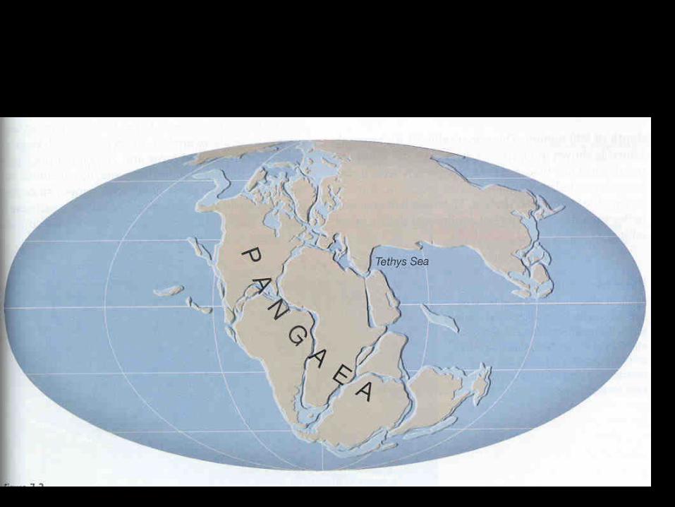
Pangaea
• Pangaea is the name Alfred Wegener gave to the super continent that existed 250 million years ago.

Fossil Evidence
• Glossopteris is an extinct fern fossil found in South Africa, Antarctica, Australia & India
• Lystrosaurus is an extinct land reptile found on different continents including Antarctica.


Geologic Evidence for Continental Drift
• 1. Glacier striations.
• 2. Igneous flood basalt.
• 3. Diamond and coal mines match up.
• 4. Magnetism in the rock.

1. Glacier Striations
• The glacier striations only make sense if the continents are put together. Otherwise, continental ice sheets would have originated from the center of the ocean.


2. Flood Basalts
• Igneous flood basalts match up perfectly in South America, Africa, and Antarctica. This could have only occurred if the continents were once together.


3. Coal Mines
• Coal mines form a straight “vein” through Pangaea. This only makes sense if you put the continents back together.

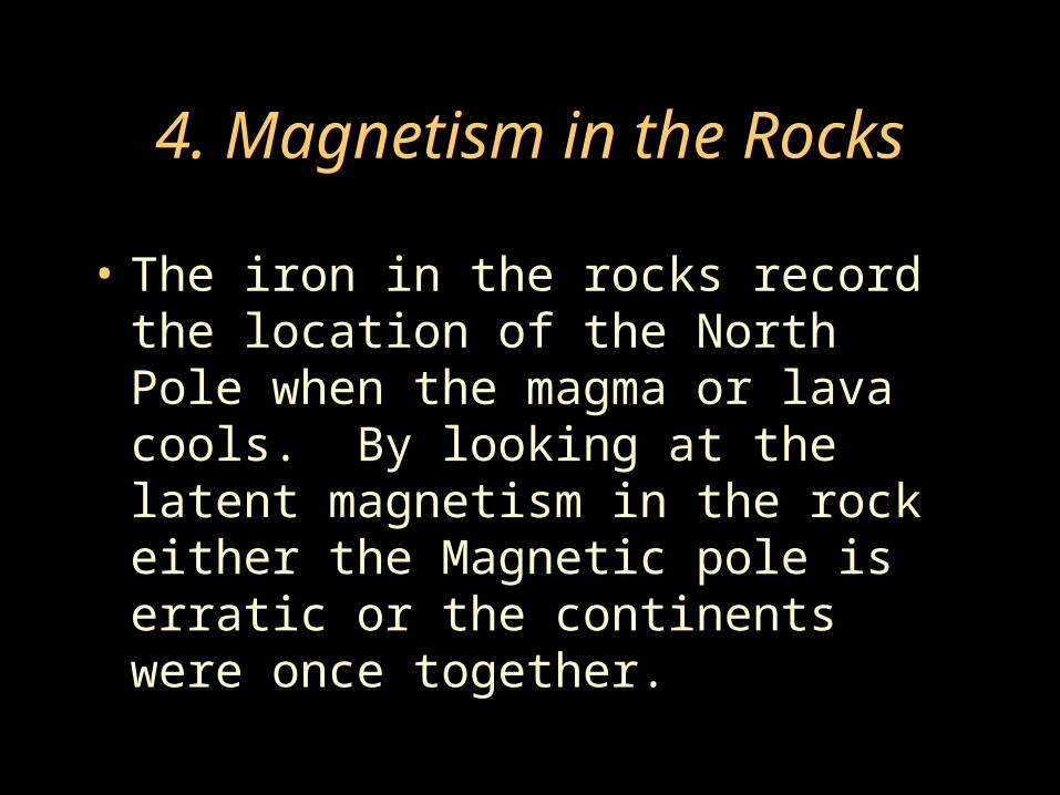
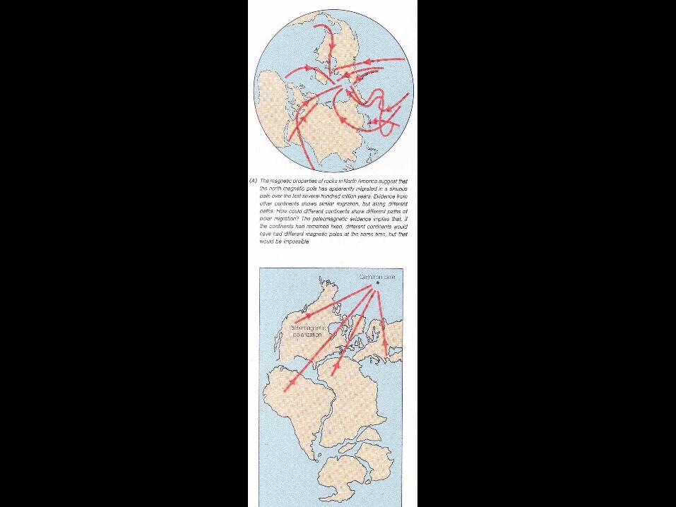
4. Magnetism in the Rocks
• The iron in the rocks record the location of the North Pole when the magma or lava cools. By looking at the latent magnetism in the rock either the Magnetic pole is erratic or the continents were once together.

Wegener Died with his Theory
• Alfred Wegener died in 1930 along with his theory on continental drift.
• Scientist did not believe his theory because he could not explain a force strong enough to push the continents through the solid ocean crust.

Modern Evidence
• After Wegener’s death new evidence was found to support the theory of continental drift.

Harry Hess & W.W. II
• With the invention of Sonar in W.W. II we started making the first maps of the ocean floor.
• Harry Hess was a Geologist and commander in the Pacific. He was amazed at the first sonar maps of the ocean floor.


Mid Atlantic Ridge
• The Longest Mountain chain on the planet was found running through the center of the Atlantic Ocean. This is called the Mid Atlantic Ridge.


Exploration in the1950’s
• The Glomar Challenger was an exploration ship that mapped the ocean floor and took core samples.


Exploration 1970’s
• The submersible Alvin went down in the deep Atlantic to study the Mid Atlantic Ridge.


Pillow Lava
• In the center of the Mid Atlantic Ridge, Alvin found a deep rift zone or crack. Pillow lava was found coming out of this rift.


Sea Floor Spreading
• Hot magma rises in the rift valley of the Mid Atlantic ridge. This creates new sea floor (Basalt) causing the Atlantic ocean to expand.

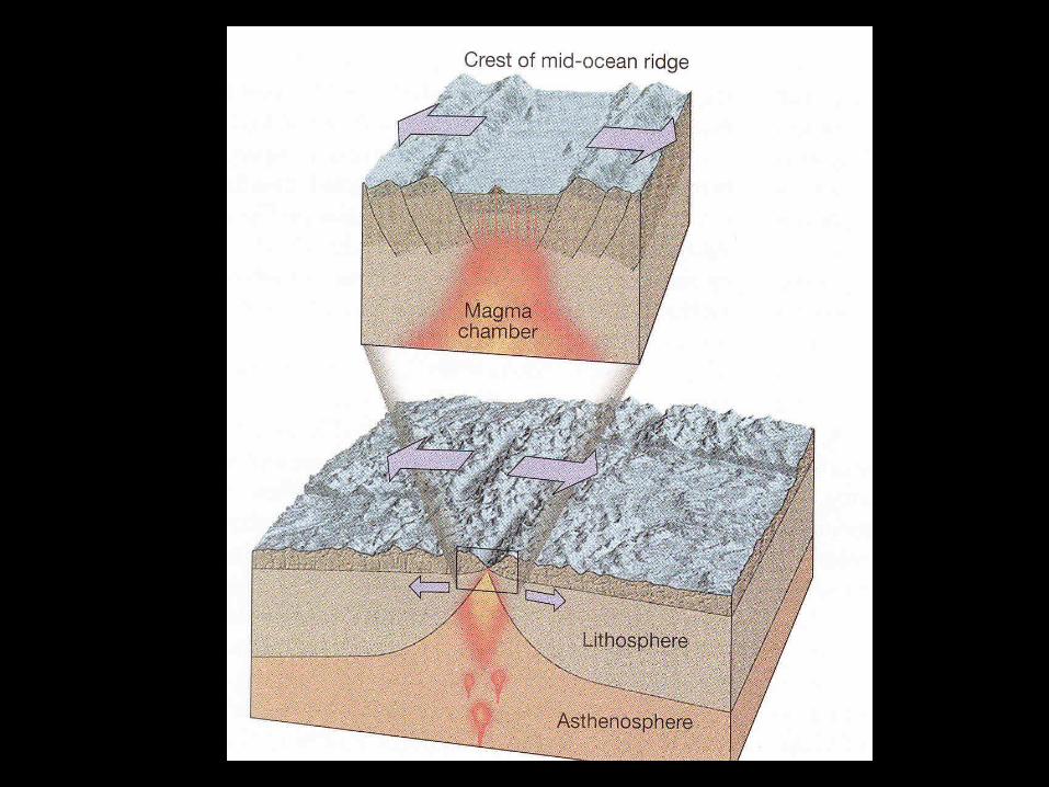

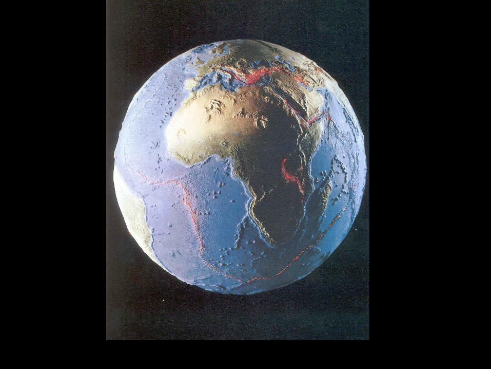
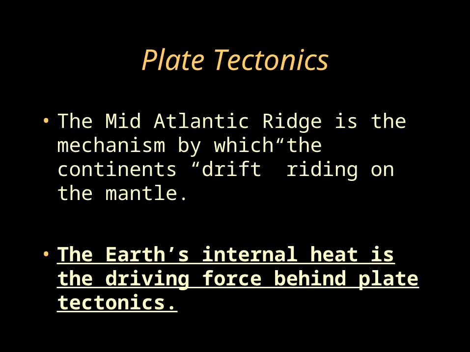
Plate Tectonics
• The Mid Atlantic Ridge is the mechanism by which the continents “drift” riding on the mantle.
• The Earth’s internal heat is the driving force behind plate tectonics.

The Plates
• Earth’s crust is broken up into plates. These plates ride on top of the mantle or asthenosphere.


Earthquakes & Volcanoes
• The distribution of earthquakes and volcanoes outline the boundaries of the plates.


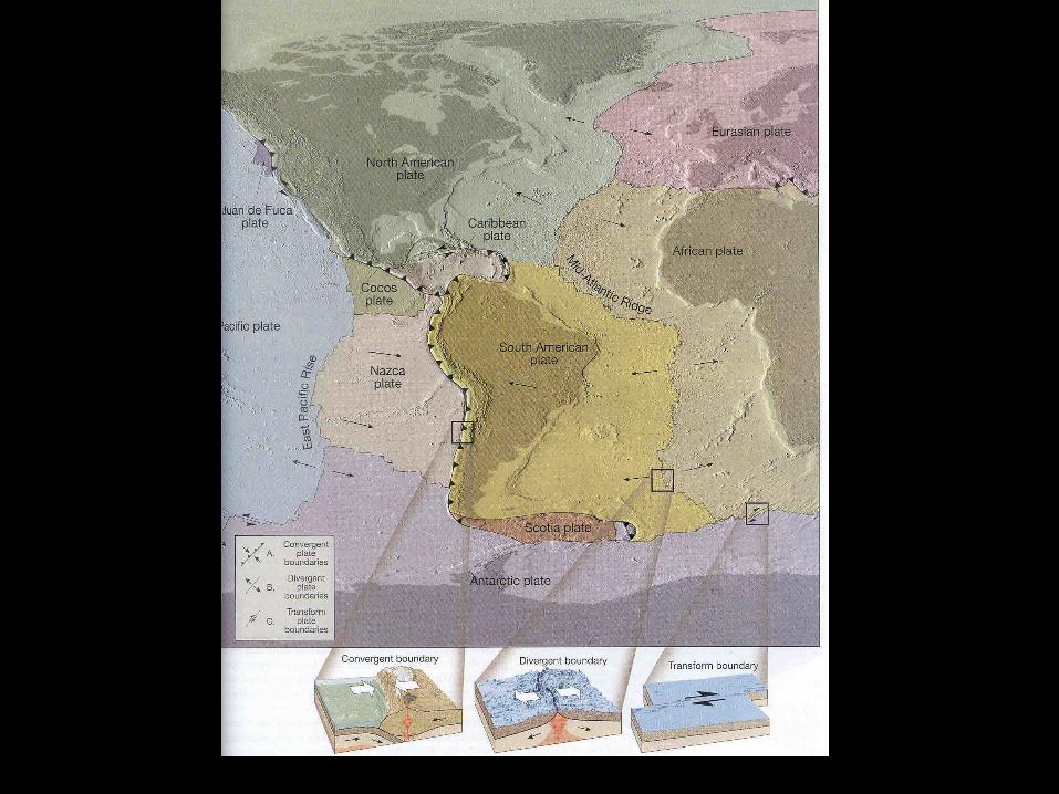
Plate Boundaries
• There are 3 types of plate boundaries
• 1. Converging = colliding
• 2. Diverging = separating
• 3. Transform = sliding past each other

Two types of crust
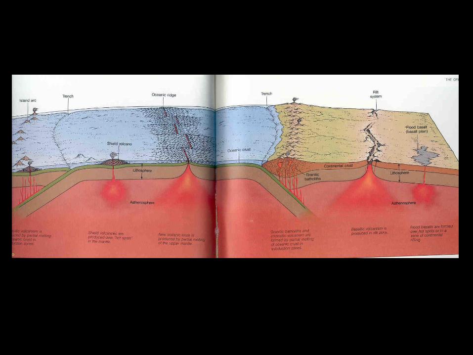
• 1. Ocean crust is dense and made up of basalt.
• 2. Continental crust is less dense and made up of granite.

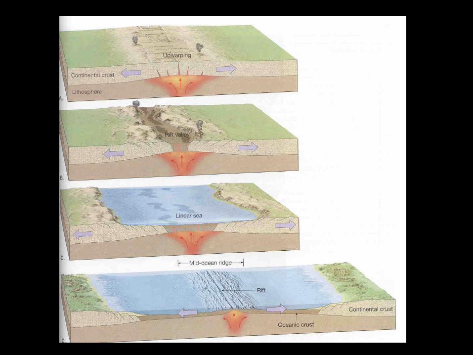
Diverging Zone
• The Mid Atlantic Ridge is an example of two ocean plates diverging.
• The Red Sea is another example of sea floor spreading.
• The continent of Africa is diverging forming a rift and lake Victoria.
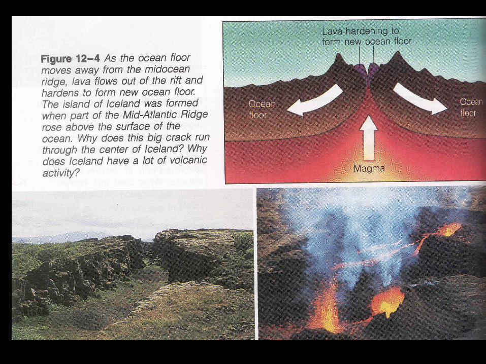
Iceland
• Iceland is a special place for geologist.
• This is where the Mid Atlantic Ridge has actually risen above the sea forming Iceland.
• There is a rift running down the center of Iceland.

The Red Sea
• The Red Sea is growing wider every year. This pushes Africa away from Saudi Arabia.


The African Rift
• Africa is the old center of Pangaea.
• It is still being ripped or rifted apart.

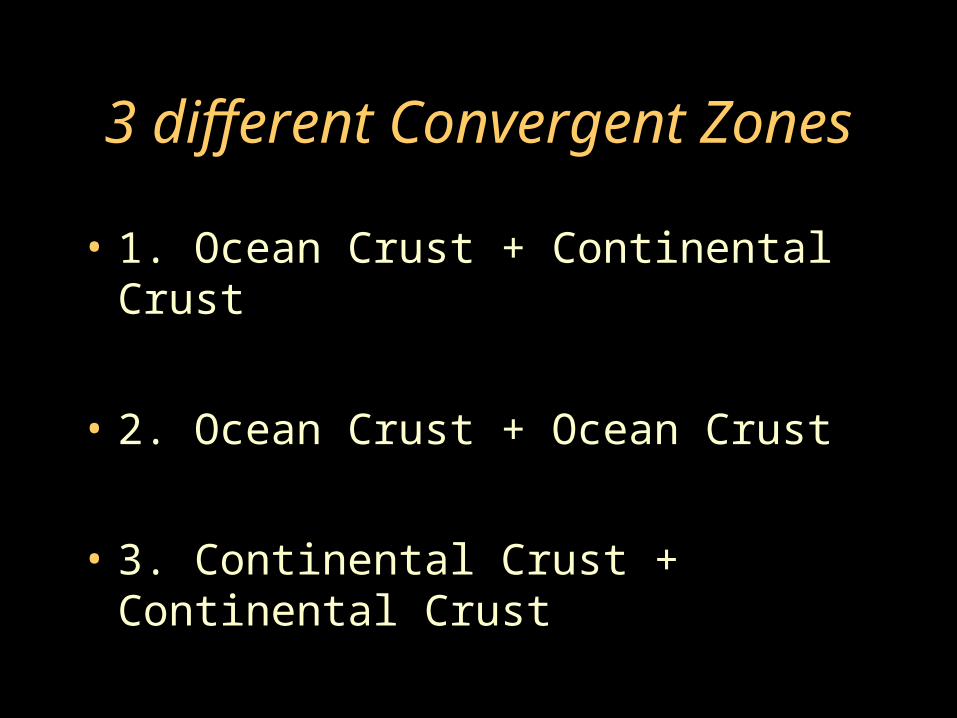
3 different Convergent Zones
• 1. Ocean Crust + Continental Crust
• 2. Ocean Crust + Ocean Crust
• 3. Continental Crust + Continental Crust

Convergent Zone #1Ocean crust + Continental crust
• When dense ocean crust collides with lighter continental crust the ocean crust is forced underneath. This creates a deep trench and a volcanic mountain range.
• Examples are the Cascades and the Andes.


Convergent Zone #2Ocean crust + Ocean crust
• When two dense ocean crusts collide it forms a deep ocean trench and a volcanic island.
• Example: The Mariana’s trench and Japan.

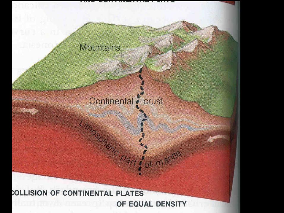
Convergent Zone #3Continental + Continental crust
• When two light continental plates collide they create a large mountain range.
• India is being pushed into China forming the Himalayan mountains.


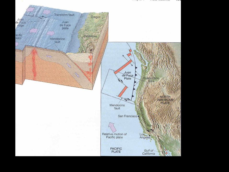
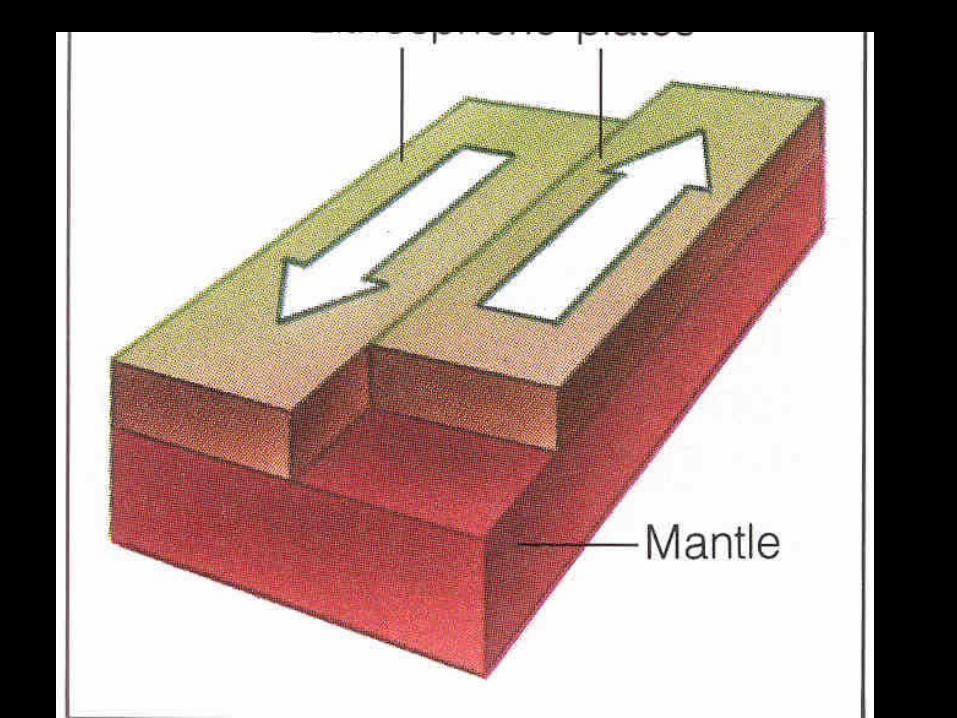
Transform Fault
• Two plates slide past each other in a transform fault.
• Transform faults can cause earthquakes.
• Example: San Andreas Fault.


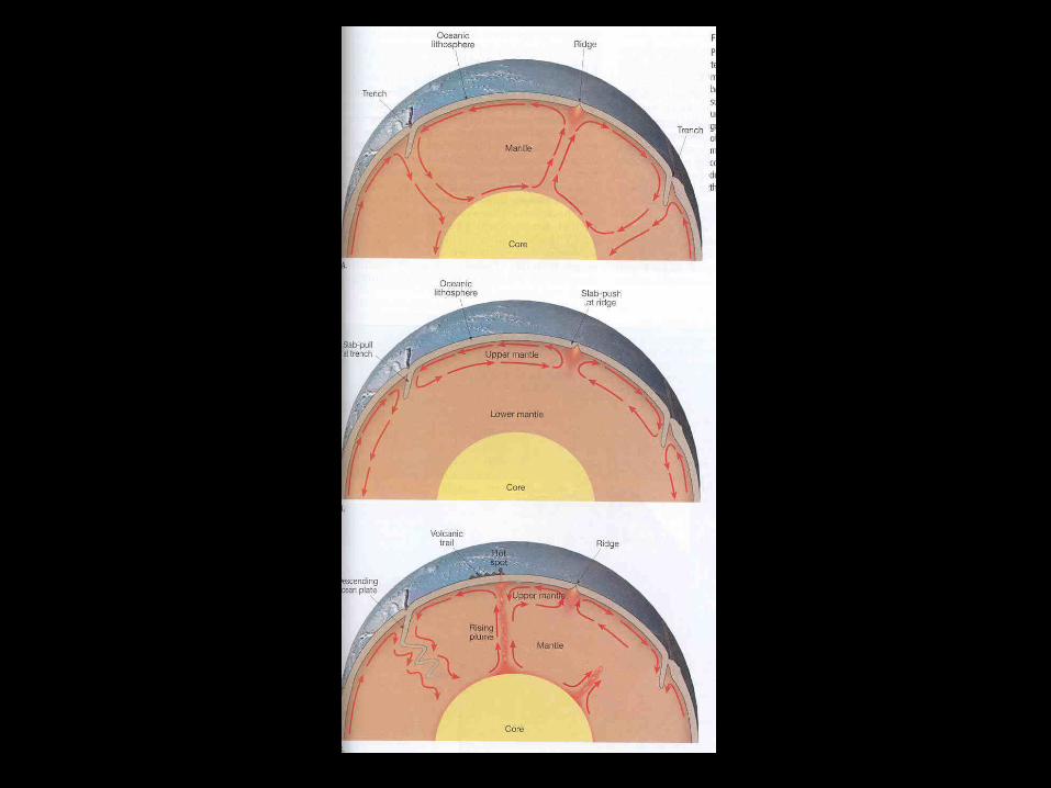
The Driving Force
• The Earth’s internal heat is the driving force behind plate tectonics.
• Hot spots in the mantle have created the Hawaiian Islands.


Pangaea
• 250 million years ago Pangaea broke up.
• What about future projections of plate movement????

The End


