Hurricanes
Typhoons and tropical cyclones

Tropical Storms
• What are they
• How they form
• Where they form
• Where they go
• What they do
Today
• Finishing global circulations– Monsoons– ITCZ
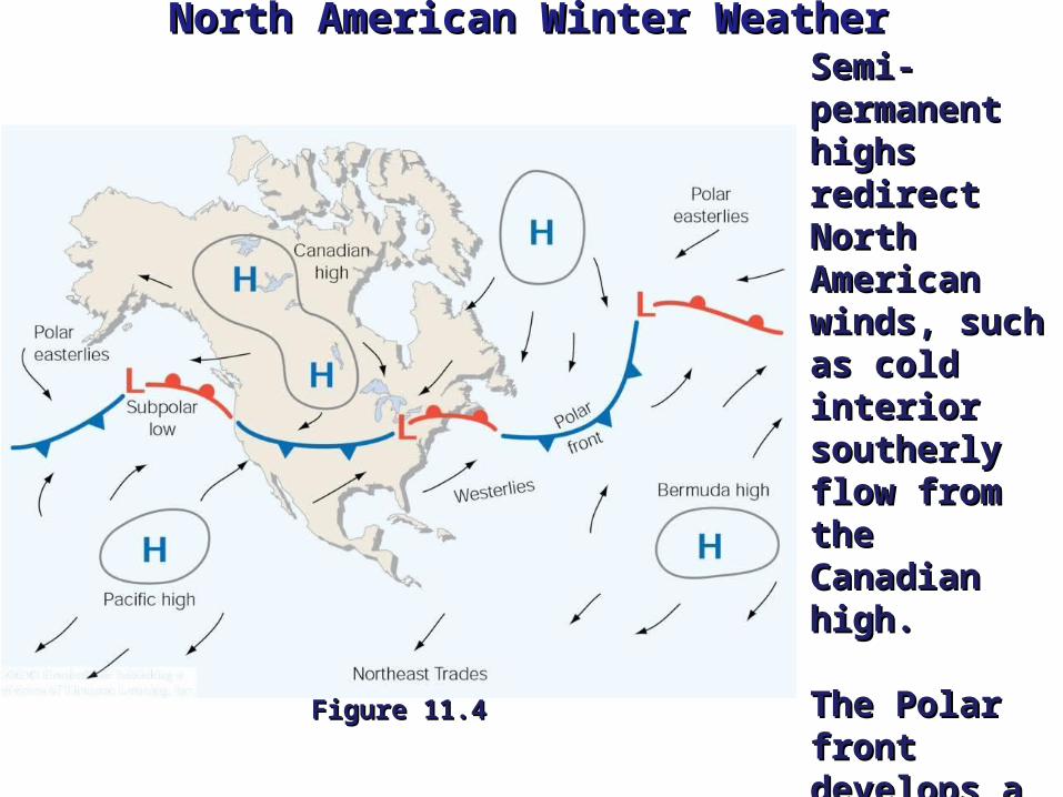
North American Winter WeatherNorth American Winter Weather
Figure 11.4Figure 11.4
Semi-Semi-permanent permanent highs redirect highs redirect North North American American winds, such as winds, such as cold interior cold interior southerly flow southerly flow from the from the Canadian high.Canadian high.
The Polar front The Polar front develops a develops a wave like wave like pattern as air pattern as air flows around flows around lows.lows.

Global Precipitation PatternsGlobal Precipitation Patterns
Global low pressure Global low pressure zones around the zones around the equator and 60° equator and 60° latitude generate latitude generate convergence at the convergence at the surface, rising air surface, rising air and cloud and cloud formation.formation.
Zones of high Zones of high pressure at 30° and pressure at 30° and the Poles experience the Poles experience convergence aloft convergence aloft with sinking, drying with sinking, drying air.air. Figure 11.5Figure 11.5

Example of these effects: Monsoon
• Wind systems that exhibit a pronounced seasonal reversal in direction.
• Best known monsoon is found in India and southeast Asia.
• Winter -- Flow is predominantly off the continent keeping the continent dry.
• Summer -- Flow is predominantly off the oceans keeping the continent wet.
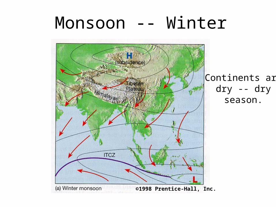
Monsoon -- Winter
Continents aredry -- dryseason.
©1998 Prentice-Hall, Inc.

Monsoon -- Summer
Continents arewet -- rainy
season.
©1998 Prentice-Hall, Inc.
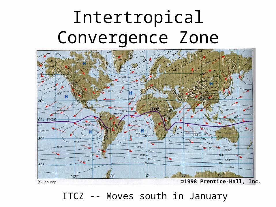
Intertropical Convergence Zone
ITCZ -- Moves south in January
©1998 Prentice-Hall, Inc.
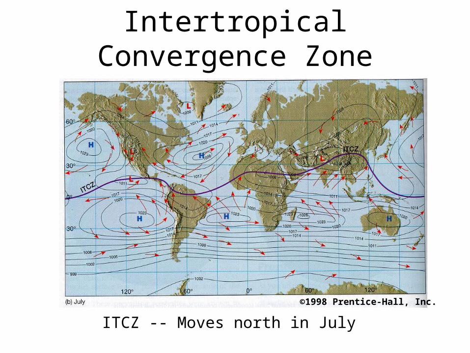
ITCZ -- Moves north in July
Intertropical Convergence Zone
©1998 Prentice-Hall, Inc.
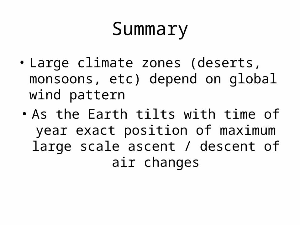
Summary
• Large climate zones (deserts, monsoons, etc) depend on global wind pattern
• As the Earth tilts with time of year exact position of maximum large scale ascent /
descent of air changes

Hurricanes
• Hurricanes are large, tropical storm systems that form and develop over the warm waters near the equator.
• They are responsible for weather that can devastate entire communities:– Heavy rain -- Flooding– Strong Winds– Very Large Waves and Storm Surge– Possibly Tornadoes
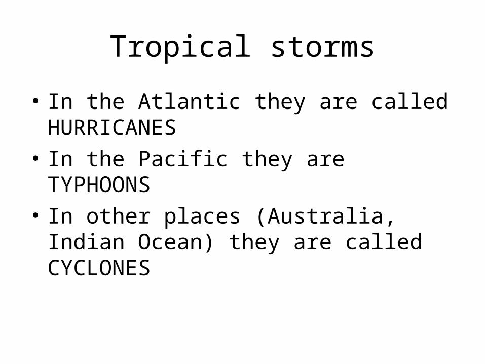
Tropical storms
• In the Atlantic they are called HURRICANES
• In the Pacific they are TYPHOONS
• In other places (Australia, Indian Ocean) they are called CYCLONES

Hurricanes
• To be a hurricane the storm must have a distinctive eye and sustained winds over 74 mph (120 km/h)
• Hurricanes are typically a few hundred miles across with an eye 15 to 30 miles wide
• Effects of the hurricane may be felt further away
Tropical storms
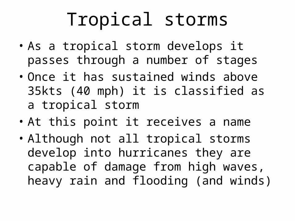
• As a tropical storm develops it passes through a number of stages
• Once it has sustained winds above 35kts (40 mph) it is classified as a tropical storm
• At this point it receives a name
• Although not all tropical storms develop into hurricanes they are capable of damage from high waves, heavy rain and flooding (and winds)
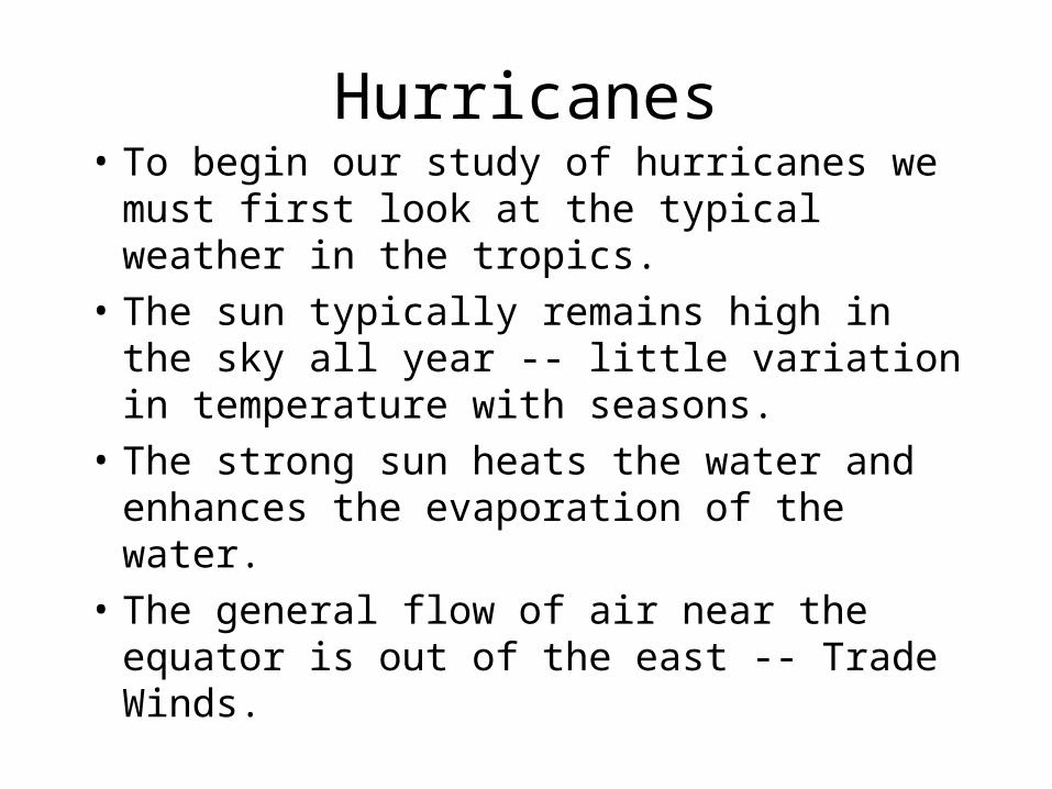
Hurricanes• To begin our study of hurricanes we
must first look at the typical weather in the tropics.
• The sun typically remains high in the sky all year -- little variation in temperature with seasons.
• The strong sun heats the water and enhances the evaporation of the water.
• The general flow of air near the equator is out of the east -- Trade Winds.

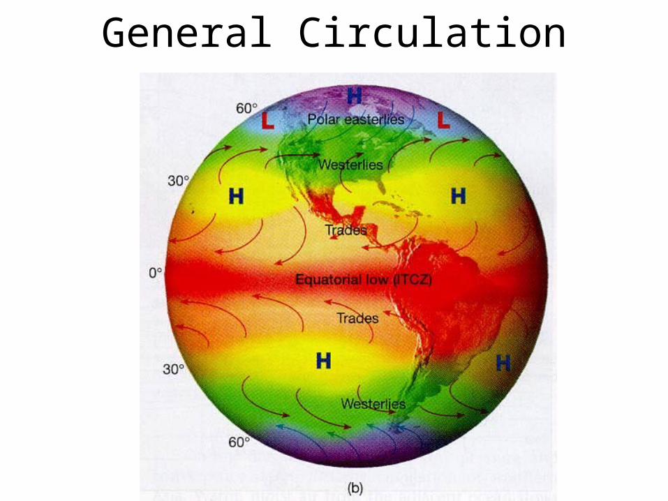
General Circulation

Hurricanes
• The trade winds blow from the northeast in the Northern Hemisphere and from the southeast in the Southern Hemisphere.
• A region of convergence (Intertropical Convergence Zone -- ITCZ) creates a band of thunderstorms near the equator.
General Circulation

Hurricanes
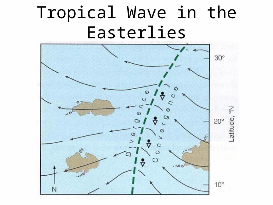
• Since pressure gradients are small near the equator, we look at the flow of wind to find trough regions.
• A trough or ripple in the easterly flow is known as a “tropical wave.”
• Surface convergence occurs on the east side of this wave and surface divergence occurs on the west side.
• Thunderstorms tend to form on the east side of the tropical wave.
Tropical Wave in the Easterlies
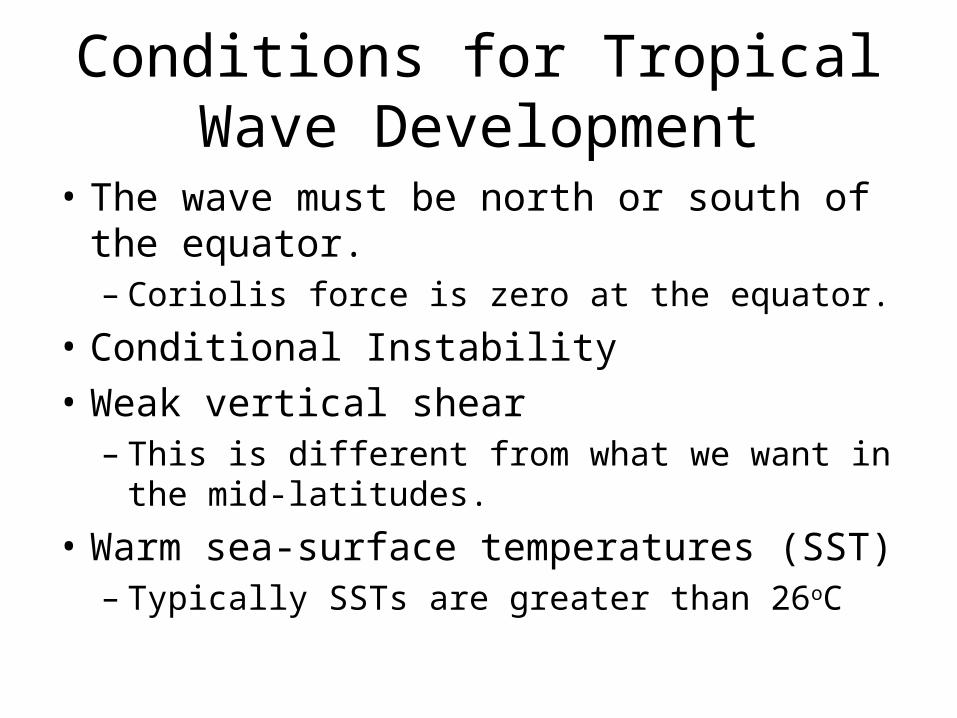
Conditions for Tropical Wave Development
• The wave must be north or south of the equator.– Coriolis force is zero at the equator.
• Conditional Instability• Weak vertical shear
– This is different from what we want in the mid-latitudes.
• Warm sea-surface temperatures (SST)– Typically SSTs are greater than 26oC

Hurricane Development• Convergence at the surface leads to
convergence of moisture.
• The convection or thunderstorms that form release latent heat which intensifies the surface low.
• The warm core column of air will create an upper level high pressure center.
• The weak shear allows the storm to remain vertical and allows for the latent heat release to enhance the surface low.


