Business Council of New Orleans
Louisiana’s Future
May 2, 2012
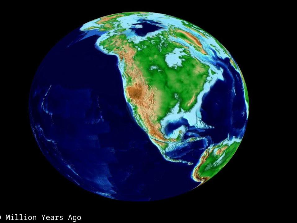
60 Million Years Ago
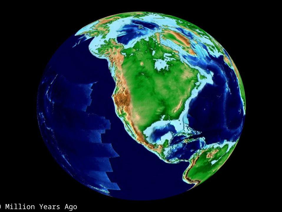
40 Million Years Ago
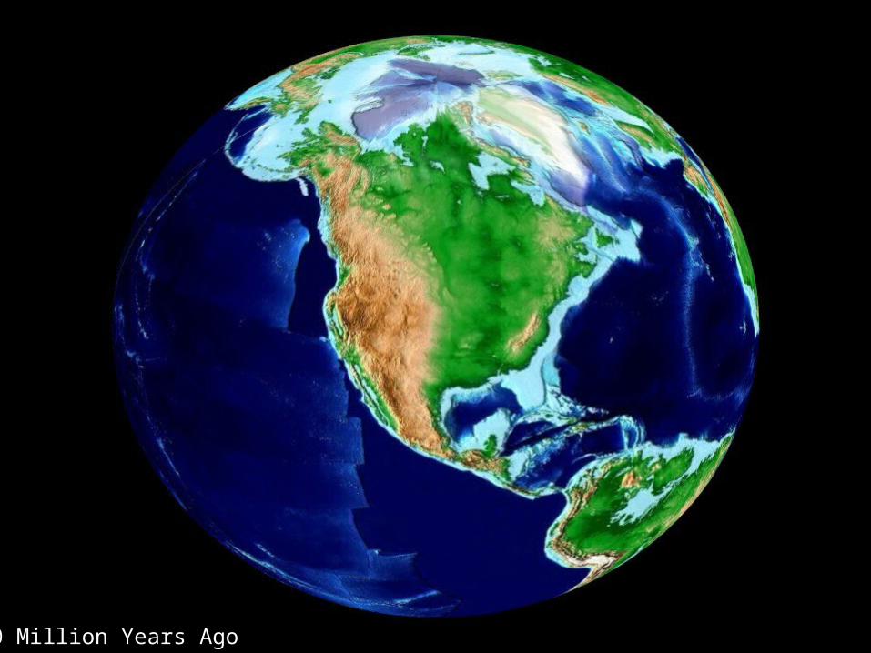
20 Million Years Ago
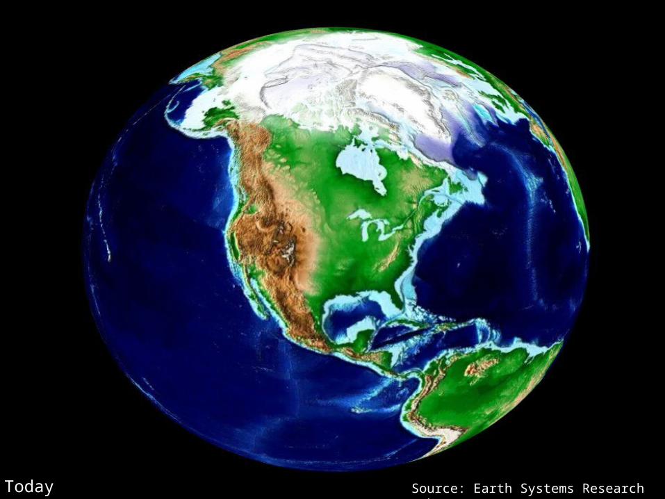
Today Source: Earth Systems Research Laboratory
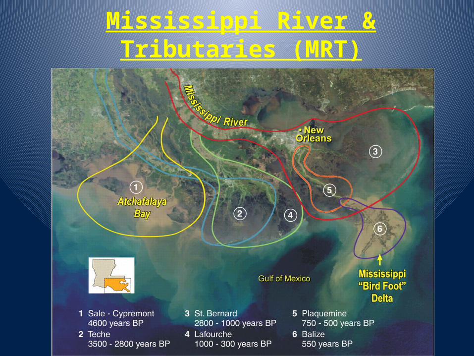
Mississippi River & Tributaries (MRT)
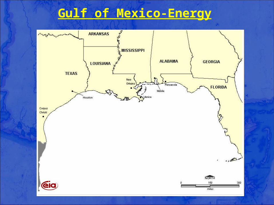
Gulf of Mexico-Energy
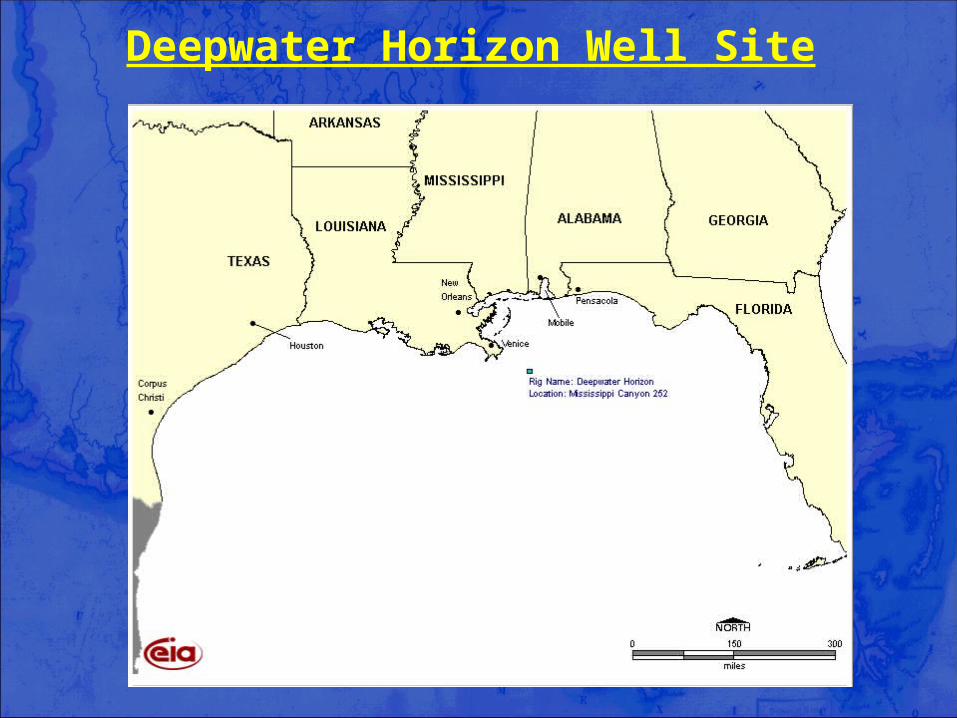
Deepwater Horizon Well Site
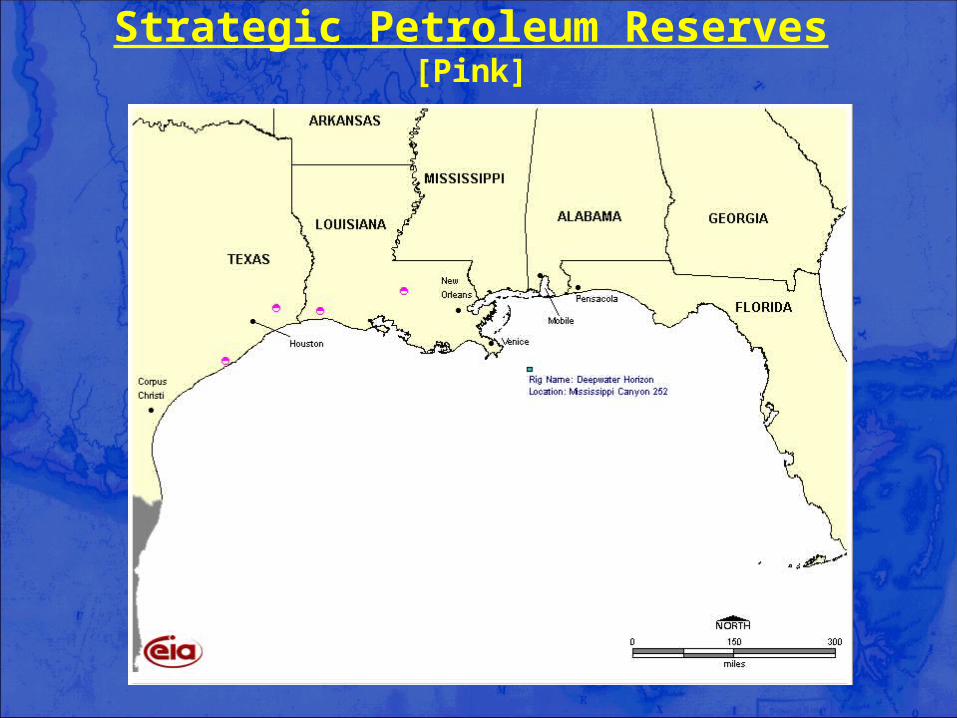
Strategic Petroleum Reserves[Pink]

LNG Terminals[Green]
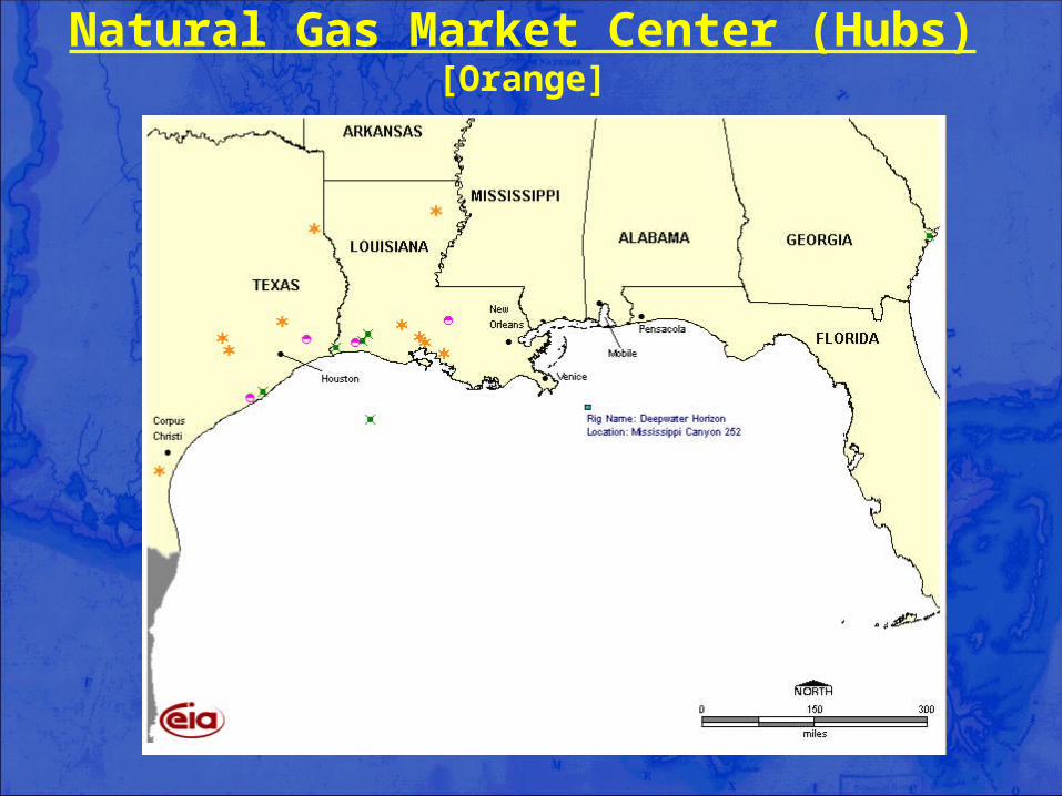
Natural Gas Market Center (Hubs)[Orange]
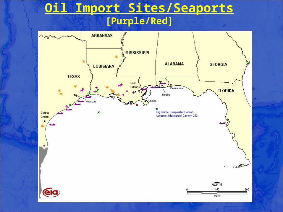
Oil Import Sites/Seaports[Purple/Red]
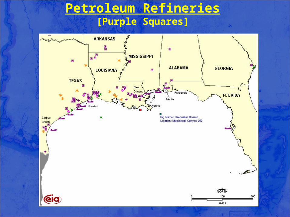
Petroleum Refineries[Purple Squares]
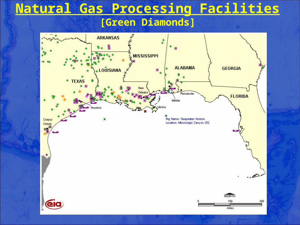
Natural Gas Processing Facilities[Green Diamonds]
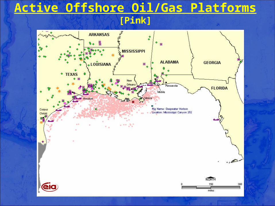
Active Offshore Oil/Gas Platforms[Pink]
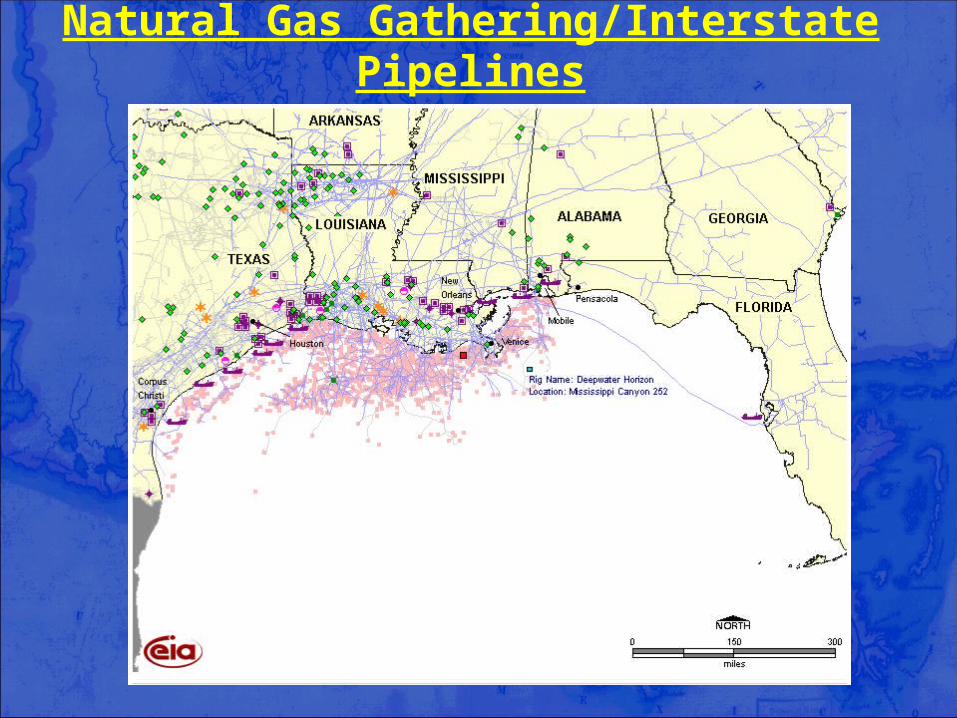
Natural Gas Gathering/Interstate Pipelines
restoring and protecting Louisiana’s coast
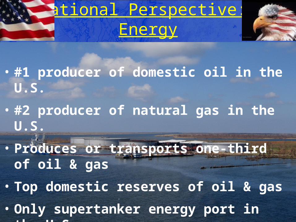
National Perspective: Energy
• #1 producer of domestic oil in the U.S.
• #2 producer of natural gas in the U.S.
• Produces or transports one-third of oil & gas
• Top domestic reserves of oil & gas
• Only supertanker energy port in the U.S.
• #2 oil refining capacity
• $5 billion/annually to US Treasury
restoring and protecting Louisiana’s coast
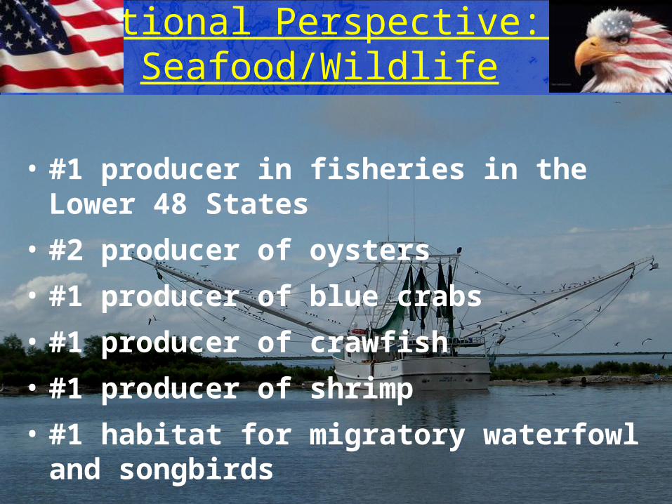
National Perspective: Seafood/Wildlife
• #1 producer in fisheries in the Lower 48 States
• #2 producer of oysters
• #1 producer of blue crabs
• #1 producer of crawfish
• #1 producer of shrimp
• #1 habitat for migratory waterfowl and songbirds
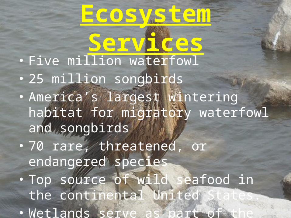
Ecosystem Services• Five million waterfowl • 25 million songbirds• America’s largest wintering habitat for
migratory waterfowl and songbirds• 70 rare, threatened, or endangered species• Top source of wild seafood in the continental
United States.• Wetlands serve as part of the hurricane
protection system
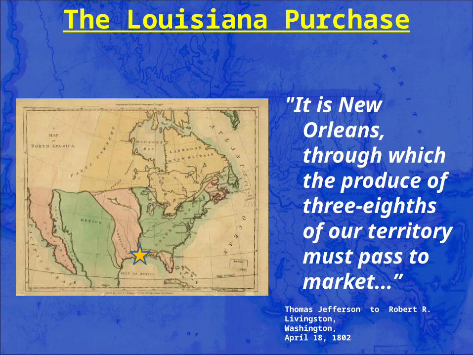
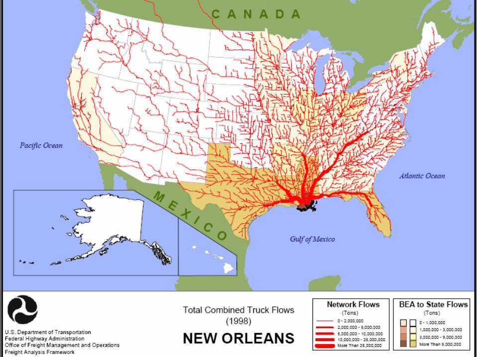
"It is New Orleans, through which the produce of three-eighths of our territory must pass to market...”
Thomas Jefferson to Robert R. Livingston, Washington, April 18, 1802
The Louisiana Purchase
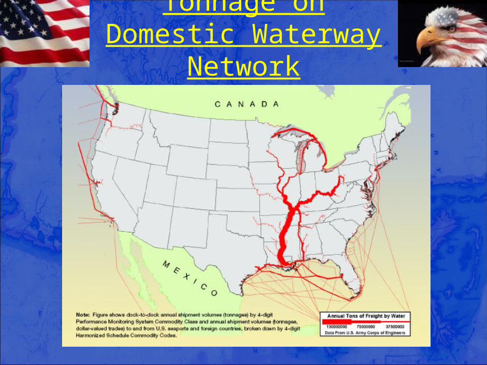
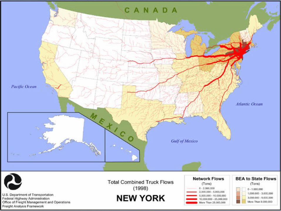
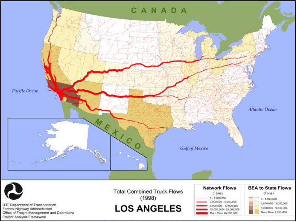
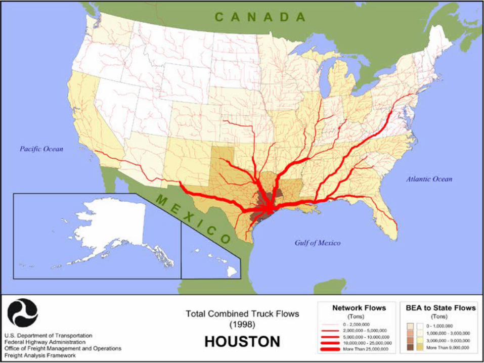
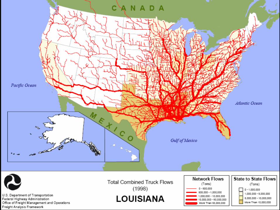
Tonnage on Domestic Waterway Network
restoring and protecting Louisiana’s coast
restoring and protecting Louisiana’s coast
restoring and protecting Louisiana’s coast
restoring and protecting Louisiana’s coast
restoring and protecting Louisiana’s coast
restoring and protecting Louisiana’s coast
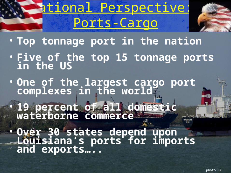
National Perspective: Ports-Cargo
• Top tonnage port in the nation
• Five of the top 15 tonnage ports in the US
• One of the largest cargo port complexes in the world
• 19 percent of all domestic waterborne commerce
• Over 30 states depend upon Louisiana’s ports for imports and exports…..
photo LA DOTD
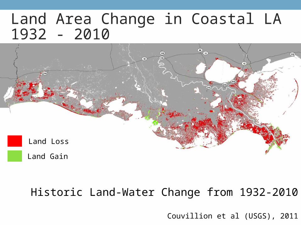
Historic Land-Water Change from 1932-2010
Couvillion et al (USGS), 2011
Land Loss
Land Gain
Land Area Change in Coastal LA1932 - 2010
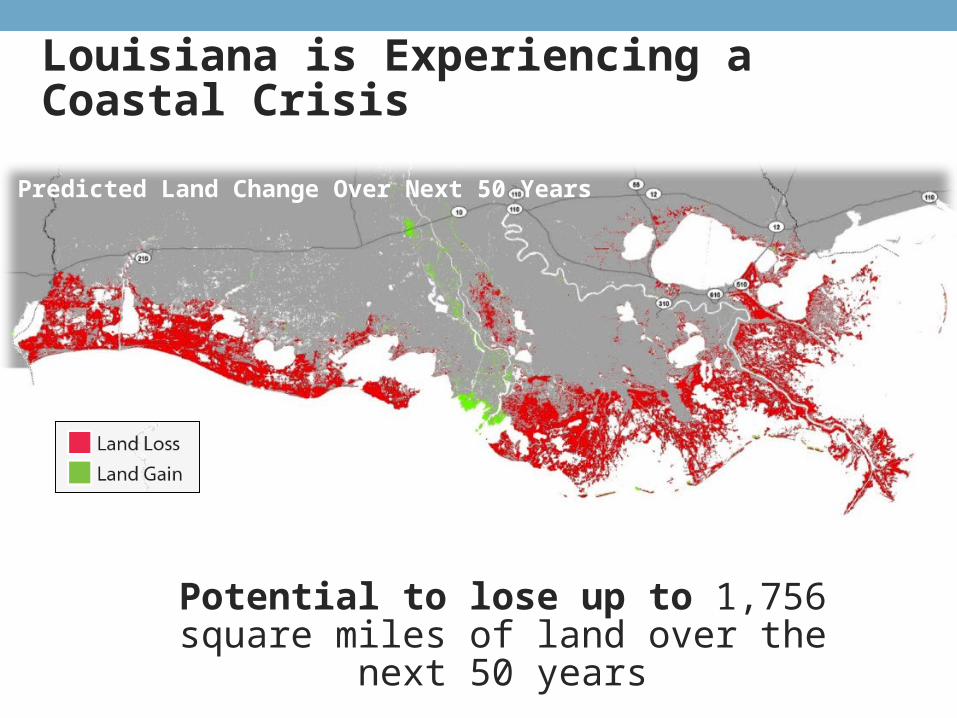
Potential to lose up to 1,756 square miles of land over the next 50 years
Louisiana is Experiencing a Coastal Crisis
Predicted Land Change Over Next 50 Years
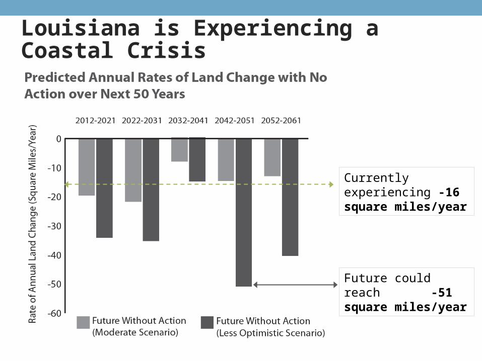
Projected Land Change 2012-2061
Currently experiencing -16 square miles/year
Future could reach -51 square miles/year
Louisiana is Experiencing a Coastal Crisis
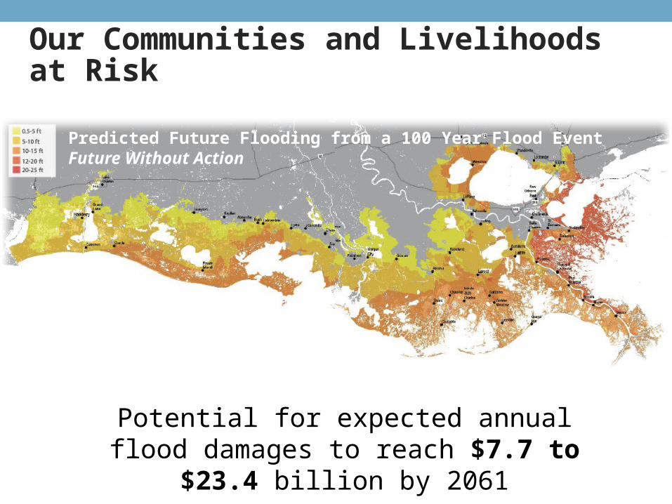
Our Communities and Livelihoods at Risk
Predicted Future Flooding from a 100 Year Flood EventFuture Without Action
Potential for expected annual flood damages to reach $7.7 to $23.4 billion by
2061
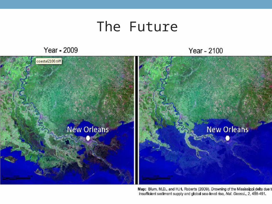
The Future
32
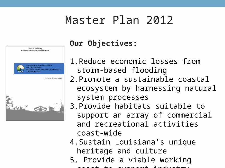
Our Objectives:
1.Reduce economic losses from storm-based flooding
2.Promote a sustainable coastal ecosystem by harnessing natural system processes
3.Provide habitats suitable to support an array of commercial and recreational activities coast-wide
4.Sustain Louisiana’s unique heritage and culture
5. Provide a viable working coast to support industry.
Master Plan 2012
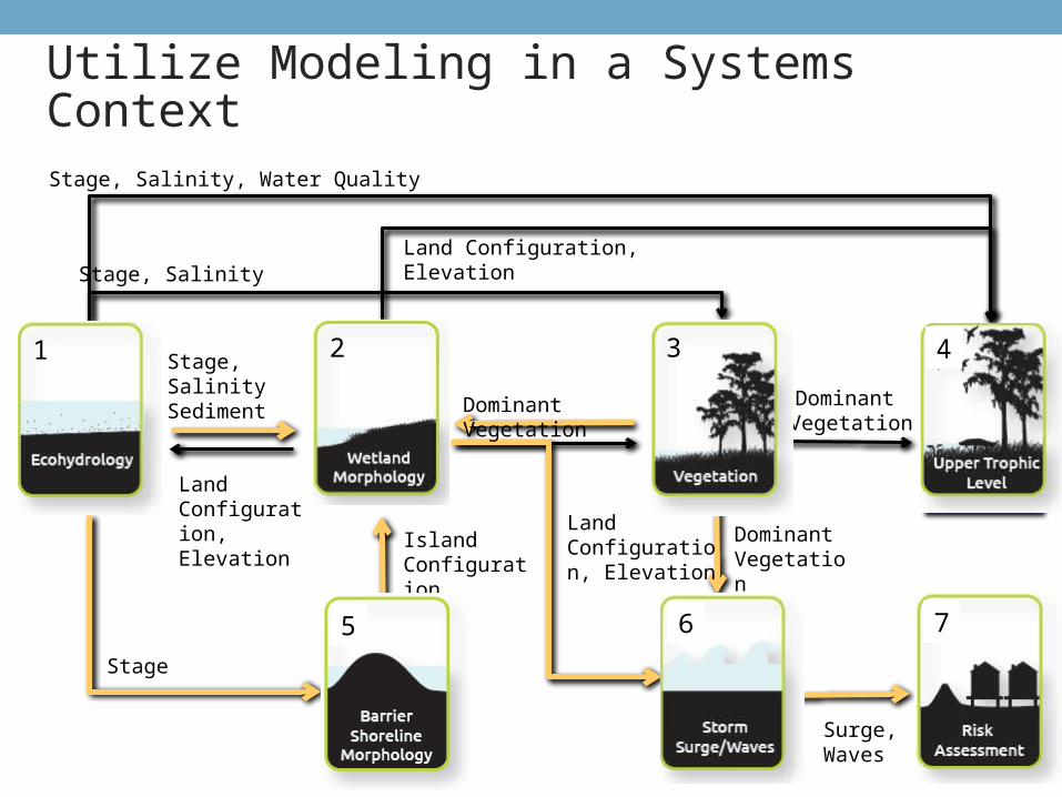
Utilize Modeling in a Systems Context
Surge
Upper Trophic
Stage,Salinity Sediment
Stage, Salinity
Stage, Salinity, Water Quality
Dominant Vegetation
Dominant Vegetation
Land Configuration, Elevation
Land Configuration, Elevation
Stage
Island Configuration
Land Configuration, Elevation
Surge, Waves
Dominant Vegetation
1 3 4
5 6 7
2
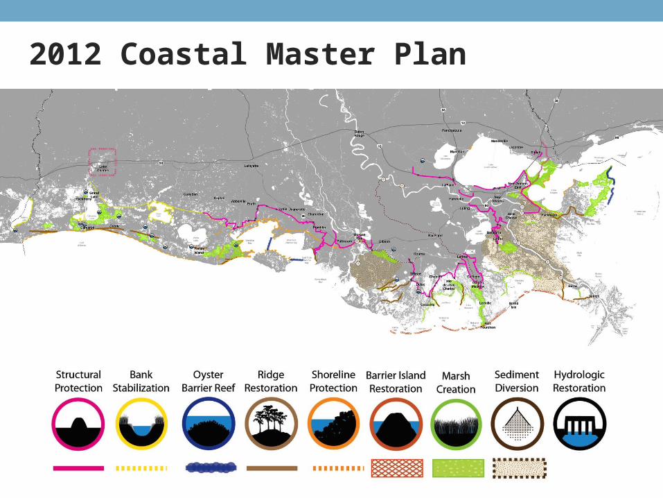
2012 Coastal Master Plan
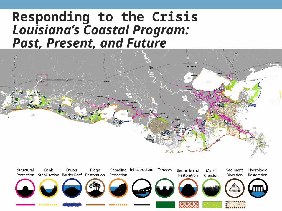
Responding to the CrisisLouisiana’s Coastal Program: Past, Present, and Future
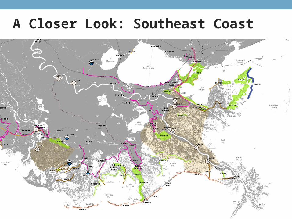
A Closer Look: Southeast Coast
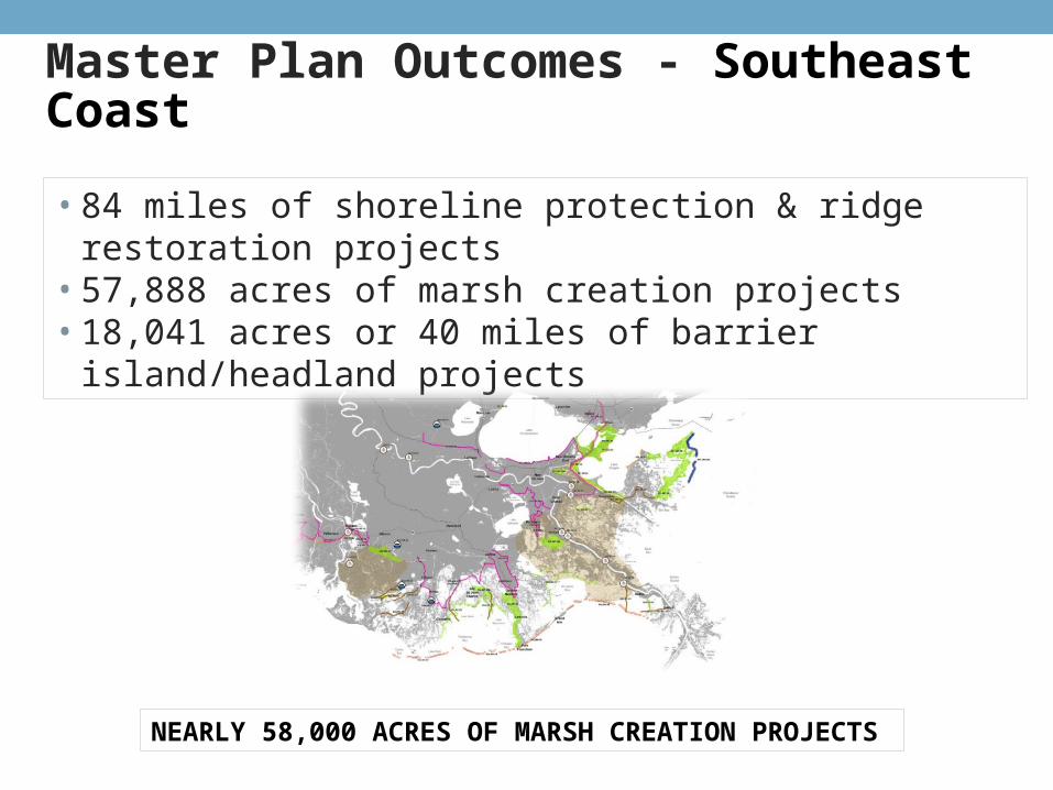
Master Plan Outcomes - Southeast Coast
• 84 miles of shoreline protection & ridge restoration projects• 57,888 acres of marsh creation projects• 18,041 acres or 40 miles of barrier island/headland projects
NEARLY 58,000 ACRES OF MARSH CREATION PROJECTS
39
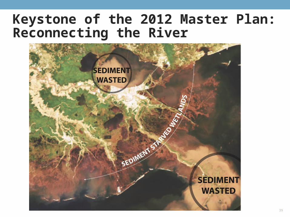
Keystone of the 2012 Master Plan: Reconnecting the River
UPDATE
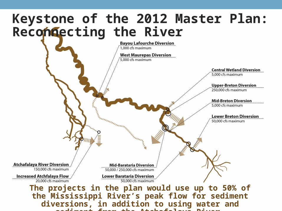
Keystone of the 2012 Master Plan: Reconnecting the River
The projects in the plan would use up to 50% of the Mississippi River’s peak flow for sediment diversions, in addition to using
water and sediment from the Atchafalaya River.
• Greater New Orleans High Level Levee – aimed at providing the area with 500 year level of protection
• Lake Pontchartrain Barrier project
• Greater New Orleans LaPlace Extension
• Maintain West Bank Levees (>100 year level of protection)
• New Orleans East Land Bridge Restoration
• Central Wetlands Marsh Creation project
• Lake Borgne Marsh Creation project
• Mississippi River Diversion into Barataria and Breton provide significant protection and benefits to Greater New Orleans
Greater New Orleans Area
41
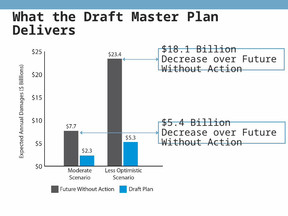
What the Draft Master Plan Delivers
$5.4 Billion Decrease over Future Without Action
$18.1 Billion Decrease over Future Without Action
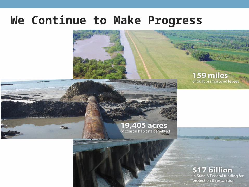
We Continue to Make Progress
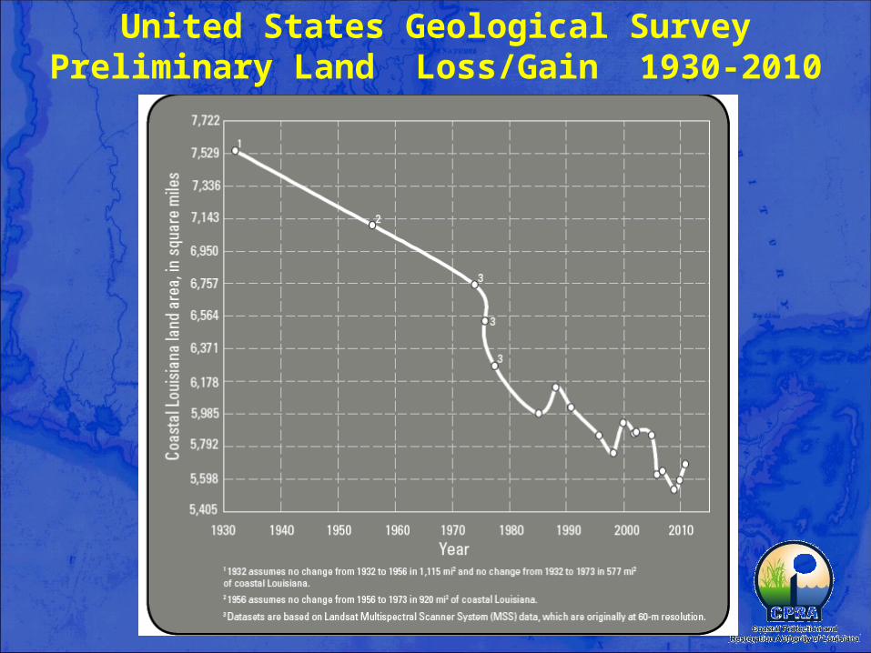
United States Geological SurveyPreliminary Land Loss/Gain 1930-2010
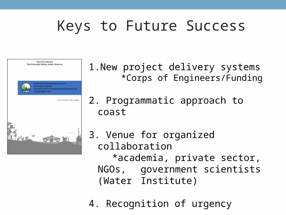
1.New project delivery systems*Corps of Engineers/Funding
2. Programmatic approach to coast
3. Venue for organized collaboration *academia, private sector, NGOs, government scientists (Water
Institute)
4. Recognition of urgency
Keys to Future Success
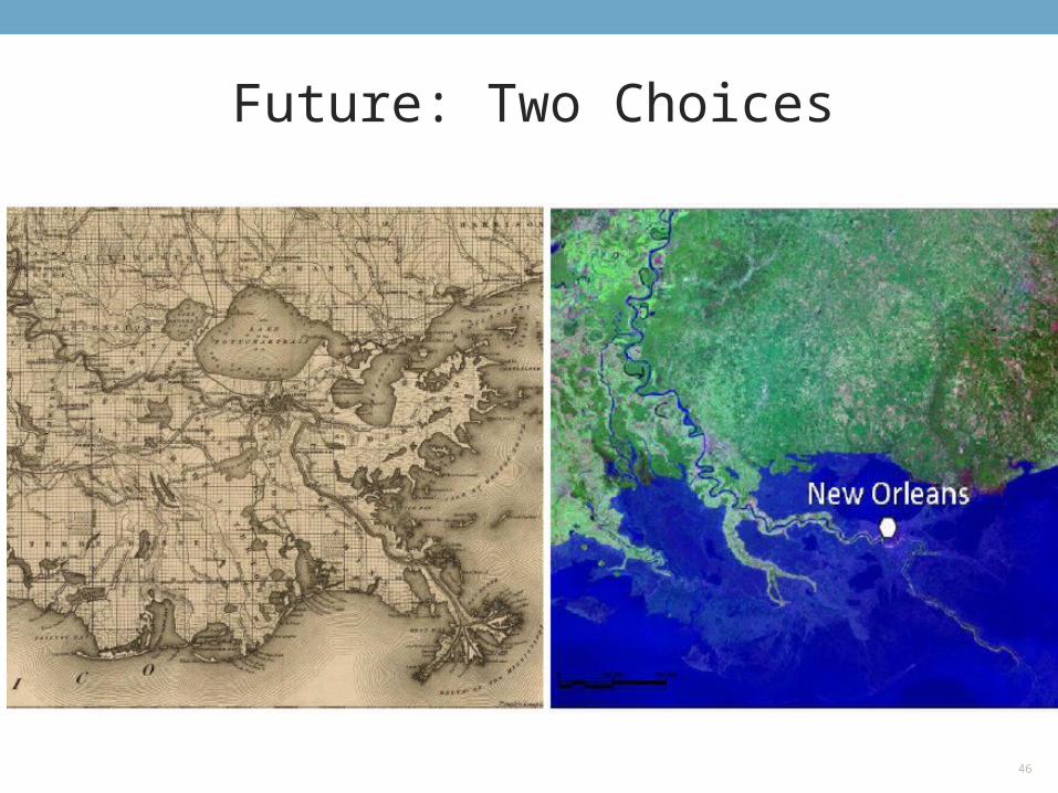
Future: Two Choices
46
Thank You


