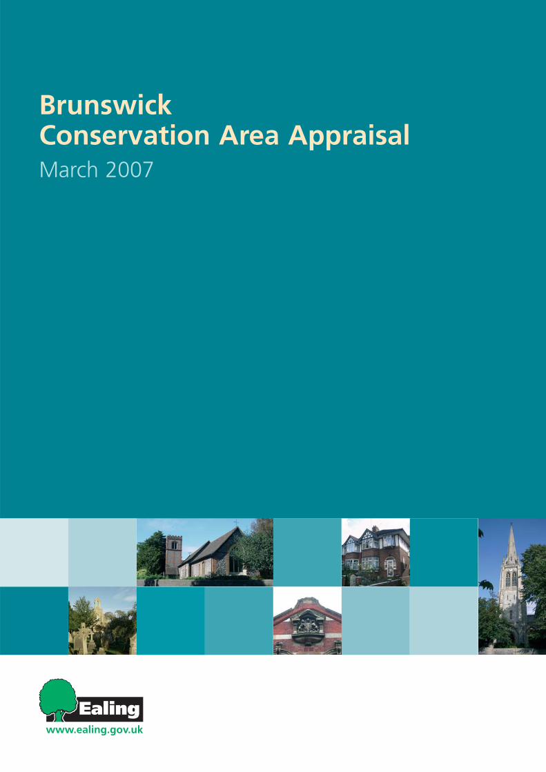
BrunswickConservation Area AppraisalMarch 2007
Brunswick Conservation Area Character Appraisal
Ealing Borough Council 2007 1
This document was written and produced by The Conservation Studioon behalf of the London Borough of Ealing in 2007
The Conservation Studio 1 Querns Lane Cirencester Gloucestershire GL7 1RL T: 01285 642428 F: 01285 642488 [email protected] www.theconservationstudio.co.uk
Brunswick Conservation Area Character Appraisal
Ealing Borough Council 2007 2
BRUNSWICK CONSERVATION AREA CHARACTER APPRAISAL
1. INTRODUCTION............................................................................................................... 3
1.1. THE DEFINITION AND PURPOSE OF CONSERVATION AREAS ................................................................3 1.2. THE PURPOSE AND STATUS OF THIS APPRAISAL ...............................................................................3 1.3. PLANNING AND POLICY FRAMEWORK...............................................................................................4 1.4. SUMMARY OF SPECIAL INTEREST ....................................................................................................4
2. LOCATION AND CONTEXT, USES AND ACTIVITIES...................................................... 5 2.1. LOCATION AND CONTEXT................................................................................................................5 2.2. USES AND ACTIVITIES ....................................................................................................................5 2.3. TOPOGRAPHY AND GEOLOGY .........................................................................................................6 2.4. RELATIONSHIP OF THE CONSERVATION AREA TO ITS SURROUNDINGS .................................................6
3. HISTORIC DEVELOPMENT AND ARCHAEOLOGY......................................................... 8 3.1. HISTORIC DEVELOPMENT ...............................................................................................................8 3.2. ARCHAEOLOGY ...........................................................................................................................10
4. SPATIAL ANALYSIS ...................................................................................................... 11 4.1. PLAN, FORM AND LAYOUT ............................................................................................................11 4.2. FOCAL POINTS, OPEN SPACES AND VIEWS ....................................................................................11 4.3. TREES AND LANDSCAPE ...............................................................................................................12 4.4. PUBLIC REALM ............................................................................................................................13
5. THE BUILDINGS OF THE CONSERVATION AREA ....................................................... 14 5.1. BUILDINGS TYPES........................................................................................................................14 5.2. BUILDINGS MATERIALS AND LOCAL DETAILS ...................................................................................15 5.3. LISTED BUILDINGS .......................................................................................................................15
6. THE CHARACTER OF THE CONSERVATION AREA .................................................... 16 7. ISSUES AND RECOMMENDATIONS ............................................................................. 19
7.1. LIST OF ISSUES ...........................................................................................................................19 7.2. RECOMMENDATIONS ....................................................................................................................20
8. COMMUNITY INVOLVEMENT ........................................................................................ 22 9. SUMMARY...................................................................................................................... 22 10. PLANNING AND POLICY FRAMEWORK....................................................................... 23 11. GLOSSARY .................................................................................................................... 25 12. BIBLIOGRAPHY AND FURTHER READING.................................................................. 29 13. APPENDIX...................................................................................................................... 29
13.1. STAKEHOLDER LIST .....................................................................................................................29
Brunswick Conservation Area Character Appraisal
Ealing Borough Council 2007 3
1. Introduction
1.1. The Definition and Purpose of Conservation Areas
According to Section 69 of the Town and Country Planning (Listed Buildings and Conservation Areas) Act 1990, a Conservation Area (CA) is an “area of special architectural or historic interest the character and the appearance of which is desirable to preserve or enhance”. It is the duty of Local Authorities to designate such areas and to use their legal powers to safeguard and enhance the special qualities of these areas within the framework of controlled and positive management of change.
1.2. The Purpose and Status of this Appraisal
Brunswick Conservation Area (CA) was first designated in 2004. This appraisal updates the work that contributed to its original designation and following Adoption by Ealing Council it will become the first published guidance for this CA. The scope of this appraisal is summarised in the following points: Assess the special interest of the architectural and natural heritage of Brunswick CA highlighting elements of special merit which contribute to the character. Assess the action needed to protect and enhance the special qualities of the CA. Propose the revised boundaries of the CA. The document is, however, not intended to be comprehensive in its scope and content. Omission of any specific building, space or feature or aspect of its appearance or character should not be taken to imply that they have no significance. The methodology of the CA Character Appraisal for Brunswick follows the guidance provided by the Planning Policy guidelines 15: Planning and the Historic Environment (1994); the Guidance on Conservation Appraisals by English Heritage (2005); and the Guidance on Management of Conservation Areas by English Heritage (2005). The analysis has been conducted on the basis of visits to the area, the involvement of local associations, and with consultation of primary and secondary sources on the local history and architecture.
Brunswick Conservation Area Character Appraisal
Ealing Borough Council 2007 4
1.3. Planning and Policy Framework CAs often arise from a process of local interest and action. Where areas have been designated, it is the Council’s statutory duty to give special consideration to the preservation or enhancement of their character or appearance in the exercise of their planning functions. To that end, special policies, relevant to the Brunswick CA, are included in the Council’s Unitary Development Plan (UDP) to sensitively guide and manage development. The policies and the wider framework for development proposals in the London Borough of Ealing, are summarised at the back of this document.
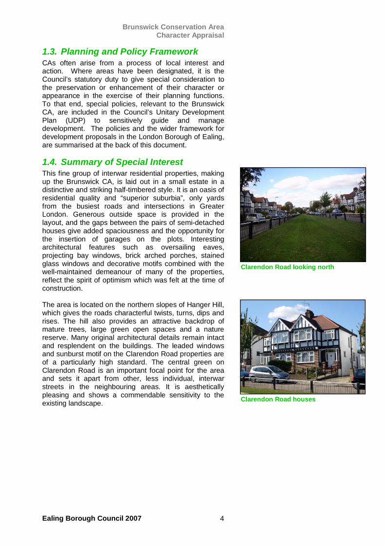
1.4. Summary of Special Interest This fine group of interwar residential properties, making up the Brunswick CA, is laid out in a small estate in a distinctive and striking half-timbered style. It is an oasis of residential quality and “superior suburbia”, only yards from the busiest roads and intersections in Greater London. Generous outside space is provided in the layout, and the gaps between the pairs of semi-detached houses give added spaciousness and the opportunity for the insertion of garages on the plots. Interesting architectural features such as oversailing eaves, projecting bay windows, brick arched porches, stained glass windows and decorative motifs combined with the well-maintained demeanour of many of the properties, reflect the spirit of optimism which was felt at the time of construction. The area is located on the northern slopes of Hanger Hill, which gives the roads characterful twists, turns, dips and rises. The hill also provides an attractive backdrop of mature trees, large green open spaces and a nature reserve. Many original architectural details remain intact and resplendent on the buildings. The leaded windows and sunburst motif on the Clarendon Road properties are of a particularly high standard. The central green on Clarendon Road is an important focal point for the area and sets it apart from other, less individual, interwar streets in the neighbouring areas. It is aesthetically pleasing and shows a commendable sensitivity to the existing landscape.
Clarendon Road looking north
Clarendon Road houses
Brunswick Conservation Area Character Appraisal
Ealing Borough Council 2007 5
2. Location and Context, Uses and Activities
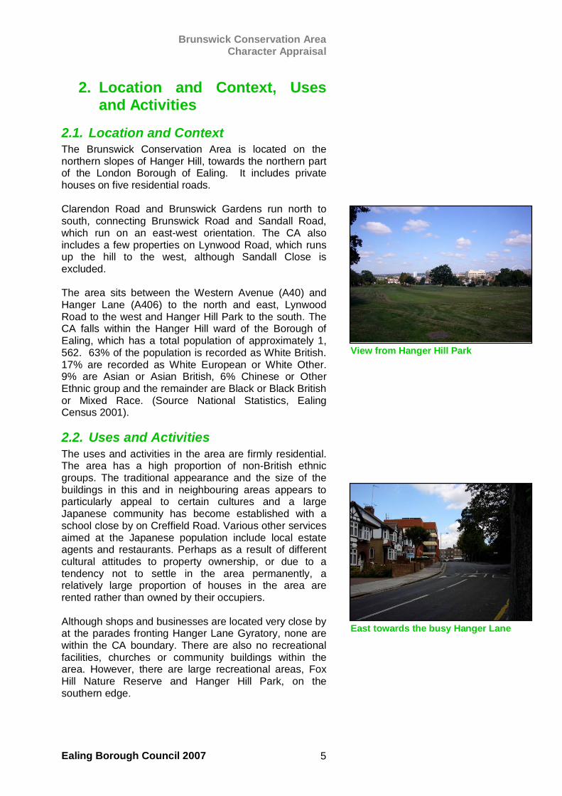
2.1. Location and Context The Brunswick Conservation Area is located on the northern slopes of Hanger Hill, towards the northern part of the London Borough of Ealing. It includes private houses on five residential roads. Clarendon Road and Brunswick Gardens run north to south, connecting Brunswick Road and Sandall Road, which run on an east-west orientation. The CA also includes a few properties on Lynwood Road, which runs up the hill to the west, although Sandall Close is excluded. The area sits between the Western Avenue (A40) and Hanger Lane (A406) to the north and east, Lynwood Road to the west and Hanger Hill Park to the south. The CA falls within the Hanger Hill ward of the Borough of Ealing, which has a total population of approximately 1, 562. 63% of the population is recorded as White British. 17% are recorded as White European or White Other. 9% are Asian or Asian British, 6% Chinese or Other Ethnic group and the remainder are Black or Black British or Mixed Race. (Source National Statistics, Ealing Census 2001).
2.2. Uses and Activities The uses and activities in the area are firmly residential. The area has a high proportion of non-British ethnic groups. The traditional appearance and the size of the buildings in this and in neighbouring areas appears to particularly appeal to certain cultures and a large Japanese community has become established with a school close by on Creffield Road. Various other services aimed at the Japanese population include local estate agents and restaurants. Perhaps as a result of different cultural attitudes to property ownership, or due to a tendency not to settle in the area permanently, a relatively large proportion of houses in the area are rented rather than owned by their occupiers. Although shops and businesses are located very close by at the parades fronting Hanger Lane Gyratory, none are within the CA boundary. There are also no recreational facilities, churches or community buildings within the area. However, there are large recreational areas, Fox Hill Nature Reserve and Hanger Hill Park, on the southern edge.
View from Hanger Hill Park
East towards the busy Hanger Lane
Brunswick Conservation Area Character Appraisal
Ealing Borough Council 2007 6
A bus route passes directly through the CA, serving residents with transportation to larger commercial areas and other transport links (bus routes and Hanger Lane Central Line Station). The lack of other facilities in Brunswick was probably due to the assumption that residents’ needs would be fulfilled by services already provided in other areas close by. Another activity noticeable in the CA comes from the many workmen who can be seen repairing or extending the properties. They inject an air of steady industry on most weekdays.
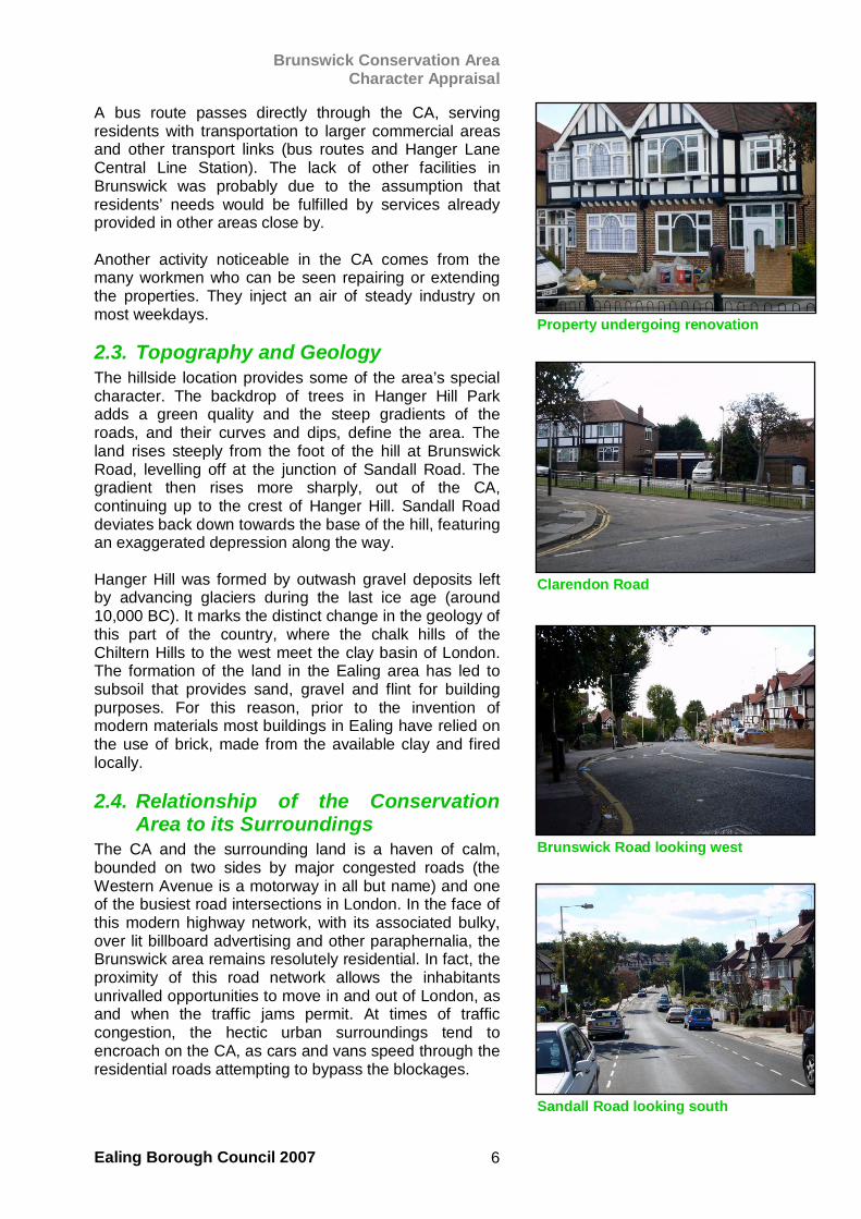
2.3. Topography and Geology The hillside location provides some of the area’s special character. The backdrop of trees in Hanger Hill Park adds a green quality and the steep gradients of the roads, and their curves and dips, define the area. The land rises steeply from the foot of the hill at Brunswick Road, levelling off at the junction of Sandall Road. The gradient then rises more sharply, out of the CA, continuing up to the crest of Hanger Hill. Sandall Road deviates back down towards the base of the hill, featuring an exaggerated depression along the way. Hanger Hill was formed by outwash gravel deposits left by advancing glaciers during the last ice age (around 10,000 BC). It marks the distinct change in the geology of this part of the country, where the chalk hills of the Chiltern Hills to the west meet the clay basin of London. The formation of the land in the Ealing area has led to subsoil that provides sand, gravel and flint for building purposes. For this reason, prior to the invention of modern materials most buildings in Ealing have relied on the use of brick, made from the available clay and fired locally.
2.4. Relationship of the Conservation Area to its Surroundings
The CA and the surrounding land is a haven of calm, bounded on two sides by major congested roads (the Western Avenue is a motorway in all but name) and one of the busiest road intersections in London. In the face of this modern highway network, with its associated bulky, over lit billboard advertising and other paraphernalia, the Brunswick area remains resolutely residential. In fact, the proximity of this road network allows the inhabitants unrivalled opportunities to move in and out of London, as and when the traffic jams permit. At times of traffic congestion, the hectic urban surroundings tend to encroach on the CA, as cars and vans speed through the residential roads attempting to bypass the blockages.
Property undergoing renovation
Brunswick Road looking west
Clarendon Road
Sandall Road looking south
Brunswick Conservation Area Character Appraisal
Ealing Borough Council 2007 7
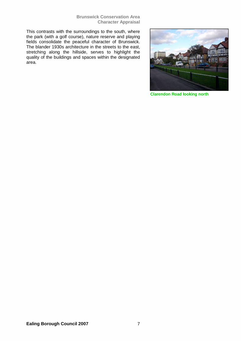
This contrasts with the surroundings to the south, where the park (with a golf course), nature reserve and playing fields consolidate the peaceful character of Brunswick. The blander 1930s architecture in the streets to the east, stretching along the hillside, serves to highlight the quality of the buildings and spaces within the designated area.
Clarendon Road looking north
Brunswick Conservation Area Character Appraisal
Ealing Borough Council 2007 8
3. Historic Development and Archaeology
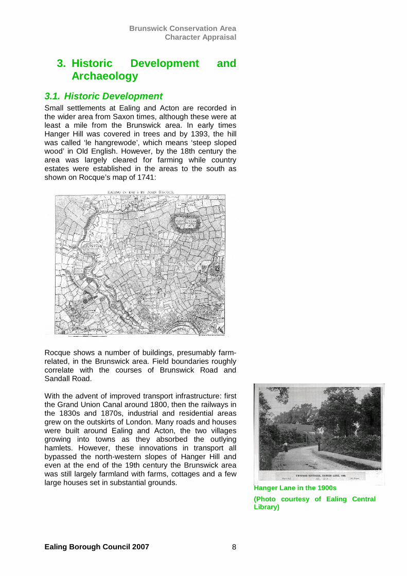
3.1. Historic Development Small settlements at Ealing and Acton are recorded in the wider area from Saxon times, although these were at least a mile from the Brunswick area. In early times Hanger Hill was covered in trees and by 1393, the hill was called ‘le hangrewode’, which means ‘steep sloped wood’ in Old English. However, by the 18th century the area was largely cleared for farming while country estates were established in the areas to the south as shown on Rocque’s map of 1741:
Rocque shows a number of buildings, presumably farm-related, in the Brunswick area. Field boundaries roughly correlate with the courses of Brunswick Road and Sandall Road. With the advent of improved transport infrastructure: first the Grand Union Canal around 1800, then the railways in the 1830s and 1870s, industrial and residential areas grew on the outskirts of London. Many roads and houses were built around Ealing and Acton, the two villages growing into towns as they absorbed the outlying hamlets. However, these innovations in transport all bypassed the north-western slopes of Hanger Hill and even at the end of the 19th century the Brunswick area was still largely farmland with farms, cottages and a few large houses set in substantial grounds.
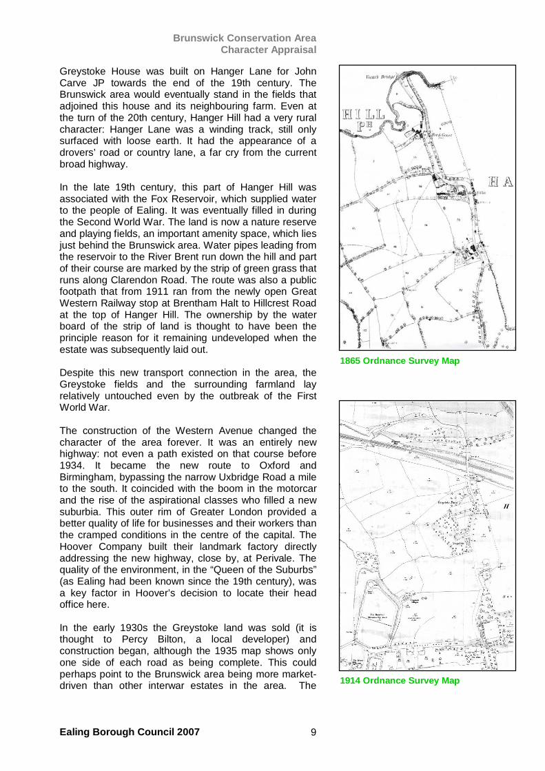
Hanger Lane in the 1900s (Photo courtesy of Ealing CentralLibrary)
Brunswick Conservation Area Character Appraisal
Ealing Borough Council 2007 9
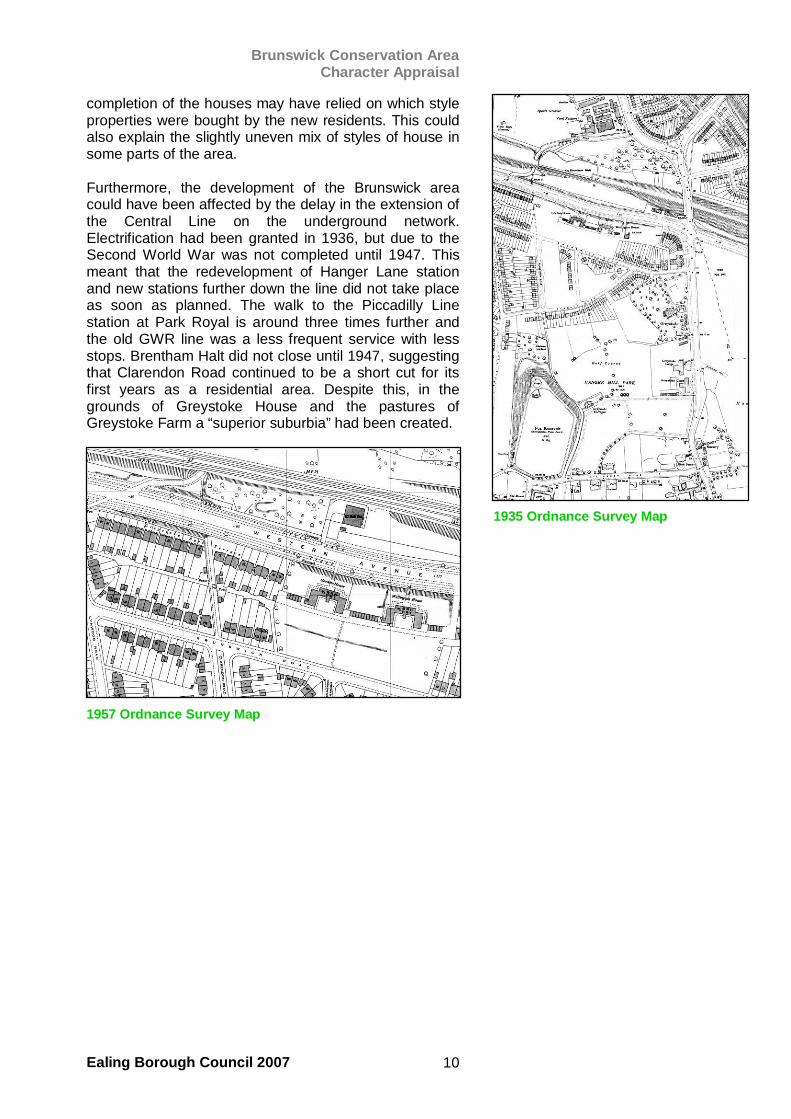
Greystoke House was built on Hanger Lane for John Carve JP towards the end of the 19th century. The Brunswick area would eventually stand in the fields that adjoined this house and its neighbouring farm. Even at the turn of the 20th century, Hanger Hill had a very rural character: Hanger Lane was a winding track, still only surfaced with loose earth. It had the appearance of a drovers’ road or country lane, a far cry from the current broad highway. In the late 19th century, this part of Hanger Hill was associated with the Fox Reservoir, which supplied water to the people of Ealing. It was eventually filled in during the Second World War. The land is now a nature reserve and playing fields, an important amenity space, which lies just behind the Brunswick area. Water pipes leading from the reservoir to the River Brent run down the hill and part of their course are marked by the strip of green grass that runs along Clarendon Road. The route was also a public footpath that from 1911 ran from the newly open Great Western Railway stop at Brentham Halt to Hillcrest Road at the top of Hanger Hill. The ownership by the water board of the strip of land is thought to have been the principle reason for it remaining undeveloped when the estate was subsequently laid out. Despite this new transport connection in the area, the Greystoke fields and the surrounding farmland lay relatively untouched even by the outbreak of the First World War. The construction of the Western Avenue changed the character of the area forever. It was an entirely new highway: not even a path existed on that course before 1934. It became the new route to Oxford and Birmingham, bypassing the narrow Uxbridge Road a mile to the south. It coincided with the boom in the motorcar and the rise of the aspirational classes who filled a new suburbia. This outer rim of Greater London provided a better quality of life for businesses and their workers than the cramped conditions in the centre of the capital. The Hoover Company built their landmark factory directly addressing the new highway, close by, at Perivale. The quality of the environment, in the “Queen of the Suburbs” (as Ealing had been known since the 19th century), was a key factor in Hoover’s decision to locate their head office here. In the early 1930s the Greystoke land was sold (it is thought to Percy Bilton, a local developer) and construction began, although the 1935 map shows only one side of each road as being complete. This could perhaps point to the Brunswick area being more market-driven than other interwar estates in the area. The 1914 Ordnance Survey Map
1865 Ordnance Survey Map
Brunswick Conservation Area Character Appraisal
Ealing Borough Council 2007 10
completion of the houses may have relied on which style properties were bought by the new residents. This could also explain the slightly uneven mix of styles of house in some parts of the area. Furthermore, the development of the Brunswick area could have been affected by the delay in the extension of the Central Line on the underground network. Electrification had been granted in 1936, but due to the Second World War was not completed until 1947. This meant that the redevelopment of Hanger Lane station and new stations further down the line did not take place as soon as planned. The walk to the Piccadilly Line station at Park Royal is around three times further and the old GWR line was a less frequent service with less stops. Brentham Halt did not close until 1947, suggesting that Clarendon Road continued to be a short cut for its first years as a residential area. Despite this, in the grounds of Greystoke House and the pastures of Greystoke Farm a “superior suburbia” had been created.
3.2. Archaeology There is no archaeological evidence on record for this area, although this does not discount the possibility of earlier settlements having been here. The location close to a river (the Brent) and the shelter of a wooded hill would have provided useful resources to an early settler.
1935 Ordnance Survey Map
1957 Ordnance Survey Map
Brunswick Conservation Area Character Appraisal
Ealing Borough Council 2007 11
4. Spatial Analysis
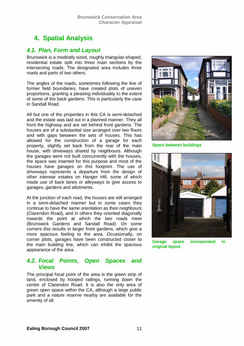
4.1. Plan, Form and Layout Brunswick is a modestly sized, roughly triangular-shaped, residential estate split into three main sections by the intersecting roads. The designated area includes three roads and parts of two others. The angles of the roads, sometimes following the line of former field boundaries, have created plots of uneven proportions, granting a pleasing individuality to the extent of some of the back gardens. This is particularly the case in Sandall Road. All but one of the properties in this CA is semi-detached and the estate was laid out in a planned manner. They all front the highway and are set behind front gardens. The houses are of a substantial size arranged over two floors and with gaps between the sets of houses. This has allowed for the construction of a garage for each property, slightly set back from the rear of the main house, with driveways shared by neighbours. Although the garages were not built concurrently with the houses, the space was inserted for this purpose and most of the houses have garages on this footprint. The use of driveways represents a departure from the design of other interwar estates on Hanger Hill, some of which made use of back lanes or alleyways to give access to garages, gardens and allotments. At the junction of each road, the houses are still arranged in a semi-detached manner but in some cases they continue to have the same orientation as their neighbours (Clarendon Road), and in others they oriented diagonally towards the point at which the two roads meet (Brunswick Gardens and Sandall Road). On some corners this results in larger front gardens, which give a more spacious feeling to the area. Occasionally, on corner plots, garages have been constructed closer to the main building line, which can inhibit the spacious appearance of the area.
4.2. Focal Points, Open Spaces and Views
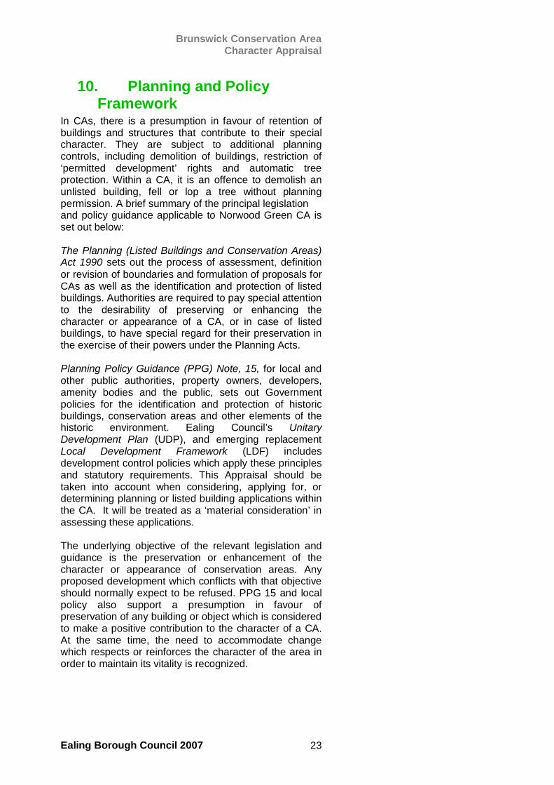
The principal focal point of the area is the green strip of land, enclosed by hooped railings, running down the centre of Clarendon Road. It is also the only area of green open space within the CA, although a large public park and a nature reserve nearby are available for the amenity of all.
Space between buildings
Garage space incorporated inoriginal layout
Brunswick Conservation Area Character Appraisal
Ealing Borough Council 2007 12
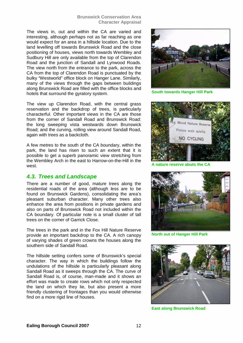
The views in, out and within the CA are varied and interesting, although perhaps not as far reaching as one would expect for an area in a hillside location. Due to the land levelling off towards Brunswick Road and the close positioning of houses, views north towards Wembley and Sudbury Hill are only available from the top of Clarendon Road and the junction of Sandall and Lynwood Roads. The view north from the entrance to the park, across the CA from the top of Clarendon Road is punctuated by the bulky “Westworld” office block on Hanger Lane. Similarly, many of the views through the gaps between buildings along Brunswick Road are filled with the office blocks and hotels that surround the gyratory system. The view up Clarendon Road, with the central grass reservation and the backdrop of trees, is particularly characterful. Other important views in the CA are those from the corner of Sandall Road and Brunswick Road: the long sweeping vista westwards down Brunswick Road; and the curving, rolling view around Sandall Road, again with trees as a backcloth. A few metres to the south of the CA boundary, within the park, the land has risen to such an extent that it is possible to get a superb panoramic view stretching from the Wembley Arch in the east to Harrow-on-the-Hill in the west.
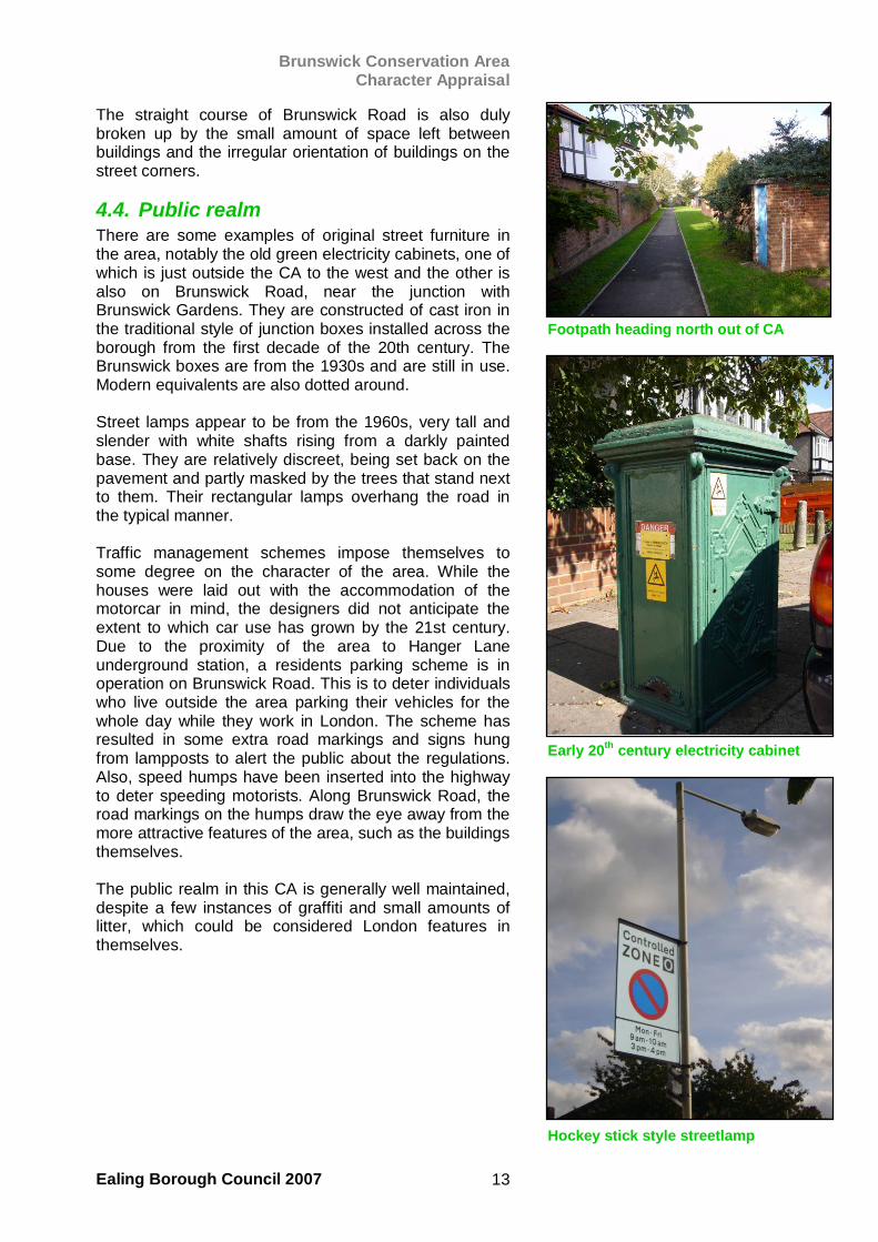
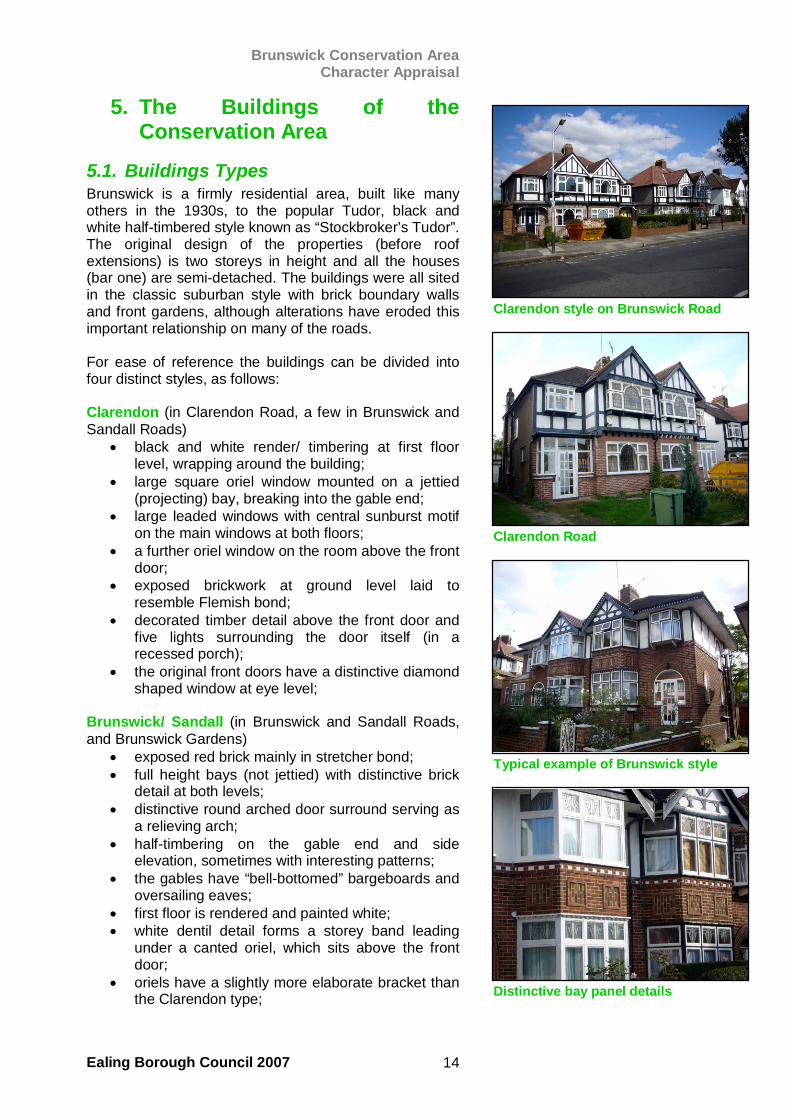
4.3. Trees and Landscape There are a number of good, mature trees along the residential roads of the area (although less are to be found on Brunswick Gardens), consolidating the area’s pleasant suburban character. Many other trees also enhance the area from positions in private gardens and also on parts of Brunswick Road not included within the CA boundary. Of particular note is a small cluster of tall trees on the corner of Garrick Close. The trees in the park and in the Fox Hill Nature Reserve provide an important backdrop to the CA. A rich canopy of varying shades of green crowns the houses along the southern side of Sandall Road. The hillside setting confers some of Brunswick’s special character. The way in which the buildings follow the undulations of the hillside is particularly pleasant along Sandall Road as it sweeps through the CA. The curve of Sandall Road is, of course, man-made and it shows an effort was made to create rows which not only respected the land on which they lie, but also present a more friendly clustering of frontages than you would otherwise find on a more rigid line of houses.
South towards Hanger Hill Park
North out of Hanger Hill Park
East along Brunswick Road
A nature reserve abuts the CA
Brunswick Conservation Area Character Appraisal
Ealing Borough Council 2007 13
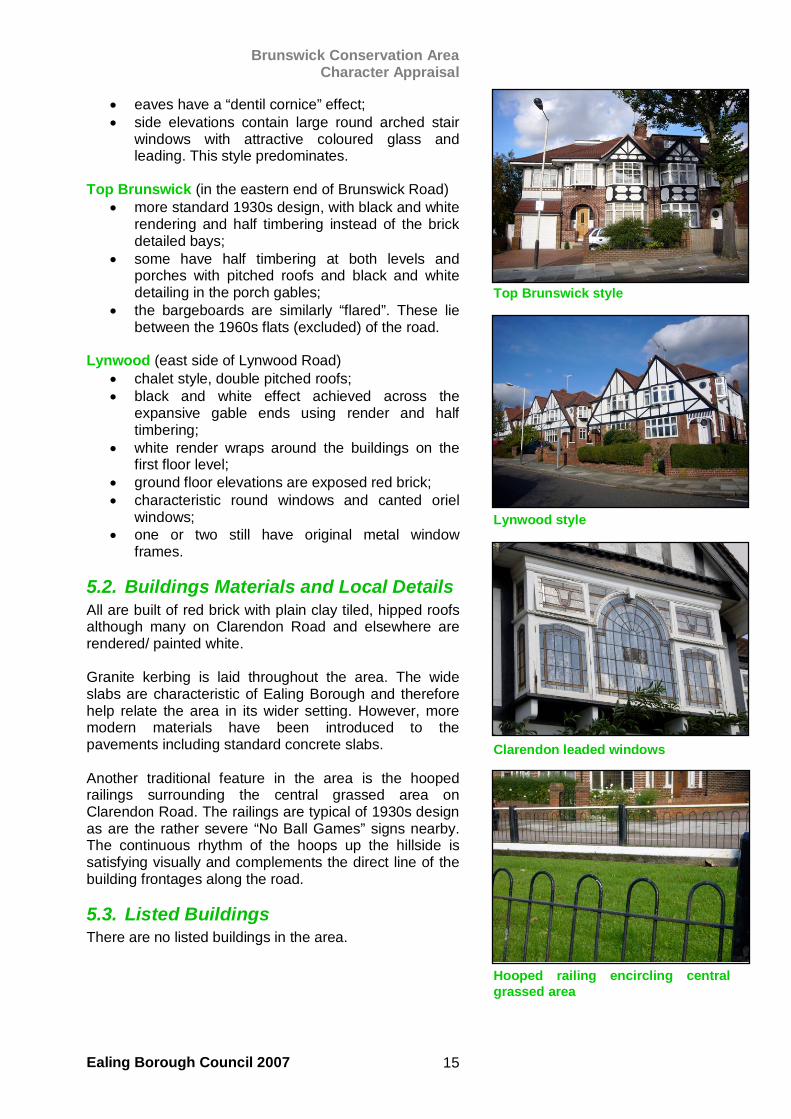
The straight course of Brunswick Road is also duly broken up by the small amount of space left between buildings and the irregular orientation of buildings on the street corners.
4.4. Public realm There are some examples of original street furniture in the area, notably the old green electricity cabinets, one of which is just outside the CA to the west and the other is also on Brunswick Road, near the junction with Brunswick Gardens. They are constructed of cast iron in the traditional style of junction boxes installed across the borough from the first decade of the 20th century. The Brunswick boxes are from the 1930s and are still in use. Modern equivalents are also dotted around. Street lamps appear to be from the 1960s, very tall and slender with white shafts rising from a darkly painted base. They are relatively discreet, being set back on the pavement and partly masked by the trees that stand next to them. Their rectangular lamps overhang the road in the typical manner. Traffic management schemes impose themselves to some degree on the character of the area. While the houses were laid out with the accommodation of the motorcar in mind, the designers did not anticipate the extent to which car use has grown by the 21st century. Due to the proximity of the area to Hanger Lane underground station, a residents parking scheme is in operation on Brunswick Road. This is to deter individuals who live outside the area parking their vehicles for the whole day while they work in London. The scheme has resulted in some extra road markings and signs hung from lampposts to alert the public about the regulations. Also, speed humps have been inserted into the highway to deter speeding motorists. Along Brunswick Road, the road markings on the humps draw the eye away from the more attractive features of the area, such as the buildings themselves. The public realm in this CA is generally well maintained, despite a few instances of graffiti and small amounts of litter, which could be considered London features in themselves.
Footpath heading north out of CA
Early 20th century electricity cabinet
Hockey stick style streetlamp
Brunswick Conservation Area Character Appraisal
Ealing Borough Council 2007 14
5. The Buildings of the Conservation Area
5.1. Buildings Types Brunswick is a firmly residential area, built like many others in the 1930s, to the popular Tudor, black and white half-timbered style known as “Stockbroker’s Tudor”. The original design of the properties (before roof extensions) is two storeys in height and all the houses (bar one) are semi-detached. The buildings were all sited in the classic suburban style with brick boundary walls and front gardens, although alterations have eroded this important relationship on many of the roads. For ease of reference the buildings can be divided into four distinct styles, as follows: Clarendon (in Clarendon Road, a few in Brunswick and Sandall Roads)
• black and white render/ timbering at first floor level, wrapping around the building;
• large square oriel window mounted on a jettied (projecting) bay, breaking into the gable end;
• large leaded windows with central sunburst motif on the main windows at both floors;
• a further oriel window on the room above the front door;
• exposed brickwork at ground level laid to resemble Flemish bond;
• decorated timber detail above the front door and five lights surrounding the door itself (in a recessed porch);
• the original front doors have a distinctive diamond shaped window at eye level;
Brunswick/ Sandall (in Brunswick and Sandall Roads, and Brunswick Gardens)
• exposed red brick mainly in stretcher bond; • full height bays (not jettied) with distinctive brick
detail at both levels; • distinctive round arched door surround serving as
a relieving arch; • half-timbering on the gable end and side
elevation, sometimes with interesting patterns; • the gables have “bell-bottomed” bargeboards and
oversailing eaves; • first floor is rendered and painted white; • white dentil detail forms a storey band leading
under a canted oriel, which sits above the front door;
• oriels have a slightly more elaborate bracket than the Clarendon type;
Clarendon style on Brunswick Road
Clarendon Road
Typical example of Brunswick style
Distinctive bay panel details
Brunswick Conservation Area Character Appraisal
Ealing Borough Council 2007 15
• eaves have a “dentil cornice” effect; • side elevations contain large round arched stair
windows with attractive coloured glass and leading. This style predominates.
Top Brunswick (in the eastern end of Brunswick Road)
• more standard 1930s design, with black and white rendering and half timbering instead of the brick detailed bays;
• some have half timbering at both levels and porches with pitched roofs and black and white detailing in the porch gables;
• the bargeboards are similarly “flared”. These lie between the 1960s flats (excluded) of the road.
Lynwood (east side of Lynwood Road)
• chalet style, double pitched roofs; • black and white effect achieved across the
expansive gable ends using render and half timbering;
• white render wraps around the buildings on the first floor level;
• ground floor elevations are exposed red brick; • characteristic round windows and canted oriel
windows; • one or two still have original metal window
frames.
5.2. Buildings Materials and Local Details All are built of red brick with plain clay tiled, hipped roofs although many on Clarendon Road and elsewhere are rendered/ painted white. Granite kerbing is laid throughout the area. The wide slabs are characteristic of Ealing Borough and therefore help relate the area in its wider setting. However, more modern materials have been introduced to the pavements including standard concrete slabs. Another traditional feature in the area is the hooped railings surrounding the central grassed area on Clarendon Road. The railings are typical of 1930s design as are the rather severe “No Ball Games” signs nearby. The continuous rhythm of the hoops up the hillside is satisfying visually and complements the direct line of the building frontages along the road.
5.3. Listed Buildings There are no listed buildings in the area.
Top Brunswick style
Lynwood style
Clarendon leaded windows
Hooped railing encircling centralgrassed area
Brunswick Conservation Area Character Appraisal
Ealing Borough Council 2007 16
6. The Character of the Conservation Area
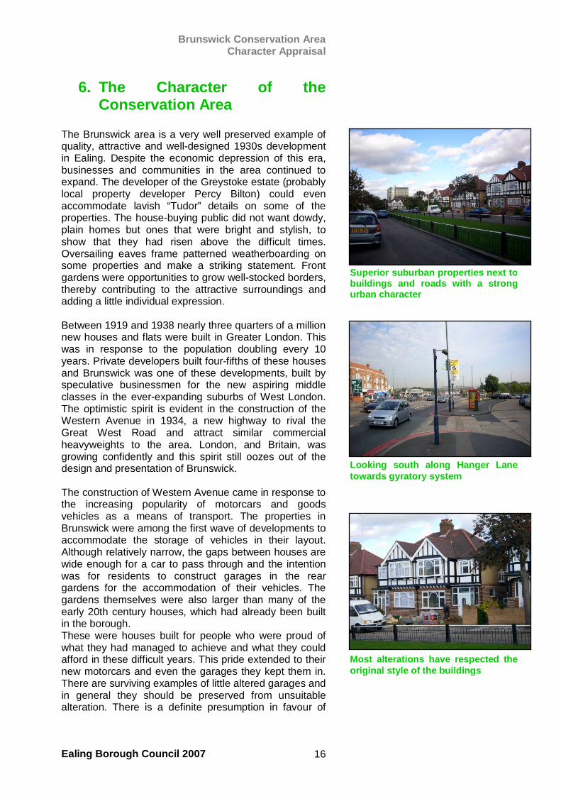
The Brunswick area is a very well preserved example of quality, attractive and well-designed 1930s development in Ealing. Despite the economic depression of this era, businesses and communities in the area continued to expand. The developer of the Greystoke estate (probably local property developer Percy Bilton) could even accommodate lavish “Tudor” details on some of the properties. The house-buying public did not want dowdy, plain homes but ones that were bright and stylish, to show that they had risen above the difficult times. Oversailing eaves frame patterned weatherboarding on some properties and make a striking statement. Front gardens were opportunities to grow well-stocked borders, thereby contributing to the attractive surroundings and adding a little individual expression. Between 1919 and 1938 nearly three quarters of a million new houses and flats were built in Greater London. This was in response to the population doubling every 10 years. Private developers built four-fifths of these houses and Brunswick was one of these developments, built by speculative businessmen for the new aspiring middle classes in the ever-expanding suburbs of West London. The optimistic spirit is evident in the construction of the Western Avenue in 1934, a new highway to rival the Great West Road and attract similar commercial heavyweights to the area. London, and Britain, was growing confidently and this spirit still oozes out of the design and presentation of Brunswick. The construction of Western Avenue came in response to the increasing popularity of motorcars and goods vehicles as a means of transport. The properties in Brunswick were among the first wave of developments to accommodate the storage of vehicles in their layout. Although relatively narrow, the gaps between houses are wide enough for a car to pass through and the intention was for residents to construct garages in the rear gardens for the accommodation of their vehicles. The gardens themselves were also larger than many of the early 20th century houses, which had already been built in the borough. These were houses built for people who were proud of what they had managed to achieve and what they could afford in these difficult years. This pride extended to their new motorcars and even the garages they kept them in. There are surviving examples of little altered garages and in general they should be preserved from unsuitable alteration. There is a definite presumption in favour of
Superior suburban properties next tobuildings and roads with a strongurban character
Most alterations have respected theoriginal style of the buildings
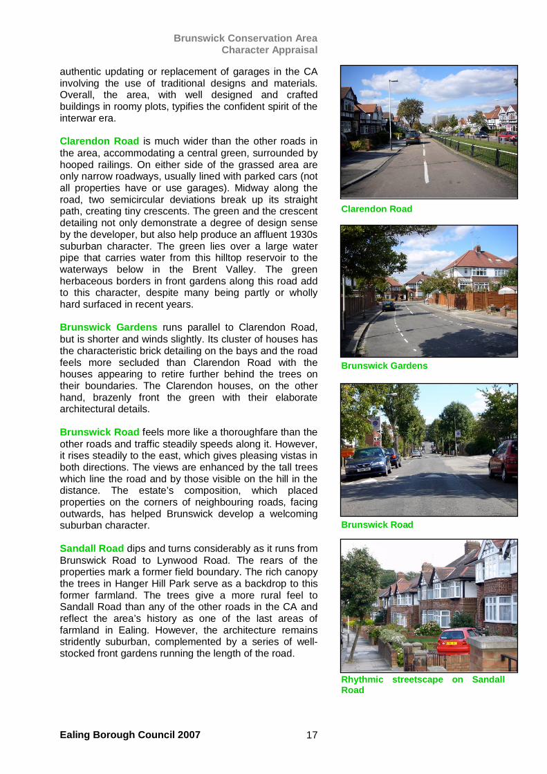
Looking south along Hanger Lanetowards gyratory system
Brunswick Conservation Area Character Appraisal
Ealing Borough Council 2007 17
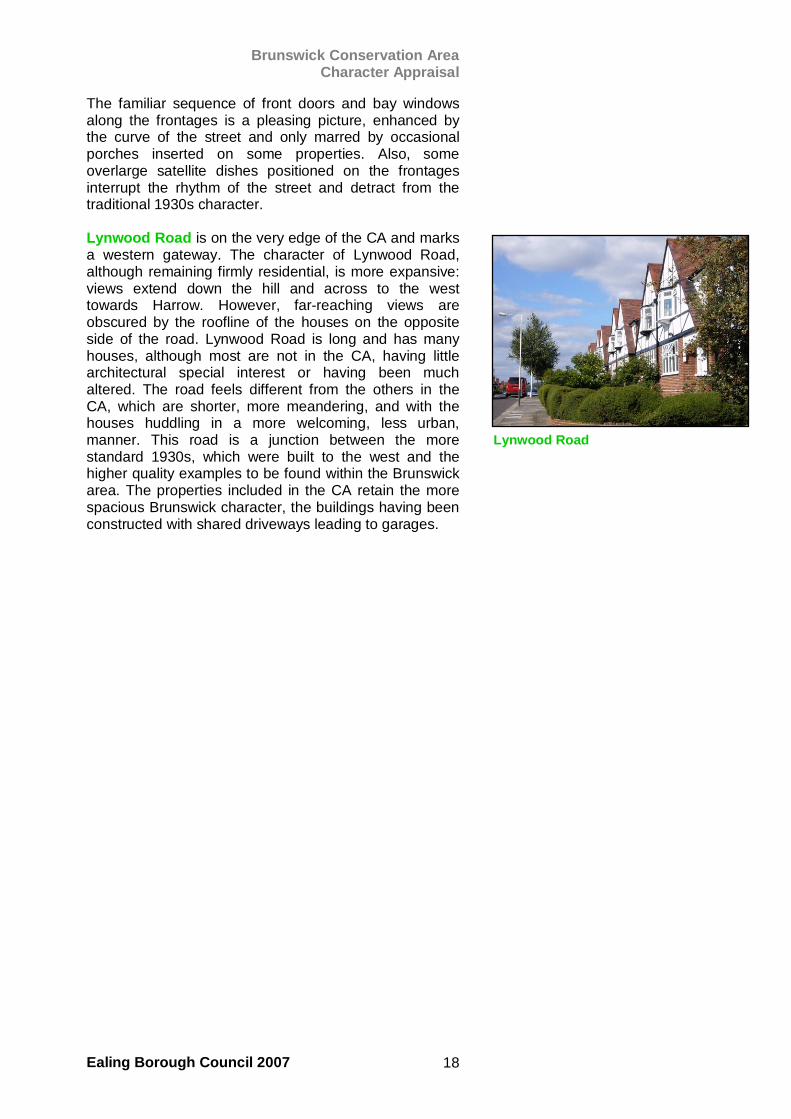
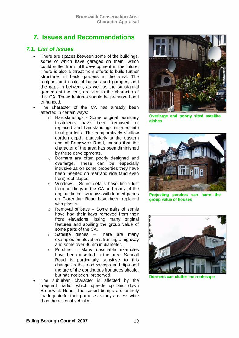
authentic updating or replacement of garages in the CA involving the use of traditional designs and materials. Overall, the area, with well designed and crafted buildings in roomy plots, typifies the confident spirit of the interwar era. Clarendon Road is much wider than the other roads in the area, accommodating a central green, surrounded by hooped railings. On either side of the grassed area are only narrow roadways, usually lined with parked cars (not all properties have or use garages). Midway along the road, two semicircular deviations break up its straight path, creating tiny crescents. The green and the crescent detailing not only demonstrate a degree of design sense by the developer, but also help produce an affluent 1930s suburban character. The green lies over a large water pipe that carries water from this hilltop reservoir to the waterways below in the Brent Valley. The green herbaceous borders in front gardens along this road add to this character, despite many being partly or wholly hard surfaced in recent years. Brunswick Gardens runs parallel to Clarendon Road, but is shorter and winds slightly. Its cluster of houses has the characteristic brick detailing on the bays and the road feels more secluded than Clarendon Road with the houses appearing to retire further behind the trees on their boundaries. The Clarendon houses, on the other hand, brazenly front the green with their elaborate architectural details. Brunswick Road feels more like a thoroughfare than the other roads and traffic steadily speeds along it. However, it rises steadily to the east, which gives pleasing vistas in both directions. The views are enhanced by the tall trees which line the road and by those visible on the hill in the distance. The estate’s composition, which placed properties on the corners of neighbouring roads, facing outwards, has helped Brunswick develop a welcoming suburban character. Sandall Road dips and turns considerably as it runs from Brunswick Road to Lynwood Road. The rears of the properties mark a former field boundary. The rich canopy the trees in Hanger Hill Park serve as a backdrop to this former farmland. The trees give a more rural feel to Sandall Road than any of the other roads in the CA and reflect the area’s history as one of the last areas of farmland in Ealing. However, the architecture remains stridently suburban, complemented by a series of well-stocked front gardens running the length of the road.
Clarendon Road
Rhythmic streetscape on SandallRoad
Brunswick Road
Brunswick Gardens
Brunswick Conservation Area Character Appraisal
Ealing Borough Council 2007 18
The familiar sequence of front doors and bay windows along the frontages is a pleasing picture, enhanced by the curve of the street and only marred by occasional porches inserted on some properties. Also, some overlarge satellite dishes positioned on the frontages interrupt the rhythm of the street and detract from the traditional 1930s character. Lynwood Road is on the very edge of the CA and marks a western gateway. The character of Lynwood Road, although remaining firmly residential, is more expansive: views extend down the hill and across to the west towards Harrow. However, far-reaching views are obscured by the roofline of the houses on the opposite side of the road. Lynwood Road is long and has many houses, although most are not in the CA, having little architectural special interest or having been much altered. The road feels different from the others in the CA, which are shorter, more meandering, and with the houses huddling in a more welcoming, less urban, manner. This road is a junction between the more standard 1930s, which were built to the west and the higher quality examples to be found within the Brunswick area. The properties included in the CA retain the more spacious Brunswick character, the buildings having been constructed with shared driveways leading to garages.
Lynwood Road
Brunswick Conservation Area Character Appraisal
Ealing Borough Council 2007 19
7. Issues and Recommendations
7.1. List of Issues • There are spaces between some of the buildings,
some of which have garages on them, which could suffer from infill development in the future. There is also a threat from efforts to build further structures in back gardens in the area. The footprint and scale of houses and garages, and the gaps in between, as well as the substantial gardens at the rear, are vital to the character of this CA. These features should be preserved and enhanced.
• The character of the CA has already been affected in certain ways:
o Hardstandings - Some original boundary treatments have been removed or replaced and hardstandings inserted into front gardens. The comparatively shallow garden depth, particularly at the eastern end of Brunswick Road, means that the character of the area has been diminished by these developments.
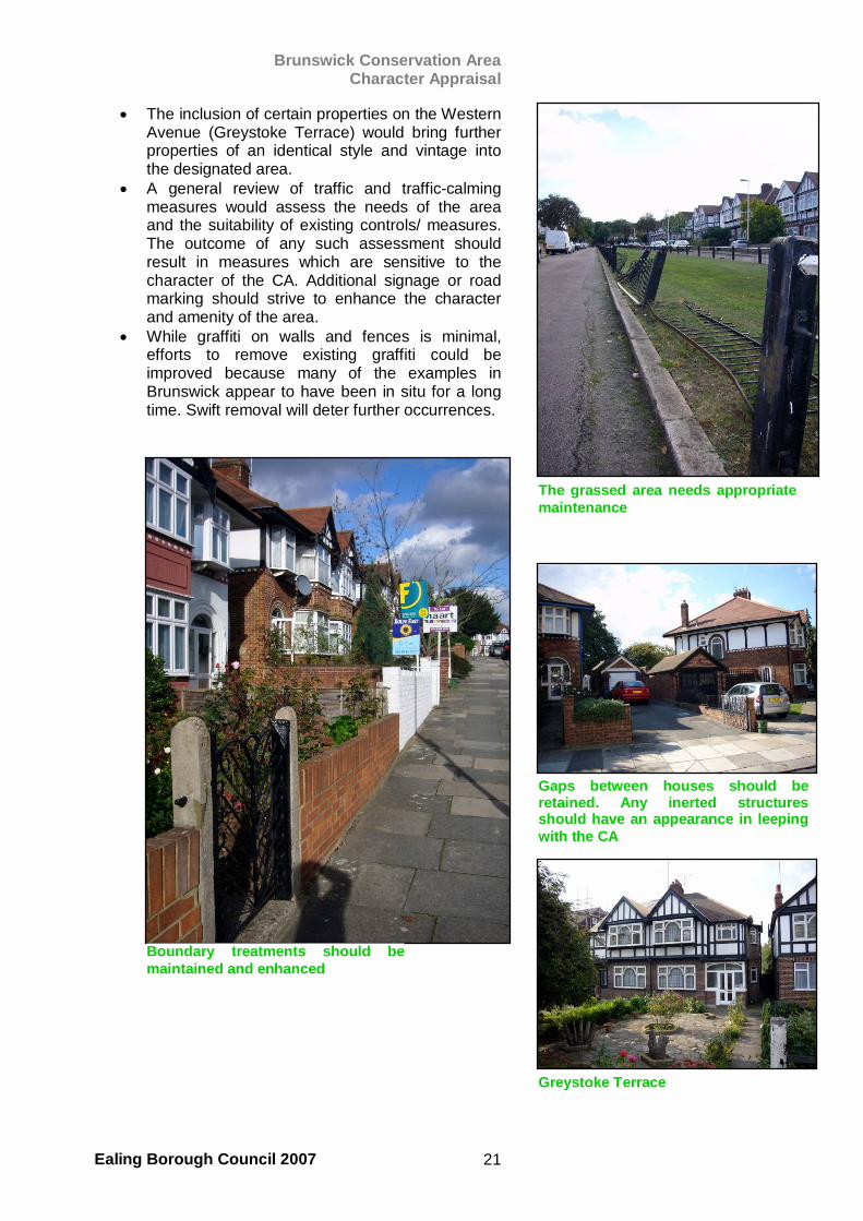
o Dormers are often poorly designed and overlarge. These can be especially intrusive as on some properties they have been inserted on rear and side (and even front) roof slopes.
o Windows - Some details have been lost from buildings in the CA and many of the original timber windows with leaded panes on Clarendon Road have been replaced with plastic.
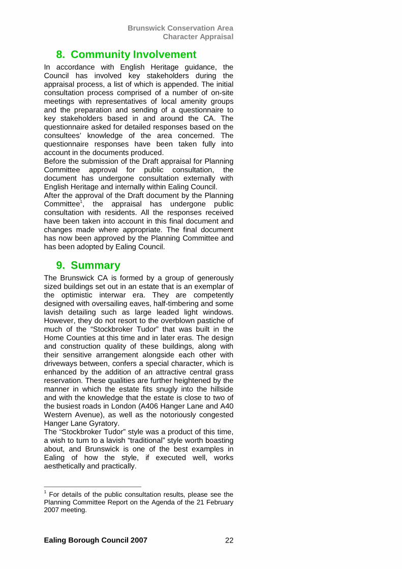
o Removal of bays – Some pairs of semis have had their bays removed from their front elevations, losing many original features and spoiling the group value of some parts of the CA.
o Satellite dishes – There are many examples on elevations fronting a highway and some over 90mm in diameter.
o Porches – Many unsuitable examples have been inserted in the area. Sandall Road is particularly sensitive to this change as the road sweeps and dips and the arc of the continuous frontages should, but has not been, preserved.
• The suburban character is affected by the frequent traffic, which speeds up and down Brunswick Road. The speed bumps are entirely inadequate for their purpose as they are less wide than the axles of vehicles.
Overlarge and poorly sited satellitedishes
Projecting porches can harm thegroup value of houses
Dormers can clutter the roofscape
Brunswick Conservation Area Character Appraisal
Ealing Borough Council 2007 20
• This results in cars regularly speeding at 40 – 50 mph along the highways.
• There is some graffiti in the area, particularly around a derelict trailer and broken fence and wall on Brunswick Road.
• The central green is maintained although the railings have been damaged at the southern end.
• Without any central public building, such as a church or community centre, the CA suffers from a lack of focus, which would otherwise enhance Brunswick’s special character.
7.2. Recommendations • Any planning applications involving proposals to
infill areas around properties on these roads should be scrutinised especially carefully by the Council. The character of this CA is particularly sensitive to changes of this kind and any permitted extensions should respect the original layout, design and scale of properties.
• Additional planning controls to protect the remaining gardens from conversion to hardstandings and the replacement of original windows and doors with uPVC should be considered. The relatively small size of this CA would mean that any additional burden on officer caseload should be minimal. However, the benefits would be great given the degree to which works of this kind can affect the character of the area.
• The formation of a local Conservation Area Advisory Panel to scrutinise individual planning applications and make comments on the proposals should take place as soon as possible. This would give an important local community input into planning decisions in the CA.
• There are many insensitively-sited satellite dishes installed on front elevations in the area. If it is found that these do not have Planning Permission, efforts to remove them to more suitable sites on the buildings could instantly enhance the character of the CA, particularly on the eastern end of Sandall Road.
• The private owners (Thames Water) of the grass area on Clarendon Road might be encouraged to maintain the railing boundary treatment, which retains a good deal of character and makes a very positive contribution to the area. Its repair would be greatly welcomed in conservation terms. The signs at each end of the green could also be improved or replaced. The appearance of the area could be improved by some limited planting and subtle landscaping.
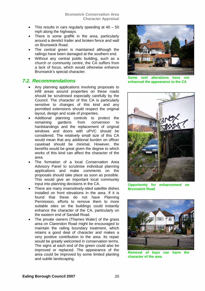
Some roof alterations have notenhanced the appearance to the CA
Opportunity for enhancement onBrunswick Road
Removal of bays can harm thecharacter of the area
Brunswick Conservation Area Character Appraisal
Ealing Borough Council 2007 21
• The inclusion of certain properties on the Western Avenue (Greystoke Terrace) would bring further properties of an identical style and vintage into the designated area.
• A general review of traffic and traffic-calming measures would assess the needs of the area and the suitability of existing controls/ measures. The outcome of any such assessment should result in measures which are sensitive to the character of the CA. Additional signage or road marking should strive to enhance the character and amenity of the area.
• While graffiti on walls and fences is minimal, efforts to remove existing graffiti could be improved because many of the examples in Brunswick appear to have been in situ for a long time. Swift removal will deter further occurrences.
Gaps between houses should be retained. Any inerted structures should have an appearance in leeping with the CA
The grassed area needs appropriatemaintenance
Boundary treatments should bemaintained and enhanced
Greystoke Terrace
Brunswick Conservation Area Character Appraisal
Ealing Borough Council 2007 22
8. Community Involvement In accordance with English Heritage guidance, the Council has involved key stakeholders during the appraisal process, a list of which is appended. The initial consultation process comprised of a number of on-site meetings with representatives of local amenity groups and the preparation and sending of a questionnaire to key stakeholders based in and around the CA. The questionnaire asked for detailed responses based on the consultees’ knowledge of the area concerned. The questionnaire responses have been taken fully into account in the documents produced. Before the submission of the Draft appraisal for Planning Committee approval for public consultation, the document has undergone consultation externally with English Heritage and internally within Ealing Council. After the approval of the Draft document by the Planning Committee1, the appraisal has undergone public consultation with residents. All the responses received have been taken into account in this final document and changes made where appropriate. The final document has now been approved by the Planning Committee and has been adopted by Ealing Council.
9. Summary The Brunswick CA is formed by a group of generously sized buildings set out in an estate that is an exemplar of the optimistic interwar era. They are competently designed with oversailing eaves, half-timbering and some lavish detailing such as large leaded light windows. However, they do not resort to the overblown pastiche of much of the “Stockbroker Tudor” that was built in the Home Counties at this time and in later eras. The design and construction quality of these buildings, along with their sensitive arrangement alongside each other with driveways between, confers a special character, which is enhanced by the addition of an attractive central grass reservation. These qualities are further heightened by the manner in which the estate fits snugly into the hillside and with the knowledge that the estate is close to two of the busiest roads in London (A406 Hanger Lane and A40 Western Avenue), as well as the notoriously congested Hanger Lane Gyratory. The “Stockbroker Tudor” style was a product of this time, a wish to turn to a lavish “traditional” style worth boasting about, and Brunswick is one of the best examples in Ealing of how the style, if executed well, works aesthetically and practically.
1 For details of the public consultation results, please see the Planning Committee Report on the Agenda of the 21 February 2007 meeting.
Brunswick Conservation Area Character Appraisal
Ealing Borough Council 2007 23
10. Planning and Policy Framework
In CAs, there is a presumption in favour of retention of buildings and structures that contribute to their special character. They are subject to additional planning controls, including demolition of buildings, restriction of ‘permitted development’ rights and automatic tree protection. Within a CA, it is an offence to demolish an unlisted building, fell or lop a tree without planning permission. A brief summary of the principal legislation and policy guidance applicable to Norwood Green CA is set out below: The Planning (Listed Buildings and Conservation Areas) Act 1990 sets out the process of assessment, definition or revision of boundaries and formulation of proposals for CAs as well as the identification and protection of listed buildings. Authorities are required to pay special attention to the desirability of preserving or enhancing the character or appearance of a CA, or in case of listed buildings, to have special regard for their preservation in the exercise of their powers under the Planning Acts. Planning Policy Guidance (PPG) Note, 15, for local and other public authorities, property owners, developers, amenity bodies and the public, sets out Government policies for the identification and protection of historic buildings, conservation areas and other elements of the historic environment. Ealing Council’s Unitary Development Plan (UDP), and emerging replacement Local Development Framework (LDF) includes development control policies which apply these principles and statutory requirements. This Appraisal should be taken into account when considering, applying for, or determining planning or listed building applications within the CA. It will be treated as a ‘material consideration’ in assessing these applications. The underlying objective of the relevant legislation and guidance is the preservation or enhancement of the character or appearance of conservation areas. Any proposed development which conflicts with that objective should normally expect to be refused. PPG 15 and local policy also support a presumption in favour of preservation of any building or object which is considered to make a positive contribution to the character of a CA. At the same time, the need to accommodate change which respects or reinforces the character of the area in order to maintain its vitality is recognized.

Brunswick Conservation Area Character Appraisal
Ealing Borough Council 2007 24
Many local planning policies, not just design and conservation, can affect what happens in a CA. For example, policies on sustainable development, meeting housing needs, affordable housing, landscape, biodiversity, energy efficiency, sustainable construction, transport, people with disabilities, employment, town centres and many others can all influence development and the quality of the environment in CAs. However, policies concerned with design quality and character generally take on greater importance in CAs. The adopted Unitary Development Plan’s chapter on Urban Design includes policies dealing with: • Design of Development (4.1) • Mixed Use (4.2) • Landscaping, Tree Protection and Planting (4.5) • Statutory Listed Buildings (4.6) • Locally Listed Buildings (4.7) • Conservation areas (4.8) • Ancient Monuments and Archaeological interest areas (4.9) • Commercial Frontage and Advertising signs (4.10) Throughout the Chapter, references are made after each policy to other relevant documents and policies, including: • SPG 5: How to prepare an Urban Design Statement • SPG 12: Greening Your Home; • Ealing LA21 'Keeping Your Front Garden Alive' • PPS 1 Delivering Sustainable Development • PPG 15 Listed Buildings and Conservation Areas • PPG 16 Archaeology and Planning • PPG 19 Outdoor Advertisement Control • By Design: Urban Design in the planning system: towards better practice (CABE & and DETR, 2000); • 'Better Places to Live: By Design'. A companion guide to PPG 3 (CABE, 2001) • The London Plan, Policy 4B.5, 4B10, 4B11, 4B12, 4B14 The Council has also published a Supplementary Planning Document ‘Residential Extensions’, which was adopted in June 2006. In general it is applicable to residential properties in CAs. A draft Conservation Areas SPD is currently being prepared and will be subject to formal consultation in the Spring of 2007.
Brunswick Conservation Area Character Appraisal
Ealing Borough Council 2007 25
Further advice on policies in the UDP, restrictions on residential and commercial properties and how to apply for permission may be obtained from London Borough of Ealing, Planning and Surveying Services, 14-16 Uxbridge Road, London, W5 2HL Tel (020) 8825 6600 (General Planning Enquiries), (020) 8825 9357 (Conservation & Urban Design) and the Council’s website www.ealing.gov.uk or email [email protected].
11. Glossary Arch - the spanning of an opening by means other than a lintel. Most commonly arches are curved and made up of wedge shaped blocks. Numerous variations exist e.g. Blind, Triumphant, Vernacular Band – an unmoulded, projecting string course, often delineating a floor/storey. Bargeboards – projecting boards set against the incline of the gable of a building Bay - the vertical division of the exterior, (or interior) of a building marked by a window opening. They may be Round, (or Canted) or Square. Bond – style of laying Headers, (bricks laid with the long side at right angles to the face of a wall), and Stretchers, (bricks laid with the long side along the face of the wall), within masonry courses. Flemish Bond is where alternate Headers and Stretchers are used in the face of the wall. English Bond is where alternate courses of bricks in the facing wall are either Headers or Stretchers. Buttress – a mass of masonry or brickwork projecting from or built against a wall to give additional strength Capitals – the top or head of a column, pier or pilaster, which relate to Classical architecture Casement window – a window hinged vertically to open like a door Cladding – an external covering applied to a structure for protective/aesthetic purposes Column – an upright, often supporting, structure either, round, square or rectangular in form
Brunswick Conservation Area Character Appraisal
Ealing Borough Council 2007 26
Coping – a capping or covering found on top of a wall. They can be flat or sloping to discharge water Cornice – a projecting, decorative moulding found along the top of a building. refers to a cornice made up of a series of small square blocks Dentil Cornice Corbel – a projecting block, usually stone, supporting a horizontal beam Course – a continuous layer of stones or bricks found in a wall. Referred to as String, (horizontal) or Soldier (vertical) Cupola – a dome that crowns a roof or turret Curtilage – the available space attached to a property which forms a singular enclosure Door hood – a projected moulding above an exterior door designed to through off the rain Dormer window – a projecting window placed vertically in a sloping roof with a roof of its own Dressings - a decorative feature made of stones, most commonly set around windows Eaves – the underpart of a sloping roof overhanging a wall, (Oversailing), or flush with it Elevation – the external wall or face of a building Façade – commonly the front face of a building Fanlights – a window, often semi-circular with radiating glazing panels, found over a door in Georgian buildings Fenestration – the arrangement of windows in a building Finial - a formal ornament, (usually in Fleur-de-Lis) at the top of a gable, pinnacle or canopy Footprint – the total area over which a building is situated Gable – the triangular upper part of a wall found at the end of a ridged roof Grain – refers to the arrangement and size of buildings in the urban context
Brunswick Conservation Area Character Appraisal
Ealing Borough Council 2007 27
Hardstanding – an area of hard material used for parking cars within the cartilage, (often front garden space) of a house Hipped roof – a shallowish pitch with sloping at the vertical ends Keystone – central wedge-shaped stone at the crown of an arch Mortar – mixture of cement, (or lime), sand and water laid between bricks as an adhesive Lintel – a horizontal supporting element of timber, metal or stone found across the top of a door or window Mansard roof – has a double slope where the lower part is steeper than the upper part Moulding – a continuous projection or groove used decoratively to throw shadow or rain water off a wall Mullion – a vertical element (glazing bar) that divides a window into two or more lights Pantile – a roofing tile with a curved S shape designed to interlock Parapet – a low wall used as a safety device where a drop or edge exists Pediment – a low pitched Gable above a Portico Pier – a solid vertical masonry support (or mass) found in buildings and walls Pilaster – a shallow pier projecting slightly from a wall Pinnacle – a small pyramidal or conical shaped crowing element Pitched roof – the most common type. Gables exist at each end of the pitch Plinth – the projecting base of a wall or column Pointing – the exposed mortar finish to brick or masonry joints Polychromatic – multi-coloured brickwork Portico – a roofspace open or partly enclosed Quatrefoil – a set of decorative openings, often leaf shaped cut into an arch
Brunswick Conservation Area Character Appraisal
Ealing Borough Council 2007 28
Quoins – dressed bricks found at the corners of buildings, usually laid so that the brick faces are alternately large and small Ragstone – rubble masonry, rough building stones or flints, generally laid in irregular courses Recess – space set back in a wall, often the setting for an entrance porch Render – plaster or stucco applied to a wall Rooflight – a window set flush into the slope of a roof Rusticated – masonry cut in huge blocks, often in its original hewn state, that is normally found on the lower half of buildings Sash window – a window that is double hung with wooden frames (sashes) that slide up and down with pulleys Sepulchre – a recess with Tombchest designed to receive an effigy of Christ Sett – paving slabs Sills – the horizontal element found at the base of a window or door frame Stucco – a form of plaster used internally or externally to decorate or protect Transom – a horizontal bar of stone or wood across a window
Brunswick Conservation Area Character Appraisal
Ealing Borough Council 2007 29
12. Bibliography and Further Reading
Baker et al. A History of the County of Middlesex: Volume 7 Acton, Chiswick, Ealing and Brentford, West Twyford, Willesden, Victoria County History 1982 Hounsell, P. Ealing and Hanwell Past: a visual history of Ealing and Hanwell, Historical Publications, 1991 Hounsell, P. The Ealing Book, Historical Publications, 2005 Jackson, A. Semi-detached London. Suburban development, life and transport, 1900-39, Wild Swan Publications Ltd., 1991 (ed.) Pevsner, N. & Cherry, B. The Buildings of England, London 3: North-West, Penguin 1983 (ed.)
13. Appendix
13.1. Stakeholder List Ealing Civic Society N.B. There is currently no residents association or Conservation Area Advisory Panel representing the Brunswick Conservation Area.

Ealing CouncilPerceval House14-16 Uxbridge RoadLondon W5 2HL
www.ealing.gov.uk


