david roy - landsat · david roy val kovalskyy & indu kommareddy geographic information science...
TRANSCRIPT
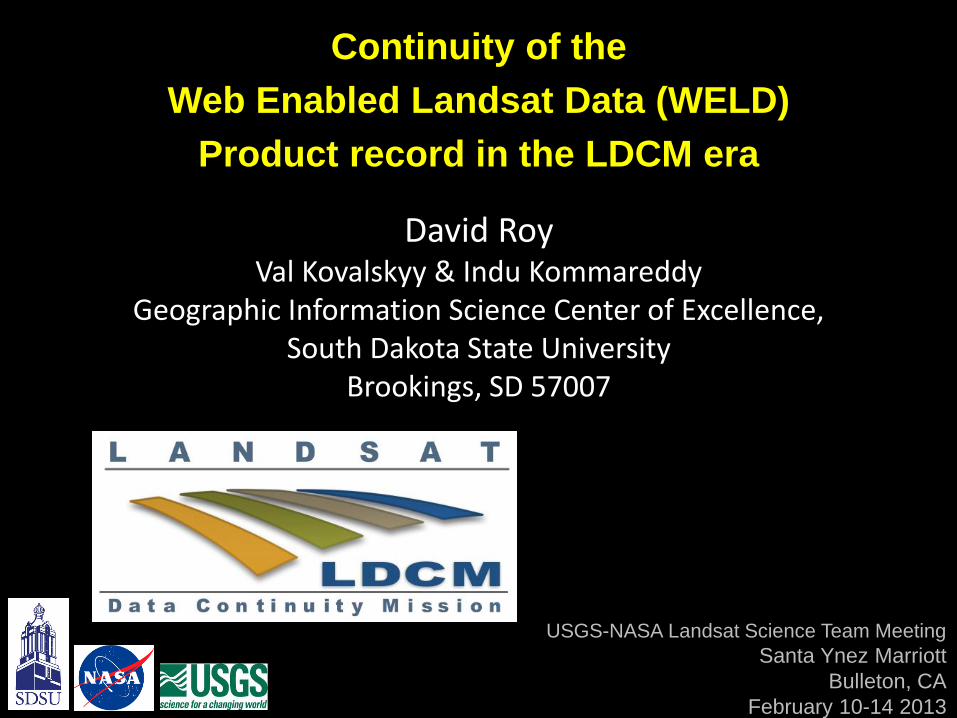
David Roy Val Kovalskyy & Indu Kommareddy
Geographic Information Science Center of Excellence, South Dakota State University
Brookings, SD 57007
Continuity of the
Web Enabled Landsat Data (WELD)
Product record in the LDCM era
USGS-NASA Landsat Science Team Meeting
Santa Ynez Marriott
Bulleton, CA
February 10-14 2013
2013+
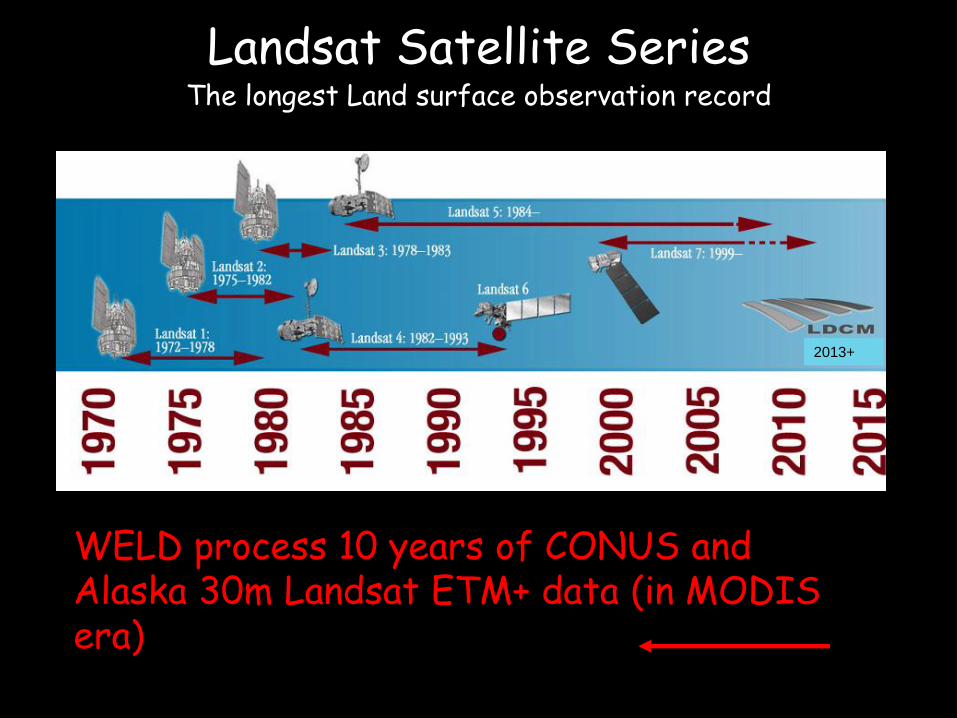
WELD process 10 years of CONUS and Alaska 30m Landsat ETM+ data (in MODIS era)
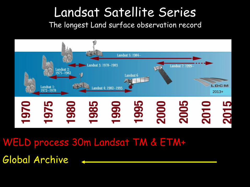
Landsat Satellite Series
The longest Land surface observation record
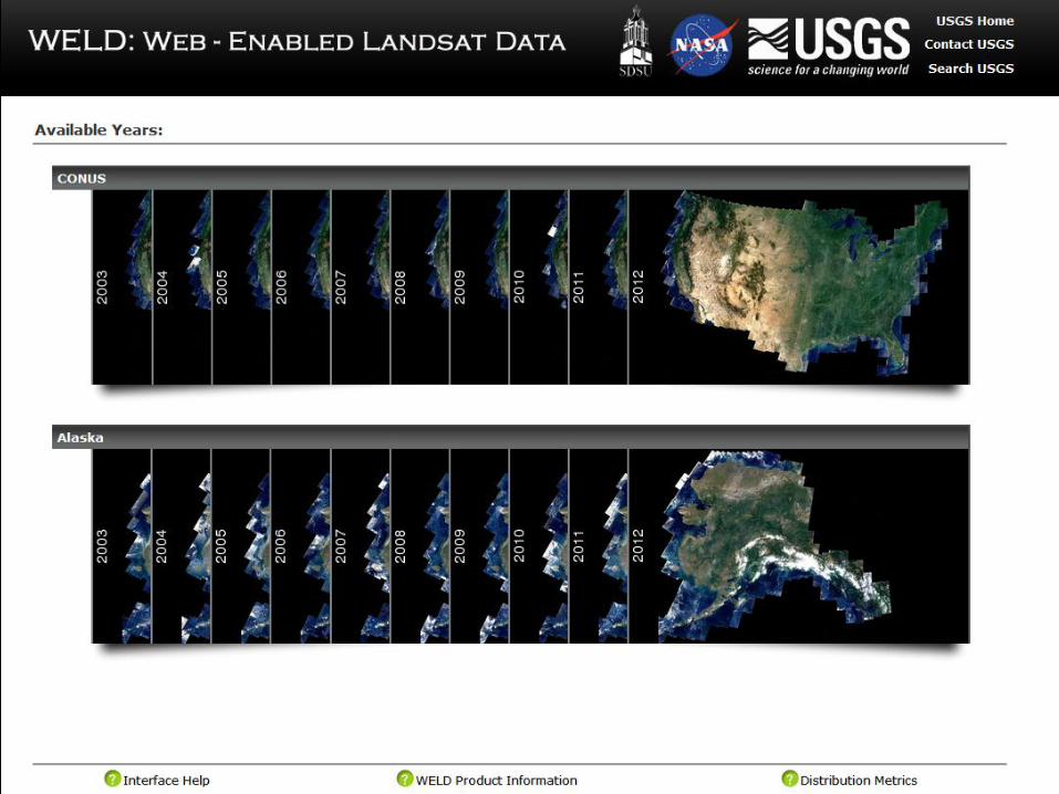
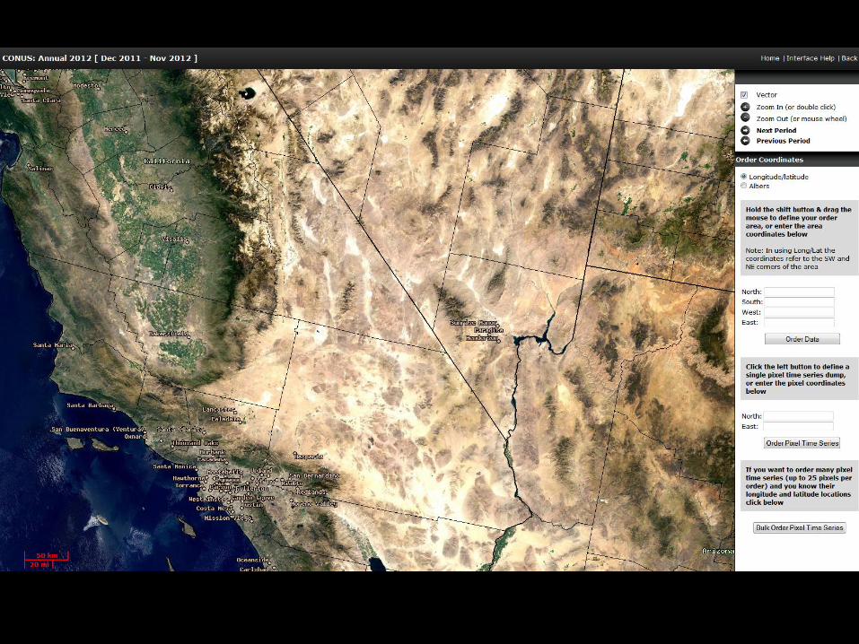
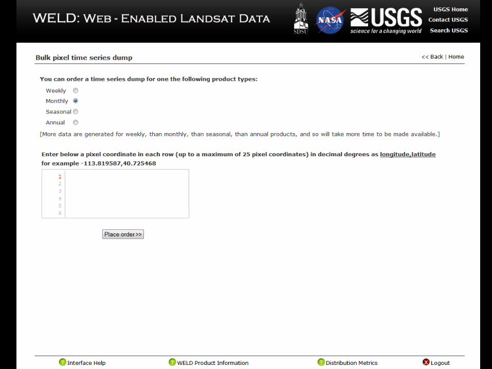
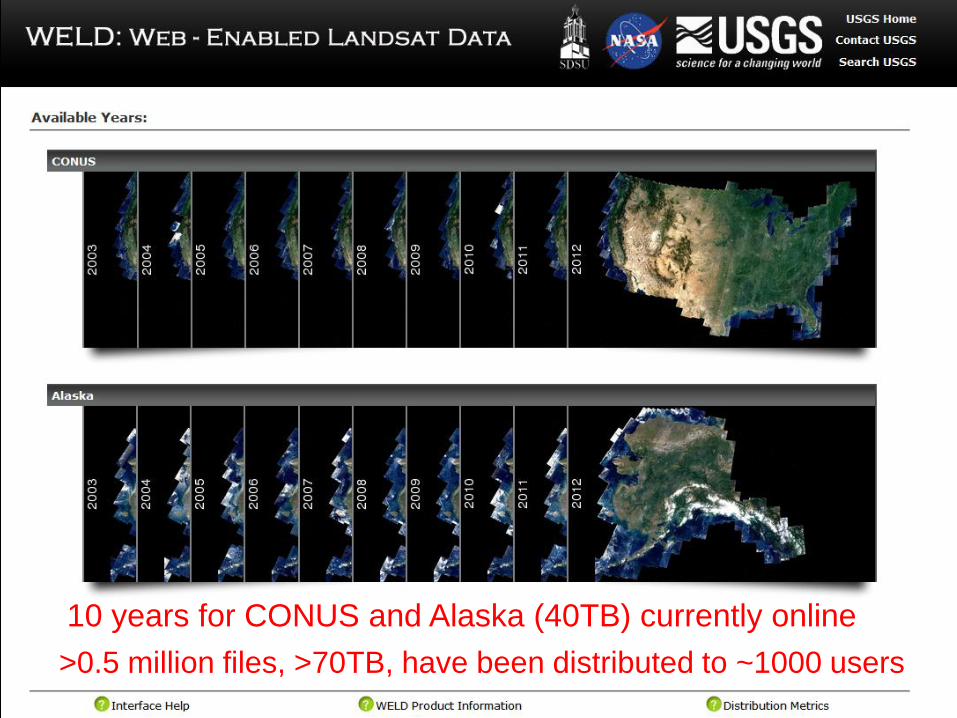
10 years for CONUS and Alaska (40TB) currently online
>0.5 million files, >70TB, have been distributed to ~1000 users
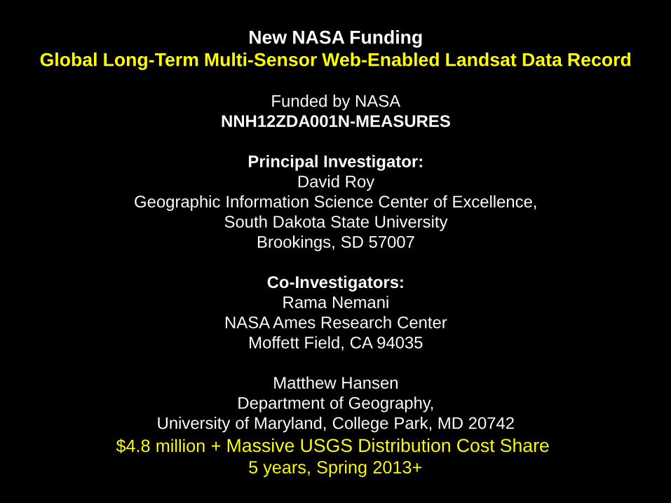
New NASA Funding
Global Long-Term Multi-Sensor Web-Enabled Landsat Data Record
Funded by NASA
NNH12ZDA001N-MEASURES
Principal Investigator:
David Roy
Geographic Information Science Center of Excellence,
South Dakota State University
Brookings, SD 57007
Co-Investigators:
Rama Nemani
NASA Ames Research Center
Moffett Field, CA 94035
Matthew Hansen
Department of Geography,
University of Maryland, College Park, MD 20742
$4.8 million + Massive USGS Distribution Cost Share 5 years, Spring 2013+
2013+
WELD process 30m Landsat TM & ETM+
Global Archive
Landsat Satellite Series
The longest Land surface observation record
CONUS Alaska
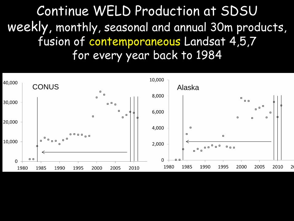
Continue WELD Production at SDSU weekly, monthly, seasonal and annual 30m products,
fusion of contemporaneous Landsat 4,5,7 for every year back to 1984
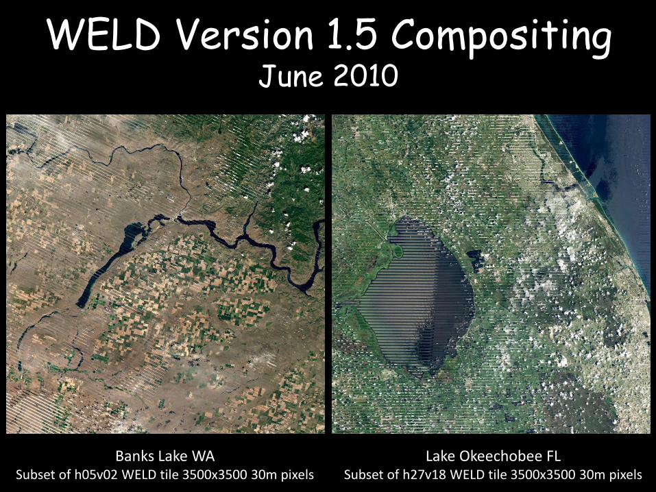
WELD Version 1.5 Compositing June 2010
Lake Okeechobee FL Subset of h27v18 WELD tile 3500x3500 30m pixels
Banks Lake WA Subset of h05v02 WELD tile 3500x3500 30m pixels
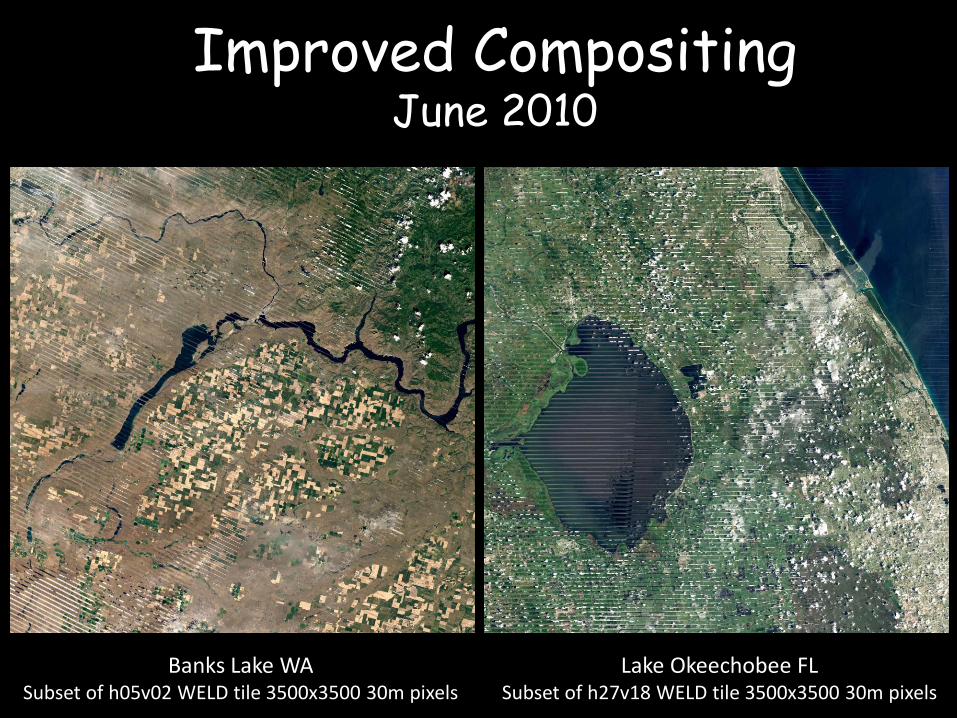
Lake Okeechobee FL Subset of h27v18 WELD tile 3500x3500 30m pixels
Banks Lake WA Subset of h05v02 WELD tile 3500x3500 30m pixels
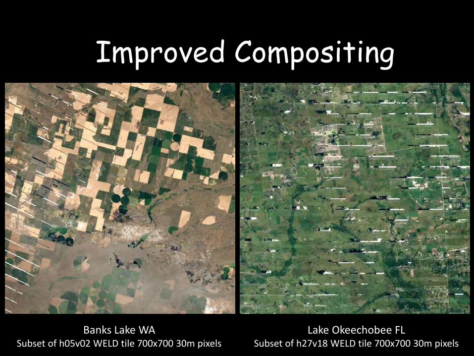
Improved Compositing June 2010
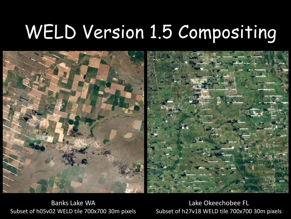
Lake Okeechobee FL Subset of h27v18 WELD tile 700x700 30m pixels
Banks Lake WA Subset of h05v02 WELD tile 700x700 30m pixels
WELD Version 1.5 Compositing
Lake Okeechobee FL Subset of h27v18 WELD tile 700x700 30m pixels
Banks Lake WA Subset of h05v02 WELD tile 700x700 30m pixels
Improved Compositing
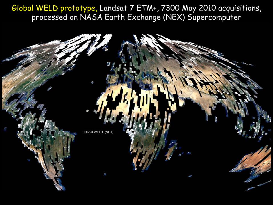
Global WELD prototype, Landsat 7 ETM+, 7300 May 2010 acquisitions, processed on NASA Earth Exchange (NEX) Supercomputer
1.8km TOA true color browse, each browse pixel generated from 60 x 60 30m pixels MODIS Land Sinusoidal Projection
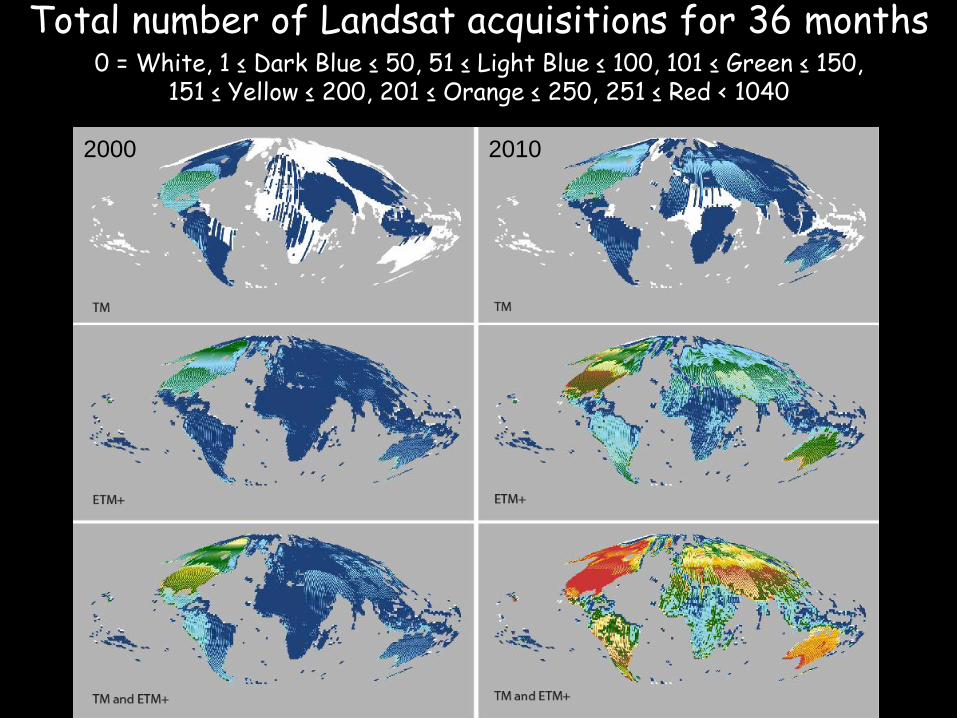
Total number of Landsat acquisitions for 36 months
0 = White, 1 ≤ Dark Blue ≤ 50, 51 ≤ Light Blue ≤ 100, 101 ≤ Green ≤ 150, 151 ≤ Yellow ≤ 200, 201 ≤ Orange ≤ 250, 251 ≤ Red < 1040
2000 2010
2000 2010
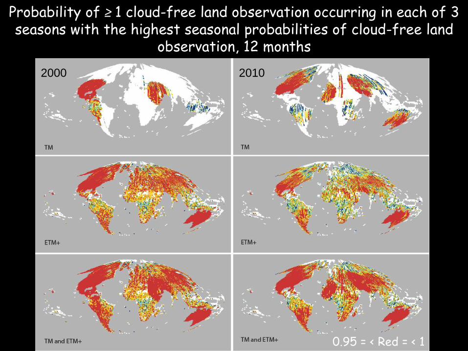
Probability of ≥ 1 cloud-free land observation occurring in each of 3 seasons with the highest seasonal probabilities of cloud-free land
observation, 12 months
0.95 = < Red = < 1
2010 2000
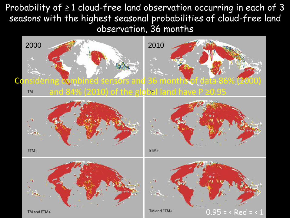
Considering combined sensors and 36 months of data 86% (2000) and 84% (2010) of the global land have P ≥0.95
0.95 = < Red = < 1
Probability of ≥ 1 cloud-free land observation occurring in each of 3 seasons with the highest seasonal probabilities of cloud-free land
observation, 36 months
2010 2000
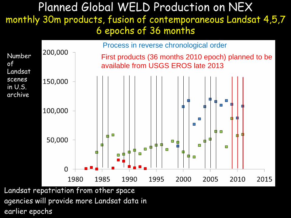
Planned Global WELD Production on NEX monthly 30m products, fusion of contemporaneous Landsat 4,5,7
6 epochs of 36 months
Landsat repatriation from other space
agencies will provide more Landsat data in
earlier epochs
Number of Landsat scenes in U.S. archive
First products (36 months 2010 epoch) planned to be
available from USGS EROS late 2013
Process in reverse chronological order
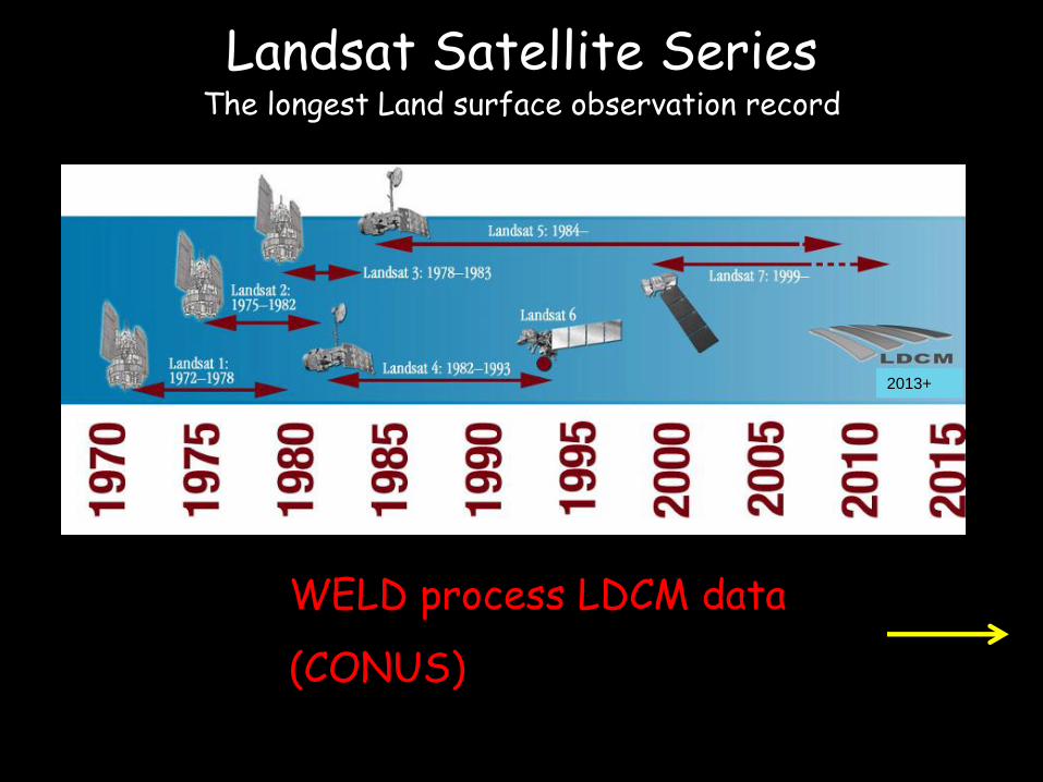
2013+
WELD process LDCM data
(CONUS)
Landsat Satellite Series
The longest Land surface observation record
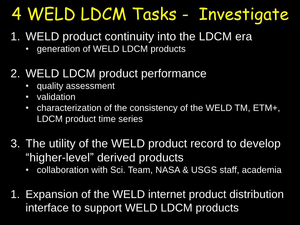
4 WELD LDCM Tasks - Investigate 1. WELD product continuity into the LDCM era
• generation of WELD LDCM products
2. WELD LDCM product performance • quality assessment
• validation
• characterization of the consistency of the WELD TM, ETM+,
LDCM product time series
3. The utility of the WELD product record to develop
“higher-level” derived products • collaboration with Sci. Team, NASA & USGS staff, academia
1. Expansion of the WELD internet product distribution
interface to support WELD LDCM products
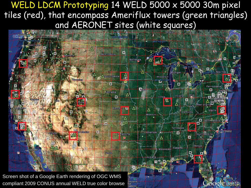
[email protected] (GEOG-484-S01) Screen shot of a Google Earth rendering of OGC WMS
compliant 2009 CONUS annual WELD true color browse
WELD LDCM Prototyping 14 WELD 5000 x 5000 30m pixel tiles (red), that encompass Ameriflux towers (green triangles)
and AERONET sites (white squares)
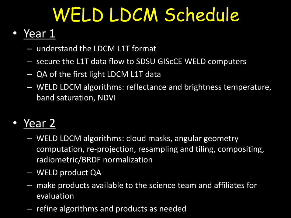
WELD LDCM Schedule
• Year 1 – understand the LDCM L1T format
– secure the L1T data flow to SDSU GIScCE WELD computers
– QA of the first light LDCM L1T data
– WELD LDCM algorithms: reflectance and brightness temperature, band saturation, NDVI
• Year 2 – WELD LDCM algorithms: cloud masks, angular geometry
computation, re-projection, resampling and tiling, compositing, radiometric/BRDF normalization
– WELD product QA
– make products available to the science team and affiliates for evaluation
– refine algorithms and products as needed
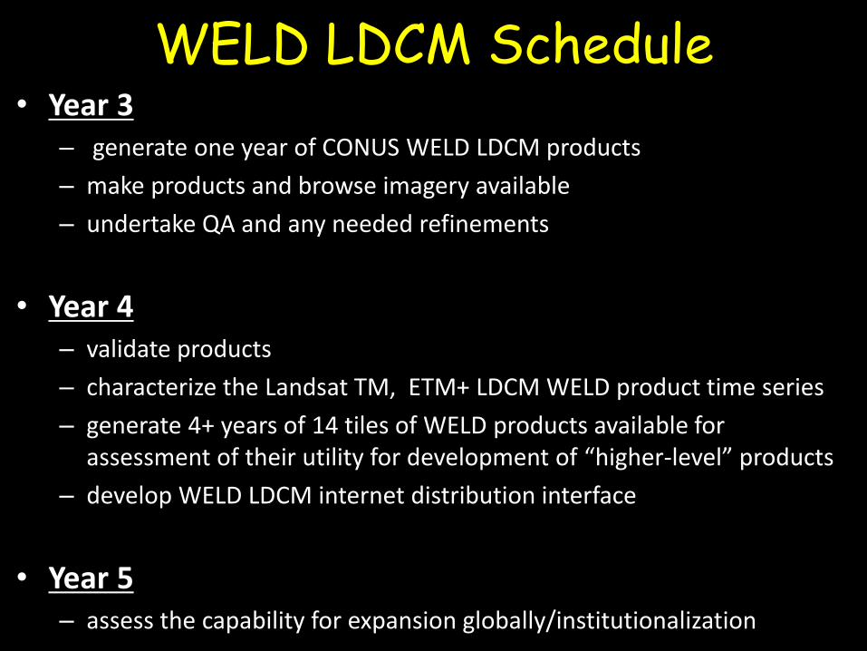
• Year 3 – generate one year of CONUS WELD LDCM products
– make products and browse imagery available
– undertake QA and any needed refinements
• Year 4
– validate products
– characterize the Landsat TM, ETM+ LDCM WELD product time series
– generate 4+ years of 14 tiles of WELD products available for assessment of their utility for development of “higher-level” products
– develop WELD LDCM internet distribution interface
• Year 5 – assess the capability for expansion globally/institutionalization
WELD LDCM Schedule