cycling route lemesos - pano platres6 lemesos - pano platres cycling route lemesos - pano platres...
TRANSCRIPT
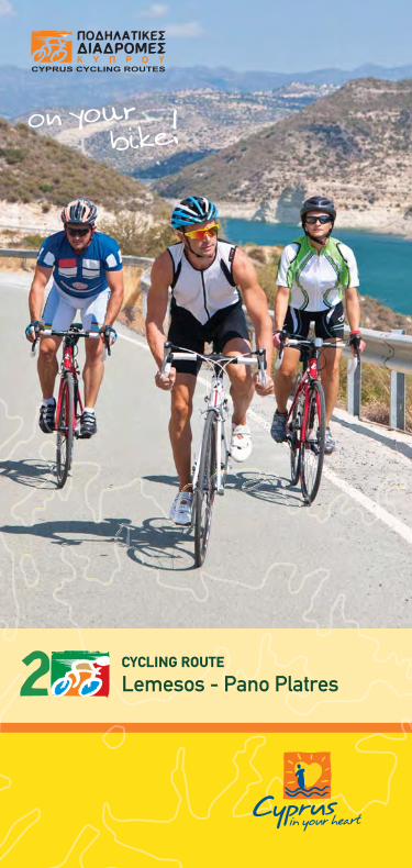
1LEMESOS - PANO PLATRES CYCLING ROUTE
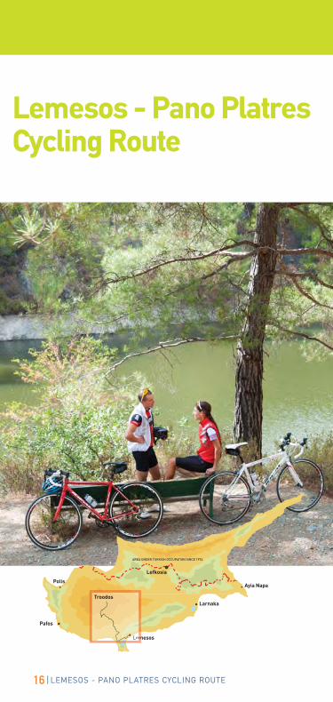
Lemesos - Pano PlatresCYCLING ROUTE
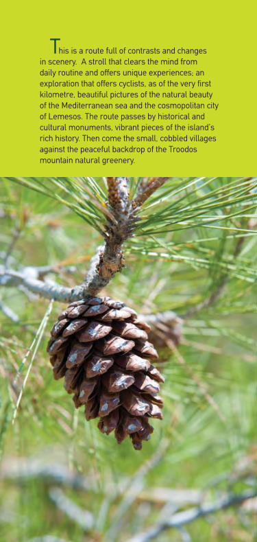
This is a route full of contrasts and changes
in scenery. A stroll that clears the mind from
daily routine and offers unique experiences; an
exploration that offers cyclists, as of the very first
kilometre, beautiful pictures of the natural beauty
of the Mediterranean sea and the cosmopolitan city
of Lemesos. The route passes by historical and
cultural monuments, vibrant pieces of the island’s
rich history. Then come the small, cobbled villages
against the peaceful backdrop of the Troodos
mountain natural greenery.
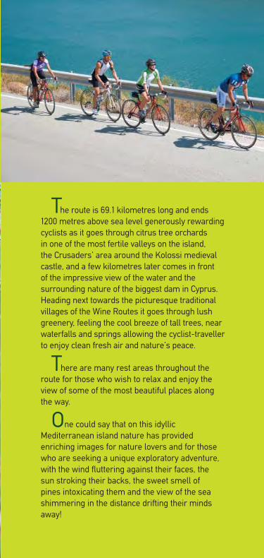
The route is 69.1 kilometres long and ends
1200 metres above sea level generously rewarding
cyclists as it goes through citrus tree orchards
in one of the most fertile valleys on the island,
the Crusaders’ area around the Kolossi medieval
castle, and a few kilometres later comes in front
of the impressive view of the water and the
surrounding nature of the biggest dam in Cyprus.
Heading next towards the picturesque traditional
villages of the Wine Routes it goes through lush
greenery, feeling the cool breeze of tall trees, near
waterfalls and springs allowing the cyclist-traveller
to enjoy clean fresh air and nature’s peace.
There are many rest areas throughout the
route for those who wish to relax and enjoy the
view of some of the most beautiful places along
the way.
One could say that on this idyllic
Mediterranean island nature has provided
enriching images for nature lovers and for those
who are seeking a unique exploratory adventure,
with the wind fluttering against their faces, the
sun stroking their backs, the sweet smell of
pines intoxicating them and the view of the sea
shimmering in the distance drifting their minds
away!

CONTENTS
Lemesos - Pano Platres Cycling Route 6
Route general information 8
Cycling Routes road signs and road markings 34
General Information 36
6 LEMESOS - PANO PLATRES CYCLING ROUTE
Lemesos - Pano PlatresCycling RouteThe Lemesos - Pano Platres Cycling Route represents
the second phase of a broader cycling network that will
eventually cover the whole of Cyprus.
This is an asphalt track surface route. Few parts of the asphalt
track surface are not in good condition. However, public
roads have both road markings and road signs for the users’
information and safety. Forest roads have only signs.
Notes:
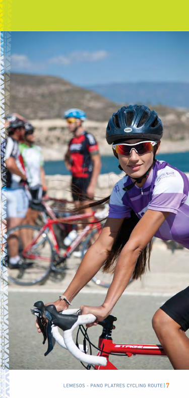
The roads included in the entire route are used jointly
by both motor vehicles and bicycles.
Cyprus uses the British left-hand traffic system, which
means that vehicles and bicycles have to use the left
lane.
When approaching a roundabout you must always give
priority to vehicles on the roundabout coming from
your right.
Cyprus uses the metric system. Altitudes are indicated
in metres and distances in kilometres.
7LEMESOS - PANO PLATRES CYCLING ROUTE
8 LEMESOS - PANO PLATRES CYCLING ROUTE
General Information
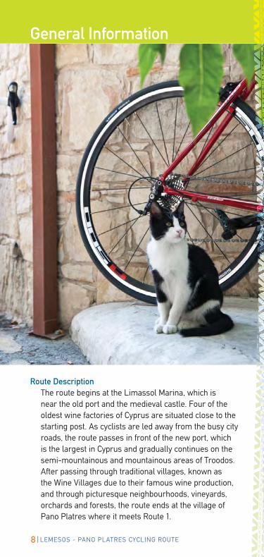
Route DescriptionThe route begins at the Limassol Marina, which is
near the old port and the medieval castle. Four of the
oldest wine factories of Cyprus are situated close to the
starting post. As cyclists are led away from the busy city
roads, the route passes in front of the new port, which
is the largest in Cyprus and gradually continues on the
semi-mountainous and mountainous areas of Troodos.
After passing through traditional villages, known as
the Wine Villages due to their famous wine production,
and through picturesque neighbourhoods, vineyards,
orchards and forests, the route ends at the village of
Pano Platres where it meets Route 1.
9LEMESOS - PANO PLATRES CYCLING ROUTE
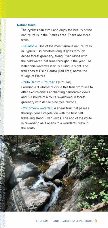
Nature trails
The cyclists can stroll and enjoy the beauty of the
nature trails in the Platres area. There are three
trails:
-Kaledonia. One of the most famous nature trails
in Cyprus, 3 kilometres long. It goes through
dense forest greenery, along River Kryos with
the cold water that runs throughout the year. The
Kaledonia waterfall is truly a unique sight. The
trail ends at Psilo Dentro (Tall Tree) above the
village of Platres.
-Psilo Dentro - Pouziaris (Circular).
Forming a 9 kilometre circle this trail promises to
offer excursionists enchanting panoramic views
and 3-4 hours of a route swallowed in forest
greenery with dense pine tree clumps.
-Myllomeris waterfall. A linear trail that passes
through dense vegetation with the first half
travelling along River Kryos. The end of the route
is rewarding as it opens to a wonderful view in
the south.
10 LEMESOS - PANO PLATRES CYCLING ROUTE
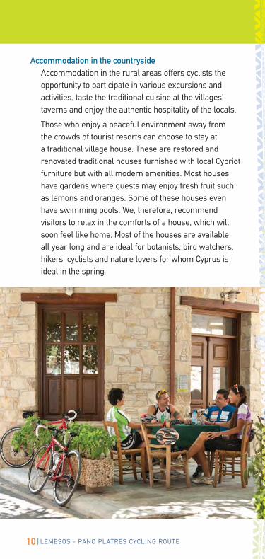
Accommodation in the countryside
Accommodation in the rural areas offers cyclists the
opportunity to participate in various excursions and
activities, taste the traditional cuisine at the villages’
taverns and enjoy the authentic hospitality of the locals.
Those who enjoy a peaceful environment away from
the crowds of tourist resorts can choose to stay at
a traditional village house. These are restored and
renovated traditional houses furnished with local Cypriot
furniture but with all modern amenities. Most houses
have gardens where guests may enjoy fresh fruit such
as lemons and oranges. Some of these houses even
have swimming pools. We, therefore, recommend
visitors to relax in the comforts of a house, which will
soon feel like home. Most of the houses are available
all year long and are ideal for botanists, bird watchers,
hikers, cyclists and nature lovers for whom Cyprus is
ideal in the spring.
11LEMESOS - PANO PLATRES CYCLING ROUTE
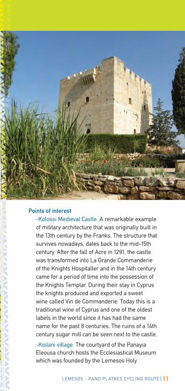
Points of interest-Kolossi Medieval Castle. A remarkable example
of military architecture that was originally built in
the 13th century by the Franks. The structure that
survives nowadays, dates back to the mid-15th
century. After the fall of Acre in 1291, the castle
was transformed into La Grande Commanderie
of the Knights Hospitaller and in the 14th century
came for a period of time into the possession of
the Knights Templar. During their stay in Cyprus
the knights produced and exported a sweet
wine called Vin de Commanderie. Today this is a
traditional wine of Cyprus and one of the oldest
labels in the world since it has had the same
name for the past 8 centuries. The ruins of a 14th
century sugar mill can be seen next to the castle.
-Koilani village. The courtyard of the Panayia
Eleousa church hosts the Ecclesiastical Museum
which was founded by the Lemesos Holy
12 LEMESOS - PANO PLATRES CYCLING ROUTE
Bishopric. The museum houses collections of
icons and ecclesiastical objects of the community
covering a period of seven centuries. Visitors may
also visit the Viniculture Museum housed in one
of the village’s traditional houses. Viniculture tools
and popular art objects are the main exhibits,
while in the courtyard there is a large boiler
for the production of zivania, the local alcoholic
drink. Outside the village of Koilani, the church
of St Mavri is still preserved with its single-nave
cupola. The church was built in the 12th century
and is decorated with frescos of the 15th century.
-Vouni. Vouni is one of the oldest vine-growing
villages and is famous for its grapes. In the past it
was the regional wine centre attracting workers
from various places during harvest. The Mavro
variety still holds the sceptre but many of the
new vineyards have been planted with Cabernet
Sauvignon and Grenache varieties. There are
also sites of cultural interest in Vouni such as old
churches and the Cyprus Donkey Sanctuary.
13LEMESOS - PANO PLATRES CYCLING ROUTE
14 LEMESOS - PANO PLATRES CYCLING ROUTE
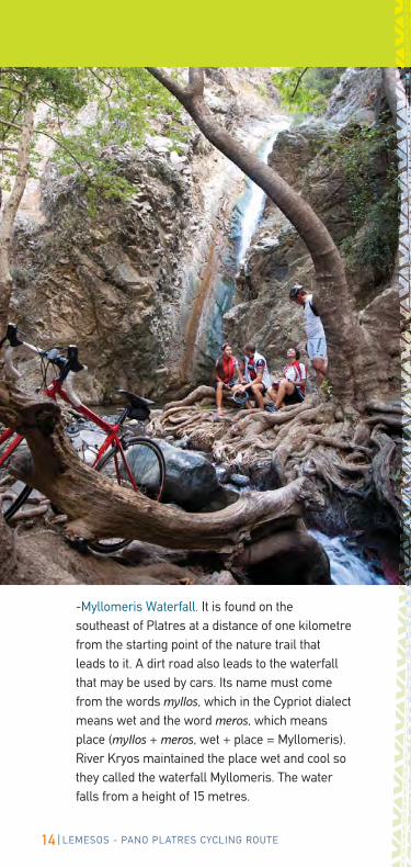
-Myllomeris Waterfall. It is found on the
southeast of Platres at a distance of one kilometre
from the starting point of the nature trail that
leads to it. A dirt road also leads to the waterfall
that may be used by cars. Its name must come
from the words myllos, which in the Cypriot dialect
means wet and the word meros, which means
place (myllos + meros, wet + place = Myllomeris).
River Kryos maintained the place wet and cool so
they called the waterfall Myllomeris. The water
falls from a height of 15 metres.
15LEMESOS - PANO PLATRES CYCLING ROUTE
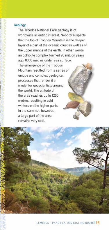
Geology.
The Troodos National Park geology is of
worldwide scientific interest. Nobody suspects
that the top of Troodos Mountain is the deeper
layer of a part of the oceanic crust as well as of
the upper mantle of the earth. In other words
an ophiolite complex formed 90 million years
ago, 8000 metres under sea surface.
The emergence of the Troodos
Mountain resulted from a series of
unique and complex geological
processes that render it a
model for geoscientists around
the world. The altitude of
the area reaches up to 1200
metres resulting in cold
winters on the higher parts.
In the summer, however,
a large part of the area
remains very cool.
16 LEMESOS - PANO PLATRES CYCLING ROUTE
A
NORTH
Lemesos - Pano PlatresCycling Route
�
��
�
�
Pafos
Lemesos
Larnaka
Lefkosia
Lem
Troodos
Ayia NapaPolis
AREA UNDER TURKISH OCCUPATION SINCE 1974
F
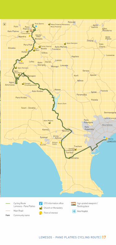
17LEMESOS - PANO PLATRES CYCLING ROUTE
AyiosIoannis
Agios Amvrosios
Agios Therapon
NORTH
Pera Pedi
Omodos
Pelendri
MandriaPERA PEDI
FOREST
PanoPlatres
Foini
Kato PlatresFaneromeni
Mesa Potamos MonasteryPsilo Dentro
Kato Kivides
Pano Kivides
Alassa FasoulaSpitali
Paramytha
Palodia
Kouris Dum
Monagri Limnatis
Laneia
Trimiklini
Kapileio
Ayios Mamas
Mesa Potamos
AyiosPavlos
AyiosTheodoros
KaloChorio
Zoopigi
Gerasa
Korfi
Apesia
Apsiou
AyiosGeorgios
Lofou
Silikou
Vouni
Moniatis
Koilani
Kouka
Doros
Kantou
ErimiEpiskopi
Kourion
Souni - Zanakia
LEMESOS
Kolossi
Trachoni
Mesa Geitonia
Ayios Athanasios
Louvaras
Germasogeia
Ypsonas
Kato Polemidia
PanoPolemidia
Tserkezi
Asomatos
Kolossi Castle
Marina
Timios Stavros
Agios Georgios
Agios Theodoros
Ayios Georgios
AyiaMavri
PanagiaChrysospiliotissa
Ayios Mamas
PanagiaChryseleousa
�
�Cycling Route Lemesos - Pano Platres
Main Road
Community name
CTO information office
Church or Monastery
Point of interest
Sign-posted viewpoint / Resting place
Area Hospital
Foini
18 LEMESOS - PANO PLATRES CYCLING ROUTE
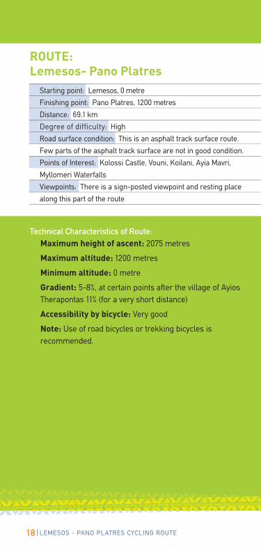
Starting point: Lemesos, 0 metre
Finishing point: Pano Platres, 1200 metres
Distance: 69,1 km
Degree of difficulty: High
Road surface condition: This is an asphalt track surface route.
Few parts of the asphalt track surface are not in good condition.
Points of Interest: Kolossi Castle, Vouni, Koilani, Ayia Mavri,
Myllomeri Waterfalls
Viewpoints: There is a sign-posted viewpoint and resting place
along this part of the route
Technical Characteristics of Route:
Maximum height of ascent: 2075 metres
Maximum altitude: 1200 metres
Minimum altitude: 0 metre
Gradient: 5-8%, at certain points after the village of Ayios
Therapontas 11% (for a very short distance)
Accessibility by bicycle: Very good
Note: Use of road bicycles or trekking bicycles is
recommended.
ROUTE: Lemesos- Pano Platres
19LEMESOS - PANO PLATRES CYCLING ROUTE
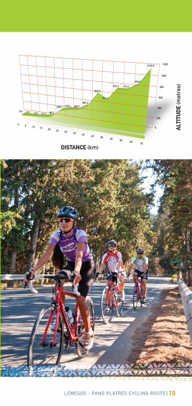
DISTANCE (km)
ALT
ITU
DE
(met
res)
20 LEMESOS - PANO PLATRES CYCLING ROUTE
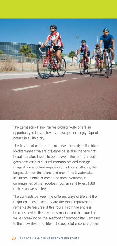
The Lemesos - Pano Platres cycling route offers an
opportunity to bicycle lovers to escape and enjoy Cypriot
nature in all its glory.
The first point of the route, in close proximity to the blue
Mediterranean waters of Lemesos, is also the very first
beautiful natural sight to be enjoyed. The 69.1 km route
goes past various cultural monuments and through
magical areas of low vegetation, traditional villages, the
largest dam on the island and one of the 3 waterfalls
in Platres. It ends at one of the most picturesque
communities of the Troodos mountain and forest 1200
metres above sea level!
The contrasts between the different ways of life and the
major changes in scenery are the most important and
remarkable features of this route. From the endless
beaches next to the luxurious marina and the sound of
waves breaking on the seafront of cosmopolitan Lemesos
to the slow rhythm of life in the peaceful greenery of the
21LEMESOS - PANO PLATRES CYCLING ROUTE
mountain forest, cyclists will travel in a very short time
through two different worlds that seem dissimilar at
first but are in essence strongly connected to Cypriot
culture and tradition.
The starting point of this route is the Limassol Marina
where cyclists can find the first signpost showing the
route map, the points of interest, and the chart with the
altitude difference.
The cyclists will cover the first kilometres of the route
in the city of Lemesos and must ride carefully due to
traffic.

22 LEMESOS - PANO PLATRES CYCLING ROUTE
Very close to the starting point, one kilometre to the
south, there are four of the oldest wine factories in
Cyprus (KEO, SODAP, LOEL, ETKO).
After 2.7 km the route turns to the left and the
cyclists can see the Lemesos Port, which is
the biggest port in Cyprus. Even though
the road is still wide, the cyclists are
led away from the city and closer to a
quieter environment. At the big roundabout
at 3.1 km, they must take the 4th exit having
the Lemesos Port on their left.
The bicycle track starts after 2.4 km,
specifically at 5.5 km of the route, passes
by three intersections and goes north
where one of the largest shopping malls in Lemesos
is found.
At the next roundabout (7km) the route changes
course to the west and the cyclists come into the big
plain of the Tserkezi area. The plain is planted with
citrus trees that yield sufficient quantities of fruit
to cover the needs of the local market and for the
production of fruit drinks.
Throughout the plain the cyclists can enjoy the shade
of tall cypress trees. The conditions in these parts
of the route are ideal for cycling even when the
temperature is quite high.
After the village of Assomatos, at 12.4 km the route
changes direction again this time to the north on the
way to the Kolossi community, with an unexpected
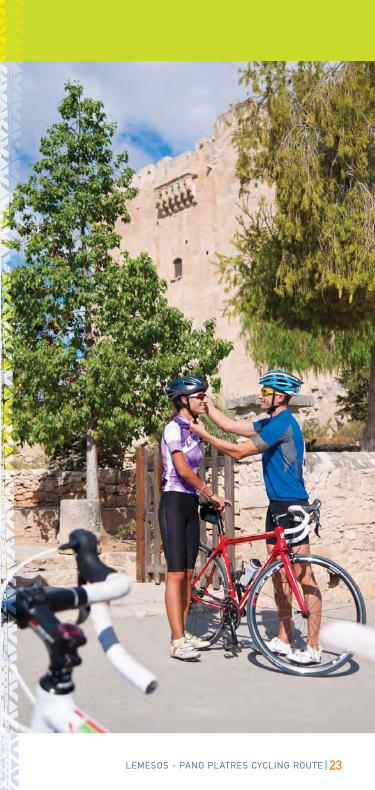
view of the medieval castle appearing at 15.8 km. The
castle was built in 1210 AD by the Franks who wanted
to have control over the sugar cane plantations in the
area. For those who like exploring, it is worth stopping
and visiting the castle.
One kilometre further on the route there is a stop sign
23LEMESOS - PANO PLATRES CYCLING ROUTE
24 LEMESOS - PANO PLATRES CYCLING ROUTE
and the cyclists should turn right towards Ypsonas where
at 19.7 km they will turn left to go through the heart of the
village. At 21.3 km they turn left again to go to the largest
water dam in Cyprus. At this point the route goes uphill
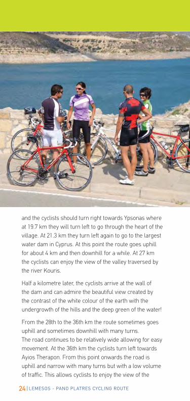
for about 4 km and then downhill for a while. At 27 km
the cyclists can enjoy the view of the valley traversed by
the river Kouris.
Half a kilometre later, the cyclists arrive at the wall of
the dam and can admire the beautiful view created by
the contrast of the white colour of the earth with the
undergrowth of the hills and the deep green of the water!
From the 28th to the 36th km the route sometimes goes
uphill and sometimes downhill with many turns.
The road continues to be relatively wide allowing for easy
movement. At the 36th km the cyclists turn left towards
Ayios Therapon. From this point onwards the road is
uphill and narrow with many turns but with a low volume
of traffic. This allows cyclists to enjoy the view of the
25LEMESOS - PANO PLATRES CYCLING ROUTE
surrounding mountains and hills as well as the dense
undergrowth in combination with the sparse vegetation
of pines and vines. They are now in the area of the
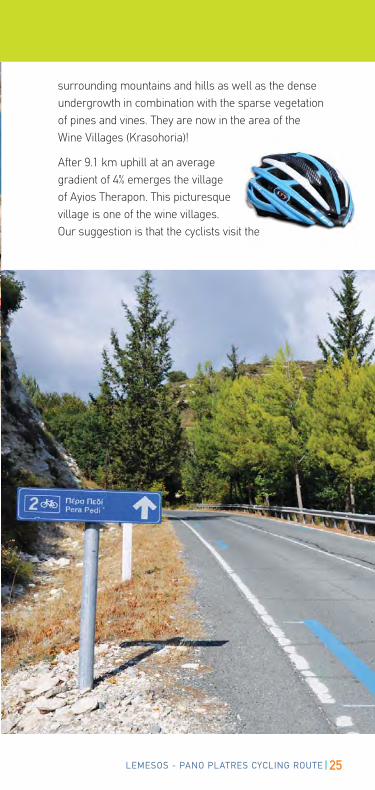
Wine Villages (Krasohoria)!
After 9.1 km uphill at an average
gradient of 4% emerges the village
of Ayios Therapon. This picturesque
village is one of the wine villages.
Our suggestion is that the cyclists visit the the
26 LEMESOS - PANO PLATRES CYCLING ROUTE
27LEMESOS - PANO PLATRES CYCLING ROUTE
village and admire the traditional architecture of its
neighbourhoods. It is a settlement emerging in a
unique natural landscape. Most of the streets are
paved with pebbles reminiscent of mosaics while
some, especially on the edges of the village, are
cobbled. What is particularly impressive are the twelve
traditional Vota. Vota is a type of original construction,
which can be found in very few villages in Cyprus. It is
a vaulted room on the ground floor that the residents
used as a storage room for vats of wine or even as an
animal stable. The upper floor was built on top with
local stone and it was the residents’ living area.
The centre of the village is also very picturesque with
a coffee shop where the cyclists can rest and taste a
Cypriot coffee! Those who choose to visit the village
should be careful on their way out because the road
has a steep descent.
The distance between Ayios Therapon and Ayios
Amvrosios is 4km downhill at an average gradient
of 5-6% and an uphill gradient of 6.5%. At 49.5 km the
road intersects with E601 and cyclists must bear right.
The village of Ayios Amvrosios is on the left hand
side with its imposing church dating back to the 14th
century. The village is also known for its vinicultures
and its famous wines.
Leaving Ayios Amvrosios and E601 cyclists must
turn right towards Vouni. The route is uphill for 5 km
at an average gradient of 5%. The road is wide and
comfortable without any significant traffic. At 54.4 km
cyclists enter and cross the very unique village of
Vouni. This village with its cobbled streets, traditional
houses with wooden doors, large windows, narrow
balconies, and patios is rich in architectural heritage
attracting local and foreign visitors alike. The scenic
and peaceful coffee shops and traditional restaurants
invite visitors to sit and relax!
28 LEMESOS - PANO PLATRES CYCLING ROUTE
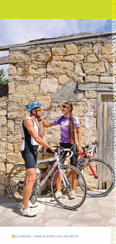
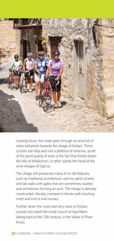
Leaving Vouni, the route goes through an area full of
vines and pines towards the village of Koilani. There,
cyclists can stop and visit a plethora of wineries, proof
of the good quality of wine is the fact that Koilani bears
the title of Kefalochori, in other words the Head of the
wine villages of Cyprus.
The village still preserves many of its old features,
such as traditional architecture, narrow uphill streets,
and tall walls with gates that are sometimes vaulted
and sometimes forming an arch. The village is densely
constructed, literally cramped in blocks with touching
roofs and end to end houses.
Further down the route and very close to Koilani,
cyclists will reach the small church of Ayia Mavri,
dating back to the 12th century, in the Valley of River
Kryos.
29LEMESOS - PANO PLATRES CYCLING ROUTE
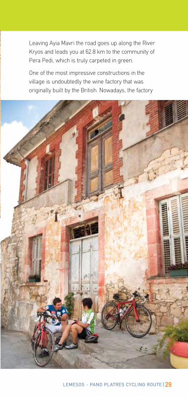
Leaving Ayia Mavri the road goes up along the River
Kryos and leads you at 62.8 km to the community of
Pera Pedi, which is truly carpeted in green.
One of the most impressive constructions in the
village is undoubtedly the wine factory that was
originally built by the British. Nowadays, the factory
30 LEMESOS - PANO PLATRES CYCLING ROUTE
receives annually three million kilos of black grapes
from the greater area.
Another impressive construction in the village is the
traditional Water Mill that was operating until the ‘40’s
and which has been declared as an Ancient Monument.
At this point, cyclists have the option to follow the
cycling route or the alternative route through the
communities of Mandria and Kato Platres of which
the uphill gradients are not as steep. This route meets
Route 1 and ends at the final destination of Route 2.
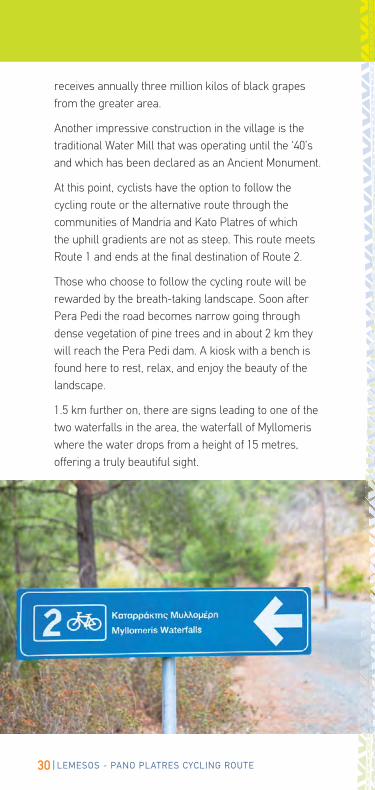
Those who choose to follow the cycling route will be
rewarded by the breath-taking landscape. Soon after
Pera Pedi the road becomes narrow going through
dense vegetation of pine trees and in about 2 km they
will reach the Pera Pedi dam. A kiosk with a bench is
found here to rest, relax, and enjoy the beauty of the
landscape.
1.5 km further on, there are signs leading to one of the
two waterfalls in the area, the waterfall of Myllomeris
where the water drops from a height of 15 metres,
offering a truly beautiful sight.
31LEMESOS - PANO PLATRES CYCLING ROUTE
32 LEMESOS - PANO PLATRES CYCLING ROUTE
33LEMESOS - PANO PLATRES CYCLING ROUTE
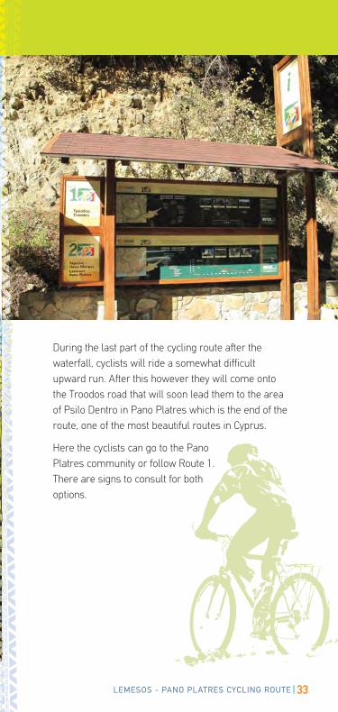
During the last part of the cycling route after the
waterfall, cyclists will ride a somewhat difficult
upward run. After this however they will come onto
the Troodos road that will soon lead them to the area
of Psilo Dentro in Pano Platres which is the end of the
route, one of the most beautiful routes in Cyprus.
Here the cyclists can go to the Pano
Platres community or follow Route 1.
There are signs to consult for both
options.
34 LEMESOS - PANO PLATRES CYCLING ROUTE
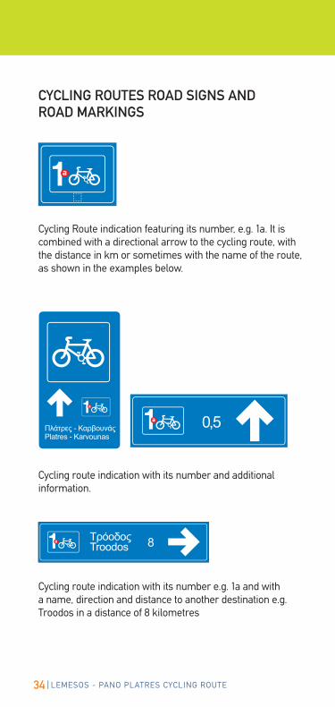
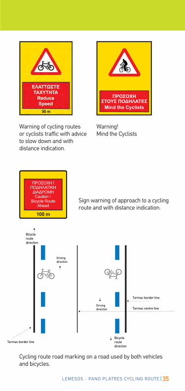
Cycling Route indication featuring its number, e.g. 1a. It is combined with a directional arrow to the cycling route, with the distance in km or sometimes with the name of the route, as shown in the examples below.
Cycling route indication with its number and additional information.
Cycling route indication with its number e.g. 1a and with a name, direction and distance to another destination e.g. Troodos in a distance of 8 kilometres
CYCLING ROUTES ROAD SIGNS AND ROAD MARKINGS
Ta
35LEMESOS - PANO PLATRES CYCLING ROUTE
Sign warning of approach to a cycling route and with distance indication.
Cycling route road marking on a road used by both vehicles and bicycles.
Bicycle routedirection
Bicycle routedirection
Driving direction
Driving direction
Tarmac border line
Tarmac border line
Tarmac centre line
Warning of cycling routes or cyclists traffic with advice to slow down and with distance indication.
Warning! Mind the Cyclists
36 LEMESOS - PANO PLATRES CYCLING ROUTE
Cycling Centres / StationsBike CyprusColumbia Beach Resort - Pissouri BayTel/Fax: +357 25634093 Mob: +357 99 [email protected]@[email protected] station manager: Thomas Wegmueller
Bikin’Cyprus AdventuresMina Antoniou 8, Tochni CY-7740, LarnacaMob: +357 97702200info@bikincyprusadventures.comwww.bikincyprusadventures.comBike station manager: Mike Hadjioannou
Cyprus Villages Bike Station7733 Kalavasos village (in the village square)Mob: +357 99587325, Tel: +357 [email protected] station managers: Anna Bickei and Borje Ekstam
Mountain Bike CyprusKoukliaTel: +357 26432033Mob: +357 96518061Mob: +357 96518062 [email protected] (for Mountain bikes)
[email protected] (for Road bikes)Manager: Alan Yates
Wheelie CyprusOperation base: 3km outside of Polis (off the E709 between Prodromi and Drousia) Tel: +357 99350898Mob: +357 [email protected] Person: Helen Smeaton
Zephyros Adventure SportsShop No 7, Royal Complex, Tombs of the Kings Road, 8046 PafosTel: +357 26 930037Fax: +357 26 930037Mob: +357 99 [email protected] station manager: Lee Stevens
ZypernbikeGeorge Mouskis AvenueLatouros District, Alaminos opposite Hotel Club Aldiana (operation base)Mob: +357 99838167 (Station)Fax: +49-6093-9737-16info@zypernbike.dewww.zypernbike.dewww.cyprus-village.deManager: Alfred Baum
USEFUL TELEPHONESPOLICEFIRE BRIGADEFIRST AID
112
Note: Cycling centres are considered premises manned with full-time personnel and equipped with all the necessary equipment for cycling, such as adequate number of bicycles, helmets, accessories, cleaning and storage facility etc. They also provide satisfactory information concerning routes, car escort service and support to organised excursions as well as the provision of cycling guide for organised groups.
LC(LPTFEW
A(CT
LaT
bP(T
cPST
LaLΤ
bCT
Rural AccommodationCyprus Agrotourism CompanyTel: +357 22340071, Fax: +357 22334764, www.agrotourism.com.cy
USEFUL INFORMATION Cyprus Cycling FederationOlympic House, 21, Amfipoleos Str., Office 220, 2025 LefkosiaTel: +357 22449870, Fax: + 357 22449871, E-mail: [email protected]
37LEMESOS - PANO PLATRES CYCLING ROUTE
For more information regarding the CTO offices abroad, please visit the website www.visitcyprus.com
OFFICES ABROAD
CYPRUS TOURISM ORGANISATIONΓ
IN CYPRUSLefkosiaCyprus Tourism Organisation(Head Offices)Leoforos Lemesou 19, LefkosiaP.C. 24535, LefkosiaTel: +357 22 691 100Fax: +357 22 331 644E-mail: [email protected]:www.visitcyprus.com
Aristokyprou 11, Laiki Geitonia(East of Plateia Eleftherias)CY 1011 LefkosiaTel: 22 67 42 64, Fax: 22 66 07 78
Lemesosa) Agiou Andreou 142, CY 3036 LemesosTel: 25 36 27 56, Fax: 25 74 65 96
b) Georgiou Α’ 22, CY 4047 LemesosPotamos tis Germasogeias(eastern entrance of Dasoudi beach)Tel: 25 32 32 11, Fax: 25 31 34 51
c) Lemesos HarbourP.O.Box 55605, CY 3781 LemesosServices to all passenger boatsTel: 25 57 18 68, Fax: 25 56 03 43
Larnakaa) Plateia Vasileos Pavlou, CY 6023 LarnakaΤηλ. 24 65 43 22, Φαξ: 24 65 34 92
b) Larnaka International AirportCY 7130 LarnakaTel: 24 00 83 68, Fax: 24 00 83 69
Pafosa) Agoras 8, CY 8010 PafosTel: 26 93 28 41, Fax: 26 95 33 41
b) Poseidonos Ave. 63Α, CY 8042, Kato PafosTel: 26 93 05 21, Fax: 26 93 05 19
γ) Pafos International AirportTel: 26 00 73 68 (Service to all flights)Fax: 26 00 73 69
Polis Vasileos Stasioikou Α’ 2, CY 8820, Polis ChrysochousTel: 26 32 24 68, Fax: 26 32 13 27
Agia NapaLeoforos Kryou Nerou 12, CY 5330 Agia NapaTel: 23 72 17 96, Fax: 23 72 45 07
Paralimni - ProtarasLeoforos Protara 14, CY 5296 ParalimniTel: 23 83 28 65, Fax: 23 83 28 64
PlatresCY 4820 PlatresTel: 25 42 13 16, Fax: 25 81 30 80
Production: Cyprus Tourism Organisation
Text: Cyprus Tourism Organisation, Mike Hadjioannou
Design: Appios Communications Ltd
Photography: Cyprus Tourism Organisation, Nicos Louca
Printing: Laser Graphics Ltd
11’ 2013
CODE:166.01.13

The project was implemented
by the Cyprus Tourism Organisation
and co-financed by the European Agricultural Fund
for Rural Development (EAFRD).
Europe investing in rural areas.
REPUBLIC OF CYPRUS EUROPEAN UNIONCYPRUS
TOURISM ORGANISATION