crowsnest fishing holes - vic bergman
TRANSCRIPT
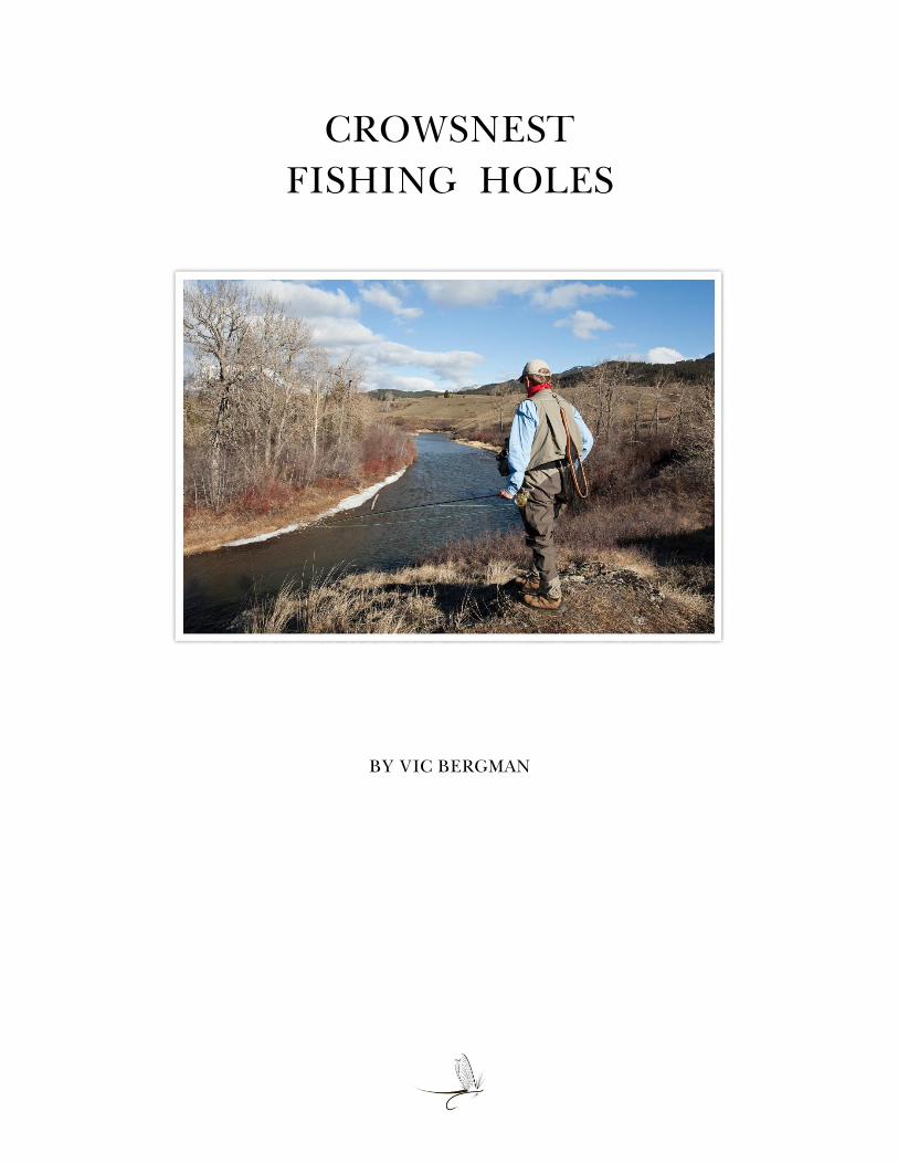
CROWSNEST
FISHING HOLES
BY VIC BERGMAN
Table of Contents
Introduction ........................................................................................... 1
Oldman Reservoir to Lundbreck Falls .................................................. 4
Lundbreck Falls to Highway 507 Bridge .............................................. 9
Highway 507 Bridge to East Hillcrest Bridge ...................................... 17
East Hillcrest Bridge to Frank .............................................................. 22
Frank to Crowsnest Lake ...................................................................... 30
Final Thoughts ...................................................................................... 34
References & Credits ............................................................................. 35

Page | 1
Crowsnest Fishing Holes
It’s not unusual for popular trout streams to have stretches of their waters named by anglers.
Alberta’s Bow River is a good example, with places like Must Be Nice, Policeman’s Flats, Far
& Fine, and the Trico Hole.
The Crowsnest River also has stretches of water that have been named. Providing the anglers you
are speaking with are familiar with these places, it’s a good way of letting them know where you
were fishing, and which pool or run might have been productive – or not!
I like the idea of having names attached to some of the waters I fish. It evokes a sense of history,
tradition, and lore, and provides a connection to those anglers who visited these places long
before me.
Horseshoe Bend on the Crowsnest River – Oct., 1983

Page | 2
There’s always a reason why a fishing hole has been given a special name. Sometimes, it’s
named in honor of a person – perhaps an angler who frequented the place at one time. It could be
named after a landowner whose property adjoins the river. The name could also refer to an
access point or a nearby landmark such as a bridge. It could describe the surrounding landscape
or a unique feature in the river. Other times, the name may have been inspired by an interesting
or unusual event that occurred while someone was fishing there.
1923 Bridge Pool on the Crowsnest River – July, 2005
Angler: Bill Young
Fishing Holes on the Crow
Like the Bow, the Crowsnest River has various reaches, runs, and pools that have been named by
anglers over the years. There’s nothing official about any of these names, and the only maps you
will find them listed on are those that are hastily-scribbled by someone on a scrap piece of paper
or napkin. Some of these places have more than one name – it all depends on who you are
conversing with. Anglers from another generation, or different circles of friends, may have a
different name for the same stretch of water. Some Crowsnest River names go back decades and
remain in use to this day. There are names of fishing holes on the river that have been forgotten
and lost over time, and there are places that will come to have new names in the future.
Rainbow Ridge – 1989
Angler: Blair Spence

Page | 3
While selecting the photos for this article, I thought it might be interesting to include some of my
vintage ones – pictures dating to the early 1980s. Others were taken as recently as this year. The
surroundings in some of the early photographs have changed since I took them, but in most
cases, the locations should be recognizable to anyone fishing here today.
The photos and comments begin on the lower river, where it enters the Oldman Reservoir, and
progress upstream. The majority of places shown can be reached by walking along the river from
bridges and other public access points. Please respect private property and be sure to obtain
permission from landowners, prior to crossing their land.
While working on this piece, I contacted a number of long-time Crowsnest River anglers for
information on various places along the river. I thank everyone for their response and help with
this.
The Corrals – 2001
Angler: Peter Amundsen

Page | 4
Oldman Reservoir to Lundbreck Falls
The Stone House (a.k.a. The Drewry House, Rener’s Farmhouse)
This historic home is located immediately downstream of the Todd Creek Day-Use Area. It was
constructed in 1910 of locally quarried sandstone. The structure was spared during construction
of the Oldman Dam. Upon completion of the dam in 1992, approximately 8 kilometers (5 miles)
of the lower Crowsnest became flooded. Today, the Stone House stands next to where the river
empties into the reservoir. At one time, the waters downstream of here produced some of the
largest trout in the river. For those who remember watching Jim McLennan in his 1992 video,
Fishing Southern Alberta Trout Streams, this is where he battles and lands a magnificent
Crowsnest rainbow trout.
The Stone House – 1989
Eric’s Bend
Named by Bob Costa in remembrance of his friend, Eric Brown. They met on the Crow and
enjoyed fishing the river together, until Eric’s passing in 2009.
Eric’s Bend – 2019
Angler: Bob Costa
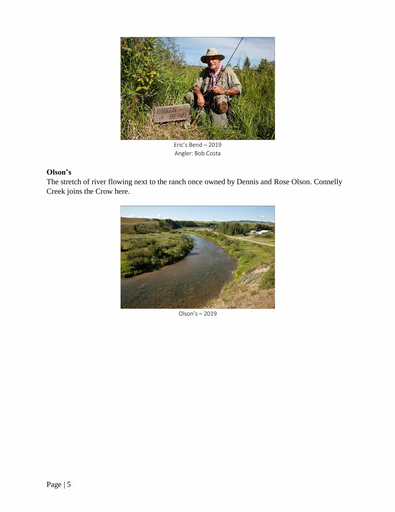
Page | 5
Eric’s Bend – 2019
Angler: Bob Costa
Olson’s
The stretch of river flowing next to the ranch once owned by Dennis and Rose Olson. Connelly
Creek joins the Crow here.
Olson’s – 2019
Page | 6
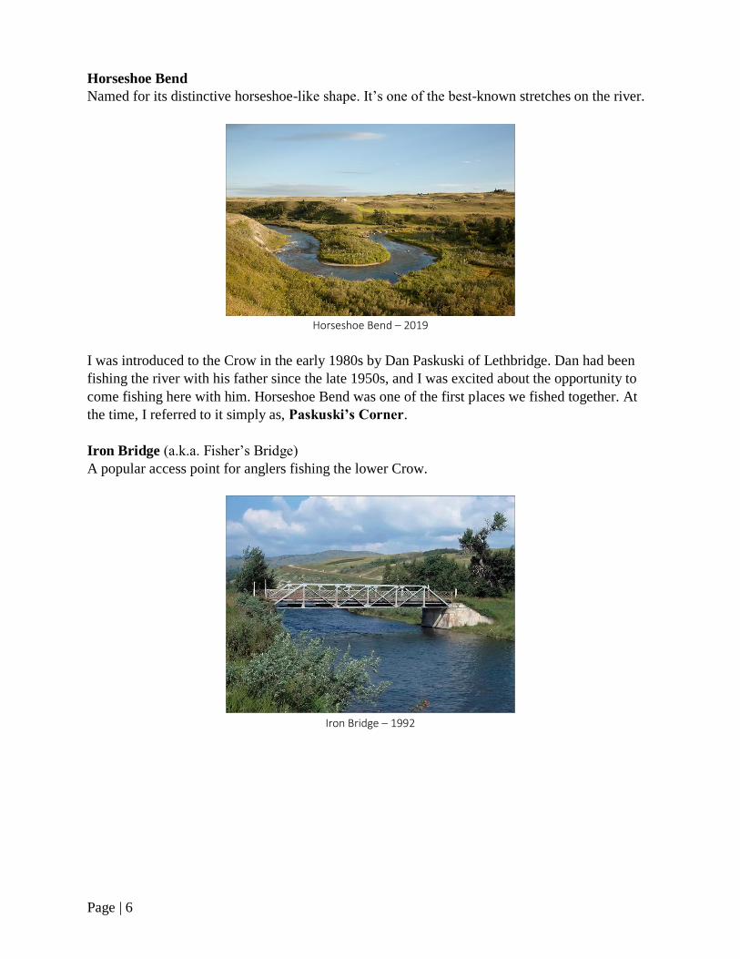
Horseshoe Bend
Named for its distinctive horseshoe-like shape. It’s one of the best-known stretches on the river.
Horseshoe Bend – 2019
I was introduced to the Crow in the early 1980s by Dan Paskuski of Lethbridge. Dan had been
fishing the river with his father since the late 1950s, and I was excited about the opportunity to
come fishing here with him. Horseshoe Bend was one of the first places we fished together. At
the time, I referred to it simply as, Paskuski’s Corner.
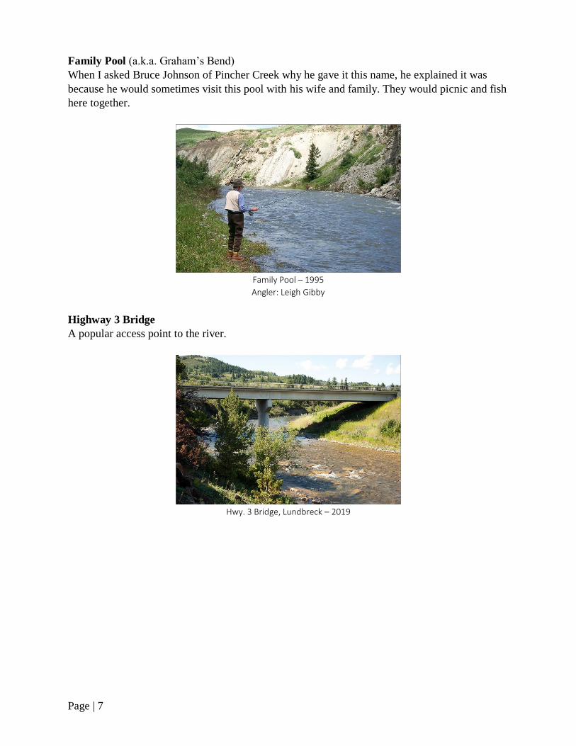
Iron Bridge (a.k.a. Fisher’s Bridge)
A popular access point for anglers fishing the lower Crow.
Iron Bridge – 1992
Page | 7
Family Pool (a.k.a. Graham’s Bend)
When I asked Bruce Johnson of Pincher Creek why he gave it this name, he explained it was
because he would sometimes visit this pool with his wife and family. They would picnic and fish
here together.
Family Pool – 1995
Angler: Leigh Gibby
Highway 3 Bridge
A popular access point to the river.
Hwy. 3 Bridge, Lundbreck – 2019

Page | 8
Rat Hole
A deep pool located a short distance downstream of Lundbreck Falls Campground. Sometimes,
it’s used as a swimming hole by local kids from Lundbreck.
Rat Hole – 2019
Lundbreck Falls (a.k.a. The Falls)
One of the most popular and photographed places on the river. A provincial campground is
located immediately downstream of the falls.
Lundbreck Falls – July, 1990
Page | 9
Lundbreck Falls to Highway 507 Bridge
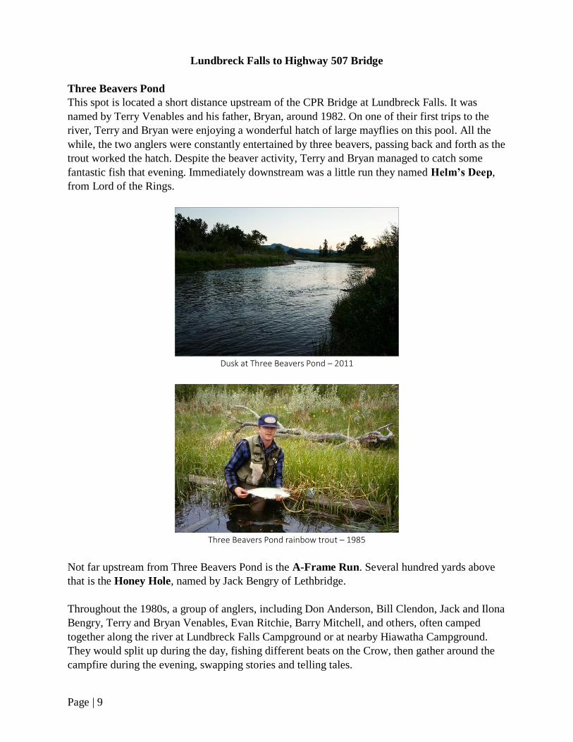
Three Beavers Pond
This spot is located a short distance upstream of the CPR Bridge at Lundbreck Falls. It was
named by Terry Venables and his father, Bryan, around 1982. On one of their first trips to the
river, Terry and Bryan were enjoying a wonderful hatch of large mayflies on this pool. All the
while, the two anglers were constantly entertained by three beavers, passing back and forth as the
trout worked the hatch. Despite the beaver activity, Terry and Bryan managed to catch some
fantastic fish that evening. Immediately downstream was a little run they named Helm’s Deep,
from Lord of the Rings.
Dusk at Three Beavers Pond – 2011
Three Beavers Pond rainbow trout – 1985
Not far upstream from Three Beavers Pond is the A-Frame Run. Several hundred yards above
that is the Honey Hole, named by Jack Bengry of Lethbridge.
Throughout the 1980s, a group of anglers, including Don Anderson, Bill Clendon, Jack and Ilona
Bengry, Terry and Bryan Venables, Evan Ritchie, Barry Mitchell, and others, often camped
together along the river at Lundbreck Falls Campground or at nearby Hiawatha Campground.
They would split up during the day, fishing different beats on the Crow, then gather around the
campfire during the evening, swapping stories and telling tales.
Page | 10
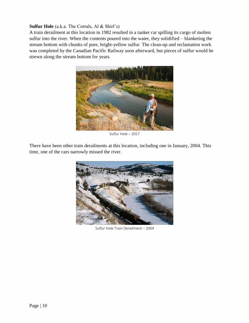
Sulfur Hole (a.k.a. The Corrals, Al & Shirl’s)
A train derailment at this location in 1982 resulted in a tanker car spilling its cargo of molten
sulfur into the river. When the contents poured into the water, they solidified – blanketing the
stream bottom with chunks of pure, bright-yellow sulfur. The clean-up and reclamation work
was completed by the Canadian Pacific Railway soon afterward, but pieces of sulfur would be
strewn along the stream bottom for years.
Sulfur Hole – 2017
There have been other train derailments at this location, including one in January, 2004. This
time, one of the cars narrowly missed the river.
Sulfur Hole Train Derailment – 2004

Page | 11
Weigh Scales
The section of river upstream of the Sulfur Hole, toward the Burmis Weigh Station Scales on
Hwy. 3.
Weigh Scales stretch in distance – 2017
Bedside Manor Bed & Breakfast (a.k.a. Sara’s)
Owned and operated by Shirley and Bill Sara, this popular B&B is located along the stretch of
river upstream of the Weigh Scales.
The Bedside Manor – 1992

Page | 12
The three-story home, constructed in 1904, was moved to this location from Lethbridge in 1978.
The B&B opened in 1986.
Moving the house onto Sara’s property – 1978
House on the move
The house on its new foundation
Page | 13
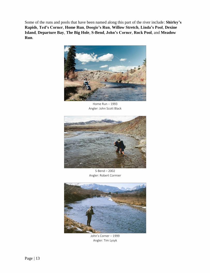
Some of the runs and pools that have been named along this part of the river include: Shirley’s
Rapids, Ted’s Corner, Home Run, Doogie’s Run, Willow Stretch, Linda’s Pool, Dexine
Island, Departure Bay, The Big Hole, S-Bend, John’s Corner, Rock Pool, and Meadow
Run.
Home Run – 1993
Angler: John Scott Black
S-Bend – 2002
Angler: Robert Cormier
John’s Corner – 1999
Angler: Tim Lysyk
Page | 14
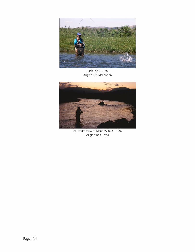
Rock Pool – 1992
Angler: Jim McLennan
Upstream view of Meadow Run – 1992
Angler: Bob Costa
Page | 15
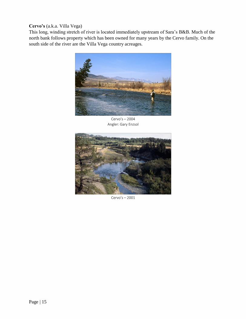
Cervo’s (a.k.a. Villa Vega)
This long, winding stretch of river is located immediately upstream of Sara’s B&B. Much of the
north bank follows property which has been owned for many years by the Cervo family. On the
south side of the river are the Villa Vega country acreages.
Cervo’s – 2004
Angler: Gary Enzsol
Cervo’s – 2001

Page | 16
Hopper Hole
This deep pool and the run below were given its name in 1992 by Bob Costa, after a great day of
hopper fishing for big rainbows. In August, the grassy pastures and fields high above the river
are often teeming with grasshoppers. All it takes to get them onto the water is some wind – a
common occurrence around here.
Hopper Hole – 1992
Angler: Bob Costa
Highway 507 Bridge (a.k.a. Lee Lake Bridge, Burmis Bridge)
A popular access point to the river.
Hwy. 507 Bridge – 2019
Page | 17
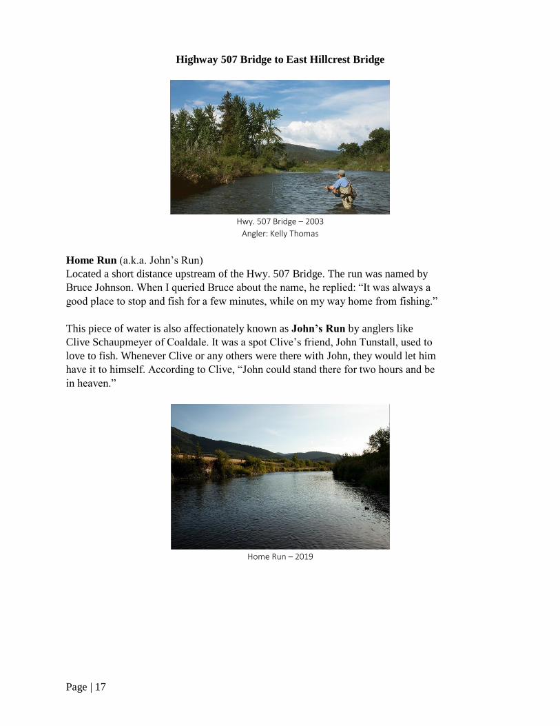
Highway 507 Bridge to East Hillcrest Bridge
Hwy. 507 Bridge – 2003
Angler: Kelly Thomas
Home Run (a.k.a. John’s Run)
Located a short distance upstream of the Hwy. 507 Bridge. The run was named by
Bruce Johnson. When I queried Bruce about the name, he replied: “It was always a
good place to stop and fish for a few minutes, while on my way home from fishing.”
This piece of water is also affectionately known as John’s Run by anglers like
Clive Schaupmeyer of Coaldale. It was a spot Clive’s friend, John Tunstall, used to
love to fish. Whenever Clive or any others were there with John, they would let him
have it to himself. According to Clive, “John could stand there for two hours and be
in heaven.”
Home Run – 2019

Page | 18
Dog Run (a.k.a. Gerry’s Lawn Pool)
A run adjacent to the Nestle Inn Bed & Breakfast, owned and operated by Penny & Gerry
Nichol.
Pink Bridge (a.k.a. Green’s Bridge)
A popular access point to the river.
Pink Bridge – 2001
West Bank
A lovely stretch of water named by Clive Schaupmeyer.
West Bank – 1998
Angler: Bob Costa
Page | 19
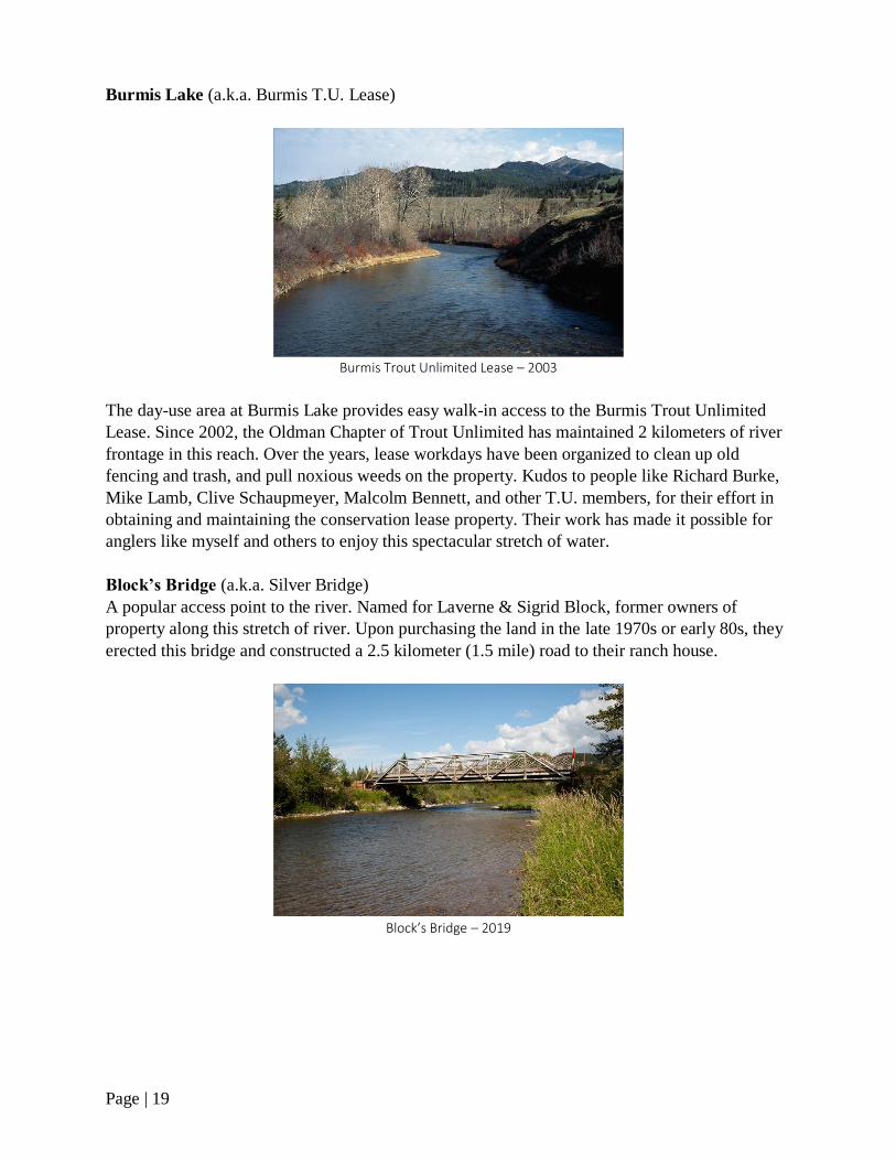
Burmis Lake (a.k.a. Burmis T.U. Lease)
Burmis Trout Unlimited Lease – 2003
The day-use area at Burmis Lake provides easy walk-in access to the Burmis Trout Unlimited
Lease. Since 2002, the Oldman Chapter of Trout Unlimited has maintained 2 kilometers of river
frontage in this reach. Over the years, lease workdays have been organized to clean up old
fencing and trash, and pull noxious weeds on the property. Kudos to people like Richard Burke,
Mike Lamb, Clive Schaupmeyer, Malcolm Bennett, and other T.U. members, for their effort in
obtaining and maintaining the conservation lease property. Their work has made it possible for
anglers like myself and others to enjoy this spectacular stretch of water.
Block’s Bridge (a.k.a. Silver Bridge)
A popular access point to the river. Named for Laverne & Sigrid Block, former owners of
property along this stretch of river. Upon purchasing the land in the late 1970s or early 80s, they
erected this bridge and constructed a 2.5 kilometer (1.5 mile) road to their ranch house.
Block’s Bridge – 2019
Page | 20
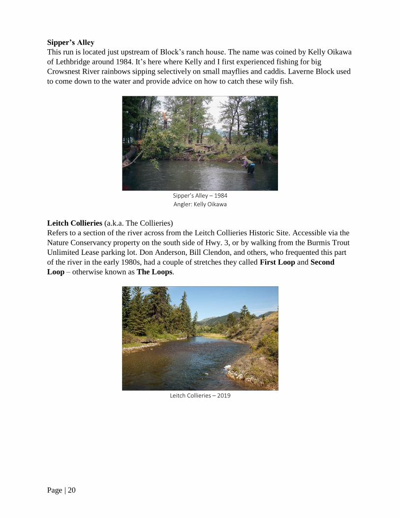
Sipper’s Alley
This run is located just upstream of Block’s ranch house. The name was coined by Kelly Oikawa
of Lethbridge around 1984. It’s here where Kelly and I first experienced fishing for big
Crowsnest River rainbows sipping selectively on small mayflies and caddis. Laverne Block used
to come down to the water and provide advice on how to catch these wily fish.
Sipper’s Alley – 1984
Angler: Kelly Oikawa
Leitch Collieries (a.k.a. The Collieries)
Refers to a section of the river across from the Leitch Collieries Historic Site. Accessible via the
Nature Conservancy property on the south side of Hwy. 3, or by walking from the Burmis Trout
Unlimited Lease parking lot. Don Anderson, Bill Clendon, and others, who frequented this part
of the river in the early 1980s, had a couple of stretches they called First Loop and Second
Loop – otherwise known as The Loops.
Leitch Collieries – 2019

Page | 21
Checkers Hole (a.k.a. Checkerboard Hole, Five-Star Pool)
According to Richard Burke of Lethbridge, it’s named this from the railway sign where the
tracks downstream of the East Hillcrest Bridge come into view of the river.
Checkers Hole – 2002
The Five-Star Pool label came from fisheries biologists in the early 1990s. While conducting a
fish population survey on the river, the biologists were impressed by the large numbers of trout
inhabiting the deep corner pool. On a scale of one to five, it received a Five-Star rating.
Hiking to the Checkers Hole – 1998
Anglers: Tim Lysyk & Bob Costa
Page | 22
East Hillcrest Bridge (a.k.a. Passburg Bridge)
A popular access point to the river. Byron Creek enters the Crowsnest River here.
East Hillcrest Bridge – 2019
East Hillcrest Bridge to Frank
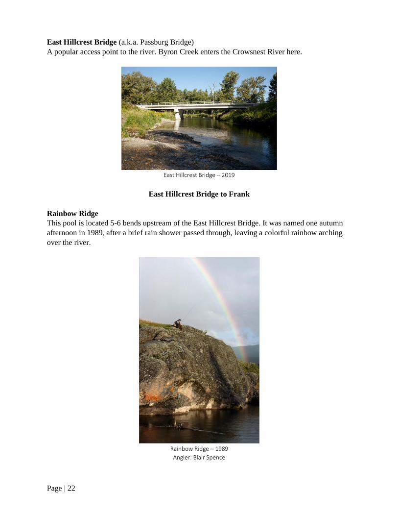
Rainbow Ridge
This pool is located 5-6 bends upstream of the East Hillcrest Bridge. It was named one autumn
afternoon in 1989, after a brief rain shower passed through, leaving a colorful rainbow arching
over the river.
Rainbow Ridge – 1989
Angler: Blair Spence
Page | 23
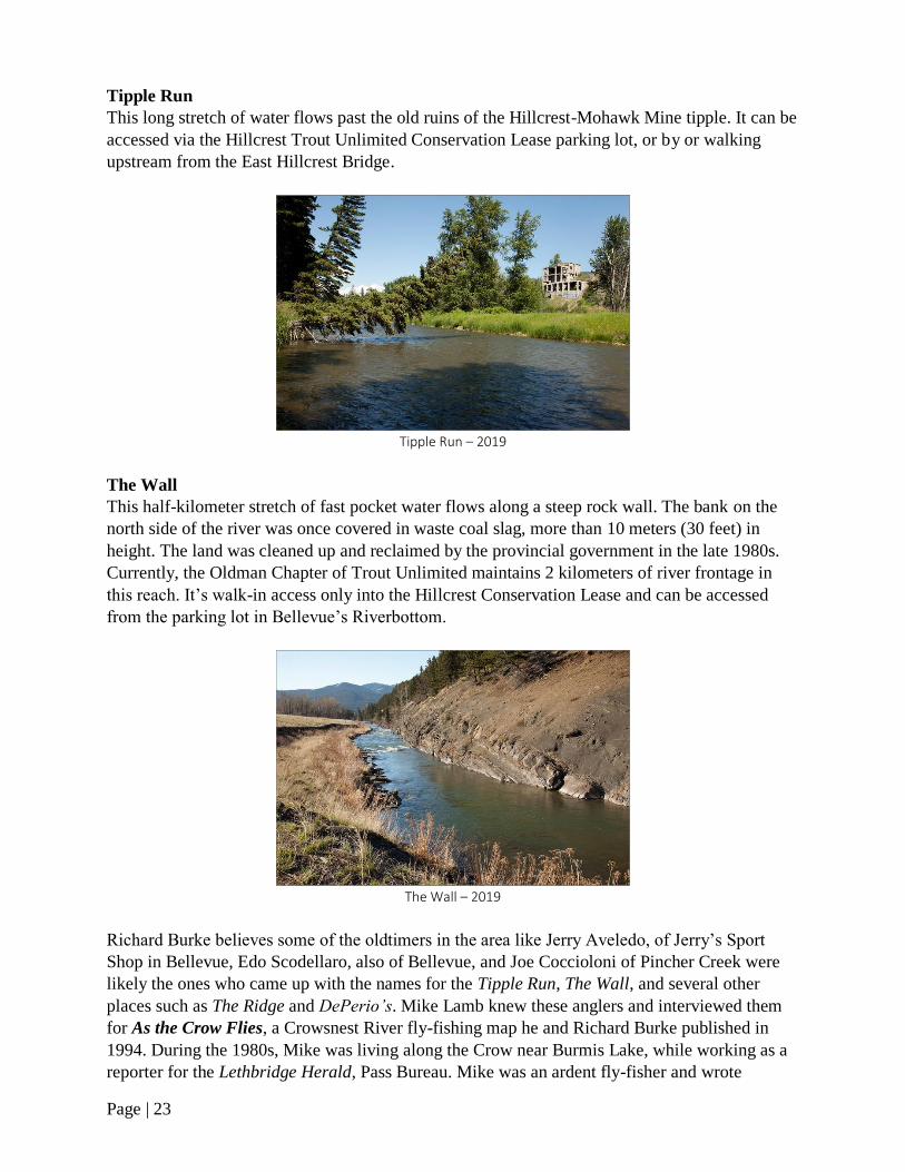
Tipple Run
This long stretch of water flows past the old ruins of the Hillcrest-Mohawk Mine tipple. It can be
accessed via the Hillcrest Trout Unlimited Conservation Lease parking lot, or by or walking
upstream from the East Hillcrest Bridge.
Tipple Run – 2019
The Wall
This half-kilometer stretch of fast pocket water flows along a steep rock wall. The bank on the
north side of the river was once covered in waste coal slag, more than 10 meters (30 feet) in
height. The land was cleaned up and reclaimed by the provincial government in the late 1980s.
Currently, the Oldman Chapter of Trout Unlimited maintains 2 kilometers of river frontage in
this reach. It’s walk-in access only into the Hillcrest Conservation Lease and can be accessed
from the parking lot in Bellevue’s Riverbottom.
The Wall – 2019
Richard Burke believes some of the oldtimers in the area like Jerry Aveledo, of Jerry’s Sport
Shop in Bellevue, Edo Scodellaro, also of Bellevue, and Joe Coccioloni of Pincher Creek were
likely the ones who came up with the names for the Tipple Run, The Wall, and several other
places such as The Ridge and DePerio’s. Mike Lamb knew these anglers and interviewed them
for As the Crow Flies, a Crowsnest River fly-fishing map he and Richard Burke published in
1994. During the 1980s, Mike was living along the Crow near Burmis Lake, while working as a
reporter for the Lethbridge Herald, Pass Bureau. Mike was an ardent fly-fisher and wrote

Page | 24
numerous articles for the Herald about fly-fishing in Crowsnest Pass and of some of the anglers
living here.
Toilet Bowl
There are several municipal sewage aeration lagoons located on the south side of the river, just
upstream of The Wall. It’s here, where the river makes a sharp turn at the rock escarpment,
forming a deep, swirling pool, dubbed the Toilet Bowl. Despite its malodorous-sounding name,
it’s a pleasant place to fish.
Toilet Bowl – 2019
Hillcrest Trout Unlimited Lease – 2019
Page | 25
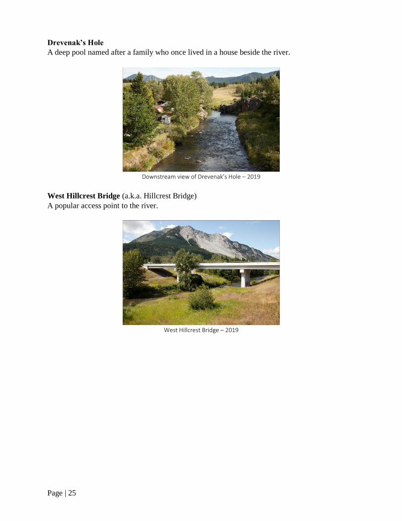
Drevenak’s Hole
A deep pool named after a family who once lived in a house beside the river.
Downstream view of Drevenak’s Hole – 2019
West Hillcrest Bridge (a.k.a. Hillcrest Bridge)
A popular access point to the river.
West Hillcrest Bridge – 2019
Page | 26
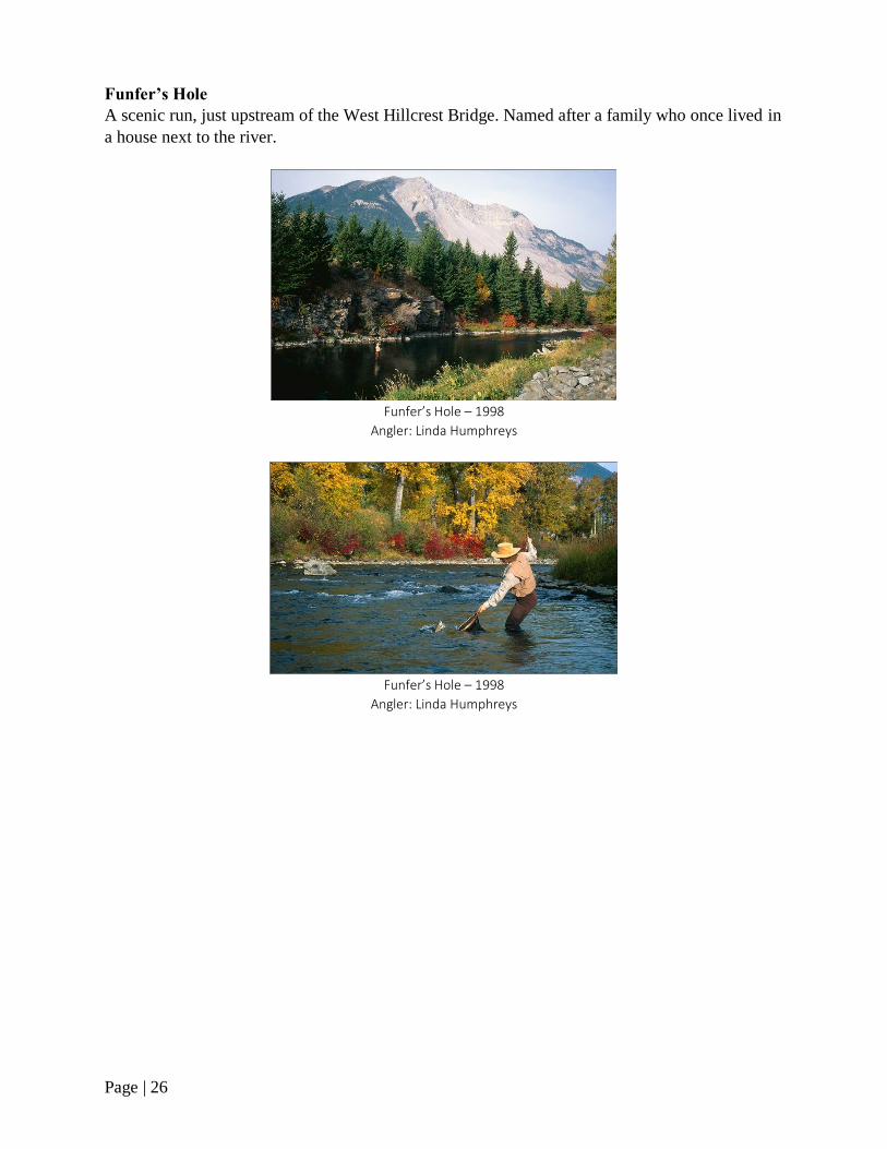
Funfer’s Hole
A scenic run, just upstream of the West Hillcrest Bridge. Named after a family who once lived in
a house next to the river.
Funfer’s Hole – 1998
Angler: Linda Humphreys
Funfer’s Hole – 1998
Angler: Linda Humphreys
Page | 27
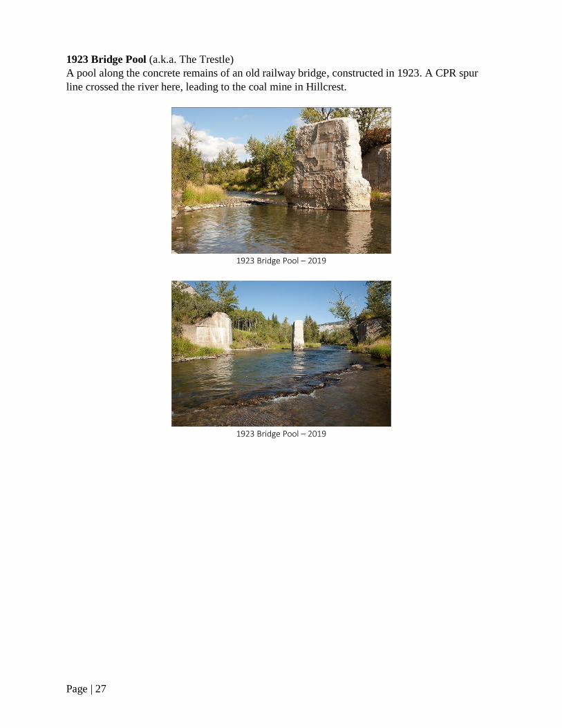
1923 Bridge Pool (a.k.a. The Trestle)
A pool along the concrete remains of an old railway bridge, constructed in 1923. A CPR spur
line crossed the river here, leading to the coal mine in Hillcrest.
1923 Bridge Pool – 2019
1923 Bridge Pool – 2019
Page | 28
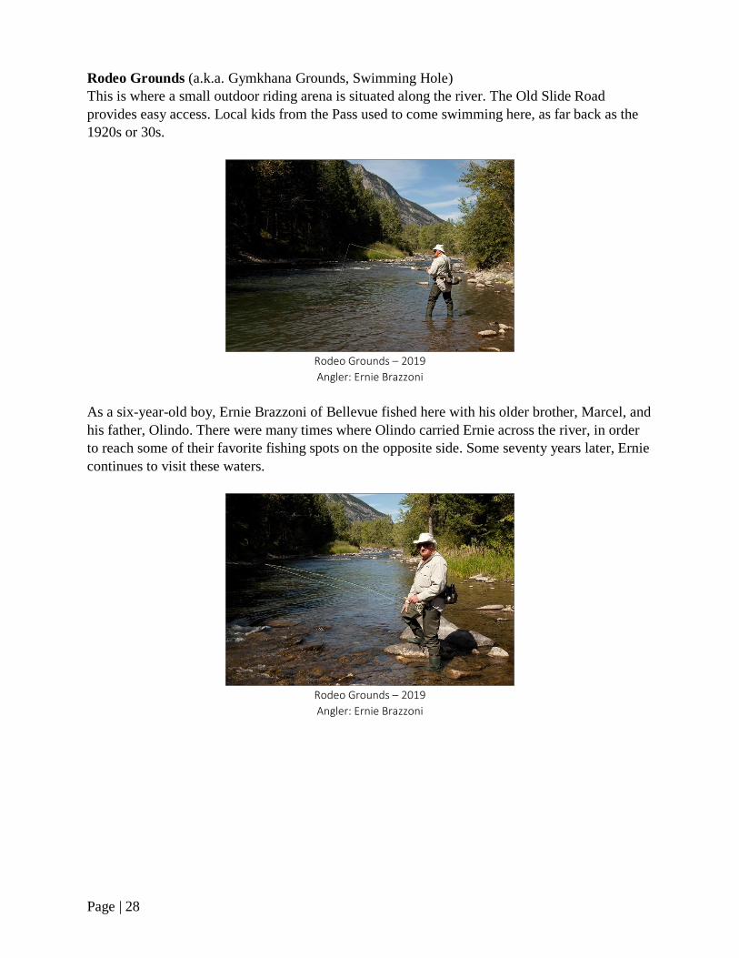
Rodeo Grounds (a.k.a. Gymkhana Grounds, Swimming Hole)
This is where a small outdoor riding arena is situated along the river. The Old Slide Road
provides easy access. Local kids from the Pass used to come swimming here, as far back as the
1920s or 30s.
Rodeo Grounds – 2019
Angler: Ernie Brazzoni
As a six-year-old boy, Ernie Brazzoni of Bellevue fished here with his older brother, Marcel, and
his father, Olindo. There were many times where Olindo carried Ernie across the river, in order
to reach some of their favorite fishing spots on the opposite side. Some seventy years later, Ernie
continues to visit these waters.
Rodeo Grounds – 2019
Angler: Ernie Brazzoni

Page | 29
Frank Lake (a.k.a. The Slide)
It’s not really a lake, but a widening in the river at the base of Turtle Mountain. Much of Frank
Lake has become filled in with sediment over the past couple of decades and it’s not as deep as it
once was. A defined river channel is forming along the east and west end. In order to fish here,
you have to scramble over massive rocks and boulders to get down to the water. It can be a bit
unnerving fishing here, as loose rocks sometimes become dislodged from the mountain face,
only to be heard tumbling down the steep slope.
Bird’s-eye view of Frank Lake – 2019
Old Slide Road on the far right
The river at the outlet of Frank Lake is another favorite spot among anglers.
Frank Lake outlet – 2007
Angler: Terry Hrudey
During the 1980s, I would occasionally bump into a local oldtimer, Elias “Eli” Hurtak, along this
stretch of water. Eli lived in a small house along the Old Slide Road. He knew these waters
intimately and probably fished along here more than anyone. In August, 1983, Eli caught a five-
pound, six-ounce rainbow trout at Frank Lake. The fish went for a wet fly and took 20 minutes to
land. Eli’s catch earned him first place for best rainbow trout caught in a stream at the Willow
Valley Trophy Competition that year. It was the seventh time in as many years Eli walked away
with the same prize.
Page | 30
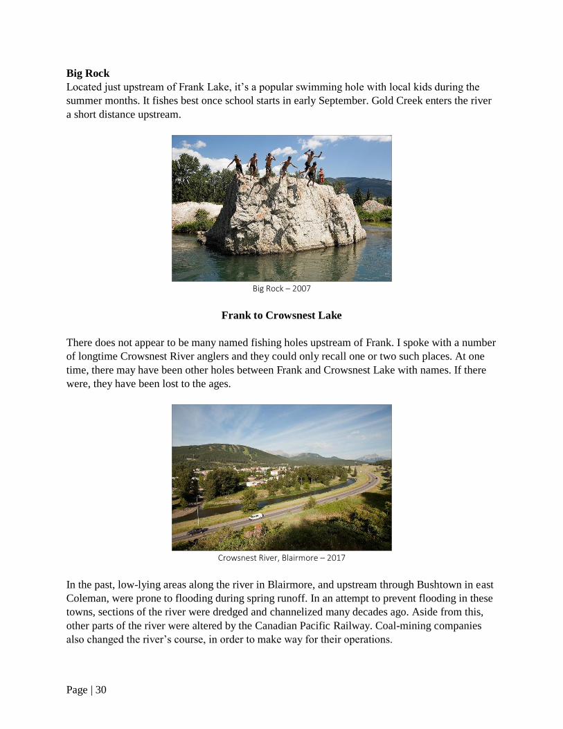
Big Rock
Located just upstream of Frank Lake, it’s a popular swimming hole with local kids during the
summer months. It fishes best once school starts in early September. Gold Creek enters the river
a short distance upstream.
Big Rock – 2007
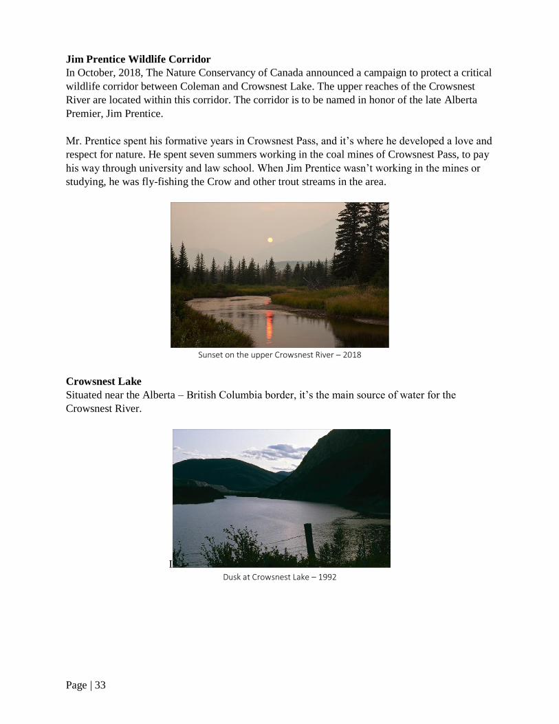
Frank to Crowsnest Lake
There does not appear to be many named fishing holes upstream of Frank. I spoke with a number
of longtime Crowsnest River anglers and they could only recall one or two such places. At one
time, there may have been other holes between Frank and Crowsnest Lake with names. If there
were, they have been lost to the ages.
Crowsnest River, Blairmore – 2017
In the past, low-lying areas along the river in Blairmore, and upstream through Bushtown in east
Coleman, were prone to flooding during spring runoff. In an attempt to prevent flooding in these
towns, sections of the river were dredged and channelized many decades ago. Aside from this,
other parts of the river were altered by the Canadian Pacific Railway. Coal-mining companies
also changed the river’s course, in order to make way for their operations.

Page | 31
Lost Lemon Campground
This popular campground is located along the Crowsnest River at the west end of Blairmore.
York Creek enters the river here.
Lost Lemon Campground, Blairmore – 2019
Bushtown (a.k.a. East Coleman)
A historic part of Coleman, dating to the early 1900s.
Crowsnest River, Bushtown – 2019

Page | 32
The Meadows
At the end of Willow Drive in west Coleman, the river valley widens and becomes almost
meadow-like in appearance. It’s a beautiful area, with spectacular views of the High Rock and
Flathead Mountain Ranges. Wildlife, including deer, elk, moose, bears, and mountain sheep
inhabit the area.
The Meadows – 1993
Crowsnest River, upstream of Willow Drive – 2017
Page | 33
Jim Prentice Wildlife Corridor
In October, 2018, The Nature Conservancy of Canada announced a campaign to protect a critical
wildlife corridor between Coleman and Crowsnest Lake. The upper reaches of the Crowsnest
River are located within this corridor. The corridor is to be named in honor of the late Alberta
Premier, Jim Prentice.
Mr. Prentice spent his formative years in Crowsnest Pass, and it’s where he developed a love and
respect for nature. He spent seven summers working in the coal mines of Crowsnest Pass, to pay
his way through university and law school. When Jim Prentice wasn’t working in the mines or
studying, he was fly-fishing the Crow and other trout streams in the area.
Sunset on the upper Crowsnest River – 2018
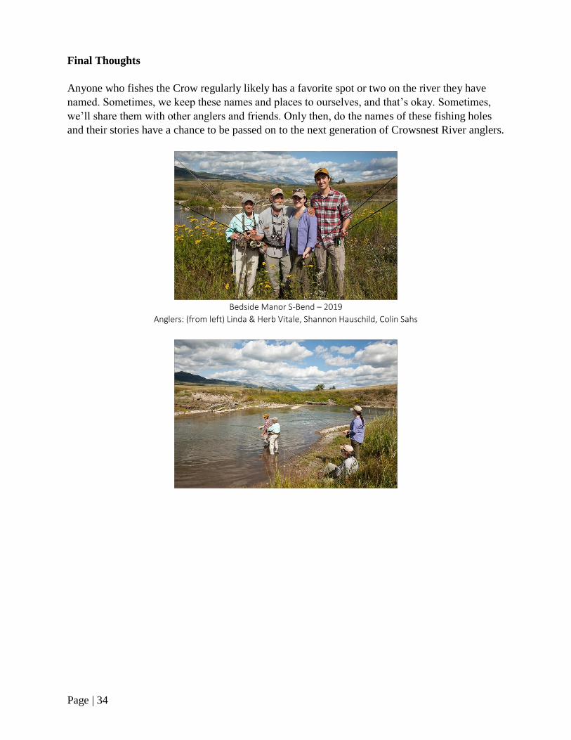
Crowsnest Lake
Situated near the Alberta – British Columbia border, it’s the main source of water for the
Crowsnest River.
I Dusk at Crowsnest Lake – 1992
Page | 34
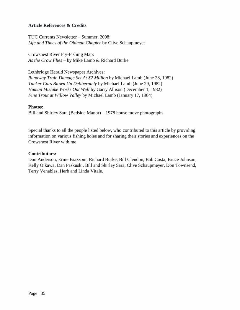
Final Thoughts
Anyone who fishes the Crow regularly likely has a favorite spot or two on the river they have
named. Sometimes, we keep these names and places to ourselves, and that’s okay. Sometimes,
we’ll share them with other anglers and friends. Only then, do the names of these fishing holes
and their stories have a chance to be passed on to the next generation of Crowsnest River anglers.
Bedside Manor S-Bend – 2019
Anglers: (from left) Linda & Herb Vitale, Shannon Hauschild, Colin Sahs
Page | 35
Article References & Credits
TUC Currents Newsletter – Summer, 2008:
Life and Times of the Oldman Chapter by Clive Schaupmeyer
Crowsnest River Fly-Fishing Map:
As the Crow Flies – by Mike Lamb & Richard Burke
Lethbridge Herald Newspaper Archives:
Runaway Train Damage Set At $2 Million by Michael Lamb (June 28, 1982)
Tanker Cars Blown Up Deliberately by Michael Lamb (June 29, 1982)
Human Mistake Works Out Well by Garry Allison (December 1, 1982)
Fine Trout at Willow Valley by Michael Lamb (January 17, 1984)
Photos:
Bill and Shirley Sara (Bedside Manor) – 1978 house move photographs
Special thanks to all the people listed below, who contributed to this article by providing
information on various fishing holes and for sharing their stories and experiences on the
Crowsnest River with me.
Contributors:
Don Anderson, Ernie Brazzoni, Richard Burke, Bill Clendon, Bob Costa, Bruce Johnson,
Kelly Oikawa, Dan Paskuski, Bill and Shirley Sara, Clive Schaupmeyer, Don Townsend,
Terry Venables, Herb and Linda Vitale.

Page | 36
“Eventually, all things merge into one, and a river runs through it. The river was cut
by the world’s great flood and runs over rocks from the basement of time. On some of
the rocks are timeless raindrops. Under the rocks are the words, and some of the
words are theirs. I am haunted by waters.”
― Norman Maclean, A River Runs Through It and Other Stories (1976)