courses:(global&studies,&ancient&history grades:( th … ·...
TRANSCRIPT
Courses:(Global&Studies,&Ancient&History(
Grades:(8th711th&
Unit:(Early&Civilizations&
&
Aim:(How(did(geography(impact(the(development(of(Mesopotamian(
civilizations?(
(
Materials:(
7 Maps&and&geographic&features&images&
7 Blank&student&chart&and&teacher&answer&key&
7 “The&Land&of&Two&Rivers”&excerpt&
&
Do(Now:(How&has&the&geography&around&our&area&impacted&us?&
&
Procedures:(
1. Intro(7 Write&Aim&and&Do&Now&on&the&board.&&After&students&have&written&their&Do&
Now&answers,&discuss&together.&&Answers&will&vary&depending&on&where&you&
live.&
7 Explain&we&will&be&examining&this&same&question,&but&about&ancient&
Mesopotamian&civilizations.&
(
2. Types(of(Geographic(Features(7 Pass&out&Mesopotamian&geographic&images&to&partners&or&groups&
7 Be&sure&everyone&can&find&the&“Fertile&Crescent”&on&the&map&and&knows&this&is&
the&general&location&of&Mesopotamia&
7 Have&students&jot&down&ideas&of&different&geographic&characteristics&they&see&
in&Mesopotamia,&then&make&a&board&list.&&Students&may&come&up&with:&
o Crescent7shaped;&stretches&from&Persian&Gulf&to&Mediterranean&Sea&
o Two&main&rivers:&Tigris&and&Euphrates&
o Areas&that&aren’t&by&rivers&are&dry&and&arid&
o Not&many&natural&boundaries&aside&from&mountains&in&north&and&
deserts&in&south&
&
3. Significance(of(Geographic(Features(7 Have&students&read&the&“The&Land&of&Two&Rivers”&and&answer&the&questions&
either&independently&or&in&partners.&&Discuss&together.&(See&teacher&answer&
key)&
o Don’t&need&to&take&board¬es&for&this&part&–&they’ll&go&over&the&key&
concepts&again&in&the&Chart.&
7 Then&have&students&complete&the&Mesopotamia&Geography&chart,&either&in&
partners&or&as&the&whole&class&together,&depending&on&level.&&Go&over&
together,&taking&board¬es&to&make&sure&everyone&has&the&important&ideas.&&
(See&teacher&answer&key)(
7 Ask:&Why&was&this&area&called&the&“Fertile&Crescent”?(
7 If&students&have&previously&learned&about&Jared&Diamond’s&theories&in&Guns,&Germs,&and&Steel,&ask:&“How&would&Jared&Diamond&explain&the&early&success&of&Mesopotamian&civilization?”&&(
o Alternatively,&discuss&the&meaning&of&the&phrase:&“Geography&
determines&destiny.”(
&
4. Impact(of(Rivers(7 Assign&students&to&think,&pair,&and&share&on&the&question&“Were&rivers&a&
blessing&or&a&curse&for&Mesopotamia?”&
o Alternatively&run&a&quick&class&debate&on&the&question&or&assign&it&as&in&
independent&writing&response.&
&
5. WrapNup(7 Have&students&write&a¶graph&answering&the&lesson’s&Aim&using&what&they&
learned.&
&
& &
Name:(________________________________________________(( ( Date:(_________________(
(
Ancient(Mesopotamia(Reading(and(Questions(
!According&to&the&eminent&historian&Samuel&N.&Kramer,&“History&begins&at&
Sumer,”&and&there&is&a&good&deal&of&truth&to&that&judgment.&&It&is&in&Sumer,&which&lay&just&to&the&north&of&the&Persian&Gulf&in&an&area&encompassed&by&the&southern®ions&
of&modern&Iraq,&that&we&discover&the&first&evidence&of&human&civilization.&&By&3500&
BCE&a&number&of&Sumerian&city7states&had&emerged,&and&humanity&was&embarked&on&
the&adventure&of&civilization.&
Generally&we&call&the&Sumerians,&and&the&other&peoples&who&succeeded&them&
in&this®ion&of&Southwest&Asia,&Mesopotamians.&&The&term,&which&means&“those&who&dwell&between&the&rivers”&acknowledges&the&origin&of&the&world’s&first&known&
civilization&in&the&valley&created&by&the&Tigris&and&Euphrates&rivers.&
By&approximately&1800&BCE,&the&Sumerians&had&been&absorbed&by&waves&of&
infiltrators&and&invaders&and&ceased&to&exist&as&an&identifiable&people.&&Moreover,&the&
cultural¢er&of&gravity&within&Mesopotamia&had&shifted&northward&to&the®ion&
of&middle&Mesopotamia,¢ering&on&the&city&of&Babylon.&
Despite&their&disappearance&as&a&people,&the&Sumerians&had&set&the&
framework&for&a&dynamic&Mesopotamian&civilization&that&exercised&profound&
cultural&influence&throughout&West&Asia&and&beyond&for&about&three&thousand&years.&&
Between&roughly&3500&and&5000&BCE&Mesopotamia&was&where&much&of&the&action&
was,&so&far&as&the&history&of&West&Asian&civilization&was&concerned.&
That&action&was&both&constructive&and&destructive.&&The&Mesopotamians&have&
been&credited&with&having&created&the&world’s&first&governments,&schools,&codes&of&
law,ðical&systems,&and&epic&literature.&&Just&as&prominent&in&Mesopotamian&life&
were&disasters,&both&natural&and&human&generated.&
The&geography&of&Mesopotamia&provided&its&people&with&the&challenge&of&
harnessing&the&waters&of&its&two&great&rivers,&and&from&that&necessary&cooperative&
effort&civilization&arose.&&Yet&those&rivers&also&threatened&to&destroy&the&fragile&fabric&
of&civilized&society&because&they&were&unpredictable&and&could&easily&turn&into&
uncontrollable&torrents.&&Moreover,&most&of&southern&Mesopotamia&was&covered&by&
either&arid&wasteland&or&marsh.&&Consequently,&Sumerian&civilization&was&built&upon&
heroic&labor&in&the&midst&of&a&hostile&environment.&
Another&significant&geographical&aspect&of&Mesopotamian&life,&which&also&
proved&to&be&an&important&factor&throughout&its&history,&is&the&land’s&openness&to&
incursions.&&To&the&north&and&east&lie&the&hills&and&mountains&of&Iran&and&Armenia,&
from&which&wave&after&wave&of&invaders&descended&into&the&inviting&valley&of&cities.&&
To&the&south&and&west&lies&the&desert&of&Arabia,&out&of&which&came&countless&nomads&
century&after¢ury.&&In&many&instances&these&invaders&toppled&a&preexisting&state&
and&then&settled&down&to&become,&in&turn,&Mesopotamians.&
Whether&they&came&from&the&desert&fringes,&such&as&the&Amorites,&who&established&the&first&Babylonian&Empire&around&1800&BCE,&or&were&mountain&folk,&
such&as&the&chariot7driving&Kassites,&who&toppled&Babylon&soon&after&1700,&they&all&
eventually&became&part&of&a&Mesopotamian&cultural&complex,&with&modes&of&life&and&
thought&the&Sumerians&had&set&in&place&at&the&dawn&of&human&civilization.&
&
Excerpted&from&“The&Human&Record:&To&1700”&by&Alfred&J.&Andrea&and&James&H.&Overfield&
&
&
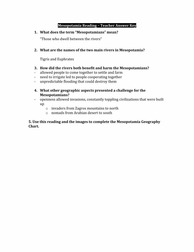
1.(What(does(the(term(“Mesopotamians”(mean?(
_________________________________________________________________________________________________
_________________________________________________________________________________________________(
&
2.(What(are(the(names(of(the(two(main(rivers(in(Mesopotamia?(
_________________________________________________________________________________________________
_________________________________________________________________________________________________(
&
3.(How(did(the(rivers(both(benefit(and(harm(the(Mesopotamians?(
_________________________________________________________________________________________________
_________________________________________________________________________________________________
_________________________________________________________________________________________________(
_________________________________________________________________________________________________(
&
4.(What(other(geographic(aspects(presented(a(challenge(for(the(
Mesopotamians?(
_________________________________________________________________________________________________
_________________________________________________________________________________________________
_________________________________________________________________________________________________(
_________________________________________________________________________________________________&
(
5.(Use(this(reading(and(the(images(to(complete(the(Mesopotamia(Geography(
Chart.(
( (
Mesopotamia(Reading(–(Teacher(Answer(Key(
1. What(does(the(term(“Mesopotamians”(mean?((
“Those&who&dwell&between&the&rivers”&
&
2. What(are(the(names(of(the(two(main(rivers(in(Mesopotamia?((
Tigris&and&Euphrates&
&
3. How(did(the(rivers(both(benefit(and(harm(the(Mesopotamians?(7 allowed&people&to&come&together&to&settle&and&farm&
7 need&to&irrigate&led&to&people&cooperating&together&
7 unpredictable&flooding&that&could&destroy&them&
(
4. What(other(geographic(aspects(presented(a(challenge(for(the(Mesopotamians?(
7 openness&allowed&invasions,&constantly&toppling&civilizations&that&were&built&
up&
o invaders&from&Zagros&mountains&to&north&
o nomads&from&Arabian&desert&to&south&
(
5.(Use(this(reading(and(the(images(to(complete(the(Mesopotamia(Geography(
Chart.& &
Name:(________________________________________________(( ( Date:(_________________(
(
Ancient(Mesopotamia(Geography(Chart(
(
Geographic(Characteristic( Impact(
Mountains&&
(especially&Zagros&mountains&in&the&north)&
(
Open&space& (
Borders&Persian&Gulf&and&Red&Sea& (
“Land&between&two&rivers”& (
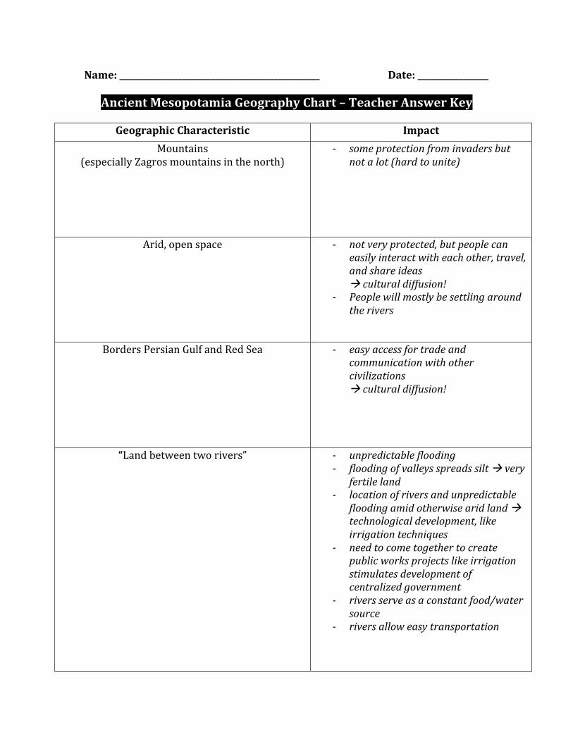
Name:(________________________________________________(( ( Date:(_________________(
(
Ancient(Mesopotamia(Geography(Chart(–(Teacher(Answer(Key(((
(
Geographic(Characteristic( Impact(
Mountains&&
(especially&Zagros&mountains&in&the&north)&
7 some&protection&from&invaders&but¬&a&lot&(hard&to&unite)&&
&
Arid,&open&space& 7 not&very&protected,&but&people&can&easily&interact&with&each&other,&travel,&and&share&ideas&&!&cultural&diffusion!&
7 People&will&mostly&be&settling&around&the&rivers&&
Borders&Persian&Gulf&and&Red&Sea& 7 easy&access&for&trade&and&communication&with&other&civilizations&!&cultural&diffusion!&
“Land&between&two&rivers”& 7 unpredictable&flooding&7 flooding&of&valleys&spreads&silt&!&very&
fertile&land&7 location&of&rivers&and&unpredictable&
flooding&amid&otherwise&arid&land&!&technological&development,&like&irrigation&techniques&
7 need&to&come&together&to&create&public&works&projects&like&irrigation&stimulates&development&of¢ralized&government&
7 rivers&serve&as&a&constant&food/water&source&
7 rivers&allow&easy&transportation&
(
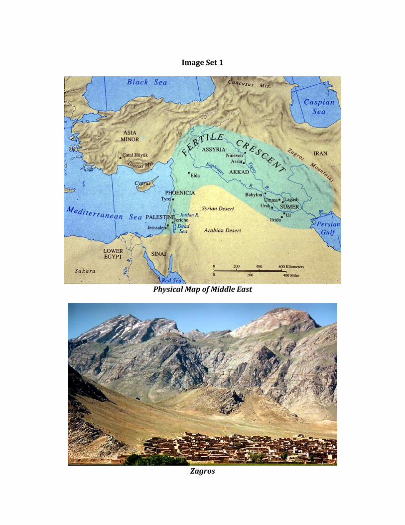
Image(Set(1(
(
(Physical!Map!of!Middle!East!
(
(Zagros!
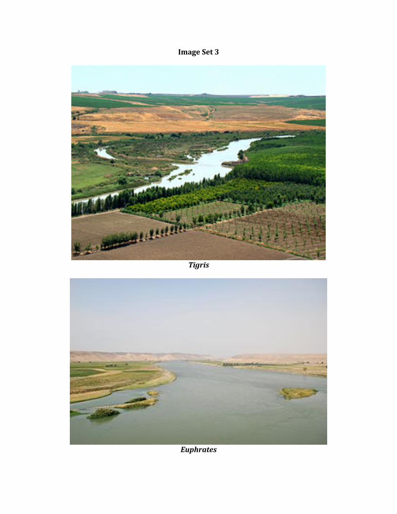
Image(Set(3(
(
&Tigris!
(
(
Euphrates!
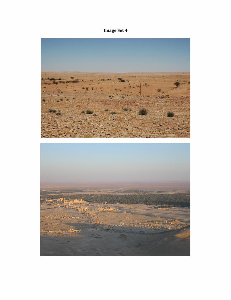
Image(Set(4(
(
(
!
!