city of phoenix planning & development … draft north 32nd st... · city of phoenix planning...
TRANSCRIPT
CITY OF PHOENIX PLANNING &
DEVELOPMENT DEPARTMENT 2015

PAGE 4 NORTH 32ND
Table of contents
Acknowledgements page 5Message from Councilman Bill Gates pages 6-7Executive Summary / Highlights page 8Context and boundaries page 9Assets pages 10-11History pages 12-14 What’s Happening Now page 15Public Outreach pages 16-17Current State pages 18-19Vision page 20Focus Areas page 21
Design / BrandingCirculationLand Use
Mapping Exercise pages 22-28Description of mapping exerciseMapping results by phase
This is Just the Beginning page 29Links to external reports and studies page 29
ULI AZ TapASU Graduate ReportDraft Neighborhood Flyer

PAGE 5NORTH 32ND
Acknowledgements
City Council
Mayor Greg StantonVice Mayor Jim Waring, D2
Councilwoman Thelda Williams, D1Councilman Bill Gates, D3
Councilwoman Laura Pastor, D4Councilman Daniel Valenzuela, D5
Councilman Sal DiCiccio, D6Councilman Michael Nowakowski, D7
Councilwoman Kate Gallego, D8
City Manager’s Office
Ed ZuercherMilton Dohoney, Jr.
Rick NaimarkLisa TakataPaul Blue
Deanna JonovichGinger Spencer
Council District 3
Laura EtterGreta Brandt
Council District 2
Brian SchmittAshley Bunch
Community Partners
North 32nd Working GroupJohn Barker (Gavan Barker Inc.)
City Staff
Craig MavisJoshua Bednarek
Ray BrownRacelle EscolarVania Fletcher
City Management
Alan StephensonSandra Hoffman
Ray Dovalina

PAGE 6 MESSAGE FROM COUNCILMAN BILL GATES
MESSAGE FROM COUNCILMAN BILL GATES:
I pose a question: How can we, as a community, work together and help North 32nd become a thriving area of business and community that promotes a sense of place and improves quality of life for area residents?
North 32nd is an area ripe for revitalization. While the State Route 51 has taken traffic away from the once heavily traveled corridor, our great residential community remains. Over the past two years, North 32nd has seen some great success and new businesses, such as 32 Shea, Jambo, and The Rock at 32nd Street / Genesis Church, just to name a few. North 32nd is an ideal location for both residents and businesses looking to be centrally located and close to almost everything. We are surrounded by the beautiful Phoenix Mountain Preserves, parks and recreation areas, great businesses and have quick access to the entire Valley.
The North 32nd Policy Plan is the result of input from an ASU Graduate Student Study, Urban Land Institute Technical Assistance Panel recommendations, and numerous community meetings and input, but it’s only just the beginning. Working together we can continue to improve the corridor and North 32nd
will become its own destination. I’ve included a few items on my wish list – as a community member, what is on yours?
Councilman Gates’ North 32nd Wish List:• Thriving North 32nd Working Community Group – Subcommittees included• North 32nd Business Coalition• Branding throughout the corridor on street lights and poles• Access for recreation from Dreamy Draw all the way north to the Reach 11 Complex• Full occupancy with new residential and business in existing strip malls and on vacant parcels• Updated and increased landscaping promoting walkability
I look forward to your involvement in North 32nd. And as always, please contact my office for additional information or to get involved at 602-262-7441 or [email protected].
Sincerely,
Councilman Bill Gates
PAGE 7NORTH 32ND

PAGE 8 NORTH 32ND
The North 32nd Street Corridor (North 32nd) is a citizen driven effort to improve the conditions along North 32nd Street. The Corridor is approximately eight miles, from the north side of Phoenix Mountain Preserve to the Loop 101 Freeway. For many years, North 32nd Street was the main north-south transportation corridor in north central Phoenix. Before State Route 51, there were 58,000 vehicle trips per day. After the State Route 51 was completed, the vehicle trips per day dropped to 21,000; a difference of 37,000 vehicle trips per day. The completion of State Route 51 from Northern Avenue to the Loop 101 Freeway impacted the traffic and business characteristics along North 32nd. Residents and businesses in the area are interested in revitalizing the land uses along North 32nd to upgrade the number and types of businesses by increasing visitation and to improve the amenities available for residents of the area.
Recognizing the unique conditions along North 32nd, Phoenix Vice Mayor Jim Waring and Councilman Bill Gates formed a coalition of area business leaders and residents to study and make recommendations about improving these conditions along North 32nd. This coalition, the North 32nd Working Group, started meeting in the spring of 2012 and formed three subcommittees to focus on specific issues within the entire focus area. In addition, reports related to North 32nd were provided by Arizona State University and the Urban Land Institute Technical Advisory Panel. The Working Group subcommittees: Branding and Events, Transportation and Street Improvements, Land Use have met several times and have developed a number of recommendations and ideas that have directly contributed to this policy plan. The goal of the Branding and Events
subcommittee is to promote the area’s unique character through marketing, branding, and community events. The Transportation and Street Improvement subcommittee will identify public property in need of repair and encourage private property improvements. The Land Use subcommittee will recommend improvements to city processes, regulations, and enforcement, while also providing feedback to future land use improvements and entitlement changes.
Limited municipal funding is available at this time. The City of Phoenix will continue to seek out funding sources to help facilitate revitalization within North 32nd. This Plan is the beginning of revitalizing the area. Both residents and businesses need to work towards the common goal of revitalizing North 32nd. To find out how to get involved, please contact the Council District 3 office at 602-262-7441.
E xe c ut iveSUMMARY
PAGE 9NORTH 32ND
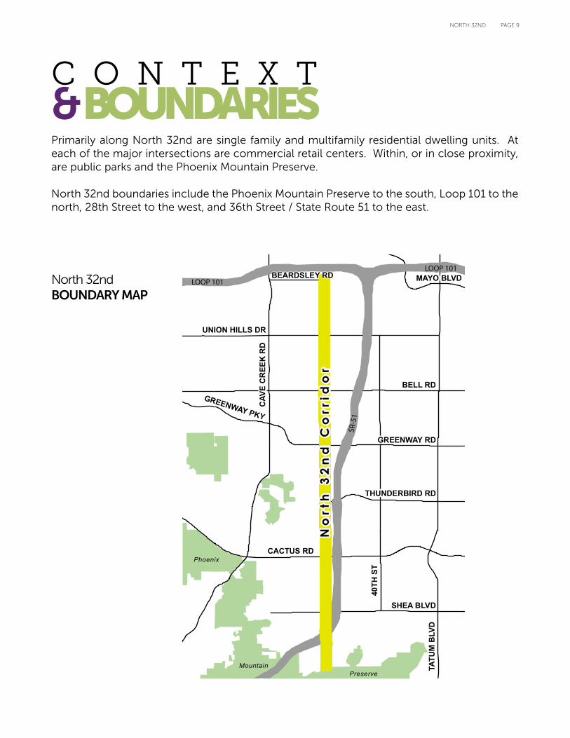
Primarily along North 32nd are single family and multifamily residential dwelling units. At each of the major intersections are commercial retail centers. Within, or in close proximity, are public parks and the Phoenix Mountain Preserve.
North 32nd boundaries include the Phoenix Mountain Preserve to the south, Loop 101 to the north, 28th Street to the west, and 36th Street / State Route 51 to the east.
C O N T E X T &BOUNDARIES
Phoenix
MountainPreserve
No
rth
32
nd
Co
rrid
or
No
rth
32
nd
Co
rrid
or
40TH
ST
TATU
M B
LVD
BELL RD
CAV
E C
REE
K R
D
CACTUS RD
SHEA BLVD
UNION HILLS DR
GREENWAY RD
GREENWAY PKY
THUNDERBIRD RD
MAYO BLVDBEARDSLEY RD
SR-5
1
LOOP 101
LOOP 101
North 32ndBOUNDARY MAP
PAGE 10 NORTH 32ND
There are numerous assets within North 32nd. The existing transportation infrastructure provides excellent access to the area. The Piestewa Freeway (State Route 51) provides easy vehicular access to and from the area. There are several different bus routes that service the area, from the local bus routes up to the Express/RAPID Dreamy Draw transit station located at Shea Boulevard and State Route 51. There are future plans for a Metro light rail extension to the Paradise Valley Mall area with a stop near the Dreamy Draw transit station to be completed in 2032. However, further studies are needed to determine the details of this extension.
In close proximity to the Corridor are several public parks; Palomino Park, Venturoso Park, Reach 11 Sports Complex, Roadrunner Park, Altadena Park, Christy Cove Park and the Phoenix Mountain Preserve. All offer excellent recreational outlets for neighborhood residents and visitors.
The housing stock within North 32nd is diverse. The character is primarily single-family residential with small pockets of multifamily residential dwelling units. The neighborhoods are generally well maintained and attractive with no signs of distress. Overall, the residential areas are established and stable making
the area a desirable place to live.
Each of the major intersections has a strong commercial presence with varying different degrees of size and scale. The major employers in the area are the Maricopa County Community College District, Pro Serve Commercial Cleaning, Frys Food Stores, Paradise Valley Unified School District 69 and the Hubbard Family Swim School.
There are active neighborhoods associations, block watches and community groups within the Corridor. They include the Cactus Sweetwater Block Watch, Cactus Neighborhood Association, Kiva Dos Block Watch, Palomino Community Power, Northeast Phoenix Neighborhood Action Alliance, Paradise Valley Oasis Neighborhood Block Watch, The Phoenix Elks Lodge No. 335, North 32nd Street Working Group and The Rock at 32nd Street.
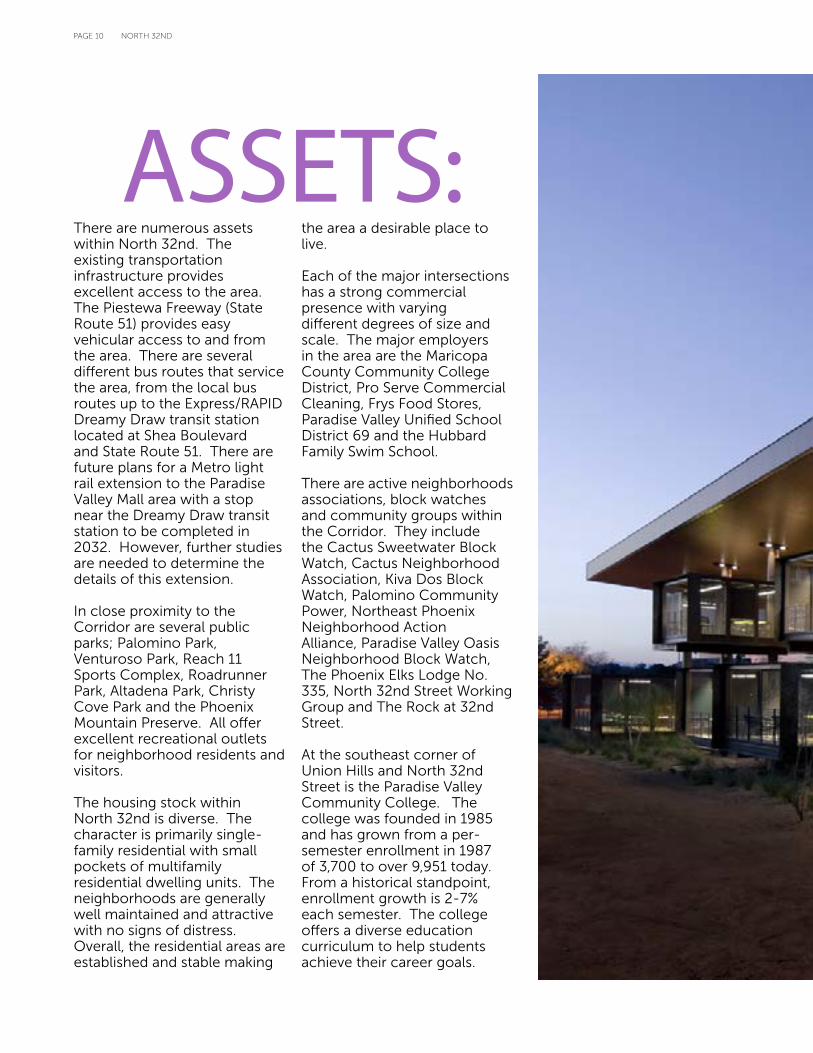
At the southeast corner of Union Hills and North 32nd Street is the Paradise Valley Community College. The college was founded in 1985 and has grown from a per-semester enrollment in 1987 of 3,700 to over 9,951 today. From a historical standpoint, enrollment growth is 2-7% each semester. The college offers a diverse education curriculum to help students achieve their career goals.
ASSETS:

PAGE 11NORTH 32ND
PARADISE VALLEY COMMUNITY COLLEGE LIFE SCIENCES BUILDING
PAGE 12 NORTH 32ND
32ND STREET CORRIDOR
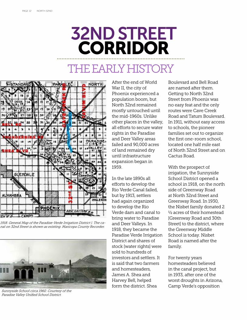
THE EARLY HISTORYAfter the end of World War II, the city of Phoenix experienced a population boom, but North 32nd remained mostly untouched until the mid-1960s. Unlike other places in the valley, all efforts to secure water rights in the Paradise and Deer Valley areas failed and 90,000 acres of land remained dry until infrastructure expansion began in 1959.
In the late 1890s all efforts to develop the Rio Verde Canal failed, but by 1913, settlers had again organized to develop the Rio Verde dam and canal to bring water to Paradise and Deer Valleys. In 1918, they became the Paradise Verde Irrigation District and shares of stock [water rights] were sold to hundreds of investors and settlers. It is said that two farmers and homesteaders, James A. Shea and Harvey Bell, helped form the district. Shea
Boulevard and Bell Road are named after them. Getting to North 32nd Street from Phoenix was no easy feat and the only routes were Cave Creek Road and Tatum Boulevard. In 1911, without easy access to schools, the pioneer families set out to organize the first one-room school, located one half mile east of North 32nd Street and on Cactus Road.
With the prospect of irrigation, the Sunnyside School District opened a school in 1918, on the north side of Greenway Road at North 32nd Street and Greenway Road. In 1930, the Nisbet family donated 2 ½ acres of their homestead [Greenway Road and 30th Street] to the district, where the Greenway Middle School is today. Nisbet Road is named after the family.
For twenty years homesteaders believed in the canal project, but in 1933, after one of the worst droughts in Arizona, Camp Verde’s opposition
1918. General Map of the Paradise-Verde Irrigation District ]. The ca-nal on 32nd Street is shown as existing. Maricopa County Recorder.
Sunnyside School circa 1960. Courtesy of the Paradise Valley Unified School District.

PAGE 13NORTH 32ND
to the dam, and years of legal disputes with the Salt River Water Users Association over water rights, the district failed to materialize. A detail of the district’s map and survey filed with the County Recorder in 1918 shows a canal that would have brought water along North 32nd Street. No water ever flowed in it.
Without irrigation, only a few horse and cattle ranches remained in the area until 1952 when the first parcel of land was platted as Charter Oak Park, a large 1/3 acre lot subdivision located north of Cactus Road west of North 32nd Street, these were large 1/3 acre parcels with enough space for a horse.
Development continued slowly until the construction of a new road through Dreamy Draw mountain pass allowing water and sewer lines to reach the north valley. By 1959, low cost residential subdivisions took off, such as the Melrose Paradise in 1961, at Cholla and North 32nd Streets, and the largest and most ambitious, Paradise Valley Oasis, with several plats, starting with two subdivisions opening in 1962 on 32nd Street at Emile Zola Avenue, south of Shea Boulevard.
The biggest event on North 32nd Street came on May 10, 1962 when the Paradise Hills Shopping Center opened on 8.7 acres, with 24 stores. Over the years, many locally owned businesses settled on North 32nd Street, but the longest family owned business to this day is The Western Ranchman, owned by the Francisco family for almost 50 years, opening in 1966. In the early years The Ranchman held cattle auctions and was a feed store serving the ranching community.
By 1979, North 32nd was surrounded by residential subdivisions, many facing directly on North 32nd Street, and commercial development consisted of mostly small locally owned businesses. Although a few strip malls opened during the mid 1980s, they were typically at intersections and the mid-block character and size of businesses remained constant.
The construction of the Paradise Valley Community College by the Maricopa County Community College District accelerated development north of Bell Road which was on the way to becoming a large scale commercial street, with several auto malls. Overbuilding in the north valley during the 1980-90s and the opening of the 101 Freeway and State Route 51 were some of the causes that redirected customers away from the North 32nd Street Corridor.
Courtesy of The Western Ranchman
Paradise Hill Grand Opening, May 10, 1962. Arizona Republic.

PAGE 14 NORTH 32ND
32
nd
ST
SHEA BLVD
BELL RD
THUNDERBIRD RD
GREENWAY RD
CACTUS RD
UNION HILLS DR
Road Runner Park under construction
Left: The Western Ranchman, 1966 Right: Copper Cattle MHP, 1962
32nd STREET CORRIDOR March 1969 Aerial Photograph, Maricopa County
Charter Oak Park, 1952
Campo Bello Subdivision platted 1952, 0.8 acre lots
1949 Sunnyside school [originally built in 1930]
Sunnyside Acres, 1952
Paradise Hil ls Shopping Center, 1962
1969 aerial. Eventually these buildings would be demolished and the school site redesigned.
Melrose Paradise, platted 1959
Paradise Valley Oasis, 1961
PAGE 15NORTH 32ND
This is What’s Happening NOW: Since the formation of the North 32nd Street Working Group, here is a sampling of the improvements that have occurred within North 32nd:
• Original Breakfast House at the southeast corner of North 32nd Street and Thunderbird Road.• NextCare Urgent Care opened at the southeast corner of North 32nd Street and Greenway Road (3229
East Greenway Road). • Building elevation improvements to the northwest corner of North 32nd Street and Shea Boulevard.• The commercial center at the southeast corner of North 32nd Street and Thunderbird Road housing the
Rock at 32nd Street and Genesis Church, is fully occupied. • Jabz Boxing located north of the northwest corner of North 32nd Street and Shea Boulevard.• Rezoning on the north side of BASIS Charter school to allow 31 single-family residential dwelling units.• A new health club, YouFit, in the commercial center at the northwest corner of North 32nd Street and
Shea Boulevard.• “at Home” occupies the entire building at the southeast corner of North 32nd Street and Cactus Road.• Sunday Cycles bike shop has opened at the shopping center north of the northwest corner of North
32nd Street and Shea Boulevard relocated from North 32nd Street and Bell Road. • 32 Shea has expanded their patio dining area. • A new Walgreens with a drive through window is proposed at the northwest corner of North 32nd Street
and Shea Boulevard.
Future city improvements to the area include road improvements to Shea Boulevard between State Route 51 and North 32nd Street, a road diet for North 32nd, and branding signs at the entrances to the corridor on light poles. The Shea Boulevard improvement project will re-purpose the 1/8th mile corridor of Shea Boulevard by reducing the curb width to approx-imately 64 feet from the existing width of 94 feet. The horizontal adjustment of such curb reduc-tions of roadway width will require a vertical profile adjustment to ac-commodate a five lane section for the length of the 1/8th mile corri-dor. The project involves adding bike lanes in both directions along with constructing detached and wider sidewalks. This new corridor
segment would transition from North 32nd Street and State Route 51. The anticipated construction start date for this project is January 2016.
The road diet calls for the removal of one vehicular northbound travel lane and addition of bike lanes on both sides of North 32nd Street between Shea Boulevard and Hart-ford Avenue. The project includes a microseal of North 32nd Street from Hartford Avenue to Shea Boulevard except between Green-way and Thunderbird Road which will receive a rubber overlay This project will be completed in the spring of 2015. The poor quality of the roadway between Thunderbird Road and Greenway Road requires the street to be milled and resur-
faced with rubberized asphalt. The project also includes modifications to several traffic signal poles and the addition of traffic cameras at several intersections.
The Phoenix Office of Arts and Culture’s Public Art Program will select artists to work with the community to design artworks to be attached to light poles along 32nd Street, from Shea Boulevard to Bell Road in north Phoenix. The artwork will bolster the visual iden-tity of the area. The design process is expected to begin in the spring of 2015 and coincide with other revitalization efforts throughout the corridor.

PAGE 16 NORTH 32ND
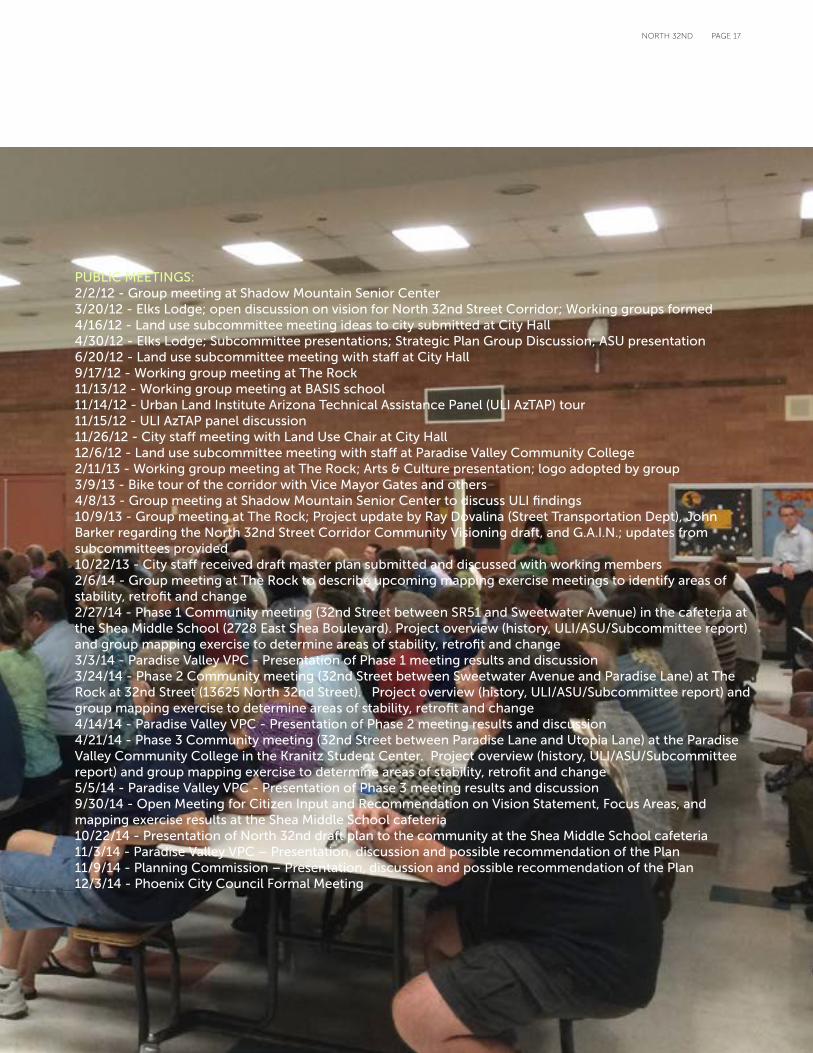
WORKING GROUP FORMED IN SPRING 20124/8/12 - North 32nd Street working group meeting6/25/12 - Meeting with community members re: North 32nd Street area plan and restaurants6/26/12 - North 32nd Street Working Group meeting 8/21/12 - Meeting with North 32nd Street Subcommittee Leaders8/26/12 - Meeting re: North 32nd Street Revitalization9/17/12 - North 32nd Street Working Group Meeting9/25/12 - Staff meeting re: North 32nd street improvements and revitalization11/13/12 - North 32nd Street Working Group meeting12/17/12 - Staff meeting re: North 32nd street corridor plan12/18/12 - Staff meeting to discuss North 32nd street 12/19/12 - Staff meeting re: arts and culture opportunities on North 32nd street 1/16/13 - Council District 3 staff meeting to discuss North 32nd street2/5/13 - Meeting with North 32nd street subcommittee members2/11/13 - Meeting re: 32nd street working group 2/27/13 - North 32nd street roundtable event10/9/13 - North 32nd street revitalization group meeting 1/30/14 - Staff meeting re: North 32nd street 2/6/14 - North 32nd Street Pre-phase meeting (Genesis Church)2/10/14 - Staff meeting re: North 32nd Street 2/13/14 - Tour of North 32nd street with city staff 2/27/14 - North 32nd street Phase 1 Community Meeting 3/24/14 - North 32nd Street Phase 2 Community Meeting 4/21/14 - North 32nd Street Phase 3 Community Meeting 6/16/14 - City staff meeting re: North 32nd Street 9/30/14 - North 32nd Street Community Meeting re: draft plan10/22/14 - North 32nd Street Community Meeting re: draft plan
PublicOUTREACH
PAGE 17NORTH 32ND
PUBLIC MEETINGS: 2/2/12 - Group meeting at Shadow Mountain Senior Center3/20/12 - Elks Lodge; open discussion on vision for North 32nd Street Corridor; Working groups formed 4/16/12 - Land use subcommittee meeting ideas to city submitted at City Hall 4/30/12 - Elks Lodge; Subcommittee presentations; Strategic Plan Group Discussion; ASU presentation6/20/12 - Land use subcommittee meeting with staff at City Hall9/17/12 - Working group meeting at The Rock11/13/12 - Working group meeting at BASIS school11/14/12 - Urban Land Institute Arizona Technical Assistance Panel (ULI AzTAP) tour11/15/12 - ULI AzTAP panel discussion11/26/12 - City staff meeting with Land Use Chair at City Hall12/6/12 - Land use subcommittee meeting with staff at Paradise Valley Community College2/11/13 - Working group meeting at The Rock; Arts & Culture presentation; logo adopted by group 3/9/13 - Bike tour of the corridor with Vice Mayor Gates and others4/8/13 - Group meeting at Shadow Mountain Senior Center to discuss ULI findings 10/9/13 - Group meeting at The Rock; Project update by Ray Dovalina (Street Transportation Dept), John Barker regarding the North 32nd Street Corridor Community Visioning draft, and G.A.I.N.; updates from subcommittees provided10/22/13 - City staff received draft master plan submitted and discussed with working members2/6/14 - Group meeting at The Rock to describe upcoming mapping exercise meetings to identify areas of stability, retrofit and change2/27/14 - Phase 1 Community meeting (32nd Street between SR51 and Sweetwater Avenue) in the cafeteria at the Shea Middle School (2728 East Shea Boulevard). Project overview (history, ULI/ASU/Subcommittee report) and group mapping exercise to determine areas of stability, retrofit and change3/3/14 - Paradise Valley VPC - Presentation of Phase 1 meeting results and discussion3/24/14 - Phase 2 Community meeting (32nd Street between Sweetwater Avenue and Paradise Lane) at The Rock at 32nd Street (13625 North 32nd Street). Project overview (history, ULI/ASU/Subcommittee report) and group mapping exercise to determine areas of stability, retrofit and change4/14/14 - Paradise Valley VPC - Presentation of Phase 2 meeting results and discussion4/21/14 - Phase 3 Community meeting (32nd Street between Paradise Lane and Utopia Lane) at the Paradise Valley Community College in the Kranitz Student Center. Project overview (history, ULI/ASU/Subcommittee report) and group mapping exercise to determine areas of stability, retrofit and change5/5/14 - Paradise Valley VPC - Presentation of Phase 3 meeting results and discussion9/30/14 - Open Meeting for Citizen Input and Recommendation on Vision Statement, Focus Areas, and mapping exercise results at the Shea Middle School cafeteria10/22/14 - Presentation of North 32nd draft plan to the community at the Shea Middle School cafeteria11/3/14 - Paradise Valley VPC – Presentation, discussion and possible recommendation of the Plan11/9/14 - Planning Commission – Presentation, discussion and possible recommendation of the Plan12/3/14 - Phoenix City Council Formal Meeting

PAGE 18 NORTH 32ND
PAGE 19NORTH 32ND
CurrentSTATEFor many years, North 32nd Street was the main thoroughfare from Central Phoenix to Northeast Phoenix. The intersection of North 32nd Street and Shea Boulevard was once the second busiest intersection in the entire city.
The completion of State Route 51 from Northern Avenue to the Loop 101 Freeway reduced vehicle use along the Corridor and demographic changes within neighborhoods adjacent to the freeway have impacted and changed the businesses and traffic characteristics of the area along North 32nd Street. While there have been improvements, North 32nd faces challenges with vacant lots, dated buildings, signage, lack of bicycle lanes, parking design, decrepit landscaping and under capacity traffic.
Evolving out of the efforts of the North 32nd Street Corridor Working Group, three separate documents were produced in relation to the improving the Corridor. They include the Arizona State University Graduate Student Student study, Urban Land Institute Arizona Technical Assistance Panel (ULI AzTAP), and the Draft Corridor Community Visioning document.
The May 2012 ASU Graduate Student Study accomplished the following:
In February 2013, the Urban Land Institute Arizona Technical Assistance Panel (AzTAP) released a summary report for North 32nd. This panel is an extension of the national Urban Land Institute (ULI) Advisory Services Program. ULI’s advisory services panels provide strategic advice to clients (public agencies and nonprofit organizations) on complex land use and real estate development issues.
The goal of the AzTAP was to gain a better understanding of the strengths and weaknesses of North 32nd and develop a plan of action to revitalize and create a vibrant community corridor for residents. To encourage redevelopment, the panel identified the need for a catalyst project guided by a plan that is supported by the neighborhood and integrated into the City General Plan. The panel identified the following as planning priorities key to the future redevelopment of the corridor.
The recommendations from the February 2013 ULI AzTAP include:• Make the northwest corner of North 32nd Street and Shea Boulevard a priority for redevelopment.• Redevelop commercial properties with mixed uses.• Create a complete street focused on the Phoenix Mountain Preserve.• Set an identity/vision for the Corridor based on community wants.• Attract youth and create opportunities for multi-generational developments, interactions and activities.• Create a separate cultural plan that includes fitness, arts, open space and a community center that
enhances and strengthens other planning efforts. This will help to create neighborhood buy-in to redevelopment and speak to the heart of the community.
• Reduce the number of traffic lanes to provide space for bicycle lanes and shaded sidewalks.• Facilitate neighborhood sustainability through housing rehabilitation programs and streamlined City of
Phoenix permitting.• Seek key leadership in the community to groom leaders and support those leaders with a process. • Split North 32nd into manageable sections.
The Draft North 32nd Street Corridor Community Vision identified:• Visioning Goals and Strategies.• Shore up the Corridor for the next generation.• Enhance the Corridor to attract investment from business owners and residents.• Make the Corridor a desirable place to live, work, and play.• Create an identity and sense of place.• Create a handout that identifies the tools to implement the vision of North 32nd.
• Described current conditions of the Corridor.• Implementation tools.• Future ambitions
• Light rail• Recreation resort
• Broad goals • Branding • Public Art• Road Diet• Landscaping
PAGE 20 NORTH 32ND
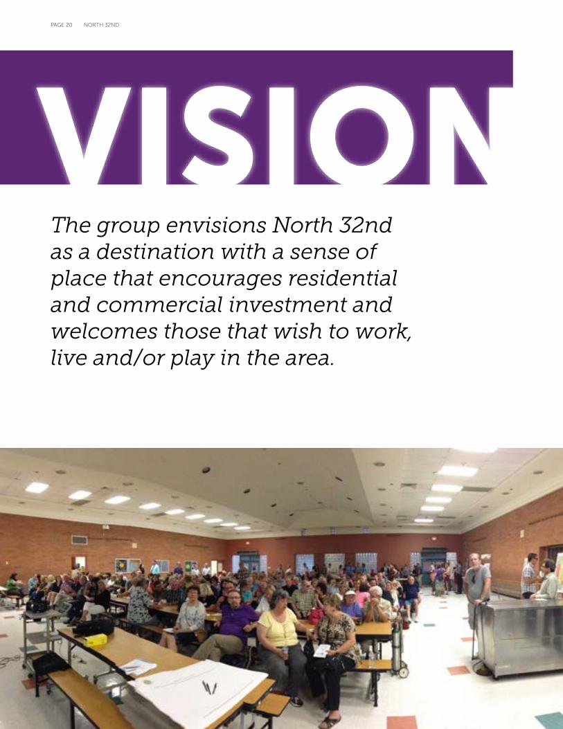
VISIONThe group envisions North 32nd as a destination with a sense of place that encourages residential and commercial investment and welcomes those that wish to work, live and/or play in the area.
PAGE 21NORTH 32ND
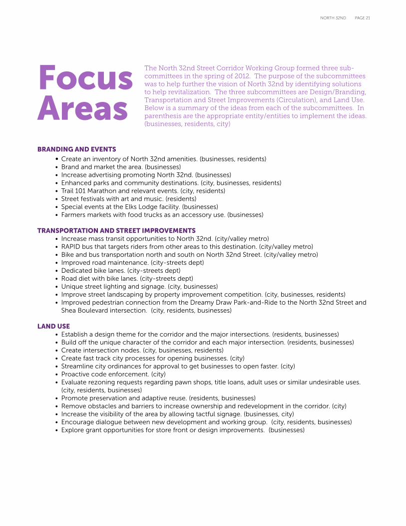
The North 32nd Street Corridor Working Group formed three sub-committees in the spring of 2012. The purpose of the subcommittees was to help further the vision of North 32nd by identifying solutions to help revitalization. The three subcommittees are Design/Branding, Transportation and Street Improvements (Circulation), and Land Use. Below is a summary of the ideas from each of the subcommittees. In parenthesis are the appropriate entity/entities to implement the ideas. (businesses, residents, city)
BRANDING AND EVENTS
• Create an inventory of North 32nd amenities. (businesses, residents)• Brand and market the area. (businesses)• Increase advertising promoting North 32nd. (businesses)• Enhanced parks and community destinations. (city, businesses, residents)• Trail 101 Marathon and relevant events. (city, residents)• Street festivals with art and music. (residents)• Special events at the Elks Lodge facility. (businesses)• Farmers markets with food trucks as an accessory use. (businesses)
TRANSPORTATION AND STREET IMPROVEMENTS• Increase mass transit opportunities to North 32nd. (city/valley metro)• RAPID bus that targets riders from other areas to this destination. (city/valley metro)• Bike and bus transportation north and south on North 32nd Street. (city/valley metro)• Improved road maintenance. (city-streets dept)• Dedicated bike lanes. (city-streets dept)• Road diet with bike lanes. (city-streets dept)• Unique street lighting and signage. (city, businesses)• Improve street landscaping by property improvement competition. (city, businesses, residents)• Improved pedestrian connection from the Dreamy Draw Park-and-Ride to the North 32nd Street and Shea Boulevard intersection. (city, residents, businesses)
LAND USE • Establish a design theme for the corridor and the major intersections. (residents, businesses)• Build off the unique character of the corridor and each major intersection. (residents, businesses)• Create intersection nodes. (city, businesses, residents)• Create fast track city processes for opening businesses. (city)• Streamline city ordinances for approval to get businesses to open faster. (city)• Proactive code enforcement. (city)• Evaluate rezoning requests regarding pawn shops, title loans, adult uses or similar undesirable uses. (city, residents, businesses)• Promote preservation and adaptive reuse. (residents, businesses)• Remove obstacles and barriers to increase ownership and redevelopment in the corridor. (city)• Increase the visibility of the area by allowing tactful signage. (businesses, city)• Encourage dialogue between new development and working group. (city, residents, businesses)• Explore grant opportunities for store front or design improvements. (businesses)
Focus Areas
PAGE 22 NORTH 32ND
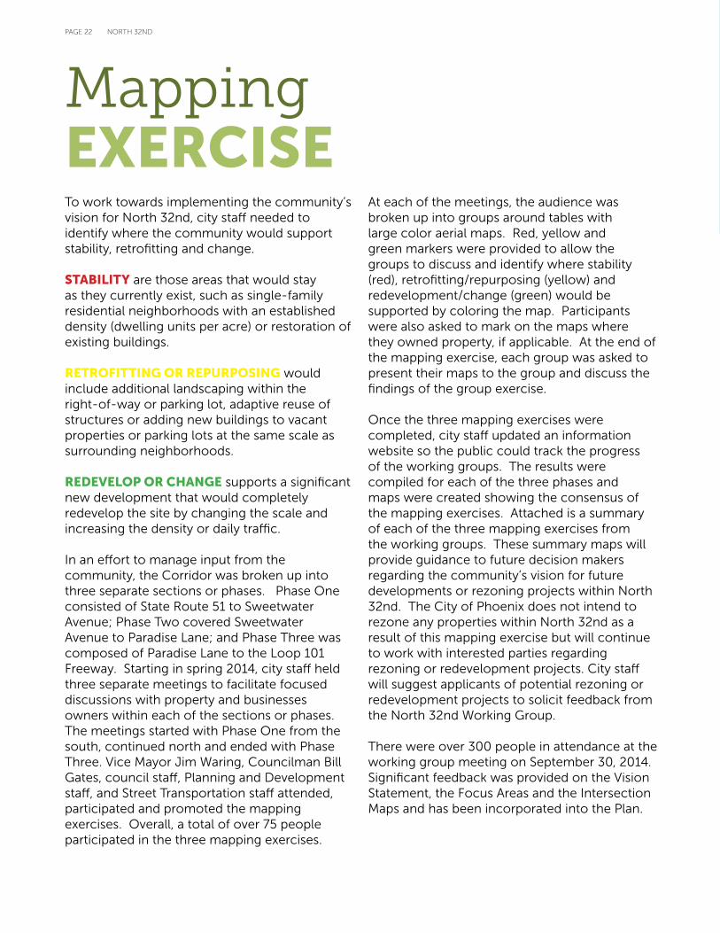
To work towards implementing the community’s vision for North 32nd, city staff needed to identify where the community would support stability, retrofitting and change.
STABILITY are those areas that would stay as they currently exist, such as single-family residential neighborhoods with an established density (dwelling units per acre) or restoration of existing buildings.
RETROFITTING OR REPURPOSING would include additional landscaping within the right-of-way or parking lot, adaptive reuse of structures or adding new buildings to vacant properties or parking lots at the same scale as surrounding neighborhoods.
REDEVELOP OR CHANGE supports a significant new development that would completely redevelop the site by changing the scale and increasing the density or daily traffic.
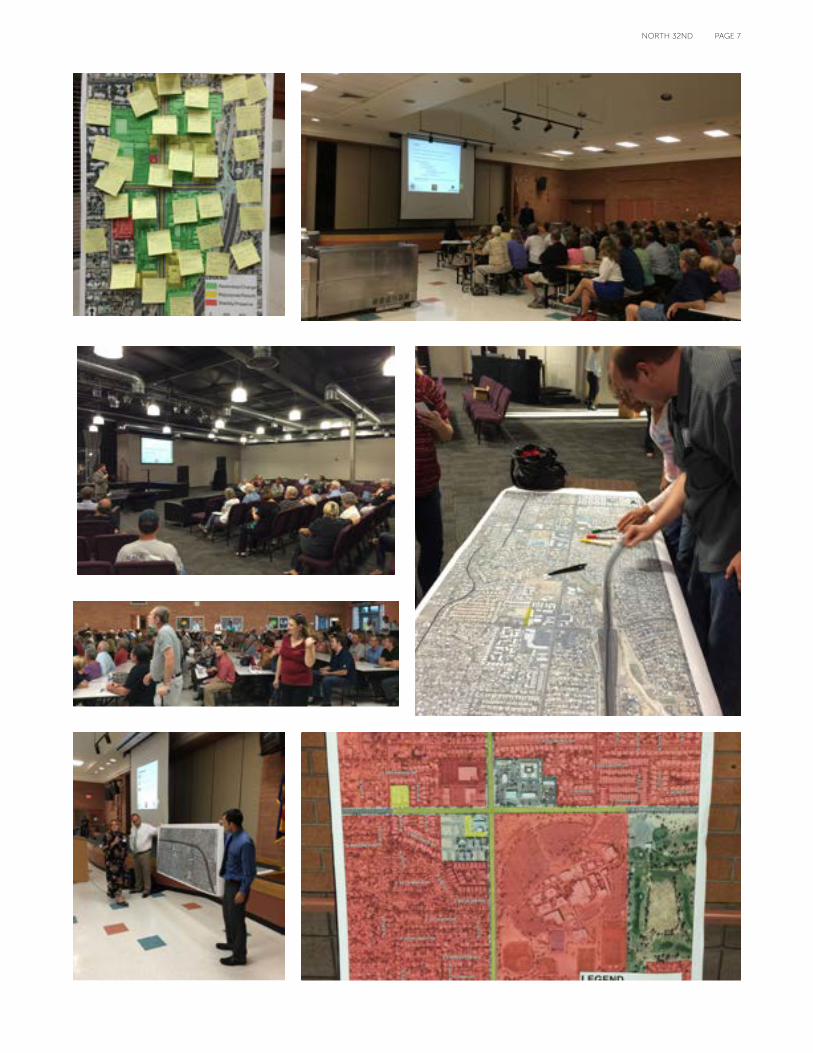
In an effort to manage input from the community, the Corridor was broken up into three separate sections or phases. Phase One consisted of State Route 51 to Sweetwater Avenue; Phase Two covered Sweetwater Avenue to Paradise Lane; and Phase Three was composed of Paradise Lane to the Loop 101 Freeway. Starting in spring 2014, city staff held three separate meetings to facilitate focused discussions with property and businesses owners within each of the sections or phases. The meetings started with Phase One from the south, continued north and ended with Phase Three. Vice Mayor Jim Waring, Councilman Bill Gates, council staff, Planning and Development staff, and Street Transportation staff attended, participated and promoted the mapping exercises. Overall, a total of over 75 people participated in the three mapping exercises.
At each of the meetings, the audience was broken up into groups around tables with large color aerial maps. Red, yellow and green markers were provided to allow the groups to discuss and identify where stability (red), retrofitting/repurposing (yellow) and redevelopment/change (green) would be supported by coloring the map. Participants were also asked to mark on the maps where they owned property, if applicable. At the end of the mapping exercise, each group was asked to present their maps to the group and discuss the findings of the group exercise.
Once the three mapping exercises were completed, city staff updated an information website so the public could track the progress of the working groups. The results were compiled for each of the three phases and maps were created showing the consensus of the mapping exercises. Attached is a summary of each of the three mapping exercises from the working groups. These summary maps will provide guidance to future decision makers regarding the community’s vision for future developments or rezoning projects within North 32nd. The City of Phoenix does not intend to rezone any properties within North 32nd as a result of this mapping exercise but will continue to work with interested parties regarding rezoning or redevelopment projects. City staff will suggest applicants of potential rezoning or redevelopment projects to solicit feedback from the North 32nd Working Group.
There were over 300 people in attendance at the working group meeting on September 30, 2014. Significant feedback was provided on the Vision Statement, the Focus Areas and the Intersection Maps and has been incorporated into the Plan.
Mapping EXERCISE
PAGE 23NORTH 32ND
N 3
2ND
ST
E SHEA BLVD
N 3
1ST
ST
E CHERYL DR
E DESERT COVE AVE
SR51
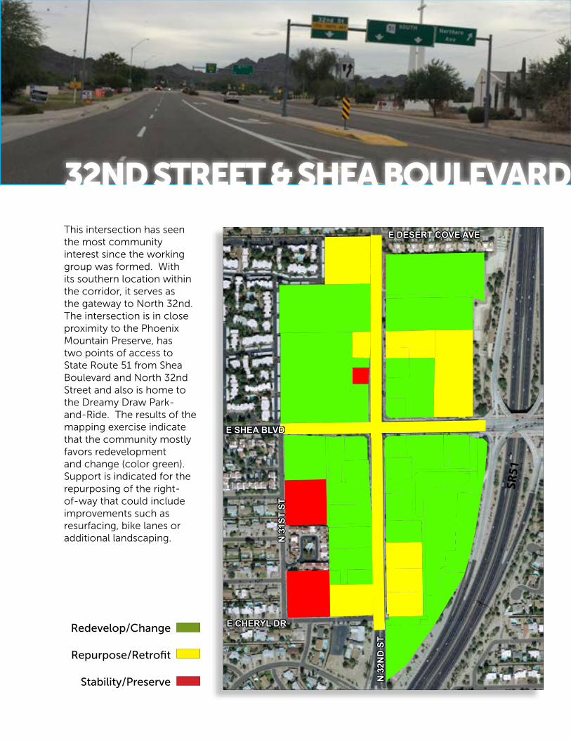
This intersection has seen the most community interest since the working group was formed. With its southern location within the corridor, it serves as the gateway to North 32nd. The intersection is in close proximity to the Phoenix Mountain Preserve, has two points of access to State Route 51 from Shea Boulevard and North 32nd Street and also is home to the Dreamy Draw Park-and-Ride. The results of the mapping exercise indicate that the community mostly favors redevelopment and change (color green). Support is indicated for the repurposing of the right-of-way that could include improvements such as resurfacing, bike lanes or additional landscaping.
Redevelop/Change
Repurpose/Retrofit
Stability/Preserve
32ND STREET & SHEA BOULEVARD
PAGE 24 NORTH 32ND
N 3
2ND
ST
N 3
1ST
ST
E LAUREL LN
E BLOOMFIELD RD
E WETHERSFIELD RD
CACTU E S DR
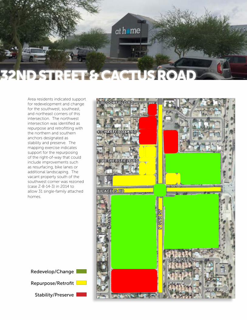
Area residents indicated support for redevelopment and change for the southwest, southeast, and northeast corners of this intersection. The northwest intersection was identified as repurpose and retrofitting with the northern and southern anchors designated as stability and preserve. The mapping exercise indicates support for the repurposing of the right-of-way that could include improvements such as resurfacing, bike lanes or additional landscaping. The vacant property south of the southwest corner was rezoned (case Z-8-14-3) in 2014 to allow 31 single-family attached homes.
Redevelop/Change
Repurpose/Retrofit
Stability/Preserve
32ND STREET & CACTUS ROAD

PAGE 25NORTH 32ND
N 3
2ND
ST
N 3
1ST
ST
N 3
0TH
ST
E EMILE ZOLA AVE
E THUNDERBIRD RD
E ACOMA DR
E HEARN RD
E WINCHCOMB DR
SR51
The northwest corner of 32nd Street and Hearn Road was rezoned (case Z-150-07-3) in 2007 to PUD (Planned Unit Development) to allow a single-family residential and a mix of other uses such as the existing Elks Lodge, medical/professional offices, and self-storage. During the mapping exercises, neighborhood residents expressed opposition to any additional entitlement beyond the parameters of the approved PUD. Therefore the property is designated as repurpose/retrofit.
Each corner of the intersection is also designated for repurpose/retrofit. Immediately beyond the intersection are residential developments designated as stability/preservation. Support is indicated for the repurposing of the right-of-way that could include improvements such as resurfacing, bike lanes or additional landscaping.
Redevelop/Change
Repurpose/Retrofit
Stability/Preserve
32ND STREET & THUNDERBIRD ROAD
Elks Lodge PUD

PAGE 26 NORTH 32ND
N 2
9TH
ST
ST
N 3
1ST
ST
N 3
0TH
ST
E NISBET RD
E GREENWAY RD
E TIERRA BUENA LN
E SUNNYSIDE LN
E MARCONI AVE
N 3
4TH
ST
SR51
The mapping exercise results show support for redevelopment / change primarily between 29th and 31st Street north of Greenway Road as well as the northeast corner of North 32nd Street and East Tierra Buena Lane. Support for additional landscape or façade improvements are shown for the frontages for the southeast, northwest and northeast corners. Each of the four corners are identified primarily as repurpose/retrofit. The neighborhoods adjacent to the southwest and southeast corners were labeled for stability / preserve. Support is indicated for the repurposing of the right-of-way that could include improvements such as resurfacing, bike lanes or additional landscaping.
Redevelop/Change
Repurpose/Retrofit
Stability/Preserve
32ND STREET & GREENWAY ROAD

PAGE 27NORTH 32ND
32ND STREET & GREENWAY ROAD
N 3
2ND
STN
30T
H S
T
N 3
1ST
ST
E PHELPS RD
N 3
4TH
WAY
E ANGELA DR
E DANBURY RD
N 3
4TH
ST
E KINGS AVE
E BELL RD
The only area designated for Redevelop/Change was the southwest corner of Bell Road and North 32nd Street. The area adjacent to that corner as well as the other three corners was earmarked for Repurpose/Retrofit. The single-family residential development north of the northeast was identified for Stability / Preserve. Support is indicated for the repurposing of the right-of-way that could include improvements such as resurfacing, bike lanes or additional landscaping.
Redevelop/Change
Repurpose/Retrofit
Stability/Preserve
32ND STREET & BELL ROAD

PAGE 28 NORTH 32ND
N 3
2ND
ST
E UTOPIA RD
N 3
4TH
ST
N 3
0TH
ST
E UNION HILLS DR
E GROVERS AVE
N 2
9TH
ST
The mapping exercise predominantly revealed Stability/Preserve for the majority of the area near this intersection. The Paradise Valley Community College acts as the northern anchor of North 32nd and the community expressed the strong desire to keep this knowledge anchor in place. Support is indicated for the repurposing of the right-of-way that could include improvements such as resurfacing, bike lanes or additional landscaping.
Redevelop/Change
Repurpose/Retrofit
Stability/Preserve
32ND STREET & UNION HILLS DRIVE

PAGE 29NORTH 32ND
32ND STREET & UNION HILLS DRIVETHIS IS JUST THE BEGINNINGThe North 32nd Policy Plan will assist future decision makers with redevelopments, improvements and new businesses within North 32nd. The Plan is not regulatory, but rather acts as a “road map” on how to work toward revitalizing North 32nd. This revitalization will require effort from the City of Phoenix and buy-in from current and future private property and business owners. Currently there are limited municipal funding sources due to the state of the economy. The city will continue to seek outside funding sources to work towards the goal of returning North 32nd Street to a vibrant and unique sense of place. The efforts utilized during this process will result in positive improvements to the streetscape, economy, livelihood and quality of life along North 32nd.
LINKS TO EXTERNAL STUDIES AND REPORTSPlease visit the following webpages to read, download or print the following external studies and reports.
Urban Land Institute Arizona Technical Assistance Panel (ULI AzTap) https://www.phoenix.gov/pddsite/Documents/pdd_pz_pdf_00387.pdf
Arizona State University Graduate Report: 2012 32nd Street Revitalization Project https://www.phoenix.gov/pddsite/Documents/pdd_pz_pdf_00388.pdf
Draft North 32nd Street Corridor Community Vision https://www.phoenix.gov/pddsite/Documents/32street_vision.pdf
CONTACT:City of Phoenix Council District 3Councilman Bill Gates200 West Washington Street, 11th FloorPhoenix, AZ 85003
(602) 262-7441 / TTY (602) [email protected]://www.phoenix.gov/district3
City of Phoenix North 32nd Planning Pagehttps://www.phoenix.gov/pdd/pz/north-32nd-street-corridor