chapter 13 - saltash - cornwall · 13. saltash 13.1 saltash is situated on the eastern edge of...
TRANSCRIPT

1
Chapter 13 - Saltash
2
13. Saltash13.1 Saltash is situated on the eastern edge of Cornwall at the lowest bridging point on the Tamar River. The town acts as a gateway to Cornwall and as the main local service centre for many of the smaller settlements surrounding it. Saltash lies across the river from Plymouth and the close proximity of the city has a heavy influence on the town. A key characteristic of the town’s population is the greater numbers of families with parents of a working age than retired people. Younger people tend to leave the area to seek training and employment.
13.2 Key Facts:
Population (2011 Census) : 16,419Dwellings (2011 Census): 7,281Average house building rate (2005-2015): 43 per annumHousing need (Bands A-E) October 2013: 671Number of jobs (2011): 2583 (ft); 2431(pt)Average Wage (ONS Annual Survey 2013): £439 per week
13.3 An outline strategy for the town is set out on the following pages, together with allocated sites; for the more detailed strategy for Saltash please refer to the Saltash Neighbourhood Development Plan, which was in the process of being developed, at the time of writing.
Saltash: Strategic Objectives and Targets
13.4 The Cornwall Local Plan: Strategic Policies DPD (LP:SP) sets out five Strategic Objectives for the wider Cornwall Gateway CNA, which Saltash forms part of, together with housing and economic targets for the Plan period (2010 to 2030). The strategic objectives can be read in full in the LP:SP and relate to issues such as the regeneration of Saltash town centre; provision of affordable housing; and the enhancement of jobs and services etc.
13.5 In relation to specific housing and economic targets, LP:SP - Policy 2a sets out the requirement for the provision of the following over the Plan period:
• Provision of around 1,200 dwellings for Saltash town in the period up to 2030; and,
• Provision of 6,917sqm of B1a office accommodation and 10,583sqm of industrial space in the Cornwall Gateway CNA.
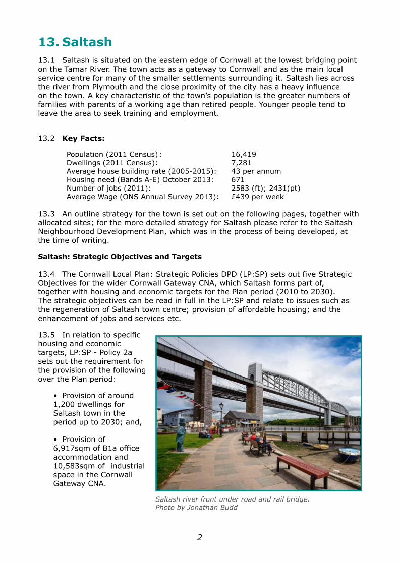
Saltash river front under road and rail bridge.Photo by Jonathan Budd
3
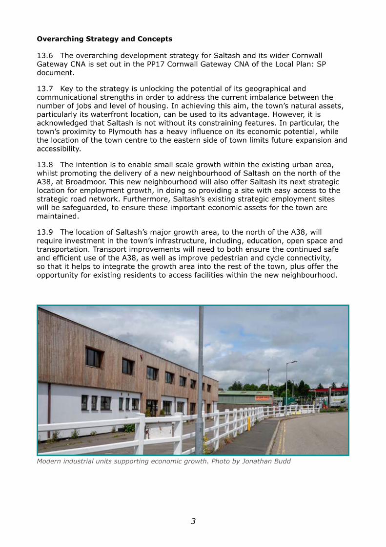
Modern industrial units supporting economic growth. Photo by Jonathan Budd
Overarching Strategy and Concepts
13.6 The overarching development strategy for Saltash and its wider Cornwall Gateway CNA is set out in the PP17 Cornwall Gateway CNA of the Local Plan: SP document.
13.7 Key to the strategy is unlocking the potential of its geographical and communicational strengths in order to address the current imbalance between the number of jobs and level of housing. In achieving this aim, the town’s natural assets, particularly its waterfront location, can be used to its advantage. However, it is acknowledged that Saltash is not without its constraining features. In particular, the town’s proximity to Plymouth has a heavy influence on its economic potential, while the location of the town centre to the eastern side of town limits future expansion and accessibility.
13.8 The intention is to enable small scale growth within the existing urban area, whilst promoting the delivery of a new neighbourhood of Saltash on the north of the A38, at Broadmoor. This new neighbourhood will also offer Saltash its next strategic location for employment growth, in doing so providing a site with easy access to the strategic road network. Furthermore, Saltash’s existing strategic employment sites will be safeguarded, to ensure these important economic assets for the town are maintained.
13.9 The location of Saltash’s major growth area, to the north of the A38, will require investment in the town’s infrastructure, including, education, open space and transportation. Transport improvements will need to both ensure the continued safe and efficient use of the A38, as well as improve pedestrian and cycle connectivity, so that it helps to integrate the growth area into the rest of the town, plus offer the opportunity for existing residents to access facilities within the new neighbourhood.
4
Saltash - Employment land (B use classes)Office(sqm)
Industrial(sqm)
Local Plan CNA Target 6,917 10,583Net Completions Apr - 10 to Mar - 16 1,094 977Net extant planning permission / under construction (at Mar -16)
-468 2,141
Residual Local Plan Target 6,291 7,465
Economic Growth13.10 The proximity of Saltash to Plymouth is, and will continue to be, a significant draw for employment, however there is an aspiration to provide additional employment opportunities, to increase the opportunity for residents to live and work within the town.
13.11 The proximity of the A38 to the town represents a key asset for the town to exploit and in turn represents the most commercially attractive for employment, particularly industrial, development; which is highlighted by the location of the town’s existing industrial estates. As a result, land will be prioritised for employment use that is within easy reach of the Strategic Road Network, as well as protecting existing employment sites with good access to the A38.
13.12 The Cornwall LP:SP document indicates that the Cornwall Gateway CNA, which Saltash falls within, should deliver at least 6,917sqm of B1a office accommodation and 10,583sqm of industrial space. Table Slt1 sets out progress towards delivery of these targets:
13.13 The assessment indicates that approximately 14,000sqm of additional office and industrial space needs to be permitted to deliver the Community Network Area’s employment targets. Land to accommodate employment growth at Saltash is identified at Stoketon Cross (SLT-E1). Stoketon Cross benefits from links to the Strategic Road Network and is sited alongside land identified, under Policy SLT-UE1 at Broadmoor, for the development of a new neighbourhood of Saltash. As a result, the site offers the opportunity to provide employment within a new neighbourhood of Saltash, whilst also offering good vehicular access to the strategic road network. With a lack of space within Saltash’s existing industrial estates, Stoketon Cross represents the town’s next strategic employment site, providing the opportunity for economic growth both within and beyond the Plan period.
13.14 Despite the lack of space for additional growth within Saltash’s existing industrial estates, their importance as key employment generators for the town and surrounding area are still recognised. Furthermore, their location adjacent to the A38 means they are still well placed to provide for the future needs of industry. As a result, four existing employment sites, at Moorlands (including Moorlands Lane and Moorlands Trading Estate), Saltash Industrial Estate, Saltash Parkway and Tamar View, are identified as being strategically important and are therefore safeguarded under Policies SLT-E2, SLT-E3, SLT-E4 and SLT-E5.
Table Slt1. Saltash - Employment Land
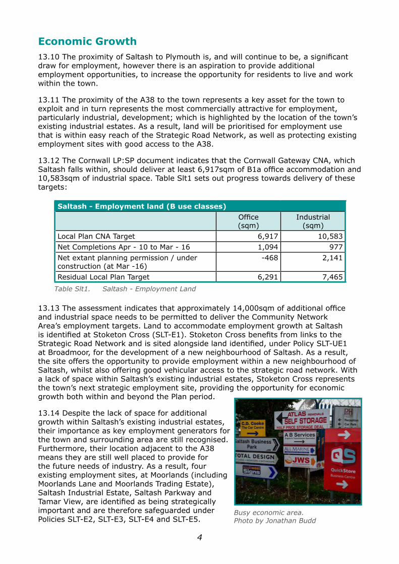
Busy economic area.Photo by Jonathan Budd
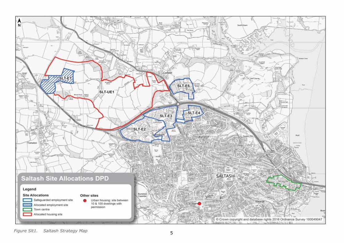
5Figure Slt1. Saltash Strategy Map
6
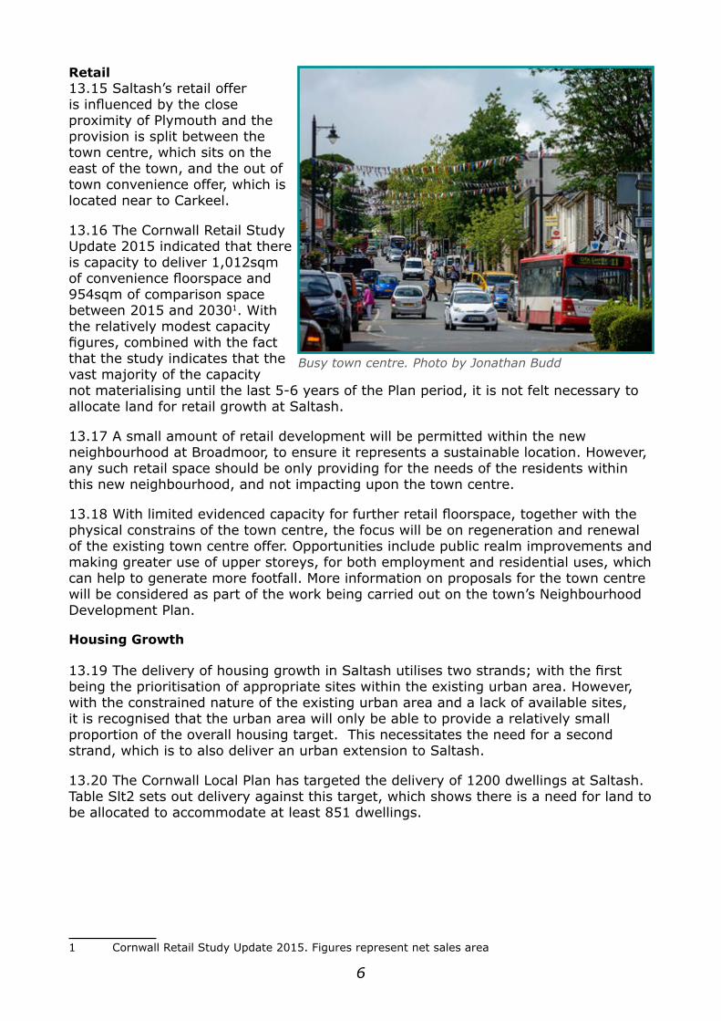
Retail13.15 Saltash’s retail offer is influenced by the close proximity of Plymouth and the provision is split between the town centre, which sits on the east of the town, and the out of town convenience offer, which is located near to Carkeel.
13.16 The Cornwall Retail Study Update 2015 indicated that there is capacity to deliver 1,012sqm of convenience floorspace and 954sqm of comparison space between 2015 and 20301. With the relatively modest capacity figures, combined with the fact that the study indicates that the vast majority of the capacity not materialising until the last 5-6 years of the Plan period, it is not felt necessary to allocate land for retail growth at Saltash.
13.17 A small amount of retail development will be permitted within the new neighbourhood at Broadmoor, to ensure it represents a sustainable location. However, any such retail space should be only providing for the needs of the residents within this new neighbourhood, and not impacting upon the town centre.
13.18 With limited evidenced capacity for further retail floorspace, together with the physical constrains of the town centre, the focus will be on regeneration and renewal of the existing town centre offer. Opportunities include public realm improvements and making greater use of upper storeys, for both employment and residential uses, which can help to generate more footfall. More information on proposals for the town centre will be considered as part of the work being carried out on the town’s Neighbourhood Development Plan.
Housing Growth
13.19 The delivery of housing growth in Saltash utilises two strands; with the first being the prioritisation of appropriate sites within the existing urban area. However, with the constrained nature of the existing urban area and a lack of available sites, it is recognised that the urban area will only be able to provide a relatively small proportion of the overall housing target. This necessitates the need for a second strand, which is to also deliver an urban extension to Saltash.
13.20 The Cornwall Local Plan has targeted the delivery of 1200 dwellings at Saltash. Table Slt2 sets out delivery against this target, which shows there is a need for land to be allocated to accommodate at least 851 dwellings.
1 Cornwall Retail Study Update 2015. Figures represent net sales area
Busy town centre. Photo by Jonathan Budd
7
Saltash - Delivery against Housing TargetTarget 1,200
Net Completions (Apr -10 to Apr - 15) 135Net Extant permissions (at Apr - 15) 97
Net windfall projection 117Net additional urban capacity 0
Residual target 851
Table Slt2. CPIR Delivery against Housing Target
13.21 In identifying the most appropriate location to accommodate housing development, an assessment was carried out which examined all potential land adjoining the built edge of the town. The details of this are contained within the Site Allocations DPD: Saltash Housing Evidence Report, which can be found at www.cornwall.gov.uk.
13.22 Broadmoor (Site reference and Policy SLT-UE1) is identified as the most suitable location to accommodate the required development for Saltash for the Plan period. With Broadmoor located on the opposite side of the A38 to the majority of the town, it is important that the site creates a new neighbourhood, containing services and facilities that are easily accessible for its residents; such as public open space, education facilities, local convenience store, community hall etc. Furthermore, the development should create appropriate highway, pedestrian and cycle linkages back into the main urban area, in doing so ensuring it represents a new neighbourhood of the town, rather than being an isolated community.
13.23 At the time of writing the site was subject to a planning application (PA14/02447) and it had been resolved to grant permission subject to outstanding highway issues being addressed. The planning application was for a mixed use scheme that included 1,000 dwellings. It is forecast that the site will be fully developed within the Plan period.
Infrastructure
13.24 A fundamental element in the future regeneration and growth of Saltash will be the provision of supporting infrastructure, including improved healthcare and education facilities; investment in the area’s utilities; plus the delivery of transportation and Green Infrastructure (GI) strategies.
Education 13.25 Primary – There are four primary schools serving the Saltash area which have the capacity to accommodate 1250 pupils. Current Local Authority forecasts predict that the schools will be collectively operating at capacity by 2017. However, when incorporating the proposed housing growth it is estimated that it will generate demand for approximately 120 places.
13.26 As a result of the anticipated deficit of places, together with the location of the town’s main site for housing, a new primary school is required, which should form part of the mixed use proposals at Broadmoor (Policy SLT-UE1). The school can be delivered in phases, with 4 classes and associated facilities required within the Plan period, whilst the site should be sufficient in size to safeguard future expansion.
8
13.27 Secondary – There is one secondary school within Saltash which has the capacity to accommodate 1360 pupils. Forecasts predict the school will be operating at, or over, capacity by 2017. It is anticipated that with the proposed housing growth for the town and immediate hinterland there will be a deficit of approximately 140 places by 2030. As a result contributions will be sought from residential development to support the expansion of the existing school and plans have been developed to help facilitate this.
Healthcare13.28 Saltash has two GP surgeries which cater for just over 19,000 residents from within the town (87%) and its wider hinterland; however both surgeries are deemed to be undersized for their patient lists. By 2030 Saltash will require 640sqm of additional space to meet Practice Size Guidance levels; although only 125sqm is generated by the targeted housing growth. Furthermore, it is estimated that the proposed growth would generate demand for approximately 1 new FTE GP.
13.29 The Health and Care system is looking at new ways of delivering care, with a shared ambition to achieve integration of provision across health, social care and the voluntary/community sector. This goal seeks to support people to live well within the community and to reduce the need for A&E attendance and hospital admissions. A transformation programme is in place, with the objective to support the “bottom up” development of local care communities. While this transformation approach seeks to reduce pressure within the system, the solution is dependent on effective care provision delivered within the community. It is expected that Primary Care will sit at the heart of this new way of working. Groups of GP Practices (known as Locality Groups) are working with health, social care and voluntary sector partners to lead the development of solutions, appropriate for their local population. This work is being managed within 10 Localities across Cornwall. Saltash sits within the East Cornwall Locality (together with Liskeard, Looe, Callington and Launceston). Focus for this Locality has been on commissioning better support for frail, vulnerable patients living in the community. Its service development plans are based on providing an integrated community care team, based around GP Practices, providing services that meet the specific needs of individuals requiring support.
13.30 The Broadmoor development (SLT-UE1) is proposing the delivery of a new healthcare facility on site; this would cater for the additional demand generated for GP services, plus offers the opportunity to deliver Locality initiatives. Furthermore, funding has been secured to improve Saltash Health Centre
Utilities13.31 Water / Drainage - Sewage is piped across the Tamar Bridge for treatment in at Ernesettle, on the edge of Plymouth. The growth planned for Saltash, combined with
The Cornish Cross, SaltashPhoto by Jonathan Budd
9
the growth for Plymouth is likely to exceed treatment capacity at Ernesettle in the medium term; plus pipe capacity across the Tamar may also be exceeded. South West Water is investigating the delivery of a new treatment works on the edge of Saltash, which will have a 3-4 year lead in time. South West Water has indicated that a new facility would be a regulated investment, as a result no developer contributions are expected for this strategic infrastructure. Cornwall Council will continue to work with South West Water to ensure the timely delivery of an appropriate capacity solution.
13.32 Electricity - Western Power Distribution (WPD) has indicated that there will be no need to improve its strategic infrastructure to accommodate the proposed growth within the town. Furthermore, WPD has indicated that it is unlikely that the growth will trigger the need to upgrade the primary substations within the town. Cornwall Council will continue to work with WPD to review impacts of growth.
Transportation
13.33 Saltash’s Transport Strategy sits within the context of Cornwall Council’s overarching transport strategy, Connecting Cornwall – as set out in more detail in Section 2.12.
13.34 Situated on one of two trunk roads into Cornwall, Saltash is the gateway to Cornwall from Plymouth. There are over 7,000 daily commuter trips between South East Cornwall and Plymouth and the vast majority of these are from Saltash. This is partly due to an imbalance between housing and jobs in the town with 43% of the town’s working population commuting to Plymouth. This presents a challenge in reducing the number and length of trips generated in the town. The high frequency of bus services to Plymouth makes bus more attractive than rail for commuting. Consequently the rail network is underutilised (1% of the town’s working population travel to work by rail). Despite the strong bus network, 67% of travel to work trips are still made by car. The demand to travel to Plymouth for employment and shopping puts pressure on the Tamar crossings and recent study work has identified a number of capacity improvements to the bridge and surrounding network capacity that will be required in the longer term. This includes improvements to the cycle routes between Plymouth and Saltash.
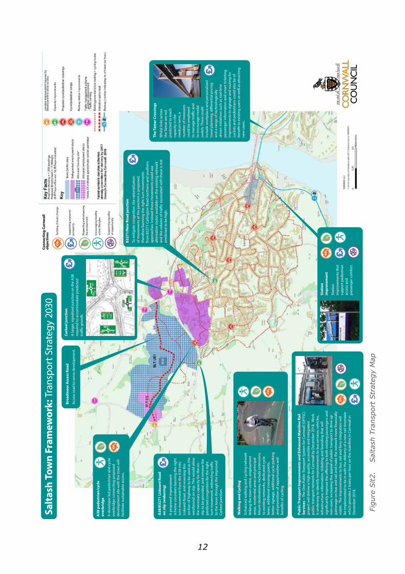
13.35 The Transport Strategy for Saltash is illustrated in Figure Slt2 and seeks to address a number of issues:
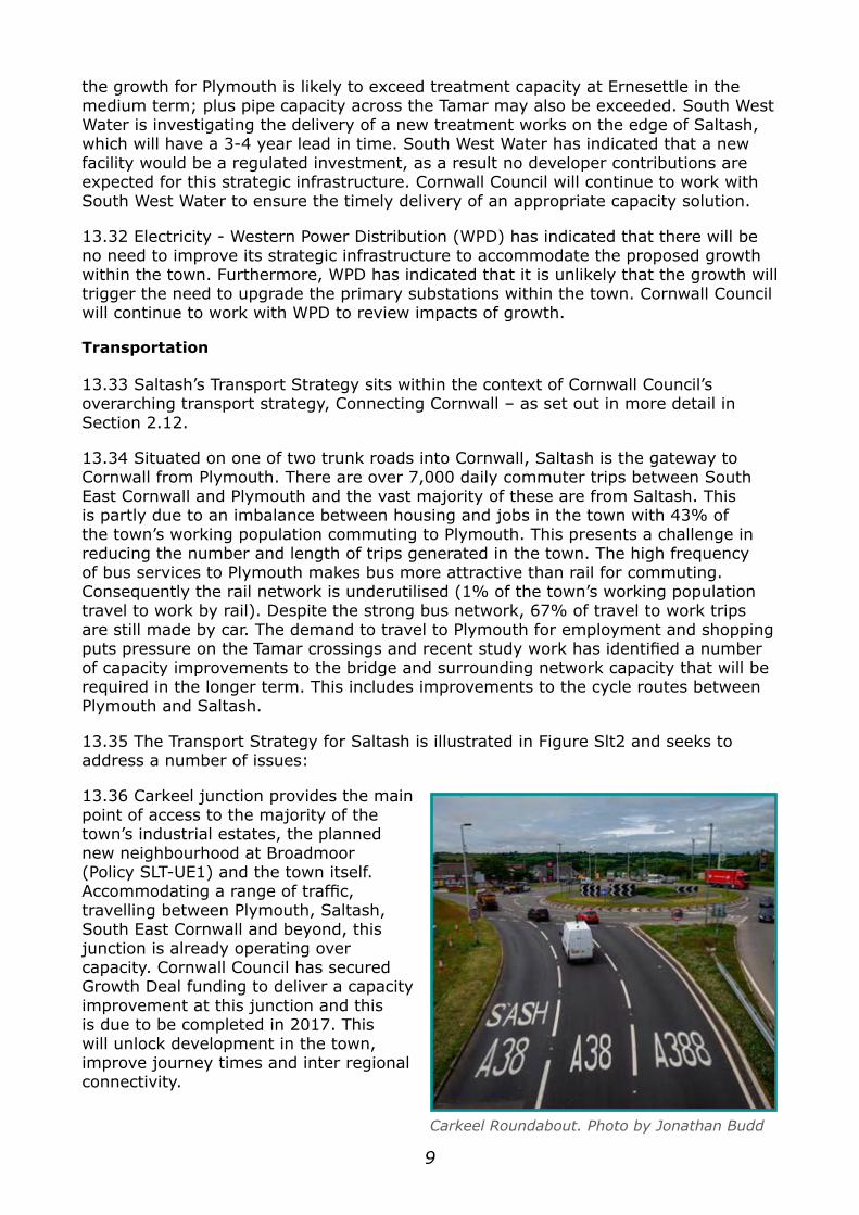
13.36 Carkeel junction provides the main point of access to the majority of the town’s industrial estates, the planned new neighbourhood at Broadmoor (Policy SLT-UE1) and the town itself. Accommodating a range of traffic, travelling between Plymouth, Saltash, South East Cornwall and beyond, this junction is already operating over capacity. Cornwall Council has secured Growth Deal funding to deliver a capacity improvement at this junction and this is due to be completed in 2017. This will unlock development in the town, improve journey times and inter regional connectivity.
Carkeel Roundabout. Photo by Jonathan Budd

10
Saltash Strategy ProjectsScheme type Scheme Comment
Junction improvements/traffic management
Carkeel Roundabout Phase 1 and overbridge
Situated on the trunk road the Carkeel roundabout already operates over capacity and will require widening if the growth planned for the town is to be delivered. The B3271/New Road signalised junction is also expected to come under signicant pressure by 2030 and the A38/B3271 Liskeard Road on slip will also need upgrading in order to accommodate predicted traffic growth.The A38/Stoketon Cross junction will need to be upgraded to a roundabout to allow access to employment land allocation and mitigate potential congestion resulting from development.Rood’s corner junction will require an improvement to support diversion of south bound traffic from the A388.To support a diversion of traffic and make pedestrian and cycling trips more attractive along the A388, calming measures will be introduced to drive down speed.
Carkeel Roundabout Phase 2 (larger signalisation)
B3271/New Road junction
A38/B3271 Liskeard Road on slip (widening)
Stoketon Cross Roundabout scheme
Rood’s Corner junction roundabout scheme, Carkeel
A388 traffic calming
Rail improvements
Station frontage and access improvements
Improved access and legibility of walking and cycling routes to the stations; additional cycle storage; the provision of half-hourly mainline rail service between Penzance and Exeter.
13.37 The B3271/New Road junction and the A38/B3271 on slip junction are predicted to be over capacity by 2030. Capacity and signalling improvements will also be required at these junctions.
13.38 The A38 creates severance between the town and the proposed growth area of Saltash, Broadmoor. This poses a challenge for the new development to achieve sustainable trips. It is important that investment is targeted to walking, cycling and public transport improvements, in order to encourage increased use of these more sustainable modes of travel to mitigate the traffic impacts and to provide travel options for people who do not have access to, or cannot afford to run a car. This includes a pedestrian bridge over the A38 connecting the Broadmoor site to the town, plus traffic calming along the A388 between Carkeel village and Carkeel junction to promote safety and walking and cycling. (This is in addition to the recently completed pedestrian bridge over the A38 at Carkeel).
11
Bus improvements
Bus services and infrastructure/RTPI
The One Public Transport System for Cornwall (OPTSC) project will deliver a high quality, accessible and integrated public transport network for Cornwall by December 2018. Work is underway to identify improvements to bus services, infrastructure, information, ticketing and branding that will significantly improving the offering to both existing passengers and non-users to improve the appeal of public transport, driving up patronage on bus and rail, making the network more financially viable. The improvements to bus, rail and ferry integration will be implemented to tie in with the delivery of a new rail timetable which provides 2 trains per hour on the mainline in Cornwall in December 2018.
Walking/cycling improvements
Town wide cycle network
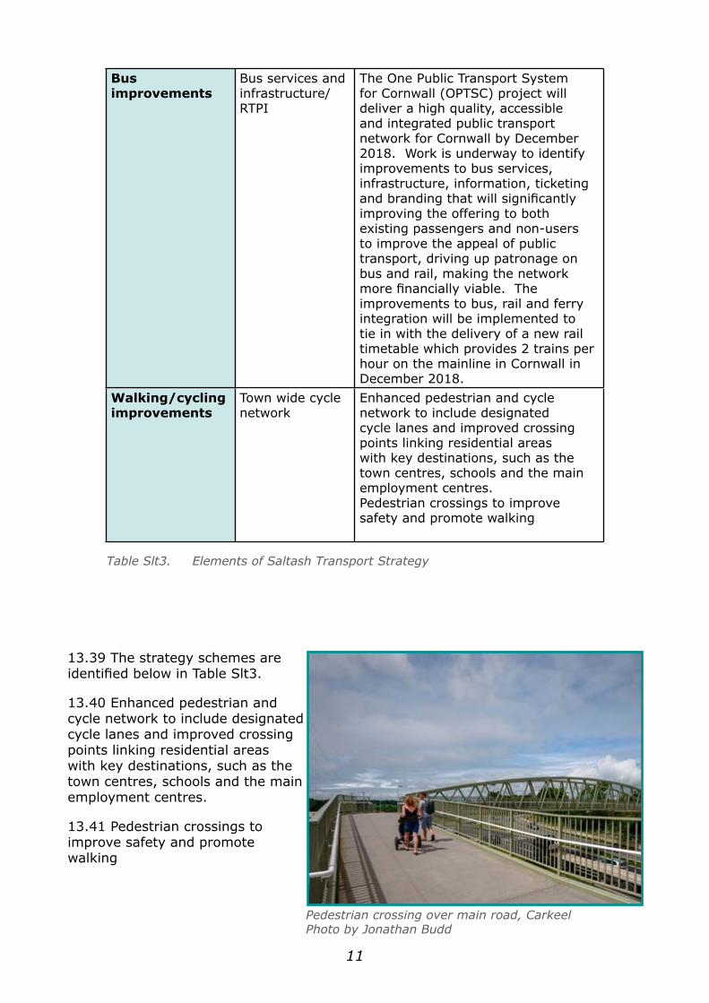
Enhanced pedestrian and cycle network to include designated cycle lanes and improved crossing points linking residential areas with key destinations, such as the town centres, schools and the main employment centres.Pedestrian crossings to improve safety and promote walking
Table Slt3. Elements of Saltash Transport Strategy
13.39 The strategy schemes are identified below in Table Slt3.
13.40 Enhanced pedestrian and cycle network to include designated cycle lanes and improved crossing points linking residential areas with key destinations, such as the town centres, schools and the main employment centres.
13.41 Pedestrian crossings to improve safety and promote walking
Pedestrian crossing over main road, CarkeelPhoto by Jonathan Budd
12
Salt
ash
Tow
n Fr
amew
ork:
Tra
nspo
rt S
trat
egy
2030
A38
ped
estr
ian/
cycl
e
over
brid
ge
A d
evel
oper
led
pede
stria
n an
d cy
cle
over
brid
ge c
onne
ctin
g pr
opos
ed
deve
lopm
ent s
ite w
ith th
e to
wn
will
fa
cilit
ate
sust
aina
ble
acce
ss.
B327
1/N
ew R
oad
junc
tion
To m
itiga
te c
onge
stio
n, th
e ra
tiona
lisat
ion
of m
ovem
ents
at t
he ju
nctio
n is
pro
pose
d,
ther
efor
e ba
nnin
g th
e rig
ht-t
urn
mov
emen
ts
from
B32
71 C
allin
gton
Roa
d no
rthe
rn a
nd s
outh
ern
appr
oach
es. I
nste
ad th
ese
mov
emen
ts c
ould
use
al
tern
ativ
e ro
utes
ava
ilabl
e on
the
exis
ting
netw
ork
and
the
volu
me
of tr
affic
asso
ciat
ed w
ith th
ese
is n
ot
pred
icte
d to
be
high
.
Broa
dmoo
r Acc
ess
Road
Acce
ss ro
ad to
ser
ve d
evel
opm
ent.
A38
/B32
71 L
iske
ard
Road
on
slip
(wid
enin
g)
A p
ropo
sed
impr
ovem
ent
sche
me
cons
ider
s ba
nnin
g th
e rig
ht
turn
mov
emen
t fro
m th
e A
38 in
to
Lisk
eard
Roa
d, a
nd re
vers
ing
this
se
ctio
n of
hig
hway
to b
e us
ed a
s th
e w
estb
ound
on-
slip
. Thi
s w
ould
allo
w
the
nece
ssar
y ca
paci
ty fo
r the
on-
slip
to b
e pr
ovid
ed, a
nd re
mov
e th
e pr
edic
ted
cong
estio
n fo
r the
righ
t tu
rn m
ovem
ent,
redi
rect
ing
traffi
c to
the
tow
n th
roug
h th
e im
prov
ed
Cark
eel j
unct
ion.
Cark
eel j
unct
ion
A la
rger
, sig
nalis
ed ju
nctio
n on
the
A38
re
quire
d to
acc
omm
odat
e pr
edic
ted
traffi
c gr
owth
.
Wal
king
and
Cyc
ling
Enha
nced
wal
king
and
cyc
ling
netw
ork
linki
ng th
e to
wn
cent
re, e
mpl
oym
ent
area
s, re
side
ntia
l are
as a
nd p
rinci
pal
leis
ure
dest
inat
ions
, inc
lude
ext
ensi
ons
to e
xist
ing
netw
orks
, ded
icat
ed c
ycle
la
nes,
addi
tiona
l cro
ssin
gs p
oint
s, be
tter
sig
nage
, add
ition
al c
ycle
par
king
an
d pr
omot
ion
of o
ppor
tuni
ties
and
bene
fits
of c
yclin
g.
The
Tam
ar C
ross
ings
Whi
lst l
inks
acr
oss
the
Tam
ar a
re n
ot
pred
icte
d to
reac
h ca
paci
ty in
the
med
ium
term
, a
num
ber o
f mea
sure
s co
uld
be e
mpl
oyed
to
man
age
traffi
c an
d to
enc
oura
ge m
odal
sw
itch.
The
se c
ould
in
clud
e w
orkp
lace
and
per
sona
lised
tr
avel
pla
nnin
g, d
iffer
entia
l pric
ing
and
a ra
nge
of te
chno
logi
cally
dr
iven
initi
ativ
es s
uch
as re
al ti
me
pass
enge
r inf
orm
atio
n an
d sm
art t
icke
ting.
Im
prov
emen
ts to
sig
nage
and
rout
ing
for
cycl
ists
and
ped
estr
ians
cou
ld a
lso
be o
f be
nefit
to e
xist
ing
user
s as
wel
l as
attr
actin
g ne
w u
sers
.
Publ
ic T
rans
port
Impr
ovem
ents
and
Enh
ance
d M
ainl
ine
Rail
Serv
ices
– T
he O
ne P
ublic
Tra
nspo
rt S
yste
m fo
r Cor
nwal
l (O
PTSC
) pr
ojec
t will
del
iver
a h
igh
qual
ity, a
cces
sibl
e an
d in
tegr
ated
pu
blic
tran
spor
t net
wor
k fo
r Cor
nwal
l by
Dec
embe
r 201
8. W
ork
is u
nder
way
to id
entif
y im
prov
emen
ts to
bus
ser
vice
s, ve
hicl
es,
infr
astr
uctu
re, i
nfor
mat
ion,
tick
etin
g an
d br
andi
ng th
at w
ill
sign
ifica
ntly
impr
ove
the
offer
ing
to b
oth
exis
ting
pass
enge
rs a
nd
non-
user
s, in
crea
sing
the
appe
al o
f pub
lic tr
ansp
ort t
o dr
ive
up
patr
onag
e on
bus
and
rail
and
mak
e th
e ne
twor
k m
ore
finan
cial
ly
viab
le. T
he im
prov
emen
ts to
bus
, rai
l and
ferr
y in
tegr
atio
n w
ill
be im
plem
ente
d to
tie
in w
ith th
e de
liver
y of
a n
ew ra
il tim
etab
le
whi
ch p
rovi
des
2 tr
ains
per
hou
r on
the
mai
nlin
e in
Cor
nwal
l in
Dec
embe
r 201
8.
Stat
ion
impr
ovem
ent
Stat
ion
impr
ovem
ents
that
su
ppor
t ped
estr
ian
acce
ss a
nd
pass
enge
r com
fort
.
Tack
ling
clim
ate
chan
ge
Supp
ortin
g ec
onom
ic
pros
perit
y
Conn
ecti
ng C
ornw
all
obje
ctiv
es Resp
ectin
g an
d en
hanc
ing
the
envi
ronm
ent
Enco
urag
ing
heal
thy
ac
tive
lifes
tyle
s
Supp
ortin
g eq
ualit
y
of o
ppor
tuni
ty
Figu
re S
lt2.
Sal
tash
Tra
nspo
rt S
trat
egy
Map
13
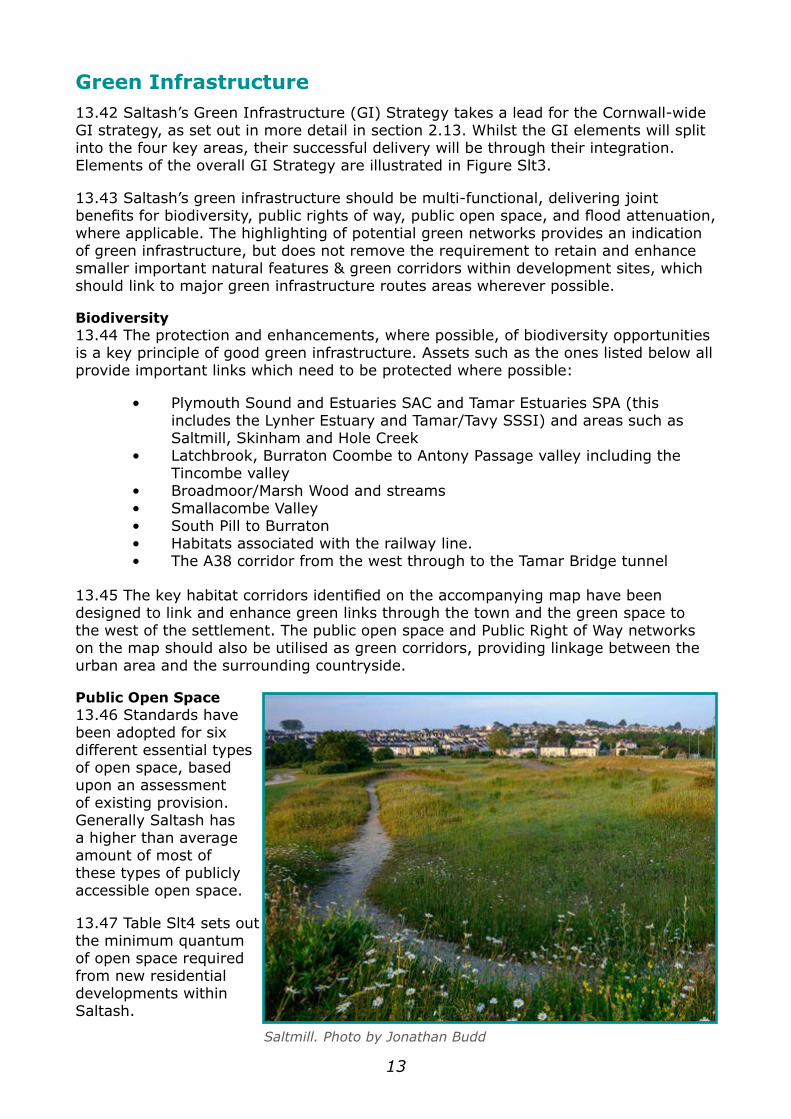
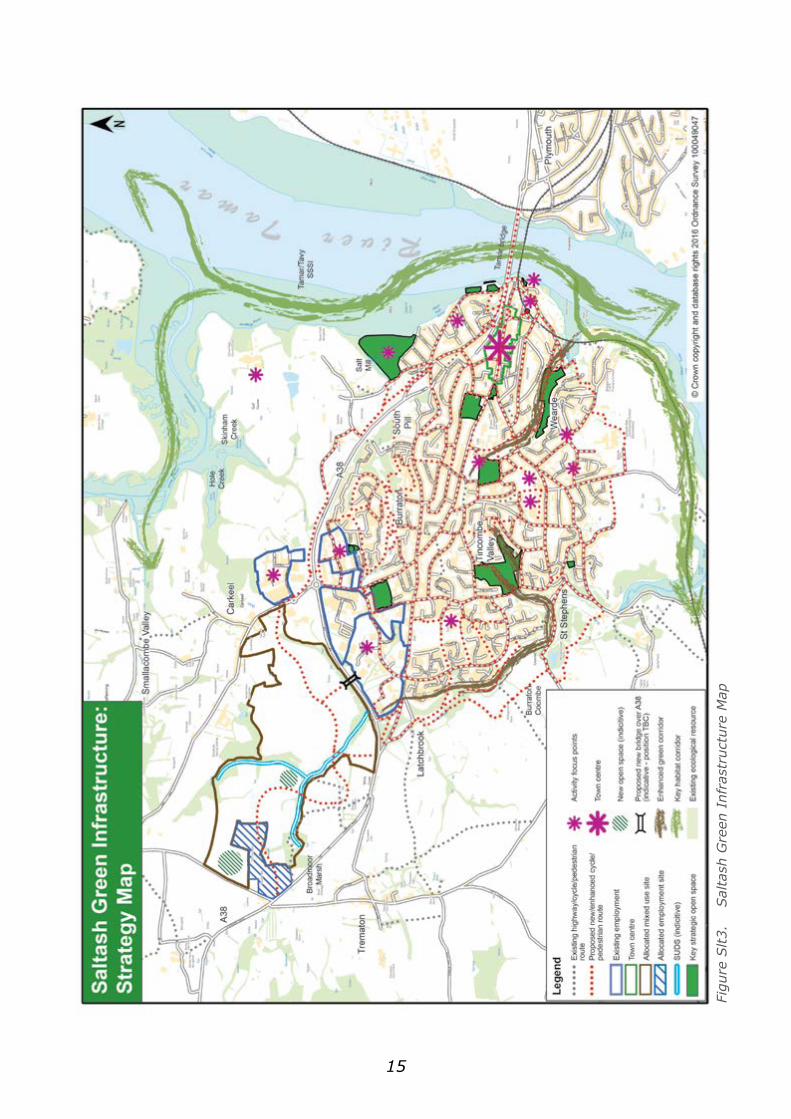
Green Infrastructure 13.42 Saltash’s Green Infrastructure (GI) Strategy takes a lead for the Cornwall-wide GI strategy, as set out in more detail in section 2.13. Whilst the GI elements will split into the four key areas, their successful delivery will be through their integration. Elements of the overall GI Strategy are illustrated in Figure Slt3.
13.43 Saltash’s green infrastructure should be multi-functional, delivering joint benefits for biodiversity, public rights of way, public open space, and flood attenuation, where applicable. The highlighting of potential green networks provides an indication of green infrastructure, but does not remove the requirement to retain and enhance smaller important natural features & green corridors within development sites, which should link to major green infrastructure routes areas wherever possible.
Biodiversity13.44 The protection and enhancements, where possible, of biodiversity opportunities is a key principle of good green infrastructure. Assets such as the ones listed below all provide important links which need to be protected where possible:
• Plymouth Sound and Estuaries SAC and Tamar Estuaries SPA (this includes the Lynher Estuary and Tamar/Tavy SSSI) and areas such as Saltmill, Skinham and Hole Creek• Latchbrook, Burraton Coombe to Antony Passage valley including the Tincombe valley• Broadmoor/Marsh Wood and streams• Smallacombe Valley• South Pill to Burraton• Habitats associated with the railway line.• The A38 corridor from the west through to the Tamar Bridge tunnel
13.45 The key habitat corridors identified on the accompanying map have been designed to link and enhance green links through the town and the green space to the west of the settlement. The public open space and Public Right of Way networks on the map should also be utilised as green corridors, providing linkage between the urban area and the surrounding countryside.
Public Open Space13.46 Standards have been adopted for six different essential types of open space, based upon an assessment of existing provision. Generally Saltash has a higher than average amount of most of these types of publicly accessible open space.
13.47 Table Slt4 sets out the minimum quantum of open space required from new residential developments within Saltash.
Saltmill. Photo by Jonathan Budd
14
Saltash Open Space RequirementsType of space Minimum Quantum
expected per dwelling
(where defined) sqmParks & Amenity Space 19.98Natural & Semi-Natural Green Spaces 32.78Public Accessible Sports Pitches 57.68Children’s Play Spaces 1.61Teenager’s equipped Spaces 0.58Allotments 1.36
Table Slt4. Launceston Open Space Requirements
13.48 It should be noted that in the case of the Broadmoor site allocation (SLT-UE1), its location on the opposite side of the A38 means that it will not benefit from existing open space, so the enhancements set out in Table Slt4 do not apply to this site. As a consequence, this should also be in the form of new open space on site.
13.49 Whilst there are different categories of open spaces, highlighted within Table Slt4, the principles of multi-functionality will be sought, i.e. providing new open spaces, or upgrading existing spaces that can perform more than one role. More detail on the assessment requirements and finance contribution for future open space can be viewed within the Cornwall Open Space Strategy for Larger Towns of Cornwall.
13.50 It would be expected that appropriate arrangements, including financial, are put in place to ensure any newly created green infrastructure can be appropriately maintained.
Green Links 13.51 In line with the Transport Strategy, the maintenance, upgrade and expansion of the area’s green links (i.e. pedestrian and cycle links) forms an important part of the overall strategy for the area. In addition to the benefits relating to reduced congestion, the improved network will provide an important recreational resource. The maintenance, upgrade and expansion of the area’s green links form an important part of the overall strategy for the area.
13.52 Improved links between Broadmoor Urban Extension (SLT-UE1) and the rest of the town represents a key element of the strategy. Furthermore, improving links to destinations within the town will be prioritised, such as the town centre, secondary school, etc. Finally, improving linkages from the town into the rural hinterland will also be sought, which can include creating an improved network from the existing routes, such as those on the south and west of the town.
Flood Attenuation13.53 The low lying area adjacent to Saltash Pier and Town Quay is vulnerable to flooding during high tidal events. The improvement of flood defences is being considered.
13.54 The Anthony Passage and Forder areas have experienced flooding. Surface water management at Forder, through the storage pond and dam on the Latchbrook Leat and the culvert at Forder requires attention, as may the SWW pumping station (see also under ‘Utilities’). Sustainable Urban Drainage Systems (SUDS) for developments must come forward ensuring they do not affect assets downstream; plus appropriate management regimes need to be put in place.
15
Figu
re S
lt3.
Sal
tash
Gre
en I
nfra
stru
ctur
e M
ap
16
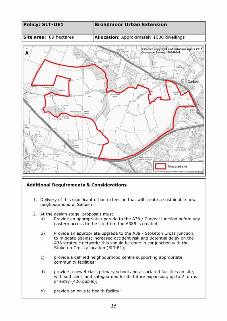
Policy: SLT-UE1
Site area: 89 hectares
Additional Requirements & Considerations
1. Delivery of this significant urban extension that will create a sustainable new neighbourhood of Saltash
2. At the design stage, proposals must:a) Provide an appropriate upgrade to the A38 / Carkeel junction before any eastern access to the site from the A388 is created;
b) Provide an appropriate upgrade to the A38 / Stoketon Cross junction, to mitigate against increased accident risk and potential delay on the A38 strategic network; this should be done in conjunction with the Stoketon Cross allocation (SLT-E1);
c) provide a defined neighbourhood centre supporting appropriate community facilities;
d) provide a new 4 class primary school and associated facilities on site, with sufficient land safeguarded for its future expansion, up to 2 forms of entry (420 pupils);
e) provide an on-site health facility;
Broadmoor Urban Extension
Allocation: Approximately 1000 dwellings
17
f) provide at least 91sqm of public open space per dwelling on site, in line with the Saltash Green Infrastructure Strategy. This new open space will also provide mitigation towards recreational impact from the development relating to the Plymouth Sound & Estuaries Special Area of Conservation (SAC)
g) ensure that surface water drainage is designed in accordance with the Sustainable Urban Drainage principles and standards set out in the Drainage Guidance for Cornwall
h) integrate watercourses and SUDS into the Green Infrastructure element of scheme design;
i) provide sustainable movement connections (including, where possible, retention of existing Public Rights of Way) through the site and to adjacent and proposed development on adjoining land. Appropriate pedestrian links should also be created south of the A38 to the rest of Saltash and, where possible, to existing and planned community facilities which may not be within the site area;
j) ensure the protection of Broadmoor Wood and Ball Wood (CWS designated site) and streams;
18
Additional Requirements & Considerations
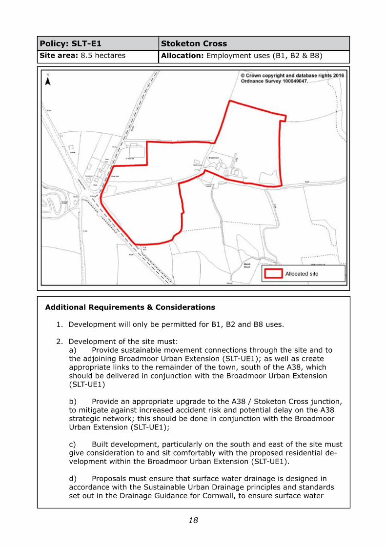
1. Development will only be permitted for B1, B2 and B8 uses.
2. Development of the site must:a) Provide sustainable movement connections through the site and to the adjoining Broadmoor Urban Extension (SLT-UE1); as well as create appropriate links to the remainder of the town, south of the A38, which should be delivered in conjunction with the Broadmoor Urban Extension (SLT-UE1)
b) Provide an appropriate upgrade to the A38 / Stoketon Cross junction, to mitigate against increased accident risk and potential delay on the A38 strategic network; this should be done in conjunction with the Broadmoor Urban Extension (SLT-UE1);
c) Built development, particularly on the south and east of the site must give consideration to and sit comfortably with the proposed residential de-velopment within the Broadmoor Urban Extension (SLT-UE1).
d) Proposals must ensure that surface water drainage is designed in accordance with the Sustainable Urban Drainage principles and standards set out in the Drainage Guidance for Cornwall, to ensure surface water
Policy: SLT-E1 Stoketon CrossSite area: 8.5 hectares Allocation: Employment uses (B1, B2 & B8)
19
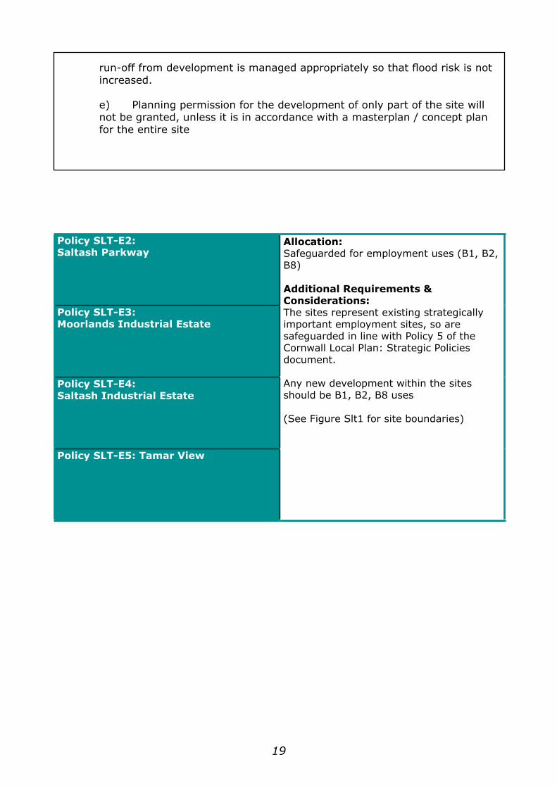
run-off from development is managed appropriately so that flood risk is not increased.
e) Planning permission for the development of only part of the site will not be granted, unless it is in accordance with a masterplan / concept plan for the entire site
Policy SLT-E2:Saltash Parkway
Allocation:Safeguarded for employment uses (B1, B2, B8)
Additional Requirements & Considerations:The sites represent existing strategically important employment sites, so are safeguarded in line with Policy 5 of the Cornwall Local Plan: Strategic Policies document.
Any new development within the sites should be B1, B2, B8 uses
(See Figure Slt1 for site boundaries)
Policy SLT-E3:Moorlands Industrial Estate
Policy SLT-E4:Saltash Industrial Estate
Policy SLT-E5: Tamar View

20
Consultation GuideBelow are a set of questions that have been prepared to help guide feedback on the contents of the document. However, please do not constrain yourself to just answering this set of questions if you would like to give feedback on an element of the documents that you feel does not fit within the set of questions set.
A feedback form can be accessed via the following link: www.cornwall.gov.uk/allocationsplan (if you intend to comment on more than one town, please use a separate form for each town). The feedback form, or any other comments, should be e-mailed to: [email protected]
Alternatively, you can send your comments to:
Cornwall Allocations DPDStrategic Planning TeamCornwall Council Dolcoath AvenueCamborne, CornwallTR14 8SX
Please ensure any feedback is received by 5pm on Monday 14 November 2016
Guide QuestionsQ1. Please state the town /conurbation that the following answers related to
Q2. Do you support the Vision /Aims /Objectives that are set out in the report?
If No, please indicate what elements you disagree with and how you would like it amended
Q3. Do you agree with the strategy text relating to the sections Overarching Strategy, Economic Growth, Retail and Housing?
If No, please indicate what elements you disagree with (including paragraph numbers where possible) and how you would like it amended
Q4. Do you agree with the proposals set out within the infrastructure section?
If No, please indicate what elements you disagree with (including paragraph numbers where possible) and how you would like it amended
Q5. Do you support the proposed allocations, and their policy wording, that are set out for the town / conurbation in question?
If No, please indicate which allocation(s) you would like amended, highlighting the site’s reference code, and set out what you dislike about the site and/or its related policy (If you would like to make comments on more than one site, please ensure you clearly indicate which comments relate to which site)

21
Q6. Is there an alternative site that you would like to propose?
If so, please indicate:
• the location of the site that you would like to propose;• the type and scale of development that you think should be delivered on the site• the site(s) within this document that you believe your site(s) should replace (please state the site allocation reference)• the reasons why you believe your proposed site is better than the site(s) you wish to replace it with
Q7. Feel free to make any other comments with regard to the document