cape cod canal - nae.usace.army.mil · movement is accomplished through the design of the canal, as...
TRANSCRIPT
Cape Cod Canal
For More Information
Write: Canal Manager U.S. Army Corps of Engineers Cape Cod Canal Field Office PO Box 1555 Buzzards Bay, MA 02532
Phone: Cape Cod Canal Field Office: 508-759-4431 Cape Cod Canal Visitor Center: 508-833-9678 Website: http://www.nae.usace.army.mil/Missions/Recreation/CapeCodCanal.aspx
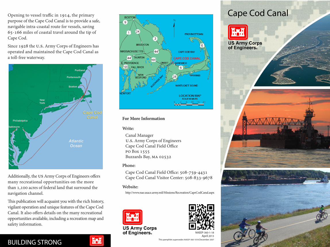
Opening to vessel traffic in 1914, the primary purpose of the Cape Cod Canal is to provide a safe, navigable intra-coastal route for vessels, saving 65-166 miles of coastal travel around the tip of Cape Cod.
Since 1928 the U.S. Army Corps of Engineers has operated and maintained the Cape Cod Canal as a toll-free waterway.
Additionally, the US Army Corps of Engineers offers many recreational opportunities on the more than 1,100 acres of federal land that surround the navigation channel.
This publication will acquaint you with the rich history, vigilant operation and unique features of the Cape Cod Canal. It also offers details on the many recreational opportunities available, including a recreation map and safety information.
BUILDING STRONG
My Kaywa QR-Codehttp://www.nae.usace.army.mil/Missions/Recreati...
http://kaywa.me/pwhQ5
Download the Kaywa QR Code Reader (App Store &Android Market) and scan your code!
NAEEP-360-1-18April 2013
This pamphlet supersedes NAEEP-360-1018 December 2007
The Cape Cod Canal is designed as a sea-level waterway. It does not contain locks even though it connects two bays that experience very different tidal cycles and ranges. The Canal’s wide and deep sea-level channel has many benefits for safe navigation including:
• Reduces the strength of the tidal current• Allows for two-way passage of large vessels• Minimizes delay to vessel traffic that would occur in a canal with locks• Reduces the chance of freezing over• Reduces the frequency of maintenance dredging
Vessel Traffic
The Cape Cod Canal is open toll-free, 24 hours a day, for all adequately powered vessels, properly equipped and seaworthy, of sizes consistent with safe navigation as governed by the controlling depth and width, and clearances of the bridges over the waterway.
Vessels 65 feet and over in length must gain permission to transit prior to entering the limits of the canal. Approximately 6,300 of these vessels transit annually, transporting 8 million tons of cargo.
Marine Traffic Control
The U.S. Army Corps of Engineers ensures safe movement of vessels using a sophisticated, centralized marine traffic control system. Located in Buzzards Bay, it provides the Corps with a complete picture of ship traffic and environmental conditions throughout the entire canal, and offers automatic processing of all data collection.
This advanced display and decision support system integrates a variety of technologies including an Automatic Identification System, radar, cameras, VHF radio, traffic lights, live tidal and weather data, and various computer displays.
Marine Operations
Marine operations personnel utilize patrol boats and rapid response boats to help manage the heavy volume of vessel traffic, enforce Canal regulations, and render assistance to vessels in distress.
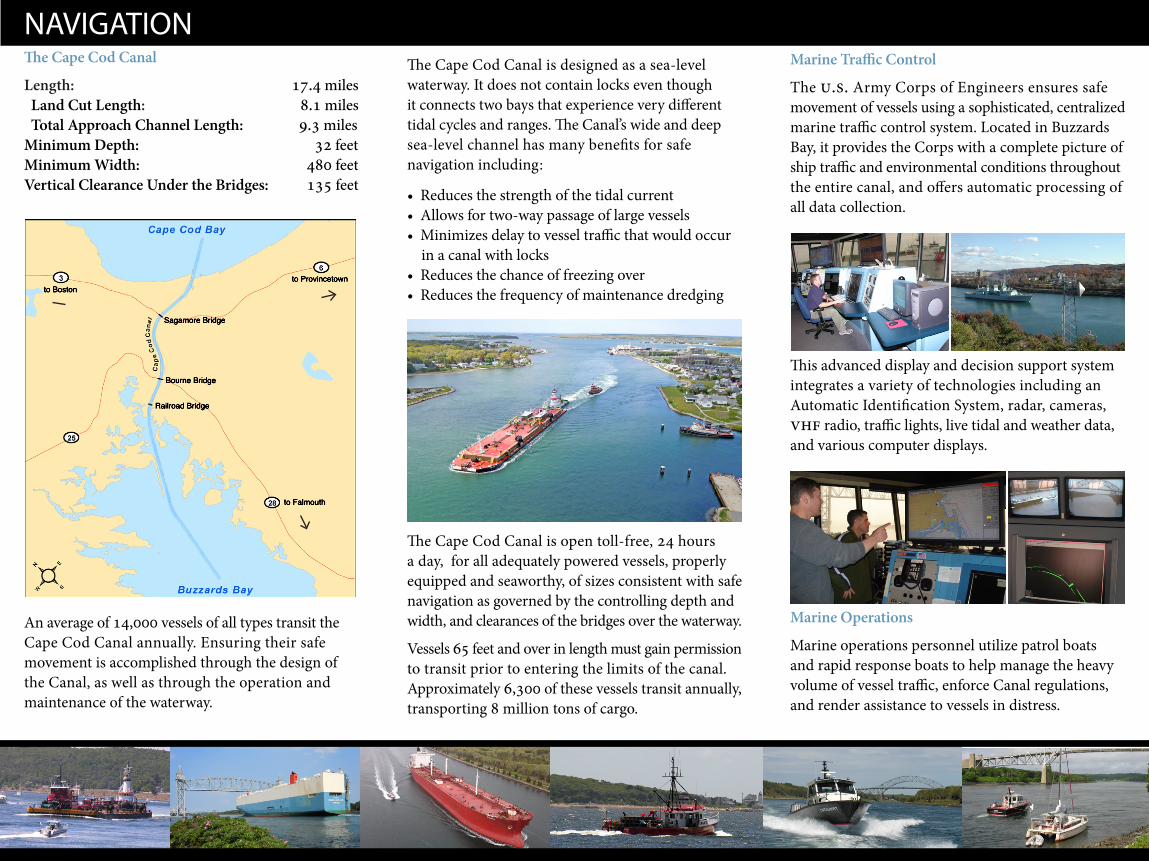
NAVIGATION The Cape Cod Canal
Length: 17.4 miles Land Cut Length: 8.1 miles Total Approach Channel Length: 9.3 miles Minimum Depth: 32 feetMinimum Width: 480 feetVertical Clearance Under the Bridges: 135 feet
An average of 14,000 vessels of all types transit the Cape Cod Canal annually. Ensuring their safe movement is accomplished through the design of the Canal, as well as through the operation and maintenance of the waterway.
to Provincetown
to Falmouth
to Boston
Railroad Bridge
Bourne Bridge
Sagamore Bridge
A Success
The federal government first assumed responsibility for the Canal operations during World War I when German submarines off the shores of Cape Cod became a threat to American vessels. After the war, the Canal was returned to private ownership until March of 1928 when the federal government purchased the Canal for $11.5 million. The U.S. Army Corps of Engineers was assigned the task of improving the waterway, to make it safe for navigation, and to operate it as a toll free waterway.
The U.S. Army Corps of Engineers directed a massive reconstruction of the Canal throughout the 1930s. It was the time of the Great Depression and many men found much needed work. To provide a safer, more viable intra-coastal waterway, the Corps replaced the original bridges, widened and deepened the channel to 480 and 32 feet respectively, straightened and lengthened the approach channels, and lined the banks of the Canal with rocks, called riprap, to limit erosion. By 1940, the reconstruction of the Cape Cod Canal was complete.
CULTIVATING AN ENGINEERING MARVEL An Idea
The idea of a canal connecting Cape Cod and Buzzards Bays dates back to the 1620s and Plymouth Colony. Arguing various economic and life saving benefits, canal proposals excited many others over the next three centuries. Meanwhile, the treacherous outer shores of Cape Cod and the Islands stranded many ships, claiming nearly a wreck a week at the height of the commercial shipping era from 1880 to 1900. Despite the obvious need and numerous plans for a canal, there were few real attempts, and no success.
A Reality
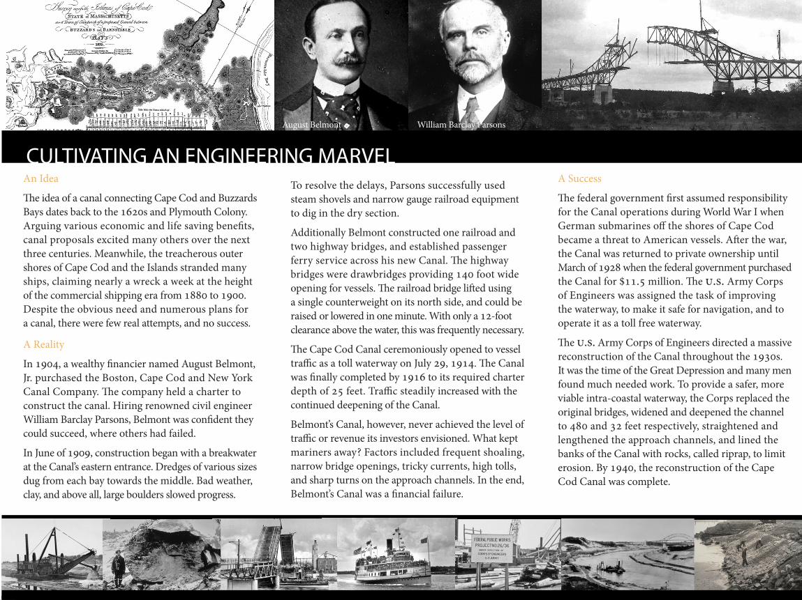
In 1904, a wealthy financier named August Belmont, Jr. purchased the Boston, Cape Cod and New York Canal Company. The company held a charter to construct the canal. Hiring renowned civil engineer William Barclay Parsons, Belmont was confident they could succeed, where others had failed.
In June of 1909, construction began with a breakwater at the Canal’s eastern entrance. Dredges of various sizes dug from each bay towards the middle. Bad weather, clay, and above all, large boulders slowed progress.
To resolve the delays, Parsons successfully used steam shovels and narrow gauge railroad equipment to dig in the dry section.
Additionally Belmont constructed one railroad and two highway bridges, and established passenger ferry service across his new Canal. The highway bridges were drawbridges providing 140 foot wide opening for vessels. The railroad bridge lifted using a single counterweight on its north side, and could be raised or lowered in one minute. With only a 12-foot clearance above the water, this was frequently necessary. The Cape Cod Canal ceremoniously opened to vessel traffic as a toll waterway on July 29, 1914. The Canal was finally completed by 1916 to its required charter depth of 25 feet. Traffic steadily increased with the continued deepening of the Canal.
Belmont’s Canal, however, never achieved the level of traffic or revenue its investors envisioned. What kept mariners away? Factors included frequent shoaling, narrow bridge openings, tricky currents, high tolls, and sharp turns on the approach channels. In the end, Belmont’s Canal was a financial failure.
August Belmont William Barclay Parsons
Length of Center Span: 544 feet
The Railroad Bridge was the longest of its kind when built. Aided by counterweights, it takes 2 ½ minutes for the center span to lower for approaching trains.
All three bridges have served traffic since 1935. Due to heavy usage and exposure to the Cape’s seaside environment, the bridges are regularly maintained to ensure their structural integrity.
Bridges
The U.S. Army Corps of Engineers maintains two nearly identical highway bridges and a vertical lift Railroad Bridge, that span over the Canal. Each offer a vertical clearance of 135 feet for vessels passing beneath.
Railroad Bridge
Bourne Highway Bridge
Length: 2,384 feet
Sagamore Highway Bridge
Length: 1,408 feet
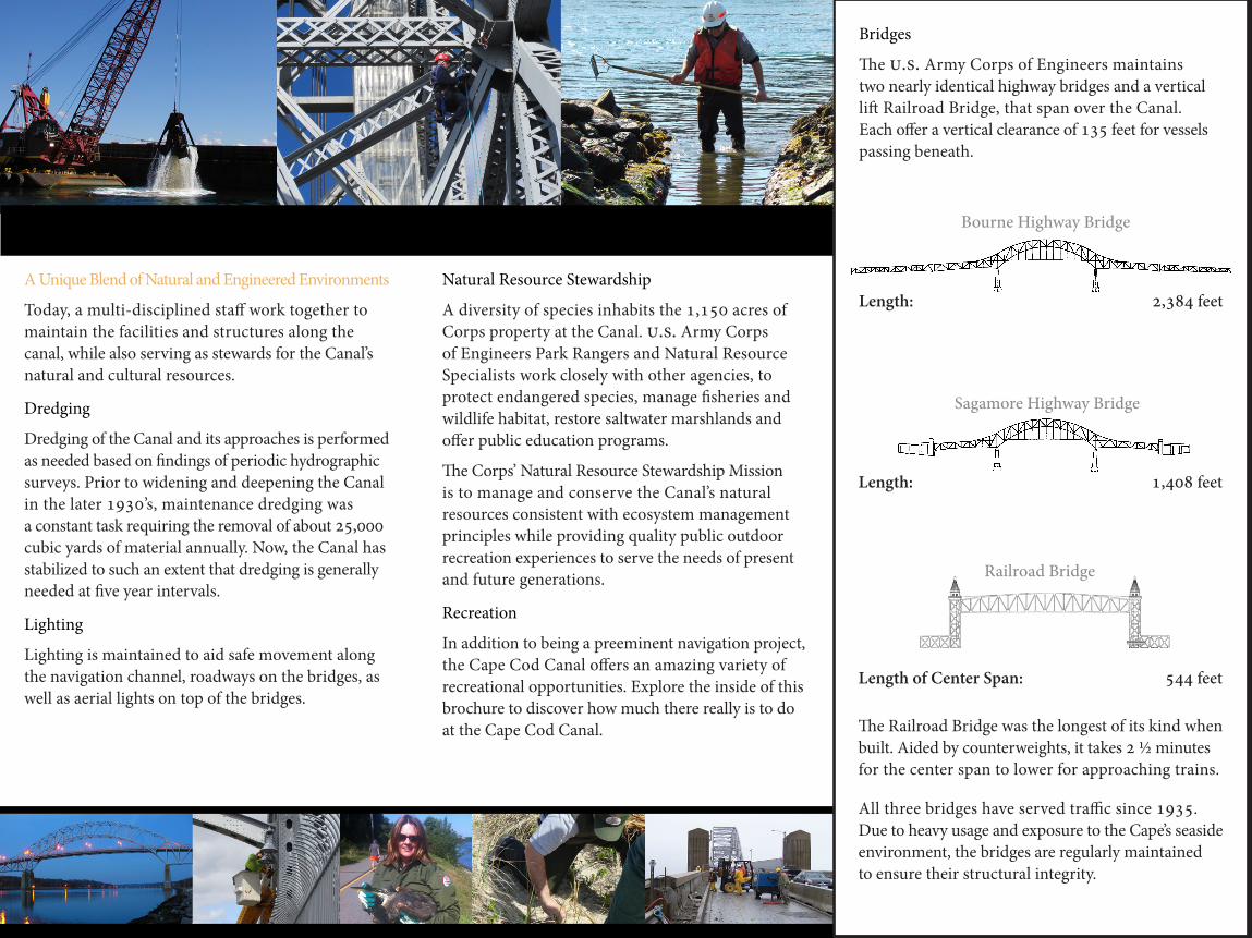
A Unique Blend of Natural and Engineered Environments
Today, a multi-disciplined staff work together to maintain the facilities and structures along the canal, while also serving as stewards for the Canal’s natural and cultural resources.
Dredging
Dredging of the Canal and its approaches is performed as needed based on findings of periodic hydrographic surveys. Prior to widening and deepening the Canal in the later 1930’s, maintenance dredging was a constant task requiring the removal of about 25,000 cubic yards of material annually. Now, the Canal has stabilized to such an extent that dredging is generally needed at five year intervals.
Lighting
Lighting is maintained to aid safe movement along the navigation channel, roadways on the bridges, as well as aerial lights on top of the bridges.
Natural Resource Stewardship
A diversity of species inhabits the 1,150 acres of Corps property at the Canal. U.S. Army Corps of Engineers Park Rangers and Natural Resource Specialists work closely with other agencies, to protect endangered species, manage fisheries and wildlife habitat, restore saltwater marshlands and offer public education programs.
The Corps’ Natural Resource Stewardship Mission is to manage and conserve the Canal’s natural resources consistent with ecosystem management principles while providing quality public outdoor recreation experiences to serve the needs of present and future generations.
Recreation
In addition to being a preeminent navigation project, the Cape Cod Canal offers an amazing variety of recreational opportunities. Explore the inside of this brochure to discover how much there really is to do at the Cape Cod Canal.
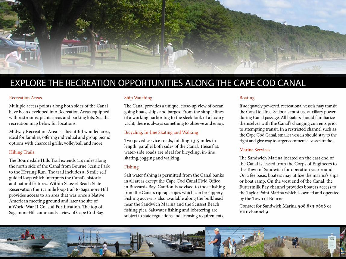
Boating
If adequately powered, recreational vessels may transit the Canal toll free. Sailboats must use auxiliary power during Canal passage. All boaters should familiarize themselves with the Canal’s changing currents prior to attempting transit. In a restricted channel such as the Cape Cod Canal, smaller vessels should stay to the right and give way to larger commercial vessel traffic.
Marina Services
The Sandwich Marina located on the east end of the Canal is leased from the Corps of Engineers to the Town of Sandwich for operation year round. On a fee basis, boaters may utilize the marina’s slips or boat ramp. On the west end of the Canal, the Buttermilk Bay channel provides boaters access to the Taylor Point Marina which is owned and operated by the Town of Bourne. Contact for Sandwich Marina 508.833.0808 or VHF channel 9
EXPLORE THE RECREATION OPPORTUNITIES ALONG THE CAPE COD CANAL
Recreation Areas
Multiple access points along both sides of the Canal have been developed into Recreation Areas equipped with restrooms, picnic areas and parking lots. See the recreation map below for locations.
Midway Recreation Area is a beautiful wooded area, ideal for families, offering individual and group picnic options with charcoal grills, volleyball and more.
Hiking Trails
The Bournedale Hills Trail extends 1.4 miles along the north side of the Canal from Bourne Scenic Park to the Herring Run. The trail includes a .8 mile self guided loop which interprets the Canal’s historic and natural features. Within Scusset Beach State Reservation the 1.1 mile loop trail to Sagamore Hill provides access to an area that was once a Native American meeting ground and later the site of a World War II Coastal Fortification. The top of Sagamore Hill commands a view of Cape Cod Bay.
Ship Watching
The Canal provides a unique, close-up view of ocean going boats, ships and barges. From the simple lines of a working harbor tug to the sleek look of a luxury yacht, there is always something to observe and enjoy.
Bicycling, In-line Skating and Walking
Two paved service roads, totaling 13.5 miles in length, parallel both sides of the Canal. These flat, water-side roads are ideal for bicycling, in-line skating, jogging and walking.
Fishing
Salt water fishing is permitted from the Canal banks in all areas except the Cape Cod Canal Field Office in Buzzards Bay. Caution is advised to those fishing from the Canal’s rip rap slopes which can be slippery. Fishing access is also available along the bulkhead near the Sandwich Marina and the Scusset Beach fishing pier. Saltwater fishing and lobstering are subject to state regulations and licensing requirements.
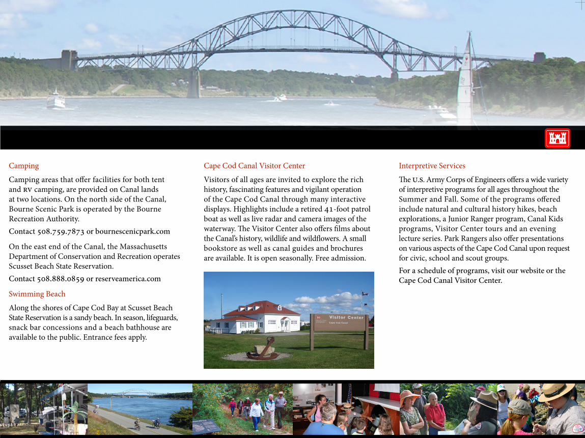
Camping
Camping areas that offer facilities for both tent and RV camping, are provided on Canal lands at two locations. On the north side of the Canal, Bourne Scenic Park is operated by the Bourne Recreation Authority. Contact 508.759.7873 or bournescenicpark.com
On the east end of the Canal, the Massachusetts Department of Conservation and Recreation operates Scusset Beach State Reservation. Contact 508.888.0859 or reserveamerica.com
Swimming Beach
Along the shores of Cape Cod Bay at Scusset Beach State Reservation is a sandy beach. In season, lifeguards, snack bar concessions and a beach bathhouse are available to the public. Entrance fees apply.
Cape Cod Canal Visitor Center
Visitors of all ages are invited to explore the rich history, fascinating features and vigilant operation of the Cape Cod Canal through many interactive displays. Highlights include a retired 41-foot patrol boat as well as live radar and camera images of the waterway. The Visitor Center also offers films about the Canal’s history, wildlife and wildflowers. A small bookstore as well as canal guides and brochures are available. It is open seasonally. Free admission.
Interpretive Services
The U.S. Army Corps of Engineers offers a wide variety of interpretive programs for all ages throughout the Summer and Fall. Some of the programs offered include natural and cultural history hikes, beach explorations, a Junior Ranger program, Canal Kids programs, Visitor Center tours and an evening lecture series. Park Rangers also offer presentations on various aspects of the Cape Cod Canal upon request for civic, school and scout groups.For a schedule of programs, visit our website or the Cape Cod Canal Visitor Center.
Mid Cape HighwayRoute 6
to Provincetown
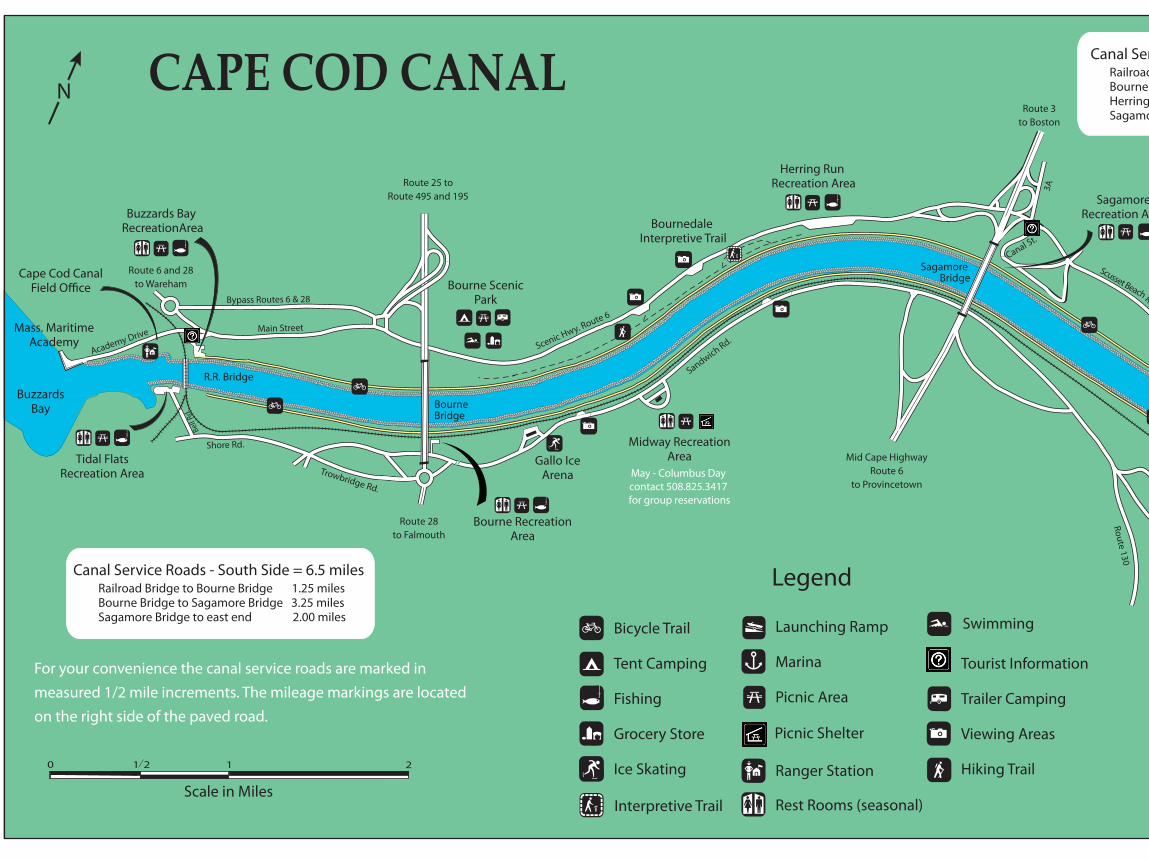
Gallo IceArena
Route 28to Falmouth
Route 25 toRoute 495 and 195
Bourne ScenicPark
Herring Run Recreation Area
Route 6 and 28to Wareham
Cape Cod Canal
Scusset BeachState ReservationAcademy Drive Main Street
Bypass Routes 6 & 28
Route 3to Boston
Mass. MaritimeAcademy
N
Bell
Rd.
Shore Rd.
Trowbridge Rd.
Scenic Hwy. Route 6
Sandwich Rd.
Bourne Bridge
Sagamore Bridge
SagamoreRecreation Area
3A
Bourne RecreationArea
Midway RecreationAreaTidal Flats
Recreation Area
SandcatcherRecreation Area
CAPE COD CANAL
Legend
For your convenience the canal service roads are marked inmeasured 1/2 mile increments. The mileage markings are locatedon the right side of the paved road.
Fishing Pier
SandwichRecreation Area
SandwichMarina
Sagamore Hill
R.R. Bridge
The Visitor Center is openseasonally. Visitors canview exhibits amd �lmson the history and operation of the Canal. Admission is free.
Tupper Road
Route 6A
BuzzardsBay
Cape CodBay
Tupper Road
Bournedale Interpretive Trail
Scale in Miles
Town Neck Rd
Cape Cod CanalVisitor Center
Dr.Ed
Route 130
Buzzards Bay RecreationArea
Canal Service Roads - North Side = 7 milesRailroad Bridge to Bourne Bridge 1.25 milesBourne Bridge to Herring Run 2.25 milesHerring Run to Sagamore Bridge 1.00 milesSagamore Bridge to east end 2.50 miles
Canal Service Roads - South Side = 6.5 milesRailroad Bridge to Bourne Bridge 1.25 milesBourne Bridge to Sagamore Bridge 3.25 milesSagamore Bridge to east end 2.00 miles
Canal St.
Scusset BeachRoad
0 121 2
Bicycle Trail
Tent Camping
Fishing
Grocery Store
Ice Skating
Interpretive Trail
Launching Ramp
Marina
Picnic Area
Ranger Station
Rest Rooms (seasonal)
Swimming
Trailer Camping
Viewing Areas
Hiking Trail
Tourist Information
Picnic Shelter
May - Columbus Day contact 508.825.3417 for group reservations
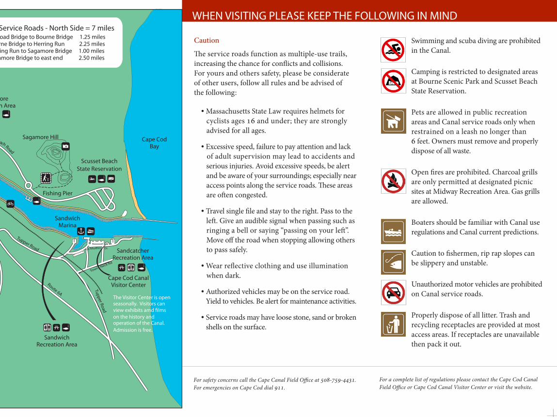
WHEN VISITING PLEASE KEEP THE FOLLOWING IN MIND
Caution
The service roads function as multiple-use trails, increasing the chance for conflicts and collisions. For yours and others safety, please be considerate of other users, follow all rules and be advised of the following:
• Massachusetts State Law requires helmets for cyclists ages 16 and under; they are strongly advised for all ages.
• Excessive speed, failure to pay attention and lack of adult supervision may lead to accidents and serious injuries. Avoid excessive speeds, be alert and be aware of your surroundings; especially near access points along the service roads. These areas are often congested.
• Travel single file and stay to the right. Pass to the left. Give an audible signal when passing such as ringing a bell or saying “passing on your left”. Move off the road when stopping allowing others to pass safely.
• Wear reflective clothing and use illumination when dark.
• Authorized vehicles may be on the service road. Yield to vehicles. Be alert for maintenance activities.
• Service roads may have loose stone, sand or broken shells on the surface.
Swimming and scuba diving are prohibited in the Canal.
Camping is restricted to designated areas at Bourne Scenic Park and Scusset Beach State Reservation.
Pets are allowed in public recreation areas and Canal service roads only when restrained on a leash no longer than 6 feet. Owners must remove and properly dispose of all waste.
Open fires are prohibited. Charcoal grills are only permitted at designated picnic sites at Midway Recreation Area. Gas grills are allowed.
Boaters should be familiar with Canal use regulations and Canal current predictions.
Caution to fishermen, rip rap slopes can be slippery and unstable.
Unauthorized motor vehicles are prohibited on Canal service roads.
Properly dispose of all litter. Trash and recycling receptacles are provided at most access areas. If receptacles are unavailable then pack it out.
For a complete list of regulations please contact the Cape Cod Canal Field Office or Cape Cod Canal Visitor Center or visit the website.
For safety concerns call the Cape Canal Field Office at 508-759-4431. For emergencies on Cape Cod dial 911.
Mid Cape HighwayRoute 6
to Provincetown
Gallo IceArena
Route 28to Falmouth
Route 25 toRoute 495 and 195
Bourne ScenicPark
Herring Run Recreation Area
Route 6 and 28to Wareham
Cape Cod Canal
Scusset BeachState ReservationAcademy Drive Main Street
Bypass Routes 6 & 28
Route 3to Boston
Mass. MaritimeAcademy
N
Bell
Rd.
Shore Rd.
Trowbridge Rd.
Scenic Hwy. Route 6
Sandwich Rd.
Bourne Bridge
Sagamore Bridge
SagamoreRecreation Area
3A
Bourne RecreationArea
Midway RecreationAreaTidal Flats
Recreation Area
SandcatcherRecreation Area
CAPE COD CANAL
Legend
For your convenience the canal service roads are marked inmeasured 1/2 mile increments. The mileage markings are locatedon the right side of the paved road.
Fishing Pier
SandwichRecreation Area
SandwichMarina
Sagamore Hill
R.R. Bridge
The Visitor Center is openseasonally. Visitors canview exhibits amd �lmson the history and operation of the Canal. Admission is free.
Tupper Road
Route 6A
BuzzardsBay
Cape CodBay
Tupper Road
Bournedale Interpretive Trail
Scale in Miles
Town Neck Rd
Cape Cod CanalVisitor Center
Dr.Ed
Route 130
Buzzards Bay RecreationArea
Canal Service Roads - North Side = 7 milesRailroad Bridge to Bourne Bridge 1.25 milesBourne Bridge to Herring Run 2.25 milesHerring Run to Sagamore Bridge 1.00 milesSagamore Bridge to east end 2.50 miles
Canal Service Roads - South Side = 6.5 milesRailroad Bridge to Bourne Bridge 1.25 milesBourne Bridge to Sagamore Bridge 3.25 milesSagamore Bridge to east end 2.00 miles
Canal St.
Scusset BeachRoad
0 121 2
Bicycle Trail
Tent Camping
Fishing
Grocery Store
Ice Skating
Interpretive Trail
Launching Ramp
Marina
Picnic Area
Ranger Station
Rest Rooms (seasonal)
Swimming
Trailer Camping
Viewing Areas
Hiking Trail
Tourist Information
Picnic Shelter
May - Columbus Day contact 508.825.3417 for group reservations