brooklyn coney island coney island comprehensive · pdf fileprojects & proposals >...
TRANSCRIPT
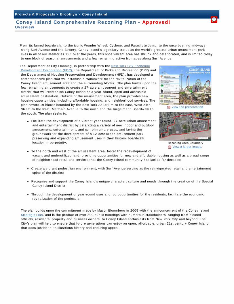
View the presentation
Rezoning Area Boundary View a larger image.
Projects & Proposals > Brooklyn > Coney Island
Coney Island Comprehensive Rezoning Plan - Approved!Overview
From its famed boardwalk, to the iconic Wonder Wheel, Cyclone, and Parachute Jump, to the once bustling midways along Surf Avenue and the Bowery, Coney Island’s legendary status as the world’s greatest urban amusement park lives in all of our memories. But over the years, this once vibrant area has shrunk and deteriorated, and is limited today to one block of seasonal amusements and a few remaining active frontages along Surf Avenue.
The Department of City Planning, in partnership with the New York City Economic Development Corporation (EDC), the Department of Parks and Recreation (DPR) and the Department of Housing Preservation and Development (HPD), has developed a comprehensive plan that will establish a framework for the revitalization of the Coney Island amusement area and the surrounding blocks. The plan builds upon the few remaining amusements to create a 27-acre amusement and entertainment district that will reestablish Coney Island as a year-round, open and accessible amusement destination. Outside of the amusement area, the plan provides new housing opportunities, including affordable housing, and neighborhood services. The plan covers 19 blocks bounded by the New York Aquarium to the east, West 24th Street to the west, Mermaid Avenue to the north and the Riegelmann Boardwalk to the south. The plan seeks to:
Facilitate the development of a vibrant year round, 27-acre urban amusement and entertainment district by catalyzing a variety of new indoor and outdoor amusement, entertainment, and complimentary uses, and laying the groundwork for the development of a 12-acre urban amusement park preserving and expanding amusement uses in their historic boardwalk location in perpetuity;
To the north and west of the amusement area, foster the redevelopment of vacant and underutilized land, providing opportunities for new and affordable housing as well as a broad range of neighborhood retail and services that the Coney Island community has lacked for decades;
Create a vibrant pedestrian environment, with Surf Avenue serving as the reinvigorated retail and entertainment spine of the district;
Recognize and support the Coney Island’s unique character, culture and needs through the creation of the Special Coney Island District;
Through the development of year-round uses and job opportunities for the residents, facilitate the economic revitalization of the peninsula.
The plan builds upon the commitment made by Mayor Bloomberg in 2005 with the announcement of the Coney Island Strategic Plan, and is the product of over 300 public meetings with numerous stakeholders, ranging from elected officials, residents, property and business owners, to Coney Island enthusiasts from New York City and beyond. The City’s plan will help to ensure that future generations can enjoy an open, affordable, urban 21st century Coney Island that does justice to its illustrious history and enduring appeal.
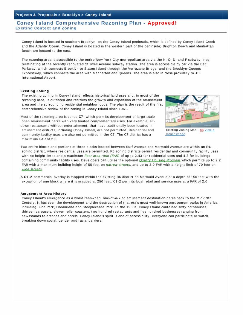
Existing Zoning Map - View a larger image.
Projects & Proposals > Brooklyn > Coney Island
Coney Island Comprehensive Rezoning Plan - Approved!Existing Context and Zoning
Coney Island is located in southern Brooklyn, on the Coney Island peninsula, which is defined by Coney Island Creek and the Atlantic Ocean. Coney Island is located in the western part of the peninsula; Brighton Beach and Manhattan Beach are located to the east.
The rezoning area is accessible to the entire New York City metropolitan area via the N, Q, D, and F subway lines terminating at the recently renovated Stillwell Avenue subway station. The area is accessible by car via the Belt Parkway, which connects Brooklyn to Staten Island through the Verrazano Bridge, and the Brooklyn-Queens Expressway, which connects the area with Manhattan and Queens. The area is also in close proximity to JFK International Airport.
Existing Zoning The existing zoning in Coney Island reflects historical land uses and, in most of the rezoning area, is outdated and restricts the growth and expansion of the amusement area and the surrounding residential neighborhoods. The plan is the result of the first comprehensive review of the zoning in Coney Island since 1961.
Most of the rezoning area is zoned C7, which permits development of large-scale open amusement parks with very limited complementary uses. For example, sit-down restaurants without entertainment, that have traditionally been located in amusement districts, including Coney Island, are not permitted. Residential and community facility uses are also not permitted in the C7. The C7 district has a maximum FAR of 2.0
Two entire blocks and portions of three blocks located between Surf Avenue and Mermaid Avenue are within an R6 zoning district, where residential uses are permitted. R6 zoning districts permit residential and community facility uses with no height limits and a maximum floor area ratio (FAR) of up to 2.43 for residential uses and 4.8 for buildings containing community facility uses. Developers can utilize the optional Quality Housing Program which permits up to 2.2 FAR with a maximum building height of 55 feet on narrow streets, and up to 3.0 FAR with a height limit of 70 feet on wide streets.
A C1-2 commercial overlay is mapped within the existing R6 district on Mermaid Avenue at a depth of 150 feet with the exception of one block where it is mapped at 250 feet. C1-2 permits local retail and service uses at a FAR of 2.0.
Amusement Area History Coney Island's emergence as a world renowned, one-of-a-kind amusement destination dates back to the mid-19th Century. It has seen the development and the destruction of that era’s most well-known amusement parks in America, including Luna Park, Dreamland and Steeplechase Park. In the 1930s, Coney Island contained sixty bathhouses, thirteen carousels, eleven roller coasters, two hundred restaurants and five hundred businesses ranging from newsstands to arcades and hotels. Coney Island’s spirit is one of accessibility: everyone can participate or watch, breaking down social, gender and racial barriers.
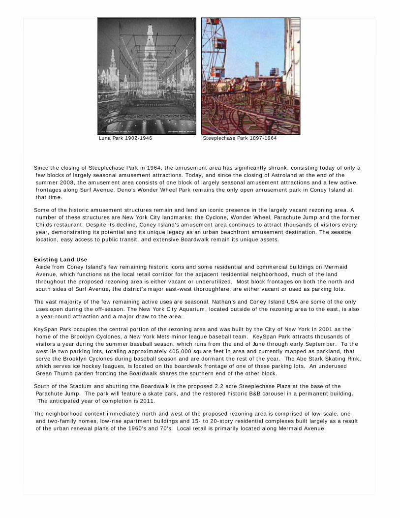
Luna Park 1902-1946 Steeplechase Park 1897-1964
Since the closing of Steeplechase Park in 1964, the amusement area has significantly shrunk, consisting today of only a few blocks of largely seasonal amusement attractions. Today, and since the closing of Astroland at the end of the summer 2008, the amusement area consists of one block of largely seasonal amusement attractions and a few active frontages along Surf Avenue. Deno’s Wonder Wheel Park remains the only open amusement park in Coney Island at that time.
Some of the historic amusement structures remain and lend an iconic presence in the largely vacant rezoning area. A number of these structures are New York City landmarks: the Cyclone, Wonder Wheel, Parachute Jump and the former Childs restaurant. Despite its decline, Coney Island's amusement area continues to attract thousands of visitors every year, demonstrating its potential and its unique legacy as an urban beachfront amusement destination. The seaside location, easy access to public transit, and extensive Boardwalk remain its unique assets.
Existing Land Use Aside from Coney Island's few remaining historic icons and some residential and commercial buildings on Mermaid Avenue, which functions as the local retail corridor for the adjacent residential neighborhood, much of the land throughout the proposed rezoning area is either vacant or underutilized. Most block frontages on both the north and south sides of Surf Avenue, the district's major east-west thoroughfare, are either vacant or used as parking lots.
The vast majority of the few remaining active uses are seasonal. Nathan’s and Coney Island USA are some of the only uses open during the off-season. The New York City Aquarium, located outside of the rezoning area to the east, is also a year-round attraction and a major draw to the area.
KeySpan Park occupies the central portion of the rezoning area and was built by the City of New York in 2001 as the home of the Brooklyn Cyclones, a New York Mets minor league baseball team. KeySpan Park attracts thousands of visitors a year during the summer baseball season, which runs from the end of June through early September. To the west lie two parking lots, totaling approximately 405,000 square feet in area and currently mapped as parkland, that serve the Brooklyn Cyclones during baseball season and are dormant the rest of the year. The Abe Stark Skating Rink, which serves ice hockey leagues, is located on the boardwalk frontage of one of these parking lots. An underused Green Thumb garden fronting the Boardwalk shares the southern end of the other block.
South of the Stadium and abutting the Boardwalk is the proposed 2.2 acre Steeplechase Plaza at the base of the Parachute Jump. The park will feature a skate park, and the restored historic B&B carousel in a permanent building. The anticipated year of completion is 2011.
The neighborhood context immediately north and west of the proposed rezoning area is comprised of low-scale, one- and two-family homes, low-rise apartment buildings and 15- to 20-story residential complexes built largely as a result of the urban renewal plans of the 1960's and 70's. Local retail is primarily located along Mermaid Avenue.
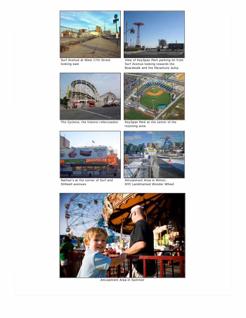
Surf Avenue at West 17th Street looking east
View of KeySpan Park parking lot from Surf Avenue looking towards the Boardwalk and the Parachute Jump
The Cyclone, the historic rollercoaster KeySpan Park at the center of the rezoning area
Nathan's at the corner of Surf and Stillwell avenues
Amusement Area in Winter, NYC Landmarked Wonder Wheel
Amusement Area in Summer
Projects & Proposals > Brooklyn > Coney Island
Coney Island Comprehensive Rezoning Plan - Approved!The Proposal
Update April 9th, 2009:
On April 9, 2009, in response to community comments received during the public process, the Department of City Planning filed a modified application (N 090273(A) ZRK) for the Special Coney Island District text.
Proposed Actions The proposal would establish a new special zoning district, the Special Coney Island District, encompassing 17 blocks located between the Aquarium, the Riegelmann Boardwalk, Mermaid Avenue and West 22nd Street. The Special Coney Island District would include use, density, bulk and parking regulations to incentivize and guide development of the amusement and entertainment district as well as the residential developments outside of the amusement area. View the zoning comparison chart.
In addition, the proposed actions of the Coney Island Plan include: Zoning map and text changes, mapping and demapping of parkland, mapping and demapping of streets, private property acquisition, UDAAP designation and project approval and disposition of City-owned property.
The zoning proposal was presented to the City Planning Commission for certification on January 20th, 2009. See the full Certification Presentation. Read the press release.
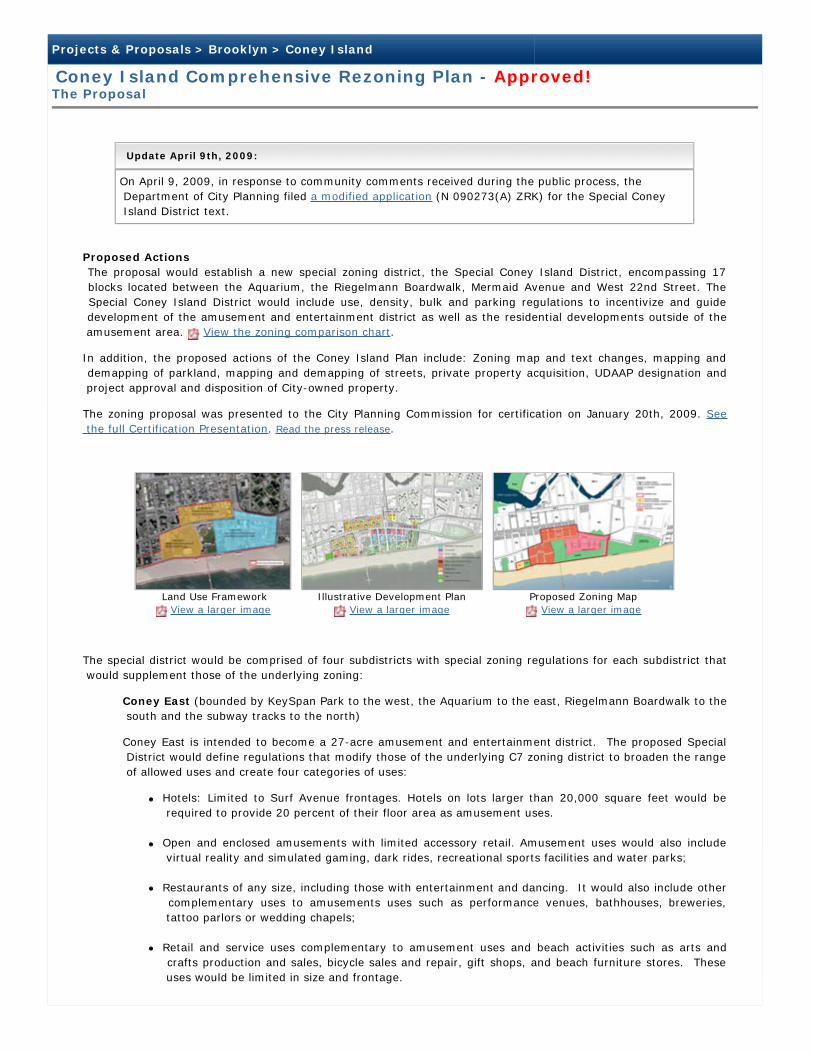
Land Use Framework View a larger image
Illustrative Development Plan View a larger image
Proposed Zoning Map View a larger image
The special district would be comprised of four subdistricts with special zoning regulations for each subdistrict that would supplement those of the underlying zoning:
Coney East (bounded by KeySpan Park to the west, the Aquarium to the east, Riegelmann Boardwalk to the south and the subway tracks to the north)
Coney East is intended to become a 27-acre amusement and entertainment district. The proposed Special District would define regulations that modify those of the underlying C7 zoning district to broaden the range of allowed uses and create four categories of uses:
Hotels: Limited to Surf Avenue frontages. Hotels on lots larger than 20,000 square feet would be required to provide 20 percent of their floor area as amusement uses.
Open and enclosed amusements with limited accessory retail. Amusement uses would also include virtual reality and simulated gaming, dark rides, recreational sports facilities and water parks;
Restaurants of any size, including those with entertainment and dancing. It would also include other complementary uses to amusements uses such as performance venues, bathhouses, breweries, tattoo parlors or wedding chapels;
Retail and service uses complementary to amusement uses and beach activities such as arts and crafts production and sales, bicycle sales and repair, gift shops, and beach furniture stores. These uses would be limited in size and frontage.
The allowable density would be increased from a Floor Area Ration (FAR) of 2.0 to a range of FARs between 2.6 and 4.5. Closer to the open amusements and along the subway tracks north of Surf Avenue, the FAR would be 2.6. Along Surf Avenue, FAR would range from 4.5 to 4.0 stepping down towards the Cyclone. These density regulations are intended to provide a transition downward from the 120 foot wide Surf Avenue to the beach and boardwalk and from KeySpan ballpark to the Cyclone.
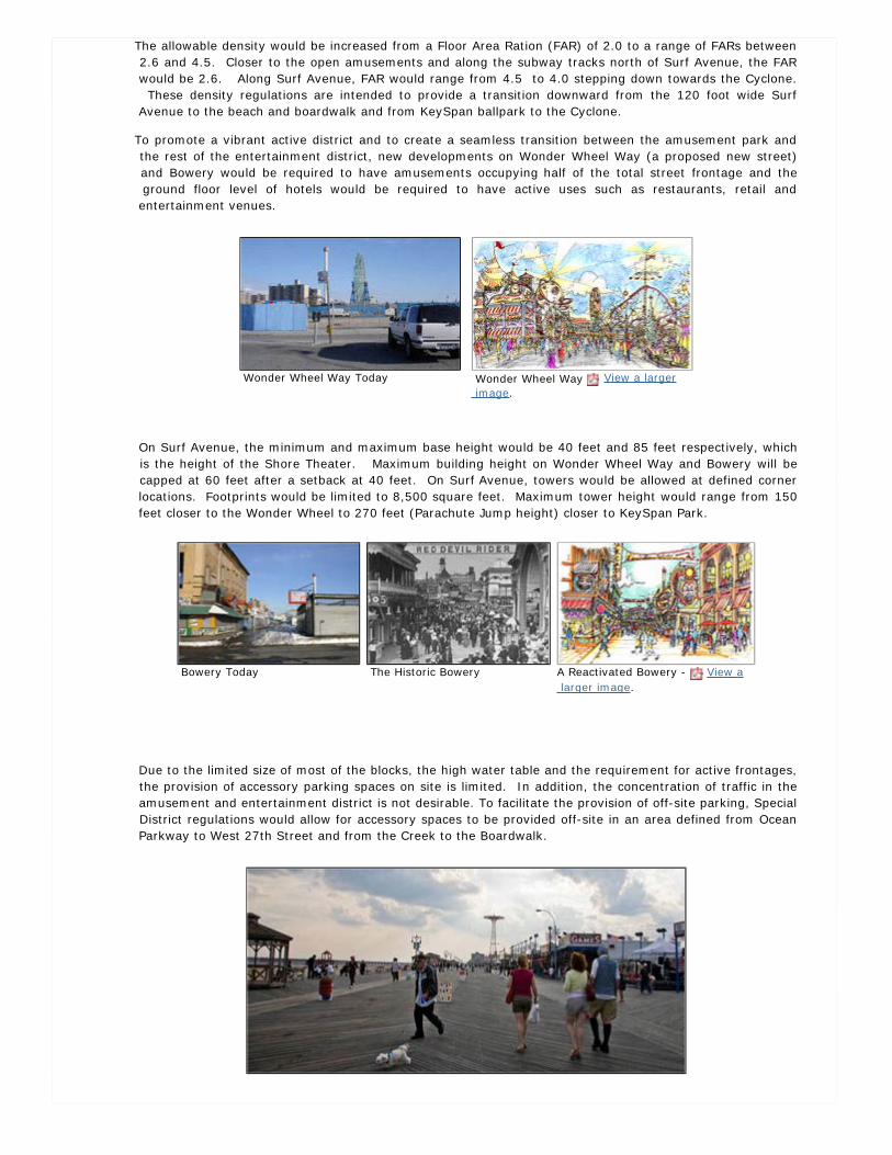
To promote a vibrant active district and to create a seamless transition between the amusement park and the rest of the entertainment district, new developments on Wonder Wheel Way (a proposed new street) and Bowery would be required to have amusements occupying half of the total street frontage and the ground floor level of hotels would be required to have active uses such as restaurants, retail and entertainment venues.
Wonder Wheel Way Today Wonder Wheel Way View a larger image.
On Surf Avenue, the minimum and maximum base height would be 40 feet and 85 feet respectively, which is the height of the Shore Theater. Maximum building height on Wonder Wheel Way and Bowery will be capped at 60 feet after a setback at 40 feet. On Surf Avenue, towers would be allowed at defined corner locations. Footprints would be limited to 8,500 square feet. Maximum tower height would range from 150 feet closer to the Wonder Wheel to 270 feet (Parachute Jump height) closer to KeySpan Park.
Bowery Today The Historic Bowery A Reactivated Bowery - View a larger image.
Due to the limited size of most of the blocks, the high water table and the requirement for active frontages, the provision of accessory parking spaces on site is limited. In addition, the concentration of traffic in the amusement and entertainment district is not desirable. To facilitate the provision of off-site parking, Special District regulations would allow for accessory spaces to be provided off-site in an area defined from Ocean Parkway to West 27th Street and from the Creek to the Boardwalk.
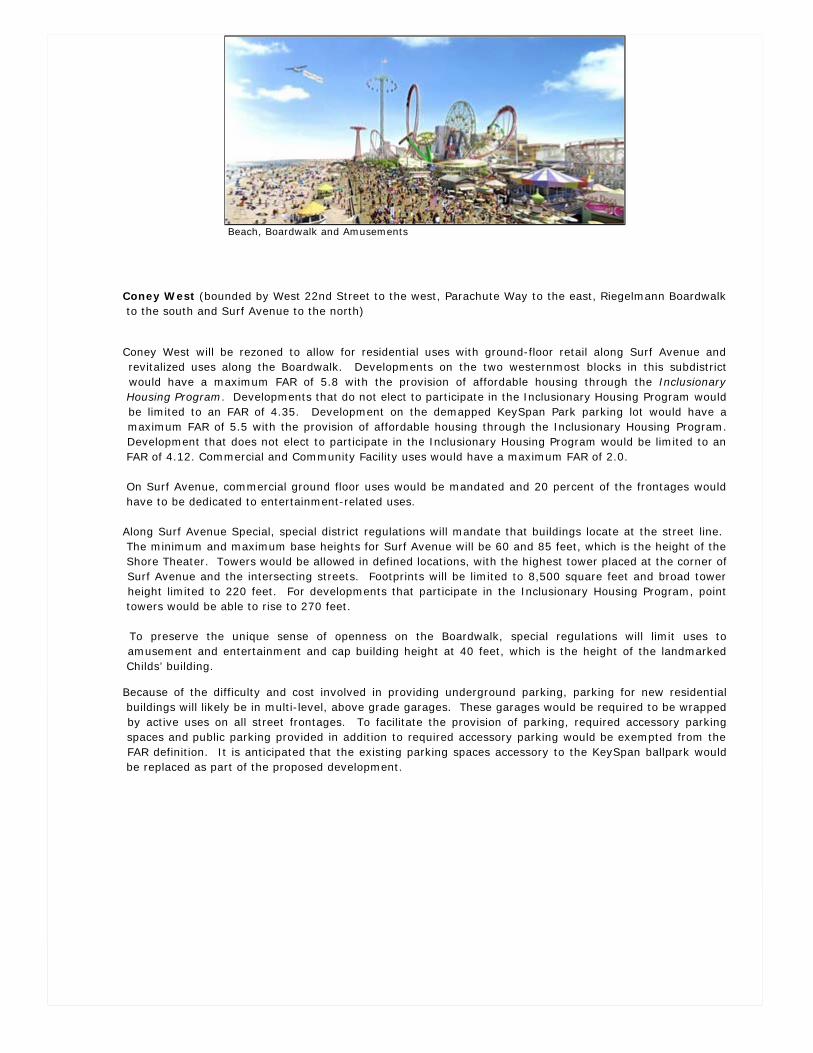
Beach, Boardwalk and Amusements
Coney West (bounded by West 22nd Street to the west, Parachute Way to the east, Riegelmann Boardwalk to the south and Surf Avenue to the north)
Coney West will be rezoned to allow for residential uses with ground-floor retail along Surf Avenue and revitalized uses along the Boardwalk. Developments on the two westernmost blocks in this subdistrict would have a maximum FAR of 5.8 with the provision of affordable housing through the Inclusionary Housing Program. Developments that do not elect to participate in the Inclusionary Housing Program would be limited to an FAR of 4.35. Development on the demapped KeySpan Park parking lot would have a maximum FAR of 5.5 with the provision of affordable housing through the Inclusionary Housing Program. Development that does not elect to participate in the Inclusionary Housing Program would be limited to an FAR of 4.12. Commercial and Community Facility uses would have a maximum FAR of 2.0.
On Surf Avenue, commercial ground floor uses would be mandated and 20 percent of the frontages would have to be dedicated to entertainment-related uses.
Along Surf Avenue Special, special district regulations will mandate that buildings locate at the street line. The minimum and maximum base heights for Surf Avenue will be 60 and 85 feet, which is the height of the Shore Theater. Towers would be allowed in defined locations, with the highest tower placed at the corner of Surf Avenue and the intersecting streets. Footprints will be limited to 8,500 square feet and broad tower height limited to 220 feet. For developments that participate in the Inclusionary Housing Program, point towers would be able to rise to 270 feet.
To preserve the unique sense of openness on the Boardwalk, special regulations will limit uses to amusement and entertainment and cap building height at 40 feet, which is the height of the landmarked Childs’ building.
Because of the difficulty and cost involved in providing underground parking, parking for new residential buildings will likely be in multi-level, above grade garages. These garages would be required to be wrapped by active uses on all street frontages. To facilitate the provision of parking, required accessory parking spaces and public parking provided in addition to required accessory parking would be exempted from the FAR definition. It is anticipated that the existing parking spaces accessory to the KeySpan ballpark would be replaced as part of the proposed development.
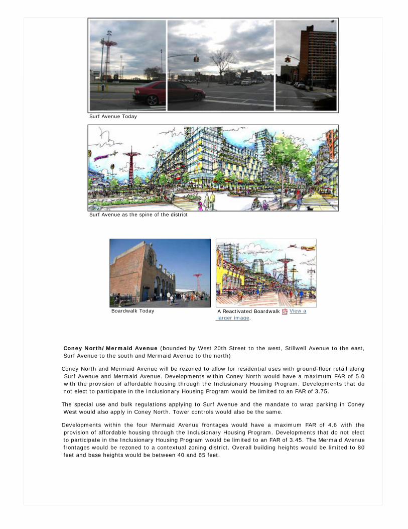
Surf Avenue Today
Surf Avenue as the spine of the district
Boardwalk Today A Reactivated Boardwalk View a larger image.
Coney North/Mermaid Avenue (bounded by West 20th Street to the west, Stillwell Avenue to the east, Surf Avenue to the south and Mermaid Avenue to the north)
Coney North and Mermaid Avenue will be rezoned to allow for residential uses with ground-floor retail along Surf Avenue and Mermaid Avenue. Developments within Coney North would have a maximum FAR of 5.0 with the provision of affordable housing through the Inclusionary Housing Program. Developments that do not elect to participate in the Inclusionary Housing Program would be limited to an FAR of 3.75.
The special use and bulk regulations applying to Surf Avenue and the mandate to wrap parking in Coney West would also apply in Coney North. Tower controls would also be the same.
Developments within the four Mermaid Avenue frontages would have a maximum FAR of 4.6 with the provision of affordable housing through the Inclusionary Housing Program. Developments that do not elect to participate in the Inclusionary Housing Program would be limited to an FAR of 3.45. The Mermaid Avenue frontages would be rezoned to a contextual zoning district. Overall building heights would be limited to 80 feet and base heights would be between 40 and 65 feet.
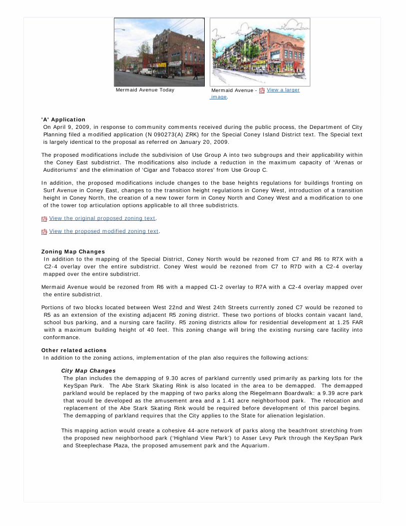
Mermaid Avenue Today Mermaid Avenue - View a larger image.
'A' Application On April 9, 2009, in response to community comments received during the public process, the Department of City Planning filed a modified application (N 090273(A) ZRK) for the Special Coney Island District text. The Special text is largely identical to the proposal as referred on January 20, 2009.
The proposed modifications include the subdivision of Use Group A into two subgroups and their applicability within the Coney East subdistrict. The modifications also include a reduction in the maximum capacity of ‘Arenas or Auditoriums’ and the elimination of ‘Cigar and Tobacco stores’ from Use Group C.
In addition, the proposed modifications include changes to the base heights regulations for buildings fronting on Surf Avenue in Coney East, changes to the transition height regulations in Coney West, introduction of a transition height in Coney North, the creation of a new tower form in Coney North and Coney West and a modification to one of the tower top articulation options applicable to all three subdistricts.
View the original proposed zoning text.
View the proposed modified zoning text.
Zoning Map Changes In addition to the mapping of the Special District, Coney North would be rezoned from C7 and R6 to R7X with a C2-4 overlay over the entire subdistrict. Coney West would be rezoned from C7 to R7D with a C2-4 overlay mapped over the entire subdistrict.
Mermaid Avenue would be rezoned from R6 with a mapped C1-2 overlay to R7A with a C2-4 overlay mapped over the entire subdistrict.
Portions of two blocks located between West 22nd and West 24th Streets currently zoned C7 would be rezoned to R5 as an extension of the existing adjacent R5 zoning district. These two portions of blocks contain vacant land, school bus parking, and a nursing care facility. R5 zoning districts allow for residential development at 1.25 FAR with a maximum building height of 40 feet. This zoning change will bring the existing nursing care facility into conformance.
Other related actions In addition to the zoning actions, implementation of the plan also requires the following actions:
City Map Changes The plan includes the demapping of 9.30 acres of parkland currently used primarily as parking lots for the KeySpan Park. The Abe Stark Skating Rink is also located in the area to be demapped. The demapped parkland would be replaced by the mapping of two parks along the Riegelmann Boardwalk: a 9.39 acre park that would be developed as the amusement area and a 1.41 acre neighborhood park. The relocation and replacement of the Abe Stark Skating Rink would be required before development of this parcel begins. The demapping of parkland requires that the City applies to the State for alienation legislation.
This mapping action would create a cohesive 44-acre network of parks along the beachfront stretching from the proposed new neighborhood park (‘Highland View Park’) to Asser Levy Park through the KeySpan Park and Steeplechase Plaza, the proposed amusement park and the Aquarium.
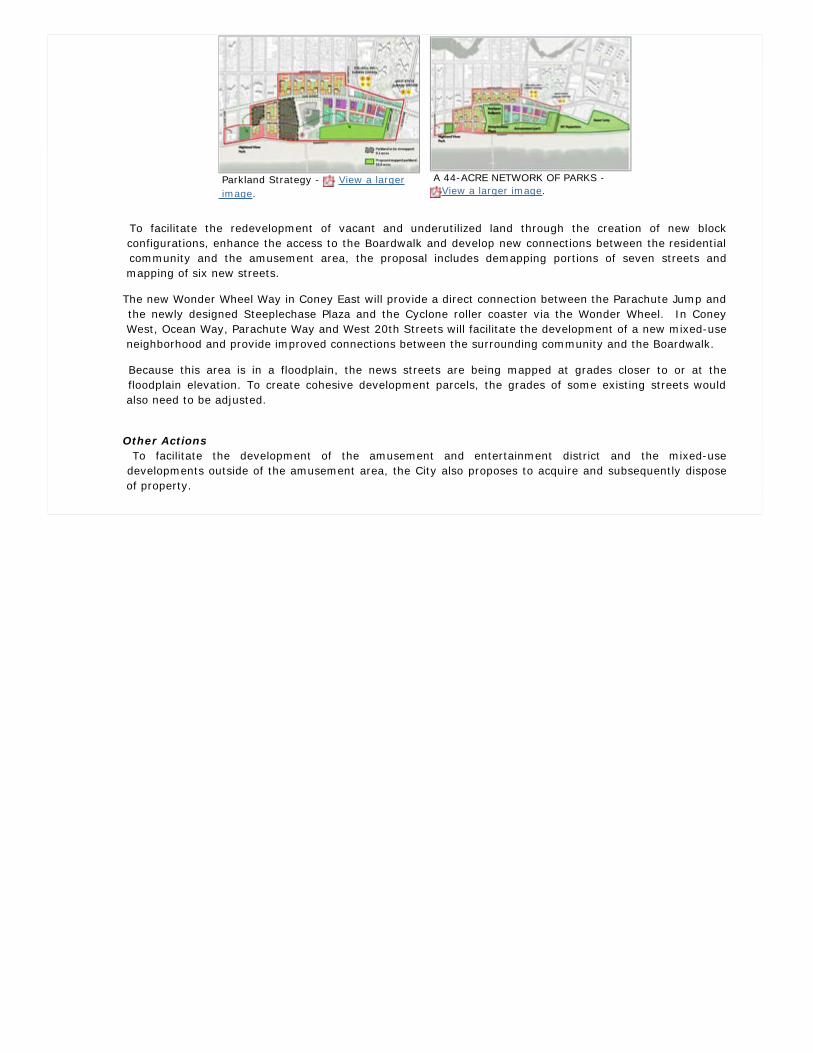
Parkland Strategy - View a larger image.
A 44-ACRE NETWORK OF PARKS - View a larger image.
To facilitate the redevelopment of vacant and underutilized land through the creation of new block configurations, enhance the access to the Boardwalk and develop new connections between the residential community and the amusement area, the proposal includes demapping portions of seven streets and mapping of six new streets.
The new Wonder Wheel Way in Coney East will provide a direct connection between the Parachute Jump and the newly designed Steeplechase Plaza and the Cyclone roller coaster via the Wonder Wheel. In Coney West, Ocean Way, Parachute Way and West 20th Streets will facilitate the development of a new mixed-use neighborhood and provide improved connections between the surrounding community and the Boardwalk.
Because this area is in a floodplain, the news streets are being mapped at grades closer to or at the floodplain elevation. To create cohesive development parcels, the grades of some existing streets would also need to be adjusted.
Other Actions To facilitate the development of the amusement and entertainment district and the mixed-use developments outside of the amusement area, the City also proposes to acquire and subsequently dispose of property.
Projects & Proposals > Brooklyn > Coney Island
Coney Island Comprehensive Rezoning Plan - Approved!Public Review
On November 8, 2007, Mayor Bloomberg unveiled the City's vision for Coney Island at an event held by the Brooklyn Chamber of Commerce at Gargiulo's restaurant, one of Coney Island's long-standing neighborhood institutions.
Since then, the DCP and the CIDC have held many public meetings to present the goals and objectives and the plan and to receive feedback from the community. This interactive process has helped shaped the final proposal.
The Office of the Deputy Mayor for Economic Development, as environmental lead agency, issued a Notice of Completion for a Draft Environmental Impact Statement (DEIS) for the proposal, on January 16, 2009.
The proposal began formal public review on January 20, 2009 with the Department of City Planning’s certification of the Uniform Land Use Review Procedure (ULURP) applications and referral of the related non-ULURP zoning text amendment.
A Public Hearing on the DEIS was held by the City Planning Commission and the Office of the Deputy Mayor for Economic Development in conjunction with the ULURP process on May 6, 2009. Public comments on the DEIS were received for a ten day period following the May 6th public hearing. On June 5, 2009, the Office of the Deputy Mayor for Economic Development issued the Notice of Completion for the Final Environmental Impact Statement (FEIS) for the Coney Island Rezoning plan.
Milestone Dates
Department of City Planning Certification January 20, 2009 - View presentation
Community Board 13 Conditional Approval March 26, 2009
Borough President Conditional Approval April 27, 2009
City Planning Commission Public Hearing May 6, 2009
City Planning Commission Approval with Modifications* (Read the CPC Reports)
June 17, 2009
City Council Approval with Modifications** July 29, 2009
*City Planning Commission Approval with ModificationsOn June 17, 2009 the City Planning Commission (CPC) approved the applications for theComprehensive Coney Island Plan with modifications to the (A) application (N 090273(A)ZRK).The original application (N 090273 ZRK) was withdrawn.
The approved Zoning Text amendment was modified by the CPC in response to concerns raisedduring the public review process. The modifications include the following:
Requirement that fifteen percent of the building frontage along the south side of Surf Avenue, both sides of Stillwell Avenue, and the west side of West 10th Street in the Coney East subdistrict be occupied by amusement uses within Use Group A(1). (Section 131-131(c)(d))
Allowance of a transfer of floor area between the landmarked Child’s building and the proposed development across West 21st Street in the Coney West subdistrict. (Section 131-321(c))
Elimination of the ‘buffer zone’ in the Coney North subdistrict. The area was previously limited in height to 23 feet and now would be allowed to rise to the maximum base height of 65 feet and the transition height of 85 feet.
The text has been modified to address issues related to proposed changes in street grades:
a. To create incentives for internal ramps, stairs and ADA accessible lifts that would
provide access to the lowest story of a building above the base floodplain elevation from the public sidewalk, up to 300 square feet of area utilized for this purpose would be exempted from the definition of floor area. (Section 131-324)
b. To minimize the visual impact of ramps, stairs and ADA accessible lifts provided outside of the building, a streetwall recess would only be permitted for access to building entrances of up to 20 feet in width and 10 feet in depth. (Sections 131-421(a)(2), 423(a), 431(a), 441(a), 443(a))
c. Outside ramps breaking the streetwall requirement shall be permitted only by authorization of the City Planning Commission. (Section 131-49)
The maximum 60-foot frontage per establishment regulation - for Surf Avenue in the Coney East subdistrict and for all streets in the Coney North and Coney West subdistricts - has been modified to a minimum of four establishments per block. (Sections 131-131(c)(1)(2)(3), 132(a)(2))
The modifications also include refinements of the zoning text related to the definition of hotels (Section 131-11) (12-10).
View the complete proposed zoning text amendment as modified by the CPC.
**City Council Approval with Modifications On July 29, 2009 the City Council adopted the Coney Island rezoning with modifications. The zoning text and map amendments are now in effect.
MODIFICATIONS TO THE CITY MAP AMENDMENT (C 090107 MMK)
Wonder Wheel Way between West 15th Street and West 16th Street and between West 12th Street and West 10th Street has been modified by substituting the 56 feet wide street approved by the City Planning Commission (CPC) with a 30 feet wide pedestrian way that would not be used for regular vehicular access. The 56-foot street will remain between West 15th Street and West 12th Street, creating a loop road connecting to Stillwell Avenue to ensure efficient vehicular circulation in the amusement and entertainment district.
West 16th Street and West 10th Street would terminate in a vehicle turnaround, portions of which would be located in areas previously proposed to be mapped as parkland.
The boundary of the proposed mapped amusement park has been be modified to eliminate the park mapping proposed for the existing Wonder Wheel site. In addition, where Wonder Wheel Way has been narrowed to 30 feet, the mapped park will be expanded to abut the new southerly line of Wonder Wheel Way. With this modification, the mapped amusement park has been increased from 9.39 acres to 9.44 acres.
As an administrative correction, in order to accommodate the continuation of the last operating amusement park in Coney Island—Deno’s Wonder Wheel Park, a separate map showing the 30-foot way between West 12th Street and West 10th Street has been created so that it can be filed and become effective at a later date than the other city map changes Until this map is filed, development of open amusements would be allowed within this area, as described below in the modifications to the Special District text.
In order to assure free pedestrian access to the Wonder Wheel and permit pedestrian and/or vehicular access related to operation of the Wonder Wheel, notes requiring easements have been added to the alteration maps for Coney East.
MODIFICATIONS TO SPECIAL USE REGULATIONS OF THE SPECIAL CONEY ISLAND DISTRICT (N 090273 (A) ZRK)
To ensure that only open amusements are developed in the 30 foot area between West 12th and West 10th Streets to be occupied by the mapped Wonder Wheel Way, the Council has created a new ‘Parcel 3’, on the Special District map. The underlying C7 use and bulk regulations shall apply on Parcel 3, except that uses will be limited to open amusement uses (Use Group 13A and Use Group 15), and the floor area attributable to Parcel 3 may only be used within Parcel 3.
The modifications also include clarifications to the text relating to lot coverage for corner lots, residential parking requirements and permitting ice skating rinks as an allowed use on the entirety of Parcel F in the Coney West sub-district.
View the adopted zoning text amendment.
For additional information, contact the Department of City Planning's Brooklyn Borough Office at 718.780.8280.
Projects & Proposals > Brooklyn > Coney Island
Coney Island Comprehensive Rezoning PlanCPC Approval With Modifications
On June 17, 2009 the City Planning Commission (CPC) approved the applications for the Comprehensive Coney Island Plan with modifications to the (A) application (N 090273(A)ZRK). The original application (N 090273 ZRK) was withdrawn.
The approved Zoning Text amendment was modified by the CPC in response to concerns raised during the public review process. The modifications include the following:
Requirement that fifteen percent of the building frontage along the south side of Surf Avenue, both sides of Stillwell Avenue, and the west side of West 10th Street in the Coney East subdistrict be occupied by amusement uses within Use Group A(1). (Section 131-131(c)(d))
Allowance of a transfer of floor area between the landmarked Child’s building and the proposed development across West 21st Street in the Coney West subdistrict. (Section 131-321(c))
Elimination of the ‘buffer zone’ in the Coney North subdistrict. The area was previously limited in height to 23 feet and now would be allowed to rise to the maximum base height of 65 feet and the transition height of 85 feet.
The text has been modified to address issues related to proposed changes in street grades:
a. To create incentives for internal ramps, stairs and ADA accessible lifts that would provide access to thelowest story of a building above the base floodplain elevation from the public sidewalk, up to 300 squarefeet of area utilized for this purpose would be exempted from the definition of floor area. (Section 131-324)
b. To minimize the visual impact of ramps, stairs and ADA accessible lifts provided outside of the building, astreetwall recess would only be permitted for access to building entrances of up to 20 feet in width and10 feet in depth. (Sections 131-421(a)(2), 423(a), 431(a), 441(a), 443(a))
c. Outside ramps breaking the streetwall requirement shall be permitted only by authorization of the CityPlanning Commission. (Section 131-49)
The maximum 60-foot frontage per establishment regulation - for Surf Avenue in the Coney East subdistrict and for all streets in the Coney North and Coney West subdistricts - has been modified to a minimum of four establishments per block. (Sections 131-131(c)(1)(2)(3), 132(a)(2))
The modifications also include refinements of the zoning text related to the definition of hotels (Section 131-11) (12-10).
View the complete proposed zoning text amendment as modified by the CPC. Read the Read the CPC Reports) for the CPC approved applications.

Projects & Proposals
Related Notes
Items accompanied by this symbol require the free Adobe Acrobat Reader.
Brief explanations of terms in green italics can be viewed by visiting glossary page. Words and phrases followed by an asterisk (*) are defined terms in the Zoning Resolution, primarily in Section 12-10. Consult the Zoning Resolution for the official and legally binding definitions of these words and phrases.