brochure pilot sites final and berat,albania
TRANSCRIPT
CHERPLANCHERPLANCHERPLANCHERPLAN
Pilot Project Sites Pilot Project Sites Pilot Project Sites Pilot Project Sites
2
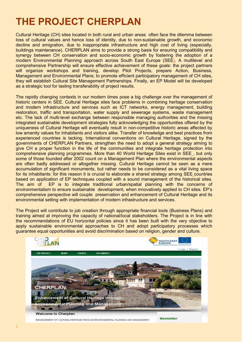
THE PROJECT CHERPLAN Cultural Heritage (CH) sites located in both rural and urban areas often face the dilemma between loss of cultural values and hence loss of identity, due to non-sustainable growth, and economic decline and emigration, due to inappropriate infrastructure and high cost of living (especially, buildings maintenance). CHERPLAN aims to provide a strong basis for ensuring compatibility and synergy between CH conservation and socio-economic growth by fostering the adoption of a modern Environmental Planning approach across South East Europe (SEE). A multilevel and comprehensive Partnership will ensure effective achievement of these goals: the project partners will organize workshops and training, develop Pilot Projects, prepare Action, Business, Management and Environmental Plans; to promote efficient participatory management of CH sites, they will establish Cultural Site Management Partnerships. Finally, an EP Model will be developed as a strategic tool for lasting transferability of project results.
The rapidly changing contexts in our modern times pose a big challenge over the management of historic centers in SEE. Cultural Heritage sites face problems in combining heritage conservation and modern infrastructure and services such as ICT networks, energy management, building restoration, traffic and transportation, water supply and sewerage systems, waste management etc. The lack of multi-level exchange between responsible managing authorities and the missing integrated sustainable development strategies fully acknowledging the opportunities offered by the uniqueness of Cultural Heritage will eventually result in non-competitive historic areas affected by low amenity values for inhabitants and visitors alike. Transfer of knowledge and best practices from experienced countries is lacking. International conventions on Cultural Heritage, signed by the governments of CHERPLAN Partners, strengthen the need to adopt a general strategy aiming to give CH a proper function in the life of the communities and integrate heritage protection into comprehensive planning programmes. More than 40 World Heritage Sites exist in SEE , but only some of those founded after 2002 count on a Management Plan where the environmental aspects are often badly addressed or altogether missing. Cultural Heritage cannot be seen as a mere accumulation of significant monuments, but rather needs to be considered as a vital living space for its inhabitants: for this reason it is crucial to elaborate a shared strategy among SEE countries based on application of EP techniques coupled with a sound management of the historical sites. The aim of EP is to integrate traditional urban/spatial planning with the concerns of environmentalism to ensure sustainable development, when innovatively applied to CH sites. EP’s comprehensive perspective will couple preservation and enhancement of Cultural Heritage and its environmental setting with implementation of modern infrastructure and services.
The Project will contribute to job creation through appropriate financial tools (Business Plans) and training aimed at improving the capacity of national/local stakeholders. The Project is in line with the recommendations of EU horizontal policies since it has been built with the very objective to apply sustainable environmental approaches to CH and adopt participatory processes which guarantee equal opportunities and avoid discrimination based on religion, gender and culture.
3
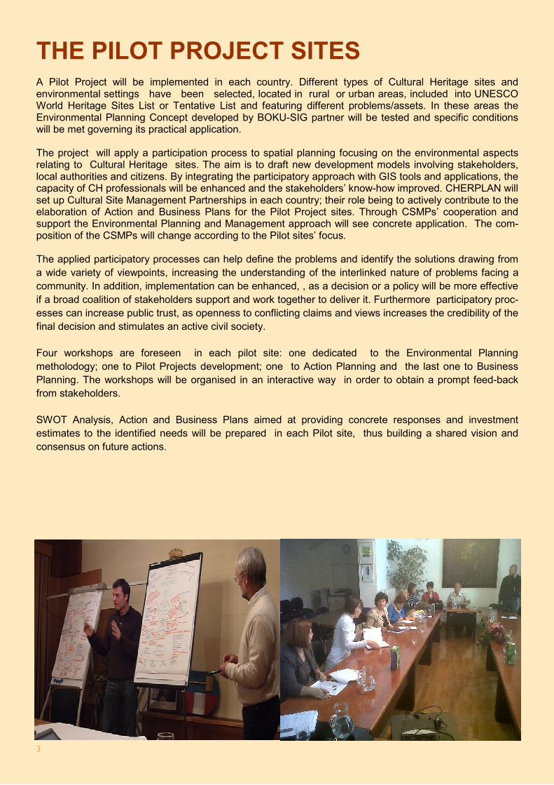
THE PILOT PROJECT SITES A Pilot Project will be implemented in each country. Different types of Cultural Heritage sites and environmental settings have been selected, located in rural or urban areas, included into UNESCO World Heritage Sites List or Tentative List and featuring different problems/assets. In these areas the Environmental Planning Concept developed by BOKU-SIG partner will be tested and specific conditions will be met governing its practical application. The project will apply a participation process to spatial planning focusing on the environmental aspects relating to Cultural Heritage sites. The aim is to draft new development models involving stakeholders, local authorities and citizens. By integrating the participatory approach with GIS tools and applications, the capacity of CH professionals will be enhanced and the stakeholders’ know-how improved. CHERPLAN will set up Cultural Site Management Partnerships in each country; their role being to actively contribute to the elaboration of Action and Business Plans for the Pilot Project sites. Through CSMPs’ cooperation and support the Environmental Planning and Management approach will see concrete application. The com-position of the CSMPs will change according to the Pilot sites’ focus. The applied participatory processes can help define the problems and identify the solutions drawing from a wide variety of viewpoints, increasing the understanding of the interlinked nature of problems facing a community. In addition, implementation can be enhanced, , as a decision or a policy will be more effective if a broad coalition of stakeholders support and work together to deliver it. Furthermore participatory proc-esses can increase public trust, as openness to conflicting claims and views increases the credibility of the final decision and stimulates an active civil society.
Four workshops are foreseen in each pilot site: one dedicated to the Environmental Planning metholodogy; one to Pilot Projects development; one to Action Planning and the last one to Business Planning. The workshops will be organised in an interactive way in order to obtain a prompt feed-back from stakeholders.
SWOT Analysis, Action and Business Plans aimed at providing concrete responses and investment estimates to the identified needs will be prepared in each Pilot site, thus building a shared vision and consensus on future actions.
4
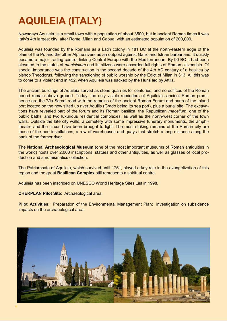
AQUILEIA (ITALY) Nowadays Aquileia is a small town with a population of about 3500, but in ancient Roman times it was Italy's 4th largest city, after Rome, Milan and Capua, with an estimated population of 200,000. Aquileia was founded by the Romans as a Latin colony in 181 BC at the north-eastern edge of the plain of the Po and the other Alpine rivers as an outpost against Gallic and Istrian barbarians. It quickly became a major trading centre, linking Central Europe with the Mediterranean. By 90 BC it had been elevated to the status of municipium and its citizens were accorded full rights of Roman citizenship. Of special importance was the construction in the second decade of the 4th AD century of a basilica by bishop Theodorus, following the sanctioning of public worship by the Edict of Milan in 313. All this was to come to a violent end in 452, when Aquileia was sacked by the Huns led by Attila. The ancient buildings of Aquileia served as stone quarries for centuries, and no edifices of the Roman period remain above ground. Today, the only visible reminders of Aquileia's ancient Roman promi-nence are the 'Via Sacra' road with the remains of the ancient Roman Forum and parts of the inland port located on the now silted up river Aquilis (Grado being its sea port), plus a burial site. The excava-tions have revealed part of the forum and its Roman basilica, the Republican macellum, one of the public baths, and two luxurious residential complexes, as well as the north-west corner of the town walls. Outside the late city walls, a cemetery with some impressive funerary monuments, the amphi-theatre and the circus have been brought to light. The most striking remains of the Roman city are those of the port installations, a row of warehouses and quays that stretch a long distance along the bank of the former river. The National Archaeological Museum (one of the most important museums of Roman antiquities in the world) hosts over 2,000 inscriptions, statues and other antiquities, as well as glasses of local pro-duction and a numismatics collection. The Patriarchate of Aquileia, which survived until 1751, played a key role in the evangelization of this region and the great Basilican Complex still represents a spiritual centre. Aquileia has been inscribed on UNESCO World Heritage Sites List in 1998. CHERPLAN Pilot Site: Archaeological area
Pilot Activities: Preparation of the Environmental Management Plan; investigation on subsidence impacts on the archaeological area.
5
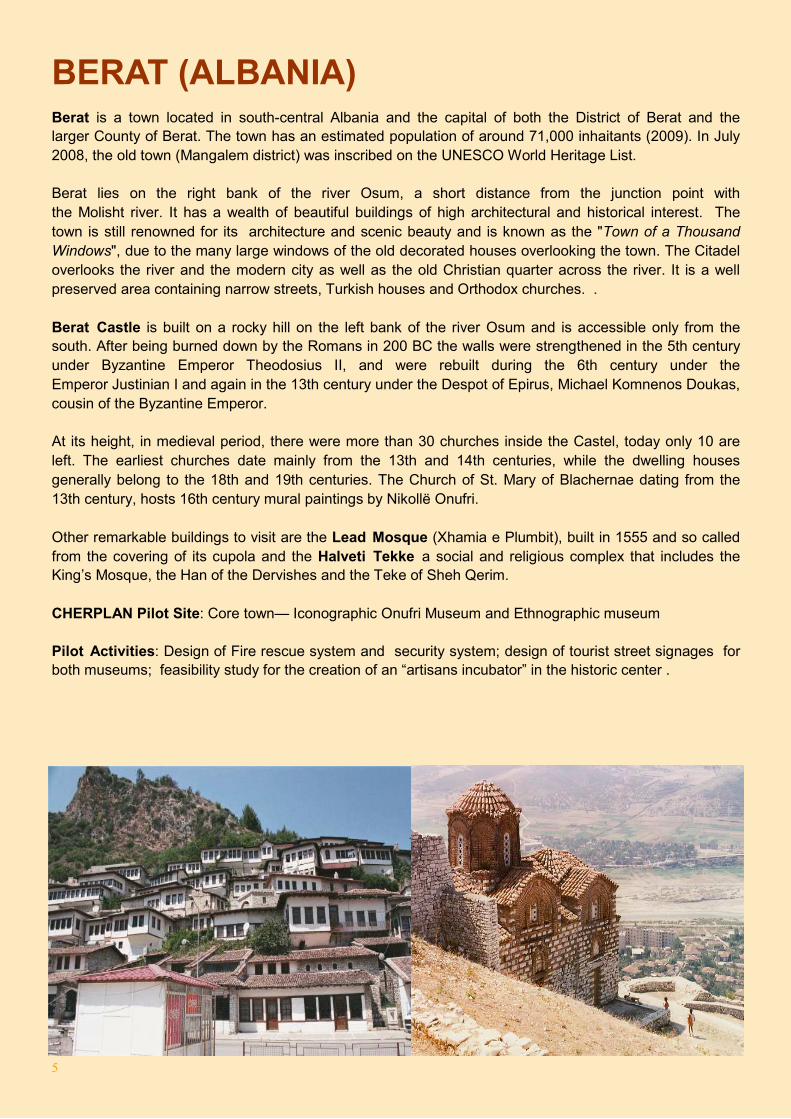
BERAT (ALBANIA) Berat is a town located in south-central Albania and the capital of both the District of Berat and the larger County of Berat. The town has an estimated population of around 71,000 inhaitants (2009). In July 2008, the old town (Mangalem district) was inscribed on the UNESCO World Heritage List.
Berat lies on the right bank of the river Osum, a short distance from the junction point with the Molisht river. It has a wealth of beautiful buildings of high architectural and historical interest. The town is still renowned for its architecture and scenic beauty and is known as the "Town of a Thousand Windows", due to the many large windows of the old decorated houses overlooking the town. The Citadel overlooks the river and the modern city as well as the old Christian quarter across the river. It is a well preserved area containing narrow streets, Turkish houses and Orthodox churches. .
Berat Castle is built on a rocky hill on the left bank of the river Osum and is accessible only from the south. After being burned down by the Romans in 200 BC the walls were strengthened in the 5th century under Byzantine Emperor Theodosius II, and were rebuilt during the 6th century under the Emperor Justinian I and again in the 13th century under the Despot of Epirus, Michael Komnenos Doukas, cousin of the Byzantine Emperor.
At its height, in medieval period, there were more than 30 churches inside the Castel, today only 10 are left. The earliest churches date mainly from the 13th and 14th centuries, while the dwelling houses generally belong to the 18th and 19th centuries. The Church of St. Mary of Blachernae dating from the 13th century, hosts 16th century mural paintings by Nikollë Onufri.
Other remarkable buildings to visit are the Lead Mosque (Xhamia e Plumbit), built in 1555 and so called from the covering of its cupola and the Halveti Tekke a social and religious complex that includes the King’s Mosque, the Han of the Dervishes and the Teke of Sheh Qerim.
CHERPLAN Pilot Site: Core town— Iconographic Onufri Museum and Ethnographic museum
Pilot Activities: Design of Fire rescue system and security system; design of tourist street signages for both museums; feasibility study for the creation of an “artisans incubator” in the historic center .
6
BITOLA (FORMER YUGOSLAV REPUBLIC OF MACEDONIA ) Bitola , formerly Monastir; is a city located in the south western part of the Former Yugoslav Republic of Macedonia. The city is an administrative, cultural, industrial, commercial, and educational centre. Bitola is the second largest city in the country. Covering an area of 422,39 km². and with a population of 74.550(2002), Bitola is an important industrial, agricultural, commercial, educational, and cultural center.
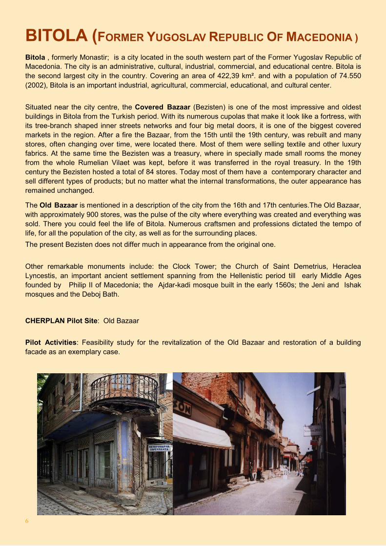
Situated near the city centre, the Covered Bazaar (Bezisten) is one of the most impressive and oldest buildings in Bitola from the Turkish period. With its numerous cupolas that make it look like a fortress, with its tree-branch shaped inner streets networks and four big metal doors, it is one of the biggest covered markets in the region. After a fire the Bazaar, from the 15th until the 19th century, was rebuilt and many stores, often changing over time, were located there. Most of them were selling textile and other luxury fabrics. At the same time the Bezisten was a treasury, where in specially made small rooms the money from the whole Rumelian Vilaet was kept, before it was transferred in the royal treasury. In the 19th century the Bezisten hosted a total of 84 stores. Today most of them have a contemporary character and sell different types of products; but no matter what the internal transformations, the outer appearance has remained unchanged.
The Old Bazaar is mentioned in a description of the city from the 16th and 17th centuries.The Old Bazaar, with approximately 900 stores, was the pulse of the city where everything was created and everything was sold. There you could feel the life of Bitola. Numerous craftsmen and professions dictated the tempo of life, for all the population of the city, as well as for the surrounding places.
The present Bezisten does not differ much in appearance from the original one.
Other remarkable monuments include: the Clock Tower; the Church of Saint Demetrius, Heraclea Lyncestis, an important ancient settlement spanning from the Hellenistic period till early Middle Ages founded by Philip II of Macedonia; the Ajdar-kadi mosque built in the early 1560s; the Jeni and Ishak mosques and the Deboj Bath.
CHERPLAN Pilot Site: Old Bazaar
Pilot Activities: Feasibility study for the revitalization of the Old Bazaar and restoration of a building facade as an exemplary case.
7
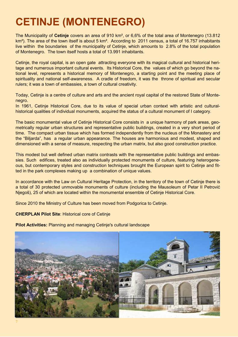
CETINJE (MONTENEGRO) The Municipality of Cetinje covers an area of 910 km², or 6,6% of the total area of Montenegro (13.812 km²). The area of the town itself is about 5 km². According to 2011 census, a total of 16.757 inhabitants live within the boundaries of the municipality of Cetinje, which amounts to 2.8% of the total population of Montenegro. The town itself hosts a total of 13.991 inhabitants. Cetinje, the royal capital, is an open gate attracting everyone with its magical cultural and historical heri-tage and numerous important cultural events. Its Historical Core, the values of which go beyond the na-tional level, represents a historical memory of Montenegro, a starting point and the meeting place of spirituality and national self-awareness. A cradle of freedom, it was the throne of spiritual and secular rulers; it was a town of embassies, a town of cultural creativity. Today, Cetinje is a centre of culture and arts and the ancient royal capital of the restored State of Monte-negro. In 1961, Cetinje Historical Core, due to its value of special urban context with artistic and cultural-historical qualities of individual monuments, acquired the status of a cultural monument of I category. The basic monumental value of Cetinje Historical Core consists in a unique harmony of park areas, geo-metrically regular urban structures and representative public buildings, created in a very short period of time. The compact urban tissue which has formed independently from the nucleus of the Monastery and the “Biljarda”, has a regular urban appearance. The houses are harmonious and modest, shaped and dimensioned with a sense of measure, respecting the urban matrix, but also good construction practice. This modest but well defined urban matrix contrasts with the representative public buildings and embas-sies. Such edifices, treated also as individually protected monuments of culture, featuring heterogene-ous, but contemporary styles and construction techniques brought the European spirit to Cetinje and fit-ted in the park complexes making up a combination of unique values. In accordance with the Law on Cultural Heritage Protection, in the territory of the town of Cetinje there is a total of 30 protected unmovable monuments of culture (including the Mausoleum of Petar II Petrović Njegoš), 25 of which are located within the monumental ensemble of Cetinje Historical Core. Since 2010 the Ministry of Culture has been moved from Podgorica to Cetinje. CHERPLAN Pilot Site: Historical core of Cetinje Pilot Activities: Planning and managing Cetinje's cultural landscape
8
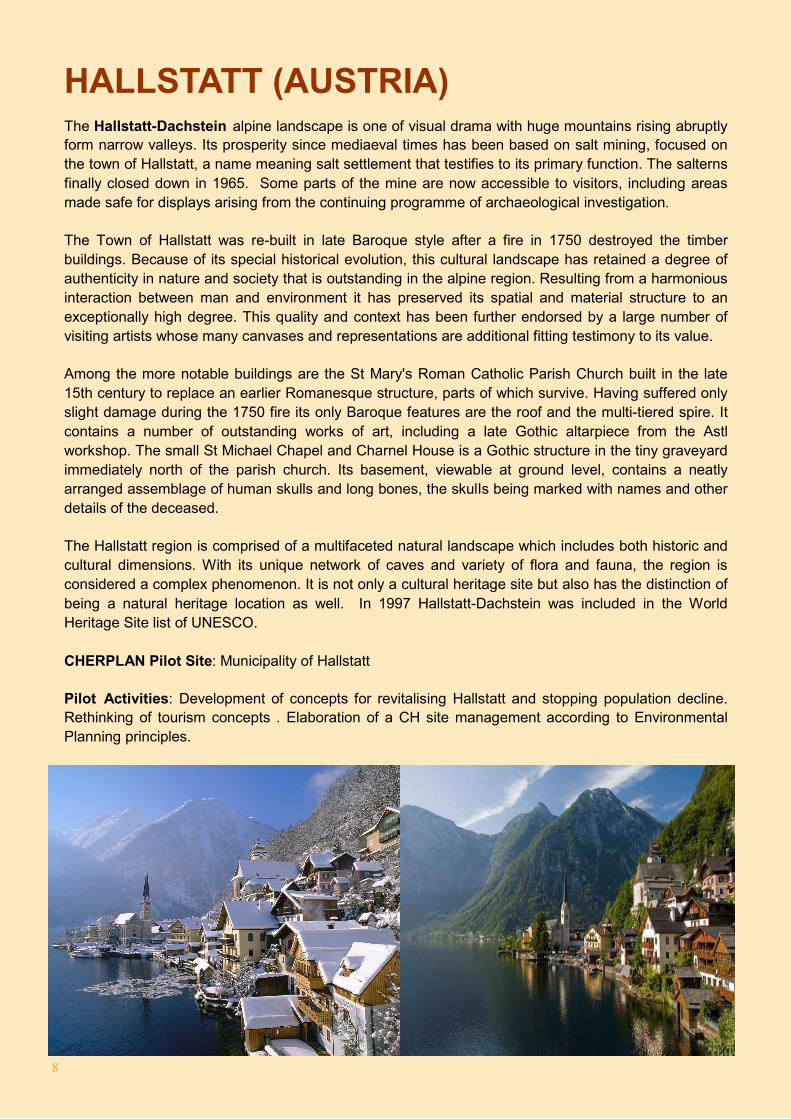
HALLSTATT (AUSTRIA) The Hallstatt-Dachstein alpine landscape is one of visual drama with huge mountains rising abruptly form narrow valleys. Its prosperity since mediaeval times has been based on salt mining, focused on the town of Hallstatt, a name meaning salt settlement that testifies to its primary function. The salterns finally closed down in 1965. Some parts of the mine are now accessible to visitors, including areas made safe for displays arising from the continuing programme of archaeological investigation.
The Town of Hallstatt was re-built in late Baroque style after a fire in 1750 destroyed the timber buildings. Because of its special historical evolution, this cultural landscape has retained a degree of authenticity in nature and society that is outstanding in the alpine region. Resulting from a harmonious interaction between man and environment it has preserved its spatial and material structure to an exceptionally high degree. This quality and context has been further endorsed by a large number of visiting artists whose many canvases and representations are additional fitting testimony to its value.
Among the more notable buildings are the St Mary's Roman Catholic Parish Church built in the late 15th century to replace an earlier Romanesque structure, parts of which survive. Having suffered only slight damage during the 1750 fire its only Baroque features are the roof and the multi-tiered spire. It contains a number of outstanding works of art, including a late Gothic altarpiece from the Astl workshop. The small St Michael Chapel and Charnel House is a Gothic structure in the tiny graveyard immediately north of the parish church. Its basement, viewable at ground level, contains a neatly arranged assemblage of human skulls and long bones, the skulIs being marked with names and other details of the deceased.
The Hallstatt region is comprised of a multifaceted natural landscape which includes both historic and cultural dimensions. With its unique network of caves and variety of flora and fauna, the region is considered a complex phenomenon. It is not only a cultural heritage site but also has the distinction of being a natural heritage location as well. In 1997 Hallstatt-Dachstein was included in the World Heritage Site list of UNESCO.
CHERPLAN Pilot Site: Municipality of Hallstatt
Pilot Activities: Development of concepts for revitalising Hallstatt and stopping population decline. Rethinking of tourism concepts . Elaboration of a CH site management according to Environmental Planning principles.
9
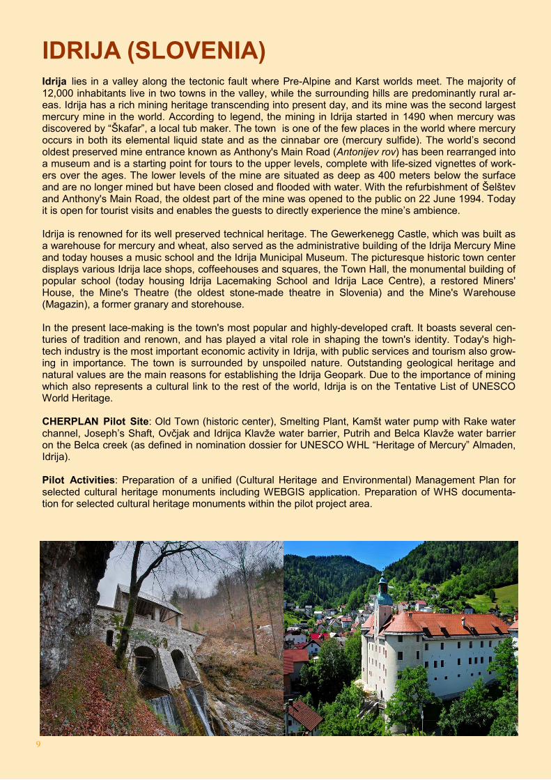
IDRIJA (SLOVENIA) Idrija lies in a valley along the tectonic fault where Pre-Alpine and Karst worlds meet. The majority of 12,000 inhabitants live in two towns in the valley, while the surrounding hills are predominantly rural ar-eas. Idrija has a rich mining heritage transcending into present day, and its mine was the second largest mercury mine in the world. According to legend, the mining in Idrija started in 1490 when mercury was discovered by “Škafar”, a local tub maker. The town is one of the few places in the world where mercury occurs in both its elemental liquid state and as the cinnabar ore (mercury sulfide). The world’s second oldest preserved mine entrance known as Anthony's Main Road (Antonijev rov) has been rearranged into a museum and is a starting point for tours to the upper levels, complete with life-sized vignettes of work-ers over the ages. The lower levels of the mine are situated as deep as 400 meters below the surface and are no longer mined but have been closed and flooded with water. With the refurbishment of Šelštev and Anthony's Main Road, the oldest part of the mine was opened to the public on 22 June 1994. Today it is open for tourist visits and enables the guests to directly experience the mine’s ambience. Idrija is renowned for its well preserved technical heritage. The Gewerkenegg Castle, which was built as a warehouse for mercury and wheat, also served as the administrative building of the Idrija Mercury Mine and today houses a music school and the Idrija Municipal Museum. The picturesque historic town center displays various Idrija lace shops, coffeehouses and squares, the Town Hall, the monumental building of popular school (today housing Idrija Lacemaking School and Idrija Lace Centre), a restored Miners' House, the Mine's Theatre (the oldest stone-made theatre in Slovenia) and the Mine's Warehouse (Magazin), a former granary and storehouse. In the present lace-making is the town's most popular and highly-developed craft. It boasts several cen-turies of tradition and renown, and has played a vital role in shaping the town's identity. Today's high-tech industry is the most important economic activity in Idrija, with public services and tourism also grow-ing in importance. The town is surrounded by unspoiled nature. Outstanding geological heritage and natural values are the main reasons for establishing the Idrija Geopark. Due to the importance of mining which also represents a cultural link to the rest of the world, Idrija is on the Tentative List of UNESCO World Heritage. CHERPLAN Pilot Site: Old Town (historic center), Smelting Plant, Kamšt water pump with Rake water channel, Joseph’s Shaft, Ovčjak and Idrijca Klavže water barrier, Putrih and Belca Klavže water barrier on the Belca creek (as defined in nomination dossier for UNESCO WHL “Heritage of Mercury” Almaden, Idrija). Pilot Activities: Preparation of a unified (Cultural Heritage and Environmental) Management Plan for selected cultural heritage monuments including WEBGIS application. Preparation of WHS documenta-tion for selected cultural heritage monuments within the pilot project area.
10
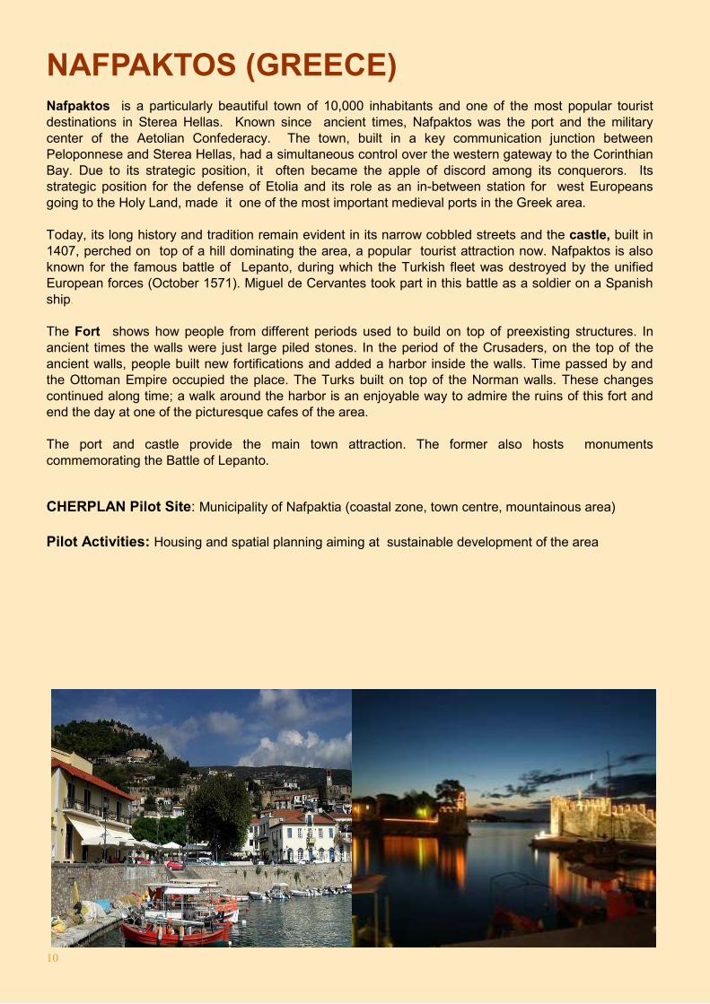
NAFPAKTOS (GREECE) Nafpaktos is a particularly beautiful town of 10,000 inhabitants and one of the most popular tourist destinations in Sterea Hellas. Known since ancient times, Nafpaktos was the port and the military center of the Aetolian Confederacy. The town, built in a key communication junction between Peloponnese and Sterea Hellas, had a simultaneous control over the western gateway to the Corinthian Bay. Due to its strategic position, it often became the apple of discord among its conquerors. Its strategic position for the defense of Etolia and its role as an in-between station for west Europeans going to the Holy Land, made it one of the most important medieval ports in the Greek area. Today, its long history and tradition remain evident in its narrow cobbled streets and the castle, built in 1407, perched on top of a hill dominating the area, a popular tourist attraction now. Nafpaktos is also known for the famous battle of Lepanto, during which the Turkish fleet was destroyed by the unified European forces (October 1571). Miguel de Cervantes took part in this battle as a soldier on a Spanish ship. The Fort shows how people from different periods used to build on top of preexisting structures. In ancient times the walls were just large piled stones. In the period of the Crusaders, on the top of the ancient walls, people built new fortifications and added a harbor inside the walls. Time passed by and the Ottoman Empire occupied the place. The Turks built on top of the Norman walls. These changes continued along time; a walk around the harbor is an enjoyable way to admire the ruins of this fort and end the day at one of the picturesque cafes of the area. The port and castle provide the main town attraction. The former also hosts monuments commemorating the Battle of Lepanto.
CHERPLAN Pilot Site: Municipality of Nafpaktia (coastal zone, town centre, mountainous area)
Pilot Activities: Housing and spatial planning aiming at sustainable development of the area
11
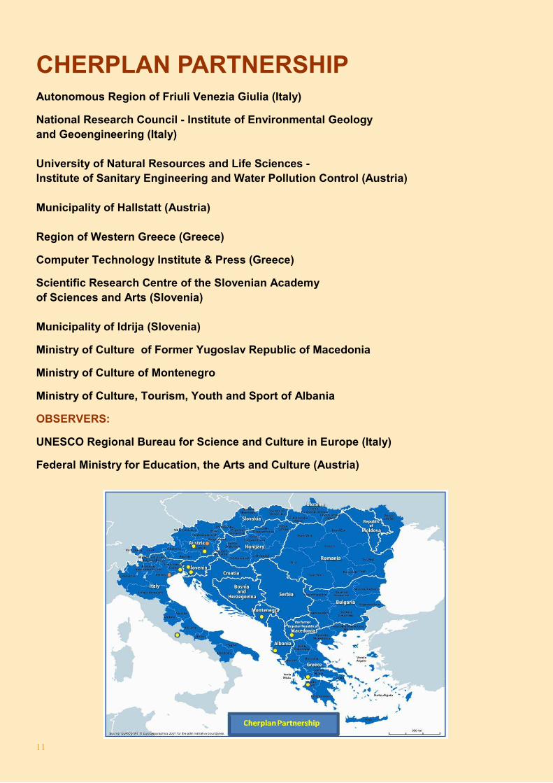
CHERPLAN PARTNERSHIP Autonomous Region of Friuli Venezia Giulia (Italy)
National Research Council - Institute of Environmental Geology
and Geoengineering (Italy)
University of Natural Resources and Life Sciences -
Institute of Sanitary Engineering and Water Pollution Control (Austria)
Municipality of Hallstatt (Austria)
Region of Western Greece (Greece)
Computer Technology Institute & Press (Greece)
Scientific Research Centre of the Slovenian Academy
of Sciences and Arts (Slovenia)
Municipality of Idrija (Slovenia)
Ministry of Culture of Former Yugoslav Republic of Macedonia
Ministry of Culture of Montenegro
Ministry of Culture, Tourism, Youth and Sport of Albania
OBSERVERS:
UNESCO Regional Bureau for Science and Culture in Europe (Italy)
Federal Ministry for Education, the Arts and Culture (Austria)
12