bennett & hock (2013) scree
DESCRIPTION
An account of a hillside wasteland in words and picturesTRANSCRIPT

1
Scree
Luke Bennett & Katja Hock
2 3
TRACT is an experiment in art publishing. A collaborative series made between Article Works and occursus, with funding from the University of Sheffield and Arts Enterprise, the ongoing series seeks to challenge artists and writers to work together to produce a single work. The aim is to create a unique publication where art and text work together, rather than describe one another.
The series editors for Tract areDr. Amanda Crawley Jackson & Ben Dunmore Tract 3: Scree - Luke Bennett & Katja Hock
For more information about tract contact Amanda Crawley Jackson, [email protected]
4 5
‘Scree’
A mass
of detritus,forming a precipitous,
stony slope upon a mountain side.Also, the material composing such a slope.
The Shorter Oxford English Dictionary, 3rd Edition
6 7
8 9
On the hillside - 1836
“The prospect of the circumjacent country, as commanded from the highest point of the wood
- a point easily attainable by pursuing the path from the Lodge near the Rolling Mill -
is one of the finest which it is almost impossible to perceive.
Shame on the indifference of the hundreds of intelligent
and, it may be, prospect-loving individuals who
have never given themselves the trouble
to walk to the top of Old Park Wood,
to look upon such a scene!”
On the hillside – 1936
“One estate just behind where I am living now, at the very summit of a hill, on horrible sticky
clay soil and swept by icy winds ... One particular picture of Sheffield stays by me. A frightful
piece of waste ground (somehow, up here a piece of waste ground attains a squalor that would
be impossible even in London), trampled quite bare of grass and littered with newspaper, old
saucepans etc.
To the right an isolated row of gaunt four room houses,
dark red, blackened by smoke.
To the left an interminable vista of factory chimneys,
chimney behind chimney, fading away into a dim blackish haze.
Behind me a railway embankment made from the slag of furnaces.”
John Holland
The Tour of the Don, Extempore Sketches Made During
A Pedestrian Ramble Along The Banks Of That River,
And Its Principal Tributaries.
George Orwell
The Road to Wigan Pier Diary
10 11
12 13
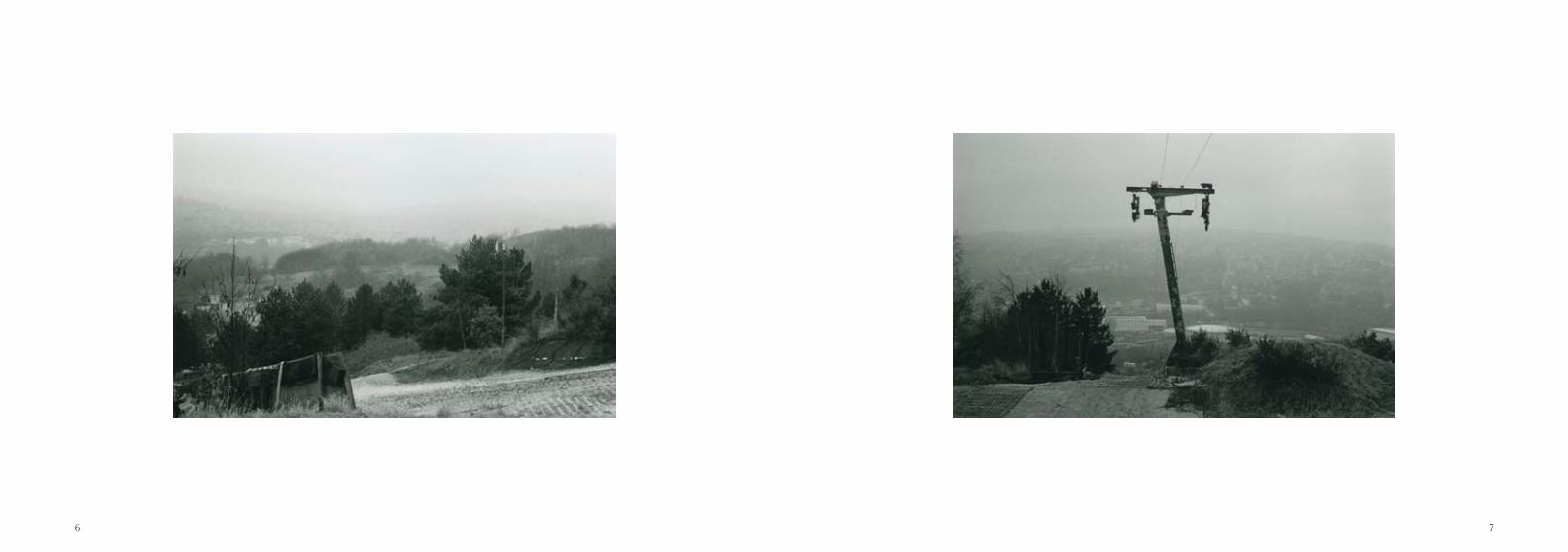
On the hillside – 2013
Starting out
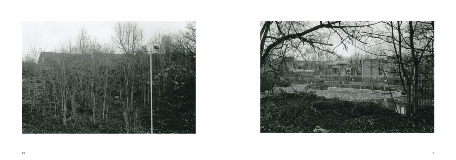
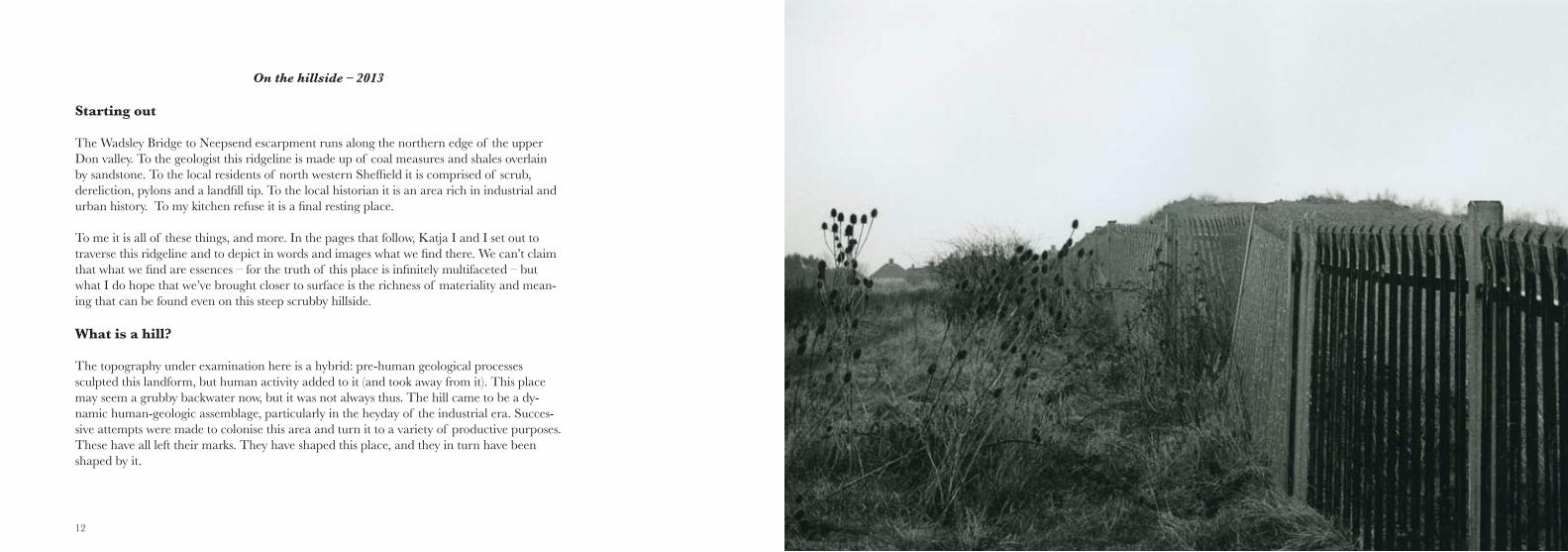
The Wadsley Bridge to Neepsend escarpment runs along the northern edge of the upper Don valley. To the geologist this ridgeline is made up of coal measures and shales overlain by sandstone. To the local residents of north western Sheffield it is comprised of scrub, dereliction, pylons and a landfill tip. To the local historian it is an area rich in industrial and urban history. To my kitchen refuse it is a final resting place.
To me it is all of these things, and more. In the pages that follow, Katja I and I set out to traverse this ridgeline and to depict in words and images what we find there. We can’t claim that what we find are essences – for the truth of this place is infinitely multifaceted – but what I do hope that we’ve brought closer to surface is the richness of materiality and mean-ing that can be found even on this steep scrubby hillside.
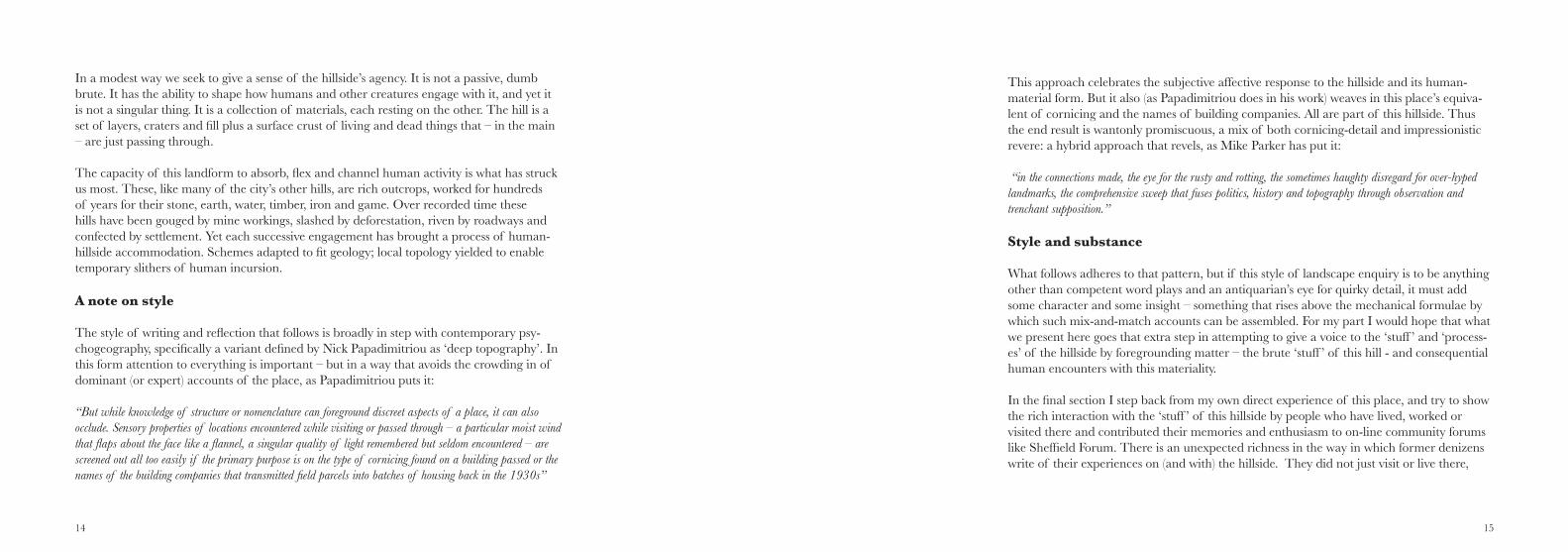
What is a hill?
The topography under examination here is a hybrid: pre-human geological processes sculpted this landform, but human activity added to it (and took away from it). This place may seem a grubby backwater now, but it was not always thus. The hill came to be a dy-namic human-geologic assemblage, particularly in the heyday of the industrial era. Succes-sive attempts were made to colonise this area and turn it to a variety of productive purposes. These have all left their marks. They have shaped this place, and they in turn have been shaped by it.
14 15
In a modest way we seek to give a sense of the hillside’s agency. It is not a passive, dumb brute. It has the ability to shape how humans and other creatures engage with it, and yet it is not a singular thing. It is a collection of materials, each resting on the other. The hill is a set of layers, craters and fill plus a surface crust of living and dead things that – in the main – are just passing through.
The capacity of this landform to absorb, flex and channel human activity is what has struck us most. These, like many of the city’s other hills, are rich outcrops, worked for hundreds of years for their stone, earth, water, timber, iron and game. Over recorded time these hills have been gouged by mine workings, slashed by deforestation, riven by roadways and confected by settlement. Yet each successive engagement has brought a process of human-hillside accommodation. Schemes adapted to fit geology; local topology yielded to enable temporary slithers of human incursion.
A note on style
The style of writing and reflection that follows is broadly in step with contemporary psy-chogeography, specifically a variant defined by Nick Papadimitriou as ‘deep topography’. In this form attention to everything is important – but in a way that avoids the crowding in of dominant (or expert) accounts of the place, as Papadimitriou puts it:
“But while knowledge of structure or nomenclature can foreground discreet aspects of a place, it can also occlude. Sensory properties of locations encountered while visiting or passed through – a particular moist wind that flaps about the face like a flannel, a singular quality of light remembered but seldom encountered – are screened out all too easily if the primary purpose is on the type of cornicing found on a building passed or the names of the building companies that transmitted field parcels into batches of housing back in the 1930s”
This approach celebrates the subjective affective response to the hillside and its human-material form. But it also (as Papadimitriou does in his work) weaves in this place’s equiva-lent of cornicing and the names of building companies. All are part of this hillside. Thus the end result is wantonly promiscuous, a mix of both cornicing-detail and impressionistic revere: a hybrid approach that revels, as Mike Parker has put it:
“in the connections made, the eye for the rusty and rotting, the sometimes haughty disregard for over-hyped landmarks, the comprehensive sweep that fuses politics, history and topography through observation and trenchant supposition.”
Style and substance
What follows adheres to that pattern, but if this style of landscape enquiry is to be anything other than competent word plays and an antiquarian’s eye for quirky detail, it must add some character and some insight – something that rises above the mechanical formulae by which such mix-and-match accounts can be assembled. For my part I would hope that what we present here goes that extra step in attempting to give a voice to the ‘stuff ’ and ‘process-es’ of the hillside by foregrounding matter – the brute ‘stuff ’ of this hill - and consequential human encounters with this materiality.
In the final section I step back from my own direct experience of this place, and try to show the rich interaction with the ‘stuff ’ of this hillside by people who have lived, worked or visited there and contributed their memories and enthusiasm to on-line community forums like Sheffield Forum. There is an unexpected richness in the way in which former denizens write of their experiences on (and with) the hillside. They did not just visit or live there,
16 17
they stood, dug, searched out, picked up, played upon and made and/or threw away things there. And in doing so they projected meaning and significance onto this matter, and onto the hillside.
The word ‘matter’ conjures both senses of what I’m pursuing here. How is matter made to matter? If we approach the hillside from this question we find a rich symbiotic relationship: the hill, its matter, its (only ever partial) colonisation for industry and dwelling and the daily interaction with human bodies entailed in all of that. This was evocatively struck home for me in one recollection I came across:
the stories of local tramps gravitating to
the
Street level to plateaux
It starts with a brick. An ordinary house brick, one of many millions. This brick has words within it, baked into its internal mortar grabbing cavity, its ‘frog’. The words are a name, Chas. Keyworth and an address: Wadsley Bridge. I resolve to take the brick back to the place of its birth. What was once an anonymous part of my garage, now intrigues me and has set me a quest.
The preparation for the journey takes me along a variety of research avenues, most swiftly guided by local brick collectors and their internet forums about Wadsley Brick Co and its later Nineteenth century brickworks at the foot of the upper Don escarpment. For a few brief years Charles Keyworth ran his independent brickworks here, eating into the local earth, baking it hard and shipping it out to feed the growing city. At one point he adopted the name New Patent Plastic Brick Co for his enterprise but, these were always earthy blocks – plastic meant something different in that era.
Across the plain
The journey from my house across the alluvial plain takes me past Mr Keyworth’s 1911 home, 22 Parkside Road, set in an unassuming brick and stone terrace overlooking the local park. The brick collectors’ research in local archives alerted me to this, and to the preva-lence of Keyworth’s bricks in the construction of the streets around the park. In their forum chatter the brickophiles point out how the Keyworth trail dries up by the 1920s, his business and its works subsumed in the multi-site operations of the Sheffield Brick Co. But Chas. Keyworth lives on. The walls of every house in the surrounding streets quietly whisper his name, the mantra-like iteration of his moniker imprinted in every recess of every brick of their fabric.
Neepsend brick works at night, to sleep in the warm shadow of the massive kilns.
18 19
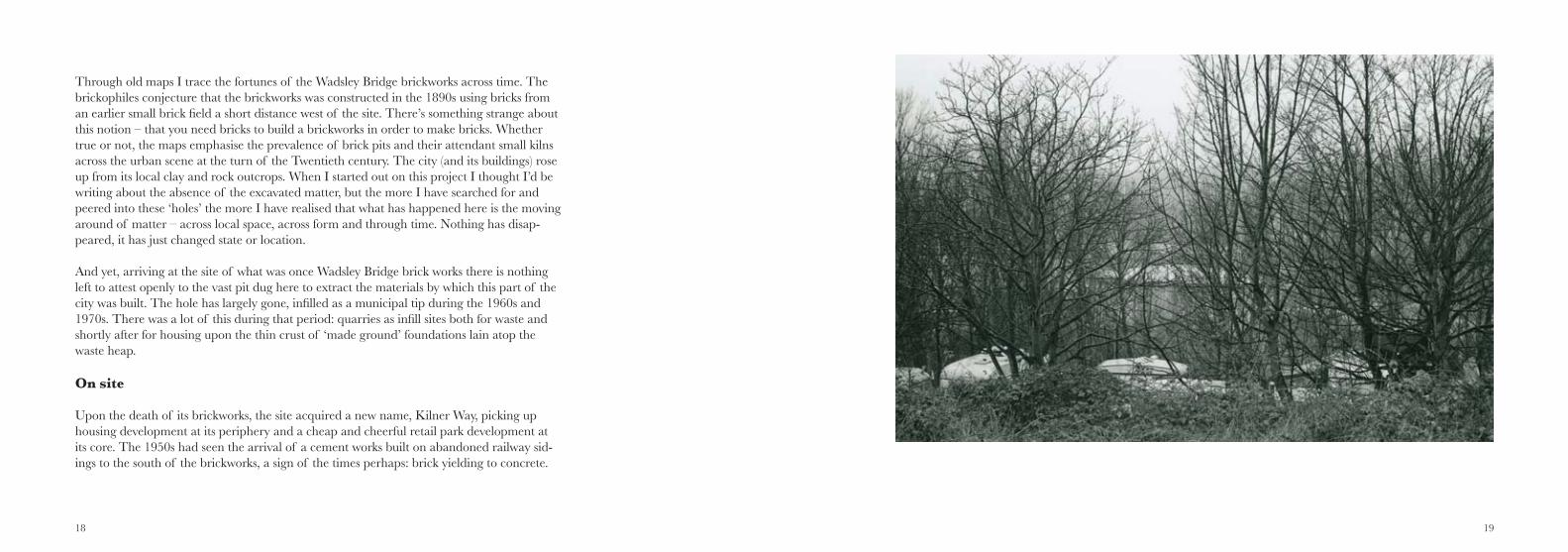
Through old maps I trace the fortunes of the Wadsley Bridge brickworks across time. The brickophiles conjecture that the brickworks was constructed in the 1890s using bricks from an earlier small brick field a short distance west of the site. There’s something strange about this notion – that you need bricks to build a brickworks in order to make bricks. Whether true or not, the maps emphasise the prevalence of brick pits and their attendant small kilns across the urban scene at the turn of the Twentieth century. The city (and its buildings) rose up from its local clay and rock outcrops. When I started out on this project I thought I’d be writing about the absence of the excavated matter, but the more I have searched for and peered into these ‘holes’ the more I have realised that what has happened here is the moving around of matter – across local space, across form and through time. Nothing has disap-peared, it has just changed state or location.
And yet, arriving at the site of what was once Wadsley Bridge brick works there is nothing left to attest openly to the vast pit dug here to extract the materials by which this part of the city was built. The hole has largely gone, infilled as a municipal tip during the 1960s and 1970s. There was a lot of this during that period: quarries as infill sites both for waste and shortly after for housing upon the thin crust of ‘made ground’ foundations lain atop the waste heap.
On site
Upon the death of its brickworks, the site acquired a new name, Kilner Way, picking up housing development at its periphery and a cheap and cheerful retail park development at its core. The 1950s had seen the arrival of a cement works built on abandoned railway sid-ings to the south of the brickworks, a sign of the times perhaps: brick yielding to concrete.
20 21
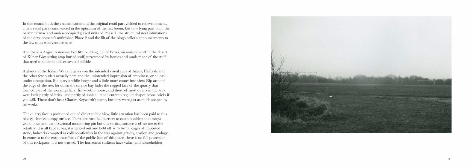
In due course both the cement works and the original retail part yielded to redevelopment, a new retail park commenced in the optimism of the last boom, but now lying part built: the barren tarmac and under-occupied glazed units of Phase 1, the structural steel intimations of the development’s unfinished Phase 2 and the lilt of the bingo caller’s announcements to the few souls who venture here.
And there is Argos. A massive box like building, full of boxes, an oasis of stuff in the desert of Kilner Way, sitting atop buried stuff, surrounded by houses and roads made of the stuff that used to underlie this excavated hillside.
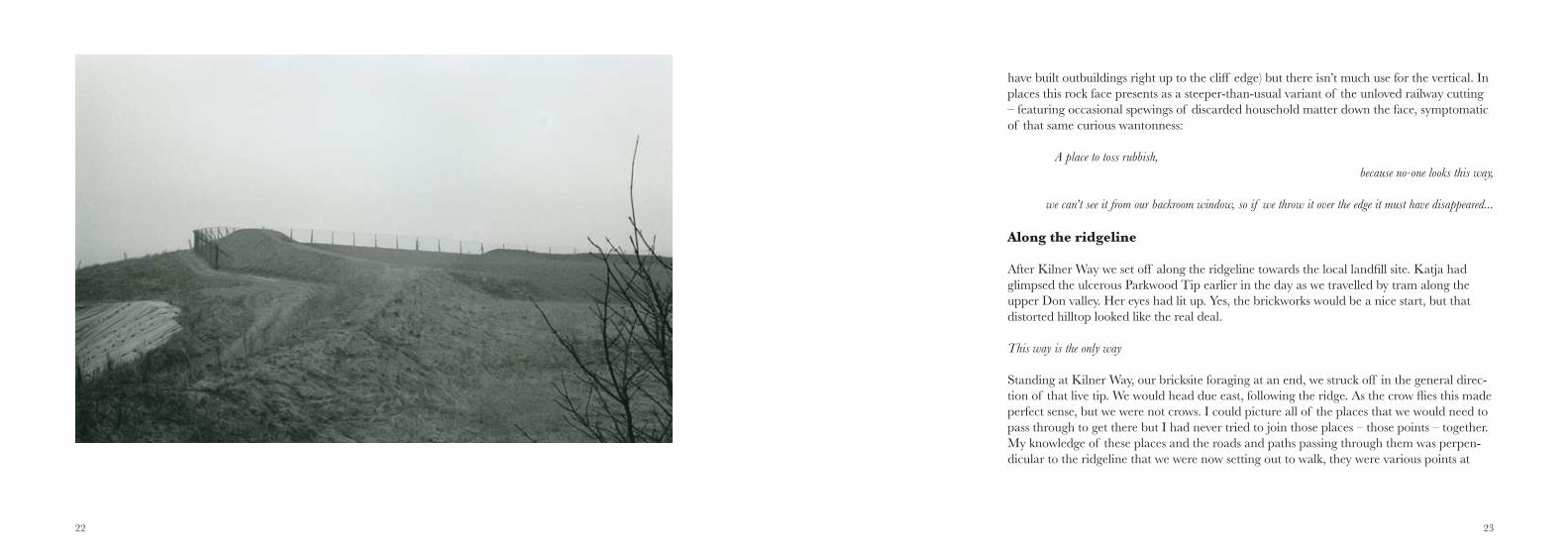
A glance at the Kilner Way site gives you the intended visual cues of Argos, Halfords and the other few outlets actually here and the unintended impression of emptiness, or at least under-occupation. But tarry a while longer and a little more comes into view. Nip around the edge of the site, for down the service bay hides the ragged face of the quarry that formed part of the workings here. Keyworth’s house, and those of most others in the area, were built partly of brick, and partly of ashlar – stone cut into regular shapes, stone bricks if you will. These don’t bear Charles Keyworth’s name, but they were just as much shaped by his works.
The quarry face is positioned out of direct public view, little attention has been paid to this blocky, chunky, lumpy surface. There are rock-fall barriers to catch boulders that might work loose, and the occasional monitoring pin but this vertical surface is of no use to the retailers. It is all kept at bay, it is fenced out and held off with brutal cages of imported stone, bulwarks co-opted as collaborationists in the war against gravity, erosion and geology. In contrast to the corporate élan of the public face of this place, there is no full possession of this rockspace; it is not trusted. The horizontal surfaces have value (and householders
22 23
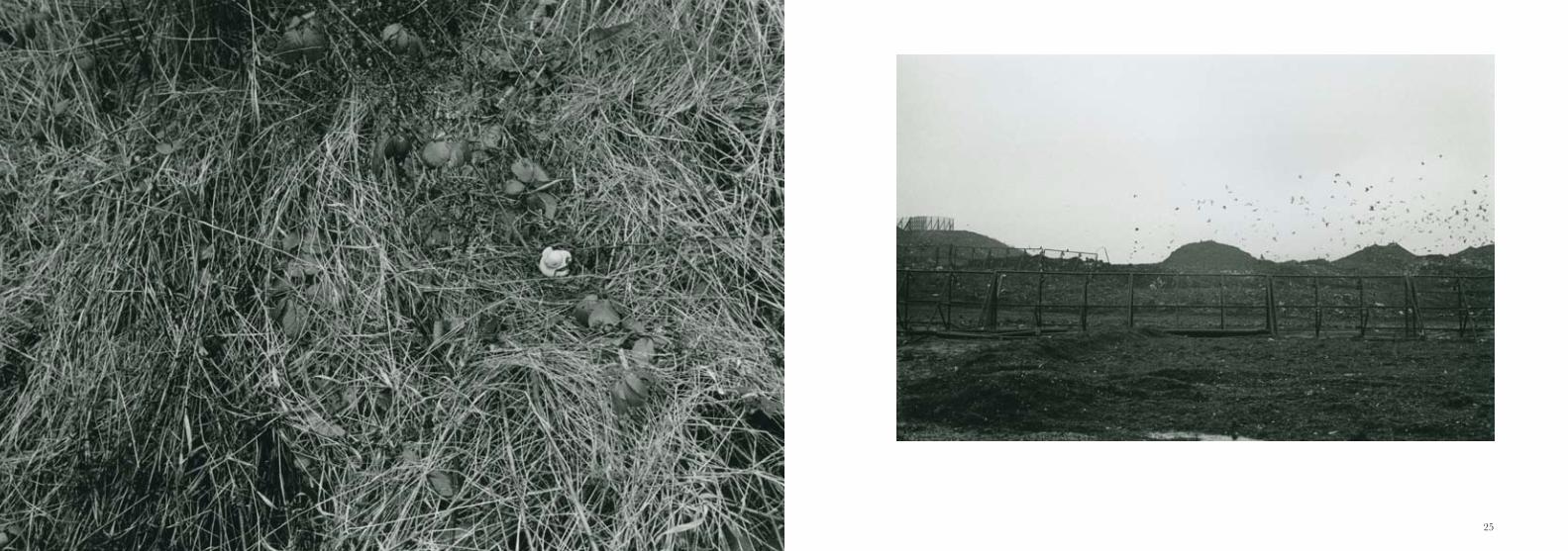
have built outbuildings right up to the cliff edge) but there isn’t much use for the vertical. In places this rock face presents as a steeper-than-usual variant of the unloved railway cutting – featuring occasional spewings of discarded household matter down the face, symptomatic of that same curious wantonness:
A place to toss rubbish, because no-one looks this way,
we can’t see it from our backroom window, so if we throw it over the edge it must have disappeared...
Along the ridgeline
After Kilner Way we set off along the ridgeline towards the local landfill site. Katja had glimpsed the ulcerous Parkwood Tip earlier in the day as we travelled by tram along the upper Don valley. Her eyes had lit up. Yes, the brickworks would be a nice start, but that distorted hilltop looked like the real deal.
This way is the only way
Standing at Kilner Way, our bricksite foraging at an end, we struck off in the general direc-tion of that live tip. We would head due east, following the ridge. As the crow flies this made perfect sense, but we were not crows. I could picture all of the places that we would need to pass through to get there but I had never tried to join those places – those points – together. My knowledge of these places and the roads and paths passing through them was perpen-dicular to the ridgeline that we were now setting out to walk, they were various points at
24 25
26 27
which the local roads pass under the railway line that skirts the foothills of the escarpment. Other than walking along the railway line, there was no co-ordinated west to east route. So, at first we had to detour into the curvy roads of inter-war estates, then finally came upon the ancient woodland vestiges of the Old Park Wood and could commence our ridge top ramble.
We followed a fence line. At first the fence was prohibiting access to the railway line, then as we scrambled higher through Scraith Wood, the fence separated us from the perilous heights (and sheer drop) of the jagged escarpment. But up on the ridge itself the fence is non-existent. Looking down, standing a respectful distance from the edge, the flat map-like expanse of northern Sheffield lay before us, a medley of streets, shops, factories, stadiums, all viewed from above, their roofs arrayed below us like a sea of metal hats. A seemingly static scene punctuated only by the occasional glimpse of cars, to shake the impression that we were visitors to a tourist attraction, gazing upon a static miniature world.
We trekked on and increasingly it became clear that sticking up close to the edge of the ridgeline was the only way that we could progress from west to east. The land-ward houses and streets and the city-ward expanse of perilous escarpment forced us along a single axis, and it was not just us who were constrained in this way, for before us the railway line, the adjacent river, the National Grid high voltage pylons, the headstones in Wardsend cemetery, the roads and paths were all channelled in this way. This steep hillside warps everything in its vicinity, pulling everything parallel to it, perpendicular is not feasible there, the gradient simply will not allow it. To be here requires linear adherence.
Energy fates and flows
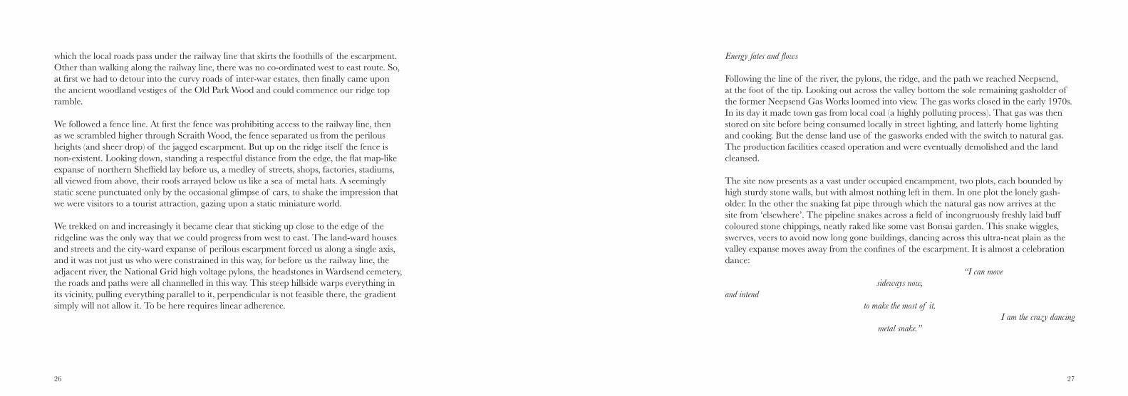
Following the line of the river, the pylons, the ridge, and the path we reached Neepsend, at the foot of the tip. Looking out across the valley bottom the sole remaining gasholder of the former Neepsend Gas Works loomed into view. The gas works closed in the early 1970s. In its day it made town gas from local coal (a highly polluting process). That gas was then stored on site before being consumed locally in street lighting, and latterly home lighting and cooking. But the dense land use of the gasworks ended with the switch to natural gas. The production facilities ceased operation and were eventually demolished and the land cleansed.
The site now presents as a vast under occupied encampment, two plots, each bounded by high sturdy stone walls, but with almost nothing left in them. In one plot the lonely gash-older. In the other the snaking fat pipe through which the natural gas now arrives at the site from ‘elsewhere’. The pipeline snakes across a field of incongruously freshly laid buff coloured stone chippings, neatly raked like some vast Bonsai garden. This snake wiggles, swerves, veers to avoid now long gone buildings, dancing across this ultra-neat plain as the valley expanse moves away from the confines of the escarpment. It is almost a celebration dance: “I can move
sideways now, and intend
to make the most of it. I am the crazy dancing
metal snake.”
28 29
The gas works was built by the Gas Consumers Company in 1852, a new company set up by the Town Council to break the monopoly of the Sheffield United Gas Light Company but without the required Act of Parliament to entitle it to break open streets to lay its gas pipes. Sheffield’s rival gas company exploited this lacuna and sent in nocturnal squads of labourers to fill in the pipeline trenches excavated by the Neepsend company during the day. Eventually they resolved this turf war by merging.
Electricity was also once made at the foot of this hillside. A coal fired power station was commissioned in 1904 on the site of the Old Park Woods Brickworks, it powered the city’s electric tram system (amongst other local needs). But arrival of the nationalised electricity generation industry saw the pylon monsters of the ‘national grid’ advance along the val-ley, bringing power in from the massed generation sites of the Trent valley. The Neepsend power station was closed in 1976 and subsequently demolished, its remains now entombed (like some feared sleeping monster than must be suppressed by surfeit of over-tipping) by an artificial mini-mountain formed in recent years by the tipping of inert wastes between the river and the railway line.
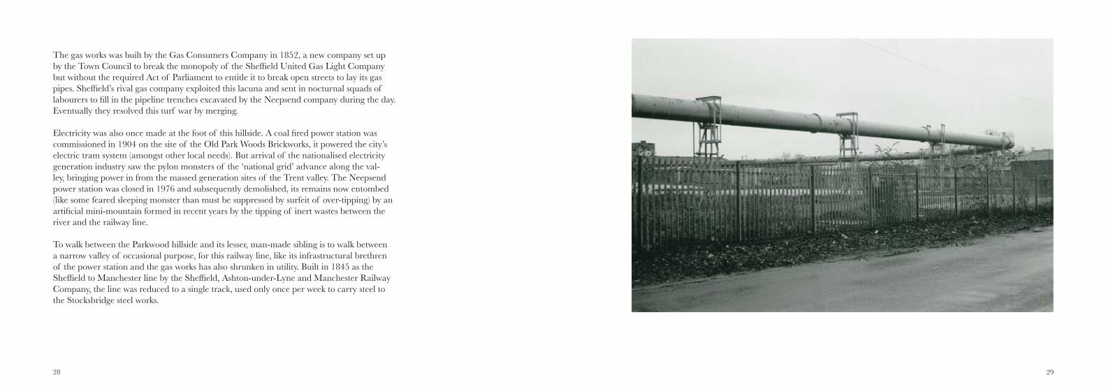
To walk between the Parkwood hillside and its lesser, man-made sibling is to walk between a narrow valley of occasional purpose, for this railway line, like its infrastructural brethren of the power station and the gas works has also shrunken in utility. Built in 1845 as the Sheffield to Manchester line by the Sheffield, Ashton-under-Lyne and Manchester Railway Company, the line was reduced to a single track, used only once per week to carry steel to the Stocksbridge steel works.
30 31
To stand in this valley, in the company of these rails, sleepers, track ballast, pylons, weirs, earth mounds and gas pipes is to stand in a place of strange smells, noise and scale. It is strange linear (and liminal) place, cut off from the city it is so near (and yet so far) from. And meanwhile, at the summit of this vast hill stands a telephone mast, like a giant totem, a sentinel foreman striding his land, signalling across the valley to his colleagues perched atop Sheffield’s other hills and an overseer for the pylon gang working its way across the valley bottom below.
Around the crater
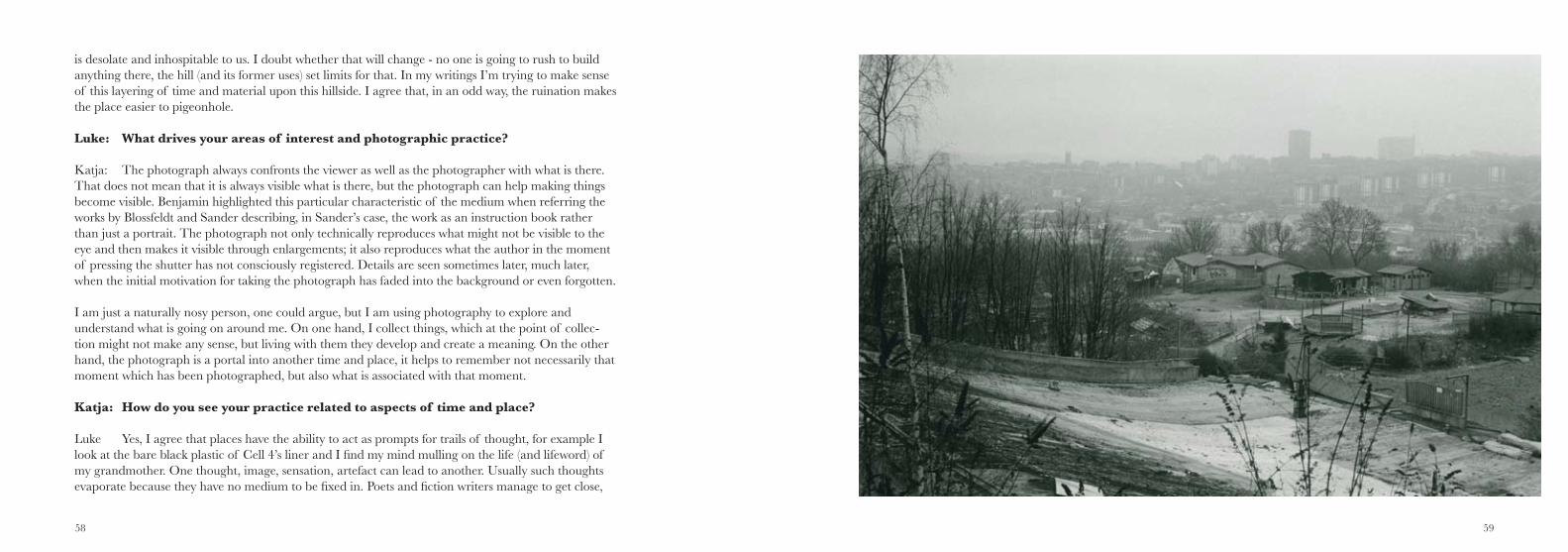
For over a decade I have seen it every morning from my sitting room. Pulling open the curtains it looms large before me, the Parkwood tip fills my field of view, it is my horizon. And yet, before starting this project I’d only ever visited the area once. It’s a dependable background, not a conventionally pretty scene but a shared familiar vista for thousands of Sheffield houses. It was a place known, but at a distance. A canvas on which the seasons would play themselves out on that brutal bald hillside: grey hue in autumn, dusting of snow in wintertime, a brighter tinge to the scrubby green in the spring.
Glimpsed from different vantage points around the city the tip gives up very different profiles to its onlookers. Viewed from above, from the heights of Crookes, one can stare down into its voids. From here the tip is wide, muddy, populated by a handful of diggers. It looks like a child’s sandpit scene: Tonka-land at lunchtime. Viewed from the valley bottom around Lower Walkley the hillside has caldera like form – an erupted earth crater, whose edge-on profile entices with what it does not reveal, offset by the off-white scratch marks of the adjacent dry ski slopes. Seen from the valley bottom, it is (like any ‘normal’ steep hill) a trickstery succession of false summits.
Ghost Towns
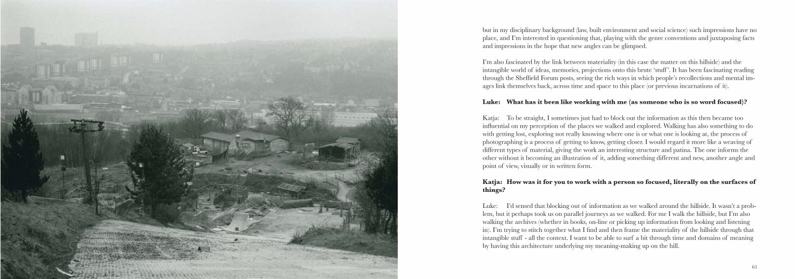
Approaching from Neepsend on the day of our full ascent we follow the road up to the remains of the Ski Village. Tumbleweed should be here, and a fanfare of Mexican trumpets. The remains of the chalets and other burnt out structures of this vertical, gravity-embracing use of land have an especially tenuous feel here, they always did, a tourist attraction in the back of beyond.
But now that attraction is gone. The ski slope is buckling (partly through natural processes, party from scavengers), the structures are slowly being erased, the land rendered back to a dirty, muddy nothing.
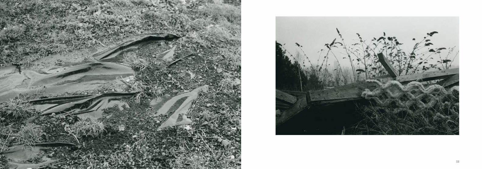
Just downhill from the Ski Village is an area of scrubland where once were the streets of Parkwood Springs, a settlement of housing built for railway workers in the 1860s. These streets were bulldozed in the 1970s, no buildings remain but a faint terracing persists - a semblance of plateaux that hints at the parallel streets that once were here.
As I ponder this I suddenly become aware that whilst the houses may have gone, there are still homes here. Before me, following the line of a garden hose stretched across the bram-bles of what once was Pickering Road, I see huddled caravans and box panelled vans that look like they have travelled their final mile to this place. Glimpsed through the bushes I see encampments, treehouses, gas canisters, washing lines.
32 33
34 35
36 37
Skyward
We withdraw. We ascend. The tip is what we came to see. As we reach the summit it starts to snow. More matter to add to this already matter-loaded hillside.
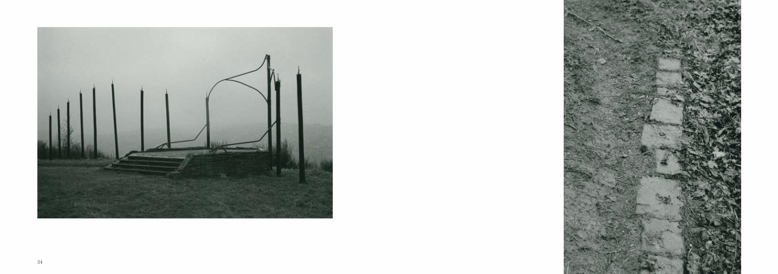
We pass a strange stone pad, the remains of an anti aircraft gun emplacement. Nearby Burngreave had suffered casualties in a Zeppelin raid in the First World War, the dense industrial use of the Don valley prompted early co-option of the hilltop as an Anti-Aircraft post, and by December 1940 there were heavy AA guns at Shirecliffe. Later the site became a rocket based emplacement (a Z battery) manned by the Home Guard. Rumour has it that this hilltop also flew barrage balloons, extending the effective height of the hill by up to 6,000 feet in attempted denial of the attractive target of the power station, gas works and foundries at the foot of the hill.
Unsurprisingly the war brought matériel (as military matter is known) to the hill. The AA battery brought bunkers, shells, metal and munitions. Enemy bombers brought bullets and bombs. On the night of 11th December 1940 a parachute bomb targeted at the AA battery destroyed houses in nearby Musgrave Terrace. Meanwhile on other occasions bombs and incendiaries fell onto the hillside. 25% of the houses in Parkwood Springs were damaged (and the community had its own communal air-raid shelter constructed on the hillside).After the war the structures built here for its wartime use lay abandoned, falling into ruins (like the ancient manor house, Shirecliffe Hall, which had also fallen into dereliction at this spot, a decline accelerated by a bomb blast). Eventually the structures were demolished, re-placed by playing fields, a local college (now – in turn – replaced by the housing of Standish Gardens) and a helipad built in the early 1960s from which pleasure trips flew, for a short while. Now, the phone mast carries on the tradition of reaching for the sky from the top of this hill.
Matter on the hillside
Parkwood Landfill sounds like the kind of oxymoron dreamt up by a PR company to reposi-tion an eyesore. But the name actually precedes the tip. Old Park Wood in its day was a deer park, a hillside covered by ancient woodland. But even in this era it was a working place – a zone of extraction and resource management. Within their coppiced woodland charcoal burners felled trees roasting it to produce optimum fuel for the iron works in the valley below. Over time this hillside became deforested as industrial exploitation of the woodland resource intensified. Meanwhile mining set in, the adjacent ward of Pittsmoor talking its name from the abundance of iron ore and coal pits being worked there. The sandstone and underlying shale measures in the escarpment yielded workable stone, fireclays and coal. This hillside was gouged successively, and it was filled successively too. Ash wastes from the Neepsend’s gas works, brick works, foundries and its power station were all deposited upon the hillside, with spoil from the mines spread upon the surface too. Holes appeared and were filled. Matter – like the demolition rubble from air raid reconstruction and slum clear-ance - rose up out of the city. This is how the hillside grew.
This hill has also had municipal tipping taking place upon it for over 100 years. The cur-rent operations are due to be concluded within the next decade. Looking down upon the as yet unused Cell 4, it appears that beneath the shallow earthen skin of the hill lies a shell of black plastic. The birds are the only occupants at the moment, basking in the warm east facing flanks of the cell’s impermeable liner. The cell looks like a vast garden pond waiting for its hose-water.
38 39
Newly built houses (the resolutely named Standish Gardens) crowd right up to the edge of the tip site, a source of tension for all concerned. An earth bund was recently built to shield these houses from the sight of the active tipping area. The earth for the bund was excavated from a flank of the site. The hole that was created was then named Cell 4.
Everything is assigned its place and productivity up here on waste mountain. Plans show the phasing of infilling, names are ascribed to amorphous zones of earth, mud, scrub and air. An empty surface is depicted vertically as active in a distinctly more-than-human way. We scratch at the surface and just below it, but processes of shallow engagement require a wider network of remote surveillance – a monitoring of the geologic through boreholes, a nervous apprehension of pollutant presence and migration through conceptualising the trafficking properties of subterranean space and the synergistic toxic potentialities of the intermixing of waste matter. All of this to be managed across greater-than-a-single-lifetime durations.
When the crater looks back at you
The first time I came to the tip I was ‘killing time’. I had dropped off one of my kids at the Ski centre for a friend’s birthday party. I had 90 minutes to waste and decided to circum-navigate the tip, to see whether that was even possible. It was.
It was a grey, wet day and my dog and I squelched off up the fence line away from the habi-tation of the then buoyant business. It was a Saturday morning but I saw no-one else on my wander. Reaching the summit I cut through a ravine of dark, dank shale rock, a fissure that felt quite disturbing to encounter. My thoughts turned to an ailing elderly family mem-ber and by the time I came upon the open Cell 4 my head was already in a gloomy place.
Looking down upon the vast expanse of black plastic, patiently awaiting its fill this place took on a special meaning which I still find difficult to shake off. Here was where I came to terms with my relative’s mortality, and it’s a place I now return to as a way of continuing to grasp that sense. Cell 4 has the connotation for me of a grave, waiting to be reunited with its content.
Ashes to ashes,
dust to dust. All of it finds its way
up onto this hillside.
Making Matter Mountain
This hill is not a mountain, at 175m (575 feet) at its highest point it falls short on that score. But it still looms over the valley beneath it. The occupants of a wide plain of valley houses look up at this vast seemingly empty hillside, a dull swathe of scrub and broken earth, a wasteland as big as London’s Hyde Park. In what follows, using the online testimonies of others, I will show how this hillside is actually rich in both matter and meaning, for it is both an extraction space and a projection space: a venue for visceral engagement with the stuff of this hill and a canvass for diverse practices of meaning making.
40 41
Working on the scree
This hill is partly made by people, and their lives in turn are partly shaped by their interac-tion with it. The place names in this area attest to the longstanding human engagement with this hillside, and of the matter that can be made to matter here – Neepsend, derived from Hnip Old English for steep hill. Shirecliffe, a bright or gleaming steep hillside in old English, and two ancient remnant woodlands Rawson Spring and Scraith Wood, the latter echoing Screith, a boulder-strewn slope in Old Norse.
There is a long history of systematic exploitation of this hillside’s natural resources. In 1392 Sir Thomas de Mounteney was given a licence by King Richard II to make a deer park on this hillside, a woodland area to be farmed for venison, hares, rabbits, game birds, fish in fishponds, plus cattle and sheep in launds, cleared heath/pasture areas. By the end of 16th century the park had been reoriented towards coppicing, in particular by charcoal burn-ers and 18th century records show sophisticated woodland management here, including bark harvesting from oak trees to make a liquor from which leather was tanned, alongside increasing timber felling to build and power the water mills down in the Don valley.
But still, much of the hillside remained wooded, with the Old Park Wood, described by Joseph Hunter in 1819 as “beautifully clothed with a forest verdue...the ground declining to the River Don” whilst John Holland could still write in 1836 of its “sylvan ornament of the neighbourhood of Sheffield”. But as industrialization took firm hold down in the valley, deforestation increased at an increasingly aggressive pace – partly due to demand for timber and charcoal to build and power the furnaces, but also to clear space for rock quarrying, brick pits and ganister mining. By the early 20th century most of the woodland at the centre
of the site had fallen, with roads and mineral tramways appearing on the hillside. But not all work was productive, with rumor of a parish-pit type scheme in operation near the then present piggeries, a field pointlessly dug over backwards and forwards in return for parish assistance.
The hill’s ganister mine operated between 1936 and 1963, its 28 miners and a pit pony called Tommy extracting 200 tons of the silica rich hard rock and 40 tons of coal each week. The coal went down the hill to the power station and the ganister was processed into refractory linings for local furnaces. By 1954 this drift mine stretched half a mile into the hillside, capillaries reaching out within the mountain in search of this locally valuable rock. Stories abound of the miners accidentally driving their tunnels into the daylight of the railway embankment or the allotments, and then hastily filling the surface eruption before anyone noticed, like an errant mole, or a wayward escape committee. Upon closure of the mine, Tommy the pony, by now blind after a lifetime underground, was put out to pasture on the hillside.
The mining and quarrying up on this hillside also created many intentional holes and spoil banks, and in the early 20th century the landowner the Duke of Norfolk, granted tipping rights to Neepsend power station for the disposal of ash from the power station upon the hillside, a system of gantries, aerial ropeways and buckets carrying the hot ash up the hill-side, and then tipping it in smouldering heaps. Mapping from the 1930s shows these tips as conical piles along the course of the ropeways, acne on the hillside. Progressively the hill’s many quarries came to be in-filled too and the mapping shows vast curling landforms as the hillside slowly rose.
42 43
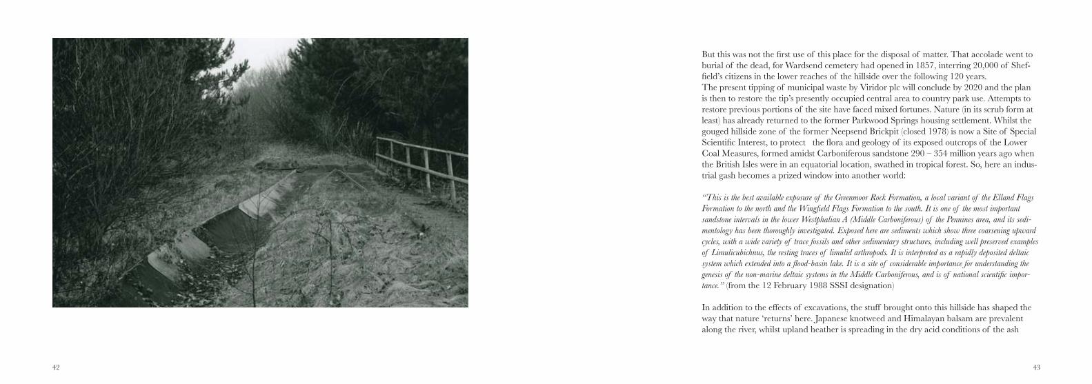
But this was not the first use of this place for the disposal of matter. That accolade went to burial of the dead, for Wardsend cemetery had opened in 1857, interring 20,000 of Shef-field’s citizens in the lower reaches of the hillside over the following 120 years. The present tipping of municipal waste by Viridor plc will conclude by 2020 and the plan is then to restore the tip’s presently occupied central area to country park use. Attempts to restore previous portions of the site have faced mixed fortunes. Nature (in its scrub form at least) has already returned to the former Parkwood Springs housing settlement. Whilst the gouged hillside zone of the former Neepsend Brickpit (closed 1978) is now a Site of Special Scientific Interest, to protect the flora and geology of its exposed outcrops of the Lower Coal Measures, formed amidst Carboniferous sandstone 290 – 354 million years ago when the British Isles were in an equatorial location, swathed in tropical forest. So, here an indus-trial gash becomes a prized window into another world:
“This is the best available exposure of the Greenmoor Rock Formation, a local variant of the Elland Flags Formation to the north and the Wingfield Flags Formation to the south. It is one of the most important sandstone intervals in the lower Westphalian A (Middle Carboniferous) of the Pennines area, and its sedi-mentology has been thoroughly investigated. Exposed here are sediments which show three coarsening upward cycles, with a wide variety of trace fossils and other sedimentary structures, including well preserved examples of Limulicubichnus, the resting traces of limulid arthropods. It is interpreted as a rapidly deposited deltaic system which extended into a flood-basin lake. It is a site of considerable importance for understanding the genesis of the non-marine deltaic systems in the Middle Carboniferous, and is of national scientific impor-tance.” (from the 12 February 1988 SSSI designation)
In addition to the effects of excavations, the stuff brought onto this hillside has shaped the way that nature ‘returns’ here. Japanese knotweed and Himalayan balsam are prevalent along the river, whilst upland heather is spreading in the dry acid conditions of the ash
44 45
tipped zone, in place of the woodland bluebells for which Old Park Woods was renowned, where they once grew now lies 30 feet under graphite dust tipped from the former Union Carbide factory down in the valley.
Playing on the scree
In reading through reminiscences of the area on the local community bulletin-board, Shef-field Forum, what has struck me most is how residents of this part of Sheffield remember their material encounters with this place – they don’t just write about where they went on the hillside, but also what they did there and the significant role given to stuff found and used there. This recollection captures the point well:
“The best den I ever saw was made by best pal … it was in the old derelict allotments at Parkwood. It was built on the foundations of an old bombed in greenhouse. He obtained bricks, timber, sheeting and old glass window frames from the tip.”
In their accounts, this hillside is recalled as a place of play, exploration and abundance of material for co-option. The stories tell of fossil hunting amidst the ganister mine’s shale heap, gathering tadpoles from the quarry ponds, rabbiting, pilfering coal, gathering scrap, searching out discarded knives from the local bowie knife factory, making braziers from gathered clay in which to burn “oil wop” (fabric soaked in oil) given to kids by the local foundry workers, digging bullets out of the firing range embankment, hunting for dynamite in the quarries, gathering bricks and stones as ammunition for the hill’s so-called ‘brick wars’ – in a battlespace betwixt rival gang territories. They also tell of co-option of the to-pography of the hillside – the slope for sledging, rolling old tyres, riding bikes down perilous
courses. The river for rafting using found materials: crates, drums.
Then there are the tales of the hillside’s structures – whether derelict or active – being en-listed into new playful possibilities, the quarries, the mine, the engine shed and of the ruins of the hilltop anti-aircraft battery’s bunkers being a place of deep dark exploration and optimistic rooftop leaps.
Remembering the scree
It is particularly notable in the following reminiscence how the hillside is remembered as simultaneously abject, and a delight:
“The sulphur from the Electricity Power Station used to smell unpleasant, rot the curtains and kill privet hedges. As children we used to climb the massive spoil heaps of black ash at the Power Station, jump into the empty buckets going up the hillside and jump off at the next heap.”
It is also interesting to look at how the forum posts engage with the past and present ‘state’ of the hillside. The deforestation is noted and frequently linked to a recurrent fable of work-ers in the 1926 General Strike harvesting the central woods. Given the amount of trees that disappear from the map between the 1920s and 1930s this suggests an unfeasibly intensive locust swarm of felling during the nine day strike and its aftermath. But the story resonates, through the popular accounts of this hill. It is part of its history, whether true or not. The effect is to ennoble the felling – oddly keying into the dignity of labour, rather than the avarice of landowners.
46 47
48 49
Likewise, the ganister mine and the hill’s quarries and brickpits attract a positive recollec-tion, and even the tipping is seen as an inevitable part of a ‘natural history’ of this site. That is not to suggest that the present tip is without its opponents - there are action groups, concerned residents and a swirl of anxieties about what may have been tipped. Interest-ingly though the arrival of suppositional stories about the tipping of radioactive waste from Windscale is challenged by forum elders. As one commentator notes: there is a tension between drawing attention to the tip as a way of opposing expansion (and/or pressing for its early closure) and a risk of adding to blight for properties and the poor fortunes of the area by foregrounding the tip and its conjectured hazards.
This hill is also haunted by a folktale of bodysnatching at Wardsend Cemetery. The truth is slightly more prosaic but the more emotive version continues to circulate. In 1862 a labour-er living above the cemetery’s coach house complained of unpleasant odour. His complaint triggered a riotous assembly at the cemetery and the destruction of the cemetery manager’s house by the angry mob. The odour trail had revealed dissected corpses buried in an un-marked grave. The manager and the local vicar were prosecuted for falsifying of burial re-cords and sentenced to brief imprisonment. The court had found that the bodies had come from the local workhouse, they had been lawfully dissected but re-interred without coffins in the mass grave. As it turned out this was more a case of fraud (the manager re-selling grave space) than the supply of bodies from the cemetery for illegal dissection.
Foregrounding the scree
What haunts the forums (and oddly echoes the dominant conventions of psychogeogra-phy and urban exploration) is a fascination with the seemingly mundane, and a desire to
50 51
re-energise it with (in the case of the forums) reminiscence and attesting to the practical engagement with this place and its matter. Indeed such rumination was in play even before the hillside was stripped of its trees. In 1836 John Holland stood at the foothills of the hill and admired its verdant vista. But his attention was drawn first to two (then state of the art) foundries beside the Don: Old Rolling Mill and Club Flour Mill. Reflecting on the strange lure of these structures, Holland signaled a proto-psychogeographic sensibility:
“at no great distance from each other, stand two buildings, both in reverse of elegant certainty, but respectively interesting to a person who is apt to make visible objects, not always in themselves striking, the nuclei of thoughts and feelings depending in a peculiar manner on the association of ideas”
Meanwhile in 1936 George Orwell stood at the same spot, figuring it in his diary rather dif-ferently (but still foregrounding a mundane structure in order to make his point):
“In front, across the piece of waste ground, a cubical building of dingy red and yellow brick, with the sign, ‘John Grocock, Haulage Contractor’. Other memories of Sheffield: stone walls blackened by smoke, a shallow river yellow with chemicals, serrated flames, like circular saws, coming out from the cowls of the foundry chimneys, thump and scream of steam hammers (the iron seems to scream under the blow), smell of sulphur, yellow clay....”
On the Sheffield History Forum site I find research striving to trace Mr Grocock, as if to bring his cubical building of dingy red and yellow brick into the foreground. The research finds the Grococks to have been a dynasty of fruiterers in this area, that business spawning – via coal and furniture shipments – a more generalised transportation services in due course. The researcher trawls trade directories to map this dynasty.
This reassembly process plays itself out with a multiple cast of participants on Sheffield Forum, in the collaborative reconstruction of the ‘lost’ community of Parkwood Springs. In reminiscence, posters to this site swap names, dates of remembered residents, at times work-ing towards clarification of misremembered points (establishing the ownership history of the local chip shop for example), at others swapping colourful stories at others simply telling where their lives took them after they left Parkwood Springs, an enclave of around 200 back to backs and houses with small back yards, five shops, two pubs, a chapel and a windswept playground, an
“island village flanked by the Manchester railway, quarries, earthworks and a vast tipping area On all sides the land rises so steeply that the only entry by road is through steelworks under a low, narrow railway bridge” (Sheffield Star 1970).
For George Orwell (he stayed here, with Gilbert and Kate Searle in 154 Wallace Road, in 2-4 March 1936 as part of his research for The Road to Wigan Pier) it was habitation at the limit of habitability. With a southerner’s disdainful eye, Orwell noted the offset cobbles needed to give grip to horses and the wobble of womens’ bottoms as they pushed prams up the (to his eye) unfeasible slopes of Parkwood Springs’ streets.
By the early 1970s this area was depopulated. The houses boarded up and this streetscape erased by demolition in 1977. The roadways remain vaguely evident on maps and on the ground but this settlement remains firmly etched in the minds of those who once lived or visited here.
To wander this hillside attentively by foot or via internet forums, alerts us to the richness of this place’s history, use and significance for those attached to it. If we look closely we
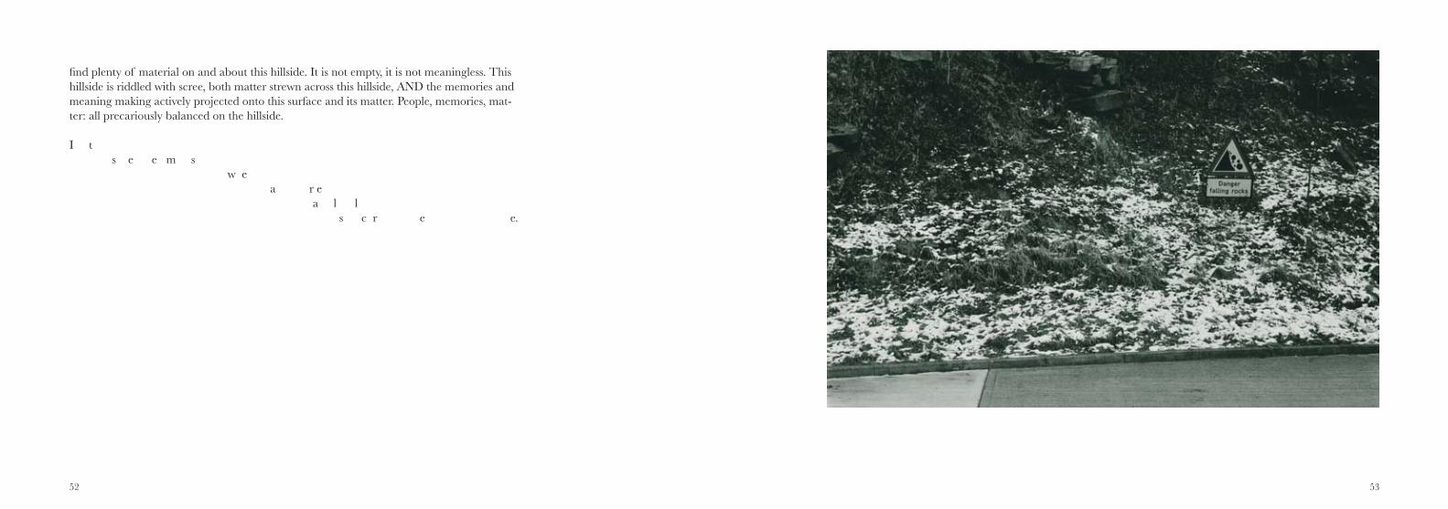
52 53
find plenty of material on and about this hillside. It is not empty, it is not meaningless. This hillside is riddled with scree, both matter strewn across this hillside, AND the memories and meaning making actively projected onto this surface and its matter. People, memories, mat-ter: all precariously balanced on the hillside.
I t s e e m s w e a r e a l l
s c r e e.
54 55
56 57
A hillside and its layers
a dialogue between Luke Bennett and Katja Hock
Luke: What has this hillside come to mean for you?
Katja: It is rather difficult to answer this question now; it might be too early. However, as a site it is interesting, as it resembles some form of layering – layering of time and material. It is not clear what the site used to be, there might be a little hint, but it is necessary to be able to decode this part of information, which to many, might not even be possible to recognise as a hint or sign. There are some bizarre constellations, the skiing area is so strange, possibly less strange now as it is desolate and a ruin, but the thought of a ski slope in the middle of England is just something unthinkable for somebody who only had to drive for a few hours to be skiing on the real thing… now that it has been partly burnt out it becomes a more familiar site again, which is in itself sad as this suggests one is more used to the demolished and ruined than the fantastical. To a certain extent, however, it reminds me of a certain area in Germany, the Ruhr Valley, Ruhrgebiet, the former heart of industrial Germany, Mannes-mann and other steel companies produced there and the area has now party been redeveloped and undergone massive changes. The hillside is at the start of this, or maybe at a moment of pause of the redevelopment stage.
Katja: What do you think is currently happening there as you are more familiar with the site and have known it for a long period of time?
Luke: The ski centre was built on the site of a former quarry which was subsequently filled with waste and then the ski buildings erected on top. These chalets were built on stilts so that gas coming out of the tip would not accumulate and explode. So, for me this is an area that is unsettled in two senses - first in the sense of restlessness, never settling on a stable long-term use and also unsettled in the human sense that we cannot get a firm grip there, it has never been fully colonised. The area
58 59
is desolate and inhospitable to us. I doubt whether that will change - no one is going to rush to build anything there, the hill (and its former uses) set limits for that. In my writings I’m trying to make sense of this layering of time and material upon this hillside. I agree that, in an odd way, the ruination makes the place easier to pigeonhole.
Luke: What drives your areas of interest and photographic practice?
Katja: The photograph always confronts the viewer as well as the photographer with what is there. That does not mean that it is always visible what is there, but the photograph can help making things become visible. Benjamin highlighted this particular characteristic of the medium when referring the works by Blossfeldt and Sander describing, in Sander’s case, the work as an instruction book rather than just a portrait. The photograph not only technically reproduces what might not be visible to the eye and then makes it visible through enlargements; it also reproduces what the author in the moment of pressing the shutter has not consciously registered. Details are seen sometimes later, much later, when the initial motivation for taking the photograph has faded into the background or even forgotten.
I am just a naturally nosy person, one could argue, but I am using photography to explore and understand what is going on around me. On one hand, I collect things, which at the point of collec-tion might not make any sense, but living with them they develop and create a meaning. On the other hand, the photograph is a portal into another time and place, it helps to remember not necessarily that moment which has been photographed, but also what is associated with that moment.
Katja: How do you see your practice related to aspects of time and place?
Luke Yes, I agree that places have the ability to act as prompts for trails of thought, for example I look at the bare black plastic of Cell 4’s liner and I find my mind mulling on the life (and lifeword) of my grandmother. One thought, image, sensation, artefact can lead to another. Usually such thoughts evaporate because they have no medium to be fixed in. Poets and fiction writers manage to get close,
60 61
but in my disciplinary background (law, built environment and social science) such impressions have no place, and I’m interested in questioning that, playing with the genre conventions and juxtaposing facts and impressions in the hope that new angles can be glimpsed.
I’m also fascinated by the link between materiality (in this case the matter on this hillside) and the intangible world of ideas, memories, projections onto this brute ‘stuff ’. It has been fascinating reading through the Sheffield Forum posts, seeing the rich ways in which people’s recollections and mental im-ages link themselves back, across time and space to this place (or previous incarnations of it).
Luke: What has it been like working with me (as someone who is so word focused)?
Katja: To be straight, I sometimes just had to block out the information as this then became too influential on my perception of the places we walked and explored. Walking has also something to do with getting lost, exploring not really knowing where one is or what one is looking at, the process of photographing is a process of getting to know, getting closer. I would regard it more like a weaving of different types of material, giving the work an interesting structure and patina. The one informs the other without it becoming an illustration of it, adding something different and new, another angle and point of view, visually or in written form.
Katja: How was it for you to work with a person so focused, literally on the surfaces of things?
Luke: I’d sensed that blocking out of information as we walked around the hillside. It wasn’t a prob-lem, but it perhaps took us on parallel journeys as we walked. For me I walk the hillside, but I’m also walking the archives (whether in books, on-line or picking up information from looking and listening in). I’m trying to stitch together what I find and then frame the materiality of the hillside through that intangible stuff - all the context. I want to be able to surf a bit through time and domains of meaning by having this architecture underlying my meaning-making up on the hill.
62 63
although the author does change the photograph or makes choices according to his or her agenda for example the impression gained while being there…. And this is where it gets really interesting for me; using a technology that is associated with an objective representation of what is there, while at the same time being highly subjective, allowing for the author’s ideas and perceptions of the space to be interpreted via the photograph – and taking all this into account, the photograph still remains a docu-ment, showing what was there, but of course, following Barthes, also what has already gone, that-has been. It’s the ambiguity of the photographic medium that interests me, the indexicality and supposedly objectiveness, and in this project this links to the exploration of what was once there but is no more, the hidden, the veiled.
Katja: The use of the written word in this case of course is equally subjective, al-though being rather authoritative at the same time, but how do you experience these two sides of the coin?
Luke: Yes, this is a major theme for me too. Professionally I’ve been trained to use words as a vehicle for either truth or persuasive, logic-driven, argumentation. So, stepping away from that is rather taboo. But working within the psychogeographic tradition and blending that with some contemporary drifts in cultural geography frees me to be a little more playful in both the way that I write and what I write about. It’s because I know that I’m not supposed to mix imagistic creative travel writing and techni-cal analysis of legal or engineering concepts that makes me want to do it. I like the effects that that instability throws up. I guess its writing against the grain for me and experimenting in other genres has made me more aware of the power of rhetoric and other stylistic devices in writing of all types. For example, I’m more alert to the ingress of metaphor, visual and spatial imagery within court judg-ments about the management of places and material things. I like the way that Graham Harman and others in the object orientated ontology movement are offering up a ‘weird realism’, an approach that both acknowledges the gritty materiality of the world that we exist in, but also of the multi-coloured symbolic realm that we project onto brute matter in our attempts to make sense of and to master the stuff of the world. This means that I increasingly find myself using the word ‘ghosts’ to describe some
But to answer your question directly, it was great that you were reading the hillside differently - and unencumbered by this archival side of things. I wanted to do this project because I wanted to see how someone else would work differently upon the same resource. I never expected our words and pictures to be directly connected, although I think that what we’ve come up with does show a remarkable simi-larity of conclusions, even though we have been working in different media and with different preoc-cupations and methodological approaches.
Luke: How do technology, technique and protocols of doing and meaning-making shape what you do?
Katja: In a way this is a difficult question, as I like to think that I am rather familiar with the techni-cal possibilities and choose the technology according to what I hope to achieve. The 35mm camera has been the ideal tool for making visual notes, like sketches and in most cases, that is the material used here. Having covered the ground, it became clear that the system I originally hoped to use was not practical as the use of a tripod and heavy camera while standing on an uneven and wobbly rock does not fill me with confidence.
This, as it turned out, was visually not a problem at all, the smaller camera is close to the photogra-pher’s body, almost like an extension of the arm and therefore I worked more instinctively, lifting the lens in front of my eye when I felt like it there and then. Going back and re-shooting always changes the image, always….,, conditions change but also the eye, the experience of the site, especially when using a different camera system.
What was clear from the outset though was the use of analogue technology – the place of the witness. The camera reproduces what is in front of the lens and transforms it from a subject into an object as soon as the shutter is pressed; an object that is immediately historical, part of the past. The light creates an imprint on the layer of gelatin, on the film surface, like a foot creates a footprint in the sand. But in the case of the photograph it stays. Having been there is important to the whole process,
64 65
of the things going on out there beyond us, but actually I’m intensely down to earth and pragmatic, I don’t believe in ghosts of the white sheet variety.
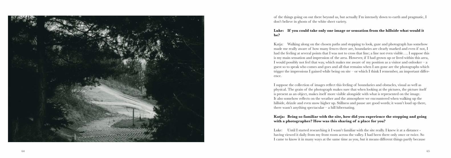
Luke: If you could take only one image or sensation from the hillside what would it be?
Katja: Walking along on the chosen paths and stopping to look, gaze and photograph has somehow made me really aware of how many fences there are, boundaries are clearly marked and even if not, I had the feeling at several points that I was not to cross that line; a line not even visible…. I suppose this is my main sensation and impression of the area. However, if I had grown up or lived within this area, I would possibly not feel that way, which makes me aware of my position as a visitor and onlooker – a guest so to speak who comes and goes and all that remains when I am gone are the photographs which trigger the impressions I gained while being on site – or which I think I remember, an important differ-ence.
I suppose the collection of images reflect this feeling of boundaries and obstacles, visual as well as physical. The grain of the photograph makes sure that when looking at the pictures, the picture itself is present as an object, makes itself more visible alongside with what is represented on the image. It also somehow reflects on the weather and the atmosphere we encountered when walking up the hillside, drizzle and even snow higher up. Stillness and pause are good words; it wasn’t loud up there, there wasn’t anything spectacular – a hill hibernating.
Katja: Being so familiar with the site, how did you experience the stopping and going with a photographer? How was this sharing of a place for you?
Luke: Until I started researching it I wasn’t familiar with the site really. I knew it at a distance - having viewed it daily from my front room across the valley. I had been there only once or twice. So I came to know it in many ways at the same time as you, but it means different things partly because
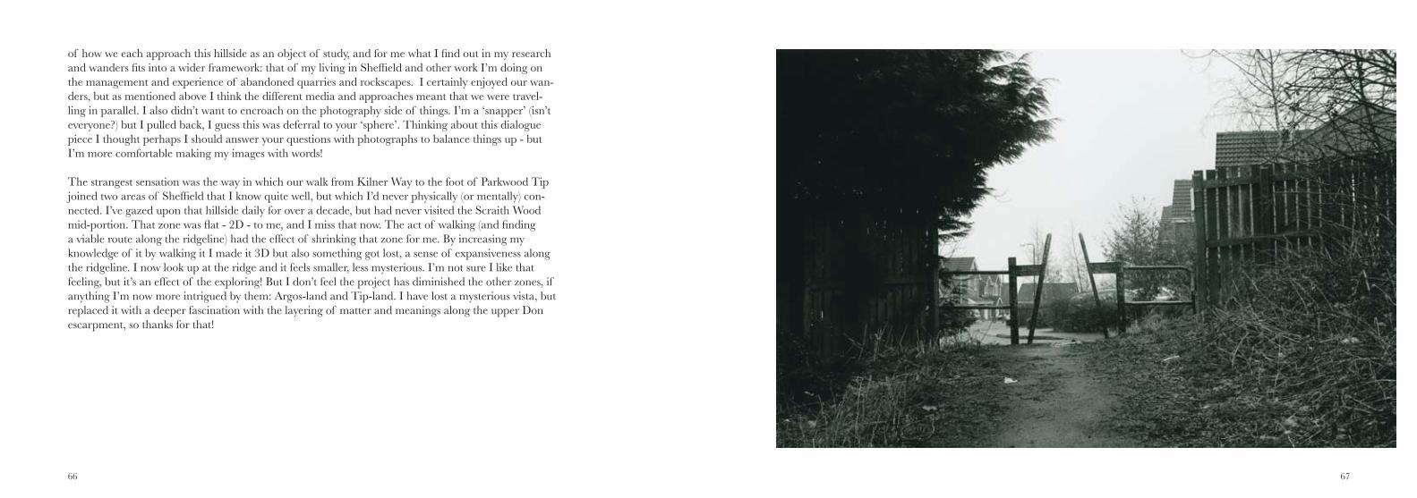
66 67
of how we each approach this hillside as an object of study, and for me what I find out in my research and wanders fits into a wider framework: that of my living in Sheffield and other work I’m doing on the management and experience of abandoned quarries and rockscapes. I certainly enjoyed our wan-ders, but as mentioned above I think the different media and approaches meant that we were travel-ling in parallel. I also didn’t want to encroach on the photography side of things. I’m a ‘snapper’ (isn’t everyone?) but I pulled back, I guess this was deferral to your ‘sphere’. Thinking about this dialogue piece I thought perhaps I should answer your questions with photographs to balance things up - but I’m more comfortable making my images with words!
The strangest sensation was the way in which our walk from Kilner Way to the foot of Parkwood Tip joined two areas of Sheffield that I know quite well, but which I’d never physically (or mentally) con-nected. I’ve gazed upon that hillside daily for over a decade, but had never visited the Scraith Wood mid-portion. That zone was flat - 2D - to me, and I miss that now. The act of walking (and finding a viable route along the ridgeline) had the effect of shrinking that zone for me. By increasing my knowledge of it by walking it I made it 3D but also something got lost, a sense of expansiveness along the ridgeline. I now look up at the ridge and it feels smaller, less mysterious. I’m not sure I like that feeling, but it’s an effect of the exploring! But I don’t feel the project has diminished the other zones, if anything I’m now more intrigued by them: Argos-land and Tip-land. I have lost a mysterious vista, but replaced it with a deeper fascination with the layering of matter and meanings along the upper Don escarpment, so thanks for that!
68 69
Bib
liog
rap
hy
Att
ercl
iffe
Lad
(201
1) th
ree
blog
pos
ts o
n O
rwel
l in
Shef
field
:
“h
ttp:
//w
ww.
rive
don.
co.u
k/or
wel
lian/
orw
ell-i
n-sh
effie
ld”
“h
ttp:
//w
ww.
rive
don.
co.u
k/au
thor
s/or
wel
l-in-
shef
field
-2”
“h
ttp:
//w
ww.
rive
don.
co.u
k/au
thor
s/ge
orge
-orw
ell-i
n-sh
effie
ld”
Bat
tye,
R. (
2004
) The
For
gott
en M
ines
of
Shef
field
, AL
D D
esig
n &
Pri
nt: S
heffi
eld.
BB
C (
2005
) ‘‘S
heffi
eld
Blit
z (M
usgr
ave
Cre
scen
t)’ W
W2
Peop
le’s
War
-
“w
ww.
bbc.
co.u
k/hi
stor
y/w
w2p
eopl
ewar
/sto
ries
/31/
a397
1531
.sht
ml”
Hob
bs, C
. (n.
d.) ‘
Geo
rge
Orw
ell a
nd S
heffi
eld,
Mar
ch 1
936’
“ht
tp:/
/ww
w.ch
rish
obbs
.com
/orw
ellsh
effie
ld19
36.h
tm”
Hol
land
, J. (
1836
) The
Tou
r of
the
Don
, ext
empo
re s
ketc
hes
Mad
e D
urin
g A
Pe
dest
rian
Ram
ble
Alo
ng T
he B
anks
Of
Tha
t Riv
er, A
nd I
ts P
rinc
ipal
Tri
buta
ries
. The
She
ffiel
d M
ercu
ry: S
heffi
eld.
Lod
ge, T
. (n.
d.) ‘
Shef
field
(Nee
psen
d &
Low
er W
alkl
ey) 1
903’
, Old
Ord
nanc
e Su
r
vey
Map
s Se
ries
, Yor
kshi
re S
heet
294
:03,
Ala
n G
odfr
ey M
aps:
Con
sett
Nat
ural
Eng
land
(198
8) S
ite o
f Sp
ecia
l Sci
entifi
c In
tere
st –
not
ifica
tion
of
Nee
psen
d B
rick
wor
ks to
the
Secr
etar
y of
Sta
te, d
ated
12
Febr
uary
198
8 -
“ww
w.ss
si.n
atur
alen
glan
d.or
g.uk
/cita
tion/
cita
tion_
phot
o/10
0032
5.pd
f”
Nor
th S
heffi
eld
Prim
ary
Car
e T
rust
(200
3) P
arkw
ood
Lan
dfill
Site
Hea
lth I
mpa
ct
A
sses
smen
t, N
orth
She
ffiel
d PC
T: S
heffi
eld
Orw
ell,
G. (
1984
) ‘T
he R
oad
to W
igan
Pie
r D
iary
’ - S
onia
Orw
ell a
nd I
an A
ngus
,
eds.,
The
Col
lect
ed E
ssay
s, Jo
urna
lism
and
Let
ters
of
Geo
rge
Orw
ell,
V
olum
e 1:
An
Age
Lik
e T
his
1920
-194
0, P
engu
in B
ooks
: Har
mon
dsw
orth
Papa
dim
itrio
u, N
. (20
12) S
carp
– in
sea
rch
of L
ondo
n’s
oute
r lim
its,
Sc
eptr
e: L
ondo
n
Park
er, M
. (20
10) M
ap A
ddic
t, C
ollin
s: L
ondo
n
Park
woo
d Sp
ring
s St
eeri
ng G
roup
(200
9) P
arkw
ood
Spri
ngs
Into
Act
ion,
Spr
ing/
Sum
mer
, PSS
G: S
heffi
eld
Park
woo
d Sp
ring
s St
eeri
ng G
roup
(201
0) P
arkw
ood
Spri
ngs
Into
Act
ion,
Spr
ing/
Sum
mer
, PSS
G: S
heffi
eld
Park
woo
d Sp
ring
s St
eeri
ng G
roup
(201
0) P
arkw
ood
Spri
ngs
Into
Act
ion,
Aut
umn,
PSSG
: She
ffiel
d
Park
woo
d Sp
ring
s St
eeri
ng G
roup
(201
1) P
arkw
ood
Spri
ngs
Into
Act
ion,
Spr
ing/
Sum
mer
, PSS
G: S
heffi
eld
Jone
s, M
& Jo
nes,
J (n
.d.)
Park
woo
d Sp
ring
s –
from
Dee
r Pa
rk to
Cou
ntry
Par
k?,
Shef
field
City
Cou
ncil:
She
ffiel
d
(ava
ilabl
e vi
a:w
ww.
park
woo
d-sp
ring
s.btc
k.co
.uk)
Shef
field
Tel
egra
ph &
Sta
r (1
948)
She
ffiel
d at
War
, She
ffiel
d T
eleg
raph
& S
tar
Ltd
: She
ffiel
d (v
ia w
ww.
sfbh
isto
ry.o
rg.u
k/Pa
ges/
shef
field
atw
ar/p
age0
3/
pa
ge03
g.ht
m)
Vic
kers
, J.E
. (19
87) A
Pop
ular
His
tory
of
Shef
field
, App
leba
um: S
heffi
eld
Wat
son,
S. &
Chi
les,
P. (2
003)
Par
kwoo
d Sp
ring
s C
omm
unity
Vis
ion
Reg
ener
atio
n
A
ctio
n Pl
an, S
heffi
eld
City
Cou
ncil
Inte
rnet
foru
ms
and
orga
nisa
tiona
l sou
rces
Frie
nds
of P
arkw
ood
Spri
ngs
- w
ww.
park
woo
d-sp
ring
s.btc
k.co
.uk
Frie
nds
of W
ards
end
Cem
eter
y –
ww
w.fr
iend
sofw
ards
endc
emet
ery.b
tck.
co.u
kPe
nmor
fa (b
rick
col
lect
ors
site
) – w
ww.
penm
orfa
.com
The
She
ffiel
d In
dexe
rs -
htt
p://
shef
field
inde
xers
.com
70 71
Shef
field
His
tory
For
um
‘AA
Site
s in
She
ffiel
d’:
ht
tp:/
/ww
w.sh
effie
ldhi
stor
y.co
.uk/
foru
ms/
inde
x.ph
p/to
pic/
1679
-aa-
site
s-
in
-she
ffiel
d/‘G
eorg
e O
rwel
l Dia
ries
’:
http
://w
ww.
shef
field
hist
ory.
co.u
k/fo
rum
s/in
dex.
php/
topi
c/39
75-g
eorg
e-
or
wel
l-dia
ries
/?hl
=or
wel
l‘O
rwel
l The
n an
d N
ow’:
ht
tp:/
/ww
w.sh
effie
ldhi
stor
y.co
.uk/
foru
ms/
inde
x.ph
p/to
pic/
5159
-orw
ell-
th
en-n
ow/#
entr
y305
14‘U
glie
st T
own
in th
e O
ld W
orld
’:
“htt
p://
ww
w.sh
effie
ldhi
stor
y.co
.uk/
foru
ms/
inde
x.ph
p/to
pic/
3267
-ugl
iest
-to
wn-
in-t
he-o
ld-w
orld
/
Shef
field
For
um:
‘Any
one
Com
e Fr
om S
hire
cliff
e’
ht
tp:/
/ww
w.sh
effie
ldfo
rum
.co.
uk/a
rchi
ve/i
ndex
.php
/t-2
0462
7-p-
3.ht
ml
‘Any
one
from
Wal
lace
Rd
or P
icke
ring
Rd
Park
woo
d Sp
ring
s?”
ht
tp:/
/ww
w.sh
effie
ldfo
rum
.co.
uk/a
rchi
ve/i
ndex
.php
/t-1
7213
2.ht
ml
‘Den
s w
e ha
d as
a k
id’
ht
tp:/
/ww
w.sh
effie
ldfo
rum
.co.
uk/a
rchi
ve/i
ndex
.php
/t-7
5712
7.ht
ml
‘Bri
ck W
ars
at P
arkw
ood
Spri
ngs’
http
://w
ww.
shef
field
foru
m.c
o.uk
/sho
wth
read
.php
?t=
8604
70&
high
light
=
br
ick+
war
s+pa
rkw
ood
‘Can
Any
one
Hel
p G
anis
ter
Wor
ks’
ht
tp:/
/ww
w.sh
effie
ldfo
rum
.co.
uk/a
rchi
ve/i
n de
x.ph
p/t-
1168
12.h
tml
‘Cha
rles
Key
wor
th /
The
New
Pat
ent P
last
ic B
rick
Com
pany
’
http
://w
ww.
shef
fiel
dfor
um.c
o.uk
/sho
wth
read
.php
?t=
2968
70‘N
eeps
end
Lan
e –
inte
rest
ed in
its
hist
ory’
http
://w
ww.
shef
field
foru
m.c
o.uk
/sho
wth
read
.php
?t=
2407
97 ‘P
arkw
ood
Lan
dfill”
http
://w
ww.
shef
field
foru
m.c
o.uk
/arc
hive
/ind
ex.p
hp/t
-874
424.
htm
l ‘P
arkw
ood
Spri
ngs
anti-
airc
raft
batt
ery’
ht
tp:/
/ww
w.sh
effie
ldfo
rum
.co.
uk/a
rchi
ve/i
ndex
.php
/t-2
1094
.htm
l‘P
arkw
ood
Spri
ngs
– an
y he
lp w
ould
be
muc
h ap
prec
iate
d’
ht
tp:/
/ww
w.sh
effie
ldfo
rum
.co.
uk/a
rchi
ve/i
ndex
.php
/t-9
3348
.htm
l
‘Par
kwoo
d Sp
ring
s St
orie
s Pl
ease
’
http
://w
ww.
shef
field
foru
m.c
o.uk
/arc
hive
/ind
ex.p
hp/t
-315
043.
htm
l‘S
hire
cliff
e M
eado
ws’
http
://w
ww.
shef
field
foru
m.c
o.uk
/arc
hive
/ind
ex.p
hp/t
-549
722.
htm
l‘S
truc
ture
at P
arkw
ood
Spri
ngs’
http
://w
ww.
shef
field
foru
m.c
o.uk
/arc
hive
/ind
ex.p
hp/t
-726
173.
htm
l‘T
he O
ld G
anis
ter
Pit P
arkw
ood
Spri
ngs’
http
://w
ww.
shef
field
foru
m.c
o.uk
/arc
hive
/ind
ex.p
hp/t
-855
095.
htm
l‘W
adsle
y B
ridg
e B
rick
Co.
’
http
://w
ww.
shef
field
foru
m.c
o.uk
/arc
hive
/ind
ex.p
hp/t
-410
377.
htm
l‘W
hy is
the
hill
with
the
Ski V
illag
e so
mes
sed
up?’
http
://w
ww.
shef
field
foru
m.c
o.uk
/arc
hive
/ind
ex.p
hp/t
-275
969.
htm
l‘W
WII
gun
em
plac
emen
t – P
arso
n C
ross
’
http
://w
ww.
shef
field
foru
m.c
o.uk
/arc
hive
/ind
ex.p
hp/t
-129
259.
htm
l
72 73
About
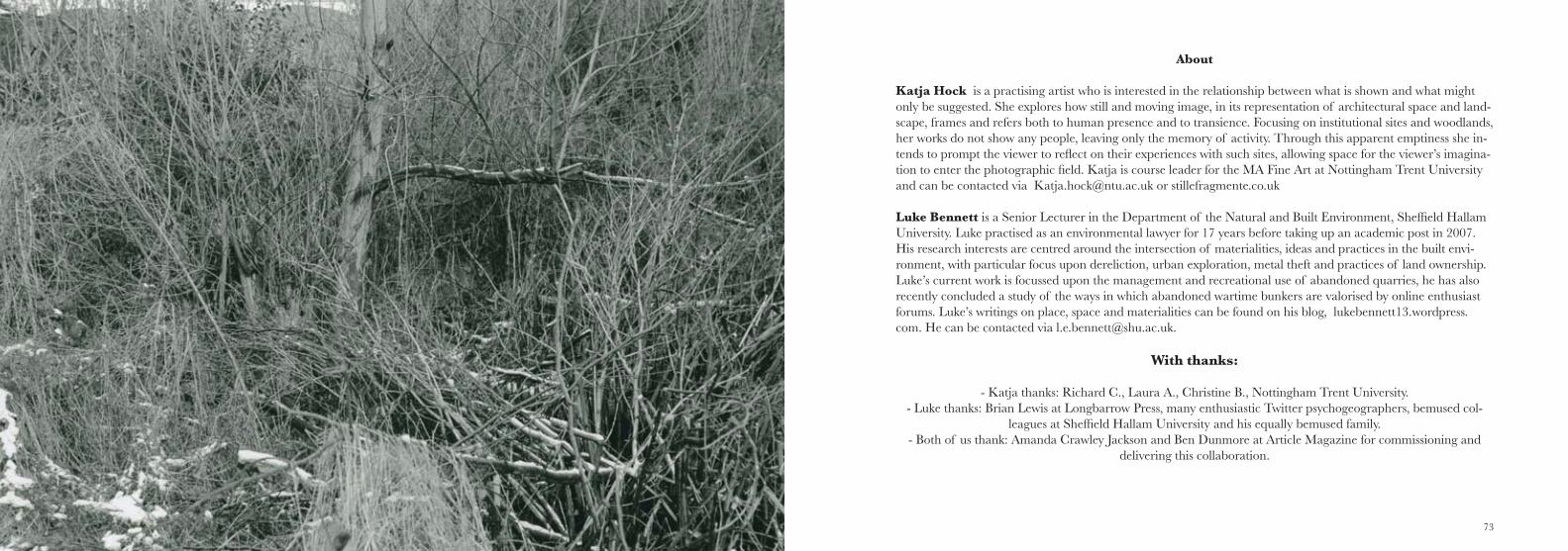
Katja Hock is a practising artist who is interested in the relationship between what is shown and what might only be suggested. She explores how still and moving image, in its representation of architectural space and land-scape, frames and refers both to human presence and to transience. Focusing on institutional sites and woodlands, her works do not show any people, leaving only the memory of activity. Through this apparent emptiness she in-tends to prompt the viewer to reflect on their experiences with such sites, allowing space for the viewer’s imagina-tion to enter the photographic field. Katja is course leader for the MA Fine Art at Nottingham Trent University and can be contacted via [email protected] or stillefragmente.co.uk
Luke Bennett is a Senior Lecturer in the Department of the Natural and Built Environment, Sheffield Hallam University. Luke practised as an environmental lawyer for 17 years before taking up an academic post in 2007. His research interests are centred around the intersection of materialities, ideas and practices in the built envi-ronment, with particular focus upon dereliction, urban exploration, metal theft and practices of land ownership. Luke’s current work is focussed upon the management and recreational use of abandoned quarries, he has also recently concluded a study of the ways in which abandoned wartime bunkers are valorised by online enthusiast forums. Luke’s writings on place, space and materialities can be found on his blog, lukebennett13.wordpress.com. He can be contacted via [email protected].
With thanks:
- Katja thanks: Richard C., Laura A., Christine B., Nottingham Trent University.- Luke thanks: Brian Lewis at Longbarrow Press, many enthusiastic Twitter psychogeographers, bemused col-
leagues at Sheffield Hallam University and his equally bemused family.- Both of us thank: Amanda Crawley Jackson and Ben Dunmore at Article Magazine for commissioning and
delivering this collaboration.
74
Published in 2013 by Tract/Article Works, 120 Trafalagar St, Sheffield, S1 4JT© The authors, 2013
The right of Luke Bennett and Katja Hock to be identified as the authors of this work has been as-serted by them in accordance with the Copyright designs and patents Act 1988.
No part of this work may be reproduced or transmitted in any form or bay any means, electronic or mechanical, including photocopying, recording, or any information storage and retrieval system, without permission in writing from the authors.
Funded By:
With support from:
Published by: