aru - practical approaches to wetland monitoring
TRANSCRIPT
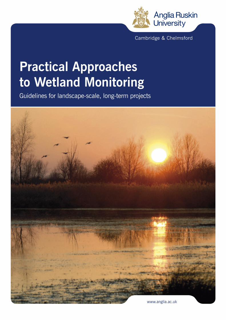
Practical Approachesto Wetland MonitoringGuidelines for landscape-scale, long-term projects
www.anglia.ac.uk

Practical Approaches to Wetland Monitoring:Guidelines for landscape-scale, long-term projects
Written byPeter Stroh and Francine Hughes
Animal & Environment Research GroupDepartment of Life Sciences
Anglia Ruskin UniversityCambridge, UK
Steering Group members:
Alan Bowley, Natural EnglandChris Gerrard, Wildlife Trust
Paul Jose, Huntingdonshire District CouncilOwen Mountford, NERC-CEH, Wallingford
Lorna Parker, Wildlife TrustLesley Saint, Environment AgencyStuart Warrington, National Trust
November 2010
This publication has been funded by the Esmée Fairbairn Foundation

ContentsSection 1: Introduction to landscape-scale projects 7
Section 2: Why monitor? 9
Section 3: What should be monitored? 11
Section 4: Monitoring physical processes 12
4.1 Understanding hydrology 12
4.2 Monitoring activities 12
4.2.1 Monitoring rainfall 12
4.2.2 Monitoring water levels 12
4.2.3 Monitoring soil moisture 12
4.2.4 Monitoring soil nutrients 15
4.2.5 Monitoring soil function 15
Section 5: Monitoring habitat mosaics 16
5.1 Case study: Monitoring landscape-scale habitatmosaics at the Wicken Fen Vision 16
5.1.1 Aerial photography 16
5.1.2 Interpretation of FCIR images 16
5.1.3 Characterising the mosaic 16
Section 6: What species should we monitor? 19
6.1 Monitoring terrestrial vegetation communities 19
6.1.1 Understanding wetland vegetation 19
6.1.2 Choosing monitoring locations 19
6.1.3 Monitoring techniques 19
6.2 Monitoring aquatic habitats 20
6.3 Monitoring species as indicators of landscapechange 20
6.3.1 Species linked to environmental quality 20
6.3.2 Flagship species 21
6.3.3 Landscape species/assemblages 21
6.3.4 Species indicative of landscape connectivity 21
Practical Approaches to Wetland Monitoring 5
Section 7: Can we monitor ecosystem services? 25
7.1 What are ecosystem services? 25
7.2 Direct measurements of ecosystem services 26
7.3 Indirect measurements of ecosystem services 26
Section 8: Monitoring local support and concerns 27
8.1 Engaging with local people 27
8.2 Measuring changing attitudes to landscape-scaleprojects 29
Section 9: Who should undertake monitoring andhow often? 31
9.1 Deciding who should monitor 31
9.1.1 Professionals/specialists 31
9.1.2 Professionals and volunteers 31
9.1.3 Volunteers 32
9.1.4 School groups/student projects 32
9.2 Frequency and timing of monitoring 32
Section 10: Funding monitoring 35
Section 11: Project evaluation 37
Section 12: Beyond the project 39
12.1 Connecting with other landscape-scale projects 39
12.2 Dissemination of monitoring data 39
References linked to superscript numbers ineach section 40
Acknowledgements 42
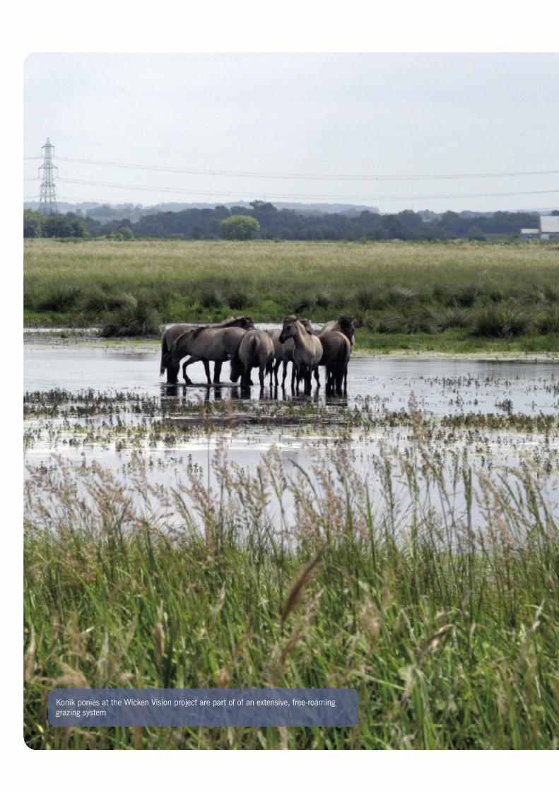
Konik ponies at the Wicken Vision project are part of of an extensive, free-roaminggrazing system
Section 1:Introduction tolandscape-scaleprojects
Practical Approaches to Wetland Monitoring 7
This document is aimed at providinginformation on long-term monitoring protocolsfor individuals and organisations involved inthe restoration or creation of wetland habitatover a ‘landscape-scale’.
‘Landscape-scale’ is a relatively recentconcept and difficult to define, as eachorganism living within a landscape has adifferent interpretation of landscape extent.Thus, a ground beetle and a marsh harrierwill view the extent of their environment atvery different spatial scales, so it follows thatthere can be no absolute size for a landscape-scale project.
Ultimately, it is up to the individual landmanager to define landscape in anappropriate manner relevant to the projectarea. However, for the purposes of thisdocument, we felt that a definition of the termwould be of practical use, and so have chosento loosely characterise ‘landscape-scale’ as anarea that:
• contains (or has the potential to contain)a heterogeneous land area composed of adynamic mosaic of interacting ecosystems1,2
• incorporates the functions and processesnecessary to restore and maintain adynamic and heterogeneous land area
• encompasses a landholding of >1 km2
Implicit in this definition of landscape scaleis the expectation that project outcomes aresomewhat open-ended, not rigidly defined in
terms of particular species numbers or ofthe location and extent of specific vegetationtypes. Instead, the development of habitatsand recruitment of species is at least partiallydetermined through natural processes suchas seed dispersal, recruitment from the seedbank and vegetation succession, combinedwith land management practices such asextensive conservation grazing andhydrological manipulation. Such projects areconceived of over very long periods of timeand monitoring needs to be set up so that itcan keep track of change over many decades.We use the more widely understood term‘monitoring’ throughout this document tomean ‘tracking change through time’ althoughwe appreciate that in many, more specialised,documents the term ‘surveillance’ is used forthis purpose.
The guidance in this report has beenconsiderably influenced by the outcomes ofmonitoring protocols designed by the authorsand applied at two landscape-scale wetlandrestoration initiatives within Cambridgeshire,UK; The Great Fen Projectwww.greatfen.org.uk and the Wicken FenVision www.wicken.org.uk/vision. Theunderlying philosophy at both project sitesis to restore and create wetland habitats witha minimum of anthropogenic intervention,although much of the monitoring guidancecontained in this document can be appliedto projects which do not undertake this moreholistic approach to restoration.
8 Practical Approaches to Wetland Monitoring
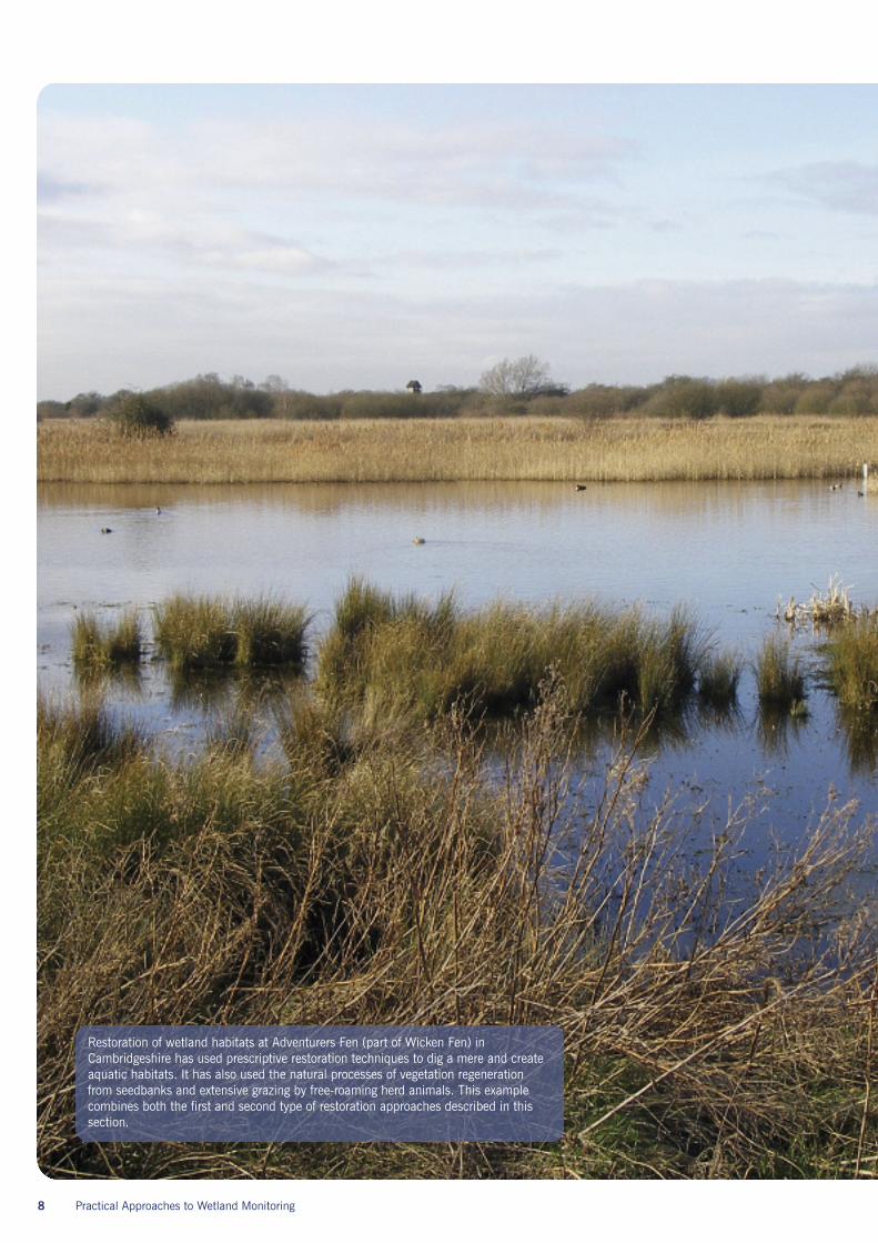
Restoration of wetland habitats at Adventurers Fen (part of Wicken Fen) inCambridgeshire has used prescriptive restoration techniques to dig a mere and createaquatic habitats. It has also used the natural processes of vegetation regenerationfrom seedbanks and extensive grazing by free-roaming herd animals. This examplecombines both the first and second type of restoration approaches described in thissection.
Section 2:Why monitor?
Practical Approaches to Wetland Monitoring 9
Long-term monitoring plays an essential rolein assessing the ecological status and functionof a project and in documenting changethrough time.
When a project is focussed on the restorationof a particular species or habitat, monitoringcan provide evidence of the impact that landmanagement decisions have had on the targetspecies or habitat and on a range ofenvironmental variables, for example,hydrological variables.
If a project has the much broader aims ofpromoting biophysical processes in thelandscape and of restoring connectivitybetween parts of the landscape in order togenerally increase biological diversity, there islikely to be less certainty about the restorationoutcomes. Under such a scenario, monitoringbecomes crucial in helping to understandwhere and why habitats form and how theyevolve over time and which species are usingthe landscape either permanently ortemporarily. This approach is increasinglybeing adopted by landscape-scale projectswhich tend to have a more ‘open-ended’view of project outcomes1.
The reasons for monitoring a restorationproject are to some extent linked to theproject’s philosophy. Project philosophies arequite varied but can perhaps be divided intothree main types1.
1. Where restoration projects tend towardsa very prescriptive approach, restorationactivities and ongoing management areclosely aligned to well-defined restorationtargets in planned locations (for example,aimed at recovery of a species).
In this type of project, monitoring of thetarget species or habitat readily allowsa project manager to know if targets arebeing met and management can thenbe adapted to meet targets.
2. Other projects have target species orhabitats but use a restoration approachthat relies more on natural processes,such as river floods, to create the requiredenvironmental conditions2. In this case thelink between processes and target speciesor habitats may be well understood butexactly where these may be restored withinthe landscape is less easy to predict.
In this type of project, monitoring oftarget species and habitats can tell aproject manager if appropriate processesare being used to produce the specifiedrange of species and habitats. Monitoringcan thus confirm if the link betweenprocesses and species or habitat has beencorrectly understood and managementcan be adapted as necessary to meettargets.
3. On the other hand restoration may focuson natural processes, with expectationsmore ‘open-ended’ in terms of the habitatsthat might form or the species likely to usethe restoration area. This approach torestoration is more experimental and lesstarget-driven and tends to occur on highlydegraded land (such as former intensivelyfarmed arable land) which is unlikely tosupport historical species assemblages.
The monitoring task in open-endedprojects is complex as there are not well-defined targets against which to monitor.Monitoring itself also becomes moreopen-ended and focused on trackingpatterns of change through time. Withno set targets against which to monitor,adaptive management cannot take placeand there is a greater element ofdocumenting what happens and acceptingwhat comes over many decades.
In any kind of restoration project monitoringhas three broad uses:
1. It describes the changestaking place? ! DESCRIPTION
2. It helps to understandthe causes of change? ! FUNCTION
3. It helps to quantify thebenefits of restoration? ! BENEFIT
The first two of these are very useful forproject managers who need to make decisionsabout aspects of habitat management and forthe many stakeholders who will want to knowwhat is happening at the site and whatimpacts restoration might have on them. Thethird is particularly useful in advocacy and forpromoting the range of benefits that ecologicalrestoration can bring to a wide range ofpeople.
10 Practical Approaches to Wetland Monitoring
Section 3:What should be monitored?
Practical Approaches to Wetland Monitoring 11
Decisions on what to monitor at the beginningof a project, especially when faced with largeareas of land, can be overwhelming. In manyinstances, decision-making will be led orinfluenced by internal policies from withinthe organisation managing the project orby external factors. These may include (a)specified targets for some habitats or species,(b) the financial and human resourcesavailable for monitoring activities, and/or(c) the terms & conditions of funding bodies.
Whatever the constraints may be, long-termmonitoring should be viewed as an essentialextension to land purchase and management.Monitoring schemes should be carefullyplanned and designed so that methods arestandardised, inexpensive, easily repeated androbust.1 An expensive baseline survey to setup the monitoring can be acceptable if repeatsurveys are inexpensive. Landscape-scaleprojects should prioritize monitoring activitiesthat reflect its attributes of large size, habitatheterogeneity and ecosystem function.
Wetlands represent a unique and dynamicbalance between hydrology, topography and
wildlife. If project managers are to havea critical understanding of why there arefluctuations in species presence, abundance(and absence) over time, monitoring mustbe targeted at underlying physical processesas well as biological diversity. In this way,monitoring can also be linked to well-informedmanagement decisions.
Wetland ecosystems provide many ecologicalservices as a result of the way they functionand therefore provide a wide range of benefitsfor wildlife and people2. The monitoring ofsuch ‘ecosystem services’ should complementthe monitoring of biotic and abiotic wetlandcomponents and will add tangible financialand social value to a project. Appreciationof the value of wetlands created across largeareas of land is intrinsically linked to thesupport of local communities. Monitoring thelevels of support for a project by local peopleallows a project manager to respond to localconcerns when they arise. It may also berelevant to monitor the effects of landscapechange on cultural or socio-economic aspectsof the landscape since these are intrinsically
linked to ecological and environmentalchange. Methods for doing this are notdescribed in this document but one exampleis the value of land.
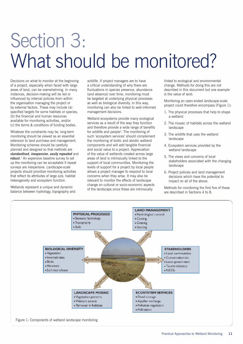
Monitoring an open-ended landscape-scaleproject could therefore encompass (Figure 1):
1. The physical processes that help to shapea wetland
2. The mosaic of habitats across the wetlandlandscape
3. The wildlife that uses the wetlandlandscape
4. Ecosystem services provided by thewetland landscape
5. The views and concerns of localstakeholders associated with the changinglandscape
6. Project policies and land managementdecisions which have the potential toimpact on all of the above.
Methods for monitoring the first five of theseare described in Sections 4 to 8.
Figure 1: Components of wetland landscape monitoring
12 Practical Approaches to Wetland Monitoring
Section 4:Monitoring physical processesThe two most important physical componentsof a wetland are its water and its soils, bothof which will determine the kind of wetlandthat develops on a restoration site.
4.1 Understanding hydrologyWetlands need water but most wetlands varyquite significantly between seasons in termsof how much water they contain. Manywetlands are flooded in the winter butbecome drier and less extensive duringsummer months. Scientists often use theterm ‘hydroperiod’ to describe the amount,the seasonal timing, the depth and theduration of water present in the wetland.All of these factors will determine the kindof wetland ecosystem that develops on arestoration site. The hydroperiod is essentiallya way of describing the hydrological characterof the wetland.
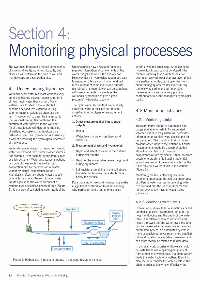
Wetlands receive water from rain, from groundwater sources and from surface water sources(for example: river flooding, runoff from slopesor ditch systems). Water also leaves a wetlandby some of these routes as well as byevaporation and by the emission of watervapour by plants (evapotranspiration).Hydrologists often talk about ‘water budgets’by which they mean the sum total of waterinputs against all the water outputs of awetland over a specified period of time (Figure2). It is a way of calculating water availability.
Understanding how a wetland functionsrequires information about elements of thewater budget and about the hydroperiod.However, not all hydrological factors are easyto measure. Often a combination of directmeasurement of some inputs and outputs(eg rainfall or stream flows) can be combinedwith measurements of aspects of thewetland’s hydroperiod to give a goodpicture of hydrological activity.
The hydrological factors that are relativelystraightforward to measure can thus beclassified into two types of measurementactivity:
1. Direct measurement of inputs and/oroutputs
• Rainfall
• Water levels in water supply/removalchannels
2. Measurement of wetland hydroperiod
• Depth and extent of water in the wetlandduring wet months
• Depth of the water table below the groundduring dry months
• Soil moisture remaining in the soil abovethe water table when the water table isbelow the surface.
Data gathered on wetland hydroperiods makea significant contribution to understandingwhy particular plants and animals occur
within a wetland landscape. Although somehydrological inputs cannot be altered (likerainfall) knowing that a wetland has, forexample, received lower than average rainfallin a particular winter, can trigger decisionsabout managing other water inputs duringthe following spring and summer. Suchmeasurements can make very practicalcontributions to a land manager’s hydrologicaltoolkit.
4.2 Monitoring activities
4.2.1 Monitoring rainfall
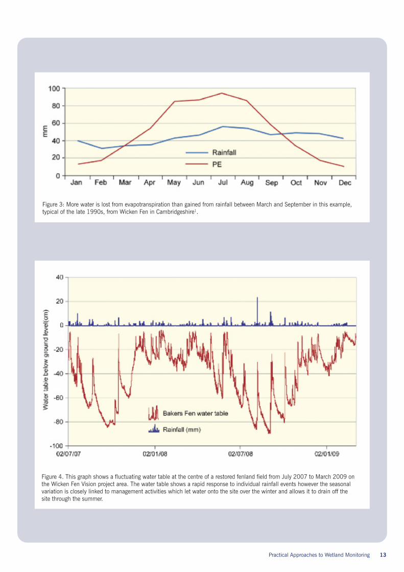
There are many brands of automated raingauge available to install. An automatedweather station is very useful as it providesinformation on rainfall, wind speeds and airtemperatures. The quantity of rainfall is anobvious water input to the wetland but othermeasurements made by a weather stationallow the calculation of ‘potentialevapotranspiration’ by plants. It then becomespossible to graph rainfall against potentialevapotranspiration to reveal in which monthsthere may be a water deficit in the wetland(Figure 3).
Monitoring rainfall is also very useful inhelping to understand the relative importanceof different water sources in providing waterto a wetland and the kinds of impacts thatrainfall events can have on water levels(Figure 4).
4.2.2 Monitoring water levels
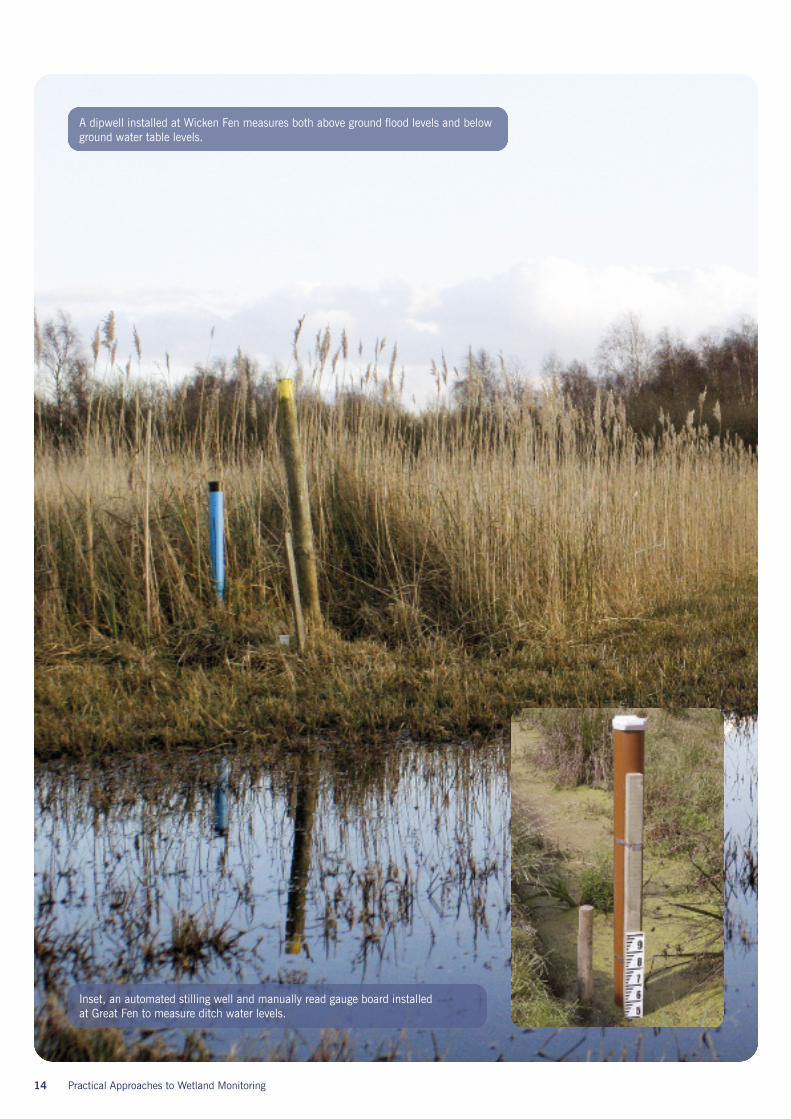
Installation of dipwells (also sometimes calledboreholes) allows measurement of both theheight of flooding and the depth of the watertable. It is relatively easy to construct andinstall a dipwell and the water levels inside itcan be measured either manually or using anautomated system. An automated system ismore expensive but gives much more detailedinformation about water table movement andcan more readily be related to rainfall data.
In an ideal world a series of dipwells shouldbe installed across a hydrological gradientfrom a drier to a wetter area. If a ditch systemfeeds the water table of a wetland then it isalso useful to monitor the water levels in theditch in order to know how effectively the
Figure 2: Hydrological inputs and outputs in a fenland restoration project
Practical Approaches to Wetland Monitoring 13
Figure 3: More water is lost from evapotranspiration than gained from rainfall between March and September in this example,typical of the late 1990s, from Wicken Fen in Cambridgeshire1.
Figure 4. This graph shows a fluctuating water table at the centre of a restored fenland field from July 2007 to March 2009 onthe Wicken Fen Vision project area. The water table shows a rapid response to individual rainfall events however the seasonalvariation is closely linked to management activities which let water onto the site over the winter and allows it to drain off thesite through the summer.
14 Practical Approaches to Wetland Monitoring
A dipwell installed at Wicken Fen measures both above ground flood levels and belowground water table levels.
Inset, an automated stilling well and manually read gauge board installedat Great Fen to measure ditch water levels.
Practical Approaches to Wetland Monitoring 15
ditch is providing water or removing waterdepending on the time of the year.
Water levels have different impacts ondifferent species, and need careful monitoringfor seasonal fluctuations. For example, agradual water level drawdown in spring/earlysummer is known to be valuable for someplants, wading birds and invertebrates, but arapid rise in the water table at the wrong timeof the year may be disastrous for all three.
Choosing sites for hydrological monitoring
In large-scale projects, it is difficult to decide where to locate hydrological equipment. Bothhydrological considerations and practical considerations must be taken into account. Threerules of thumb can be used:
1. Choose sites that are typical of many parts of the project area but are also near toimportant water sources such as ditches or rivers.
2. Choose sites where additional information is also being collected (for example informationabout soils, or vegetation or water quality) because the more that is known about one sitethe better it will be understood.
3. Choose sites that are easy to get to so that the time taken to download data loggers ortake manual measurements is minimized.
Choosing equipment for hydrological monitoring
Equipment should be robust and capable of operating in a wet environment! Manycommercial sources of monitoring equipment are available but choose the simplestequipment that is capable of doing the job you want done. There are data loggers that canbe put inside a dipwell and these will record the depth of water lying above them. In orderto use these data you need to know the height of the ground surface next to each dipwellso a survey of ground elevation across the site is essential. Data loggers can be set to takemeasurements at any interval but measurements every 1 hour are commonly chosen. Thisgives 24 data points each day and allows a really good understanding of how the water tablefluctuates in response to rainfall events or to changes in water inputs from other sourcessuch as nearby ditches. Sometimes there will be a lag between the water input and thewater level response and this tells the wetland manager how long it takes for water to movethrough the soil.
4.2.3 Monitoring soil moistureMeasuring soil moisture is not essential butcan give useful insights into the residualmoisture availability above the water tableonce the water table has retreated belowground during summer months. It is possibleto obtain hand held soil moisture probes thatread soil moisture % by volume in the surfacelayers of the soil. Over time these data canhelp a reserve manager to understand whydifferent plant communities have developedin different places and contribute to a generalunderstanding of habitat development. Soilmoisture conditions also affect other species,for example, high levels of soil moistureusually make the ground soft which is a pre-requisite for the successful breeding of waderchicks.
4.2.4 Monitoring soil nutrientsMany wetland restoration projects are onformer farmland that is rich in Nitrogen (N),Phosphorus (P) and Potassium (K) from theapplication of fertilizers. N and P are bothvery important to plant growth and willinfluence the plant communities that developfrom a seed bank in a natural regenerationmanagement regime. Once arable agriculturehas ceased, N will tend to leach away rapidly
but P, on the other hand, gets taken up by thesoil and bound to soil particles in such a waythat much of it becomes unavailable toplants. It will tend to linger in the soil forseveral decades though it can be more rapidlyreleased from organic soils than from mineralsoils. The exact levels of both N and P oncefertilization has ceased will largely bedetermined by the type of soil. As a rule ofthumb, clay soils hold nutrients for muchlonger than soils that are more porous likesilts and sands or than very organic soils likepeat. This means that a reasonably detailedsoil map2 can give a very good broadindication of the likely nutrient loading in thesoils of a restoration area without the need tocarry out nutrient analyses on a regular basis.However, it is a good idea to carry out soilanalyses at the start of a project so that
baseline values are known for N, P and K withsubsequent tests being carried out at intervalsof 5–10 years as values are unlikely to changerapidly.
Soil analyses can be carried out by sendingthem to a laboratory for detailed analyses orby using inexpensive but less accurate fieldkits. Soil chemistry is very complex and it isimportant to understand the significance ofdifferent types of tests. In general, tests for‘Available P’, ‘Available N’ and ‘Available K’will tell a land manager most about theavailability of these nutrients to plants.
4.2.5 Monitoring soil function
In the early years of a restoration project itis interesting to know something about soilfunctions and whether or not restoration isincreasing the rate of processes such asdecomposition of organic matter. Soil biotacontribute towards “the sustainablefunctioning of all ecosystems by acting as theprimary driving agents of nutrient cycling;regulating the dynamics of soil organic matter,soil carbon sequestration and greenhouse gasemission; modifying soil physical structureand water regime; enhancing the amount andefficiency of nutrient acquisition by vegetation;and enhancing plant health.” 3 One way ofmeasuring changes in the levels of activity bysoil biota is to use ‘bait lamina’ strips whichcan measure both soil microbial and soilinvertebrate activity in a very simple way.These inexpensive strips were initiallydesigned for use in arable fields and can beput into the soil over 7–20 day periods tomeasure different levels of soil biotic activity4.
Section 5:Monitoring habitat mosaics
16 Practical Approaches to Wetland Monitoring
In landscape-scale projects where naturalphysical and biological processes are allowedto determine the vegetation mosaic, it isuseful to be able to characterise the mosaicas it changes through time. This informationallows a project manager to relate thepresence of vegetation types and abioticfactors such as open water extent, to thepresence and population size of other species,and perhaps to find functional links betweenthe two. Vegetation mosaics can be mappedby hand in more or less detail but accuratecomparisons between years are difficult tomake without the help of remote-sensingtechniques. We describe a method for doingthis through a case study.
5.1 Case study: Monitoringlandscape-scale habitatmosaics at the Wicken FenVisionRemote sensing techniques offer effectiveways of monitoring broad changes in theextent of vegetation and standing wateracross large expanses of wetland habitat.A protocol designed to capture and interpretlandscape-scale data for this purpose hasbeen developed for the Wicken Fen Visionin Cambridgeshire. This is an ambitioushabitat creation project aiming to expandthe boundary of the adjacent Wicken FenNational Nature Reserve by the purchase ofc.50km of degraded farmland. Restorationof wetland habitats on the ex-arable fields isbeing carried out through natural regenerationand recovery of artificially lowered watertables. At the present time the area underrestoration covers around 880 hectares(8.8km2). The following 3 steps were taken:
5.1.1 Aerial photography
Aerial photography is one of the mostcommonly used remote-sensing techniques.Flights over the Wicken Vision project areawere undertaken in early August 2007, withTrue Colour and False Colour Infra Red (FCIR)images collected. Once the images hadbeen digitised, the suitability for mappinglandscape-scale vegetation using FCIRimagery was evaluated.
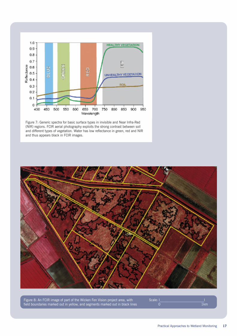
FCIR images consist of three wavebands; red,which represents near infrared reflectance;green, which represents red reflectance; andblue, which represents green reflectance(Figure 7 right). This format is particularlyuseful for visualising vegetation health anddensity as vegetation has a strong reflectancein the near infrared and appears as differentintensities of red.
5.1.2 Interpretation of FCIR images
A quality-check (known as pre-processing) wasperformed on the images to remove defects,and a single image collated from the manyaerial images taken over the project area.Within each field, vegetation boundaries werethen selected by an image segmentationtechnique (see Figure 8 right) using the FCIRimage and specialist GIS software. Thisprocedure can define very complex boundaries,but works only on the values contained withinthe FCIR image, and does not involve anyexpert ecological input. The process isautomated and so relatively objective, althoughparameters for the segmentation process needto be set in advance, which inevitably involvessome subjective evaluation. Segments (or‘patches’) were then ground-truthed by aprofessional botanist, with differences invegetation structure and species within andbetween fields observed.
5.1.3 Characterising the mosaic
There are many practical advantages to thisapproach, including the ability to analysetrends in vegetation change both across largeareas and within individual fields. The datacan be used to derive basic indices thatdescribe the nature of the vegetation mosaicin terms of its structure and (with theadditional field survey work) in terms of itsbroad communities. The outcomes of thisapproach can show:
• The relationship between field size andnumber of different vegetation patches.At the Wicken Fen Vision there is a clearrelationship between increased land areaand increased number of separatevegetation patches.
• The amount of ‘edge habitat’. Many specieslike using edge habitat due to the variationin vegetation structure and microclimate
that this provides. For each patch withineach field, an area, perimeter and perimeter/ area ratio can be calculated to measurethe extent of habitat edge.
• Vegetation patterns over substantial areasusing relatively little effort in comparisonto ground-based, fine scale vegetationmonitoring techniques. The detail ofvegetation data appears to be sufficient toinfluence and inform some kinds of landmanagement decisions such as choice ofgrazing densities.
The data gathered by this method is likely tocomplement other monitoring activities beingundertaken within the wetland as it allowsadditional mapping layers with informationabout other factors (for example soil depths)to be overlain.
A second set of FCIR images will be collectedin 2012 (five years following the first flight).At this point, it will be possible to examinechanges that have occurred within the projectarea since 2007 and rigorously test theprotocols discussed above and theirusefulness. This kind of approach tomonitoring is expensive and can be carriedout at widely spaced intervals (! 5 years).
Key steps1. Fly FCIR aerial images when wetland
vegetation is at its peak (July or earlyAugust: book flights in advance).
2. Ensure receipt of digitised FCIR imagewithin one week of flight.
3. Quality check digital images*.
4. Produce a single image from allavailable images*.
5. Instigate Image SegmentationTechnique*.
6. Commence ground-truthing amaximum of two weeks followingreceipt of aerial images**.
7. Collate imformation and analysechosen environmental indices**.
8. Repeat capture of FCIR data onceevery five years and repeat analysis.
* GIS specialist required.**ecological expertise required.
Practical Approaches to Wetland Monitoring 17
Figure 8: An FCIR image of part of the Wicken Fen Vision project area, withfield boundaries marked out in yellow, and segments marked out in black lines
Scale: l__________________________l0 1km
Figure 7: Generic spectra for basic surface types in invisible and Near Infra-Red(NIR) regions. FCIR aerial photography exploits the strong contrast between soiland different types of vegetation. Water has low reflectance in green, red and NIRand thus appears black in FCIR images.
18 Practical Approaches to Wetland Monitoring
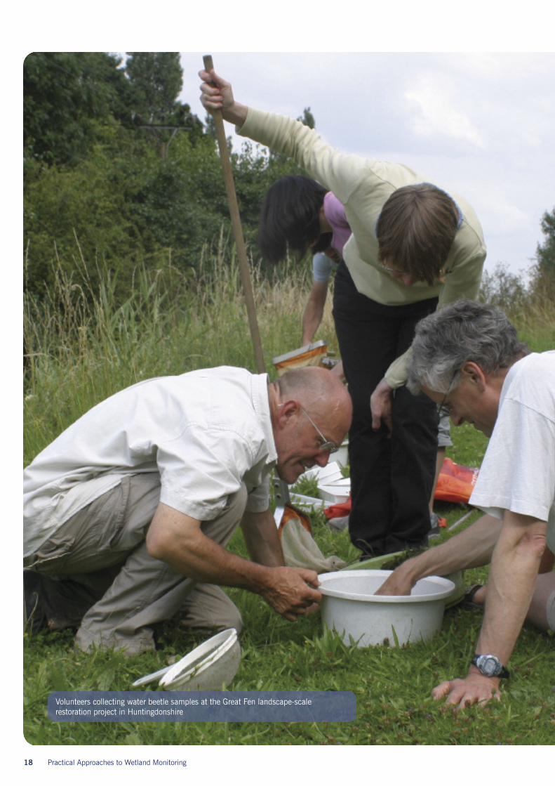
Volunteers collecting water beetle samples at the Great Fen landscape-scalerestoration project in Huntingdonshire
Wetlands have the potential to host aspectacular variety of plants and wildlife.Many species will be recorded ad-hoc by localnaturalist organisations or interested membersof the public, and whilst this information doeshave value, if it is not attached to a robustprotocol, it will often lack the necessary detailto examine subtle shifts in species compositionand location over time. Although some of theprotocols described below may be used forrecording species within any wetland we havehighlighted approaches suitable for landscape-scale projects. It is clear that only a selectionof species or species groups can be monitored,so monitoring needs to focus on those thathelp a project manager to build a picture of thechanging landscape right across a project areaand over the long-term. In this section wedistinguish between monitoring vegetationcommunities where the change in speciescomposition over time is of interest andmonitoring individual species where thefate of the individual species is of interest.
6.1 Monitoring terrestrialvegetation communities
6.1.1 Understanding wetlandvegetation
Plant species that occur within wetlands orcan tolerate wetland conditions are referredto as hydrophytes (wetland plants). The rootsystems of hydrophytic plants are able totolerate lengthy periods of standing water orsaturated soils, with the depth of inundationand duration of saturated conditions directlyinfluencing where plant species are located.These characteristics, coupled with thehydrology of the site, lead to the formationof hydroseres which are distinct, oftenoverlapping zones of vegetation across ahydrological gradient from open water to dryland. Each zone is likely to contain dominant
species, including grasses which are tolerantof wetland conditions, rushes (Juncus spp.),spike rushes (Eleocharis spp.), tall ruderalspecies, tall emergent species andmarginal/aquatic species.
Perhaps the most interesting and species-richmosaic of wetland habitat is found insituations where topography is varied andprovides a great variety of water levels. Wherewater levels drop during summer months,ephemeral areas of moist bare ground (knownas drawdown zones) are exposed. These havethe potential to contain >85% of a site’swetland species1, providing perfect conditionsfor the germination of many wetland plantspecialists, as well as suitable habitat for arange of birds, invertebrates and lower plants.
6.1.2 Choosing monitoring locationsIn general terms, vegetation monitoring is putin place to document the long-term extent anddiversity of vegetation communities across aproject area. In practical terms, monitoring isessential if informed management decisionsare to be made. Large areas of wetland arelikely to contain a wide variety of habitats,and locations for the monitoring of vegetationshould attempt to be representative of thisvariety. Replication within these representativeareas adds greatly to the statistical robustnessof long-term monitoring data, and should beconsidered at an early stage of design.
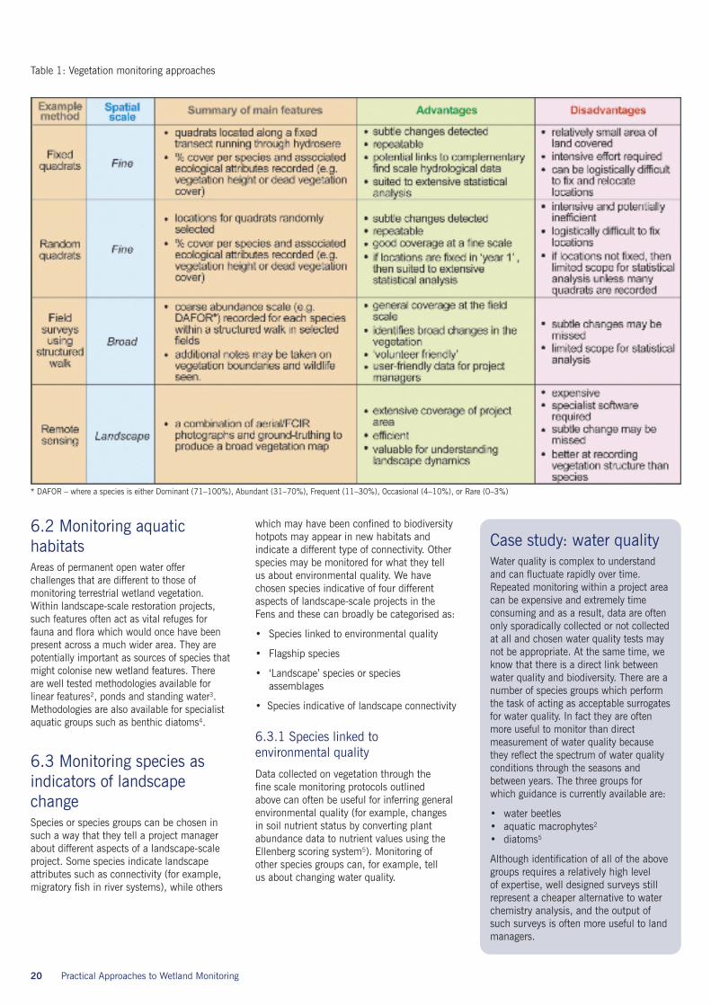
6.1.3 Monitoring techniquesMonitoring can take place at a variety ofspatial scales to pick up general trends aswell as subtle changes within the wetlandsystem and the exact method chosen shouldreflect the purpose of the monitoring. Eachscale and method has its own advantages anddisadvantages, but projects should aim toemploy a minimum of two of the techniquesset out in Table 1 (over) to pick up changesat different scales.
Practical Approaches to Wetland Monitoring 19
Section 6:What speciesshould we monitor?
6.2 Monitoring aquatichabitatsAreas of permanent open water offerchallenges that are different to those ofmonitoring terrestrial wetland vegetation.Within landscape-scale restoration projects,such features often act as vital refuges forfauna and flora which would once have beenpresent across a much wider area. They arepotentially important as sources of species thatmight colonise new wetland features. Thereare well tested methodologies available forlinear features2, ponds and standing water3.Methodologies are also available for specialistaquatic groups such as benthic diatoms4.
6.3 Monitoring species asindicators of landscapechangeSpecies or species groups can be chosen insuch a way that they tell a project managerabout different aspects of a landscape-scaleproject. Some species indicate landscapeattributes such as connectivity (for example,migratory fish in river systems), while others
which may have been confined to biodiversityhotpots may appear in new habitats andindicate a different type of connectivity. Otherspecies may be monitored for what they tellus about environmental quality. We havechosen species indicative of four differentaspects of landscape-scale projects in theFens and these can broadly be categorised as:
• Species linked to environmental quality
• Flagship species
• ‘Landscape’ species or speciesassemblages
• Species indicative of landscape connectivity
6.3.1 Species linked toenvironmental quality
Data collected on vegetation through thefine scale monitoring protocols outlinedabove can often be useful for inferring generalenvironmental quality (for example, changesin soil nutrient status by converting plantabundance data to nutrient values using theEllenberg scoring system5). Monitoring ofother species groups can, for example, tellus about changing water quality.
20 Practical Approaches to Wetland Monitoring
Table 1: Vegetation monitoring approaches
Case study: water qualityWater quality is complex to understandand can fluctuate rapidly over time.Repeated monitoring within a project areacan be expensive and extremely timeconsuming and as a result, data are oftenonly sporadically collected or not collectedat all and chosen water quality tests maynot be appropriate. At the same time, weknow that there is a direct link betweenwater quality and biodiversity. There are anumber of species groups which performthe task of acting as acceptable surrogatesfor water quality. In fact they are oftenmore useful to monitor than directmeasurement of water quality becausethey reflect the spectrum of water qualityconditions through the seasons andbetween years. The three groups forwhich guidance is currently available are:
• water beetles• aquatic macrophytes2
• diatoms5
Although identification of all of the abovegroups requires a relatively high levelof expertise, well designed surveys stillrepresent a cheaper alternative to waterchemistry analysis, and the output ofsuch surveys is often more useful to landmanagers.
* DAFOR – where a species is either Dominant (71–100%), Abundant (31–70%), Frequent (11–30%), Occasional (4–10%), or Rare (0–3%)
Practical Approaches to Wetland Monitoring 21
6.3.2 Flagship species
Some wetlands will support populationsof species which are nationally rare andvisually attractive, and monitoring theirpresence can help to gain publicity, supportand funding which will benefit a range ofother species to be found inhabiting the sameecosystem. For example, the breeding successof bitterns Botaurus stellaris will be linkedto the health and population size of the fish,amphibian and insect assemblages.
6.3.3 Landscapespecies/assemblages
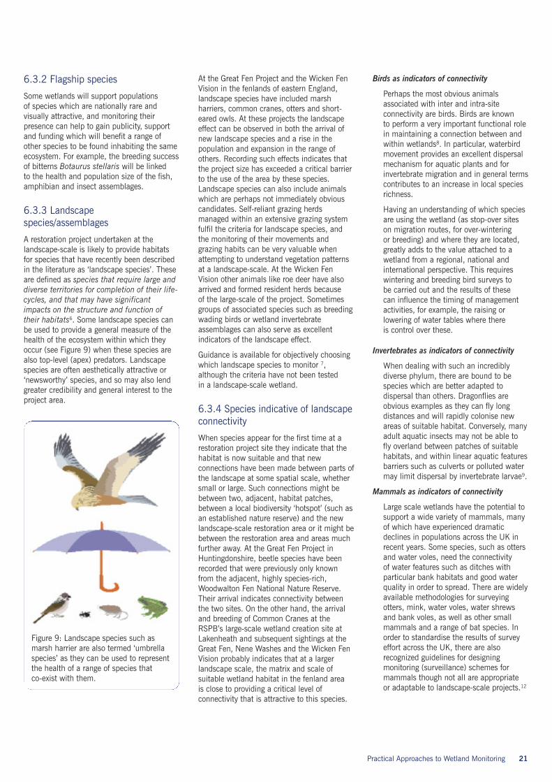
A restoration project undertaken at thelandscape-scale is likely to provide habitatsfor species that have recently been describedin the literature as ‘landscape species’. Theseare defined as species that require large anddiverse territories for completion of their life-cycles, and that may have significantimpacts on the structure and function oftheir habitats6. Some landscape species canbe used to provide a general measure of thehealth of the ecosystem within which theyoccur (see Figure 9) when these species arealso top-level (apex) predators. Landscapespecies are often aesthetically attractive or‘newsworthy’ species, and so may also lendgreater credibility and general interest to theproject area.
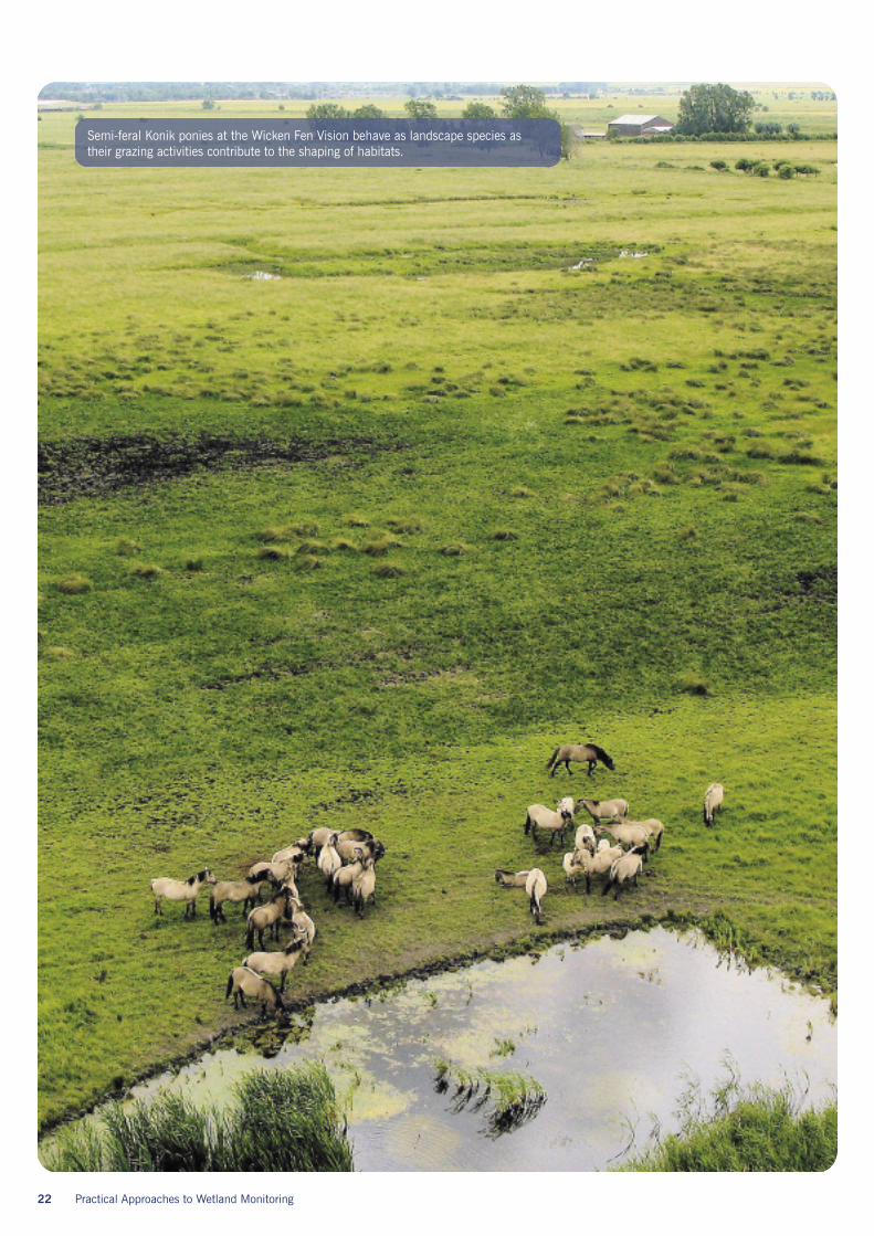
At the Great Fen Project and the Wicken FenVision in the fenlands of eastern England,landscape species have included marshharriers, common cranes, otters and short-eared owls. At these projects the landscapeeffect can be observed in both the arrival ofnew landscape species and a rise in thepopulation and expansion in the range ofothers. Recording such effects indicates thatthe project size has exceeded a critical barrierto the use of the area by these species.Landscape species can also include animalswhich are perhaps not immediately obviouscandidates. Self-reliant grazing herdsmanaged within an extensive grazing systemfulfil the criteria for landscape species, andthe monitoring of their movements andgrazing habits can be very valuable whenattempting to understand vegetation patternsat a landscape-scale. At the Wicken FenVision other animals like roe deer have alsoarrived and formed resident herds becauseof the large-scale of the project. Sometimesgroups of associated species such as breedingwading birds or wetland invertebrateassemblages can also serve as excellentindicators of the landscape effect.
Guidance is available for objectively choosingwhich landscape species to monitor 7,although the criteria have not been testedin a landscape-scale wetland.
6.3.4 Species indicative of landscapeconnectivity
When species appear for the first time at arestoration project site they indicate that thehabitat is now suitable and that newconnections have been made between parts ofthe landscape at some spatial scale, whethersmall or large. Such connections might bebetween two, adjacent, habitat patches,between a local biodiversity ‘hotspot’ (such asan established nature reserve) and the newlandscape-scale restoration area or it might bebetween the restoration area and areas muchfurther away. At the Great Fen Project inHuntingdonshire, beetle species have beenrecorded that were previously only knownfrom the adjacent, highly species-rich,Woodwalton Fen National Nature Reserve.Their arrival indicates connectivity betweenthe two sites. On the other hand, the arrivaland breeding of Common Cranes at theRSPB’s large-scale wetland creation site atLakenheath and subsequent sightings at theGreat Fen, Nene Washes and the Wicken FenVision probably indicates that at a largerlandscape scale, the matrix and scale ofsuitable wetland habitat in the fenland areais close to providing a critical level ofconnectivity that is attractive to this species.
Birds as indicators of connectivity
Perhaps the most obvious animalsassociated with inter and intra-siteconnectivity are birds. Birds are knownto perform a very important functional rolein maintaining a connection between andwithin wetlands8. In particular, waterbirdmovement provides an excellent dispersalmechanism for aquatic plants and forinvertebrate migration and in general termscontributes to an increase in local speciesrichness.
Having an understanding of which speciesare using the wetland (as stop-over siteson migration routes, for over-winteringor breeding) and where they are located,greatly adds to the value attached to awetland from a regional, national andinternational perspective. This requireswintering and breeding bird surveys tobe carried out and the results of thesecan influence the timing of managementactivities, for example, the raising orlowering of water tables where thereis control over these.
Invertebrates as indicators of connectivity
When dealing with such an incrediblydiverse phylum, there are bound to bespecies which are better adapted todispersal than others. Dragonflies areobvious examples as they can fly longdistances and will rapidly colonise newareas of suitable habitat. Conversely, manyadult aquatic insects may not be able tofly overland between patches of suitablehabitats, and within linear aquatic featuresbarriers such as culverts or polluted watermay limit dispersal by invertebrate larvae9.
Mammals as indicators of connectivity
Large scale wetlands have the potential tosupport a wide variety of mammals, manyof which have experienced dramaticdeclines in populations across the UK inrecent years. Some species, such as ottersand water voles, need the connectivityof water features such as ditches withparticular bank habitats and good waterquality in order to spread. There are widelyavailable methodologies for surveyingotters, mink, water voles, water shrewsand bank voles, as well as other smallmammals and a range of bat species. Inorder to standardise the results of surveyeffort across the UK, there are alsorecognized guidelines for designingmonitoring (surveillance) schemes formammals though not all are appropriateor adaptable to landscape-scale projects.12
Figure 9: Landscape species such asmarsh harrier are also termed ‘umbrellaspecies’ as they can be used to representthe health of a range of species thatco-exist with them.
22 Practical Approaches to Wetland Monitoring
Semi-feral Konik ponies at the Wicken Fen Vision behave as landscape species astheir grazing activities contribute to the shaping of habitats.
Practical Approaches to Wetland Monitoring 23
Amphibians as indicators of connectivity
The nature of many amphibians meansthat connectivity between hibernation andbreeding habitat is vital for their continuedsurvival. The potential for expansion ofpopulations within landscape-scalewetlands is high, and can be measuredby fairly simple survey techniques. TheNational Amphibian Survey website, runby the National Amphibian and ReptileRecording Scheme (NARRS), has moredetails about schemes currently running,and can be found atwww.narrs.org.uk/natamphibsurvey.htm
Plants as indicators of connectivity
Plants are perhaps the most difficult groupto rigorously monitor for migration andconnectivity, as they may arrive througha wide variety of dispersal mechanisms,including on peoples’ rubber boots! Thevegetation monitoring protocols set outin Table 1 (fine and broad scales) in thissection are probably the most reliable toolsfor measuring change and picking uppatterns of dispersal and spread. However,there are species which are associatedwith connectivity and dispersal which
can be targeted. These plants are almostexclusively alien ‘invasive’ species whichare frequently dispersed by birds, such asthe now widespread Australian StonecropCrassula helmsii. Such species mayspread rapidly within and betweenwetlands, and knowledge of their presenceat an early stage is desirable so thatcontrol can be considered.
Gathering baselineinformation for landscapeconnectivityIn all of the examples noted above, andonce clear goals have been assigned tomonitoring protocols, the gathering of‘baseline’ data across the wetland isan essential step in attempting tounderstand connectivity between areasand the movement of species. Oncethese data have been collected, theappearance of new species in newlocations and the establishment ofconnections can be reported withgreater confidence.
Case Study: invertebrate surveys at the landscape-scale
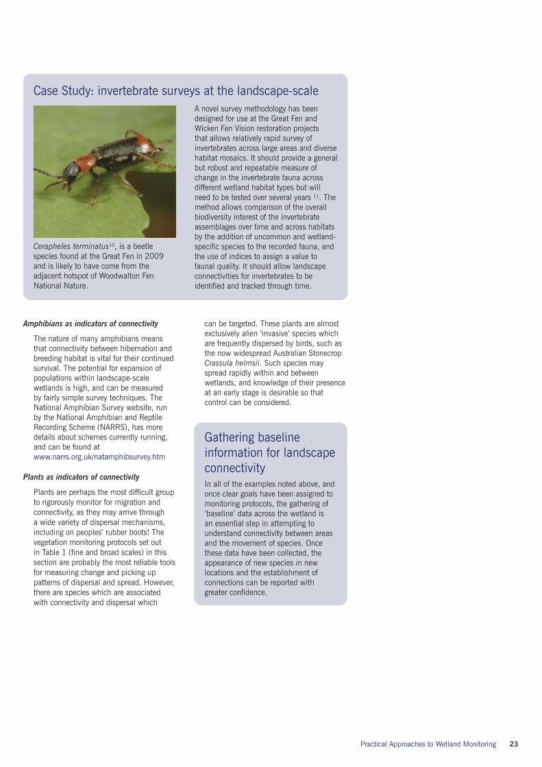
Cerapheles terminatus10, is a beetlespecies found at the Great Fen in 2009and is likely to have come from theadjacent hotspot of Woodwalton FenNational Nature.
A novel survey methodology has beendesigned for use at the Great Fen andWicken Fen Vision restoration projectsthat allows relatively rapid survey ofinvertebrates across large areas and diversehabitat mosaics. It should provide a generalbut robust and repeatable measure ofchange in the invertebrate fauna acrossdifferent wetland habitat types but willneed to be tested over several years 11. Themethod allows comparison of the overallbiodiversity interest of the invertebrateassemblages over time and across habitatsby the addition of uncommon and wetland-specific species to the recorded fauna, andthe use of indices to assign a value tofaunal quality. It should allow landscapeconnectivities for invertebrates to beidentified and tracked through time.
24 Practical Approaches to Wetland Monitoring
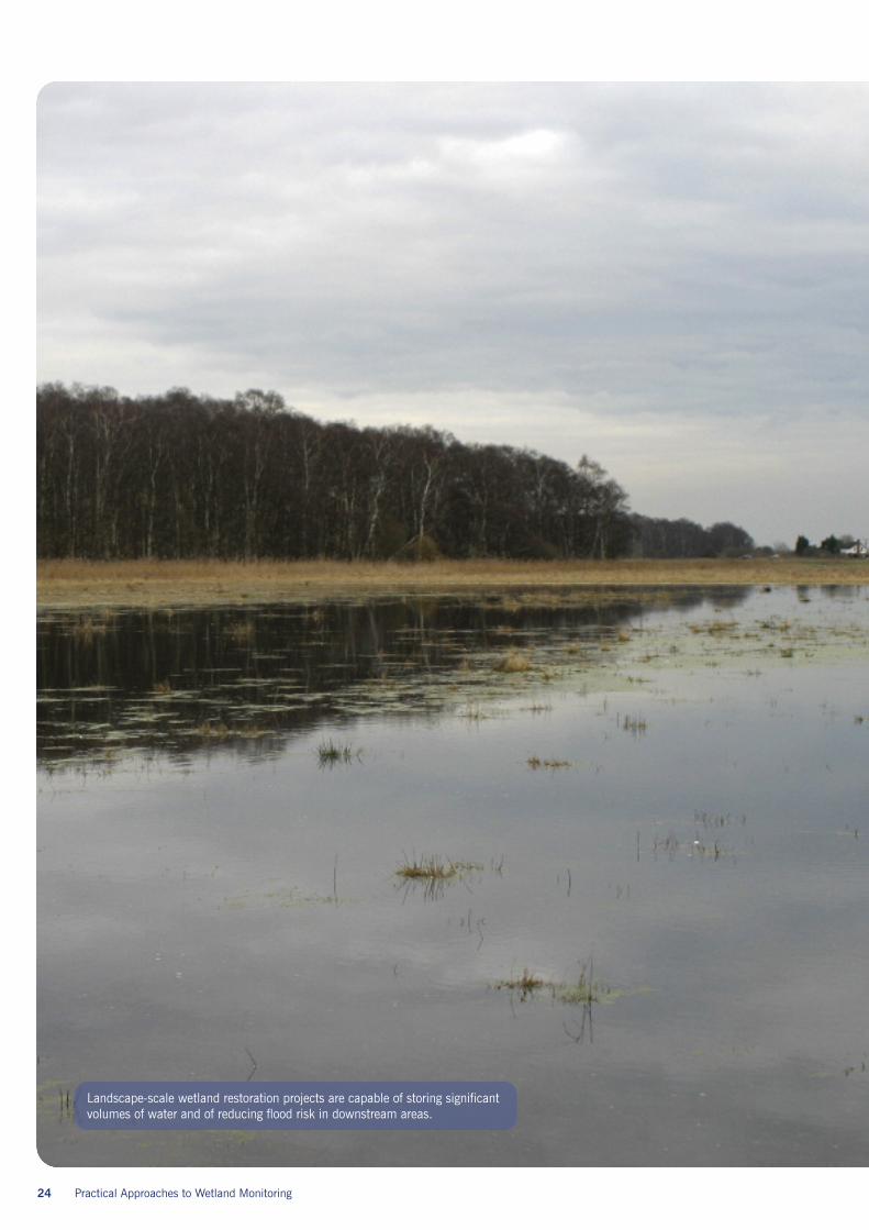
Landscape-scale wetland restoration projects are capable of storing significantvolumes of water and of reducing flood risk in downstream areas.
7.1 What are ecosystemservices?Ecosystem services can broadly be describedas the benefits that people get fromecosystems. More specifically, they areservices that a natural ecosystem can providebut which can be assigned a value, forexample an economic value or a value interms of human well-being. The concept isrelatively recent and the development of waysto measure and value ecosystem servicesis a rapidly growing field of research andapplication. There is a particular interestin how areas designated as priority areasfor nature conservation, such as wetlandnature reserves, can have their value betteracknowledged in decision-making. A widelyused classification of the particular ecosystemservices that wetlands can provide are givenin the Millennium Ecosystem Assessment andlisted in the table 2 below1
In this guideline document we will brieflyexplore direct and indirect ways of measuringecosystem services that landscape-scaleprojects can provide.
Any wetland restoration project may becapable of providing some of the ecosystemservices listed above, but a landscape-scalewetland restoration project will have a bettercapacity to provide ‘regulating’ and ‘supporting’services than a small restoration project. Manyregulating services are linked to hydrologicalpathways through the landscape and the largerthe area over which they take place the greaterthe potential for providing the service. Thelarge size of landscape-scale wetlandrestoration projects gives them a high potentialcapacity to store flood water and reduce floodrisk, and to accumulate organic matter andtherefore be a sink for greenhouse gases,though the latter is dependent on the amountand permanency of waterlogged land.
Practical Approaches to Wetland Monitoring 25
Section 7:Can we monitorecosystem services?
Table 2. Ecosystem services provided by wetlands1
26 Practical Approaches to Wetland Monitoring
7.2 Direct measurements ofecosystem servicesMeasuring and putting a value on ecosystemservices is difficult. The hydrologicalmeasurements detailed in section 3can contribute to measuring the physicalcapacity to provide some services relatedto hydrological function. Some examplesincorporating these and other measurementsare listed here:
• Knowing where water tables lie allowscalculation of remaining capacity to takeflood water at different times in the year.
• Knowing for how long water sits at thesurface of a wetland gives some indicationof its capacity to contribute to aquiferrecharge though this is one of the hardestareas to quantify.
• Knowing how dry or how waterlogged soilsare at different times of the year can feedinto numerical models for calculating thecapacity for carbon to be conserved oreven sequestered across the site.
• Measurement of visitor numbers and visitoractivities can begin to express the value ofthe site in terms of cultural services.
• Plants support invertebrates that pollinateagricultural crops. Measuring the presenceand abundance of plant species across asite can help calculate the contributionthat a site makes to essential pollinationservices.
7.3 Indirect measurementsof ecosystem servicesAlthough it is very useful to be able toquantify these ecosystem services, it isalso useful to find ways of expressing theseecosystem services in terms of the value thatpeople get from them2. Approaches to thisare still being developed but it is possible toenvisage, for example, expressing the amountof flood water that can be stored at alandscape-scale wetland restoration site interms of the number of houses not flooded asa result of that water storage. In other words,converting the physical service into its valueor benefit to people, can be used either indeveloping policies or in helping stakeholdersto see the benefits of a landscape-scaleproject area.
The biggest constraint to this process at thepresent time is the lack of reliable methodsfor attaching values to many ecosystemservices. However, when setting up amonitoring programme for a landscape-scalerestoration project it is useful to considerwhether data collected about differentbiological and physical processes on the sitecan also contribute to measuring and valuingecosystem services.
Section 8:Monitoring local supportand concerns
Practical Approaches to Wetland Monitoring 27
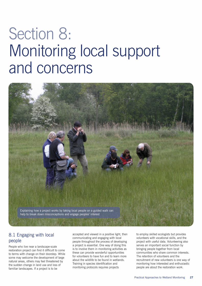
8.1 Engaging with localpeoplePeople who live near a landscape-scalerestoration project can find it difficult to cometo terms with change on their doorstep. Whilesome may welcome the development of largenatural areas, others may feel threatened bythe sudden change in land use and loss offamiliar landscapes. If a project is to be
accepted and viewed in a positive light, thencommunicating and engaging with localpeople throughout the process of developinga project is essential. One way of doing thisis to involve them in monitoring activities asthese can provide wonderful opportunitiesfor volunteers to have fun and to learn moreabout the wildlife to be found in wetlands.Training in species identification andmonitoring protocols requires projects
to employ skilled ecologists but providesvolunteers with vocational skills, and theproject with useful data. Volunteering alsoserves an important social function bybringing people together from localcommunities who share common interests.The retention of volunteers and therecruitment of new volunteers is one way ofmonitoring how interested and enthusiasticpeople are about the restoration work.
Explaining how a project works by taking local people on a guided walk canhelp to break down misconceptions and engage peoples’ interest
28 Practical Approaches to Wetland Monitoring
Practical Approaches to Wetland Monitoring 29
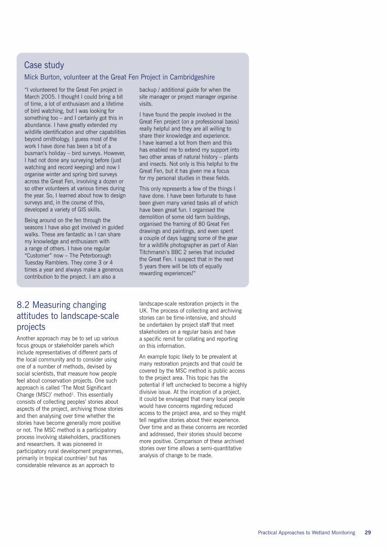
Case studyMick Burton, volunteer at the Great Fen Project in Cambridgeshire
“I volunteered for the Great Fen project inMarch 2005. I thought I could bring a bitof time, a lot of enthusiasm and a lifetimeof bird watching, but I was looking forsomething too – and I certainly got this inabundance. I have greatly extended mywildlife identification and other capabilitiesbeyond ornithology. I guess most of thework I have done has been a bit of abusman’s holiday – bird surveys. However,I had not done any surveying before (justwatching and record keeping) and now Iorganise winter and spring bird surveysacross the Great Fen, involving a dozen orso other volunteers at various times duringthe year. So, I learned about how to designsurveys and, in the course of this,developed a variety of GIS skills.
Being around on the fen through theseasons I have also got involved in guidedwalks. These are fantastic as I can sharemy knowledge and enthusiasm witha range of others. I have one regular“Customer” now – The PeterboroughTuesday Ramblers. They come 3 or 4times a year and always make a generouscontribution to the project. I am also a
backup / additional guide for when thesite manager or project manager organisevisits.
I have found the people involved in theGreat Fen project (on a professional basis)really helpful and they are all willing toshare their knowledge and experience.I have learned a lot from them and thishas enabled me to extend my support intotwo other areas of natural history – plantsand insects. Not only is this helpful to theGreat Fen, but it has given me a focusfor my personal studies in these fields.
This only represents a few of the things Ihave done. I have been fortunate to havebeen given many varied tasks all of whichhave been great fun. I organised thedemolition of some old farm buildings,organised the framing of 80 Great Fendrawings and paintings, and even spenta couple of days lugging some of the gearfor a wildlife photographer as part of AlanTitchmarsh’s BBC 2 series that includedthe Great Fen. I suspect that in the next5 years there will be lots of equallyrewarding experiences!”
8.2 Measuring changingattitudes to landscape-scaleprojectsAnother approach may be to set up variousfocus groups or stakeholder panels whichinclude representatives of different parts ofthe local community and to consider usingone of a number of methods, devised bysocial scientists, that measure how peoplefeel about conservation projects. One suchapproach is called ‘The Most SignificantChange (MSC)’ method1. This essentiallyconsists of collecting peoples’ stories aboutaspects of the project, archiving those storiesand then analysing over time whether thestories have become generally more positiveor not. The MSC method is a participatoryprocess involving stakeholders, practitionersand researchers. It was pioneered inparticipatory rural development programmes,primarily in tropical countries2 but hasconsiderable relevance as an approach to
landscape-scale restoration projects in theUK. The process of collecting and archivingstories can be time-intensive, and shouldbe undertaken by project staff that meetstakeholders on a regular basis and havea specific remit for collating and reportingon this information.
An example topic likely to be prevalent atmany restoration projects and that could becovered by the MSC method is public accessto the project area. This topic has thepotential if left unchecked to become a highlydivisive issue. At the inception of a project,it could be envisaged that many local peoplewould have concerns regarding reducedaccess to the project area, and so they mighttell negative stories about their experience.Over time and as these concerns are recordedand addressed, their stories should becomemore positive. Comparison of these archivedstories over time allows a semi-quantitativeanalysis of change to be made.
30 Practical Approaches to Wetland Monitoring
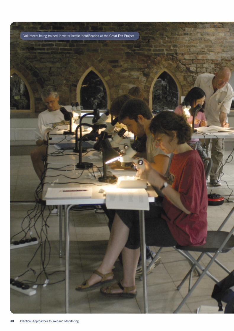
Volunteers being trained in water beetle identification at the Great Fen Project
Practical Approaches to Wetland Monitoring 31
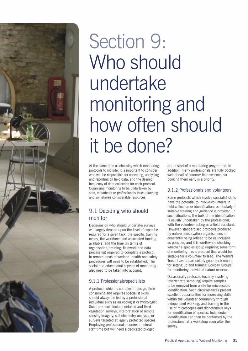
At the same time as choosing which monitoringprotocols to include, it is important to considerwho will be responsible for collecting, analysingand reporting on field data, and the desiredfrequency of data collection for each protocol.Organising monitoring to be undertaken bystaff, volunteers or professionals takes planningand sometimes considerable resources.
9.1 Deciding who shouldmonitorDecisions on who should undertake surveyswill largely depend upon the level of expertiserequired for a given task, the specific trainingneeds, the workforce and associated fundingavailable, and the time (in terms oforganisation, training, fieldwork and dataprocessing) required to complete a protocol.In remote areas of wetland, health and safetyprocedures will need to be established. Thesocial and educational aspects of monitoringalso need to be taken into account.
9.1.1 Professionals/specialists
A protocol which is complex in design, timeconsuming and requires specialist skillsshould always be led by a professionalindividual such as an ecologist or hydrologist.Such protocols include detailed and fixedvegetation surveys, interpretation of remotesensing imagery, soil chemistry analysis, orsurveys targeted at legally protected species.Employing professionals requires minimalstaff time but will need a dedicated budget
at the start of a monitoring programme. Inaddition, many professionals are fully bookedwell ahead of summer field seasons, sobooking them early is a priority.
9.1.2 Professionals and volunteers
Some protocols which involve specialist skillshave the potential to involve volunteers infield collection or identification, particularly ifsuitable training and guidance is provided. Insuch situations, the bulk of the identificationis usually undertaken by the professional,with the volunteer acting as a field assistant.However, standardised protocols producedby nature conservation organisations areconstantly being refined to be as inclusiveas possible, and it is worthwhile checkingwhether a species group requiring some formof monitoring has a protocol that would besuitable for a volunteer to lead. The WildlifeTrusts have a particularly good track recordfor setting up and training ‘Ecology Groups’for monitoring individual nature reserves.
Occasionally protocols (usually involvinginvertebrate sampling) require samplesto be removed from a site for microscopicidentification. Such circumstances presentexcellent opportunities for increasing skillswithin the volunteer community throughindependent working, and training in theuse of microscopes and dichotomous keysfor identification of species. Independentidentification can then be confirmed by theprofessional at a workshop soon after thesurvey.
Section 9:Who shouldundertakemonitoring andhow often shouldit be done?

32 Practical Approaches to Wetland Monitoring
Practical surveys which combine the skills ofprofessionals and volunteers often result in ahigh volunteer retention rate for future years.This relationship is particularly popular withvolunteers who are interested in learning moreabout the flora and fauna of their local area,and wish to be involved in broad scalesurveys. Whilst these protocols can beexpensive options to implement and maintain(provision of field equipment/microscopes,plant keys, travel & subsistence payments, etc+ payment of professionals), they do presentmany positive outcomes for a project byproviding practical and transferable skills,building a skilled and socially active volunteernetwork, and creating a positive image of therestoration project.
9.1.3 Volunteers
The level of expertise and experience thatvolunteers bring to a monitoring programmecan often be underestimated. Some will havejust graduated with environmental degreesseeking practical skills, a few may be retiredecologists, many will be enthusiastic amateurnaturalists, and others will have worked ina job sector which provides valuableorganisational, financial or analytical skills.
Choosing which protocols volunteers areinvolved in will, to a large extent, dependupon their background and experience. Oncethis is established, and after an initial periodof training in which a methodology is clearlyexplained and practically demonstrated,volunteers may be given primary responsibilityfor the collection of data for numerousprotocols, including broad scale monitoringof vegetation, bird surveys, repeated collectionof water level measurements, carefullytailored mammal surveys, etc.
It is advisable to explain the thinking behindlandscape-scale conservation and teach abasic understanding of wetland ecology toput tasks into context, but narrowing themeasurements volunteers are asked to takeis a key factor in obtaining usable data andholding the interest of the volunteer.
Lone working is not advisable for severalreasons, the most important being health andsafety, social inclusion, and practical support.
Birdwatching is an extremely popularpastime, with recent figures from theRoyal Society for the Protection of Birds(RSPB) stating that approximately threemillion adults go birdwatching every yearin the UK. This popularity results in alarge and diverse pool of potentialvolunteers who are well trained in birdsong and visual identification. Utilisingthese local skills for wintering andbreeding bird surveys, and offeringsufficient training for volunteers to expandtheir skill base, provides useful data andalso encourages a sense of inclusion forpeople who live near to (and sometimeswithin) large wetland reserves.
9.1.4 School groups/student projects
Answering very specific questions requiresa level of detail and effort which sometimesfalls somewhere between volunteers andprofessionals. Undergraduate or post-graduatestudent projects can be especially useful inproviding this type of information, althoughclose supervision in the initial design stage isadvisable so that it best fits the needs of therestoration project.
The inclusion of school groups should beapproached more from an educationalstandpoint than one in which useful data iscollected. However, it is possible to set upmethodologies which produce basic datawhilst adhering to the National Curriculum.At the Wicken Fen Vision in Cambridgeshire,transects have been set up for school groupsto record fixed quadrats along a hydrologicalgradient. The survey requires close supervisionand expert botanical guidance, but providesthe school groups with an introduction to fieldmethodologies and species identification, andprovides the project with data on thevegetation of a chosen location.
9.2 Frequency and timing ofmonitoringCollecting information can become an addictivepursuit, sometimes resulting in huge quantitiesof data being accrued, but with no time toanalyse or act upon the information given bythe data. Working with landscape-scale projectsincreases this temptation for data collection, asthere are so many aspects of a wetland whichcould be monitored. It is, therefore, essentialthat the monitoring design includes the statedfrequency of repetition for each chosenmonitoring activity.
For features such as broad-scale vegetationpatterns, annual monitoring is not requiredas long-term trends and changes can bemeasured at less frequent intervals, overmany decades. Although it could be arguedthat the minutia will be missed, trying tocapture every twist and turn in a project’sevolution is expensive and unnecessary.Remote sensing techniques give valuableinsights into vegetation change at a landscapescale, but aerial surveys will probably only beappropriate once every five or more years dueto the flight costs and time involved in imageinterpretation.
Other monitoring activities do need tobe carried out annually and these requirenecessary professionals or volunteers andsometimes financial resources or specialistequipment to undertake repetition of theprotocol. For example, breeding and winteringbird monitoring in the UK often followsprotocols designed by the British Trust forOrnithology and requires annual surveys.Monitoring the impact of management onaquatic macrophytes may also require annualsurveys, but a limited timeframe can be setfor the completion of the survey, so that theresults of monitoring can be acted upon.
When initiating a wetland restoration project,the early stages of colonization are often themost important to monitor and can produceinteresting and unexpected results which caninform future decisions on wetland creationand land management activities1, 2.Annual surveys are more justified in thesecircumstances, but can cease or become lessfrequent after the first few years. Surveys canalways be re-visited in the future if moreinformation is required, or different questionsneed answering.
The timing of a survey, when repeated, shouldtry and keep to the same date and month inall future survey years. By doing this, youhelp to eliminate general biotic and abioticvariation within seasons. However, sometimesit is impossible to plan for events whichhappen within a wetland environment. Thearrival of a flagship species (for example apair of breeding common cranes) can creategreat excitement, and often demands thatresources are (at least temporarily) quicklydirected towards the monitoring of suchspecies. In such circumstances, a momentshould be taken to assess objectively what isrequired from the monitoring, as any changesin the methodology in future years willundermine the statistical analysis that canbe performed on the data.
Practical Approaches to Wetland Monitoring 33

34 Practical Approaches to Wetland Monitoring
Monitoring can be very expensive especially ifit entails buying technical equipment such asdata loggers for hydrological measurements.Two approaches that are often neglected forensuring funding for monitoring activities are:
a. To always include a monitoring componentin the budget at the time of land purchaseand
b. To set aside some funding out of eachfinancial year’s operating costs and put itinto a special-purpose monitoring fund forthe years in which costs will be incurred.
The following steps are recommended forcosting the monitoring work:
1. List all the monitoring activities that areconsidered desirable.
2. Find out if anyone else is alreadymonitoring any of the items on the list.For example, the Environment Agencysometimes has hydrological monitoringstations in a nearby location. It is worthtalking to local representatives of therelevant agencies to find out if there wouldbe any willingness on their part to addmonitoring equipment to an alreadyexisting monitoring system.
3. Divide the list into activities that need to becarried out by professional personnel whorequire payment and activities that can becarried out by competent volunteers.
4. Look at the list and decide if all theactivities are really necessary. This requiresconsiderable thought about why you wantparticular information and who is goingto use it and how it will be disseminated.It is easy to collect data because they areinteresting but unless they also tell youwhat you would like to know about thedevelopment of the project it is worthbeing conservative with the length of yourwish list!
5. Long-term projects do not generally needall monitoring activities carried out everyyear so be strict about deciding onmonitoring intervals for differentmonitoring activities. For example, inSection 6 it was explained that monitoringof soil chemistry was not necessary everyyear and that for a project on a large scalewith many different soils, monitoringsoluble phosphorus every 5 years can tellyou as much as you need to know aboutchanges taking place. Spreading the costsacross years is a good way of keepingannual expenditure to a minimum.
6. Find out what sources of external fundingexist for monitoring activities and enlist thehelp of relevant professionals to preparefunding applications.
Practical Approaches to Wetland Monitoring 35
Section 10:Funding monitoring
36 Practical Approaches to Wetland Monitoring
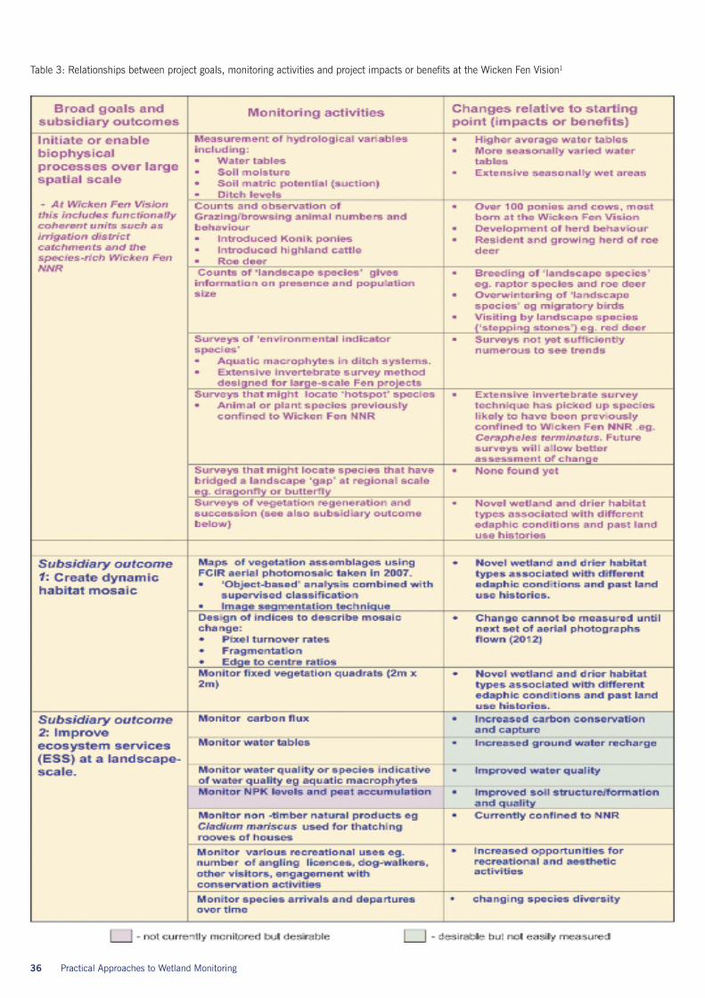
Table 3: Relationships between project goals, monitoring activities and project impacts or benefits at the Wicken Fen Vision1
If a restoration project has fixed targets forthe presence of specific flora and fauna, thenevaluation can be as simple as recordingnumber of species or extent of habitat, andthen assessing actual gain or loss betweenrecording periods. Because many landscape-scale restoration projects have as their mainaims the development of connections throughthe landscape and the promotion naturalprocesses as facilitators of landscape change,it is not possible to evaluate such projectsagainst any set species or habitat targets.However, project managers need the resultsof monitoring to make decisions on thecontinuing development of the landscapeand some form of evaluation can be usefulin creating a positive attitude
towards the project from a wide rangeof potentially sceptical stakeholders. It issuggested here that open-ended projectsshould use terms such as ‘measuring thebenefits’ or ‘impacts’ or ‘examining theconsequences of intervention’ in theirevaluation rather than invent indicatorsof success.
If a project’s starting point is ecologicallyhighly impoverished, then any recordedspecies gain might strictly speaking beconsidered a benefit. In evaluating projectoutcomes, highly variable biodiversity gainscan be expected through time, though thisis likely to be particularly marked in the firstdecades of the project. For example, whilebirds may initially exploit areas of a newly
formed marginal wetland, it may take a lotlonger to acquire the diverse soil invertebratefauna on which these bird species rely overthe long term. Similarly, vegetation resemblingspecies-poor wet grassland may form fairlyrapidly adjacent to this wetland but mighttake many decades to acquire higher diversityas this is dependent on the arrival andestablishment of plant propagules and oftenon lower levels of soil fertility which can takea long time to drop. Evaluation thus becomesa long-term process with a fairly relaxedrelationship between monitoring informationand management. Relationships betweenproject goals, monitoring activities andproject impacts at the Wicken Fen Vision inCambridgeshire are given in Table 3 (left).
Practical Approaches to Wetland Monitoring 37
Section 11:Project evaluation
38 Practical Approaches to Wetland Monitoring
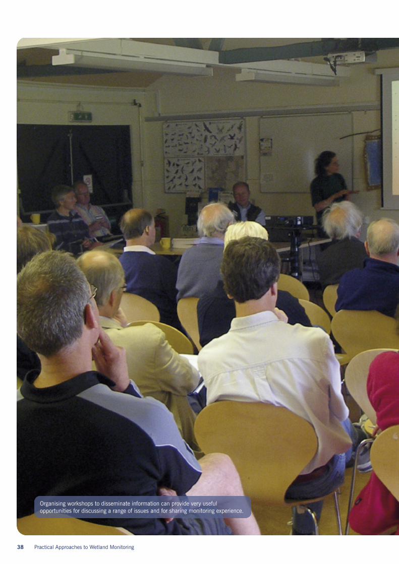
Organising workshops to disseminate information can provide very usefulopportunities for discussing a range of issues and for sharing monitoring experience.
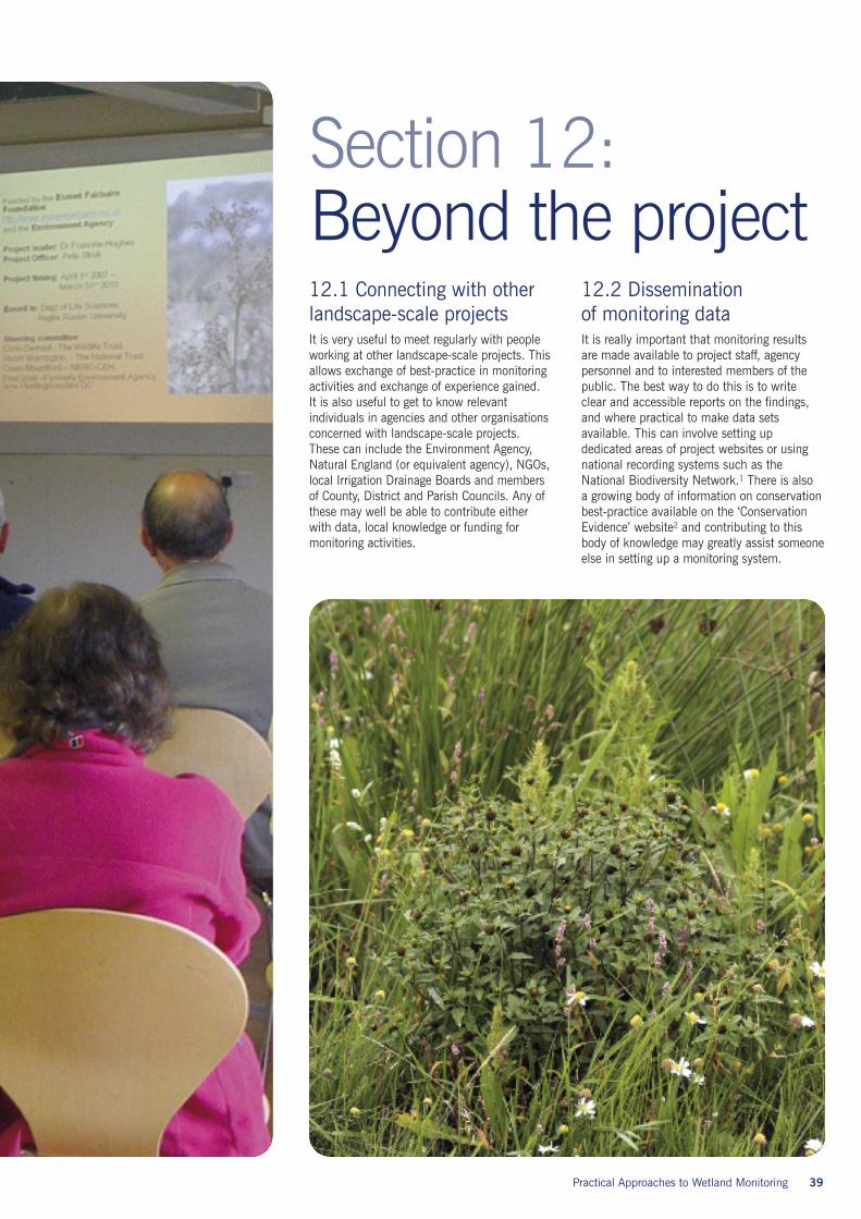
12.1 Connecting with otherlandscape-scale projectsIt is very useful to meet regularly with peopleworking at other landscape-scale projects. Thisallows exchange of best-practice in monitoringactivities and exchange of experience gained.It is also useful to get to know relevantindividuals in agencies and other organisationsconcerned with landscape-scale projects.These can include the Environment Agency,Natural England (or equivalent agency), NGOs,local Irrigation Drainage Boards and membersof County, District and Parish Councils. Any ofthese may well be able to contribute eitherwith data, local knowledge or funding formonitoring activities.
12.2 Disseminationof monitoring dataIt is really important that monitoring resultsare made available to project staff, agencypersonnel and to interested members of thepublic. The best way to do this is to writeclear and accessible reports on the findings,and where practical to make data setsavailable. This can involve setting updedicated areas of project websites or usingnational recording systems such as theNational Biodiversity Network.1 There is alsoa growing body of information on conservationbest-practice available on the ‘ConservationEvidence’ website2 and contributing to thisbody of knowledge may greatly assist someoneelse in setting up a monitoring system.
Practical Approaches to Wetland Monitoring 39
Section 12:Beyond the project

40 Practical Approaches to Wetland Monitoring
Section 1: Introduction to landscape-scale projects1 Following Forman and Godron (1986)Landscape Ecology. New York, NY, John Wileyand Sonshttp://www.pdfgeni.com/book/Forman-Godron-1986-Landscape-ecology-pdf.html
Section 2: Why monitor landscape-scale projects?1 Hughes, F.M.R., Stroh, P.A., Adams, W.M.,Kirby, K.J., Mountford, J.O. and Warrington,S. Monitoring and evaluating landscape-scale,open-ended habitat creation projects: ajourney rather than a destination. Manuscriptsubmitted for publication.2 Hughes, F.M.R. (ed) (2003) The floodedforest: guidance for policy makers and rivermanagers in Europe on the restoration offloodplain forests. European Union-FLOBAR2,Department of Geography, University ofCambridge, Cambridge, UK.http://www.geog.cam.ac.uk/research/projects/flobar2/reports/final/flobar2.pdf
Section 3: What should be monitored?1 Leon A. Bennun (2001). Long-termmonitoring and the conservation of tropicalwetlands: high ideals and harsh realities.Hydrobiologia 458: 9–19, 2001http://www.springerlink.com/content/g402404102756137/2 Millennium Ecosystem Assessment, 2005.Ecosystems and human well-being: Wetlandsand Water Synthesis. World ResourcesInstitute, Washington, DC.http://www.millenniumassessment.org/documents/document.358.aspx.pdf
Section 4: Monitoring physicalprocesses1 McCartney, M. P., & de la Hera, A. (2004)Hydrological assessment for wetlandconservation at Wicken Fen. WetlandsEcology and Management 12:189-204.2 Soil maps can be obtained from LandIS,the Land Information System operated byCranfield Universityhttp://www.landis.org.uk/index.cfm
3 Food and Agriculture Organization of theUnited Nations (FAO)http://www.fao.org/biodiversity/ecosystems/bio-soils/en/4 Kratz, W., 1998. The bait-lamina test –general aspects, applications andperspectives. Environmental Science andPollution Research 5, 94–96.
Section 6: What species shouldwe monitor?1 The Drawdown Zone website:http://www.drawdownzone.eu/Drawdown_Zone_WebSite/Welcome.html2 Margaret Palmer, Martin Drake, NickStewart (2009). A manual for the surveyand evaluation of the aquatic plant andinvertebrate assemblages of ditches.Buglife Reporthttp://www.buglife.org.uk/Resources/Buglife/Documents/Ditch%20Manual%20Version%203.pdf3 Biggs, J., Fox, G., Whitfield, M. andWilliams,P., 1998. A Guide to the Methodsof the National Pond Survey. Oxford BrookesPond Action.4 Dr. Marian Yallop (2008). A Study of theDiatom Assemblages in Grazing MarshDitches: Application to Assessment ofEcological and Conservation Status Part 1:Gwent and Somerset Levels. BristolUniversity.http://www.buglife.org.uk/Resources/Buglife/Documents/Ditch%20Project%20-%20Diatom%20Report%202008.pdf5 Hill, M. O., Preston, C. D. & Roy, D. B.(2004). PLANTATT. Attributes of British andIrish Plants: Status, Size, Life History,Geography and Habitats. NERC Centre forEcology and Hydrology. Abbots Ripton.http://www.ceh.ac.uk/products/publications/PLANTATT-AttributesofBritishandIrishPlantsStatusSizeLifeHistoryGeographyandHabitats.html6 Sanderson, E.W., Redford, K.H., Vedder, A.,Coppolillo, P.B., Ward, S.E., 2002. Aconceptual model for conservation planningbased on landscape species requirements.Landscape and Urban Planning 58, 41–56.
7 Pete Coppolillo, Humberto Gomez, FionaMaisels and Robert Wallace (2004). Selectioncriteria for suites of landscape species as abasis for site-based conservation. BiologicalConservation, Volume 115(3): 419-430http://www.sciencedirect.com/science?_ob=MImg&_imagekey=B6V5X-48WJPTC-1-8&_cdi=5798&_user=1004260&_pii=S0006320703001599&_orig=search&_coverDate=02%2F29%2F2004&_sk=998849996&view=c&wchp=dGLbVzb-zSkWz&md5=8d1ef989ccf773f5b880404223d7c353&ie=/sdarticle.pdf8 J.M. Amezaga, L. Santamaría & A.J. Green(2002) Biotic wetland connectivity –supporting a new approach for wetland policy.Acta Oecologica 23: 213–2229 Kevin Collier, Ude Shankar, Peter Smith(2004) Measuring stream networkconnectivity: how close is close enough?Water & Atmosphere 12(1): 14-1510 Image fromhttp://science.naturalis.nl/eisjubileum11 Peter Kirby (2009) Wicken Fen Visionand Great Fen invertebrate surveys availablefrom the National Trust at Wicken Fenor the Wildlife Trust for Bedfordshire,Cambridgeshire, Northamptonshire andPeterborough.12 Guidelines for designing mammalsurveillance schemes are freely available viaThe Tracking Mammals Partnership (TMP)website http://www.jncc.gov.uk/page-1757 .
Section 7: Can we monitor EcosystemServices?1 Millenium Ecosystem Assessment 2005.Ecosystems and Human well-being:Wetlands and Water. World ResourcesInstitute, Washington, DC.http://www.millenniumassessment.org/documents/document.358.aspx.pdf2 Springate-Baginski, O., Allen, D. andDarwall, W.R.T. (eds.) 2009. An IntegratedWetland Assessment Toolkit:a guide to goodpractice. Gland, Switzerland:IUCN andCambridge,UK:IUCN Species Programme.Xv+144p. www.iucn.org/species
Useful referencesand further reading

Section 8: Monitoring local supportand concerns1 Wilder, L. and M. Walpole. 2008?Measuring Social impacts in conservation:experience of using the ‘Most SignificantChange’ method in a project in Cambodia.Oryx 42(4):529-538.2 Davies, R. and Dart, J. (2005) The ‘MostSignificant Change’ (MSC) technique: A guideto its use.http://www.mande.co.uk/docs/MSCguide.htm
Section 9: Who should undertakemonitoring and how often?1 M. L. Yallop and M.J. O’Connell (2000).Wetland creation: early stages in colonizationof phytoplankton and submergedmacrophytes in hypereutrophic freshwaterlagoons. Aquatic Conserv: Mar. Freshw.Ecosyst. 10: 305–3092 M.L. Yallop, M.J. O’Connell and R. Bullock(2004). Waterbird herbivory on a newlycreated wetland complex: potentialimplications for site management and habitatcreation Wetlands Ecology and Management12: 395–408.
Section 11: Project evaluation1 Hughes, F.M.R., Stroh, P.A., Adams, W.M.,Kirby, K.J., Mountford, J.O. and Warrington,S. Monitoring and evaluating landscape-scale,open-ended habitat creation projects: ajourney rather than a destination. Manuscriptsubmitted for publication.
Section 12: Beyond the project1 NBN Gateway http://www.searchnbn.net/2 There are several conservation-evidencewebsites. The Conservation Evidence website(based at the University of Cambridge and theUniversity of East Anglia) can be found athttp://www.conservationevidence.com/ andanother similar initiative called the Centre forEvidence-Based Conservation (CEBC) basedat the University of Bangorhttp://www.cebc.bangor.ac.uk/index.php.en?menu=0&catid=0 and its associatedinternational partner websitehttp://www.environmentalevidence.org/index.htm
Practical Approaches to Wetland Monitoring 41
42 Practical Approaches to Wetland Monitoring
We would like to thank a great numberof individuals and organisations that havecontributed materially or intellectually to ourwork on monitoring landscape-scale projectsin the fenlands of East Anglia and to thedevelopment of this guideline document.
The first 6 years (2007–2012) of monitoringat the Wicken Fen Vision and at the Great Fenhave been funded by the Esmée FairbairnFoundation (Grant numbers 06-2151 & 09-2739), with contributions from theEnvironment Agency and Anglia RuskinUniversity. We are greatly indebted to theseorganisations for their generous support. Weare also indebted to National Trust staff atWicken Fen and to the Natural England andWildlife Trust Staff at Great Fen for providingconsiderable logistical and moral support. Tothe members of our steering group committee,listed at the front of the document, we areindebted for lively discussions, intellectualinput and frequent reminders of thepracticalities of managing landscape-scalerestoration projects!
This document draws on our collectivethinking over a number of years but has alsobeen influenced by contributors to a workshoporganised to explore ways to monitor andevaluate open-ended habitat creation projects,held at Wicken Fen, Cambridgeshire, UK inNovember 2009. We would like to thankeveryone who came and contributed to thisworkshop including:
Bill Adams (University of Cambridge),Malcolm Ausden (RSPB), Peter Bircham(University of Cambridge), Jennie Blood-Smyth (Volunteer Wicken Fen), Alan Bowley(Natural England), Richard Bradbury (RSPB),Philip Broadbent-Yale (National Trust),Alastair Burn (Natural England), CharlieBurrell (Knepp Wildland Project), MickBurton (Volunteer Great Fen), Peter Carey(Independent Consultant), Iain Diack (NaturalEngland), Chris Gerrard (Wildlife Trust),Simon Goodson (Wildlife Trust), DavidGowing (Open University), Matt Heard (CEHWallingford), Keith Kirby (Natural England),Peter Kirby (Independent invertebrateconsultant), Martin Lester (National Trust),Blaise Martay (Anglia Ruskin University),Nick McWilliam (Oryx Mapping & AngliaRuskin University), Owen Mountford (CEH-Wallingford), Kathy Newman (VolunteerWicken Fen), Margaret Palmer (Buglife),Lorna Parker (Wildlife Trust), Lesley Saint(Environment Agency),Norman Sills (RSPB),Geoff Smith (Specto Natura), Chris Soans(National Trust), Jo Treweek (Independentenvironmental consultant), Stuart Warrrington(National Trust).
Photographs have been taken by Bill Adams,Francine Hughes, Riamsara Knapp, RachelRees and Peter Stroh. The photograph ofCerapheles terminatus is by Roy Kleukers.Layout and design by Deb Tyrrell (CorporateMarketing, Anglia Ruskin University). Art workby Phil Stickler (Department of Geography,University of Cambridge).
Acknowledgements
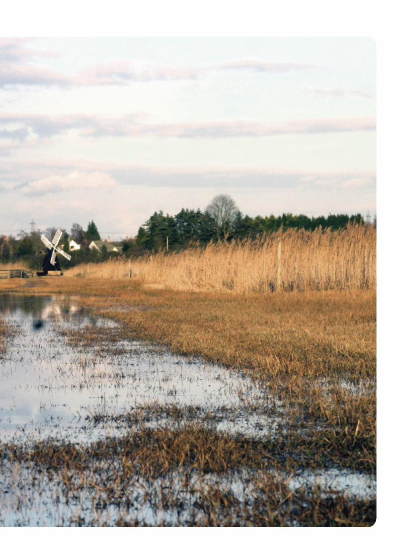

www.anglia.ac.uk
For further information contact:
Pete Stroh or Francine HughesDepartment of Life SciencesAnglia Ruskin UniversityEast RoadCambridgeCB1 1PT
Call: 0845 196 2606 / 2607Click: www.anglia.ac.uk/lifesciencesEmail: [email protected] [email protected]
Corp
orat
eM
arke
ting
4755
/10.
10/D
T