application of sequence stratigraphic techniques on the non- marine
TRANSCRIPT
GeoL. Soc. MaLaYdia, BuLLetin 56, December 1994; pp. 105-117
Application of sequence stratigraphic techniques on the nonmarine sequences: An example from the Balingian Province,
Sarawak
ISMAIL eRE MAT ZIN AND JAAFAR SIPAN
PETRONAS Carigali Sdn. Bhd. Wisma Peladang, Jalan Bukit Bintang
P.O. Box 12407 50776 Kuala Lumpur
Abstract: The Oligocene to Early Miocene sediments penetrated by several wells in the onshore Balingian and also outcropping in the area were deposited in predominantly Lower Coastal Plain environment of deposition. Based on the present stratigraphic framework, whereby the Tertiary sediments in the Sarawak Basin were subdivided into seven (7) sedimentary cycles, these sediments are of age equivalent to the Cycle I and II.
By applying the sequence stratigraphic techniques, the Cycle I sediments in the area, can be subdivided into several sequences. In brief, the sequence stratigraphic technique subdivides the sedimentary succession into the smallest unit of lamina to the highest hierarchy called sequence. The sequence is defined as a relatively conformable succession of genetically related strata bounded by unconformities or their correlative conformities. The sequence can be further subdivided into system tracts based on objective criteria including types of bounding surfaces and the position within the sequence.
The established sequence boundaries which provide the basis for the regional mapping and well correlation, helped in the understanding of the depositional setting and reservoir distribution for the non-marine sequences.
INTRODUCTION
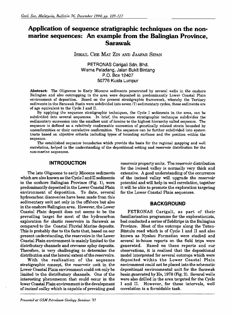
The late Oligocene to early Miocene sediments which are also known as the Cycle I and II sediments in the onshore Balingian Province (Fig. 1), were predominantly deposited in the Lower Coastal Plain environment of deposition. To date, several hydrocarbon discoveries have been made from this sedimentary unit not only in the offshore but also in the onshore Balingian area. However, the Lower Coastal Plain deposit does not seems to be the prevailing target for most of the hydrocarbon exploration for clastic reservoirs in Sarawak as compared to the Coastal Fluvial Marine deposits. This is probably due to the facts that, based on our present understanding, the reservoirs in the Lower Coastal Plain environment is mainly limited to the distributary channels and crevasse splay deposits. Therefore, is very challenging to determine the distribution and the lateral extent of the reservoirs.
With the realisation of the sequence stratigraphic concept, the reservoir unit in the Lower Coastal Plain environment could not only be limited to the distributary channels. One of the interesting phenomenon that could occur in the lower Coastal Plain environment is the development of incised valley which is capable of providing good
PreJented at GSM PetroLeum Geology Seminar '93
reservoir property units. The reservoir distribution for the incised valley is normally very thick and extensive. A good understanding ofthe occurrence of the incised valley will upgrade the reservoir potential and will help in well correlation, together it will be able to promote the exploration targeting for the Lower Coastal Plain sequences.
BACKGROUND
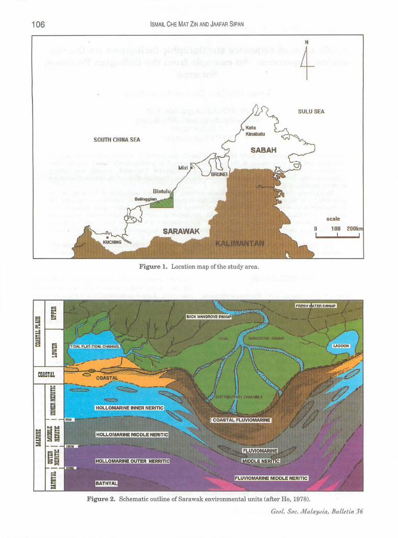
PETRONAS Carigali, as part of their familiarisation programme for the explorationists, had conducted a series offieldtrips in the Balingian Province. Most of the outcrops along the TatauBintulu road which is of Cycle I and II and also known as Nyalau Formation were studied and several in-house reports on the field trips were generated. Based on these reports and our observations, it is realised that the depositional model interpreted for several outcrops which were deposited within the Lower Coastal Plain environment could not be placed into the schematic depositional environmental unit for the Sarawak basin generated by Ho, 1978 (Fig. 2). Several wells were also drilled in the area targeted for the Cycle I and II. However, for these intervals, well correlation is a formidable task.
106 ISMAIL CHE MAT ZIN AND JAAFAR SIPAN
N
+ SULU SEA
SOUTH CHINA SEA
scale
o 100
Figure 1. Location map of the study area.
Figure 2. Schematic outline of Sarawak environmental units (after Ho, 1978).
GeoL. Soc. Ma LaYcfia, BuLletin 36
ApPLICATION OF SEQUENCE STRATIGRAPHIC TECHNIQUES ON THE BALINGIAN PROVINCE 107
By applying the sequence stratigraphic techniques, the depositional models and the setting for several outcrops could be better understood. This paper will incorporate the outcrop examples of erosional unconformities and incised valley deposits, outcropping along the Tatau-Bintulu road and the well correlations for reservoir intervals which is of predominantly Lower Coastal Plain deposits. Further, the paper will discuss on the implication of future hydrocarbon exploration for the Balingian Province after realising the possible occurrence of good reservoir units in the Lower Coastal Plain environment.
STUDY CONCEPTS
Brief on the sequence stratigraphie principles
Based on the sequence stratigraphic concept, the sedimentary succession is subdivided into several strata units with lamina as the smallest unit and grading to sequence and sequence set. The lamina is defined as the smallest megascopic layer while the sequence is defined as a relatively conformable succession of genetically related strata bounded by unconformities and their correlative conformities (Augier, 1981).
The sequence can further be subdivided into several system tracts, namely high stand, lowstand, and regressive system tracts, based on the objective criteria including types of bounding surfaces, parasequence set distribution and position within the sequence (Wagoner, 1990).
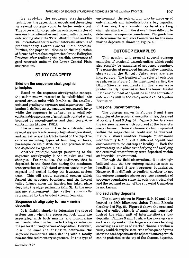
Another principle concept pertaining to the sequence stratigraphy is the relative sea-level changes. For instance, the sediment that is deposited in the shore face during the maximum transgression or highstand system tracts may be exposed and eroded during the lowstand system tract. This will create subaerial erosion which formed the sequence boundary, and the incised valley fotmed when the incision has taken place deep into the older sediments (Fig. 3). In the nonmarine environment, this valley is normally represented by the braided stream complex.
Sequence stratigraphy for non-marine deposits
It is slightly simpler to determine the type of system tract when the preserved rock units are associated with both marine and non-marine sediments, which in turn reflect a big variation in the sea level during the time of deposition. However, it will be more challenging to determine the sequence boundaries when dealing with a totally non-marine sedimentary sequences. In this type of
December 1994
environment, the rock column may be made up of only channels and interdistributary bay deposits. Furthermore, the channels may be of stacking channels which will make it even more difficult to determine the sequence boundaries. The guide line to determine the sequence boundaries for the nonmarine deposits is shown in Figure 4.
OUTCROP EXAMPLES
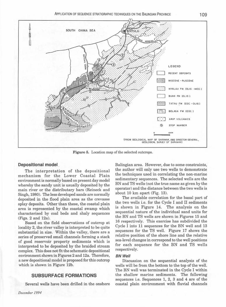
This section will present several outcrop examples of erosional unconformities which could also possibly be examples of sequence boundary. The examples of preserved incised valley deposits, observed in the Bintulu-Tatau area are also incorporated. The location of the selected outcrops are shown in Figure 5. As mentioned earlier, the Oligo-Miocene sediments in the area were predominantly deposited within the lower Coastal Plain environment of deposition and the equivalent outcropping unit in the study area is called Nyalau Formation.
Erosional unconformities The outcrops shown in Figures 6 and 7 are
examples of the erosional unconformities, observed at locality 1 and 3 (Fig. 5). Figure 6 clearly shows the incision nature which occurred at the base of a mega channel. Several channels which deposited within the mega channel could also be observed. Figure 7 shows another example of erosional unconformity but it is of a different depositional environment to the outcrop at locality 1. Both the sedimentary unit which is underlying and overlying the erosional unconformity were deposited within an intertidal environment.
Through the field observations, it is strongly believed that the two outcrop examples seen at localities 1 and 2 are sequence boundaries. However, it is difficult to confirm whether or not the outcrop examples shown are true examples of sequence boundaries since the outcrops are isolated and the regional extent of the subaerial truncation is not known.
Incised valley depOSits The outcrop shown in Figure 8, 9,10 and 11 is
located at 28th kilometre, Jalan Tatau, Bintulu (locality 2 of Fig. 5). Figure 8 shows the erosional base of a valley which is of sandy unit truncated! incised the older unit of interdistributary bay deposits. Figures 9 and 10 show the close up view on the sandy units. The large scale cross bedding occurring as a series of stacked channels within a valley could clearly be seen. The subsequent figures show the coal deposits on the adjacent outcrop which can be projected to the top of the channel deposits.
LowStand SystemTrad
ApPLICATION OF SEQUENCE STRATIGRAPHIC TECHNIQUES ON THE BALING IAN PROVINCE 109
! SOUTH CHINA SEA
. .... / .. . ... . ~ ... . .
~ ~
o t:::::::3
LEGEND
RECENT DEPOS4TS
MI OC ENE - PLI OCENE
NYALAU FM (DUG - MIOC I
BUAN FM (OLlG . )
TATAU FM (EOC -O LlG)
BELAGA FM (EOC . )
ARIP VOLC ANI CS
STOP NUMBER
(FROM GEOLOGICAL MAP OF S ARAWAK 1982 DIRECTOR GENERAL GEOLOG1CAL SURVEY OF' SARAWAK) ,
Figure 5. Location map of the selected outcrops.
Depositional model . The interpretation of the depositional
mechanism for the Lower Coastal Plain environment is normally based on present day model whereby the sandy unit is usually deposited by the main river or the distributary bars (Reineck and Singh, 1980). The less developed sands are normally deposited in the flood plain area as the crevasse splay deposits. Other than these, the coastal plain area is represented by the coastal swamp which characterised by coal beds and shaly sequences (Figs. 2 and 12a).
Based on the field observations of outcrop at locality 2, the river valley is interpreted to be quite substantial in size. Within the valley, there are a series of preserved small channels forming a stack of good reservoir property sediments which is interpreted to be deposited by the braided stream complex. This does not fit the schematic depositional environment shown in Figures 2 and 12a. Therefore, a new depositional model is proposed for this outcrop which is shown in Figure 12b.
SUBSURFACE FORMATIONS
Several wells have been drilled in the onshore
Balingian area. However, due to some constraints, the author will only use two wells to demonstrate the techniques used in correlating the non-marine sedimentary sequences. The selected wells are the BN and TS wells (not the true name as given by the operator) and the distance between the two wells is about 10 km apart (Fig. 13).
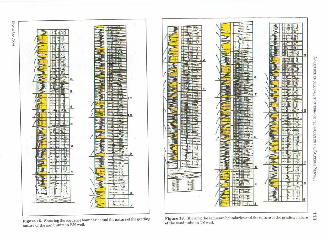
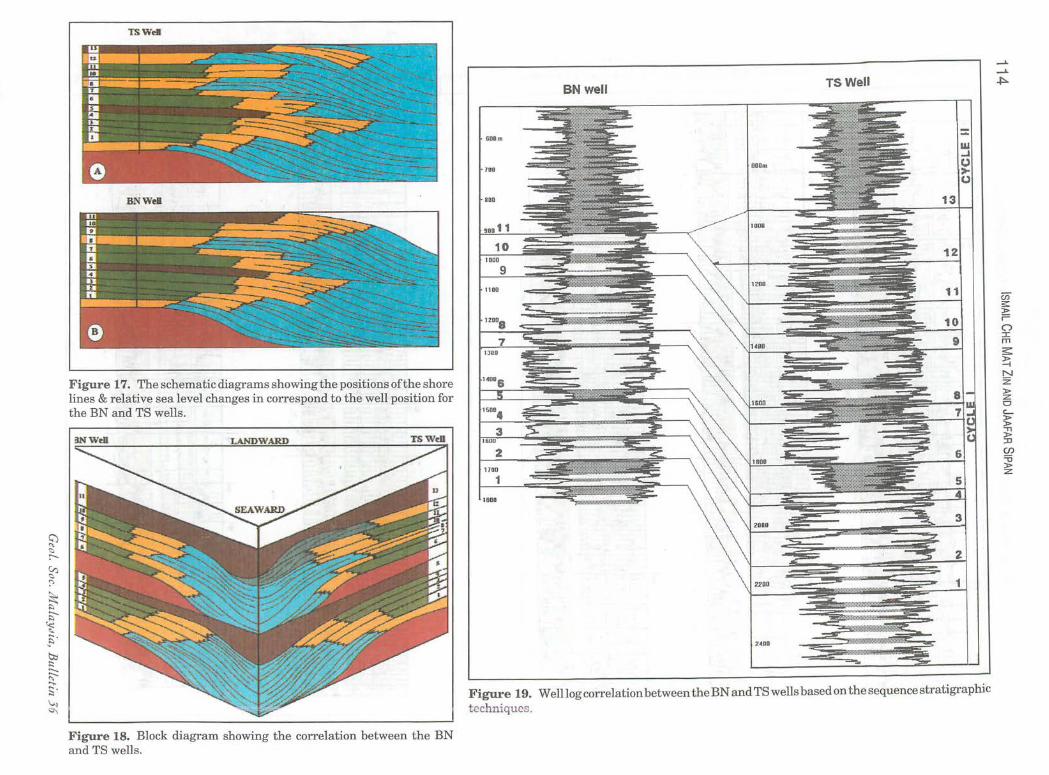
The available correlation for the basal part of the two wells i.e. for the Cycle I and II sediments is shown in Figure 14. The analysis on the sequential nature of the individual sand units for the BN and TS wells are shown in Figures 15 and 16 respectively. This exercise has subdivided the Cycle I into 11 sequences for the BN well and 13 sequences for the TS well. Figure 17 shows the relative position of the shore line and the relative sea-level changes in correspond to the well positions for each sequence for the BN and TS wells respectively.
BN Well Discussion on the sequential analysis of the
wells will be from the bottom to the top of the well. The BN well was terminated in the Cycle I within the shallow marine sediments. The following sequences i.e. Sequences 1, 2, 3 and 4 are of the coastal plain environment with fluvial channels
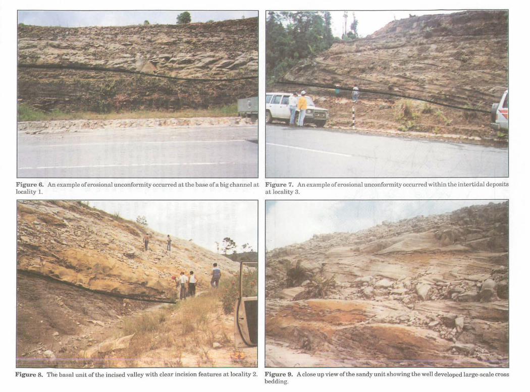
Figure 6. An example of erosional unconformity occurred at the base of a big channel at Figure 7. An example of erosional unconformity occurred within the intertidal deposits locality 1. at locality 3.
Figure 8. The basal unit of the incised valley with clear incision features at locality 2. Figure 9. A close up view ofthe sandy unit showing the well developed large-scale cross bedding.
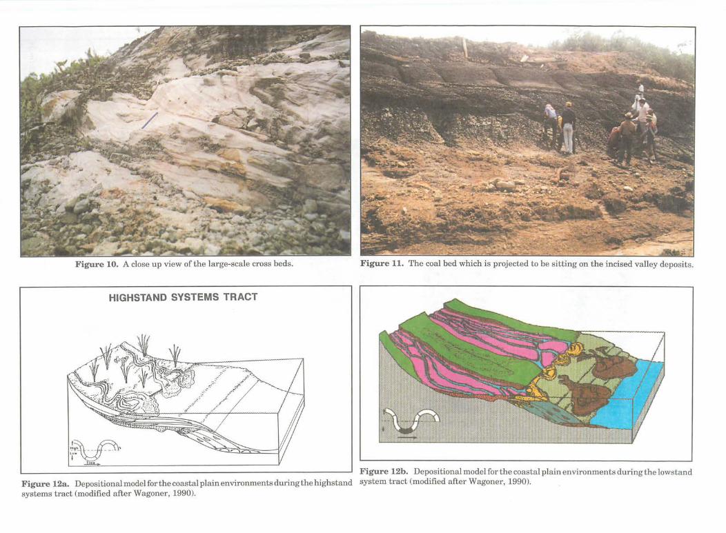
Figure 10. A close up view ofthe large-scale cross beds.
HIGHSTAND SYSTEMS TRACT
J.~ __ ~, 'I~ -Y
Figure 11. The coal bed which is projected to be sitting on the incised valley deposits.
Figure 12b. Depositional model for the coastal plain environments during the lowstand Figure 12a. Depositionalmodelforthecoastalplainenvironmentsduringthehighstand system tract (modified after Wagoner, 1990). systems tract (modified after Wagoner, 1990).
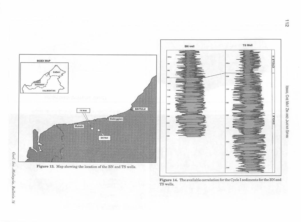
Figure 13. Map showing the location of the BN and TS wells.
BNwell TSWell
....
''''''
, ...
""
241 00
Figure 14. The available correlation for the Cycle I sediments for the BN and TS wells .
en s:: » ;= (") :c m s::: » -i N Z » :z CI c....
5: -n » :0 (J)
=0 » :z
b " " " ;3 <::--
" -.. ...... ~ ~
Figure 15. Showing the sequence boundaries and the nature of the grading nature of the sand units in BN well.
3
2
1
rilH
Figure 16. Showing the sequence boundaries and the nature ofthe grading nature of the sand units in TS well.
» "U "U , o ~ 6 z o "T1
en m o C m Z o m en -I :rJ
~ G5 :rJ }> "U ::r:: o -I m o ::r:: z (5 C m en o z -I ::r:: m OJ }> , Z Gl > Z
\J :rJ o < Z o m
.......
....... W
TSWeil
BNWei
Figure 17. The schematic diagrams showing the positions ofthe shore lines & relative sea level changes in correspond to the well position for the BN and TS wells.
Figure 18. Block diagram showing the correlation between the BN and TS wells.
BN well TS Well
Figure 19. Welllog correlation between the BN and TS wells based on the sequence stratigraphic tcchniqucs.
(Ji s: » r= o :I m ~ ~ N Z » z o "-~ ""T1 » ::IJ
en =0 » z
ApPLICATION OF SEQUENCE STRATIGRAPHIC TECHNIQUES ON THE BALING IAN PROVINCE 115 which are characterised by fining upward sand units. Sequence 5, represents a maximum transgressive with highstand system tract and this is characterised by the deposition of coal swamp deposits. A major lowstand system tract occurred at level 6 and resulted in the deposition of stacked channels with a total thickness of about 100 metres.
During the time of Sequence 8, the well bore position was located within the shallow marine environment while the Sequences 9 and 10 are of lower coastal plain deposits with fluvial influences. Another major episode of highstand/maximum transgressive occurred during the Sequence 11 time and it is represented by the coastal swamp deposits. This sequence demarked the base of Cycle II.
TS Well A similar nature of sedimentary succession can
be observed from the basal section of Cycle I sediments i.e. from the Sequence 1 till the Sequence 8 for both the TS and BN wells. From the Sequence 9 onward, the TS well showed the occurrence oftwo extra sequences which are not present in the BN well. This includes the eleventh and twelfth Sequences which is of a lower coastal plain and a shallow marine environments respectively.
TS WELL
WELL CORRELATIONS
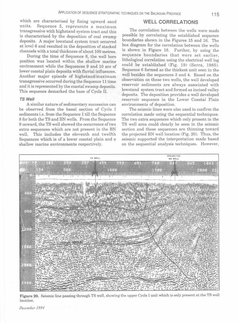
The correlation between the wells were made possible by correlating the established sequence boundaries shown in the Figures 15 and 16. The box diagram for the correlation between the wells is shown in Figure 18. Further, by using the sequence boundaries that were set earlier lithological correlation using the electrical welllo~ could be established (Fig. 19) (Serra, 1985). Sequence 6 formed as the thickest unit seen in the well besides the sequences 3 and 4. Based on the observation on these two wells, the well developed reservoir sediments are always associated with lowstand system tract and formed as incised valley deposits. The deposition provides a well developed reservoir sequence in the Lower Coastal Plain environments of deposition.
The seismic lines were also used to confirm the correlation made using the sequential techniques. The two extra sequences which only present in the TS well area could clearly be seen in the seismic section and these sequences are thinning toward the projected BN well location (Fig. 20). Thus, the seismic supported the interpretation made based on the sequential analysis techniques . However,
PROJECTED BN WELL
Figure 20. Seismic line passing through TS well, showing the upper Cycle I unit which is only present at the TS well location.
December 1994
116 ISMAIL CHE MAT ZIN AND JAAFAR SIPAN
SK I
SK2
SK4
.=te . tI'''''
Figure 21. Cycle I Paleofacies Map.
SK2
SK4
Figure 22. Cycle II Paleofacies Map.
.IJ)'fIR COAIITAl. PlAIRILCP) D OOAIITAL ICOL) . 1I0LllWARIRE INRCR KERlTIC(IIIK)
1I0lJ)WARIRE IIID11LE IWIme(HWK) .OARbCNATI
SRRRWR~ PRlEOFRCIES HRP CYCl E I
_awtM 6l1AflAl 1'Ulll(tu) D6B.UfA((fl!t.! .hljUj.~! IfiflU Uf~nff(H/~ "_"fIIf IfflHIU ",MNtO(HMII)
"6UlllAR11ft MI. HtIil1fc!(~ .6;J1Mf1Af1
PtTROHAS CARlOAU SDN BnD
SA RAWAK PALEOPACIES MAP eye!.! II
Ceo!. Soc. M aLaY.1ia, BuLLetin 3 6
ApPLICATION OF SEQUENCE STRATIGRAPHIC TECHNIQUES ON THE BALING IAN PROVINCE 117
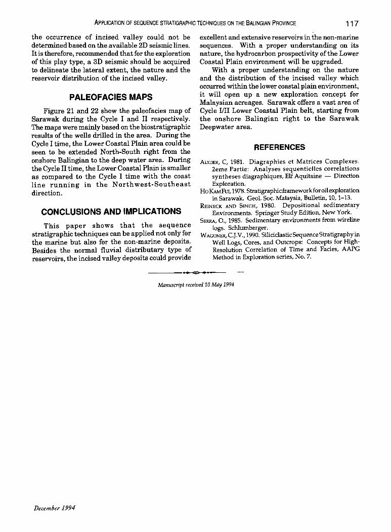
the occurrence of incised valley could not be determined based on the available 2D seismic lines. It is therefore, recommended that for the exploration of this play type, a 3D seismic should be acquired to delineate the lateral extent, the nature and the reservoir distribution of the incised valley.
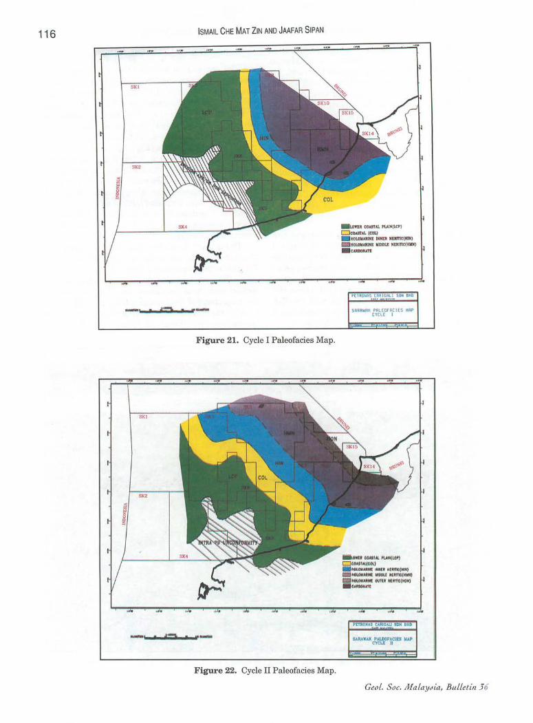
PALEOFACIES MAPS
Figure 21 and 22 show the paleofacies map of Sarawak. during the Cycle I and II respectively. The maps were mainly based on the biostratigraphic results of the wells drilled in the area. During the Cycle I time, the Lower Coastal Plain area could be seen to be extended North-South right from the onshore Balingian to the deep water area. During the Cycle II time, the Lower Coastal Plain is smaller as compared to the Cycle I time with the coast line running in the Northwest-Southeast direction.
CONCLUSIONS AND IMPLICATIONS
This paper shows that the sequence stratigraphic techniques can be applied not only for the marine but also for the non-marine deposits. Besides the normal fluvial distributary type of reservoirs, the incised valley deposits could provide
excellent and extensive reservoirs in the non-marine sequences. With a proper understanding on its nature, the hydrocarbon prospectivity ofthe Lower Coastal Plain environment will be upgraded.
With a proper understanding on the nature and the distribution of the incised valley which occurred within the lower coastal plain environment, it will open up a new exploration concept for Malaysian acreages. Sarawak offers a vast area of Cycle IIII Lower Coastal Plain belt, starting from the onshore Balingian right to the Sarawak Deepwater area.
REFERENCES
AUGIER, C, 1981. Diagraphies et Matrices Complexes. 2eme Partie: Analyses sequentielles correlations syntheses diagraphiques, Elf Aquitaine - Direction Exploration.
Ho I<AMFUl, 1978. Stratigraphic framework for oil exploration in Sarawak. Geol. Soc. Malaysia, Bulletin, 10, 1-13.
REINECK AND SINGH, 1980. Depositional sedimentary Environments. Springer Study Edition, New York.
SERRA, 0.,1985. Sedimentary environments from wireline logs. Schlumberger.
WAGONER, c.J.V., 1990. Siliciclastic Sequence Stratigraphy in Well Logs, Cores, and Outcrops: Concepts for HighResolution Correlation of Time and Facies, AAPG Method in Exploration series, No.7.
...... Manuscript received 10 May 1994
December 1994