alfred wegener & harry hess - big history project · brating his 50th birthday at the remote...
TRANSCRIPT
BIOGRAPHY
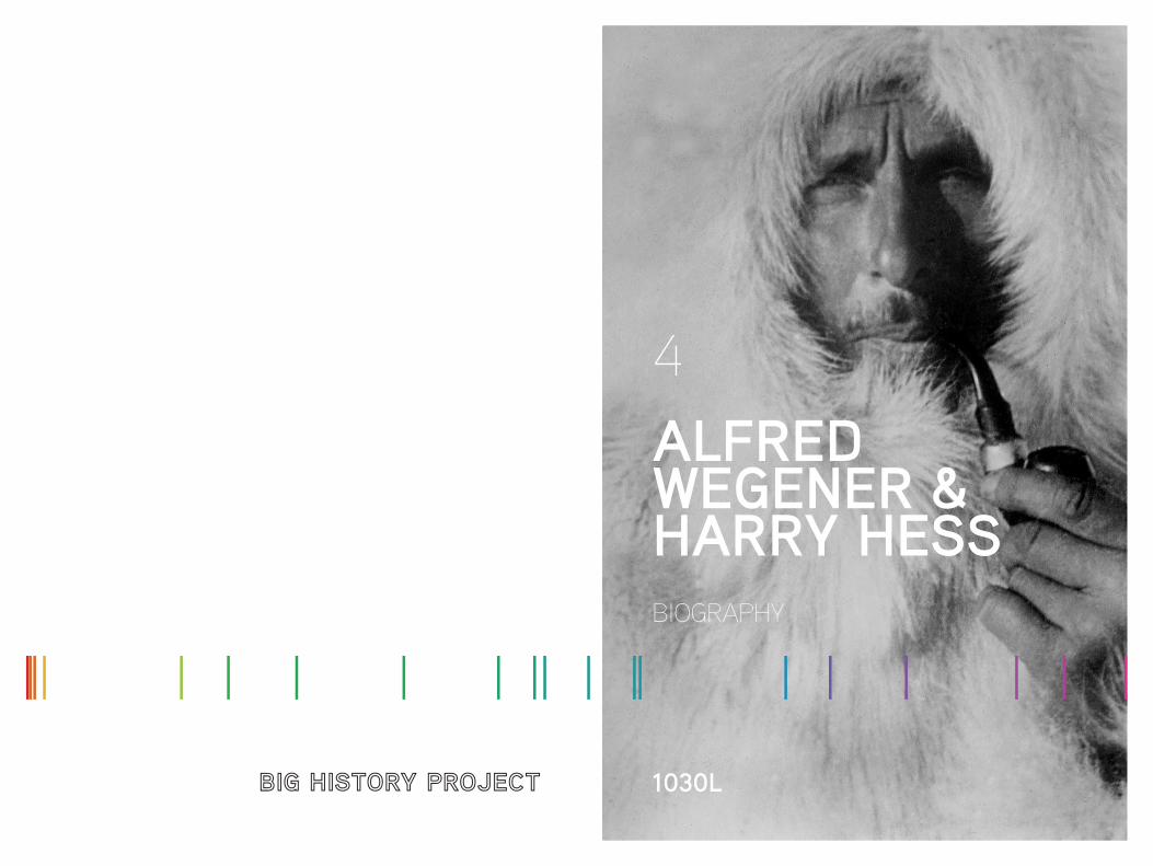
ALFRED WEGENER & HARRY HESS
4
1030L
By Cynthia Stokes Brown, adapted by Newsela
Alfred Wegner
BornNovember 1, 1880Berlin, Germany
DiedNovember 1930Clarinetania, Greenland
Harry Hammond Hess
BornMay 24, 1906New York, New York
DiedAugust 25, 1969Woods Hole, Massachusetts
CONTINENTS IN MOTION
ALFRED WEGENER & HARRY HESS
2 3
Alfred Wegener produced evidence in 1912 that the continents are in motion. But, because he could not explain what forces could move them, geologists rejected his ideas. Almost 50 years later, Harry Hess confirmed Wegener’s ideas by using the evidence of seafloor spreading to explain what moved the continents.
4 5
Balloons and Arctic airAlfred Lothar Wegener was born in Berlin, the son of a Protestant pastor. He received a PhD in astronomy from the University of Berlin in 1904. However, his real love was air balloons. He and his brother, Kurt, set the world’s record in April 1906 for the longest time spent aloft in a balloon — 52 hours.
Later that year, Wegener joined an expedition to Greenland to track polar air circulation, which could be done with the help of air balloons. He had always dreamed of polar exploration too. In 1908, he began to teach at the University of Marburg. In 1911, he co-wrote The Thermodynamics of the Atmosphere, a textbook that became popular.
Continental driftWegener was making his mark as a meteorologist, or weatherman. Yet his mind kept roaming. By 1910, he had noticed on a world map that the east coast of South America fits exactly against the west coast of Africa. It appeared almost as if they had once been joined. He looked for further evidence, found it, and, in 1915, published The Origin of Continents and Oceans. In it, he claimed that about 300 million years ago the continents formed a single mass that he labeled “Pangaea,” a Greek word meaning “whole Earth.”
Wegener was not the first to present the idea of continental drift, as he called it. But he beat everyone else in putting together extensive evidence from several different scientific approaches. He used fossil evidence, such as that of tropical plants found on the Arctic island of Spitzbergen. He found large-scale geographic features that matched, like the Appalachian Mountains in the United States and the Scottish Highlands. He located layers of rock called strata in South Africa that matched those in Brazil.
Wegener argued against the claim that earlier land bridges between the continents had sunk. He also disputed the theory that mountains formed like wrinkles on the skin of a drying apple. Instead, he claimed that mountains
formed when the edges of drifting continents crumpled and folded.
Geologists reacted to Wegener’s ideas with widespread scorn. They knew that his ideas, if correct, would shake the foundations of geology. Wegener was not even a geologist — who was he to overturn their field?
Besides, he couldn’t explain what force could be immense enough to cause the continents to plow through the Earth’s crust like an icebreaker cutt- ing through frozen sheets of ice. At a 1926 international conference in New York, many speakers were sarcastic to the point of insult; Wegener sat smoking his pipe, listening.
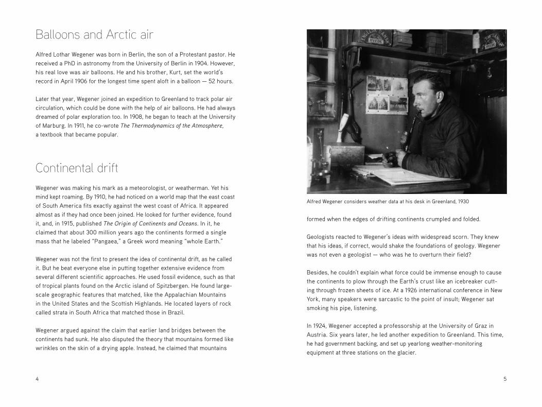
In 1924, Wegener accepted a professorship at the University of Graz in Austria. Six years later, he led another expedition to Greenland. This time, he had government backing, and set up yearlong weather-monitoring equipment at three stations on the glacier.
Alfred Wegener considers weather data at his desk in Greenland, 1930
6 7
Drifting ice delayed the expedition and the Arctic weather proved a great hardship. In November 1930, Wegener led several dogsled teams carrying supplies to his partners working at the isolated inland station. After cele-brating his 50th birthday at the remote weather station, Wegener and his companion, Rasmus Villumsen, died on their return trip west to the coast.
Seafloor spreadingThe idea of continental drift continued to circulate in scientific circles. Dur-ing World War II, sounding gear produced new evidence of what the seafloor looked like. The gear, developed in the 1930s, bounced sound waves off the seafloor to determine its depth and features.
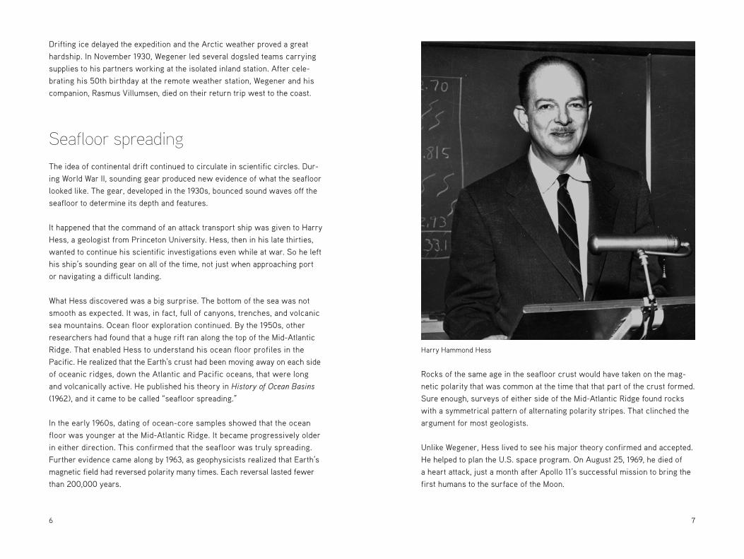
It happened that the command of an attack transport ship was given to Harry Hess, a geologist from Princeton University. Hess, then in his late thirties, wanted to continue his scientific investigations even while at war. So he left his ship’s sounding gear on all of the time, not just when approaching port or navigating a difficult landing.
What Hess discovered was a big surprise. The bottom of the sea was not smooth as expected. It was, in fact, full of canyons, trenches, and volcanic sea mountains. Ocean floor exploration continued. By the 1950s, other researchers had found that a huge rift ran along the top of the Mid-Atlantic Ridge. That enabled Hess to understand his ocean floor profiles in the Pacific. He realized that the Earth’s crust had been moving away on each side of oceanic ridges, down the Atlantic and Pacific oceans, that were long and volcanically active. He published his theory in History of Ocean Basins (1962), and it came to be called “seafloor spreading.”
In the early 1960s, dating of ocean-core samples showed that the ocean floor was younger at the Mid-Atlantic Ridge. It became progressively older in either direction. This confirmed that the seafloor was truly spreading. Further evidence came along by 1963, as geophysicists realized that Earth’s magnetic field had reversed polarity many times. Each reversal lasted fewer than 200,000 years.
Rocks of the same age in the seafloor crust would have taken on the mag-netic polarity that was common at the time that that part of the crust formed. Sure enough, surveys of either side of the Mid-Atlantic Ridge found rocks with a symmetrical pattern of alternating polarity stripes. That clinched the argument for most geologists.
Unlike Wegener, Hess lived to see his major theory confirmed and accepted. He helped to plan the U.S. space program. On August 25, 1969, he died of a heart attack, just a month after Apollo 11’s successful mission to bring the first humans to the surface of the Moon.
Harry Hammond Hess

8 9
Plate tectonicsBy the 1970s, geologists had agreed to use the term “plate tectonics.” They used the term “plates” because they had found evidence that not just continents move, but so do whole plates of the Earth’s crust. A plate might include a continent, parts of a continent, or undersea portions of the crust. Wegener’s idea of continental drift had been developed and refined.
Geologists today understand that the Earth’s surface, or crust, is broken up into eight to 12 large plates and 20 or so smaller ones. These plates move in different directions and at different speeds. Their sizes don’t correspond to the landmasses on top of them. For instance, the North American plate is much larger than the North American continent; the plate extends from the western coast of North America to the mid-Atlantic. Iceland is split down the middle, belonging to two different plates.
The continents have come together into one large mass, and then split apart again. Over the last 500 million years, this may have happened as many as three times. Scientists can only guess when the first plates formed and how they behaved further back than that.
The force that moves the plates is thought to be convection currents in the mantle under the Earth’s crust. The mantle is solid in the short term. But over longer geologic time, it does flow, though very slowly. Pockets of hot liquid magma ooze up along extensive mountain ridges deep under the water, one running roughly north-south in the mid-Atlantic and another in the mid-Pacific. Along these ridges are found active volcanoes and hydrother-mal (hot-water) vents, also known as “black smokers.” Through these vents pours very hot, mineral-rich water that supports astonishing scenes of life. These ecosystems are the only ones on Earth whose immediate energy source is not sunlight. It’s possible that these “vent communities” are where the first living organisms on Earth developed.
Where the edges of the plates meet, several things may happen. If both plates carry continents, which are lighter than the ocean floor, they may clash head on, causing high mountains to rise. If one plate is heavier, it may go
under the other, a process known as “subduction.” The material of the subducted plate returns to the mantle, recycling the Earth’s crust. Or the plates may move sideways, grinding against each other. This grinding produces cracks, or faults, in the plates, as along the California coast. In whatever form the plate edges meet, earthquakes take place; on a global map of earthquake zones, the outlines of the plates are clearly visible.
The European and North American plates are moving apart at the speed a fingernail grows. In a human lifetime, this amounts to about two meters (just over six feet). Millions of years in the future, parts of California and Mexico will probably drift off to become an island. Most of Africa is pushing northward toward Europe and will eventually squeeze out the Mediterranean Sea and cause high mountains to emerge along the whole southern coast of Europe. The eastern portion of Africa will split off at the Great Rift Valley and float off into the Indian Ocean. In geologic time, the Earth’s plates are always moving.
A map of the tectonic plates of the world
1110
SourcesBryson, Bill. A Short History of Nearly Everything. New York: Broadway Books, 2003.
Image creditsAlfred Wegener, courtesy of the Alfred Wegener Institute for Polar and Marine Research
Alfred Wegener considers weather data at his desk in Greenland, 1930, courtesy of the Alfred Wegener Institute for Polar and Marine Research
Harry Hess, courtesy of Princeton University Archives
Plate tectonics map, United States Geologic Survey (USGS)
Articles leveled by Newsela have been adjusted along several dimensions of text complexity including sentence structure, vocabulary and organization. The number followed by L indicates the Lexile measure of the article. For more information on Lexile measures and how they correspond to grade levels: http://www.lexile.com/about-lexile/lexile-overview/
To learn more about Newsela, visit www.newsela.com/about.
The Lexile® Framework for ReadingThe Lexile® Framework for Reading evaluates reading ability and text complexity on the same developmental scale. Unlike other measurement systems, the Lexile Framework determines reading ability based on actual assessments, rather than generalized age or grade levels. Recognized as the standard for matching readers with texts, tens of millions of students worldwide receive a Lexile measure that helps them find targeted readings from the more than 100 million articles, books and websites that have been measured. Lexile measures connect learners of all ages with resources at the right level of challenge and monitors their progress toward state and national proficiency standards. More information about the Lexile® Framework can be found at www.Lexile.com.