4 types of storms i.) tornadoes ii.) hurricanes iii.) blizzards iv.) thunderstorms
TRANSCRIPT
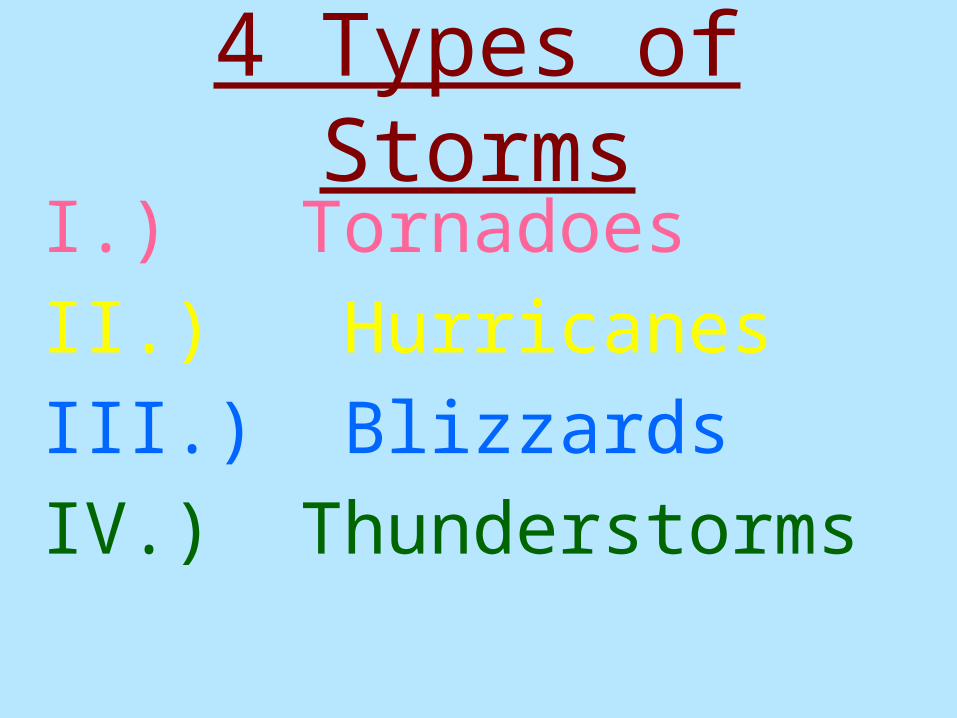
4 Types of Storms
I.) Tornadoes
II.) Hurricanes
III.) Blizzards
IV.) Thunderstorms
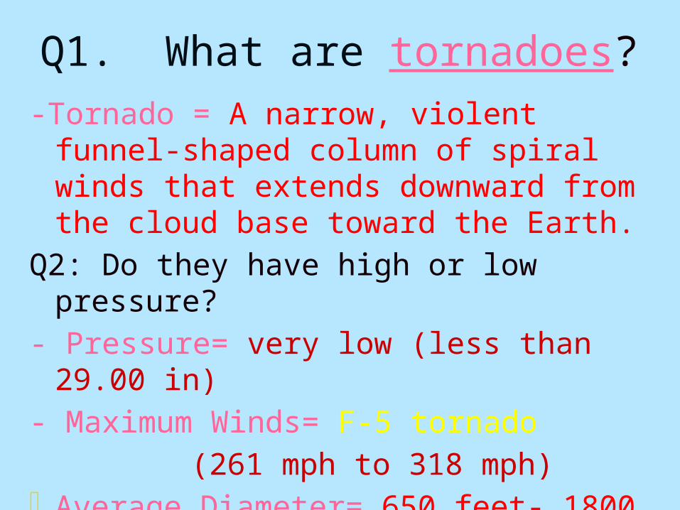
Q1. What are tornadoes?
-Tornado = A narrow, violent funnel-shaped column of spiral winds that extends downward from the cloud base toward the Earth.
Q2: Do they have high or low pressure?
- Pressure= very low (less than 29.00 in)
- Maximum Winds= F-5 tornado
(261 mph to 318 mph)- Average Diameter= 650 feet- 1800 feet
100 yard football field= 300 feet
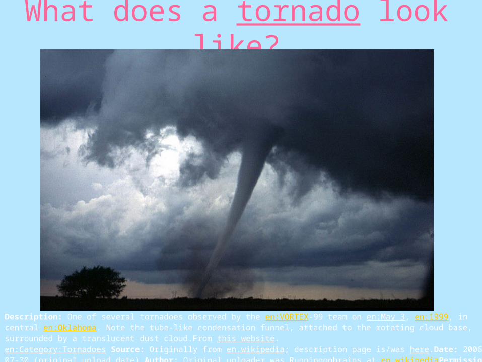
What does a tornado look like?
Description: One of several tornadoes observed by the en:VORTEX-99 team on en:May 3, en:1999, in central en:Oklahoma. Note the tube-like condensation funnel, attached to the rotating cloud base, surrounded by a translucent dust cloud.From this website.en:Category:Tornadoes Source: Originally from en.wikipedia; description page is/was here.Date: 2006-07-30 (original upload date) Author: Original uploader was Runningonbrains at en.wikipediaPermission(Reusing this image)PD-USGOV-DOC-NOAA; PD-USGOV-NOAA.
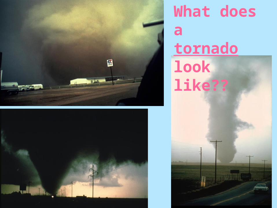
What does a tornado look like??
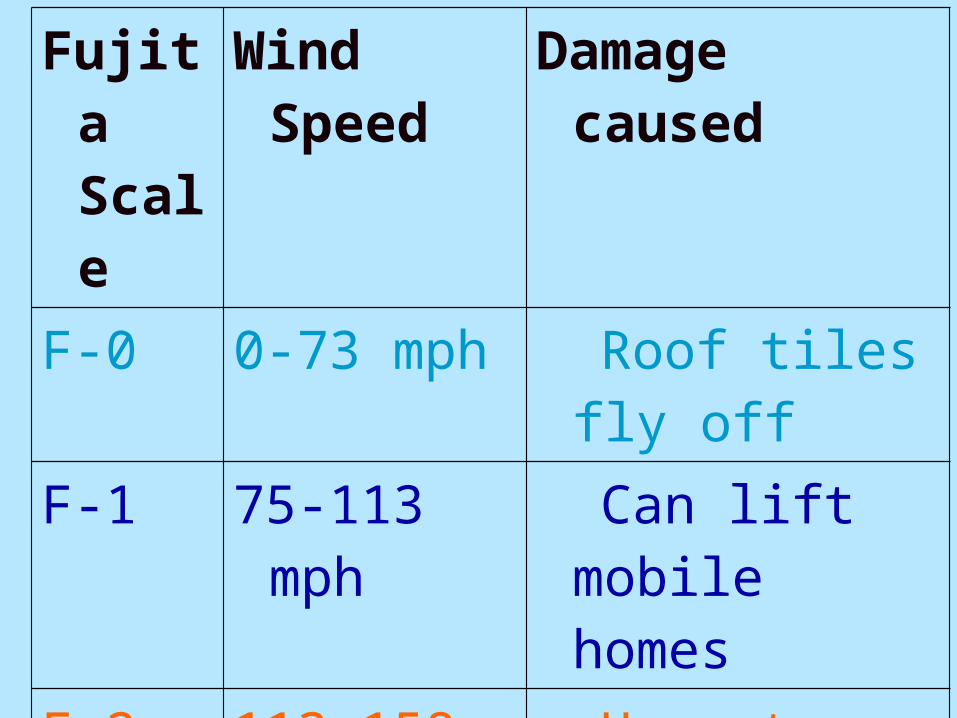
Fujita Scale
Wind Speed Damage caused
F-0 0-73 mph Roof tiles fly off
F-1 75-113 mph Can lift mobile homes
F-2 113-158 mph Uproots trees and rips roofs off of houses
F-3 158-208mph Can lift a train
http://www.tornadoproject.com/fscale/fscale.htm#fscale%20table
Q3: How are tornadoes measured? Fujita Scale
By the amount of damage caused or by the wind speed.
http://www.orato.com/lifestyles/2008/04/17/incredible-tornado-video
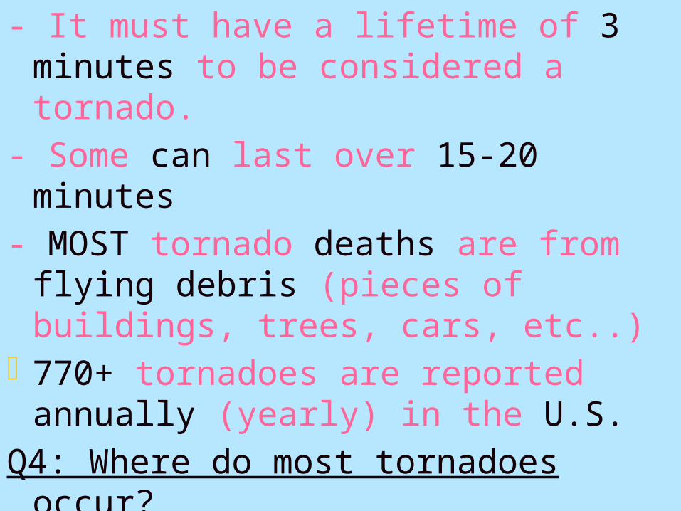
- It must have a lifetime of 3 minutes to be considered a tornado.
- Some can last over 15-20 minutes
- MOST tornado deaths are from flying debris (pieces of buildings, trees, cars, etc..)
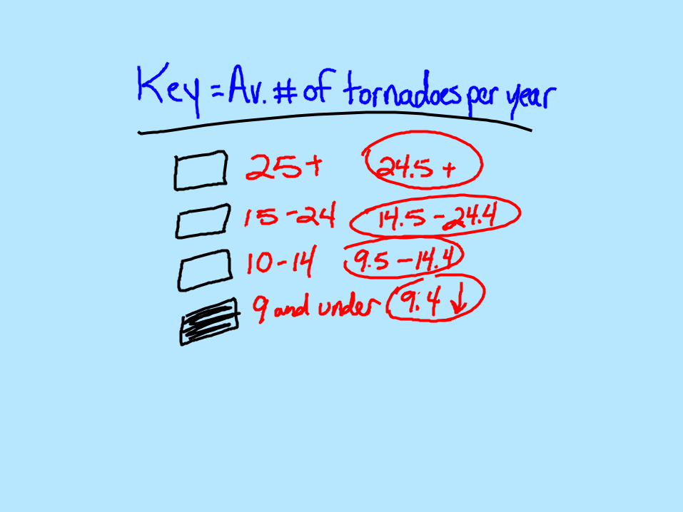
- 770+ tornadoes are reported annually (yearly) in the U.S.
Q4: Where do most tornadoes occur?
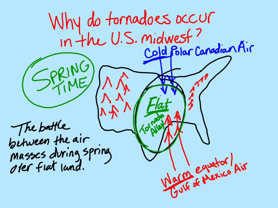
-Tornadoes occur all over the world but MOST occur in the U.S. midwest
Q5: Why are tornadoes so common in the U.S.?
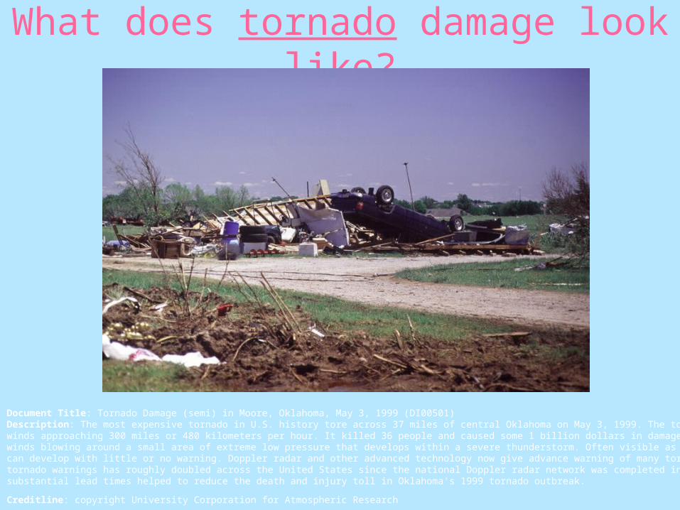
What does tornado damage look like?
Document Title: Tornado Damage (semi) in Moore, Oklahoma, May 3, 1999 (DI00501) Description: The most expensive tornado in U.S. history tore across 37 miles of central Oklahoma on May 3, 1999. The tornado was rated F5, with winds approaching 300 miles or 480 kilometers per hour. It killed 36 people and caused some 1 billion dollars in damage. Tornadoes are rapidly rotating winds blowing around a small area of extreme low pressure that develops within a severe thunderstorm. Often visible as a funnel-shaped cloud, tornadoes can develop with little or no warning. Doppler radar and other advanced technology now give advance warning of many tornadoes. The average lead time of tornado warnings has roughly doubled across the United States since the national Doppler radar network was completed in the 1990s. Prompt warnings with substantial lead times helped to reduce the death and injury toll in Oklahoma's 1999 tornado outbreak.
Creditline: copyright University Corporation for Atmospheric Research
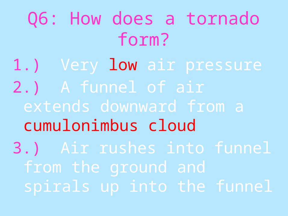
Q6: How does a tornado form?
1.) Very low air pressure
2.) A funnel of air extends downward from a cumulonimbus cloud
3.) Air rushes into funnel from the ground and spirals up into the funnel
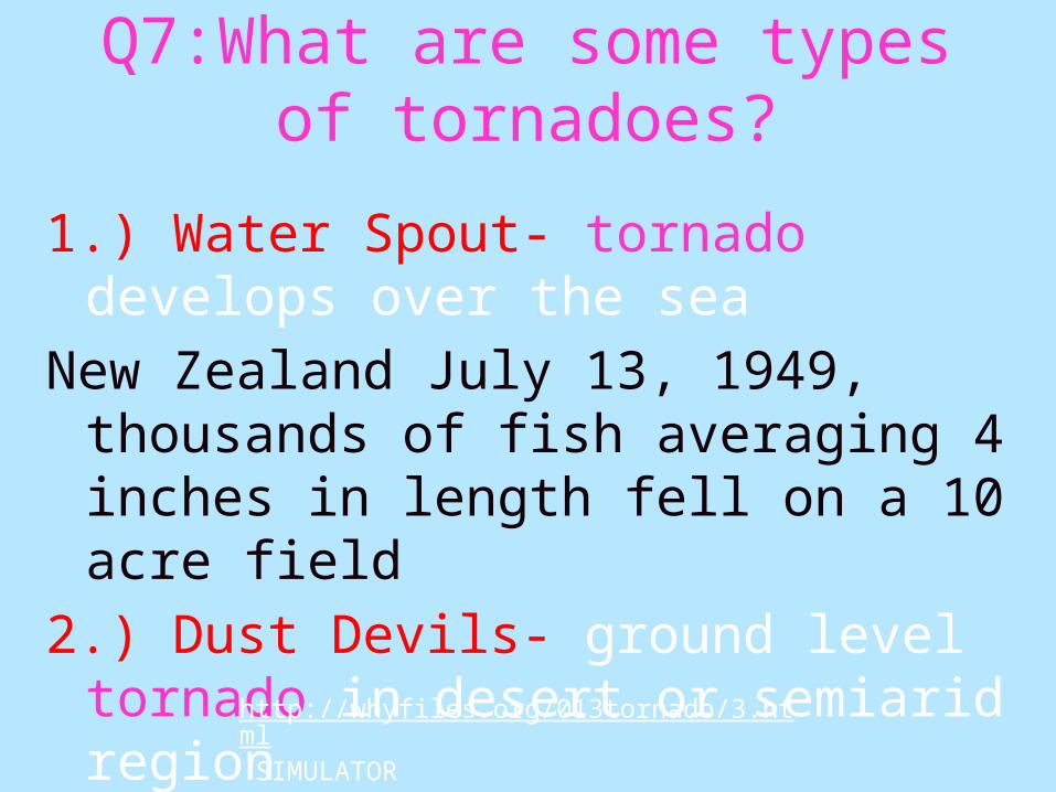
Q7:What are some types of tornadoes?
1.) Water Spout- tornado develops over the sea
New Zealand July 13, 1949, thousands of fish averaging 4 inches in length fell on a 10 acre field
2.) Dust Devils- ground level tornado in desert or semiarid region
http://whyfiles.org/013tornado/3.html SIMULATOR
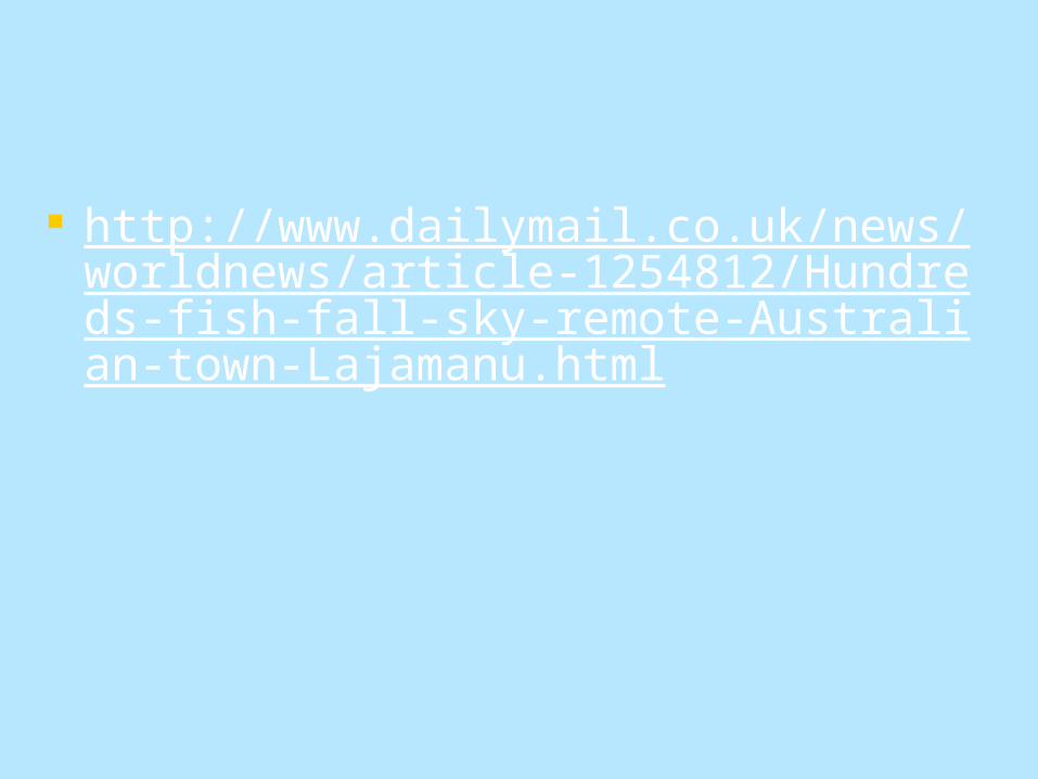
Flying FISH
http://www.dailymail.co.uk/news/worldnews/article-1254812/Hundreds-fish-fall-sky-remote-Australian-town-Lajamanu.html

Tornado Building Codes
Random Questions
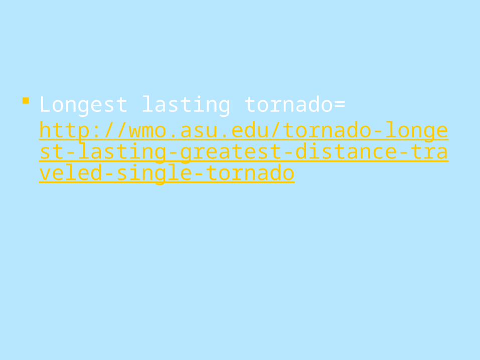
Longest lasting tornado= http://wmo.asu.edu/tornado-longest-lasting-greatest-distance-traveled-single-tornado
II. HURRICANES
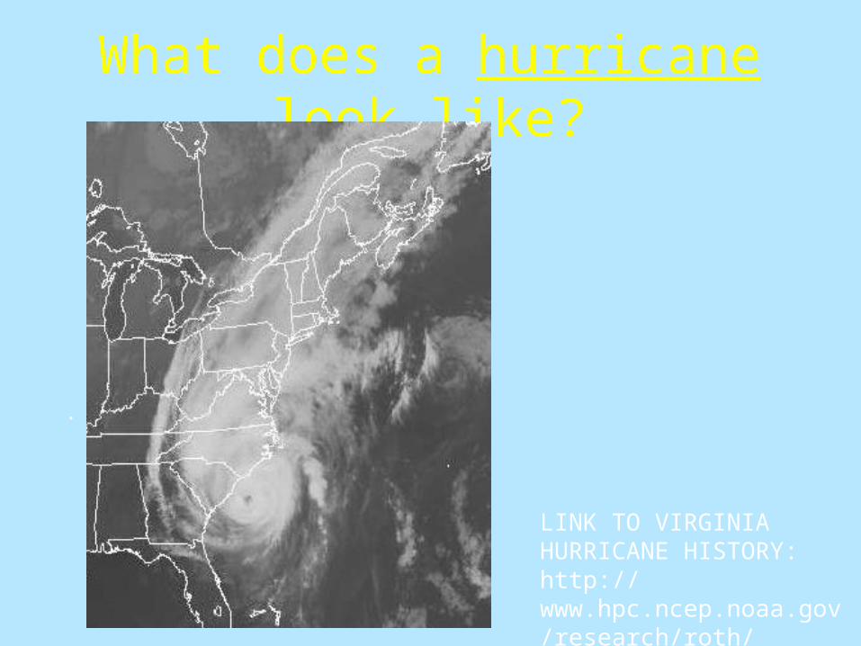
What does a hurricane look like?
.
LINK TO VIRGINIA HURRICANE HISTORY:http://www.hpc.ncep.noaa.gov/research/roth/vahur.htm
http://news.bbc.co.uk/2/hi/science/nature/7533909.stm http://www.weather.com/weather/hurricanecentral/tracker http://www.n2yo.com/hurricane/
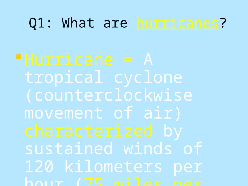
Q1: What are hurricanes?
Hurricane = A tropical cyclone (counterclockwise movement of air) characterized by sustained winds of 120 kilometers per hour (75 miles per hour) or greater.
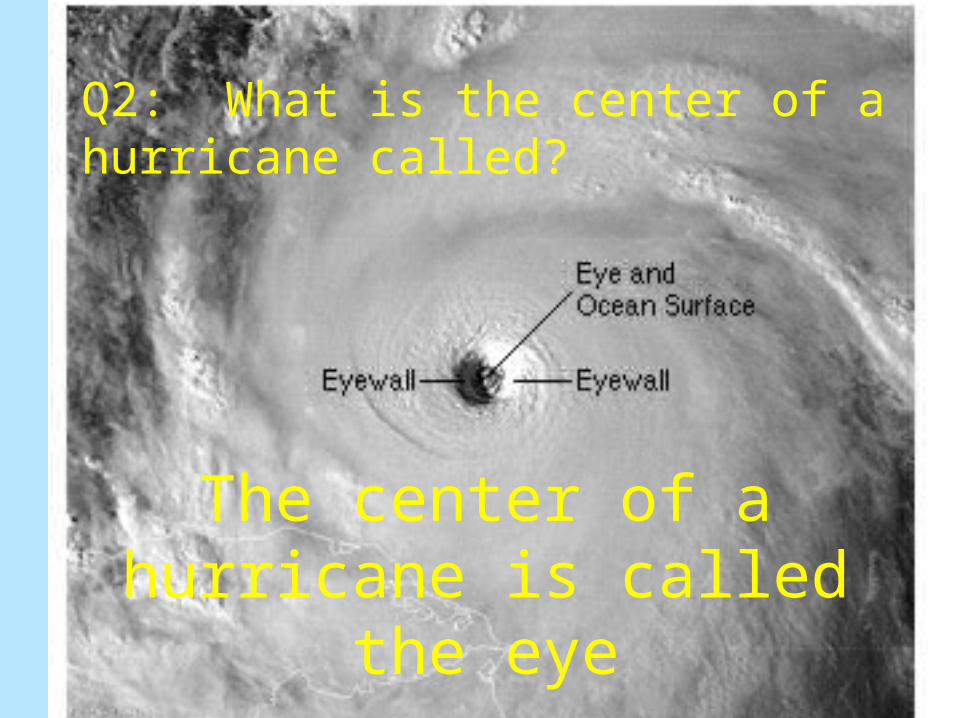
The center of a hurricane is called the eye
Q2: What is the center of a hurricane called?
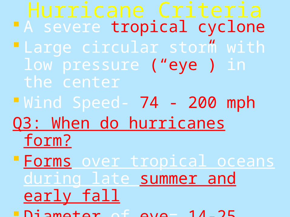
Hurricane Criteria A severe tropical cyclone Large circular storm with low
pressure (“eye”) in the center Wind Speed- 74 - 200 mphQ3: When do hurricanes form? Forms over tropical oceans during
late summer and early fall Diameter of eye= 14-25 miles wide Hurricanes can be 300-500 miles
wide
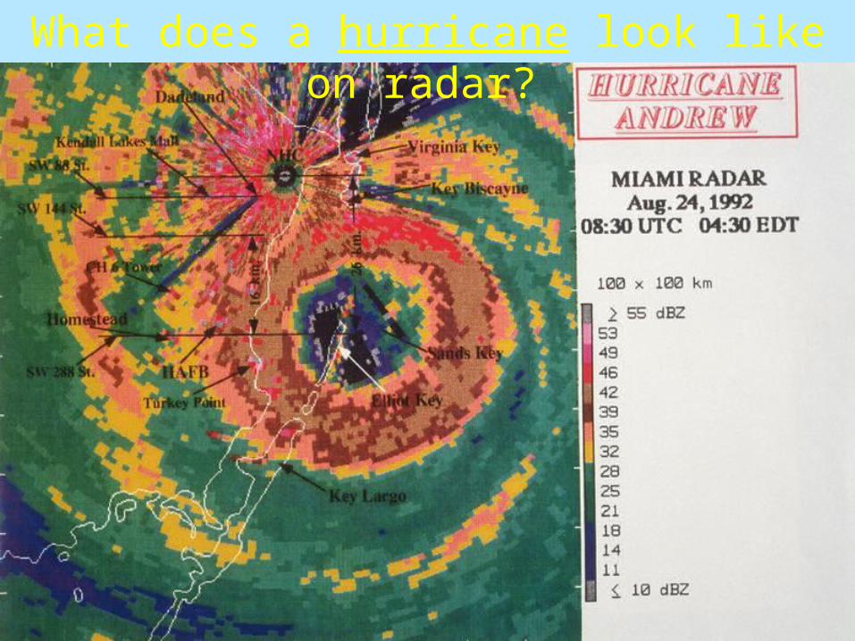
What does a hurricane look like on radar?
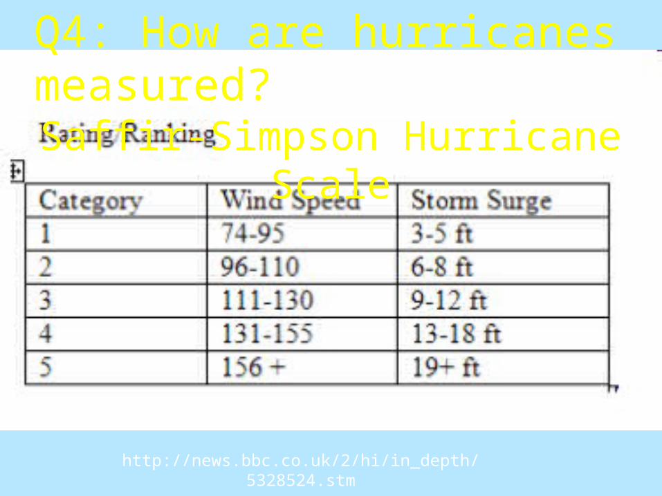
Saffir-Simpson Hurricane Scale
Q4: How are hurricanes measured?
http://news.bbc.co.uk/2/hi/in_depth/5328524.stm
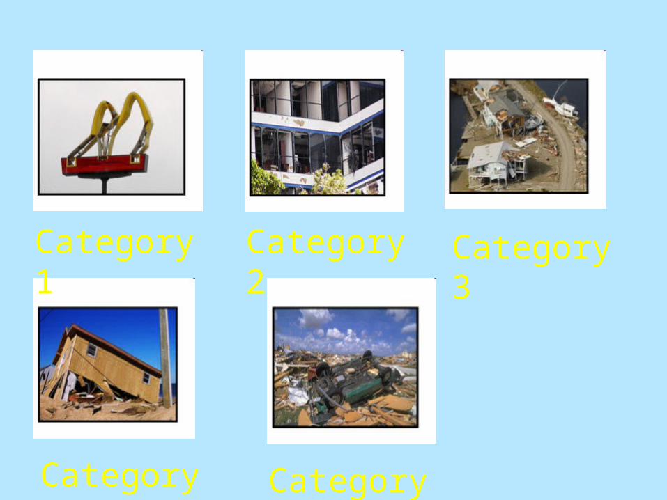
Category 1 Category 2 Category 3
Category 4 Category 5
Around 1,836 deaths$81 billion in damage
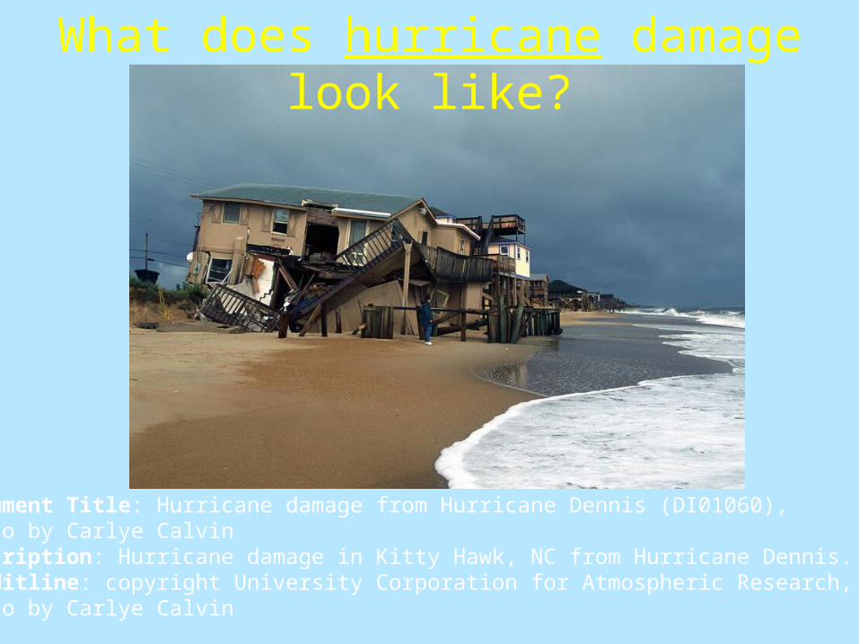
Document Title: Hurricane damage from Hurricane Dennis (DI01060), Photo by Carlye Calvin Description: Hurricane damage in Kitty Hawk, NC from Hurricane Dennis. Creditline: copyright University Corporation for Atmospheric Research, Photo by Carlye Calvin
What does hurricane damage look like?
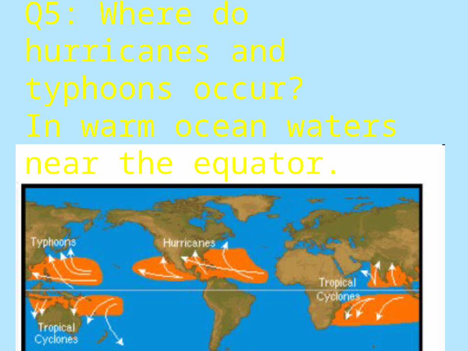
Q5: Where do hurricanes and typhoons occur?In warm ocean waters near the equator.
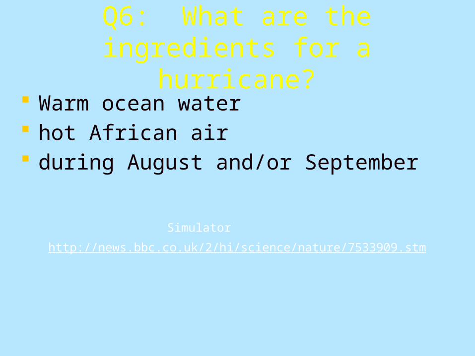
Q6: What are the ingredients for a hurricane?
Warm ocean water hot African air during August and/or September
http://news.bbc.co.uk/2/hi/science/nature/7533909.stm
Simulator

November 12, 2007 HURRICANE SEASON: THE END IS NEAR Dr. Steve Lyons, Tropical Weather Expert
Well, despite all the seasonal outlooks for a "big" hurricane season, despite 14 named storms so far this year, to make it a "big" hurricane season (the average is 10), it looks like it will be another pretty fortunate year for the United States relative to hurricane hits. We have had only one dinky (and I mean real small) category 1 hurricane on the upper Texas coast. It caused waves less than 15 feet high, a very modest
surge of less than 5 feet, and produced only modest localized wind damage. The end is near; the official end of hurricane season is just a few weeks away (November 30). So what
typically is left of hurricane season; where do storms and hurricanes form this late in the season? Well, the climatology of the tropics is a very strong indicator of what to expect and November climatology
(see graphic below) points to the west and southwest Caribbean Sea, along with random, renegade storms forming in the southwest and subtropical north Atlantic (typically moving rapidly northeast away
from land -- minus Bermuda).
Why, you ask, do they tend to cluster along the east coast of Central America in November? The answer is simple: The monsoon trough of low pressure that haunts the tropical Eastern Pacific in summer
retreats toward land and northwest South America before it dissipates in December and re-forms as a separate, unique monsoon heat low in Brazil's Amazon in Southern Hemisphere summer beginning in
late December. But, before the monsoon trough dissipates, it can become a brief stationary low pressure feature in the southwest Caribbean Sea and bring heavy rains to Honduras, Nicaragua, Costa Rica and
Panama before it dissipates. In some rare cases -- maybe once in four years, this persistent low will briefly manage to organize
enough to become a named storm; hence, we see the cluster of origins there when we look back in time. Those origins are where they first became a tropical cyclone; nearly all of these formed from the
monsoon low that sits offshore Nicaragua/Costa Rica in early November. The origin dots include some northward drift away from the monsoon trough origin prior to getting a
name. These tropical cyclones rarely become hurricanes; most are weak or moderate tropical storms and most simply drift onshore Central American and dissipate. Rarely, one gets captured by a mid-latitude
trough of low pressure and skirts by or over Florida or moves northeast across the Bahamas on the way to becoming a non-tropical low.
For the past week we have seen such a low pressure feature exactly where we tropical meteorologists expect it to be based on tropical weather climatology. The image below is taken on November 12 and
courtesy of NASA. This persistent low has brought cloud, rainy weather to southern Central America, as it does every year around this time.
The chance it will ever develop into a tropical cyclone is low, but it could cause local flooding in the mountains of Central America before it sinks southward slowly, finally dissipating along the northwest
coasts of Panama and Colombia.Yes, the 2007 Atlantic hurricane season is about over, and it looks like the United States has dodged
severe impacts for another year. But keep an eye on the southwest Caribbean Sea for one last gasp as the end nears.

How did Hurricane Katrina form?
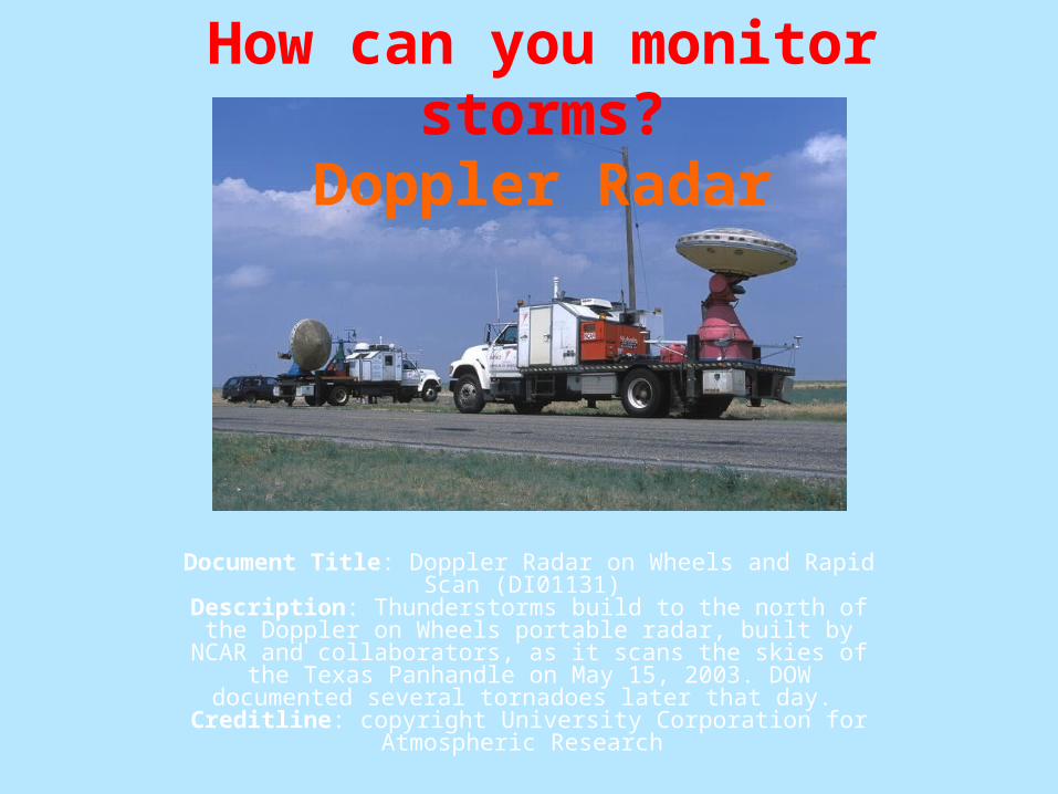
Document Title: Doppler Radar on Wheels and Rapid Scan (DI01131)
Description: Thunderstorms build to the north of the Doppler on Wheels portable radar, built by NCAR and collaborators, as it scans
the skies of the Texas Panhandle on May 15, 2003. DOW documented several tornadoes later that day.
Creditline: copyright University Corporation for Atmospheric Research
How can you monitor storms?Doppler Radar
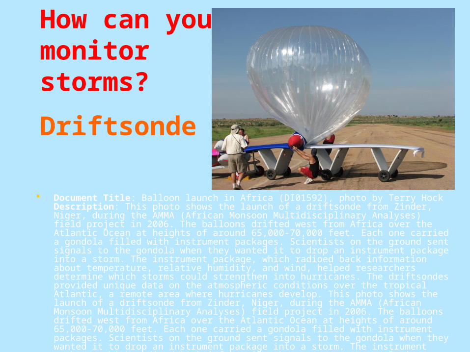
Document Title: Balloon launch in Africa (DI01592), photo by Terry Hock Description: This photo shows the launch of a driftsonde from Zinder, Niger, during the AMMA (African Monsoon Multidisciplinary Analyses) field project in 2006. The balloons drifted west from Africa over the Atlantic Ocean at heights of around 65,000-70,000 feet. Each one carried a gondola filled with instrument packages. Scientists on the ground sent signals to the gondola when they wanted it to drop an instrument package into a storm. The instrument package, which radioed back information about temperature, relative humidity, and wind, helped researchers determine which storms could strengthen into hurricanes. The driftsondes provided unique data on the atmospheric conditions over the tropical Atlantic, a remote area where hurricanes develop. This photo shows the launch of a driftsonde from Zinder, Niger, during the AMMA (African Monsoon Multidisciplinary Analyses) field project in 2006. The balloons drifted west from Africa over the Atlantic Ocean at heights of around 65,000-70,000 feet. Each one carried a gondola filled with instrument packages. Scientists on the ground sent signals to the gondola when they wanted it to drop an instrument package into a storm. The instrument package, which radioed back information about temperature, relative humidity, and wind, helped researchers determine which storms could strengthen into hurricanes. The driftsondes provided unique data on the atmospheric conditions over the tropical Atlantic, a remote area where hurricanes develop. Creditline: copyright University Corporation for Atmospheric Research, photo by Terry Hock
How can you monitor storms?
Driftsonde
III. How does a Blizzard form?
1.) Warm front and cold front meet
2.) Heavy nimbostratus clouds (snow clouds) develop
3.) Wind speed= above 35 mph
4.) Temperature= below
13 degrees F
Your Turn. Come up with your own question and then answer it.
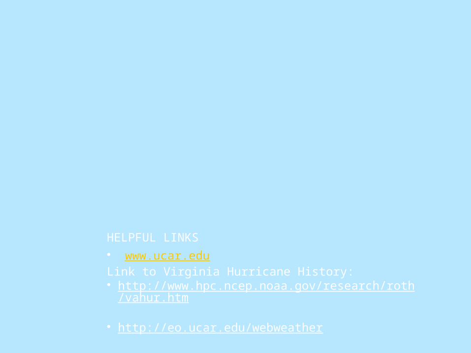
(Be creative)HELPFUL LINKS• www.ucar.eduLink to Virginia Hurricane History:• http://www.hpc.ncep.noaa.gov/research/roth/vahur.htm • http://eo.ucar.edu/webweather
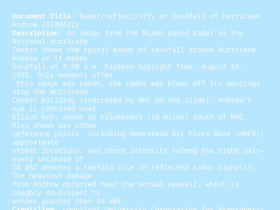
Document Title: Radar/reflectivity at landfall of hurricane Andrew (DI00422) Description: An image from the Miami-based radar at the National Hurricane Center shows the spiral bands of rainfall around Hurricane Andrew as it makeslandfall at 4:30 a.m. Eastern Daylight Time, August 24, 1992. Only moments after this image was taken, the radar was blown off its moorings atop the HurricaneCenter building (indicated by NHC on the slide). Andrew’s eye is centered over Elliot Key, about 26 kilometers (16 miles) south of NHC. Also shown are other reference points, including Homestead Air Force Base (HAFB); approximate street locations; and storm intensity (along the right axis—every increase of 10 dBZ denotes a tenfold rise in reflected radar signals). The heaviest damage from Andrew occurred near the actual eyewall, which is roughly equivalent to echoes greater than 39 dBZ. Creditline: copyright University Corporation for Atmospheric Research
RECAP
What do tornadoes look like? What does tornado damage look like? Are tornadoes scary? (video) What do hurricanes look like? What does hurricane damage look like? How did Hurricane Katrina form? (video) How do we monitor storms? What is a hurricane and tornado? (definitions)
What do you want to know about hurricanes and tornadoes?
What do tornadoes look like? What does tornado damage look like? Are tornadoes scary? (video) What do hurricanes look like? What does hurricane damage look like? How did Hurricane Katrina form? (video) How do we monitor storms? What is a hurricane and tornado? (definitions)
Are tornadoes scary?
SHORT VIDEO http://youtube.com/results?
search_query=tornado
Works Cited (MLA Format) http://www.easybib.com
Calvin, Carlye. Hurricane Damage From Hurricane Dennis (DI01060). Kitty Hawk. Digital Image Library. University Corporation for Atmospheric Research. 12 Nov. 2007 <http://www.fin.ucar.edu/netpub/server.np?find&catalog=catalog&template=detail.np&field=itemid&op=matches&value=1672&site=imagelibrary>.
Carlye, Calvin. Hurricane Damage From Hurricane Dennis (DI01060). Kitty Hawk. Digital Image Library. University for Atmospheric Research. 12 Nov. 2007 <http://www.fin.ucar.edu/netpub/server.np?
find&catalog=catalog&template=detail.np&field=itemid&op=matches&value=1672&site=imagelibrary>. Doppler Radar on Wheels (DI01136). 2003. Texas Panhandle. Digital Imagery Library. University Corporation for Atmospheric Research. 12 Nov. 2007
<http://www.fin.ucar.edu/netpub/server.np?find&catalog=catalog&template=detail.np&field=itemid&op=matches&value=1746&site=imagelibrary>.
Hock, Terry. Balloon Launch in Africa (DI01592). 2006. Zinder. Digital Imagery Library. University Corporation for Atmospheric Research. 12 Nov. 2007 <http://www.fin.ucar.edu/netpub/server.np?find&catalog=catalog&template=detail.np&field=itemid&op=matches&value=2171&site=imagelibrary>.
INCREDIBLE TORNADO VIDEO!! May 4, 2007 - Ellis Co., OK. 2007. You Tube. 12 Nov. 2007 <http://youtube.com/watch?v=DNL7ASvl4k4>. Radar/Reflectivity At Landfall of Hurricane Andrew (DI00422). 1992. National Hurricane Center, Miami. Digital Image Library. University Corporation
for Atmospheric Research. 12 Nov. 2007 <http://www.fin.ucar.edu/netpub/server.np?find&catalog=catalog&template=detail.np&field=itemid&op=matches&value=1854&site=im agelibrary>.
Richter, Harald. Texas Tornado (DI00511). 1995. Digital Image Library. University Corporation for Atmospheric Research. 12 Nov. 2007 <http://www.fin.ucar.edu/netpub/server.np?find&catalog=catalog&template=detail.np&field=itemid&op=matches&value=1325&site=im agelibrary>.
Richter, Harald. Texas Tornado (DI00512). 1995. Digital Imagery Library. University Corporation for Atmospheric Research. 12 Nov. 2007 <http://www.fin.ucar.edu/netpub/server.np?find&catalog=catalog&template=detail.np&field=itemid&op=matches&value=1326&site=im agelibrar>.
Runningonbrains. Dszpics1. 1999. NOAA, Oklahoma. Wikipedia. NOAA. 12 Nov. 2007 <http://en.wikipedia.org/wiki/Image:Dszpics1.jpg>. Tornado Near Watkins, Eastern Colorado (DI00486). Watkins. Digital Image Library. University Corporation for Atmospheric Research. 12 Nov. 2007
<http://www.fin.ucar.edu/netpub/server.np?find&catalog=catalog&template=detail.np&field=itemid&op=matches&value=1299&site=imagelibrary>.
Lesson Plan (APA Format) http://citationmachine.net/
Stephens, Elaine (2005). A Handbook of Content Literacy Strategies</< td>i>. Norwood, Massachusetts: Christopher-Gordon Publishers.