2-in-1 large format and oblique aerial camera systems for
TRANSCRIPT

2-in-1 Large Format and Oblique Aerial Camera Systems for 3D Urban Mapping
Philipp GrimmEUROSDR/ISPRS Workshop Oblique, Barcelona,
09.10.2017
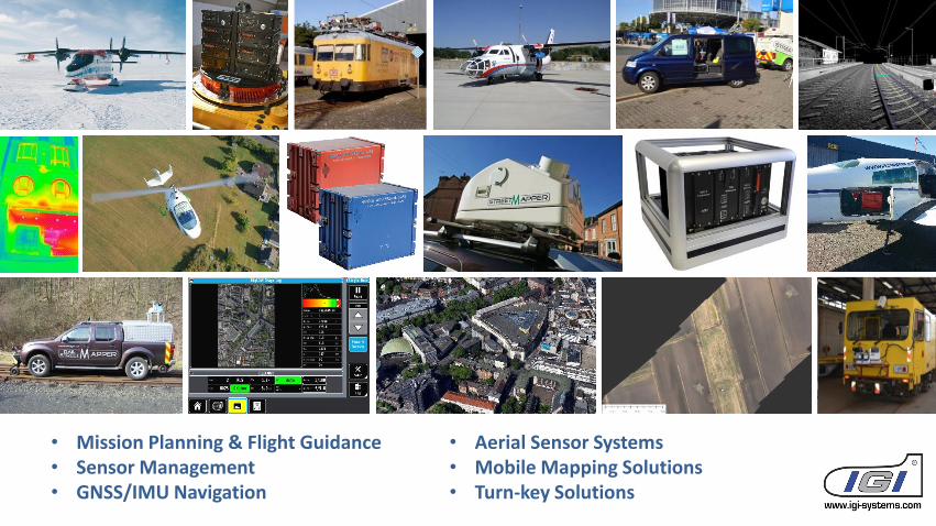
• Mission Planning & Flight Guidance• Sensor Management• GNSS/IMU Navigation
• Aerial Sensor Systems• Mobile Mapping Solutions• Turn-key Solutions
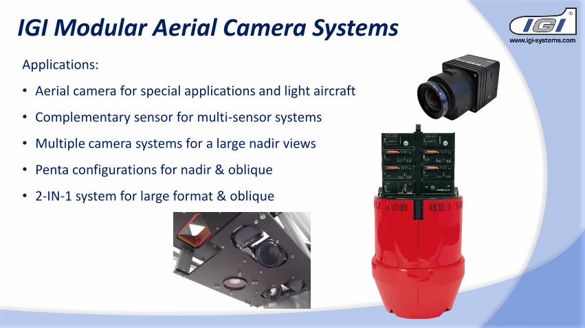
IGI Modular Aerial Camera Systems
Applications:
• Aerial camera for special applications and light aircraft
• Complementary sensor for multi-sensor systems
• Multiple camera systems for a large nadir views
• Penta configurations for nadir & oblique
• 2-IN-1 system for large format & oblique
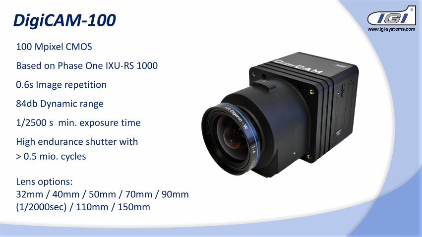
DigiCAM-100
100 Mpixel CMOS
Based on Phase One IXU-RS 1000
0.6s Image repetition
84db Dynamic range
1/2500 s min. exposure time
High endurance shutter with
> 0.5 mio. cycles
Lens options:32mm / 40mm / 50mm / 70mm / 90mm (1/2000sec) / 110mm / 150mm
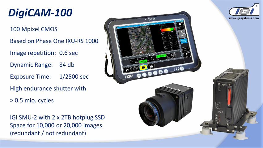
DigiCAM-100
100 Mpixel CMOS
Based on Phase One IXU-RS 1000
Image repetition: 0.6 sec
Dynamic Range: 84 db
Exposure Time: 1/2500 sec
High endurance shutter with
> 0.5 mio. cycles
IGI SMU-2 with 2 x 2TB hotplug SSDSpace for 10,000 or 20,000 images(redundant / not redundant)
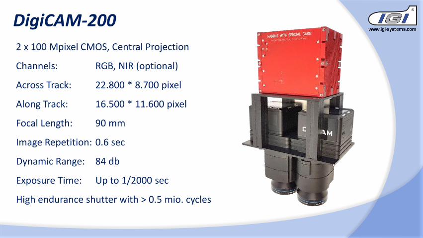
2 x 100 Mpixel CMOS, Central Projection
Channels: RGB, NIR (optional)
Across Track: 22.800 * 8.700 pixel
Along Track: 16.500 * 11.600 pixel
Focal Length: 90 mm
Image Repetition: 0.6 sec
Dynamic Range: 84 db
Exposure Time: Up to 1/2000 sec
High endurance shutter with > 0.5 mio. cycles
DigiCAM-200
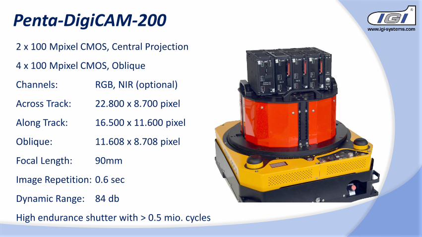
2 x 100 Mpixel CMOS, Central Projection
4 x 100 Mpixel CMOS, Oblique
Channels: RGB, NIR (optional)
Across Track: 22.800 x 8.700 pixel
Along Track: 16.500 x 11.600 pixel
Oblique: 11.608 x 8.708 pixel
Focal Length: 90mm
Image Repetition: 0.6 sec
Dynamic Range: 84 db
High endurance shutter with > 0.5 mio. cycles
Penta-DigiCAM-200
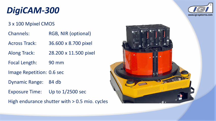
3 x 100 Mpixel CMOS
Channels: RGB, NIR (optional)
Across Track: 36.600 x 8.700 pixel
Along Track: 28.200 x 11.500 pixel
Focal Length: 90 mm
Image Repetition: 0.6 sec
Dynamic Range: 84 db
Exposure Time: Up to 1/2500 sec
High endurance shutter with > 0.5 mio. cycles
DigiCAM-300
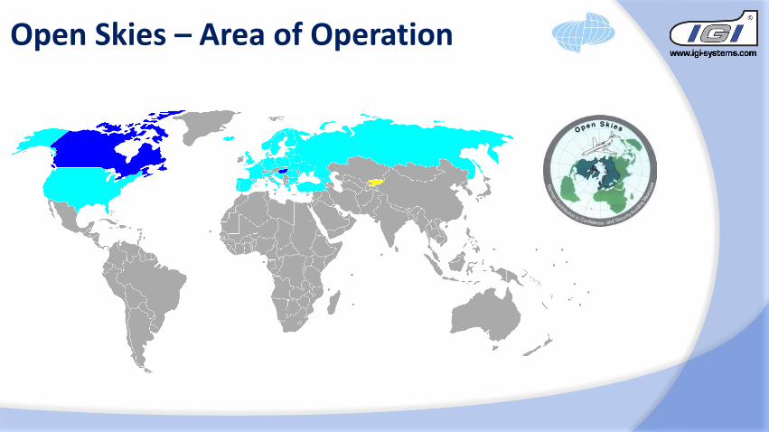
Open Skies – Area of Operation
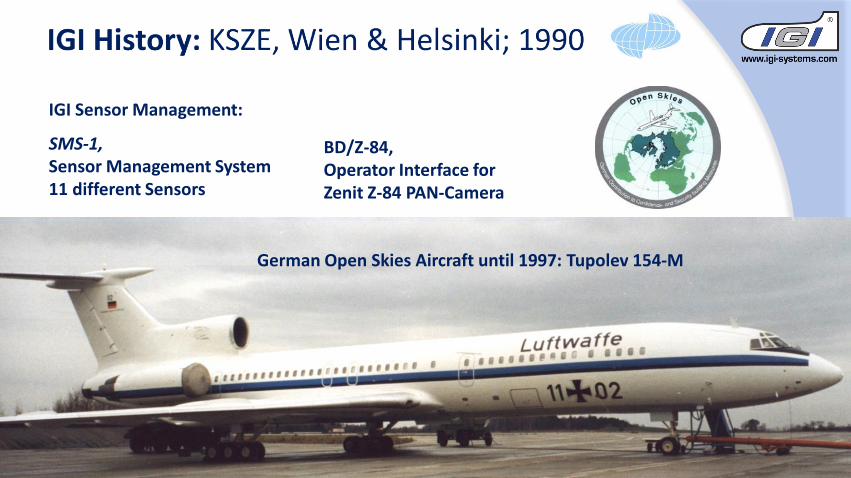
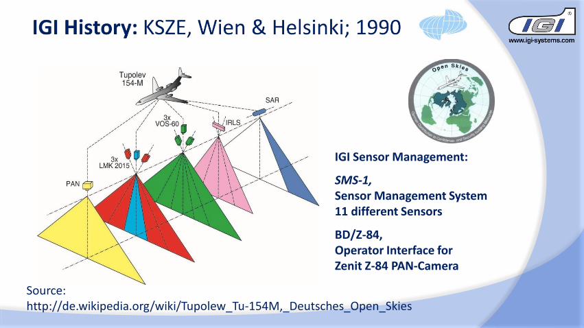
IGI Sensor Management:
SMS-1, Sensor Management System11 different Sensors
BD/Z-84,Operator Interface for Zenit Z-84 PAN-Camera
German Open Skies Aircraft until 1997: Tupolev 154-M
IGI Sensor Management:
SMS-1, Sensor Management System11 different Sensors
BD/Z-84,Operator Interface for Zenit Z-84 PAN-Camera
Source:http://de.wikipedia.org/wiki/Tupolew_Tu-154M,_Deutsches_Open_Skies
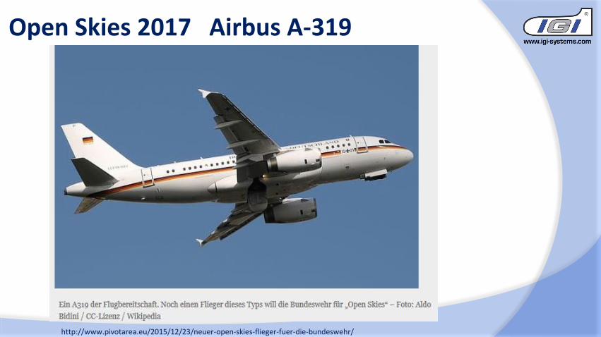
Open Skies 2017 Airbus A-319
http://www.pivotarea.eu/2015/12/23/neuer-open-skies-flieger-fuer-die-bundeswehr/

1550 m96°
63°
3400 m85°
5870 m81°
1900 m
Open Skies – Flying Altitudes
HIGH
MEDIUM
LOWDigiCAM-OS-l
DigiTHERM-OS-l
DigiCAM-OS-m
DigiCAM-OS-h
3500 m
6100 m10000 m
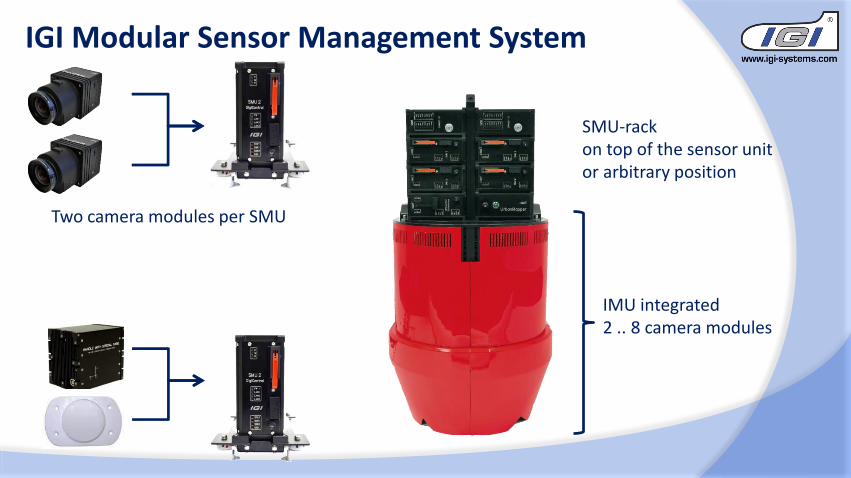
IGI Modular Sensor Management System
Two camera modules per SMU
IMU integrated2 .. 8 camera modules
SMU-rack on top of the sensor unit or arbitrary position
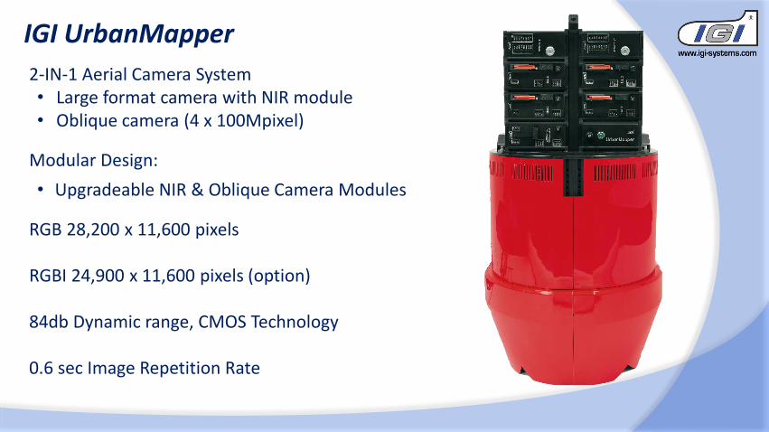
IGI UrbanMapper
2-IN-1 Aerial Camera System• Large format camera with NIR module• Oblique camera (4 x 100Mpixel)
Modular Design:
• Upgradeable NIR & Oblique Camera Modules
RGB 28,200 x 11,600 pixels
RGBI 24,900 x 11,600 pixels (option)
84db Dynamic range, CMOS Technology
0.6 sec Image Repetition Rate
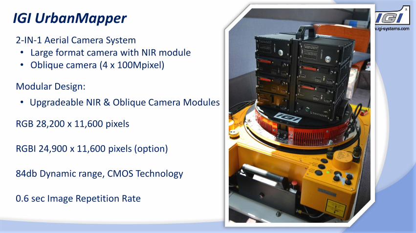
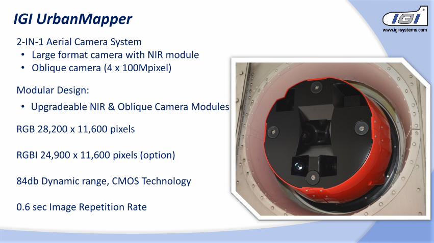

• 20” / 4K touch screen
• Control of camera groups
& single modules
• Tools and indicators for optimal
illumination
IGI UrbanMapper – IGIvisu, the operator’s view
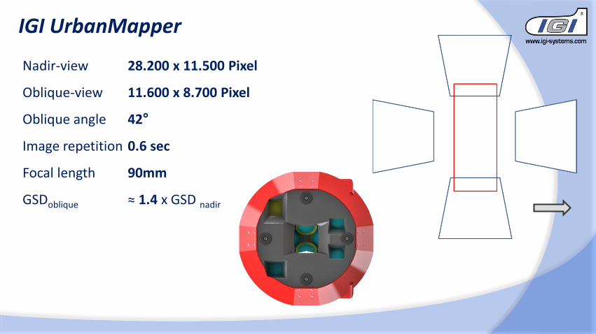
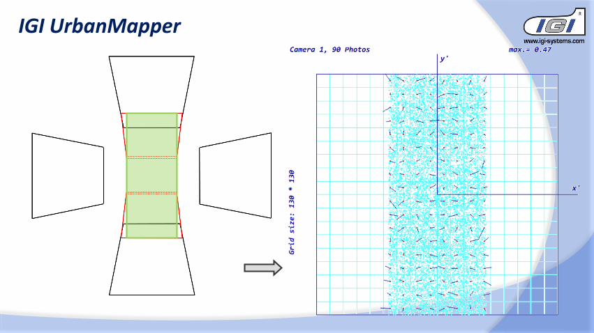
Nadir-view 28.200 x 11.500 Pixel
Oblique-view 11.600 x 8.700 Pixel
Oblique angle 42°
Image repetition 0.6 sec
Focal length 90mm
GSDoblique ≈ 1.4 x GSD nadir
IGI UrbanMapper
IGI UrbanMapper
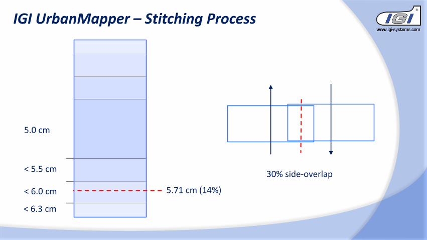
< 6.0 cm
5.0 cm
< 5.5 cm
IGI UrbanMapper – Stitching Process
< 6.3 cm
5.71 cm (14%)
30% side-overlap
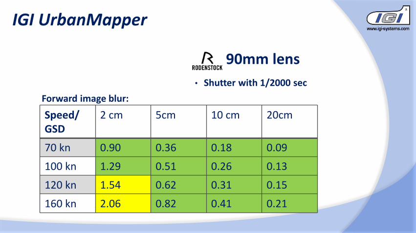
90mm lens
• Shutter with 1/2000 sec
Speed/ GSD
2 cm 5cm 10 cm 20cm
70 kn 0.90 0.36 0.18 0.09
100 kn 1.29 0.51 0.26 0.13
120 kn 1.54 0.62 0.31 0.15
160 kn 2.06 0.82 0.41 0.21
Forward image blur:
IGI UrbanMapper
IGI UrbanMapper
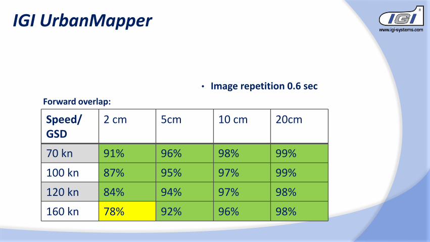
• Image repetition 0.6 sec
Speed/ GSD
2 cm 5cm 10 cm 20cm
70 kn 91% 96% 98% 99%
100 kn 87% 95% 97% 99%
120 kn 84% 94% 97% 98%
160 kn 78% 92% 96% 98%
Forward overlap:
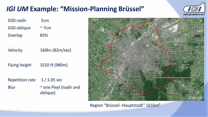
IGI UM Example: “Mission-Planning Brüssel”
GSD nadir 5cm
GSD oblique ~ 7cm
Overlap 85%
Velocity 160kn (82m/sec)
Flying height 3210 ft (980m)
Repetition rate 1 / 1.05 sec
Blur ~ one Pixel (nadir and oblique)
Region “Brüssel- Hauptstadt” 161km²
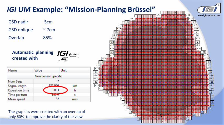
Automatic planning created with
IGI UM Example: “Mission-Planning Brüssel”
GSD nadir 5cm
GSD oblique ~ 7cm
Overlap 85%
The graphics were created with an overlap of only 60% to improve the clarity of the view.
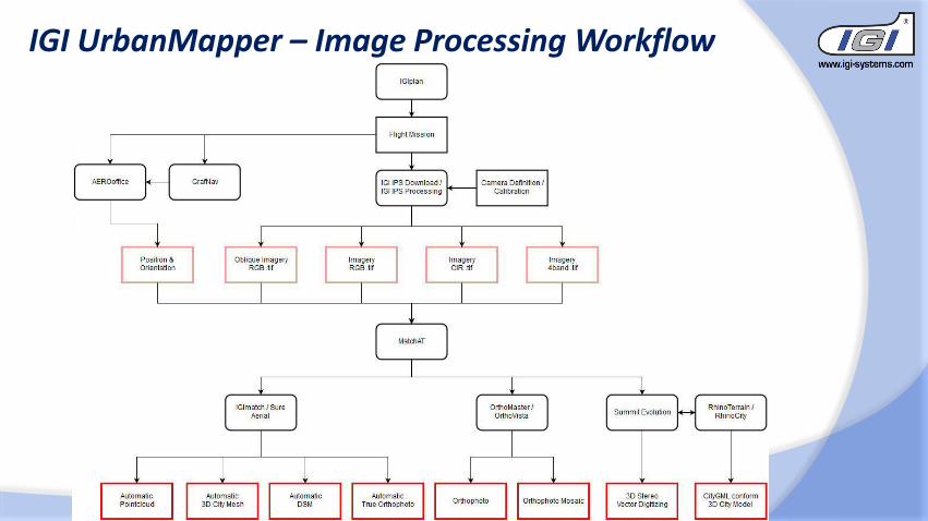
IGI UrbanMapper – Image Processing Workflow
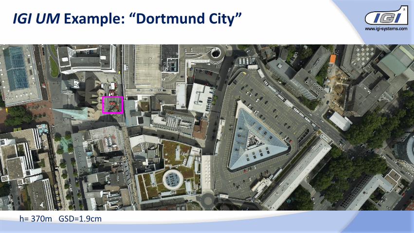
IGI UM Example: “Dortmund City”
h= 370m GSD=1.9cm
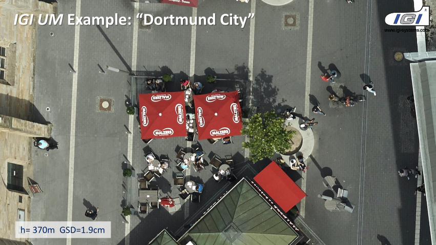
h= 370m GSD=1.9cm
IGI UM Example: “Dortmund City”
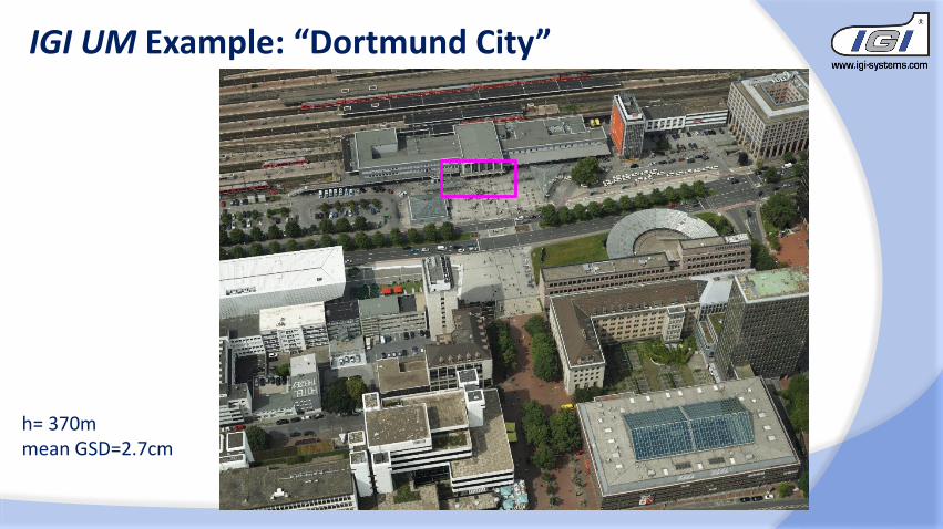
IGI UM Example: “Dortmund City”
h= 370m mean GSD=2.7cm
h= 370m mean GSD=2.7cm
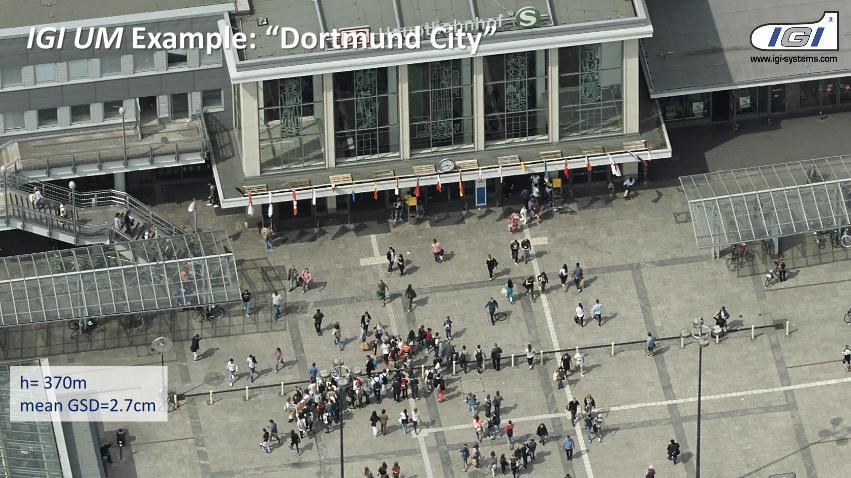
IGI UM Example: “Dortmund City”
h= 370m GSD=1.9cm
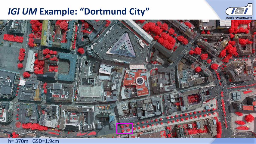
IGI UM Example: “Dortmund City”
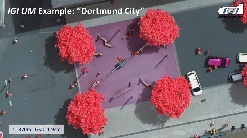
h= 370m GSD=1.9cm
IGI UM Example: “Dortmund City”
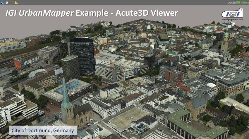
IGI UrbanMapper Example - Acute3D Viewer
City of Dortmund, Germany
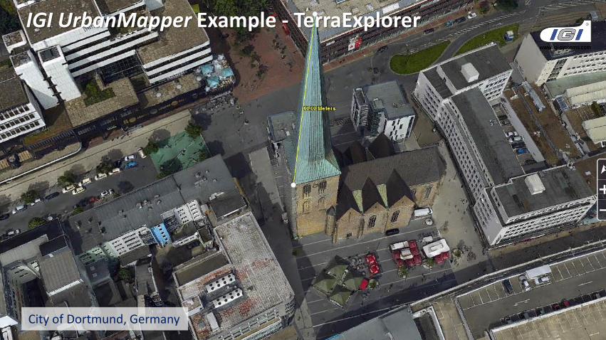
IGI UrbanMapper Example - TerraExplorer
City of Dortmund, Germany
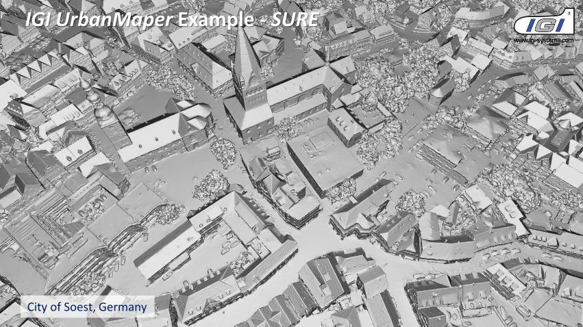
IGI UrbanMaper Example - SURE
City of Soest, Germany
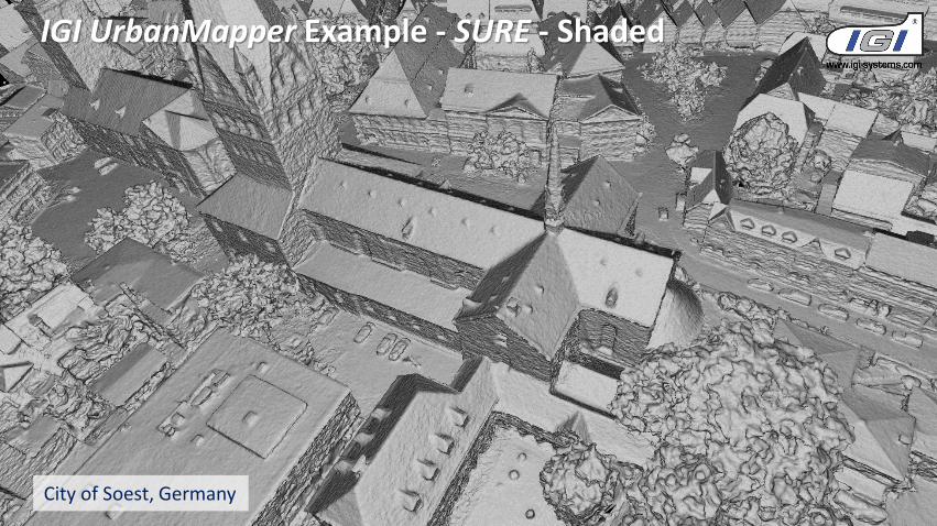
IGI UrbanMapper Example - SURE - Shaded
City of Soest, Germany
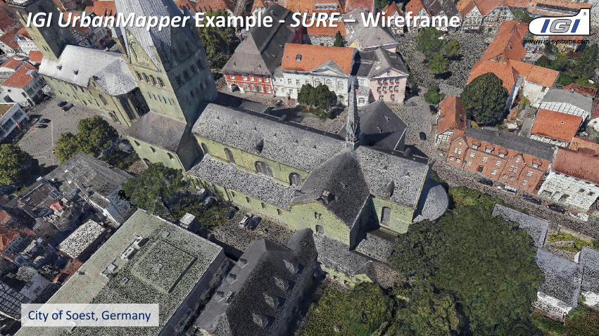
IGI UrbanMapper Example - SURE – Wireframe
City of Soest, Germany
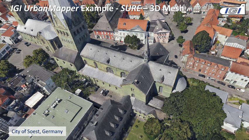
IGI UrbanMapper Example - SURE – 3D Mesh
City of Soest, Germany
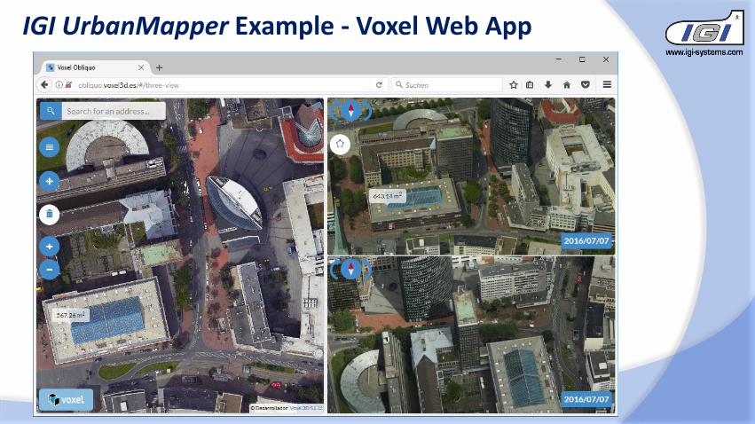
IGI UrbanMapper Example - Voxel Web App
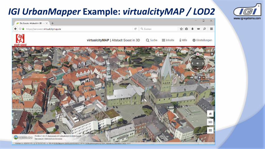
IGI UrbanMapper Example: virtualcityMAP / LOD2
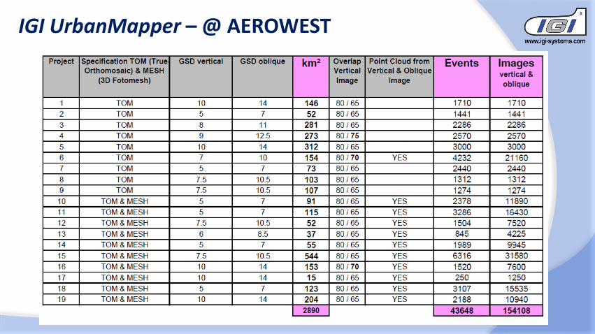
IGI UrbanMapper – @ AEROWEST
2-in-1 Large Format and Oblique Aerial Camera Systems for 3D Urban Mapping
Philipp GrimmEUROSDR/ISPRS Workshop Oblique, Barcelona,
09.10.2017
Thank You !