1 piloting session five santa barbara sail and power squadron fall 2006
Post on 19-Dec-2015
219 views
TRANSCRIPT
11
Piloting Session FivePiloting Session Five
Santa Barbara Sail and Power Santa Barbara Sail and Power Squadron Fall 2006Squadron Fall 2006
22
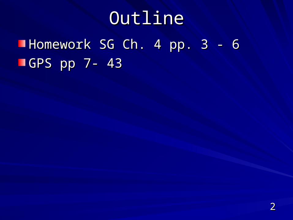
OutlineOutline
Homework SG Ch. 4 pp. 3 - 6Homework SG Ch. 4 pp. 3 - 6
GPS pp 7- 43GPS pp 7- 43
33
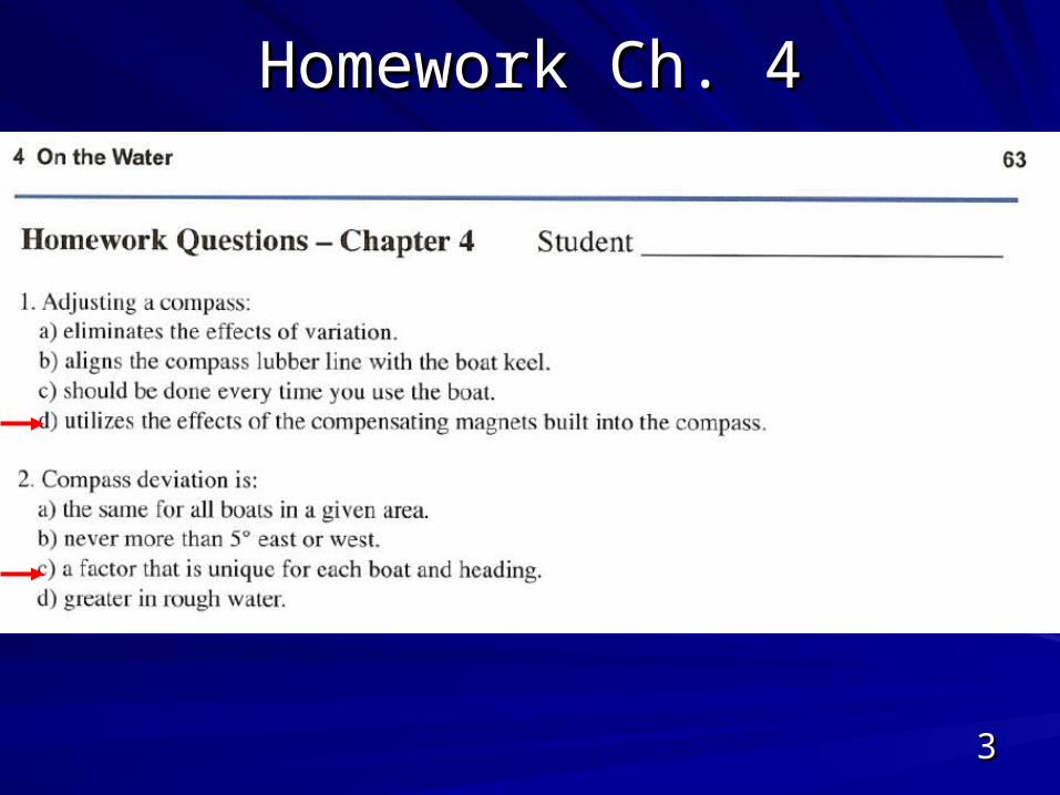
Homework Ch. 4Homework Ch. 4
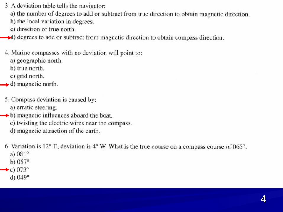
44
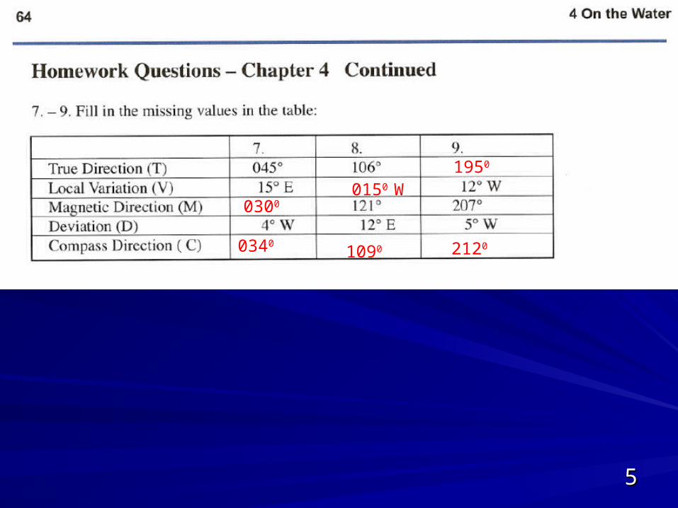
55
0300
0340
0150 W
1090
1950
2120
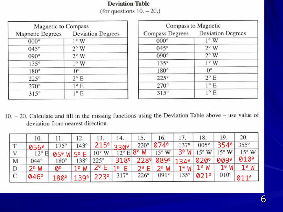
66
0560
20 W0460
050 W
00
1800
50 E
10 W1390
2150
20 E2230
10 E3180
3300
20 E2280
80 W
20 W0890
0740
10 W1340
30 W0200
10 W0210
10 W0090
3540
0100
10 W
0110
77
GPSGPS
ButtonsButtons
ScreensScreens
OperationsOperations
88
Outline SG Ch. 5Outline SG Ch. 5ObjectivesObjectives
Using GPS As a Navigation ToolUsing GPS As a Navigation Tool
What GPS Can DoWhat GPS Can Do
GPS Receiver Keyboard FunctionsGPS Receiver Keyboard Functions
Typical GPS ScreensTypical GPS Screens
Entering Waypoints Into the GPSEntering Waypoints Into the GPS
What the GPS Does When You Select a What the GPS Does When You Select a WaypointWaypoint
Navigating Using GPS and WaypointsNavigating Using GPS and Waypoints
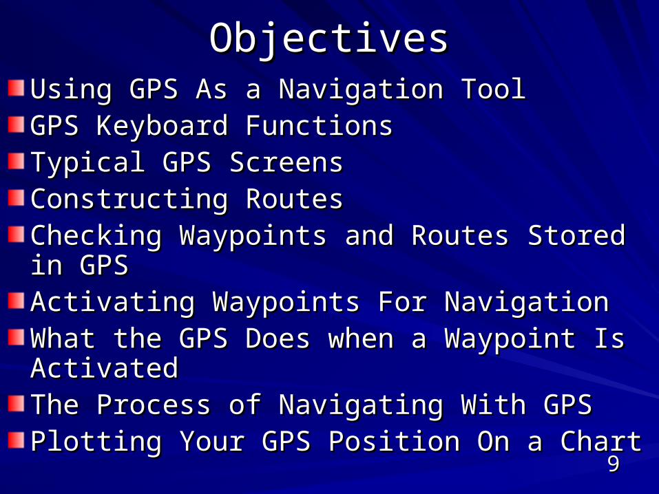
99
ObjectivesObjectivesUsing GPS As a Navigation ToolUsing GPS As a Navigation ToolGPS Keyboard FunctionsGPS Keyboard FunctionsTypical GPS ScreensTypical GPS ScreensConstructing RoutesConstructing RoutesChecking Waypoints and Routes Stored in GPSChecking Waypoints and Routes Stored in GPSActivating Waypoints For NavigationActivating Waypoints For NavigationWhat the GPS Does when a Waypoint Is What the GPS Does when a Waypoint Is ActivatedActivatedThe Process of Navigating With GPSThe Process of Navigating With GPSPlotting Your GPS Position On a ChartPlotting Your GPS Position On a Chart
1010
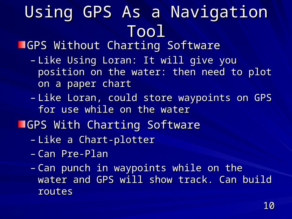
Using GPS As a Navigation ToolUsing GPS As a Navigation Tool
GPS Without Charting SoftwareGPS Without Charting Software– Like Using Loran: It will give you position on Like Using Loran: It will give you position on
the water: then need to plot on a paper chartthe water: then need to plot on a paper chart– Like Loran, could store waypoints on GPS for Like Loran, could store waypoints on GPS for
use while on the wateruse while on the water
GPS With Charting SoftwareGPS With Charting Software– Like a Chart-plotterLike a Chart-plotter– Can Pre-PlanCan Pre-Plan– Can punch in waypoints while on the water Can punch in waypoints while on the water
and GPS will show track. Can build routesand GPS will show track. Can build routes
1111
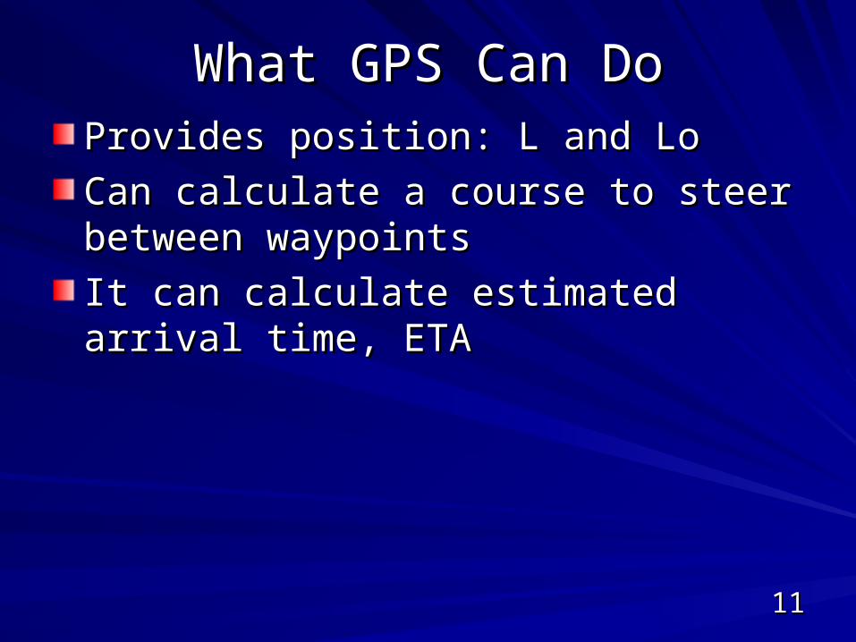
What GPS Can DoWhat GPS Can DoProvides position: L and LoProvides position: L and Lo
Can calculate a course to steer between Can calculate a course to steer between waypointswaypoints
It can calculate estimated arrival time, ETAIt can calculate estimated arrival time, ETA
1212
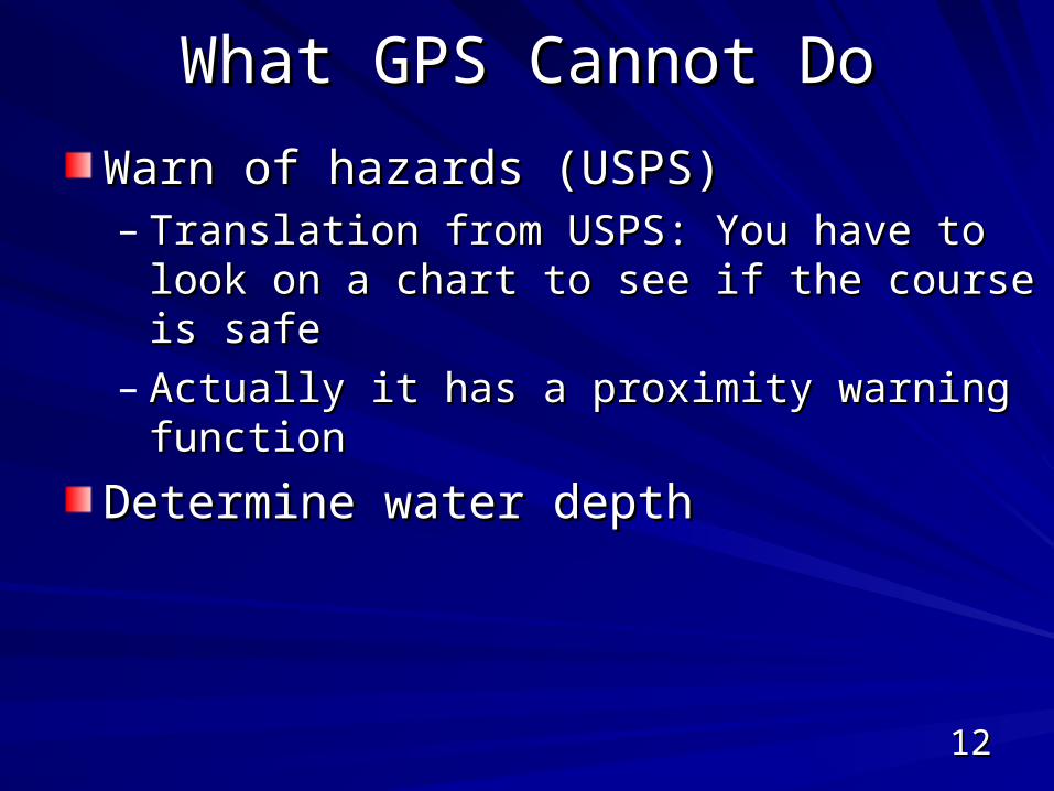
What GPS Cannot DoWhat GPS Cannot Do
Warn of hazards (USPS)Warn of hazards (USPS)– Translation from USPS: You have to look on a Translation from USPS: You have to look on a
chart to see if the course is safe chart to see if the course is safe – Actually it has a proximity warning functionActually it has a proximity warning function
Determine water depthDetermine water depth
1313
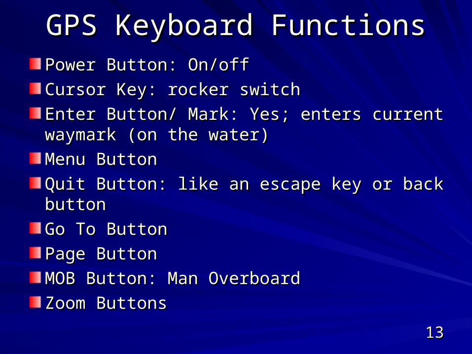
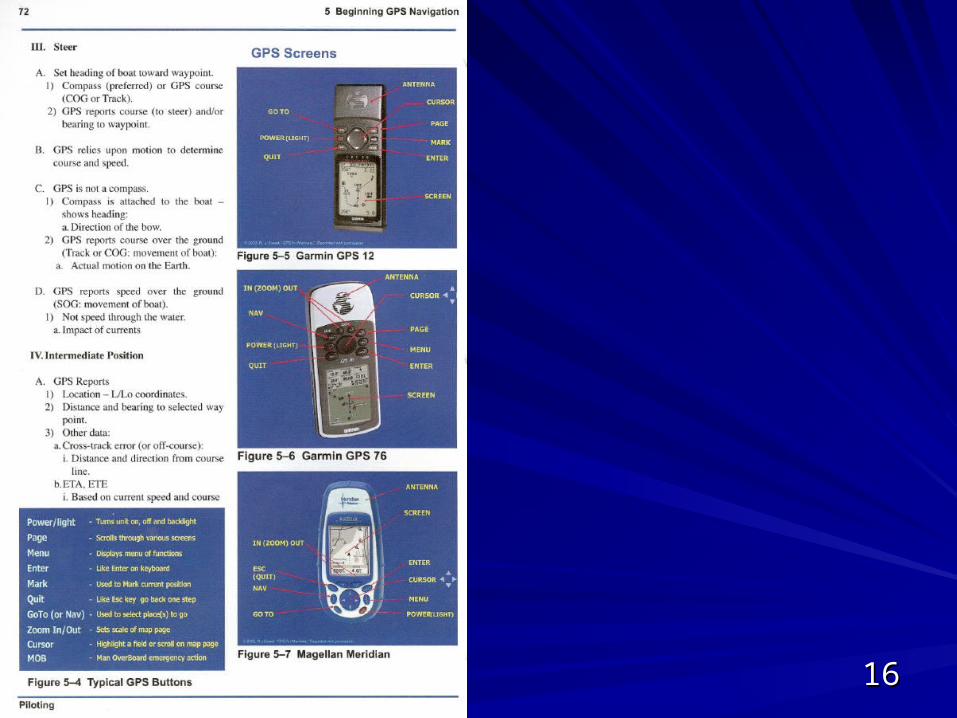
GPS Keyboard FunctionsGPS Keyboard FunctionsPower Button: On/offPower Button: On/off
Cursor Key: rocker switchCursor Key: rocker switch
Enter Button/ Mark: Yes; enters current waymark Enter Button/ Mark: Yes; enters current waymark (on the water)(on the water)
Menu ButtonMenu Button
Quit Button: like an escape key or back buttonQuit Button: like an escape key or back button
Go To ButtonGo To Button
Page ButtonPage Button
MOB Button: Man OverboardMOB Button: Man Overboard
Zoom ButtonsZoom Buttons
1414
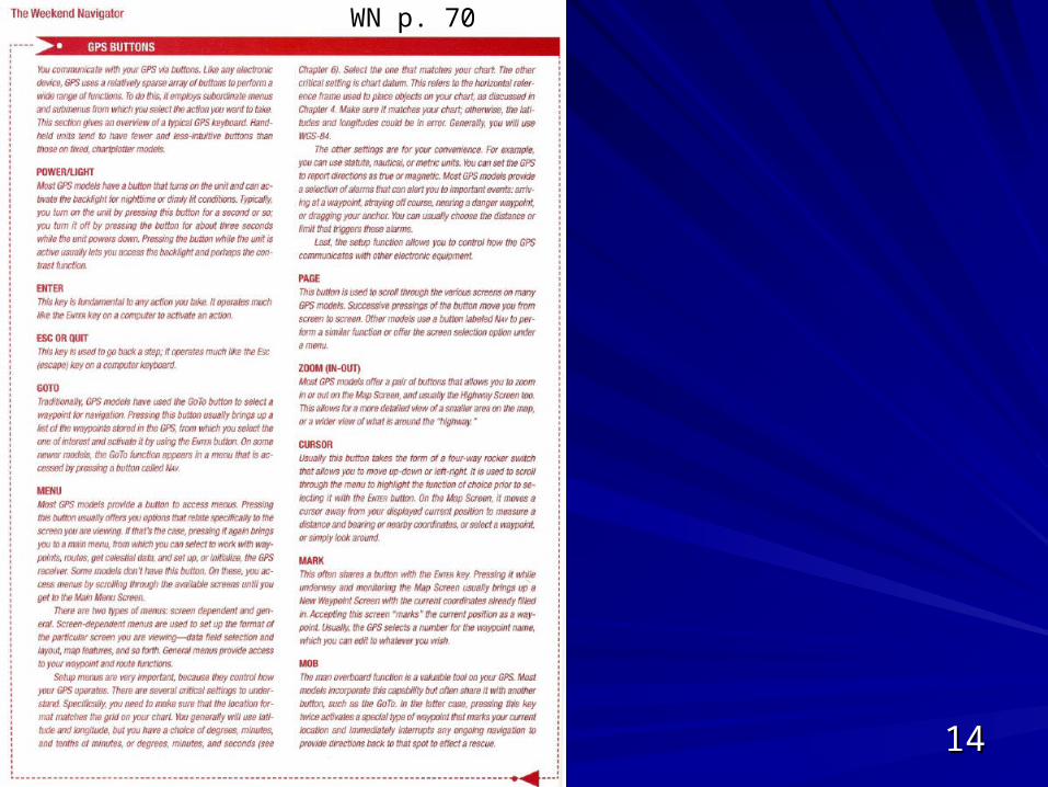
WN p. 70
1515
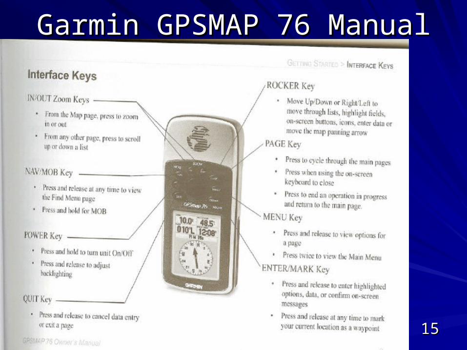
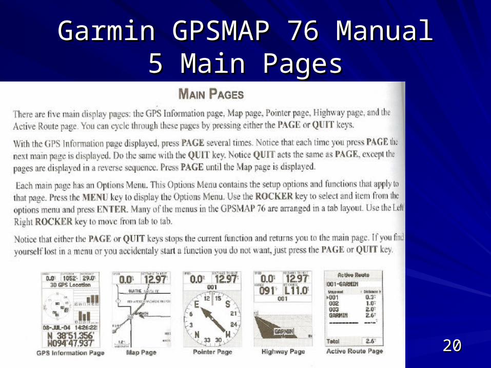
Garmin GPSMAP 76 ManualGarmin GPSMAP 76 Manual
1616
1717
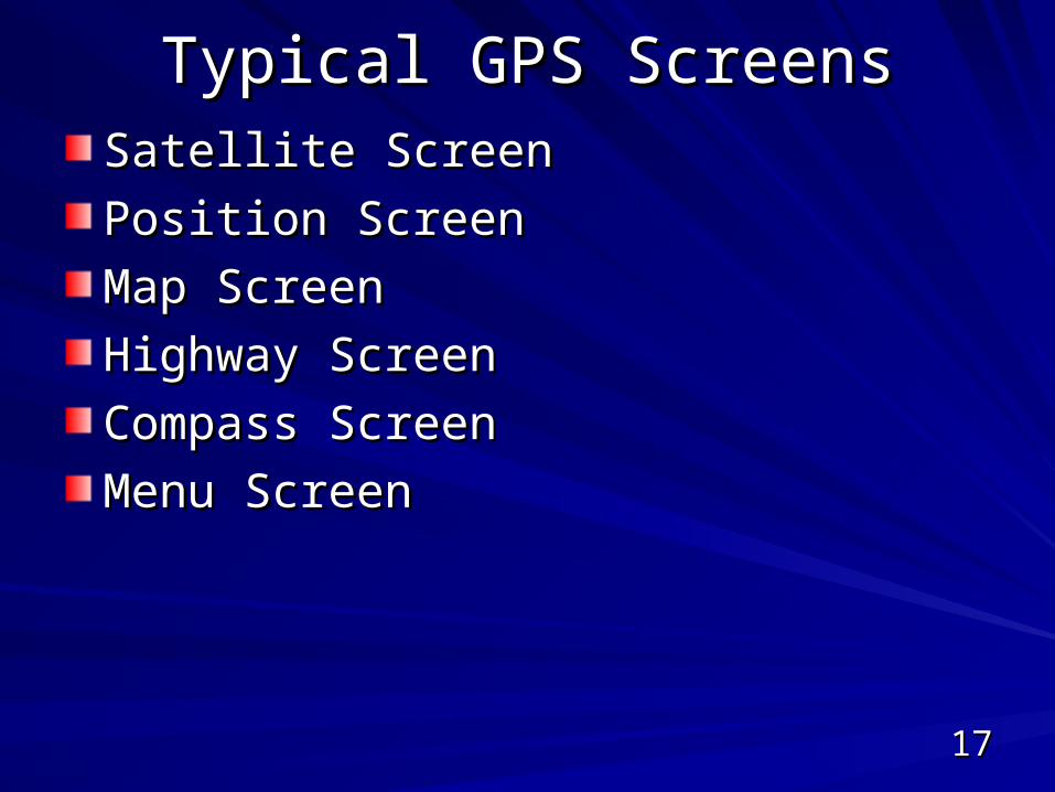
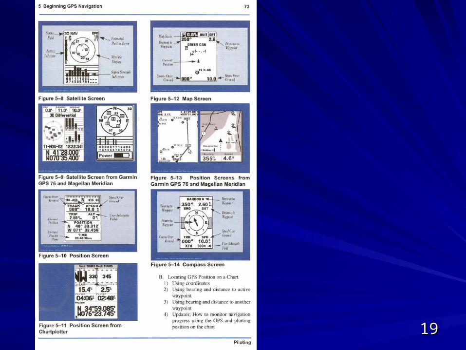
Typical GPS ScreensTypical GPS ScreensSatellite ScreenSatellite Screen
Position ScreenPosition Screen
Map ScreenMap Screen
Highway ScreenHighway Screen
Compass ScreenCompass Screen
Menu ScreenMenu Screen
1818
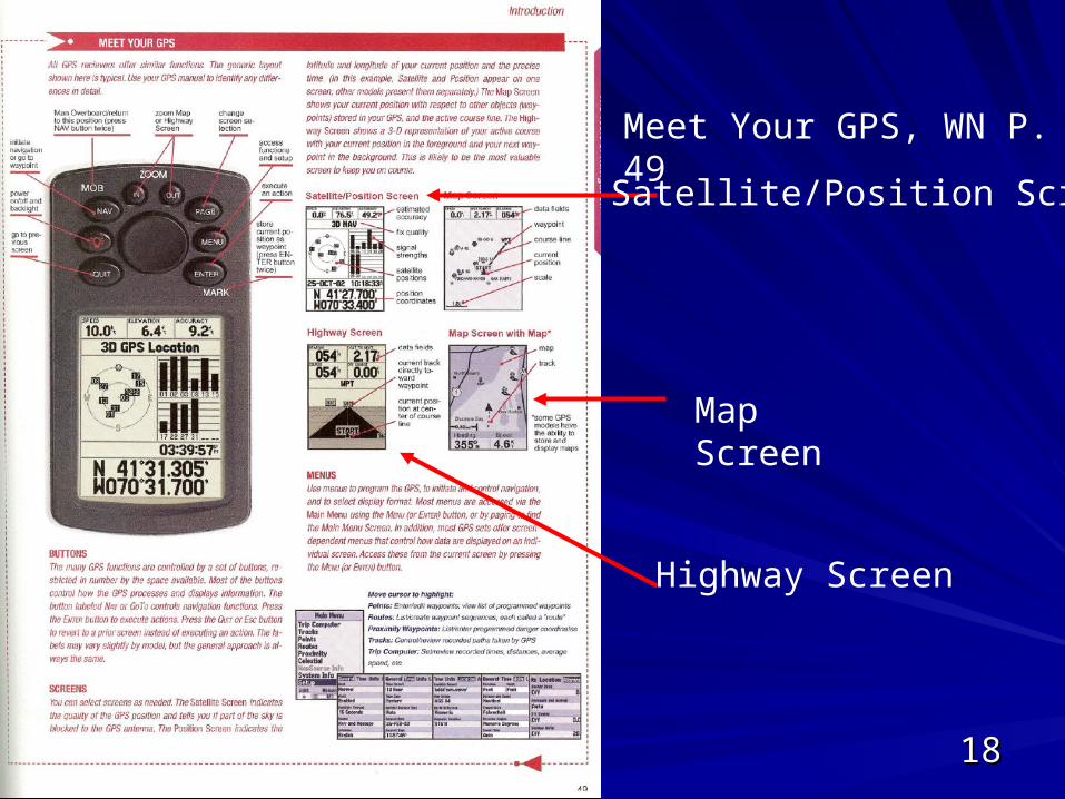
Meet Your GPS, WN P. 49
Satellite/Position Screen
Highway Screen
Map Screen
1919
2020
Garmin GPSMAP 76 ManualGarmin GPSMAP 76 Manual5 Main Pages5 Main Pages
2121
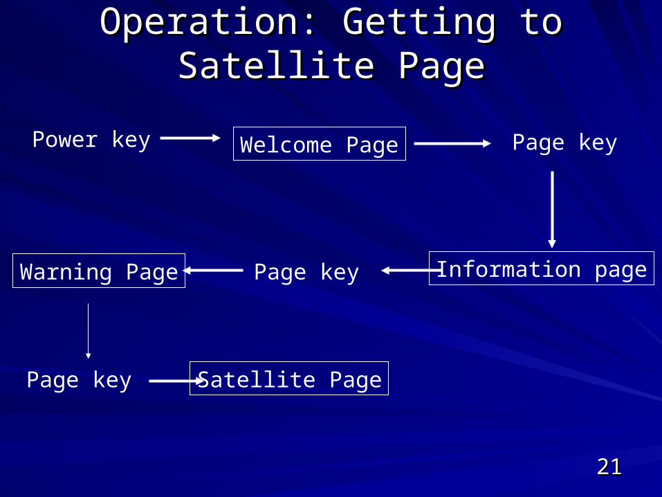
Operation: Getting to Satellite PageOperation: Getting to Satellite Page
Power key Welcome Page Page key
Information pagePage keyWarning Page
Page key Satellite Page
2222
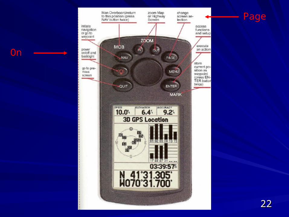
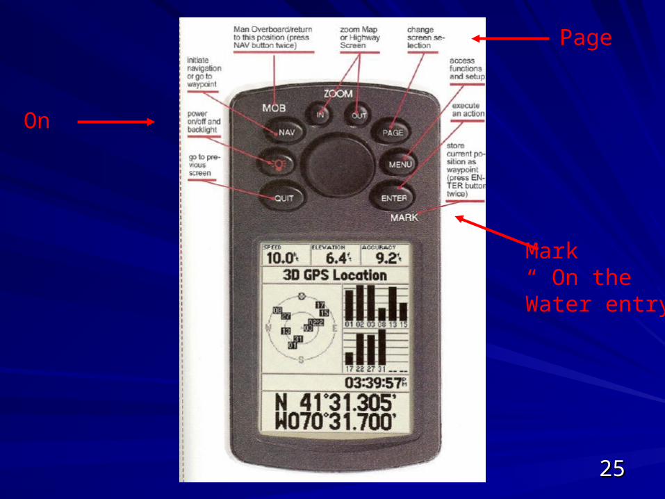
On
Page

2323
2424
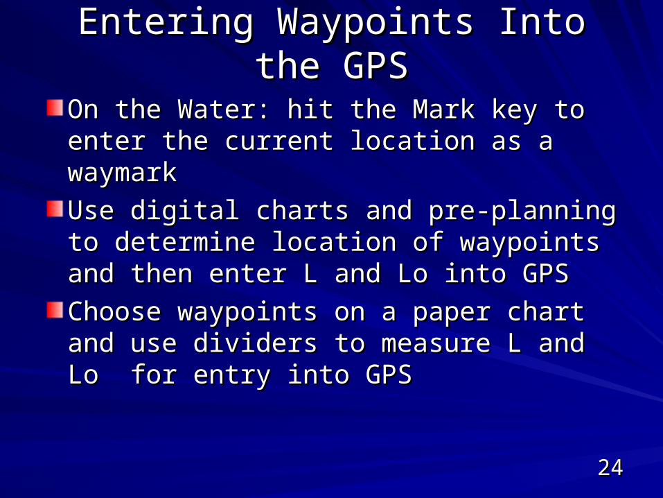
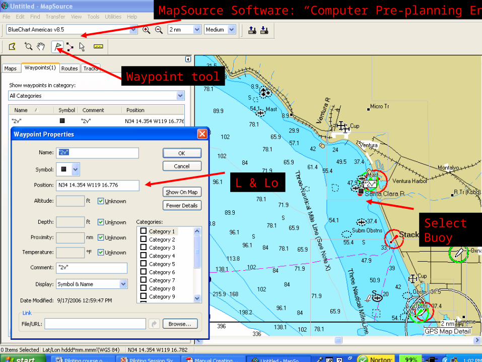
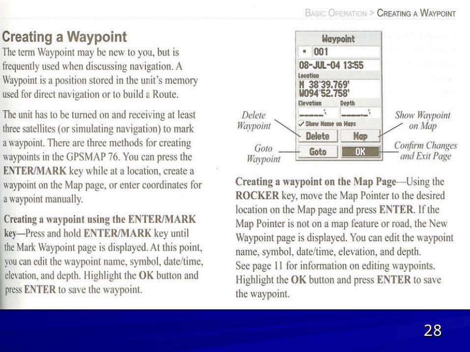
Entering Waypoints Into the GPSEntering Waypoints Into the GPS
On the Water: hit the Mark key to enter the On the Water: hit the Mark key to enter the current location as a waymarkcurrent location as a waymark
Use digital charts and pre-planning to Use digital charts and pre-planning to determine location of waypoints and then determine location of waypoints and then enter L and Lo into GPSenter L and Lo into GPS
Choose waypoints on a paper chart and Choose waypoints on a paper chart and use dividers to measure L and Lo for use dividers to measure L and Lo for entry into GPSentry into GPS
2525
On
Page
Mark“ On the Water entry”
2626
Waypoint tool
Select Buoy
L & Lo
MapSource Software: “Computer Pre-planning Entry”
2727
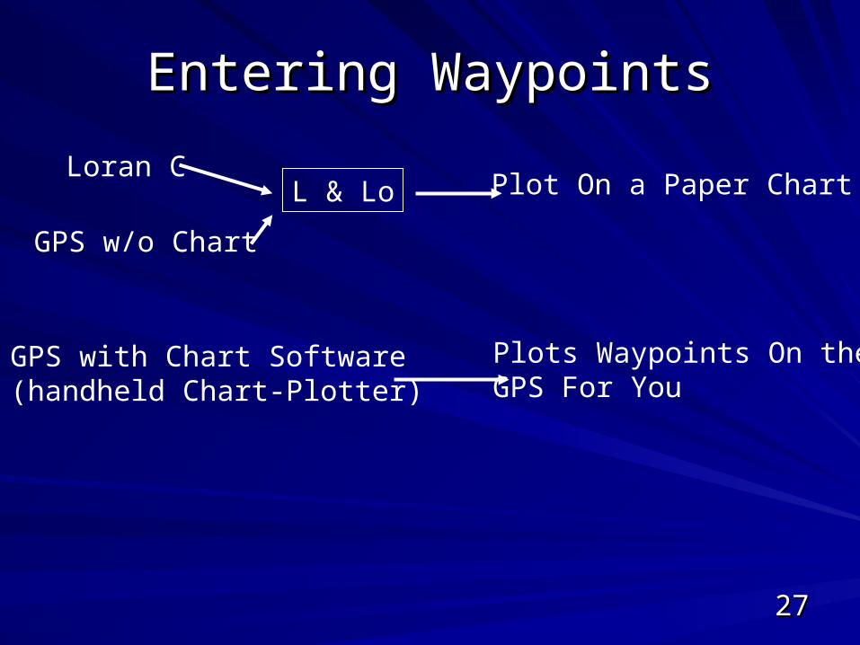
Entering WaypointsEntering Waypoints
Loran C
GPS w/o Chart
L & Lo Plot On a Paper Chart
GPS with Chart Software(handheld Chart-Plotter)
Plots Waypoints On theGPS For You
2828
2929
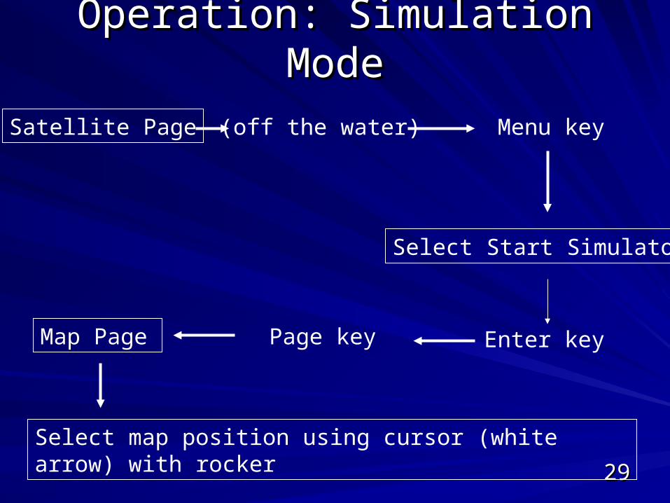
Operation: Simulation ModeOperation: Simulation Mode
Satellite Page (off the water) Menu key
Select Start Simulator
Enter keyPage keyMap Page
Select map position using cursor (white arrow) with rocker
3030
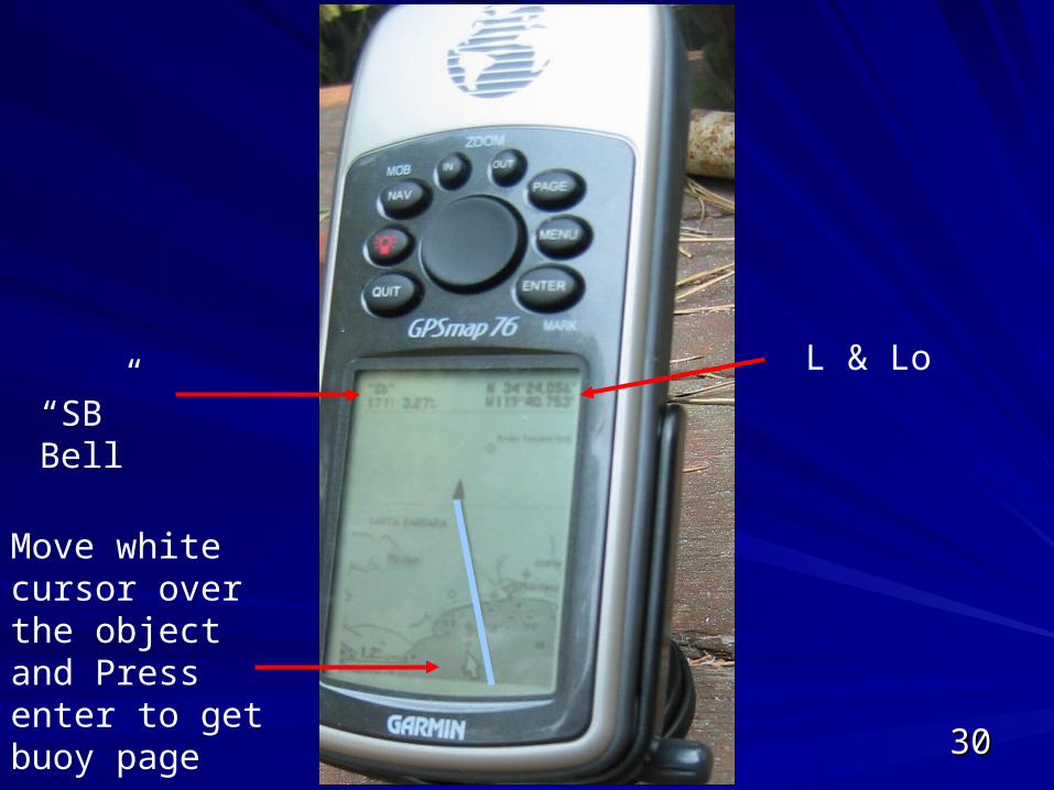
“SB” Bell
Move white cursor over the object and Press enter to get buoy page
L & Lo
3131
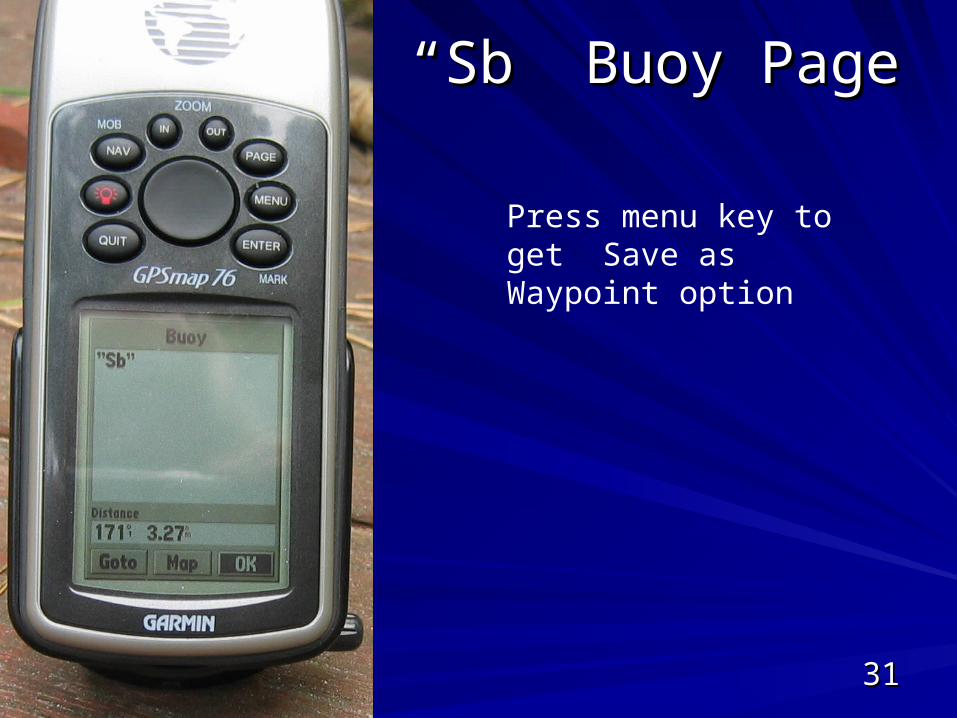
““Sb” Buoy PageSb” Buoy Page
Press menu key to get Save as Waypoint option
3232
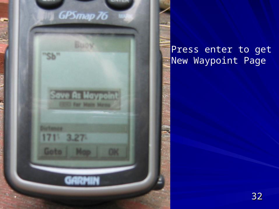
Press enter to get New Waypoint Page
3333
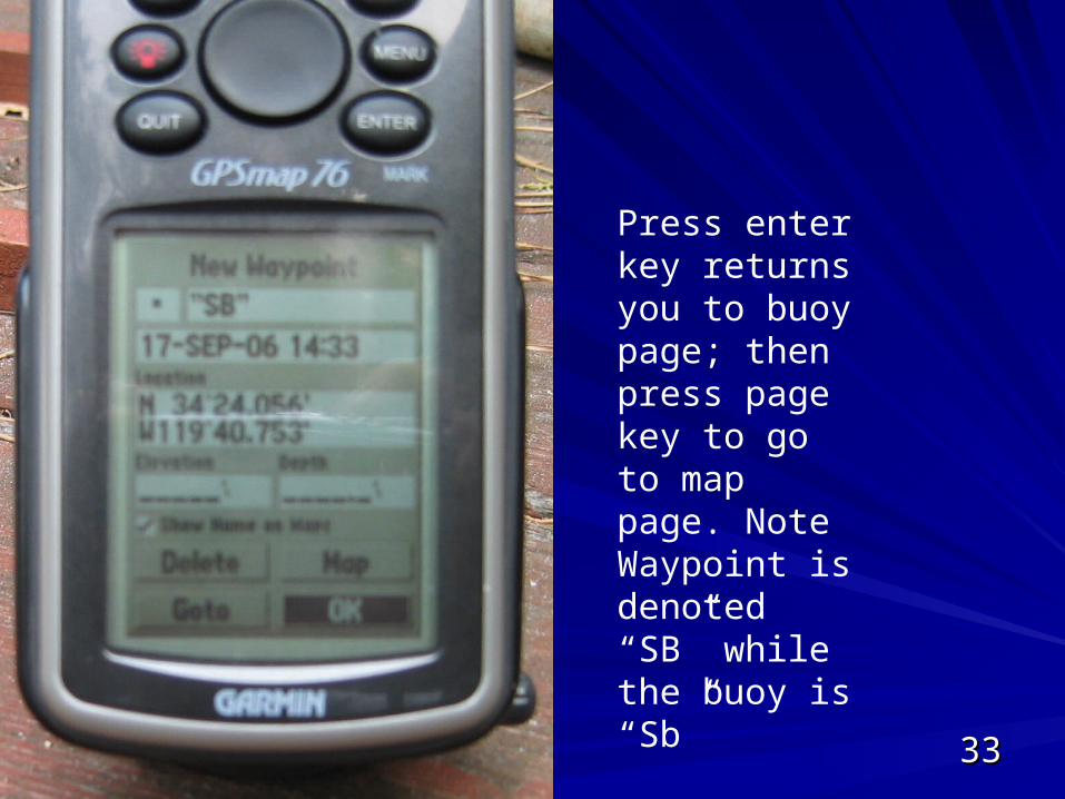
Press enter key returns you to buoy page; then press page key to go to map page. Note Waypoint is denoted “SB” while the buoy is “Sb”
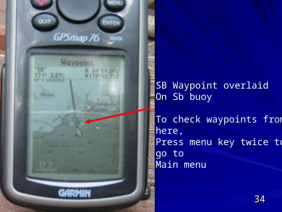
3434
SB Waypoint overlaid On Sb buoy
To check waypoints from here,Press menu key twice to go to Main menu
3535
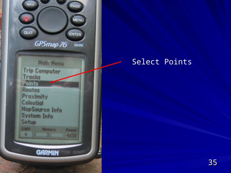
Select Points
3636
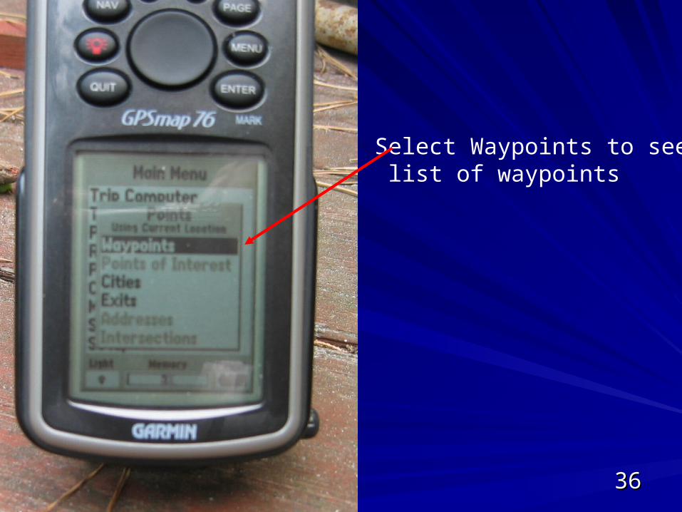
Select Waypoints to see list of waypoints
3737
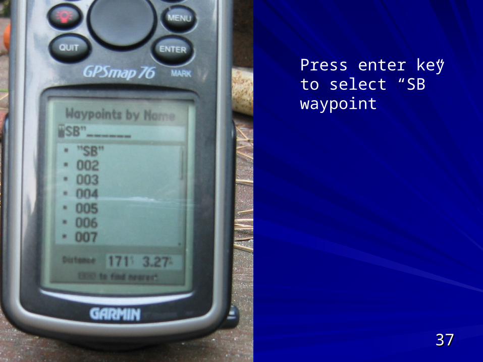
Press enter key to select “SB” waypoint
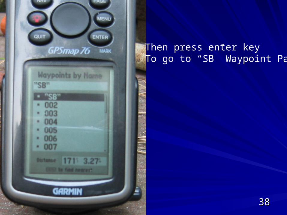
3838
Then press enter keyTo go to “SB” Waypoint Page
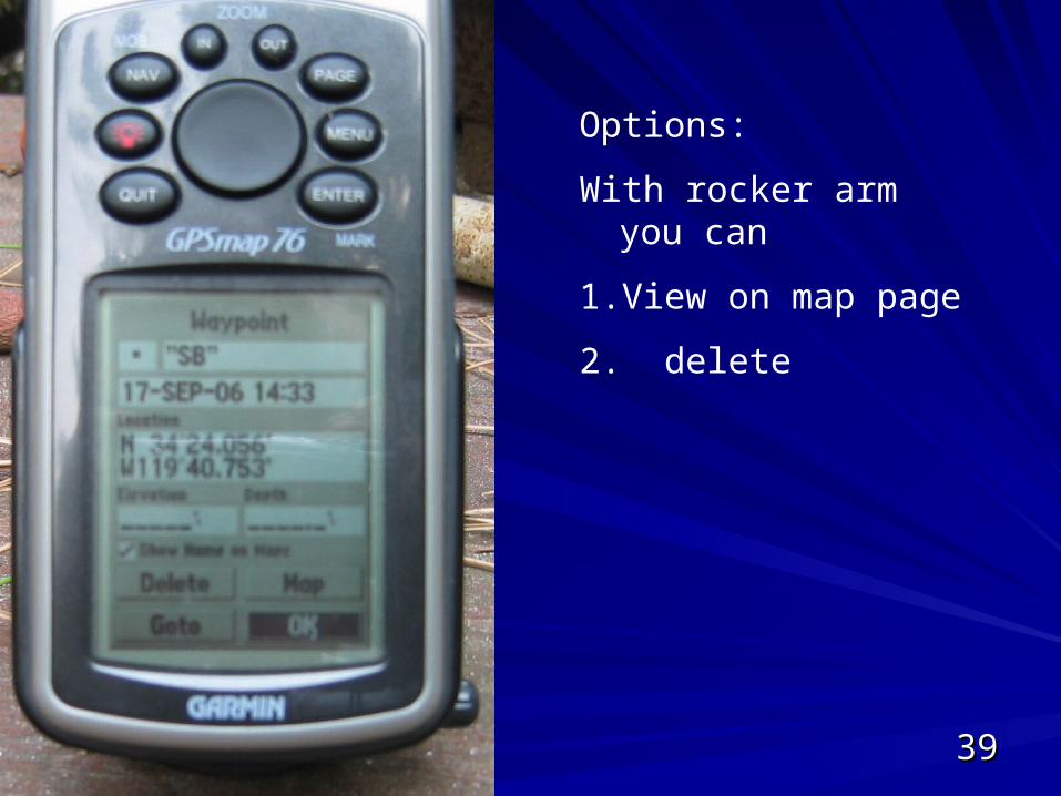
3939
Options:
With rocker arm you can
1. View on map page
2. delete
4040
What the GPS Does When You What the GPS Does When You Select a WaypointSelect a Waypoint
GPS compute course to new waypoint, GPS compute course to new waypoint, including bearing and distance from including bearing and distance from current locationcurrent location
Plots a line of the activated course on the Plots a line of the activated course on the Map ScreenMap Screen
Creates a highway on the Highway ScreenCreates a highway on the Highway Screen
4141
Exercise 5-1Exercise 5-1
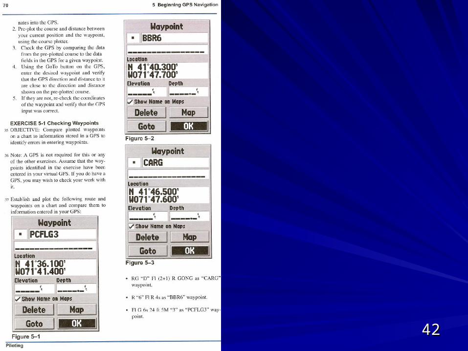
4242
4343
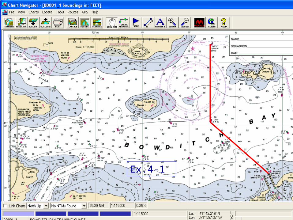
Exercise 2-2: Bowditch BayExercise 2-2: Bowditch Bay
Ex.4-1

4444